
WEATHER BLOG

Presented By:
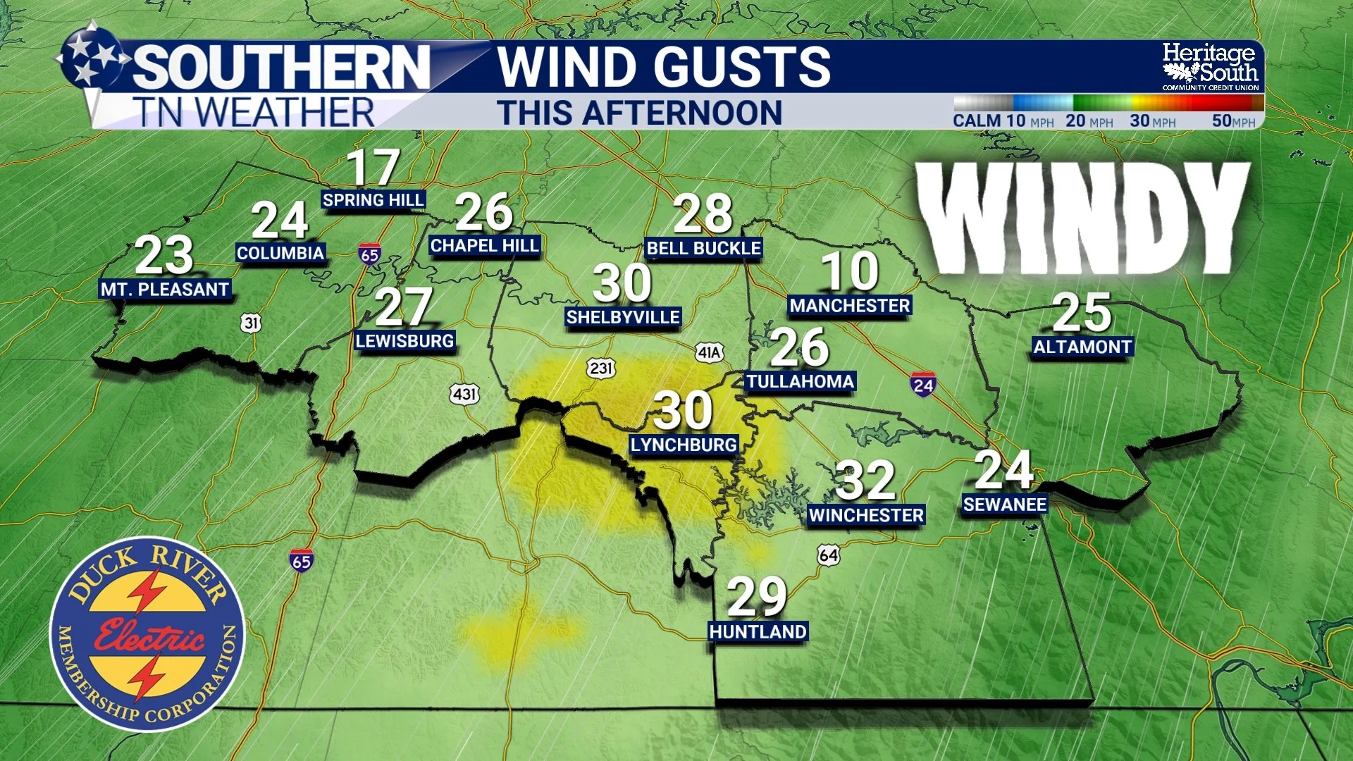
Windy today - Rain Chances Return Tomorrow… Here’s What to Expect
After several days of warm, dry, and breezy conditions across Southern Middle Tennessee, the pattern is beginning to shift. It’s not a dramatic flip, but it is a meaningful one — and it starts with our first real chance for showers and thunderstorms on Wednesday. This isn’t shaping up to be a washout or a severe weather day. Instead, it’s the beginning of a more active, spring-like pattern where the atmosphere becomes just unstable enough to support scattered storms.
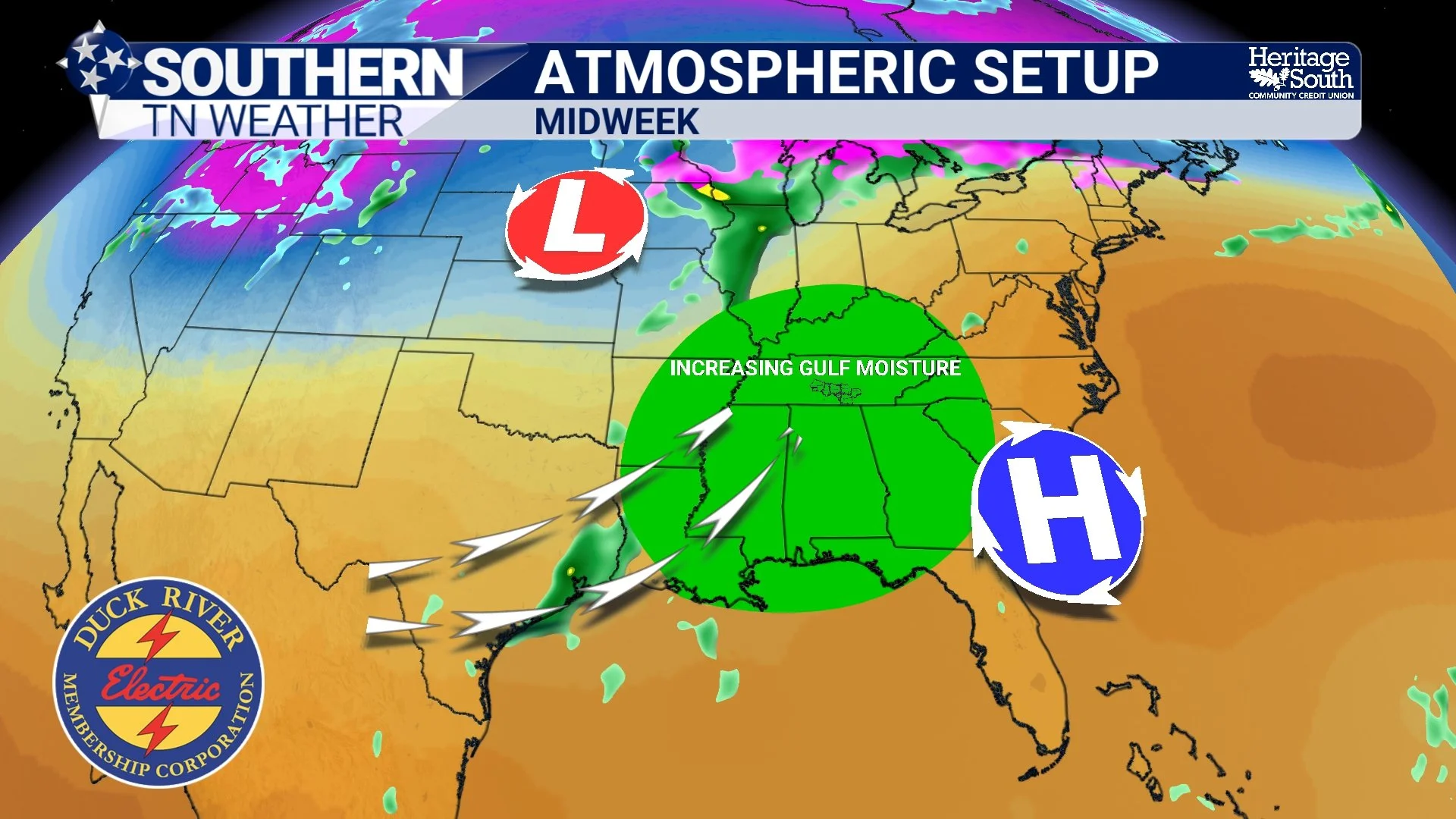
A Much Needed Pattern Change… Rain Returns This Week
After a stretch of warm, dry, and at times fire-prone weather across Southern Middle Tennessee, the overall pattern is beginning to shift in a meaningful way. At the surface, today still feels quiet and comfortable. But higher up in the atmosphere, changes are already underway that will bring multiple chances for rain (and a much-needed break from the dryness) as we move deeper into the week.
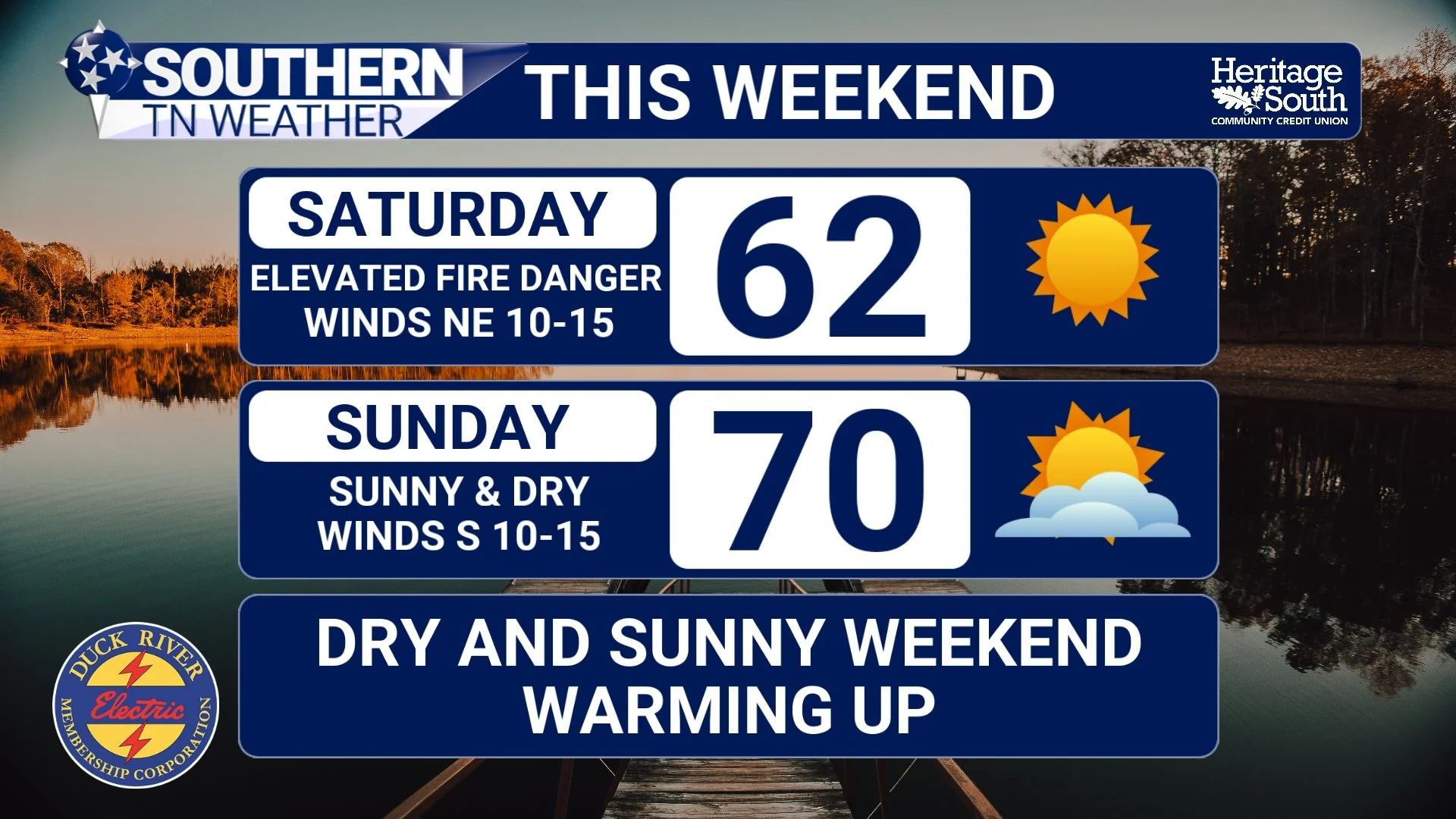
A Passing Front Today… Then a Dry and Breezy Weekend
A cold front is sliding through Southern Middle Tennessee this afternoon, bringing a subtle but important shift in our overall weather pattern. While this system won’t deliver much in the way of rainfall, it will usher in a noticeably different air mass that sets the tone for the weekend.
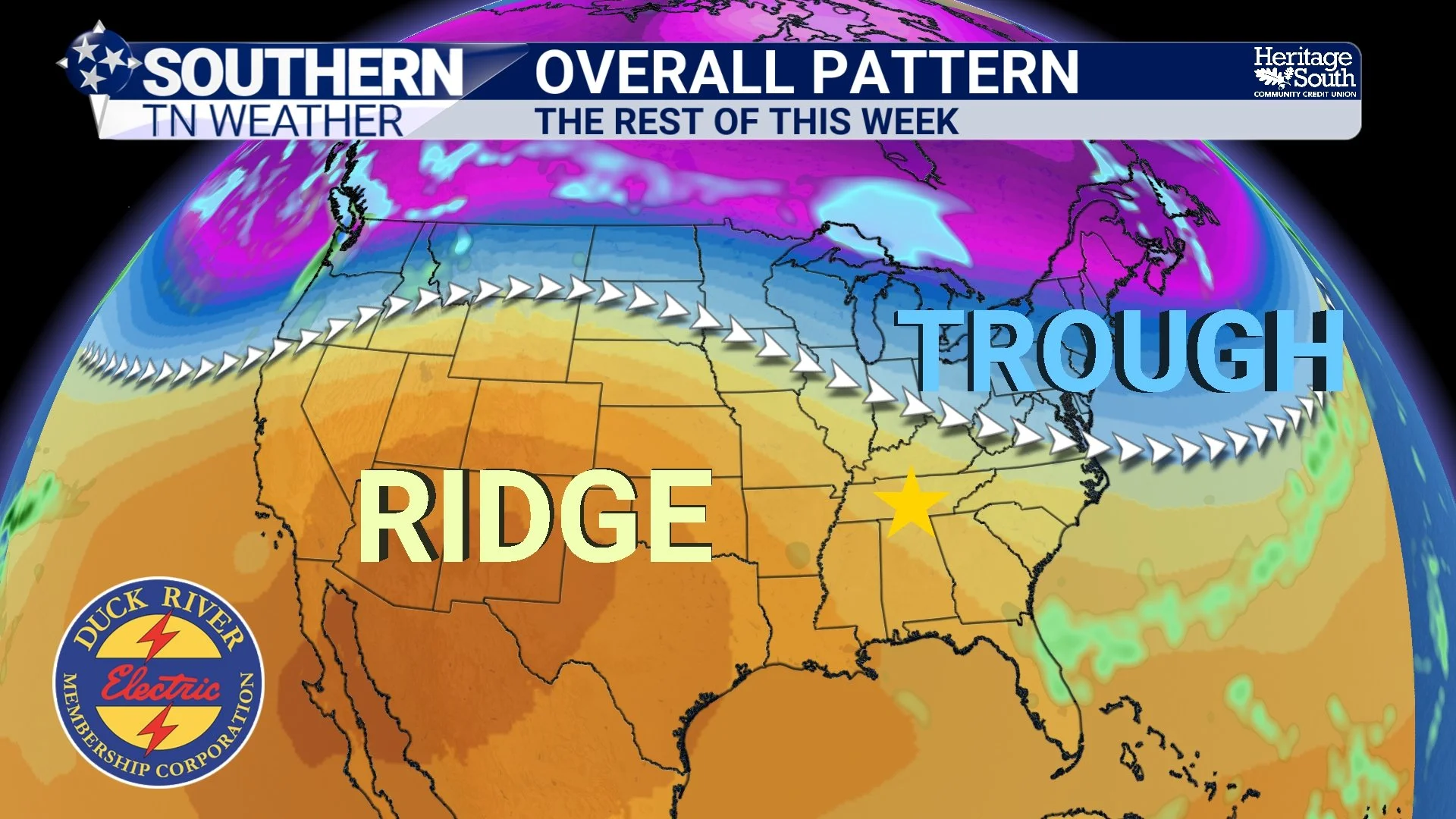
Peak Spring Heat Tomorrow… Then a Quick Pattern Reset
We’re heading into the warmest part of this current stretch across Southern Middle Tennessee, but what’s just as important as the warmth itself is how the overall pattern is evolving. Thursday will likely bring another round of near-record temperatures, but this isn’t a stagnant pattern. Instead, it’s a classic late-March setup where warmth builds quickly, gets knocked back briefly, and then returns just as fast.
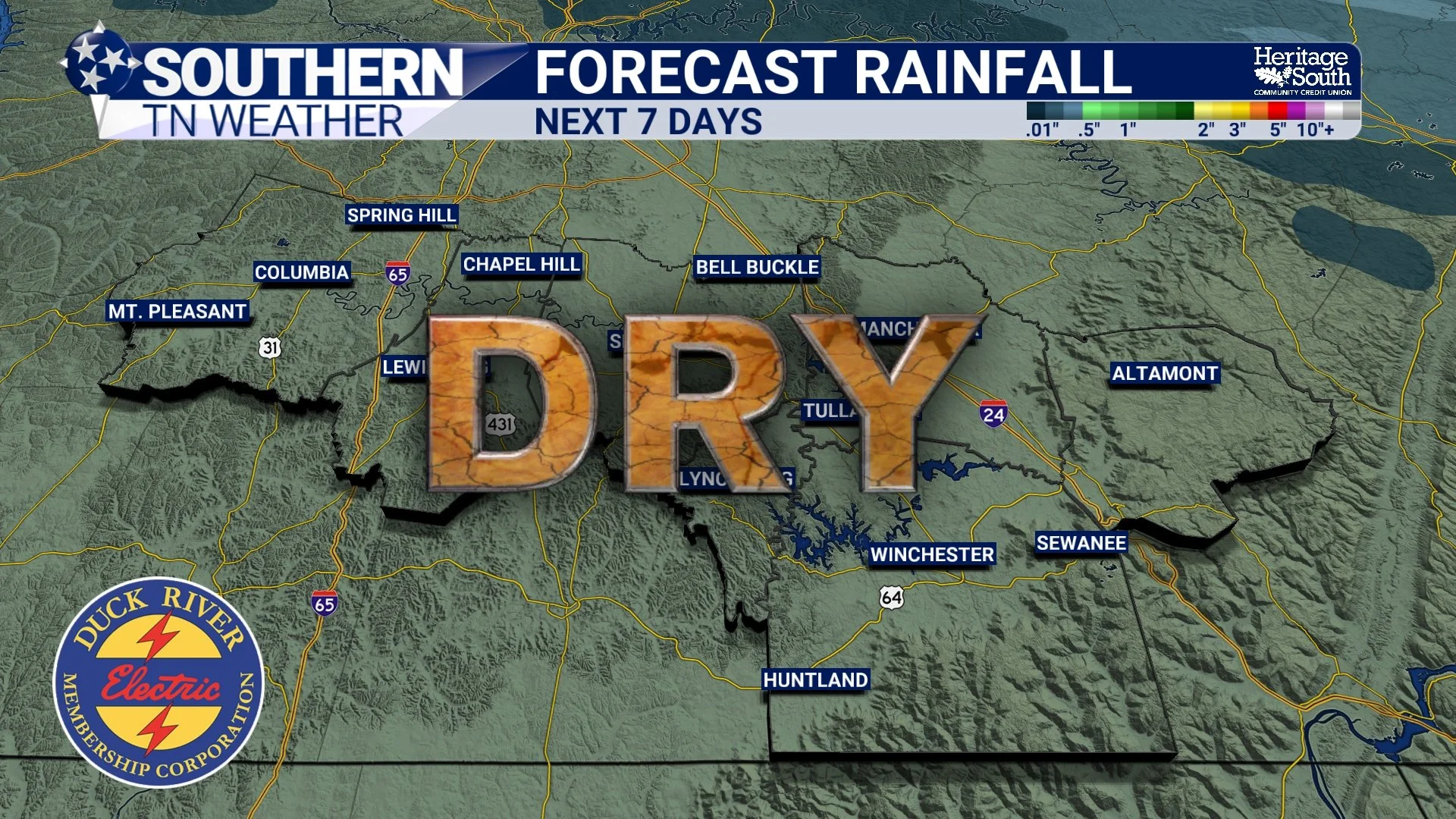
Warm & Dry Trend Continues… 80s Likely Thursday
We’re easing back into a warmer pattern across Southern Middle Tennessee, and over the next few days, temperatures will continue a steady climb back into well above-normal territory. After a cooler start to the week, the overall setup is shifting once again — and by Thursday, we’ll be talking about another round of near-record warmth.
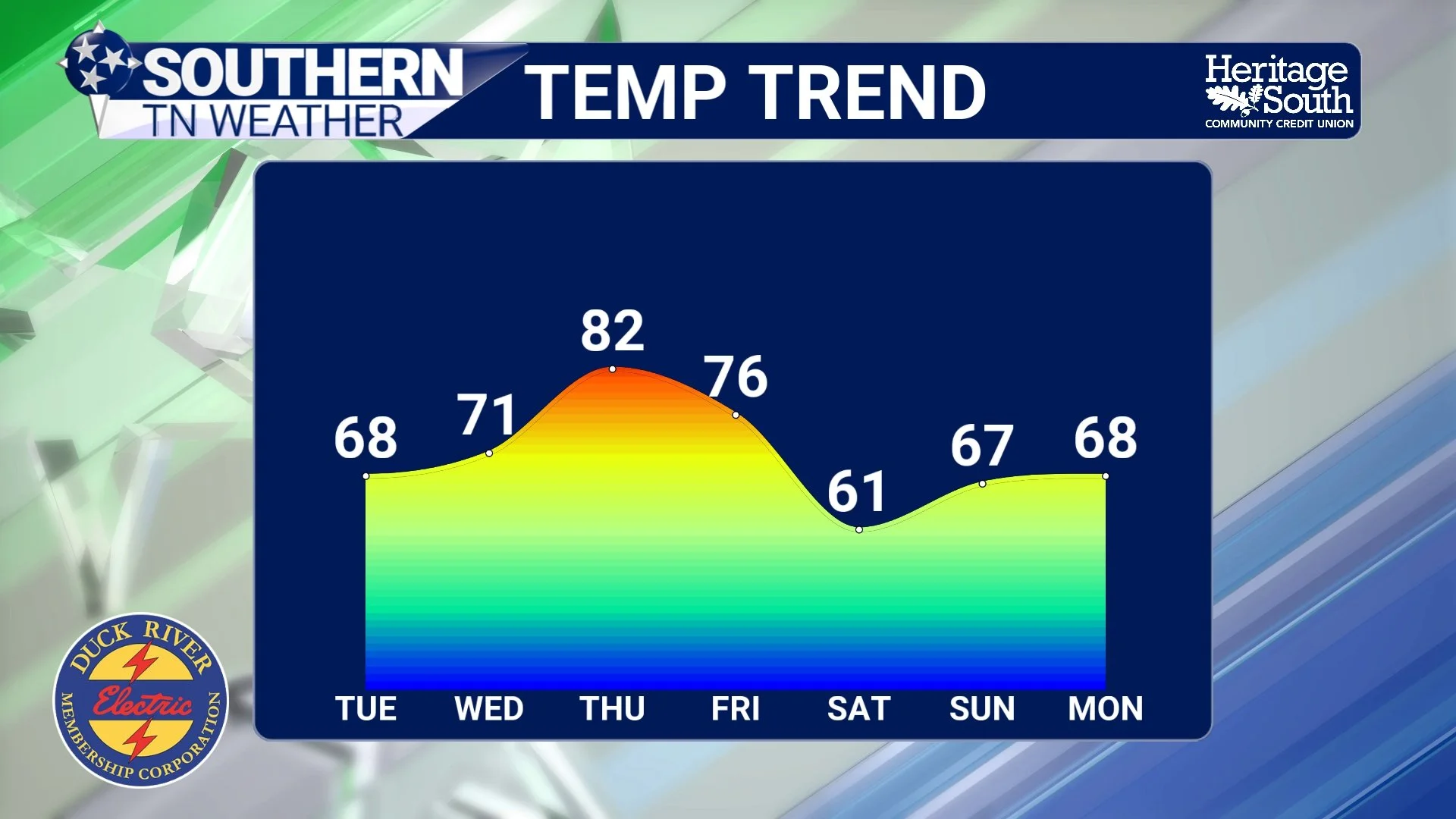
A Quick Cooldown… Then Spring Heat Returns
After a weekend that felt more like late May than mid-March, today is a bit of a reality check across Southern Middle Tennessee. A dry cold front moved through the region overnight, bringing cooler air and gusty north winds to start the week. Temperatures today are running nearly 20 to 25 degrees colder than what we experienced Sunday, with highs settling back into the upper 50s to mid 60s. While that may feel like a big drop, it’s actually much closer to what we would expect this time of year… This cooler stretch, however, will be short-lived.
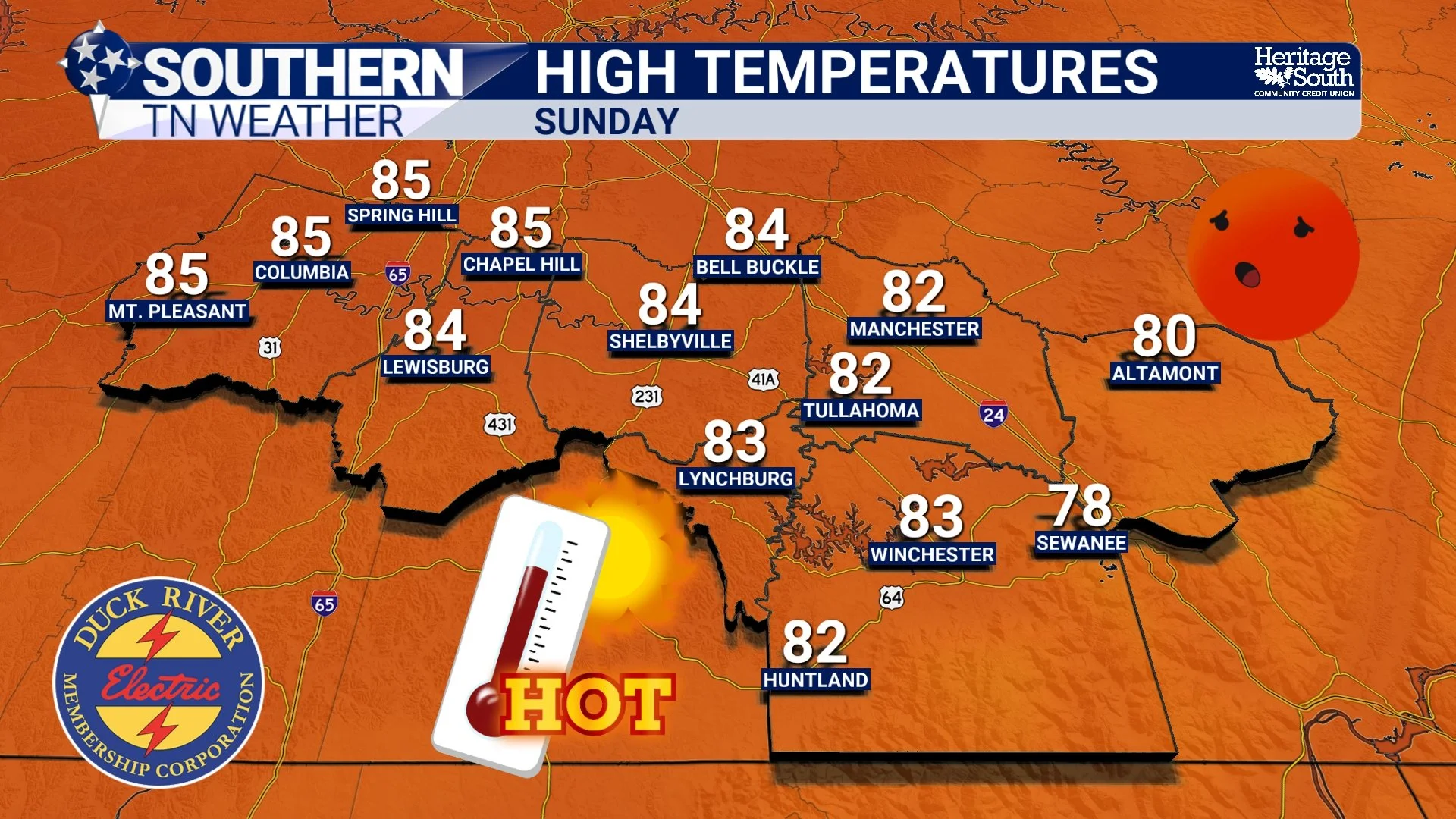
First Weekend of Spring? More Like the First Weekend of Summer…
Spring didn’t just arrive… it kicked the door in. We’re in the middle of a very warm and unusually stable weather pattern across Southern Middle Tennessee, with temperatures running 20 to 25 degrees above normal. While the headline continues to be the near-record warmth this weekend, there are a few more subtle changes happening in the atmosphere that are worth talking about today.
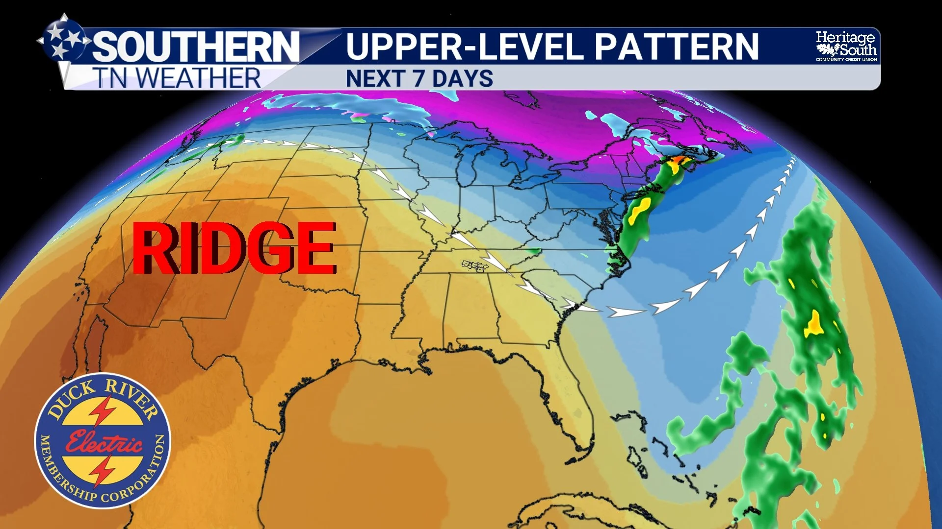
Spring Heat Building… Records Possible This Weekend
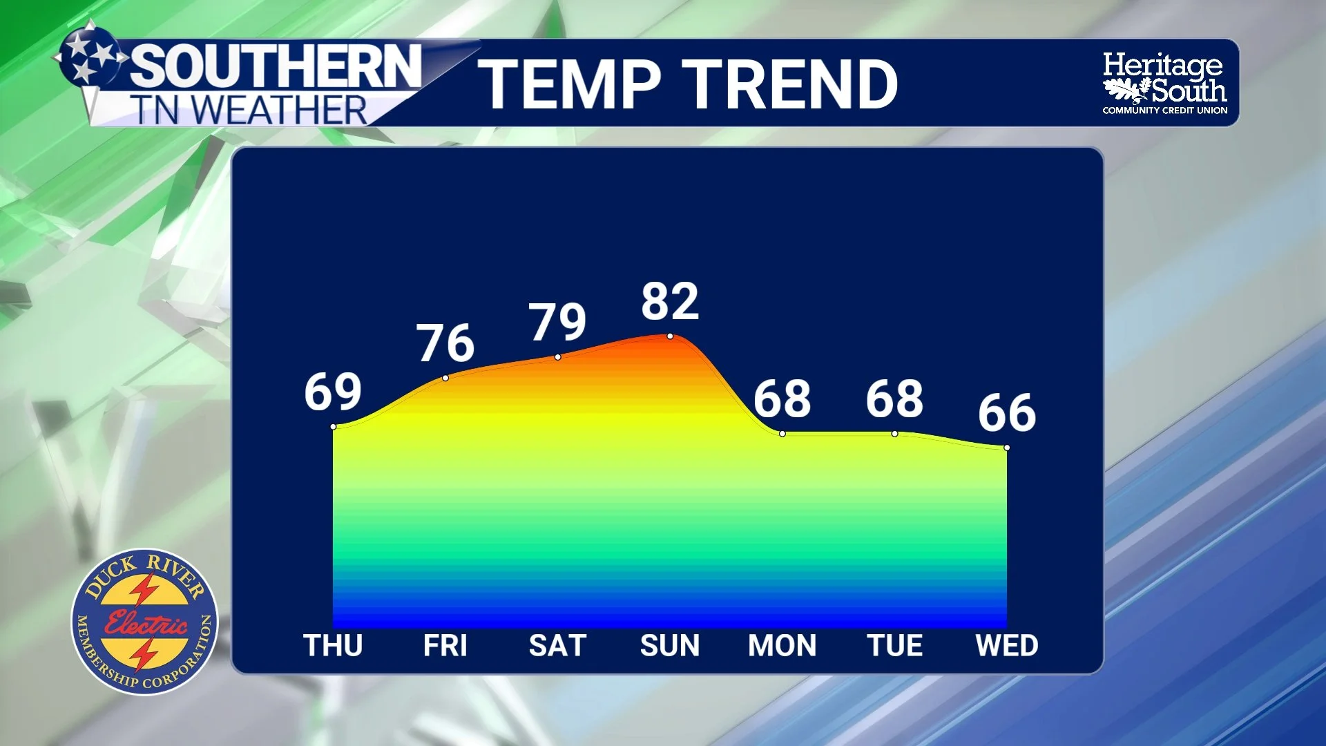
After a quiet return to more typical weather yesterday, the focus now shifts to something a little more interesting — a strong warming trend that could push temperatures near record levels across Southern Middle Tennessee this weekend.
We’re not just warming up… we’re talking about mid 80s in March, which is about 15–20 degrees above normal for this time of year.
Back to a “Normal” Pattern… Warming Trend Ahead
First off — I appreciate your patience over the past few days. It’s been a very busy stretch following this past weekend’s severe weather, but we are now getting back into a more normal schedule here at Southern Tennessee Weather.
The good news? The weather is finally calming down. After a very active and at times intense pattern, we are transitioning into a quiet and warming stretch across Southern Middle Tennessee, with no major storm systems in sight for several days.
Strong to Severe Storms Possible Sunday into Monday
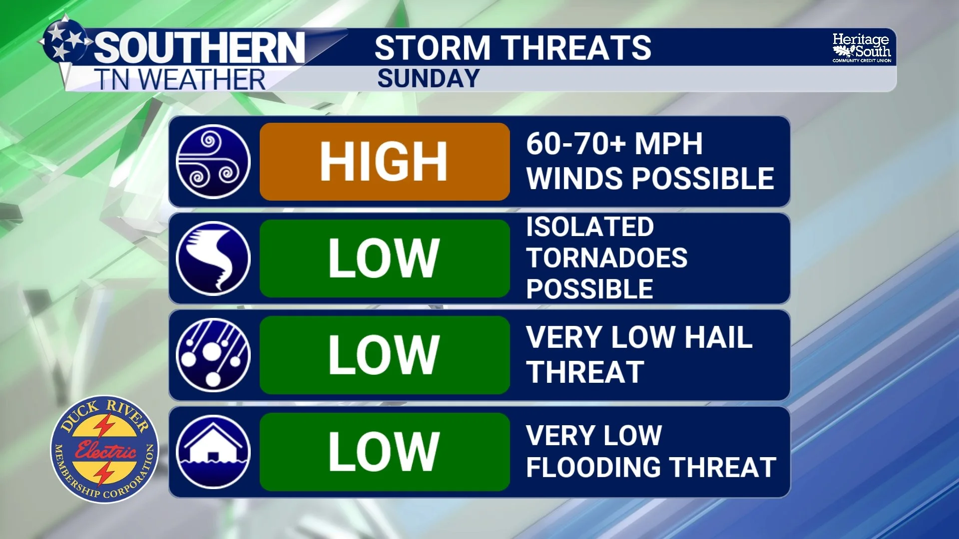
Even though we have some beautiful weather to get through tomorrow, attention is now turning to late Sunday into early Monday, when a powerful storm system and strong cold front will move across the region. This system has the potential to bring strong to severe thunderstorms to Southern Middle Tennessee, with damaging winds appearing to be the primary concern. The Storm Prediction Center has placed our area under an ENHANCED risk (level 3/5) for severe thunderstorms.
Weather Whiplash Incoming!
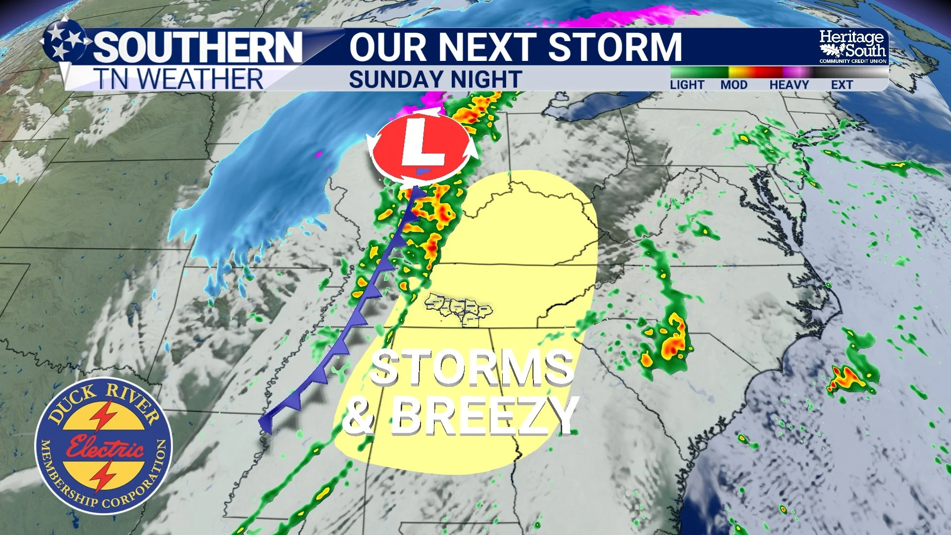
If you like dramatic weather changes, the next several days will deliver exactly that across Southern Middle Tennessee. We’re going from cool and breezy today… to spring warmth this weekend… to a stormy cold front Sunday night… and possibly even a few snowflakes early next week. In other words, WEATHER WHIPLASH is on the way.
Strong to Severe Thunderstorms Possible Wednesday
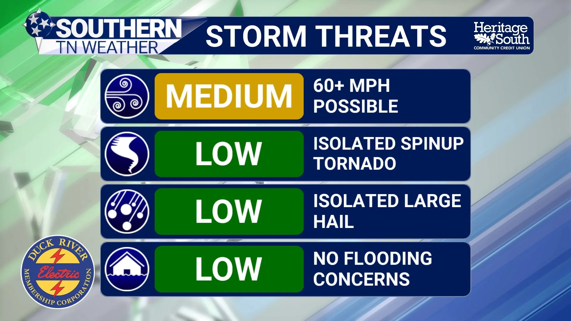
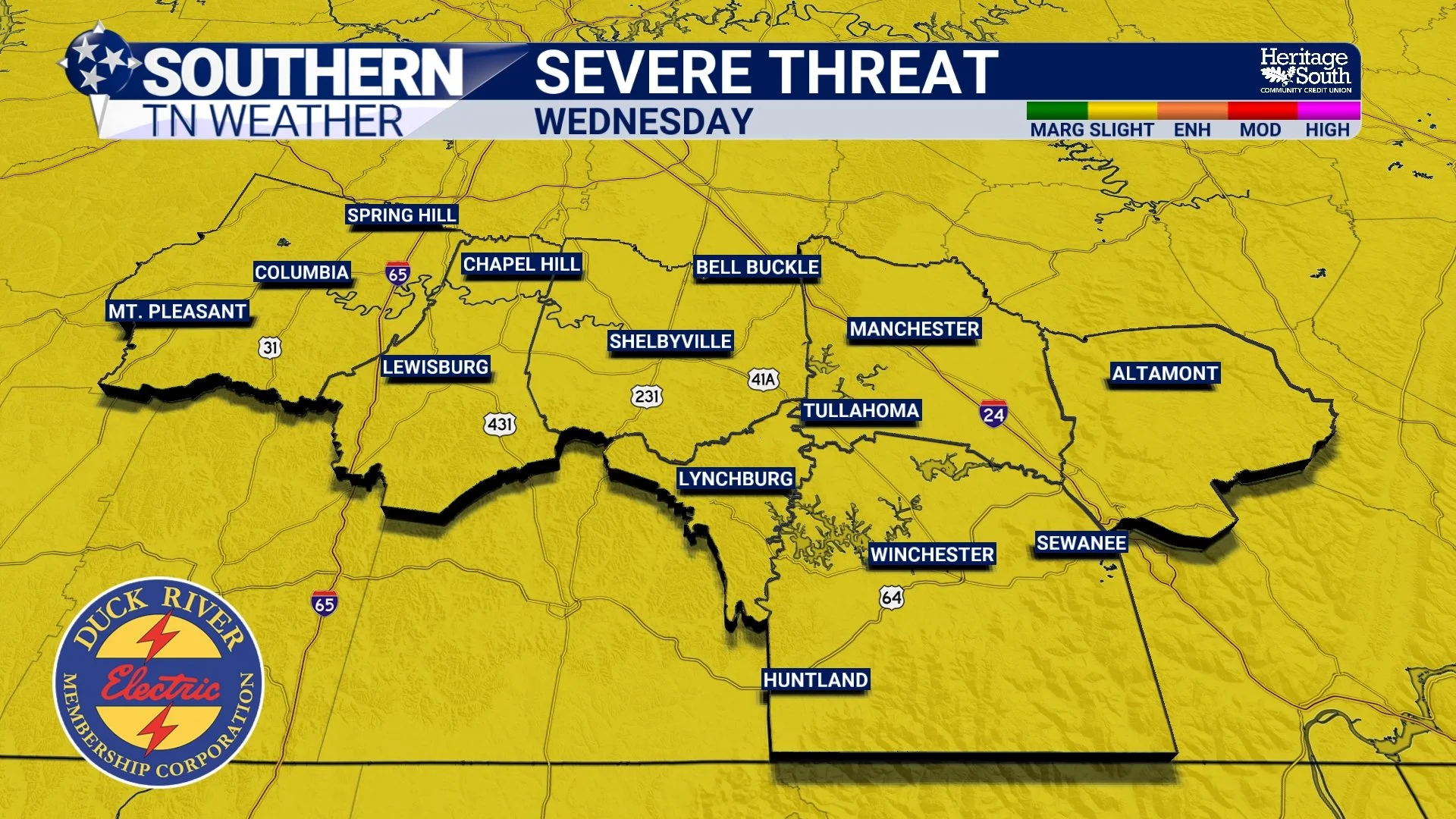
An active stretch of weather continues across Southern Middle Tennessee, with the greatest concern now shifting to Wednesday afternoon and evening, when a line of strong to severe thunderstorms may move across the region. The Storm Prediction Center has placed all of Middle Tennessee under a Slight Risk (Level 2 out of 5) for severe weather on Wednesday. While this is not an unusually high risk for this time of year, it does signal that scattered severe storms are possible, especially during the late afternoon and evening hours.
An Active Pattern to Start The Week… Latest Details Here
An unsettled stretch of weather is underway across Southern Middle Tennessee as several disturbances move through the region over the next few days. While temperatures will remain well above average with highs in the 70s to near 80°, multiple rounds of showers and thunderstorms are expected from late this afternoon through Wednesday night.
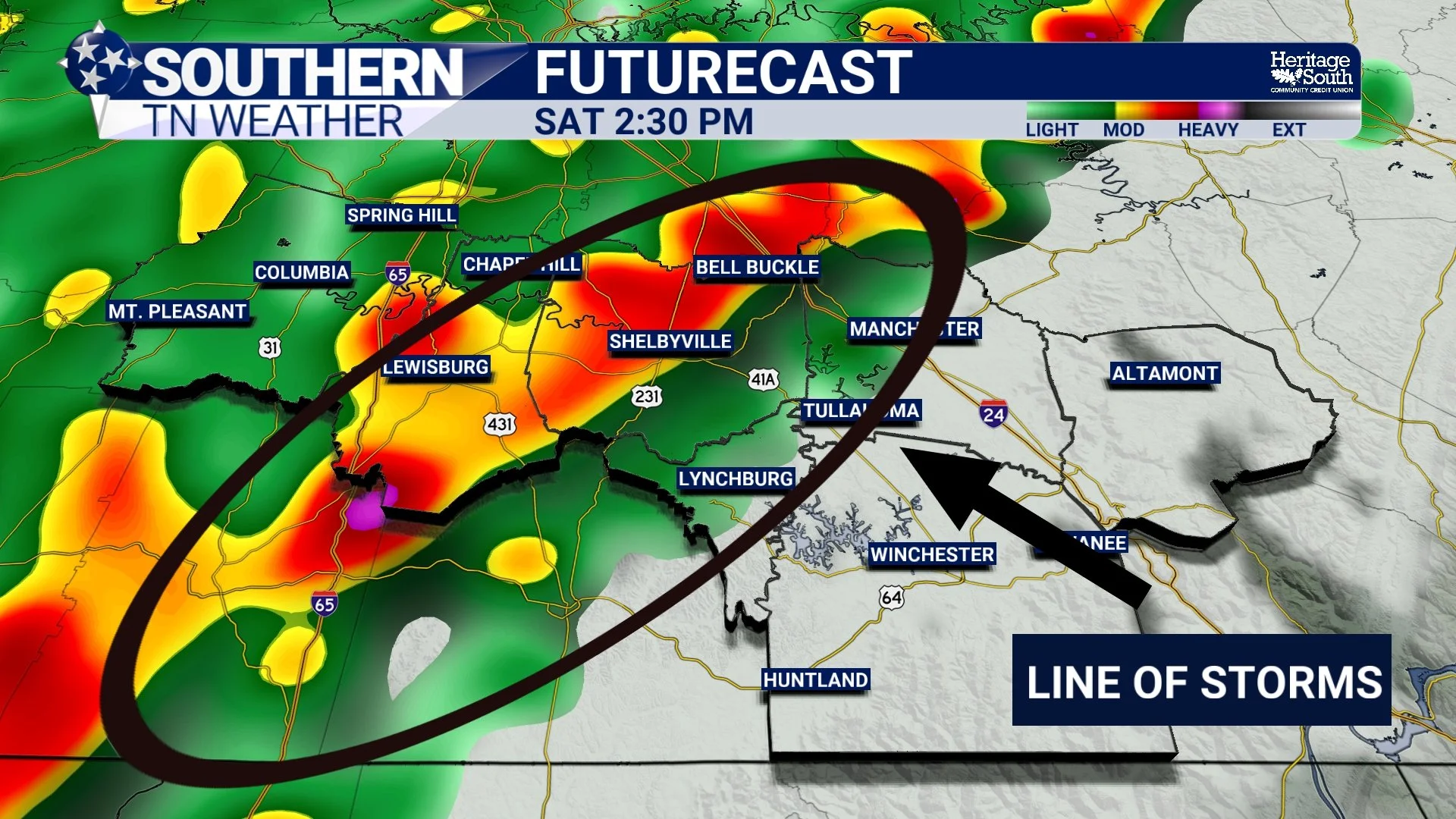
Storms Likely Saturday: Latest Details Here
Today itself remains mostly quiet. A few isolated showers or thunderstorms could pop up late this afternoon or early evening as small disturbances rotate around the ridge overhead, but coverage will remain very limited and severe weather is not expected today. The bigger story arrives tomorrow.
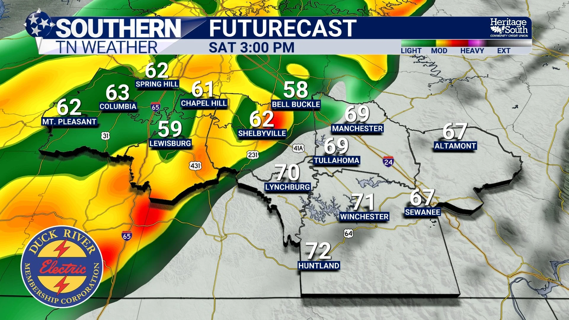
Record Warmth Continues, Weekend Storms on the Horizon
If you stepped outside today and thought it felt more like late April than early March, you’re not alone. Temperatures across Southern Middle Tennessee are pushing well into the upper 70s to near 80 degrees this afternoon, putting record highs in jeopardy for many locations.
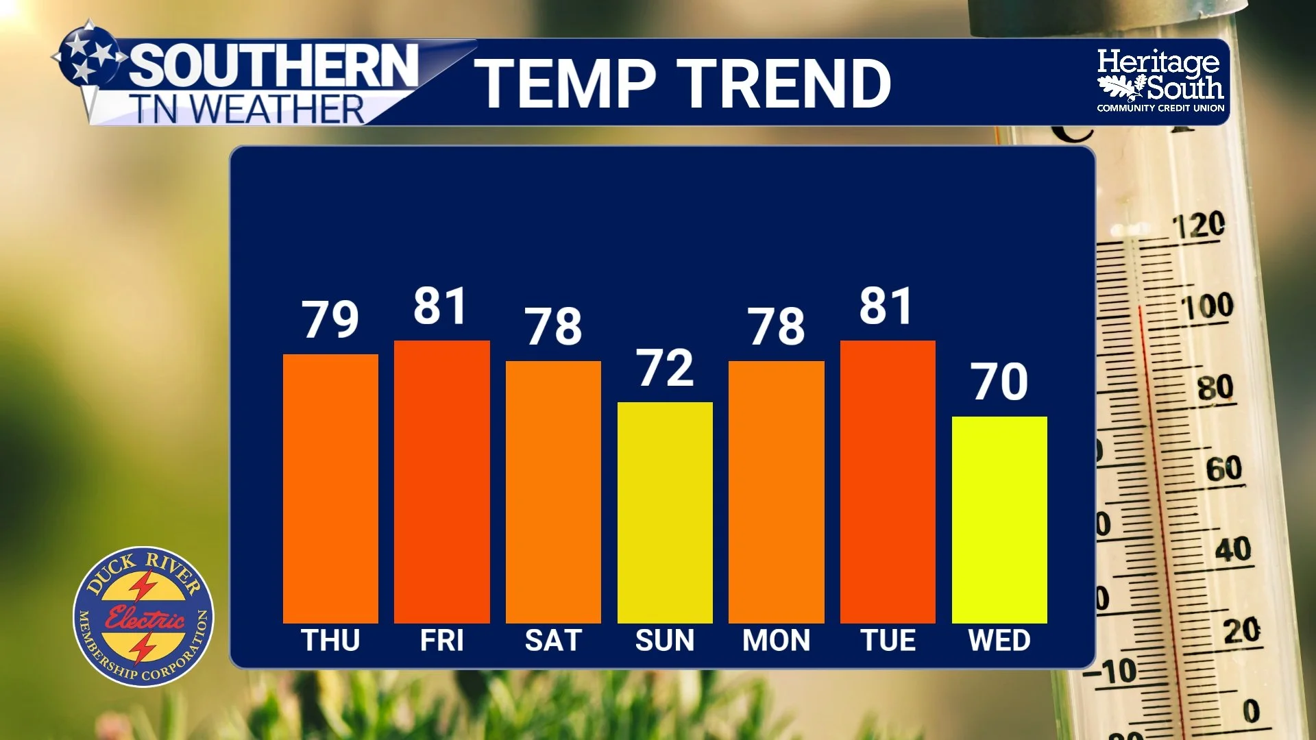
Spring Preview Continues Across Southern Middle Tennessee
If it feels more like late April than early March, you’re not imagining it. Temperatures across Southern Middle Tennessee have surged into the mid and upper 70s this afternoon, running 15 to 20 degrees above normal for this time of year.
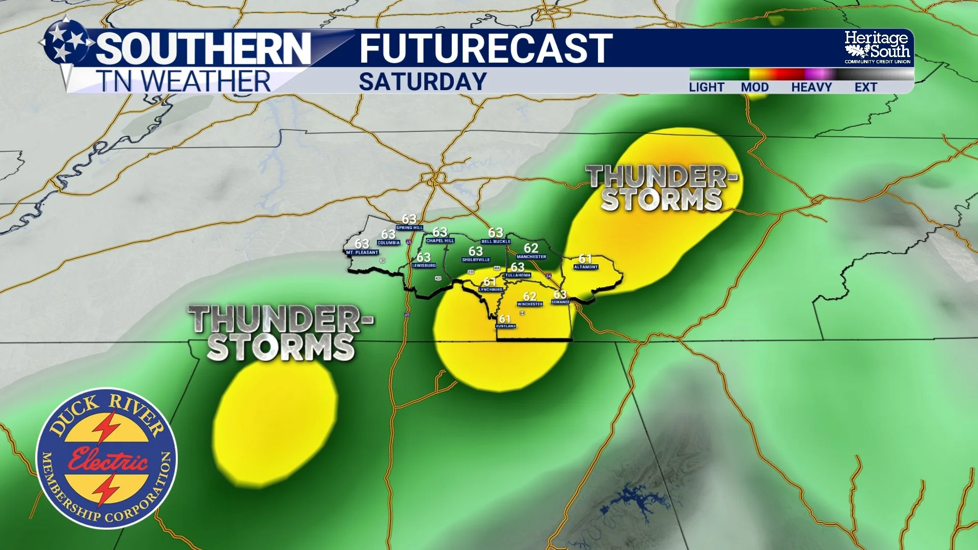
Springlike Warmth Expands, Weekend Storms Coming
Cloud cover remains in place across Southern Middle Tennessee this afternoon, but temperatures are responding to strong southerly flow. Most areas are climbing into the low to mid 70s … already running 10 to 20 degrees above early March normals.
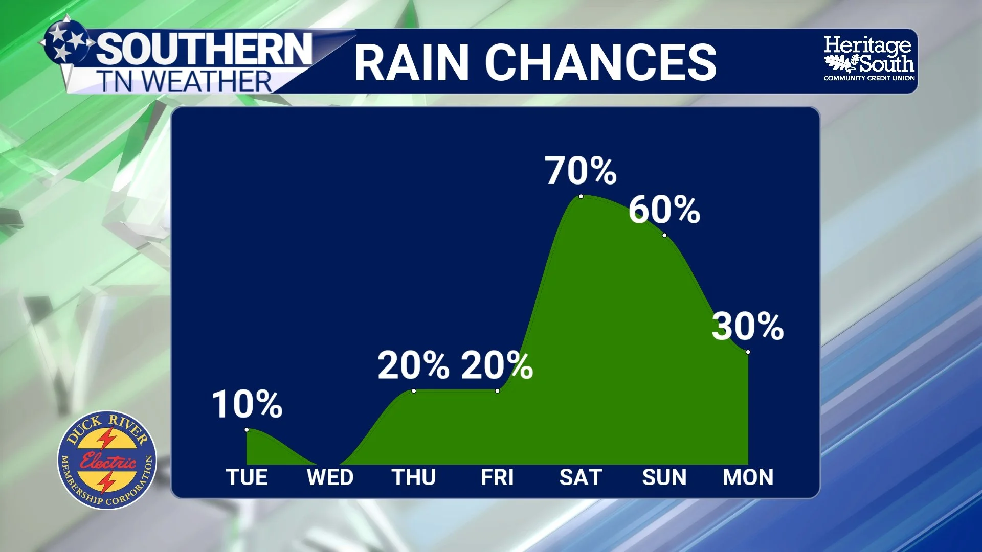
Warmth Building, Records in Sight
Light rain showers continue across parts of Southern Middle Tennessee this afternoon, especially over our western communities. Much of what’s showing up on radar has struggled to reach the ground due to dry air in the lower levels of the atmosphere.
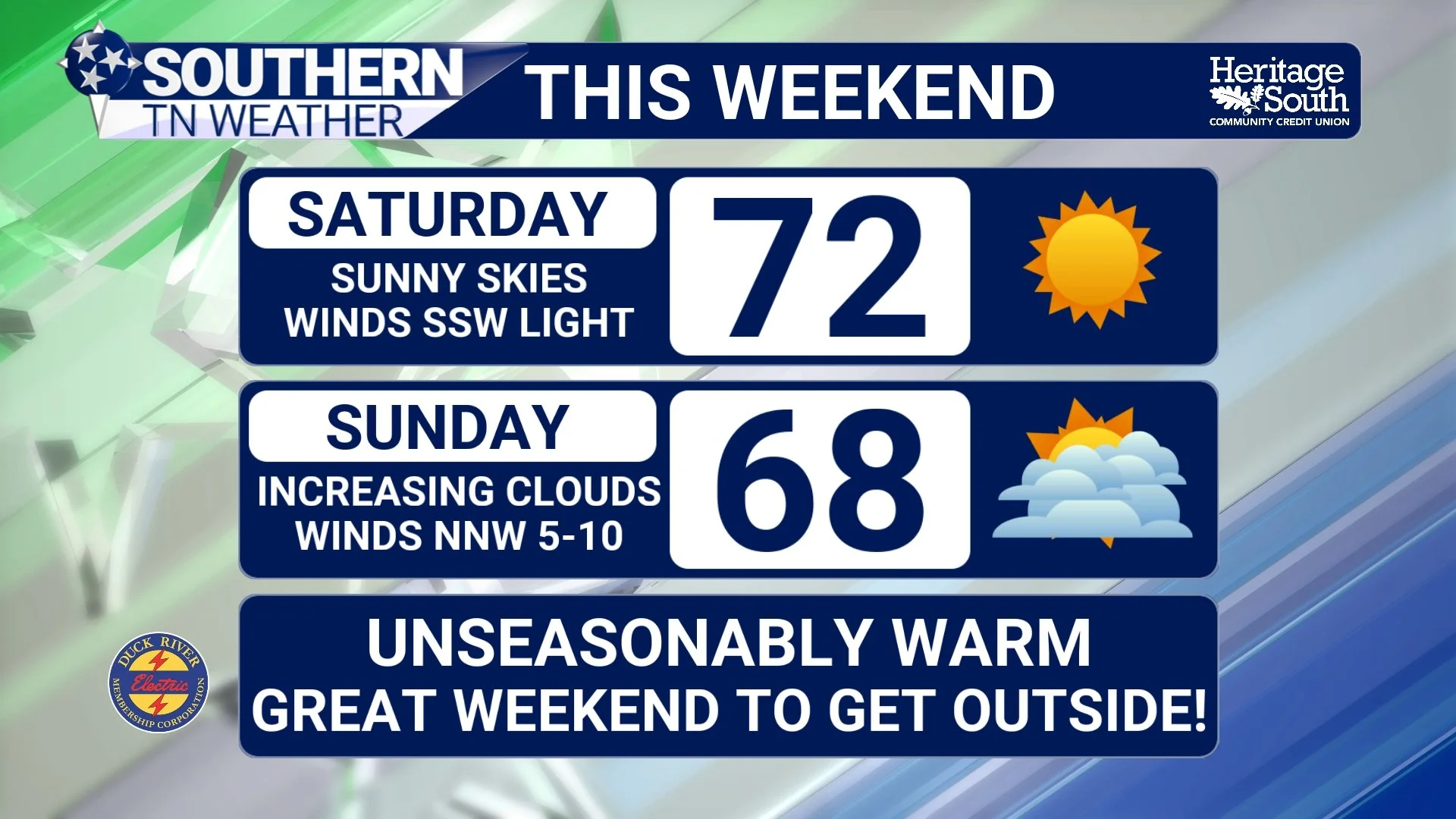
Sunshine, 70° Air, and a Spring-Like Weekend Ahead
High pressure is firmly in control across Southern Middle Tennessee this afternoon, and it shows. After a cool start this morning, temperatures have surged into the mid 60s, with a few communities flirting with 70°. That’s nearly 25 to 30 degrees warmer than where we started the day.
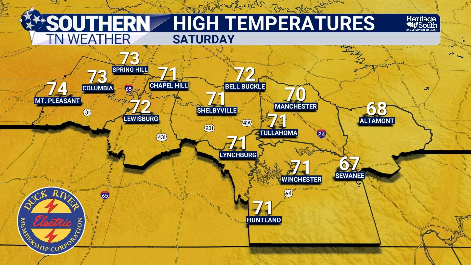
Sunshine Returns, Spring Preview This Weekend
Southern Middle Tennessee is drying out today as the cold front that brought our midweek rain pushes south of the area. Clouds linger this morning, but gradual clearing is expected through the afternoon. You’ll notice a big difference compared to yesterday — no steady rain, no thunder, just improving conditions!