
Back to a “Normal” Pattern… Warming Trend Ahead

The Southern Tennessee Weather Blog is proudly presented by Heritage South Community Credit Union.
We Help When Others Won’t!
Visit https://www.heritagesouth.org/ today to see how HSCCU can help YOU!
First off — I appreciate your patience over the past few days. It’s been a very busy stretch following this past weekend’s severe weather, but I am now getting back into a more normal schedule here at Southern Tennessee Weather.
The good news? The weather is finally calming down. After a very active and at times intense pattern, we are transitioning into a quiet and warming stretch across Southern Middle Tennessee, with no major storm systems in sight for several days.
Lingering Clouds Today, But Improving
We’re still dealing with some leftover cloud cover across the region today, especially through the early afternoon hours. A few very light sprinkles and flurries can’t be ruled out, but most locations will stay dry. As we head into the afternoon, clouds will gradually decrease from northwest to southeast, allowing for some sunshine to return.
Temperatures today will be a bit warmer than yesterday, with highs reaching the low 60s across our western counties and 50s toward the Plateau and eastern areas.
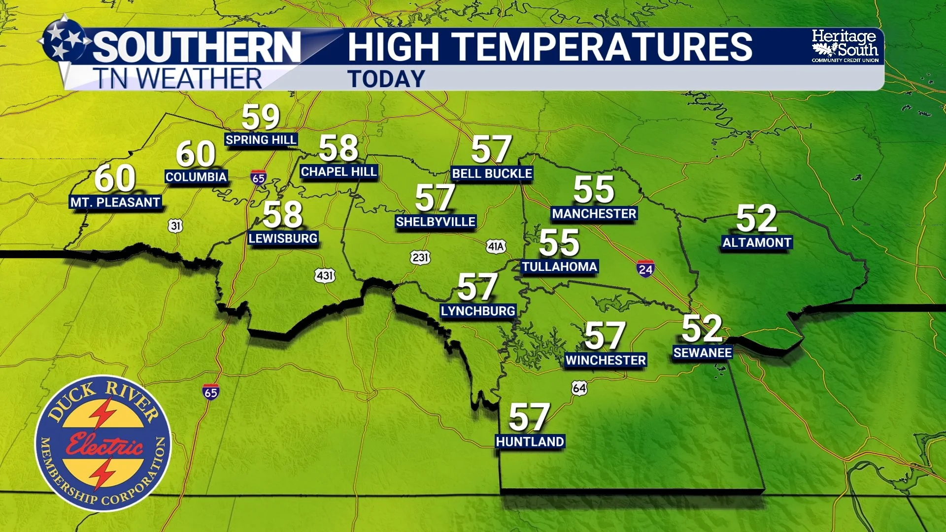
HIGH TEMPERATURES - TODAY
Warming Trend Begins Thursday
Starting Thursday, we really begin to turn the corner. A shift in the overall weather pattern will allow for warm air to move back into the region, helping temperatures climb into the upper 60s to low 70s. While we may still see some passing clouds, the atmosphere will remain fairly dry, meaning rain chances stay very low.
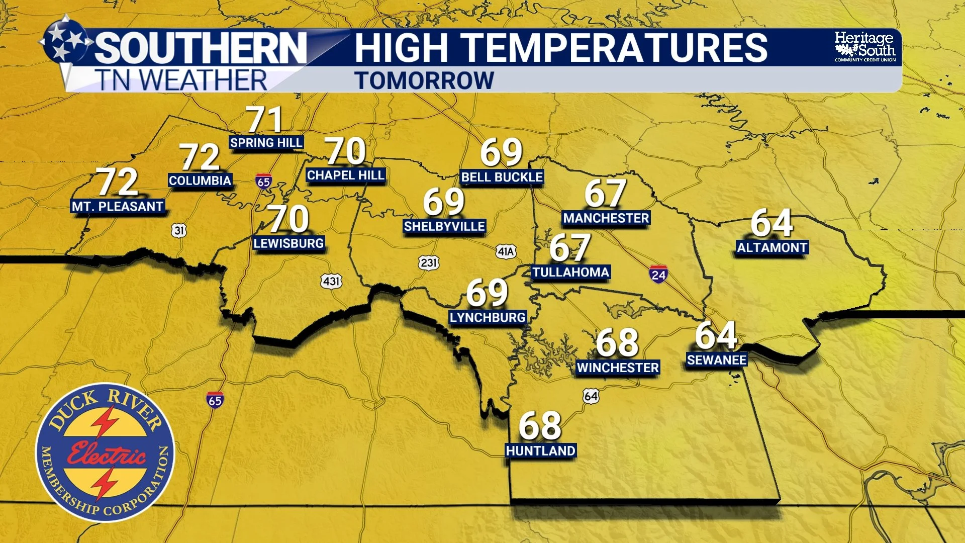
HIGH TEMPERATURES - TOMORROW
Spring-Like Weather This Weekend
If you’ve been waiting for consistent spring weather… here it is. High pressure will take control of the pattern heading into the weekend, leading to dry conditions and a steady warming trend.
By Saturday and Sunday, highs will climb into the upper 70s to low 80s across Southern Middle Tennessee, which is well above normal for mid-March. Skies will generally be partly to mostly sunny, and overall, it’s shaping up to be a great weekend to be outside.
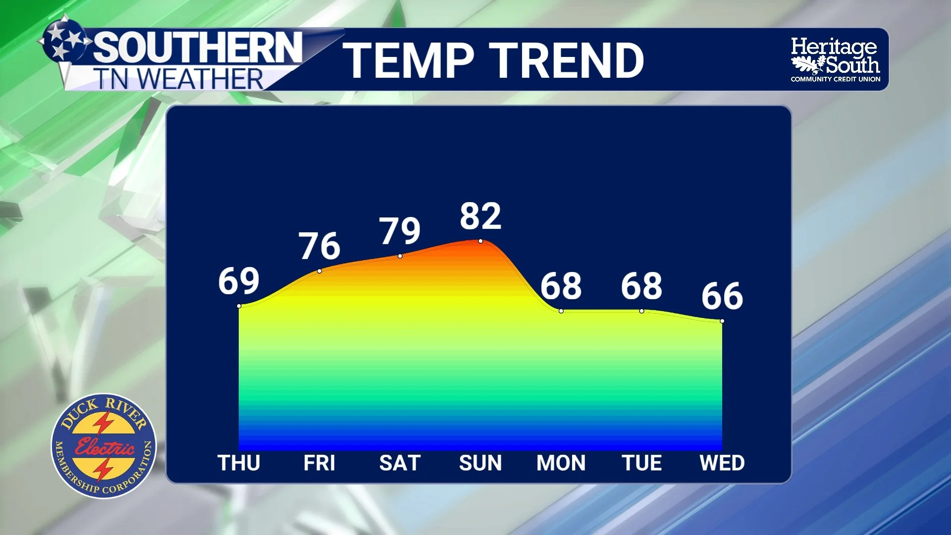
TEMPERATURE TREND - NEXT 7 DAYS
Any Rain Chances?
Rain chances over the next several days are very limited. The only thing we’re watching right now is a weak cold front early next week, which could bring a very small chance (around 20% or less) of light rain, mainly across the Cumberland Plateau on Monday. Even with that, rainfall looks minimal at best, and many areas may not see any rain at all.
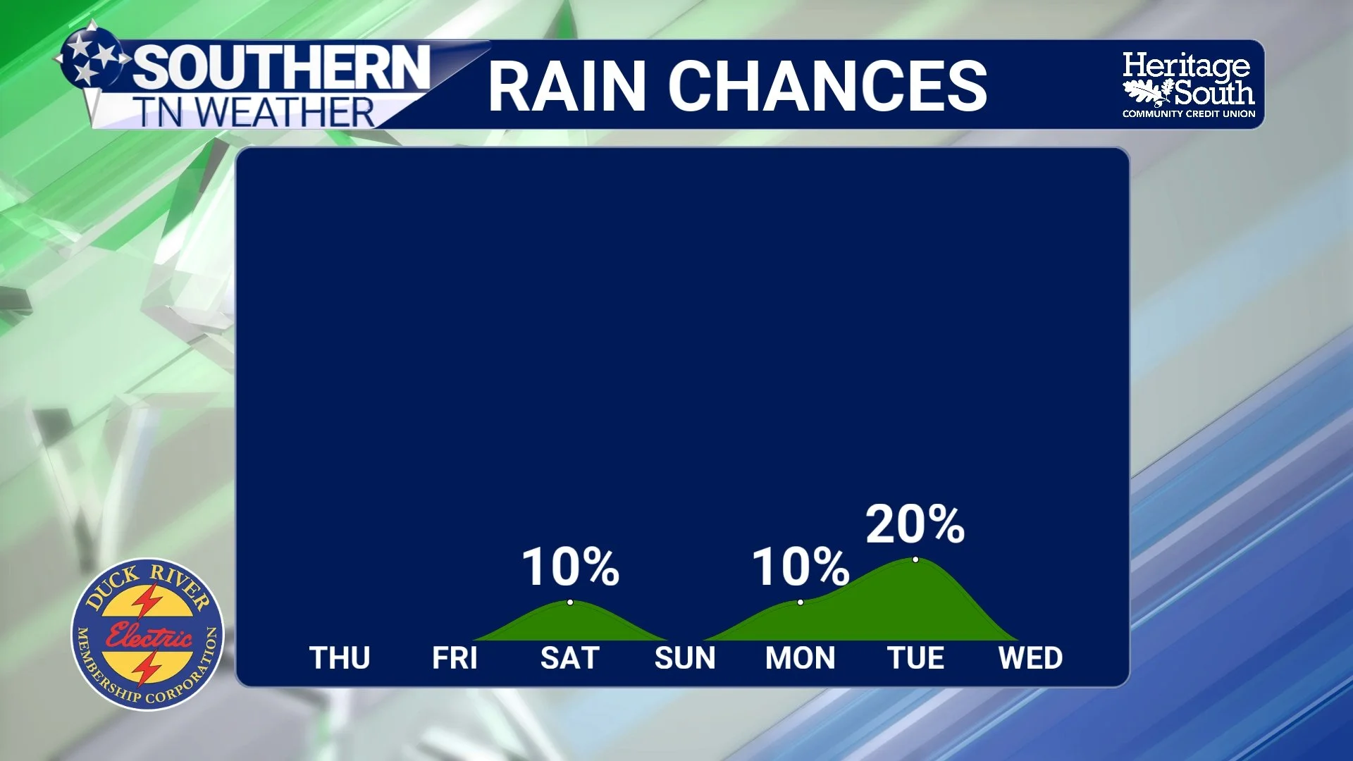
RAIN CHANCES - NEXT 7 DAYS
What About Severe Weather?
After the recent active pattern, this is the big question — and the answer is simple: No severe weather is expected across Southern Middle Tennessee through the weekend. The pattern is much more stable, with high pressure dominating and no strong storm systems moving through the region.
The Bottom Line 🧾
• Quiet weather returns after a very active stretch
• Clouds decrease this afternoon with highs in the 50s and 60s
• Warming trend begins Thursday with highs in the upper 60s to low 70s
• Spring-like weekend ahead with highs in the upper 70s to low 80s
• Dry pattern continues, with only a very low rain chance Monday
• No severe weather expected through the weekend
📰 Reminder: The Southern Tennessee Weather Blog, presented by Heritage South Community Credit Union, is updated Monday through Friday with fresh, locally tailored forecasts you can trust.