
Windy today - Rain Chances Return Tomorrow… Here’s What to Expect

The Southern Tennessee Weather Blog is proudly presented by Heritage South Community Credit Union.
We Help When Others Won’t!
Visit https://www.heritagesouth.org/ today to see how HSCCU can help YOU!
After several days of warm, dry, and breezy conditions across Southern Middle Tennessee, the pattern is beginning to shift. It’s not a dramatic flip, but it is a meaningful one — and it starts with our first real chance for showers and thunderstorms on Wednesday. This isn’t shaping up to be a washout or a severe weather day. Instead, it’s the beginning of a more active, spring-like pattern where the atmosphere becomes just unstable enough to support scattered storms.
What’s Changing Above Us
The key change is happening a few thousand feet above our heads. Up until now, we’ve been under a fairly flat, west-to-east flow pattern. That kind of setup tends to keep things quiet, with limited large-scale lift and fewer organized weather systems. Now, winds aloft are turning more out of the southwest. That may not sound like a big deal, but it opens the door for disturbances to start moving into the Tennessee Valley from the Plains.
At the same time, surface winds remain out of the south, continuing to pull in warmer and more humid air. That added moisture is a critical ingredient — without it, even passing disturbances wouldn’t be able to produce much. So what we end up with is a gradually “priming” atmosphere: more moisture, slightly more instability, and just enough lift to get things going. WInd gusts this afternoon have been in the 15-20 MPH range, with some gusts up to 30 MPH.
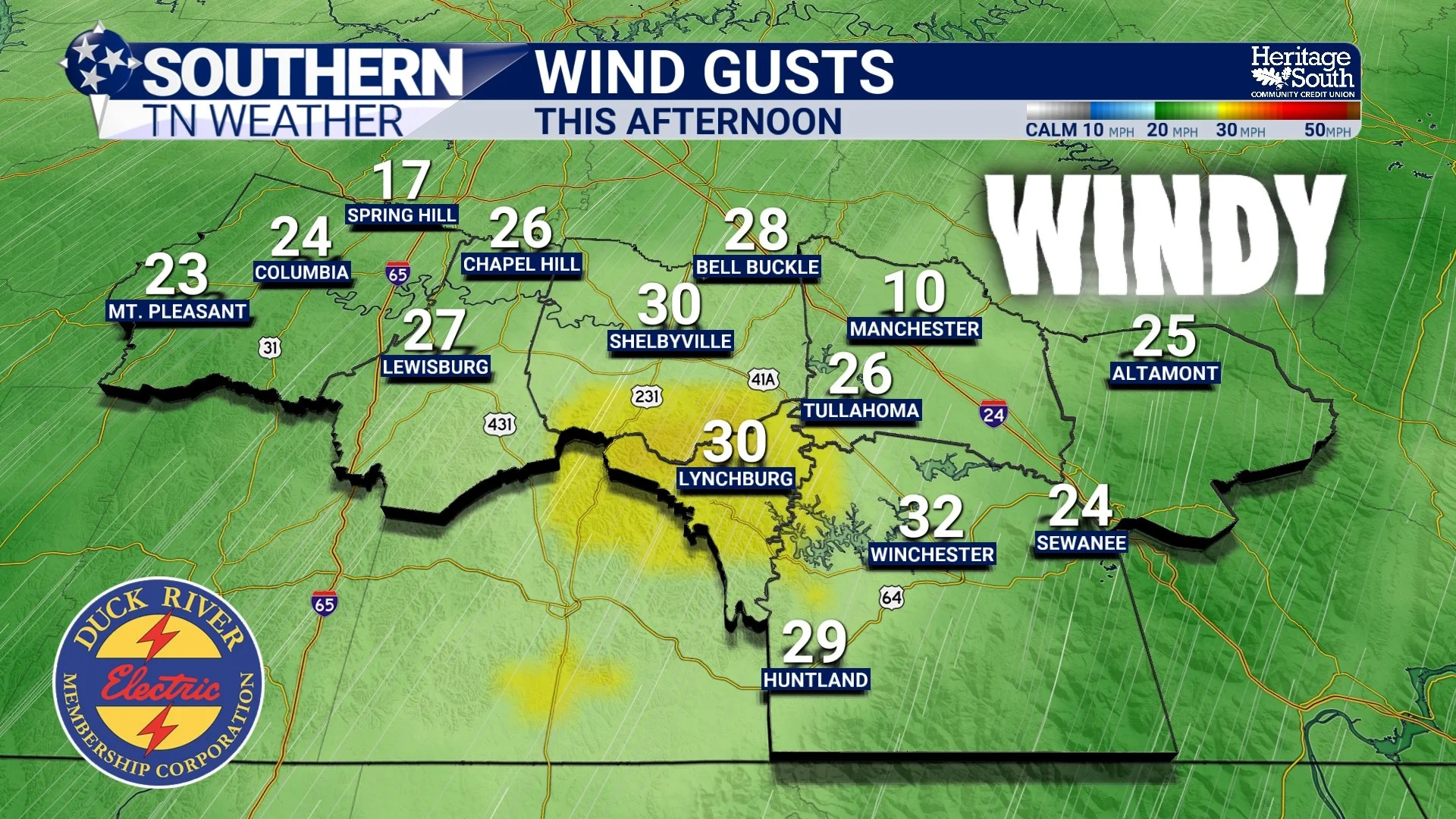
WIND GUSTS - THIS AFTERNOON
Why Wednesday Is Not a Washout
Even though rain chances return, Wednesday will not be a day where it rains all day long. This setup is driven heavily by daytime heating. As the sun warms the ground, the air near the surface becomes buoyant and wants to rise. That rising motion is what helps showers and storms develop. Because of that, the best chance for activity will come during the afternoon and early evening hours.
Outside of that window (especially during the morning) most areas will stay dry. Even during peak heating, storms will be scattered. One neighborhood could see a quick downpour, while another just a few miles away sees nothing at all.
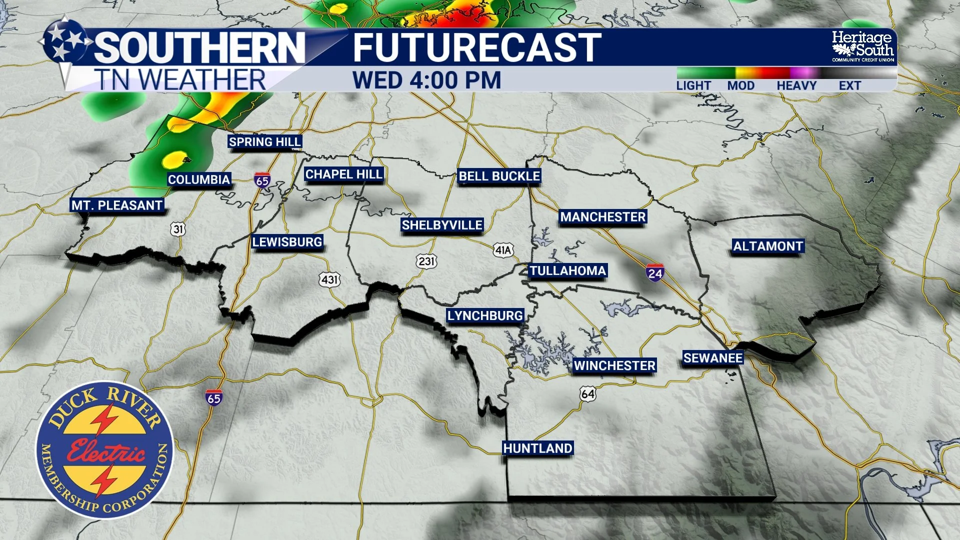
FUTURECAST - WEDNESDAY AFTERNOON
Why Storms Stay Weak
There’s a big difference between “stormy” and “severe,” and Wednesday falls firmly on the non-severe side of things. The atmosphere will have just enough instability to support storm development, but not enough to sustain strong updrafts. On top of that, wind shear is fairly weak, which means storms won’t have the organization needed to intensify.
Lapse rates are also unimpressive, meaning the atmosphere doesn’t cool quickly with height. That limits how efficiently air can rise, which further caps storm strength. Put all of that together, and what you get are classic springtime, “garden variety” storms — brief, scattered, and generally low-impact.
What You’ll Notice Locally
For Southern Middle Tennessee, Wednesday will feel warm and a bit more humid, with highs climbing into the lower 80s. Clouds will increase at times, and by the afternoon, a few showers and thunderstorms will begin to pop up. Coverage will remain scattered, and many areas may stay completely dry through the day… If you do get a storm, expect a quick burst of rain, maybe a rumble of thunder, and then it moves on.
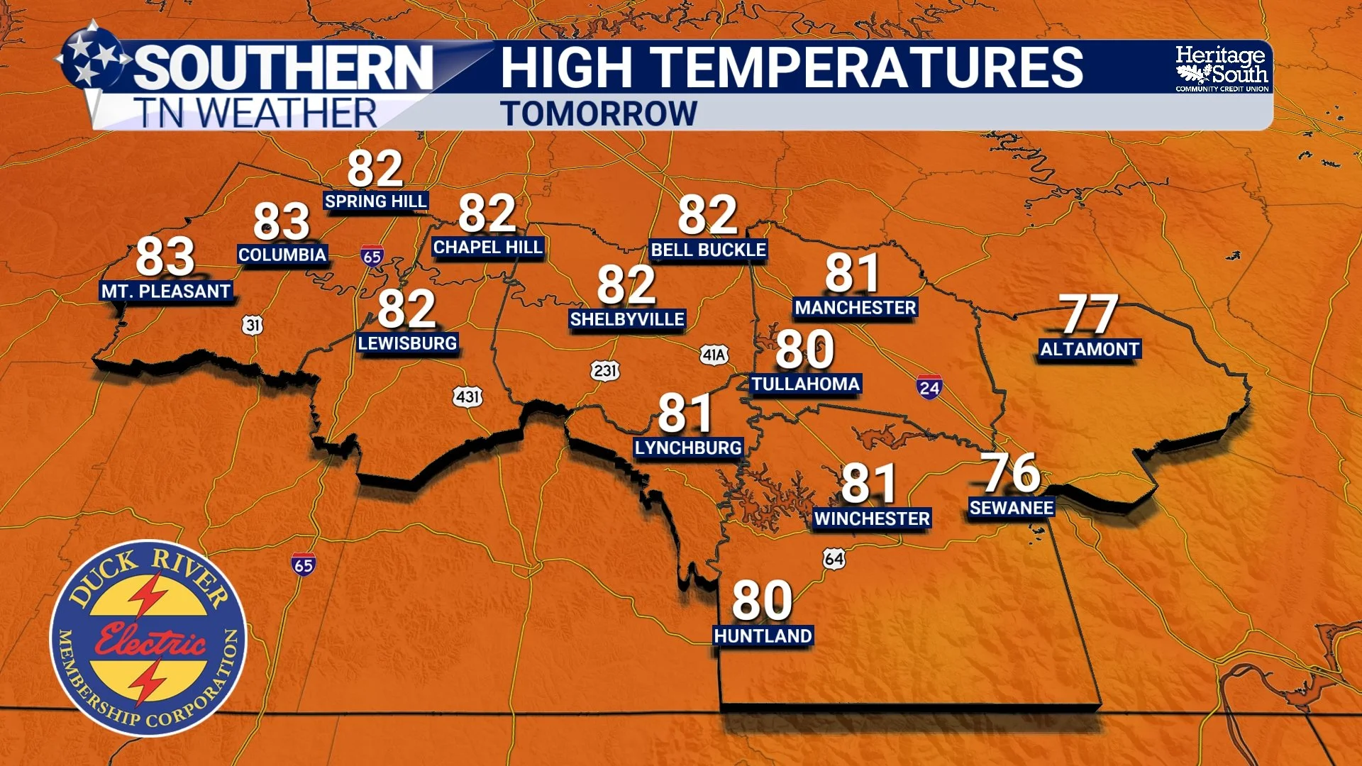
HIGH TEMPERATURES - WEDNESDAY
more rain as the week progresses…
Wednesday is more of a transition day than anything else. Once we open the door to this pattern, we keep it open. Shower and storm chances will continue Thursday, Friday, and into the weekend as additional disturbances move through.
Even then, the overall setup remains fairly low-end. We’re not looking at a strong to severe weather pattern right now, but rather multiple rounds of scattered activity in a warm, moist environment.
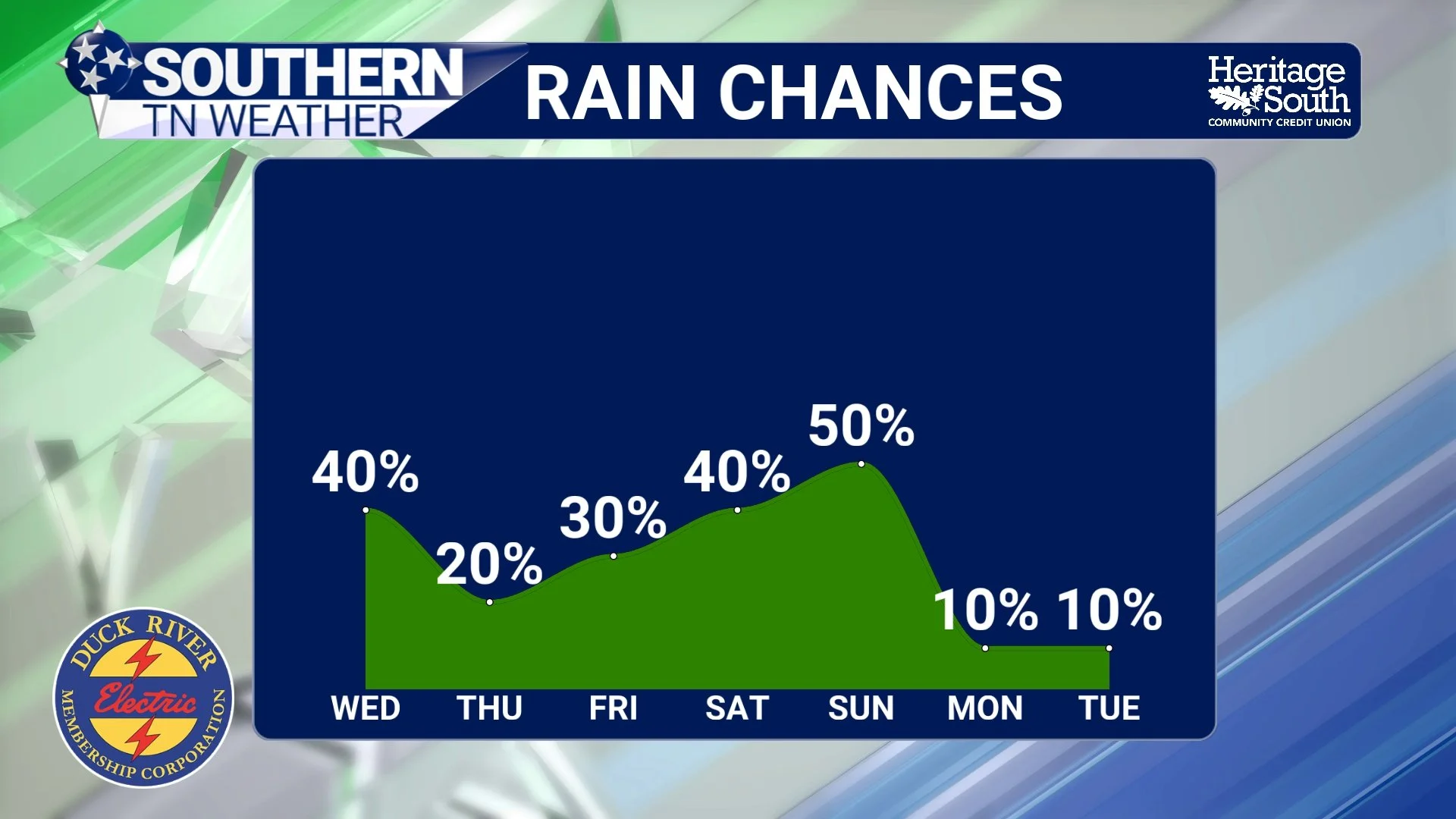
RAIN CHANCES - NEXT 7 DAYS
The Bottom Line 🧾
• Scattered showers and storms develop Wednesday afternoon and evening
• Activity will be hit-or-miss, not widespread
• Storms will remain weak with no severe weather expected
• Warm and more humid conditions continue with highs in the 80s
• Additional rain chances continue through the rest of the week
📰 Reminder: The Southern Tennessee Weather Blog, presented by Heritage South Community Credit Union, is updated Monday through Friday with fresh, locally tailored forecasts you can trust.