
Springlike Warmth Expands, Weekend Storms Coming

The Southern Tennessee Weather Blog is proudly presented by Heritage South Community Credit Union.
We Help When Others Won’t!
Visit https://www.heritagesouth.org/ today to see how HSCCU can help YOU!
Cloud cover remains in place across Southern Middle Tennessee this afternoon, but temperatures are responding to strong southerly flow. Most areas are climbing into the low to mid 70s … already running 10 to 20 degrees above early March normals. The main weather story today isn’t precipitation — it’s wind. Southerly gusts between 20 and 30 mph are developing as the pressure gradient tightens between high pressure off the East Coast and a developing system to our west. Those breezes will stick with us through the afternoon before easing tonight.
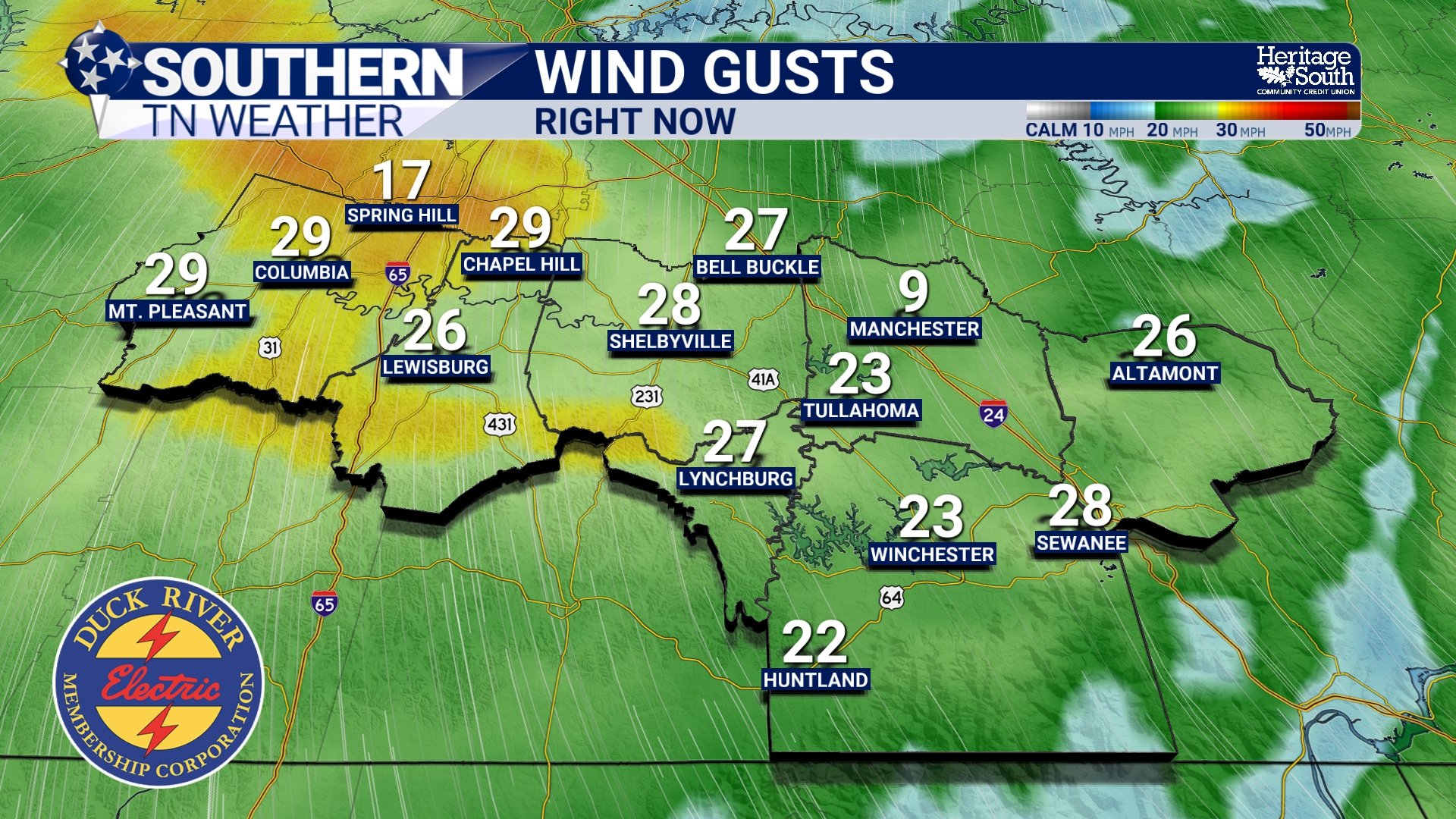
WIND GUSTS - THIS AFTERNOON
The Pattern Shift: Why It’s Getting So Warm
An upper-level ridge is building northward from the Gulf. In simple terms, this ridge acts like a dome of warm air and sinking motion. It suppresses widespread storm development locally while allowing temperatures to surge well above normal.
Because of that ridge:
Wednesday highs will push into the upper 70s to lower 80s.
Thursday and Friday could be even warmer.
Several record highs are in jeopardy late this week.
Early March averages typically sit in the mid-50s. We’re forecasting readings more typical of late April.
Overnight lows will also stay unusually mild, generally in the upper 50s to lower 60s by midweek.
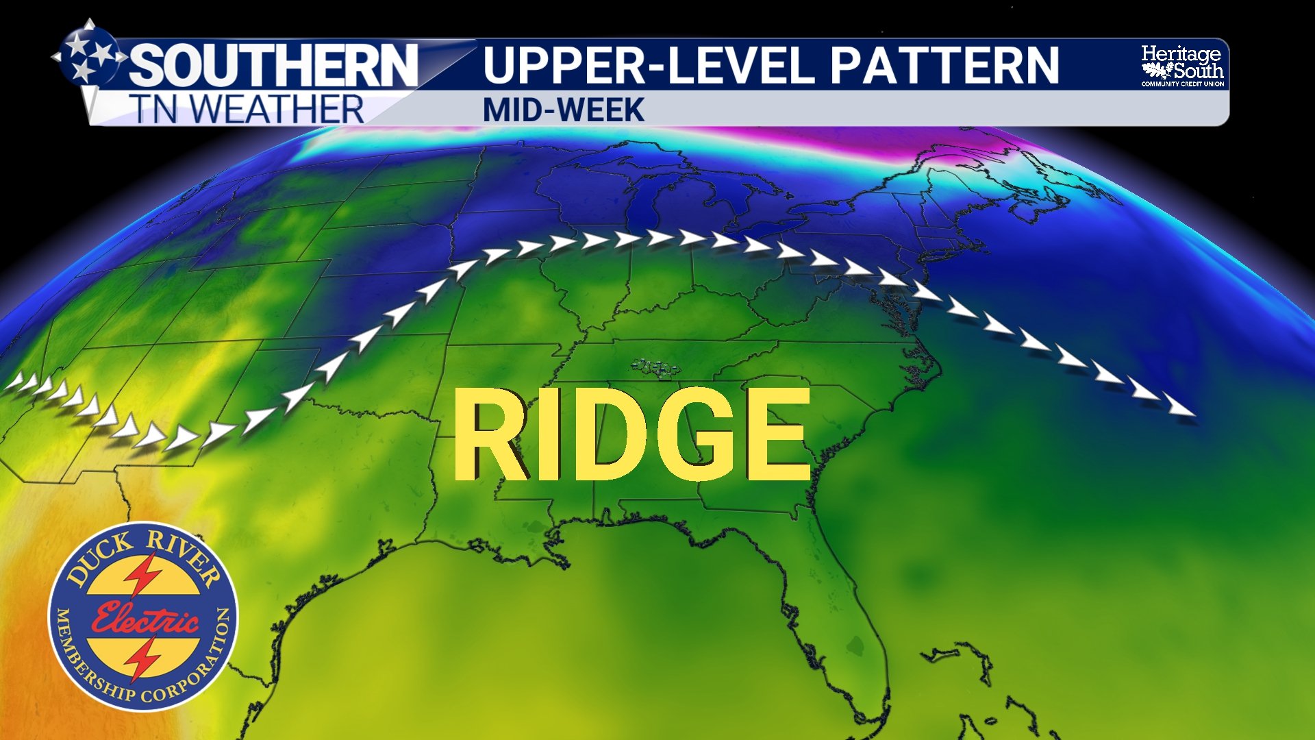
UPPER LEVEL PATTERN - MIDWEEK
What About Storms?
The ridge is also playing defense against storm systems trying to move in from the west. Most of the weather tracks this week favor areas north and west of Southern Middle Tennessee. There is a small window on Thursday where a weakening line of showers could approach. However, forcing looks limited and widespread rain during the workweek appears unlikely. The better opportunity for more organized showers and thunderstorms arrives this weekend.
As the ridge shifts east and breaks down:
Rain chances increase Saturday.
Multiple rounds of showers are possible into Sunday and Monday.
Severe weather risk currently appears low.
Flooding risk also remains low at this time.
There may be instability in place Saturday afternoon, but with the main surface low tracking well north of us, wind shear could be limited locally. That’s something we’ll monitor closely as we get closer.
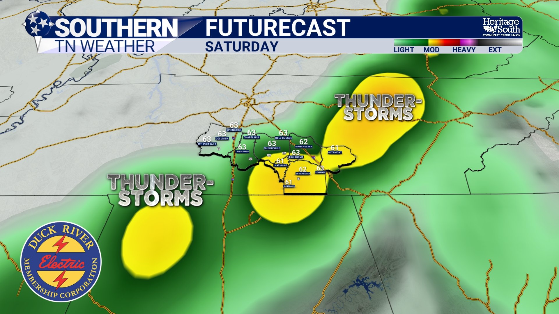
FUTURECAST - SATURDAY
Big Picture
Long-range outlooks continue to strongly favor above-normal temperatures through at least mid-March. Rainfall chances will gradually increase late week into the weekend, but at this point, no high-impact weather is expected locally.
The Bottom Line 🧾
Gusty south winds today with highs in the 70s.
Upper 70s to lower 80s Wednesday through Friday.
Record highs possible late week.
Best rain chances arrive this weekend.
Severe and flooding risks currently remain low.
📰 Reminder: The Southern Tennessee Weather Blog, presented by Heritage South Community Credit Union, is updated Monday through Friday with fresh, locally tailored forecasts you can trust.