
Sunshine, 70° Air, and a Spring-Like Weekend Ahead

The Southern Tennessee Weather Blog is proudly presented by Heritage South Community Credit Union.
We Help When Others Won’t!
Visit https://www.heritagesouth.org/ today to see how HSCCU can help YOU!
High pressure is firmly in control across Southern Middle Tennessee this afternoon, and it shows. After a cool start this morning, temperatures have surged into the mid 60s, with a few communities flirting with 70°. That’s nearly 25 to 30 degrees warmer than where we started the day.
Northwest flow behind yesterday’s front has ushered in drier air, skies have cleared nicely, and winds have relaxed. It’s about as quiet as late February weather can get.
Tonight: Clear and Cool
With clear skies and light winds, ideal radiational cooling conditions are in place tonight. Temperatures will fall quickly after sunset, bottoming out in the lower 40s across much of Southern Middle Tennessee. Fog development looks limited thanks to the dry air in place, though a few patchy areas of fog cannot be ruled out.
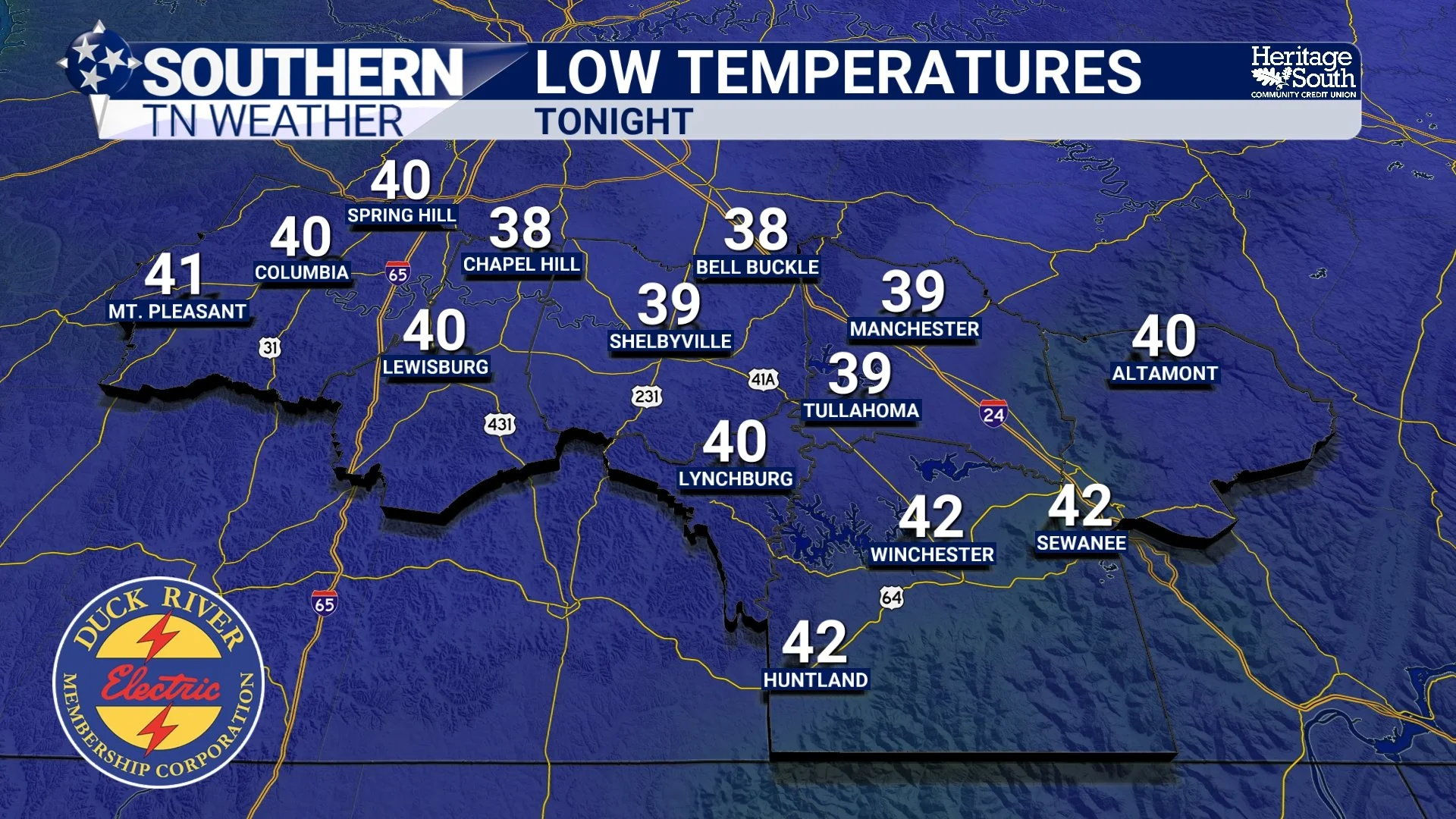
LOW TEMP FORECAST - TONIGHT
Weekend Preview: It’s Going to Feel Like April
Saturday looks even warmer than today. Abundant sunshine and light winds will push highs into the low 70s across many communities across our area. Sunday will stay warm (still in the 60s for many) but clouds will gradually increase through the day as our next system approaches from the west. Most of Sunday daytime remains dry.
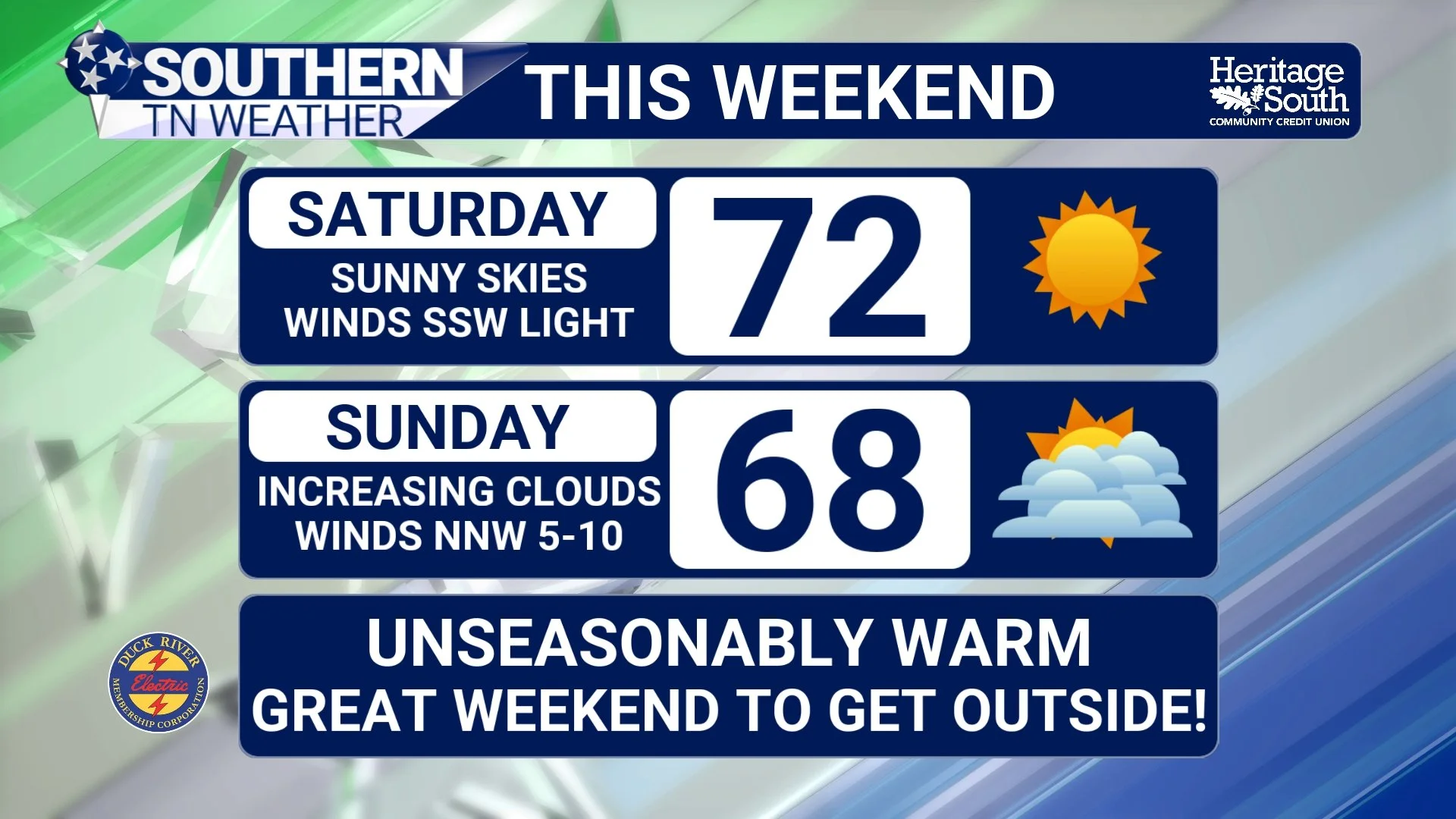
FORECAST - THIS WEEKEND
Looking Ahead
Rain chances return Sunday night into Monday as a warm front and surface trough develop near Middle Tennessee. At this time, rainfall totals look modest and no hazardous weather is expected. The broader pattern next week becomes somewhat unsettled. We’ll see periodic low to medium rain chances through midweek as a frontal boundary stalls nearby. Despite that, temperatures remain very spring-like — well above normal for early March.
Long-range outlooks continue to favor above-normal temperatures and above-normal rainfall across the area. The green below indicates above-average precip. The red indicates above-average temps.
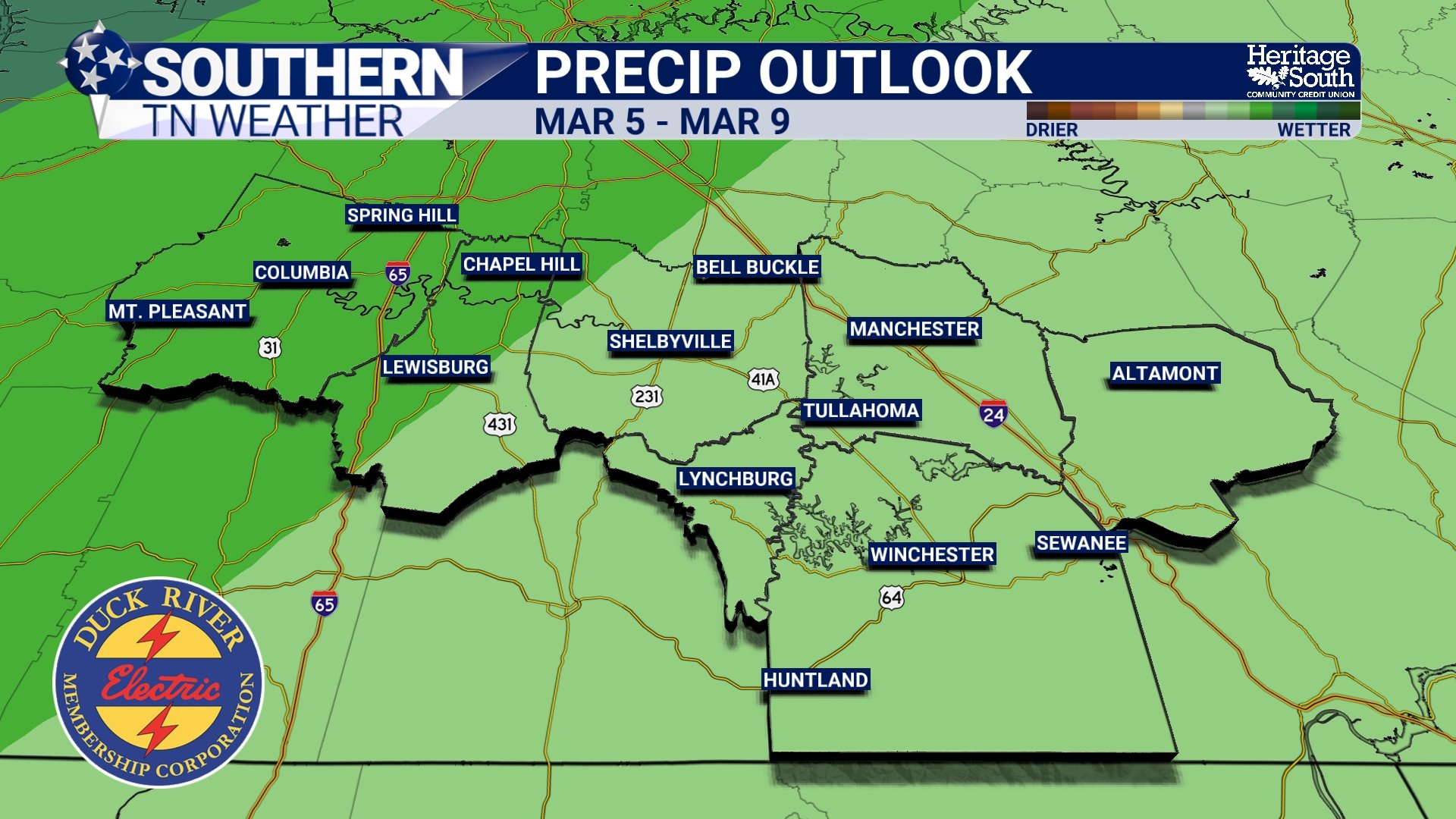
PRECIP OUTLOOK - MARCH 5th THRU MARCH 9TH
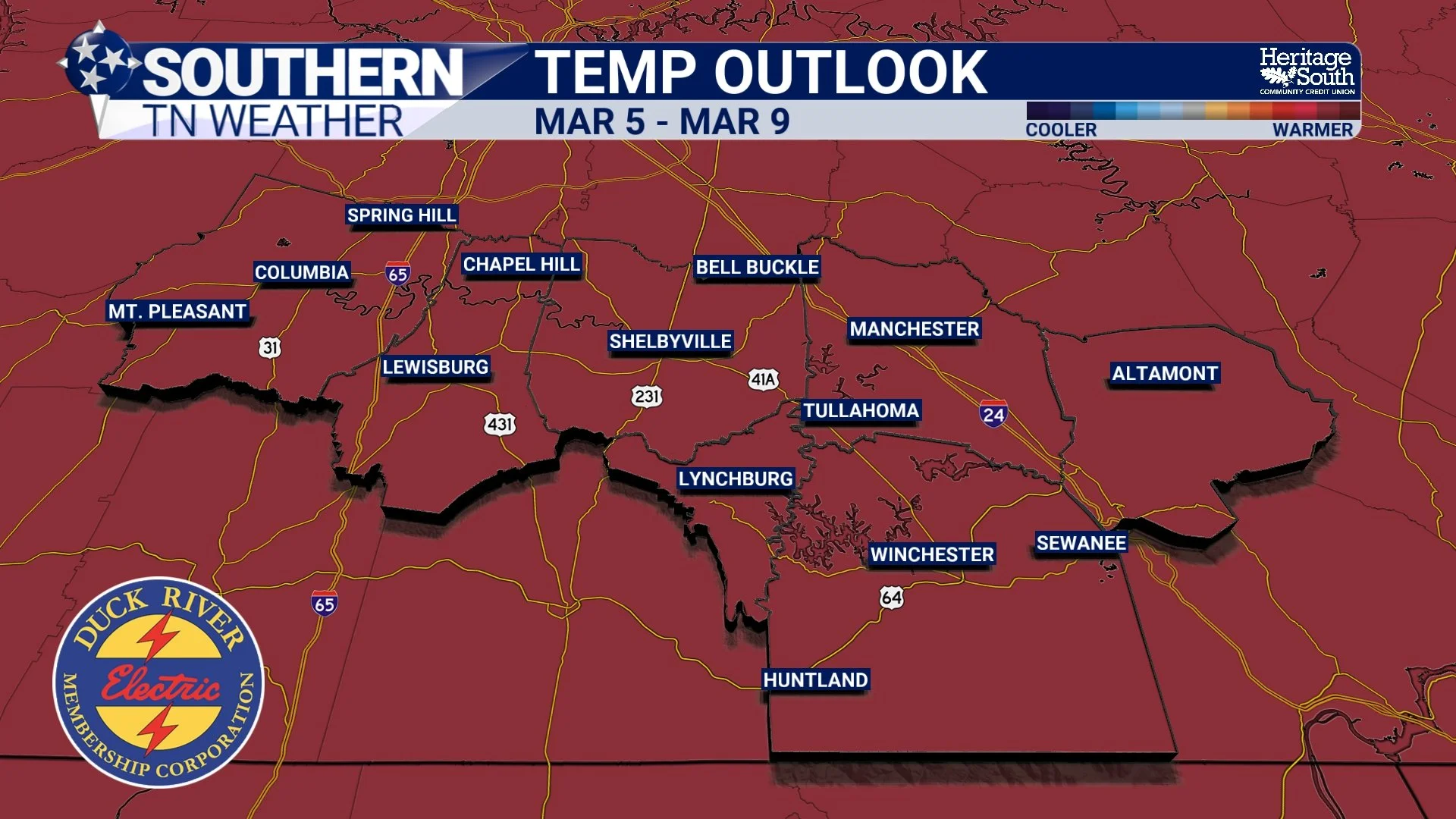
TEMP OUTLOOK - MARCH 5th THRU MARCH 9TH
The Bottom Line 🧾
Clear and cool tonight with lows in the lower 40s.
Low 70s Saturday and Sunday across Southern Middle Tennessee.
Rain chances return Sunday night into Monday.
Mild, unsettled pattern continues into next week.
📰 Reminder: The Southern Tennessee Weather Blog, presented by Heritage South Community Credit Union, is updated Monday through Friday with fresh, locally tailored forecasts you can trust.