
Warmth Building, Records in Sight

The Southern Tennessee Weather Blog is proudly presented by Heritage South Community Credit Union.
We Help When Others Won’t!
Visit https://www.heritagesouth.org/ today to see how HSCCU can help YOU!
Light rain showers continue across parts of Southern Middle Tennessee this afternoon, especially over our western communities. Much of what’s showing up on radar has struggled to reach the ground due to dry air in the lower levels of the atmosphere.
This activity will gradually fade toward sunset as a weak upper-level disturbance slides east. Once it clears out, attention quickly turns to a much warmer pattern setting up for the rest of the week.
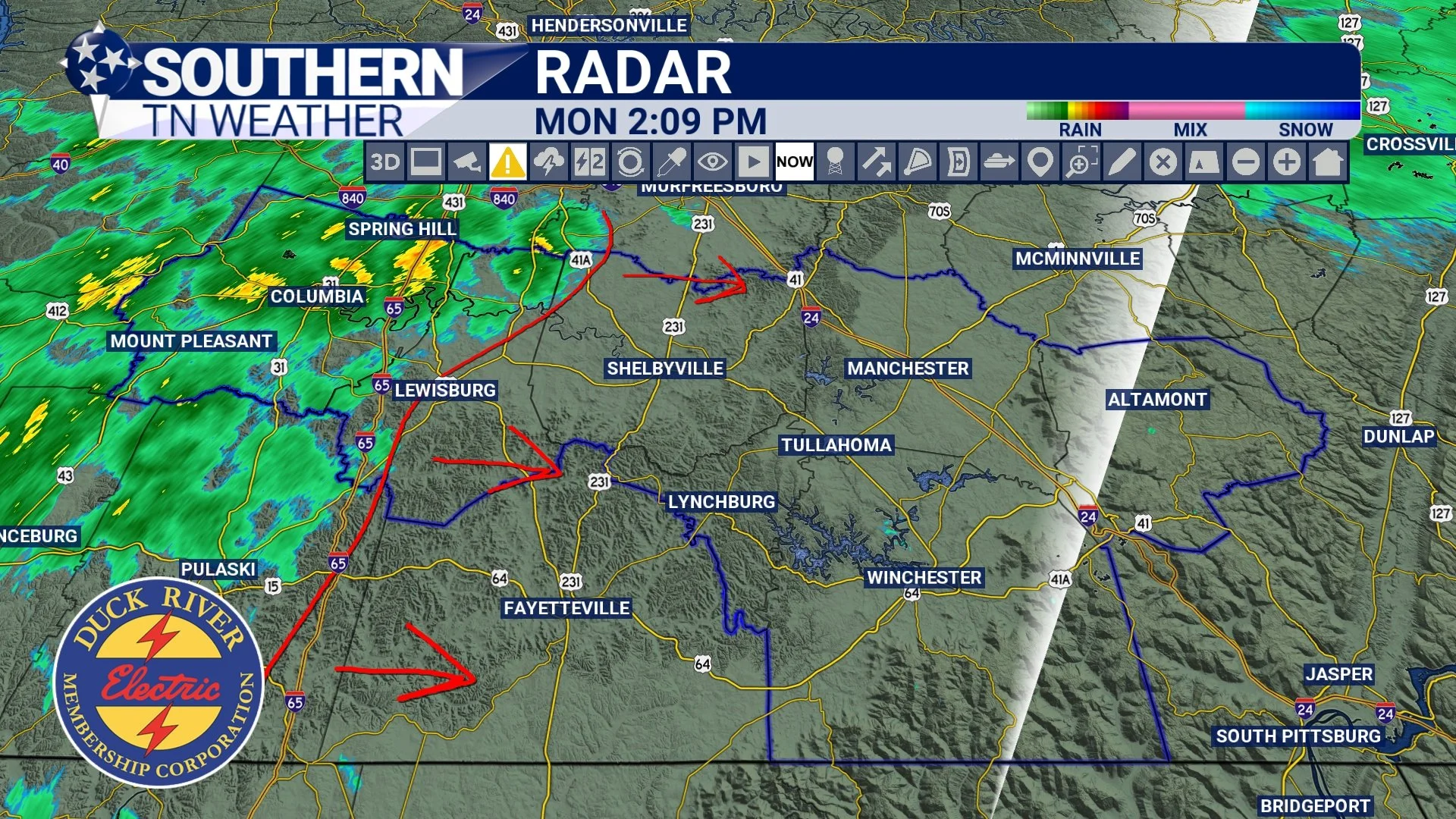
RADAR - THIS AFTERNOON
Tonight: Mild, Not Cold
Temperatures tonight will be dramatically different compared to last week. Lows will only fall into the upper 40s and 50s as southerly winds strengthen and moisture increases. Some low clouds may redevelop late tonight, and patchy fog is possible in typical low-lying areas.
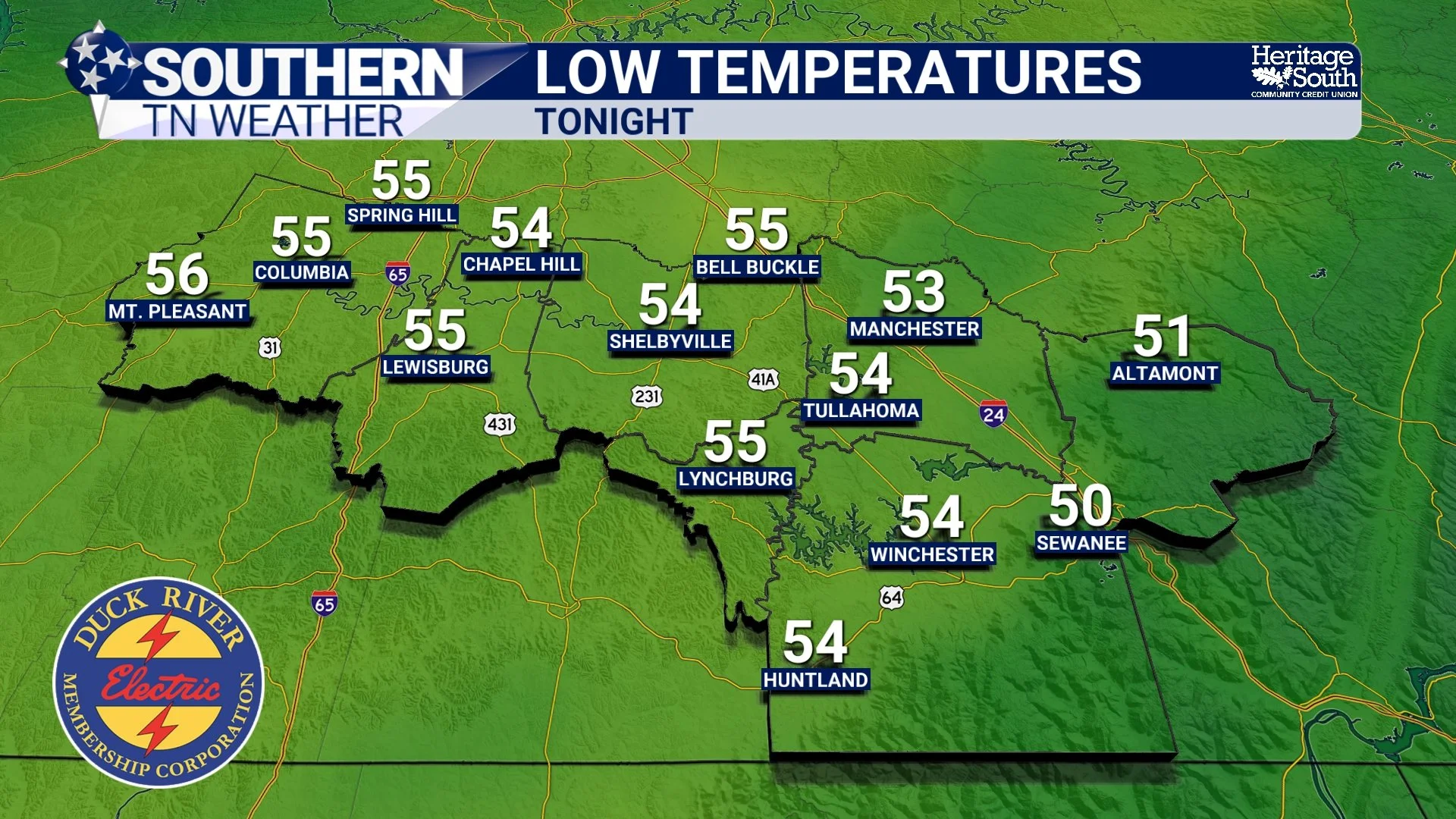
LOW TEMPS - TONIGHT
Midweek: Spring-Like and Possibly Record Warm
Beginning Tuesday, a strengthening ridge across the Southeast will allow very warm air to surge into Southern Middle Tennessee. Highs will climb well into the 70s Tuesday. By Wednesday through Friday, many locations will reach the upper 70s to lower 80s.
Forecast guidance suggests record highs could be challenged Thursday and Friday. Early March typically brings highs in the mid-50s, so this air mass is running 20 to 25 degrees above normal. While a weakening line of showers may approach Wednesday night into Thursday, widespread rainfall looks limited during the peak of the warm stretch.
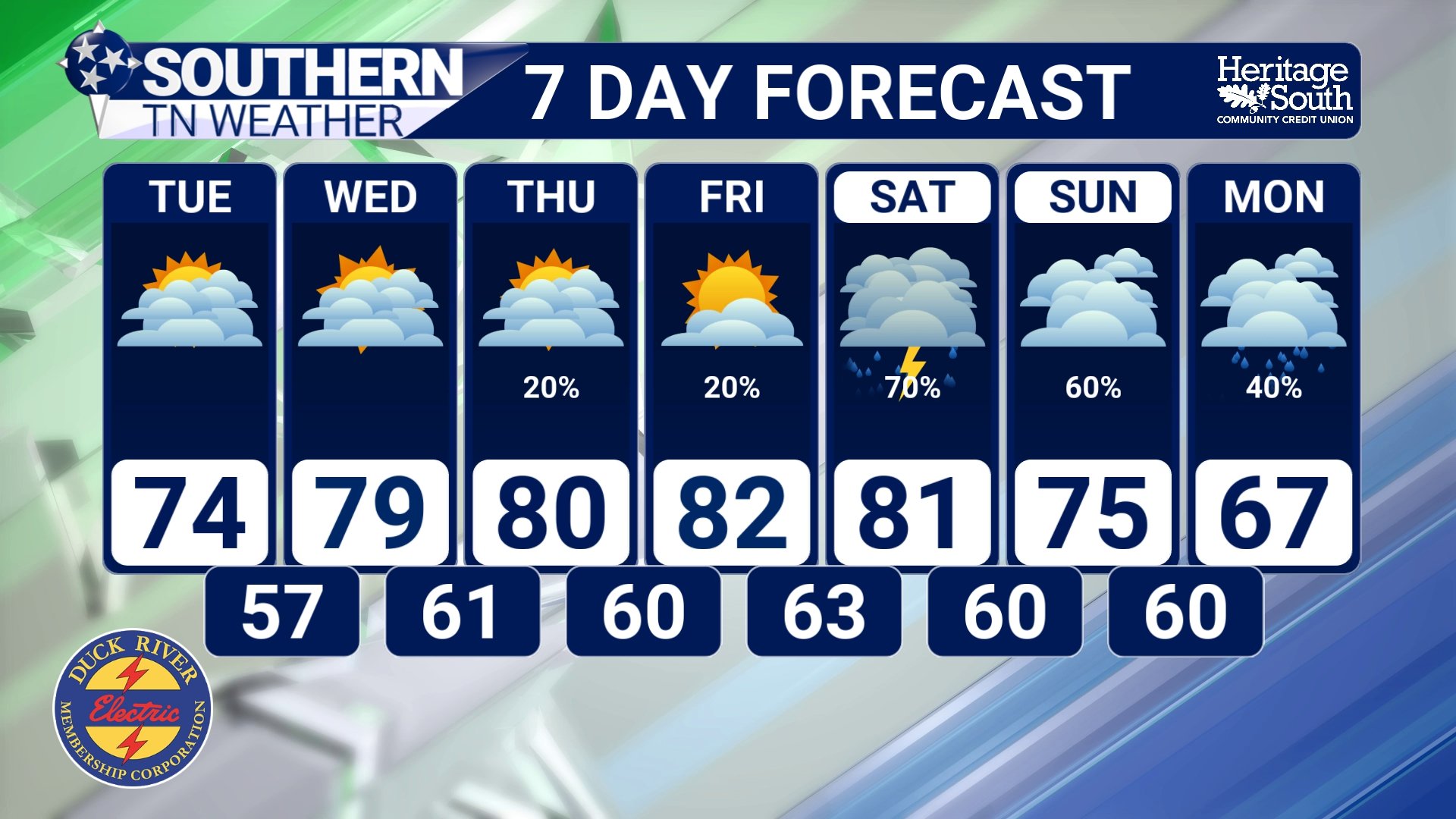
7-DAY FORECAST
Weekend Outlook: Pattern Turns More Active
The upper ridge shifts east this weekend, allowing storm systems to move closer to our area. Rain chances increase Saturday into Sunday and may linger into early next week.
Right now:
Severe weather risk is very low
Flooding risk is very low
Rainfall totals do not appear excessive
It does, however, mark a transition toward a more unsettled pattern.
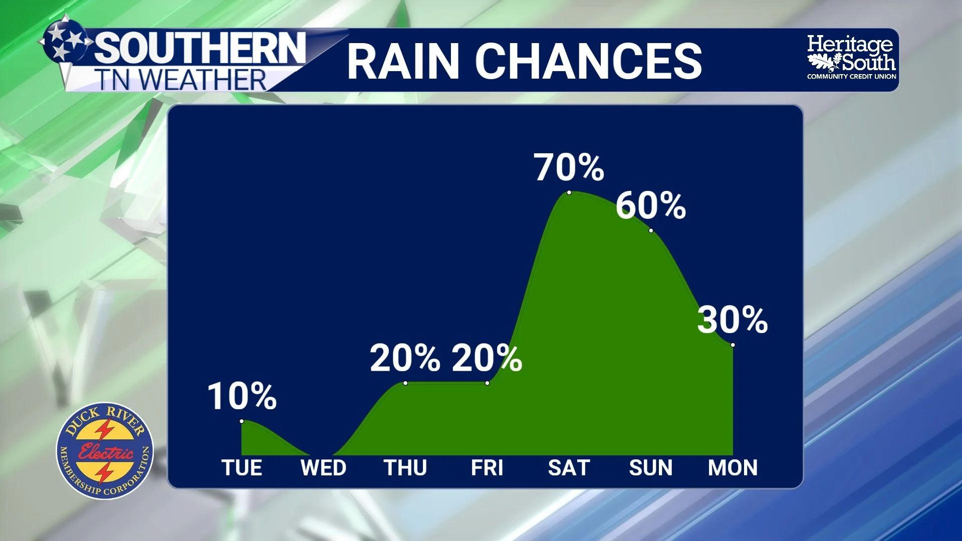
RAIN CHANCES - NEXT 7 DAYS
The Bottom Line 🧾
Light showers fade this afternoon.
Very warm temperatures build Tuesday through Friday.
Highs in the 70s and 80s mid to late week, with broken records possible.
More unsettled weather returns this weekend, but hazards look low.
📰 Reminder: The Southern Tennessee Weather Blog, presented by Heritage South Community Credit Union, is updated Monday through Friday with fresh, locally tailored forecasts you can trust.