
Strong to Severe Thunderstorms Possible Wednesday

The Southern Tennessee Weather Blog is proudly presented by Heritage South Community Credit Union.
We Help When Others Won’t!
Visit https://www.heritagesouth.org/ today to see how HSCCU can help YOU!
An active stretch of weather continues across Southern Middle Tennessee, with the greatest concern now shifting to Wednesday afternoon and evening, when a line of strong to severe thunderstorms may move across the region. The Storm Prediction Center has placed all of Middle Tennessee under a Slight Risk (Level 2 out of 5) for severe weather on Wednesday. While this is not an unusually high risk for this time of year, it does signal that scattered severe storms are possible, especially during the late afternoon and evening hours.
The main threat appears to be damaging straight-line winds, though large hail and a brief tornado cannot be completely ruled out.
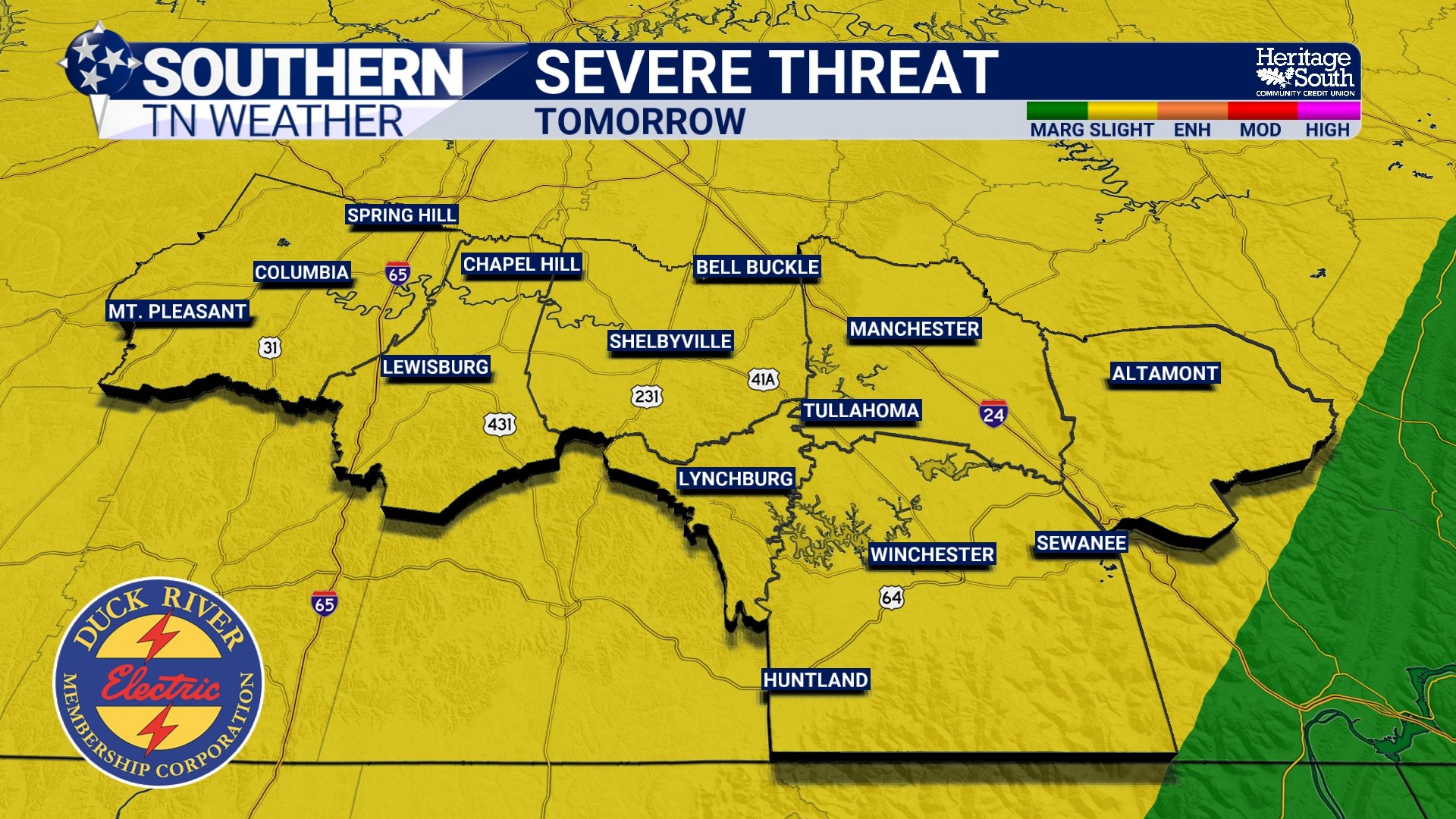
SEVERE THUNDERSTORM OUTLOOK - TOMORROW
A Warm and Humid Setup Ahead of the Storms
Ahead of Wednesday’s cold front, the atmosphere across Tennessee will remain warm, humid, and unstable. Dew points are already sitting in the mid to upper 60s, which indicates plenty of moisture in the lower atmosphere. When combined with afternoon temperatures rising into the upper 70s to near 80 degrees, this will provide fuel for thunderstorm development.
Meteorologists measure this storm “fuel” using a parameter called CAPE (Convective Available Potential Energy). Forecast values on Wednesday may range from around 500 to as high as 1500 J/kg, depending on how much sunshine we see during the day. While this level of instability is moderate, the atmosphere will also feature strong wind shear, meaning winds change speed and direction with height. This is important because wind shear helps thunderstorms organize and strengthen.
With deep-layer shear around 40 knots, storms that become well-organized could produce damaging winds and hail.
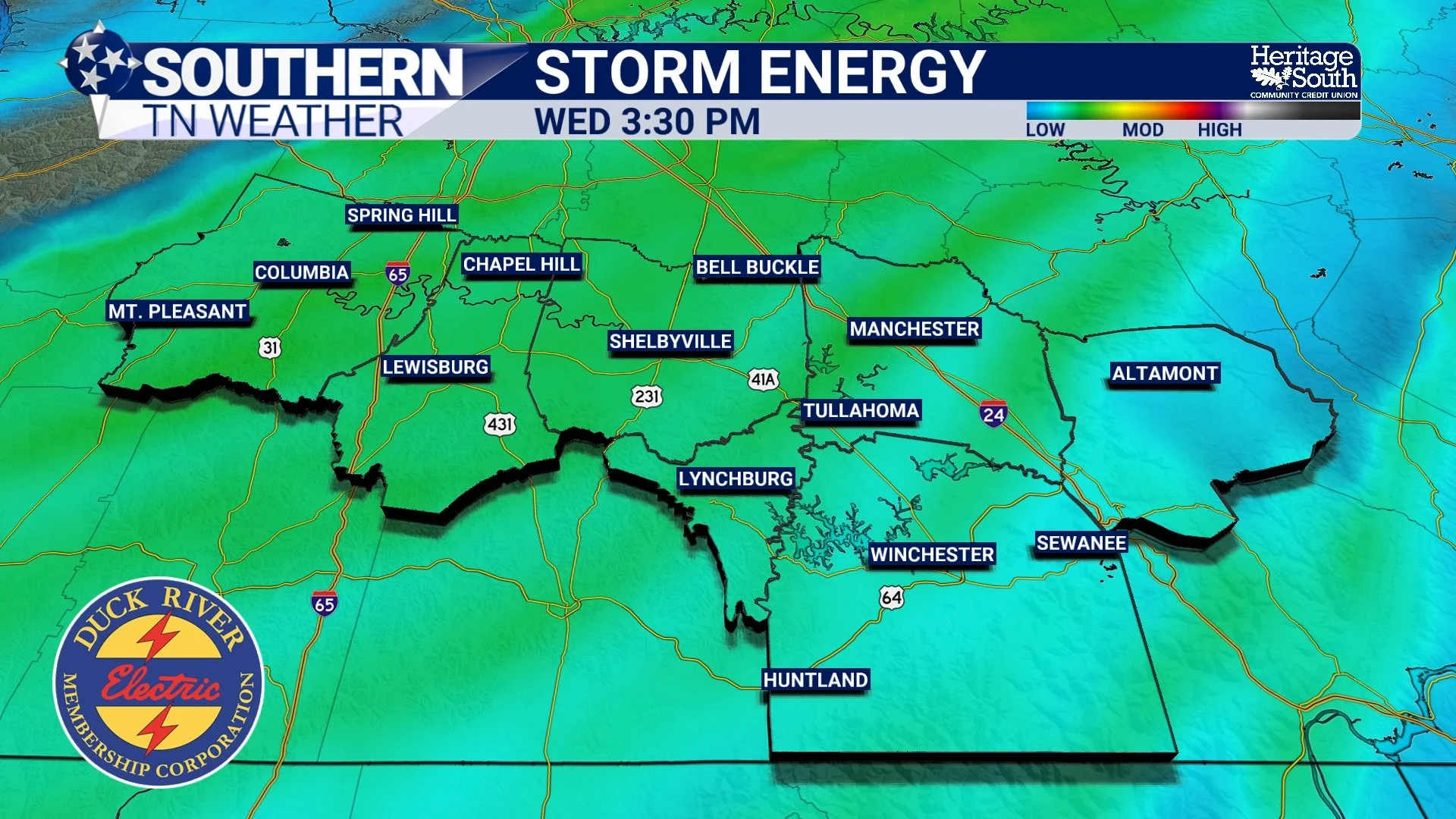
STORM ENERGY - TOMORROW
Storms Likely Forming Along a Cold Front
The main driver for Wednesday’s storms will be an approaching cold front moving into Middle Tennessee during the afternoon and evening hours. Forecast guidance suggests storms will likely organize into a QLCS (Quasi-Linear Convective System). This is essentially a line of thunderstorms that can produce pockets of damaging winds as it moves east.
Within this line, embedded rotations can sometimes develop, which is why a brief tornado cannot be ruled out, though it is not the primary concern at this time.
Another factor that could influence the severity of storms is earlier showers and thunderstorms Wednesday morning or midday. If these storms are widespread, they could limit the amount of energy available for severe storms later in the day. However, if enough breaks in the clouds develop and instability increases, storms later in the day could become stronger.
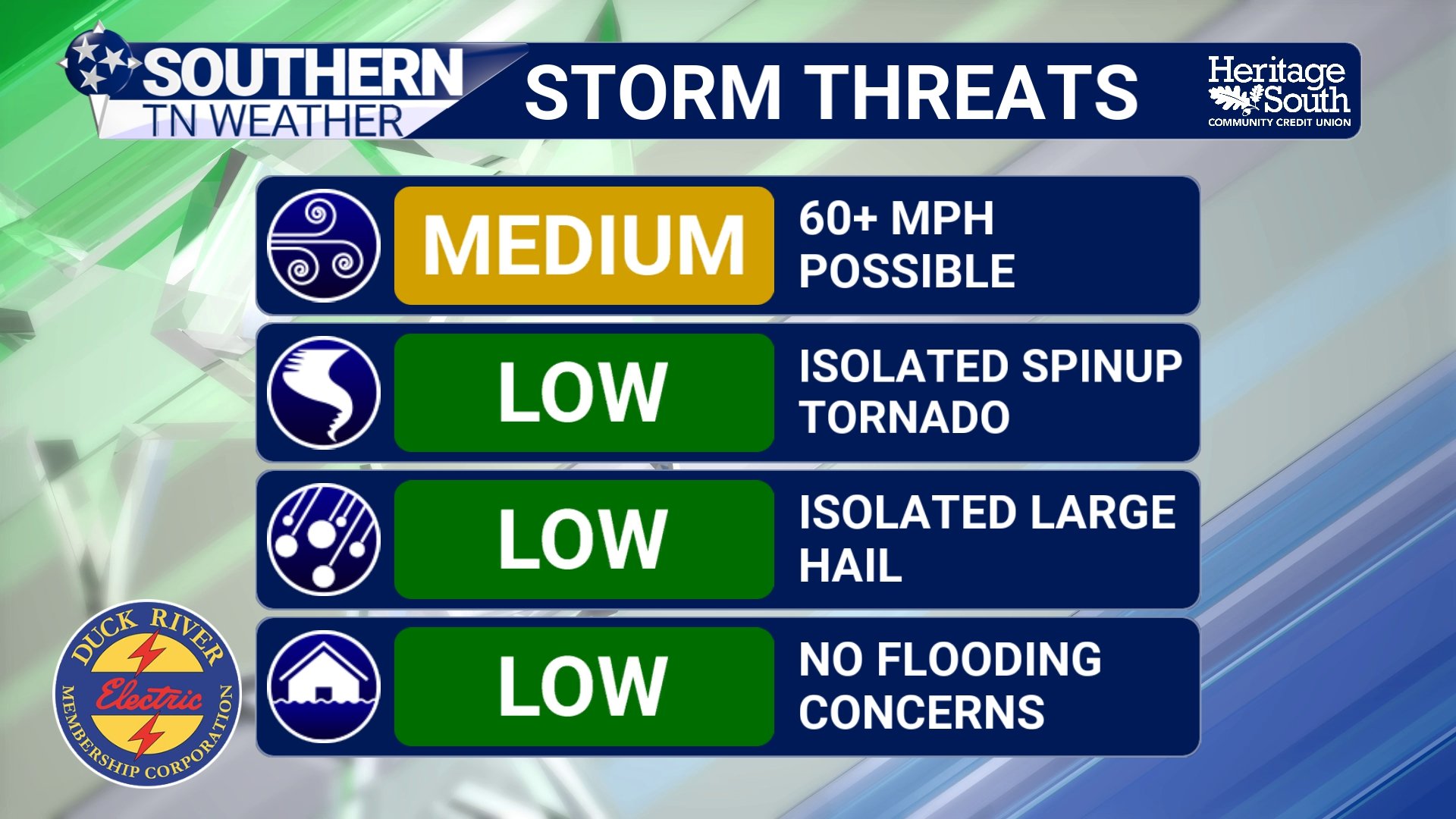
STORM THREATS - TOMORROW
Timing for Southern Middle Tennessee
Current guidance suggests storms will likely move west to east across the region Wednesday afternoon through the evening hours. For Southern Middle Tennessee the most likely timeframe appears to be roughly between 4 PM and midnight.
Storms will be capable of producing heavy downpours, and rainfall totals of 1 to 2 inches are expected across the region. While widespread flooding is not anticipated, localized flooding of low-lying areas and streets could occur during heavier downpours.
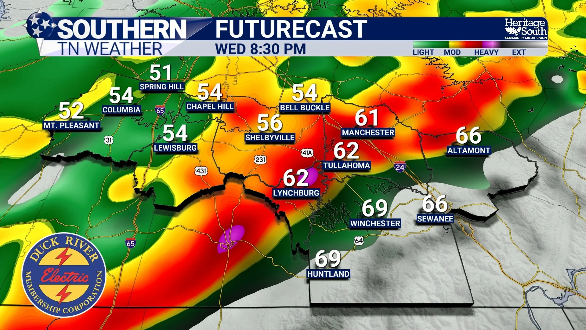
FUTURECAST - TOMORROW EVENING
A Sharp Cooldown Behind the Front
Once the cold front passes Wednesday night, the weather will change quickly. Temperatures will drop sharply overnight, with readings falling into the 30s by early Thursday morning. Thursday itself will feel dramatically different, with high temperatures only in the 50s and gusty northwest winds.
After the midweek system passes, quiet and dry weather returns late week, with temperatures gradually warming back into the 60s Friday and 70s by the weekend.
The Bottom Line 🧾
• Strong to severe thunderstorms are possible Wednesday afternoon and evening
• Slight Risk (Level 2/5) for severe weather across Middle Tennessee
• Damaging winds are the primary threat
• Large hail and a brief tornado cannot be ruled out
• Storm timing currently looks to be between 4 PM and midnight
• Much cooler weather arrives Thursday
📰 Reminder: The Southern Tennessee Weather Blog, presented by Heritage South Community Credit Union, is updated Monday through Friday with fresh, locally tailored forecasts you can trust.