
An Active Pattern to Start The Week… Latest Details Here

The Southern Tennessee Weather Blog is proudly presented by Heritage South Community Credit Union.
We Help When Others Won’t!
Visit https://www.heritagesouth.org/ today to see how HSCCU can help YOU!
An unsettled stretch of weather is underway across Southern Middle Tennessee as several disturbances move through the region over the next few days. While temperatures will remain well above average with highs in the 70s to near 80°, multiple rounds of showers and thunderstorms are expected from late this afternoon through Wednesday night.
A few storms could become strong to severe, especially Wednesday, before a sharp cooldown arrives late week behind a cold front.
Storms Possible Late Today and Tonight
After areas of fog and low clouds early this morning, many locations across Middle Tennessee are seeing breaks in the clouds and some sunshine this afternoon, allowing temperatures to warm into the mid 70s. This warming is helping to build instability in the atmosphere ahead of an approaching disturbance.
Thunderstorms have already been developing across Arkansas and parts of the Lower Mississippi Valley, and those storms are expected to organize into a large cluster of storms (known as an MCS — Mesoscale Convective System) as they move eastward later today.
The northern edge of that storm cluster could clip parts of far Southern Middle Tennessee. Because of this setup, the Storm Prediction Center has placed southwest Middle Tennessee under a Marginal Risk (Level 1 of 5) for severe storms this afternoon and evening. This includes Lincoln, Moore, and Franklin Co in our area. The main window for storms locally will be between 4 PM and 10 PM.
The atmosphere will have moderate instability (around 1500 J/kg of CAPE) combined with roughly 40 knots of wind shear, which is enough to support a few stronger storms. The main hazards will be damaging wind gusts and large hail, though widespread severe weather is not expected. Even after the main storm cluster moves east this evening, scattered showers and thunderstorms will likely continue overnight as additional disturbances move through the region. Some storms overnight could still produce gusty winds and small hail, but the severe threat should remain fairly limited.
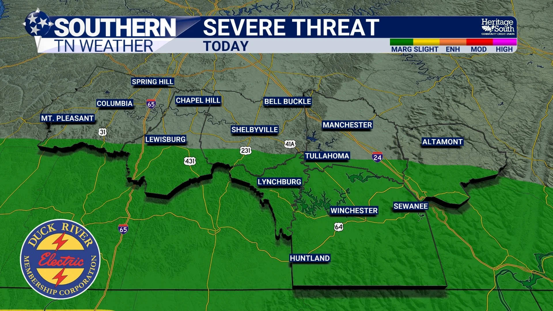
SEVERE THREAT - TODAY
Warm and Mostly Quiet Tuesday
Tuesday will likely bring a brief break in the more active weather, though the atmosphere will remain warm and humid across the Southeast. Temperatures will climb close to 80° Tuesday afternoon, and while most areas should stay dry, an isolated shower or thunderstorm cannot be ruled out during the afternoon or evening hours as small disturbances pass overhead.
Overall, Tuesday looks to be the quietest day of the week, though the atmosphere will remain primed for storms ahead of the next system.
Stronger Storm System Arrives Wednesday
Attention then turns to Wednesday afternoon and evening, when a stronger storm system and cold front approach the region. As the front moves toward Tennessee, warm and moist Gulf air will remain in place, providing fuel for thunderstorms. At the same time, strong winds in the upper levels of the atmosphere will create favorable wind shear, which helps thunderstorms organize into more intense structures.
Forecast guidance suggests storms will likely develop into a QLCS (Quasi-Linear Convective System) — essentially a line of thunderstorms that can produce widespread damaging winds as it moves eastward. Because of this setup, the Storm Prediction Center has placed all of Middle Tennessee under a Slight Risk (Level 2 of 5) for severe weather on Wednesday.
The primary threat will be damaging wind gusts, though isolated hail and a brief tornado cannot be completely ruled out, especially if any storms form ahead of the main line. The current timeframe for storms on Wednesday looks to be between roughly 4 PM and midnight.
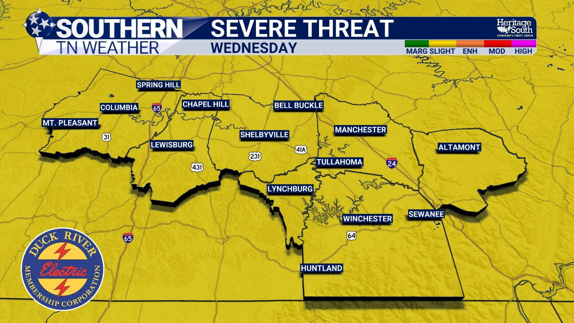
SEVERE THREAT - WEDNESDAY
Cooler Air Arrives Late Week
Once the cold front passes Wednesday night, conditions will change quickly across the region. Thursday will feel much different compared to the warm conditions earlier in the week, with northwest winds increasing to 15–20 mph and temperatures struggling to reach the 50s for afternoon highs.
Skies will turn mostly sunny, but the cooler air will be noticeable.

HIGH TEMPS - THURSDAY
Quiet Weather Returns by the Weekend
High pressure builds back into the region late in the week, bringing several days of quieter weather. Temperatures will slowly rebound with highs in the 60s Friday and back into the 70s by Saturday under mostly sunny skies.
Sunday may turn warmer ahead of another cold front, which could bring the next chance for showers by Sunday night, though details remain uncertain this far out.
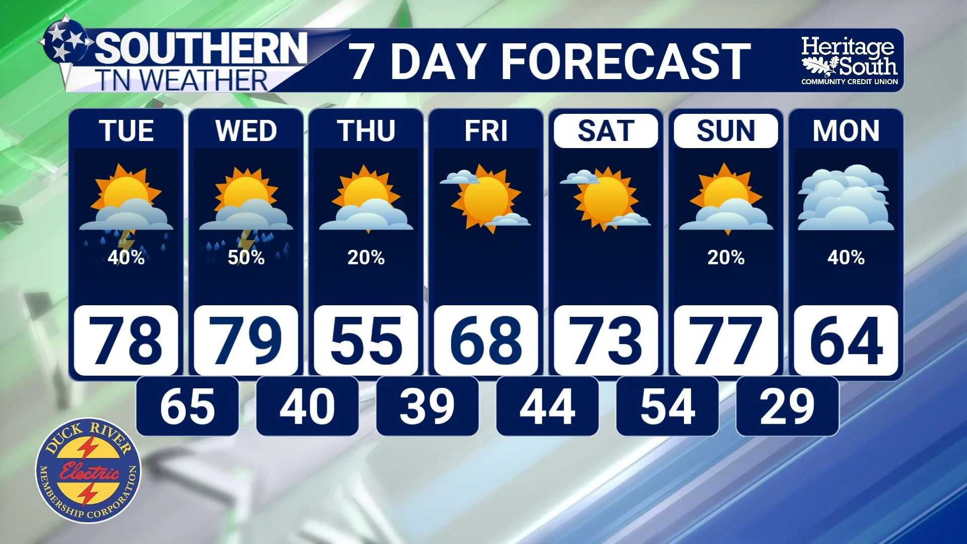
7-DAY FORECAST
The Bottom Line 🧾
• Scattered storms possible late Monday afternoon through tonight, mainly between 4 PM and 10 PM.
• Marginal Risk (Level 1/5) for severe storms over far southern Middle Tennessee this evening with hail and damaging winds possible.
• Tuesday will be warm and mostly quiet, though an isolated storm cannot be ruled out.
• Better severe weather potential arrives Wednesday afternoon and evening, with a Slight Risk (Level 2/5) for damaging winds.
• Cooler air arrives Thursday, with highs falling back into the 50s before warming again for the weekend.
📰 Reminder: The Southern Tennessee Weather Blog, presented by Heritage South Community Credit Union, is updated Monday through Friday with fresh, locally tailored forecasts you can trust.