
Storms Likely Saturday: Latest Details Here

The Southern Tennessee Weather Blog is proudly presented by Heritage South Community Credit Union.
We Help When Others Won’t!
Visit https://www.heritagesouth.org/ today to see how HSCCU can help YOU!
After several days of near-record warmth across Southern Middle Tennessee, our weather pattern is finally beginning to change. Temperatures have surged well into the upper 70s and lower 80s again today, running more than 20 degrees above normal for early March. This warm and humid air mass has set the stage for a round of showers and thunderstorms expected on Saturday.
Today itself remains mostly quiet. A few isolated showers or thunderstorms could pop up late this afternoon or early evening as small disturbances rotate around the ridge overhead, but coverage will remain very limited and severe weather is not expected today. The bigger story arrives tomorrow.
Saturday’s Setup
A developing storm system over the central United States will push a cold front toward Tennessee on Saturday, bringing a band of showers and thunderstorms across the region. Current forecast timing suggests:
Late Morning: Storms approach from the northwest
Midday to Early Afternoon: Storms move across much of Middle Tennessee
Mid to Late Afternoon: Storms move into eastern areas and begin exiting
Most of Southern Middle Tennessee will likely see storms between noon and 6 PM.
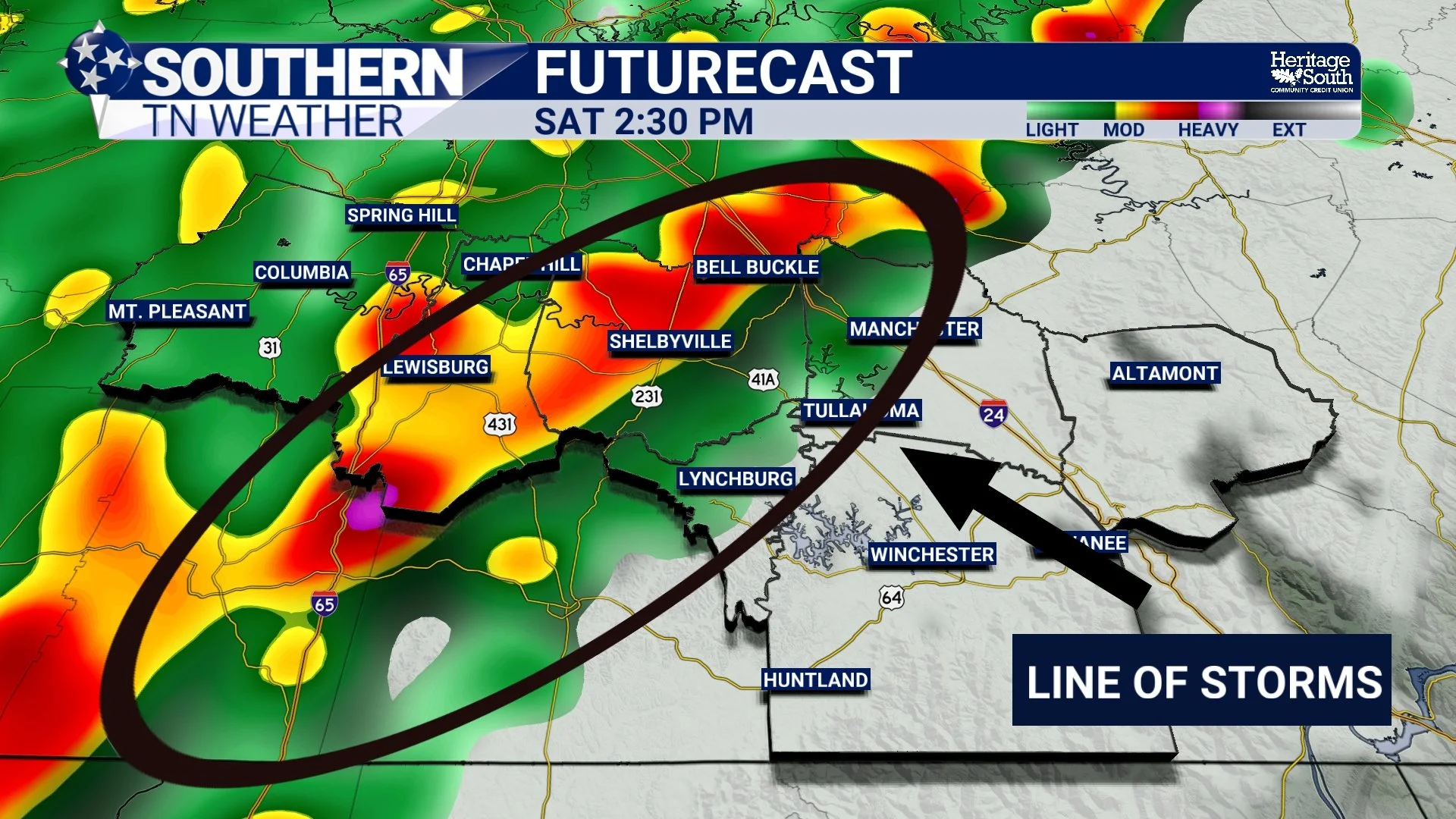
FUTURECAST - SATURDAY PM
What Could These Storms Produce?
While this does not look like a major severe weather event, the environment will support at least a few stronger storms. Key ingredients expected Saturday:
Instability (CAPE): around 500–750 J/kg
Wind Shear: 25–35 knots
Deep moisture: PWAT values above 1.25”
This setup favors line segments of storms capable of producing gusty winds. The main threats include:
• Damaging wind gusts with stronger storms
• Heavy downpours leading to water ponding on roads
• A very low tornado risk, mainly west of I-65
• Frequent lightning
The most common impact will likely be brief bursts of heavy rain and strong wind gusts as storms move through. Because of this, a MARGINAL risk (level 1/5) remains in place from the Storm Prediction Center.
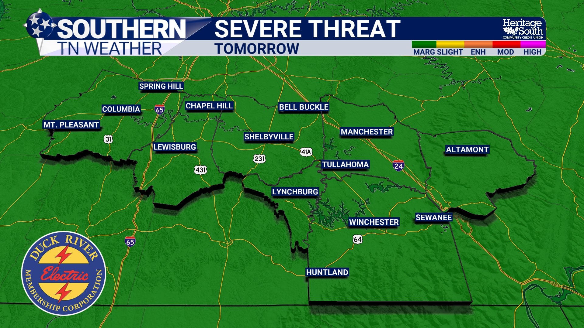
SEVERE RISK - SATURDAY
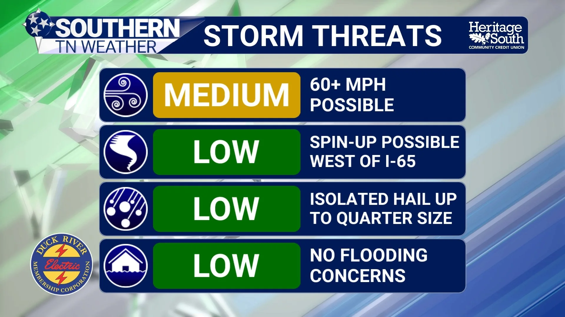
STORM THREATS - SATURDAY
Heavy Rain but Low Flood Risk
The atmosphere will contain plenty of moisture, meaning storms will be capable of producing locally heavy rainfall. However, storms should move through fairly quickly. Because of that, the overall flooding risk remains low, though drivers could encounter brief periods of heavy rain and ponding on roadways during stronger storms. 0.5 to 2” of rain still looks likely.
What Happens After the Storms?
Storms should move out by early Saturday evening, but the cold front responsible for them is expected to slow down and weaken nearby. That means additional showers could linger Saturday night into Sunday, though the risk for strong storms will decrease significantly after Saturday afternoon.
Looking ahead into next week, the pattern remains active with periodic chances for rain and thunderstorms through at least midweek. The good news is that this rainfall should help chip away at the drought conditions that have been developing across parts of Middle Tennessee.
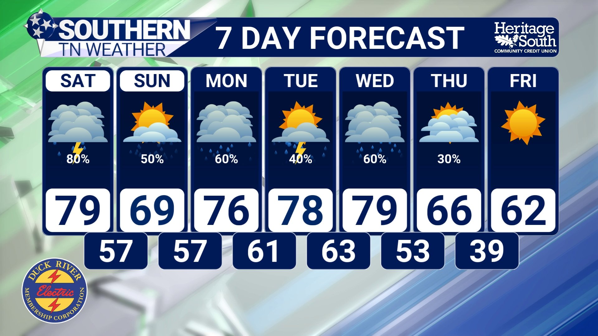
STNWX 7-DAY
The Bottom Line 🧾
Very warm again today with highs near 80 degrees.
Showers and thunderstorms likely Saturday.
A few storms could be strong, mainly producing damaging wind gusts.
Low tornado risk, but not zero.
Heavy rain possible, though flooding risk is low.
Storms should move out by early Saturday evening.
📰 Reminder: The Southern Tennessee Weather Blog, presented by Heritage South Community Credit Union, is updated Monday through Friday with fresh, locally tailored forecasts you can trust.