
Warm & Dry Trend Continues… 80s Likely Thursday

The Southern Tennessee Weather Blog is proudly presented by Heritage South Community Credit Union.
We Help When Others Won’t!
Visit https://www.heritagesouth.org/ today to see how HSCCU can help YOU!
We’re easing back into a warmer pattern across Southern Middle Tennessee, and over the next few days, temperatures will continue a steady climb back into well above-normal territory. After a cooler start to the week, the overall setup is shifting once again — and by Thursday, we’ll be talking about another round of near-record warmth.
Dry Air Still in Place Today
Even though temperatures are reaching into the upper 60s to near 70 degrees this afternoon, the air mass in place is still quite dry. Dew points have dropped into the 20s and 30s, which is unusually low for late March. As the sun heats the surface, the atmosphere mixes vertically, pulling that dry air down from a few thousand feet up.
This process, known as boundary layer mixing, is why relative humidity values are falling into the 20–30% range this afternoon. It’s a big reason why the air feels so comfortable right now, even as temperatures warm.
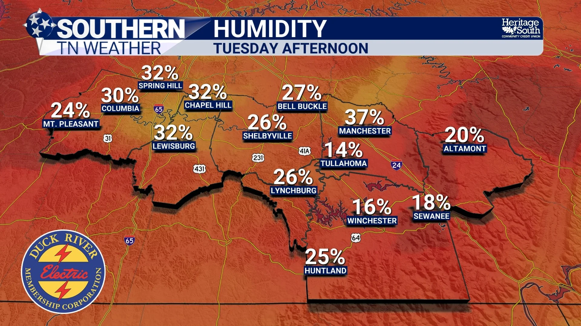
HUMIDITY - TUESDAY AFTERNOON
Moisture Gradually Returns
That dry feel won’t last much longer… As high pressure shifts eastward over the next 24 to 48 hours, winds will begin turning more out of the south and southwest. This allows moisture from the Gulf to start working its way back into the region. You’ll notice it first in the mornings and evenings, with warmer overnight lows, and then more noticeably by Thursday as the air begins to feel a bit more humid.
This is a classic return flow pattern, where the backside of high pressure allows warmer and slightly more moisture-rich air to move northward.
Thursday: Another Surge of Warmth
By Thursday, that process will be fully underway. Temperatures across Southern Middle Tennessee are expected to reach the low to mid 80s, making it the warmest day of the week. This continues a trend we’ve seen multiple times already this month, where we briefly cool down, then quickly surge back into above-normal warmth.
There’s even a chance that a few locations could challenge record highs, depending on how much sunshine we see during the day. This warmth is being driven by a strengthening upper-level ridge, which promotes sinking air, limits cloud cover, and allows for efficient daytime heating.
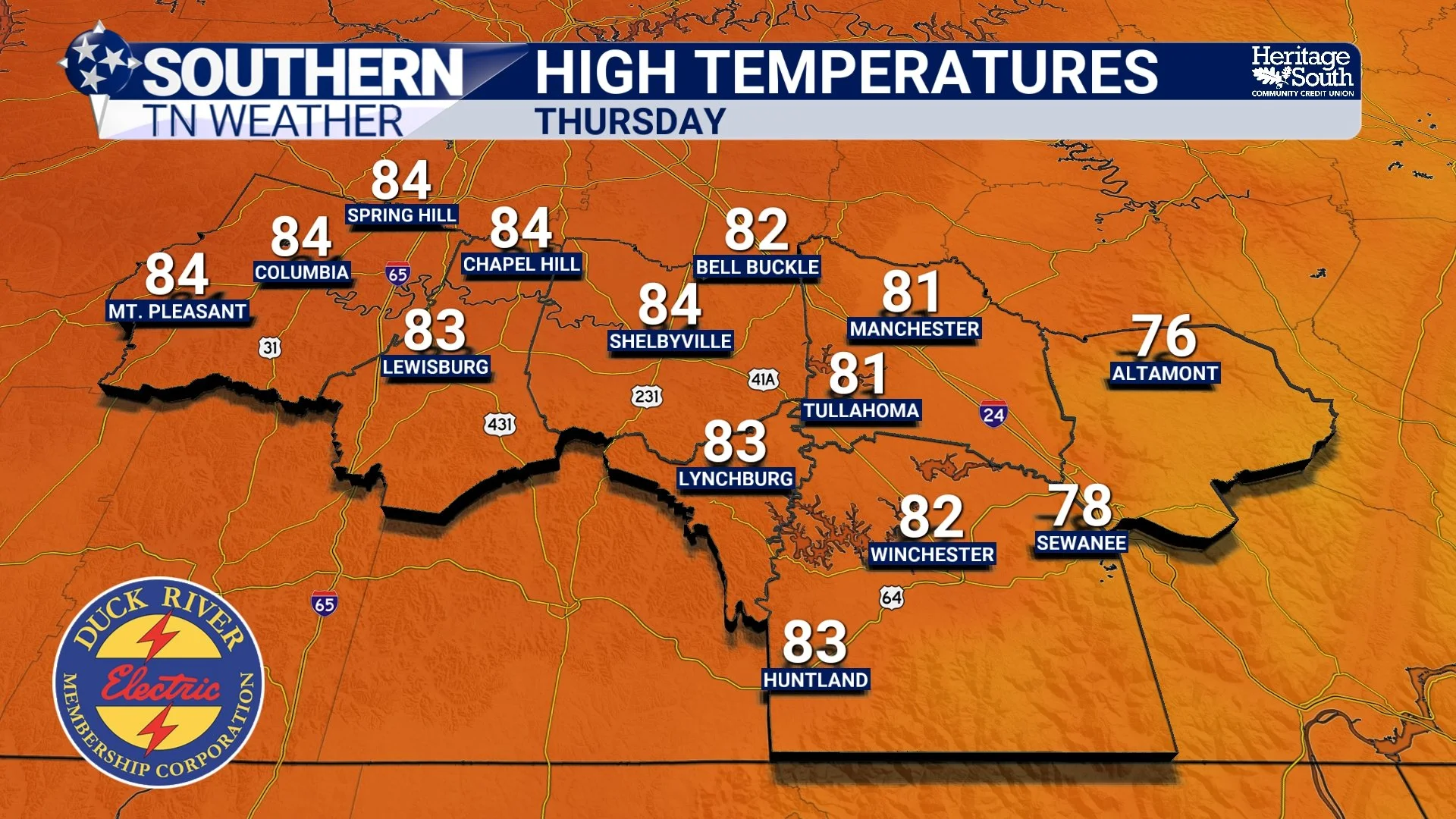
HIGH TEMPERATURES - THURSDAY
Why Rain Still Isn’t Showing Up
Even with moisture slowly returning, rain chances remain limited through most of the week. The reason comes back to that ridge. When a ridge is overhead, it creates a more stable atmosphere, making it difficult for widespread clouds and storms to develop. We may see a few passing clouds at times, especially as weak disturbances move along the edge of the ridge, but for most of Southern Middle Tennessee, the pattern stays dry through Thursday.
Friday: A Weak System Moves Through
Our next “real” opportunity for rain arrives on Friday as a weak boundary drops south into the region. Even then, expectations remain low. The best chance for showers will be north of Interstate 40, and even in those areas, rainfall totals look light — generally around a tenth of an inch or less.
Farther south in our area, many locations may not see any measurable rainfall at all.
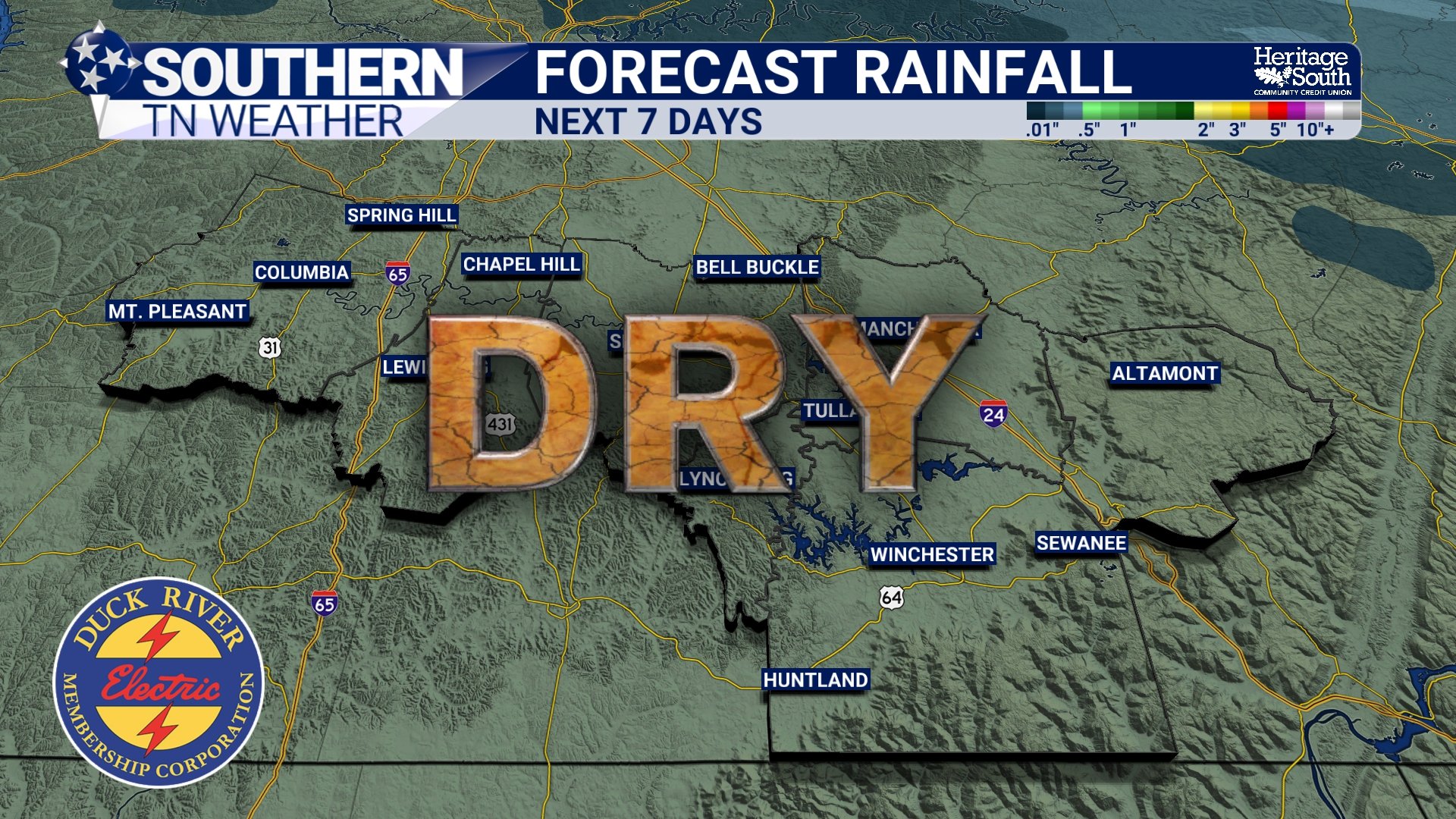
FORECAST RAINFALL - NEXT 7 DAYS
A Comfortable Weekend Ahead
Once that weak system passes, high pressure builds back in for the weekend. Temperatures will cool slightly, settling back into the 60s and 70s, which is right around where we should be this time of year. With dry conditions and mild temperatures, it’s shaping up to be a very comfortable stretch of weather.
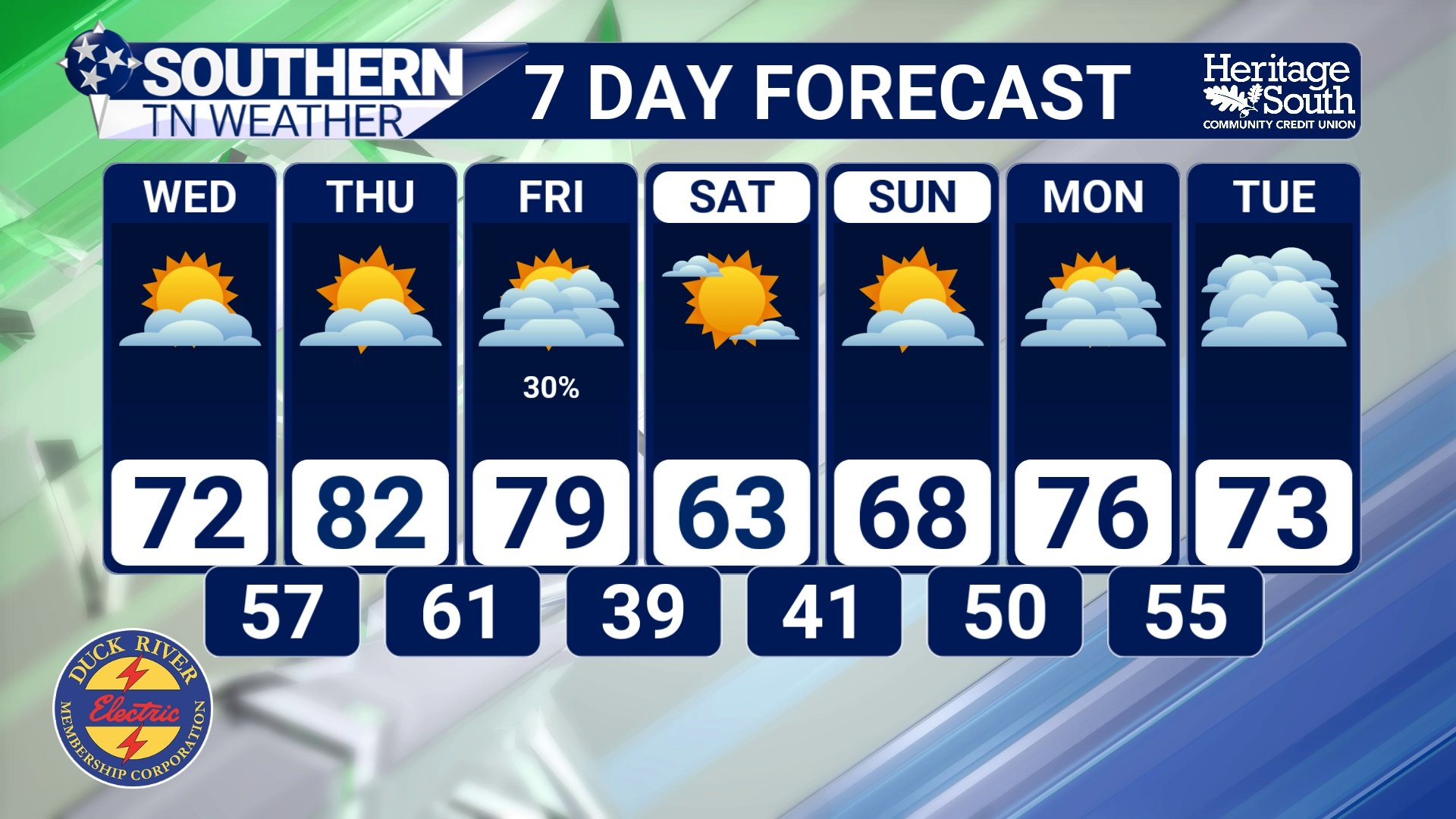
STNWX 7 DAY FORECAST
The Bottom Line 🧾
• Temperatures climb back into the 70s today and continue warming
• Thursday will be the warmest day with highs in the 80s
• Near-record warmth possible again Thursday
• Dry conditions continue through most of the week
• Limited rain chances Friday, mainly north of I-40
• Pleasant and seasonable weather returns this weekend
📰 Reminder: The Southern Tennessee Weather Blog, presented by Heritage South Community Credit Union, is updated Monday through Friday with fresh, locally tailored forecasts you can trust.