
Record Warmth Continues, Weekend Storms on the Horizon

The Southern Tennessee Weather Blog is proudly presented by Heritage South Community Credit Union.
We Help When Others Won’t!
Visit https://www.heritagesouth.org/ today to see how HSCCU can help YOU!
If you stepped outside today and thought it felt more like late April than early March, you’re not alone. Temperatures across Southern Middle Tennessee are pushing well into the upper 70s to near 80 degrees this afternoon, putting record highs in jeopardy for many locations. This warm stretch has been driven by a strong subtropical ridge across the Southeast, which is allowing warm Gulf air to surge northward into the Tennessee Valley. Southwesterly winds and increasing humidity are giving the atmosphere a more springlike feel than what we typically experience this time of year.
For perspective, the average high temperature in early March is usually in the mid to upper 50s. This week, we are running 20 degrees or more above normal.
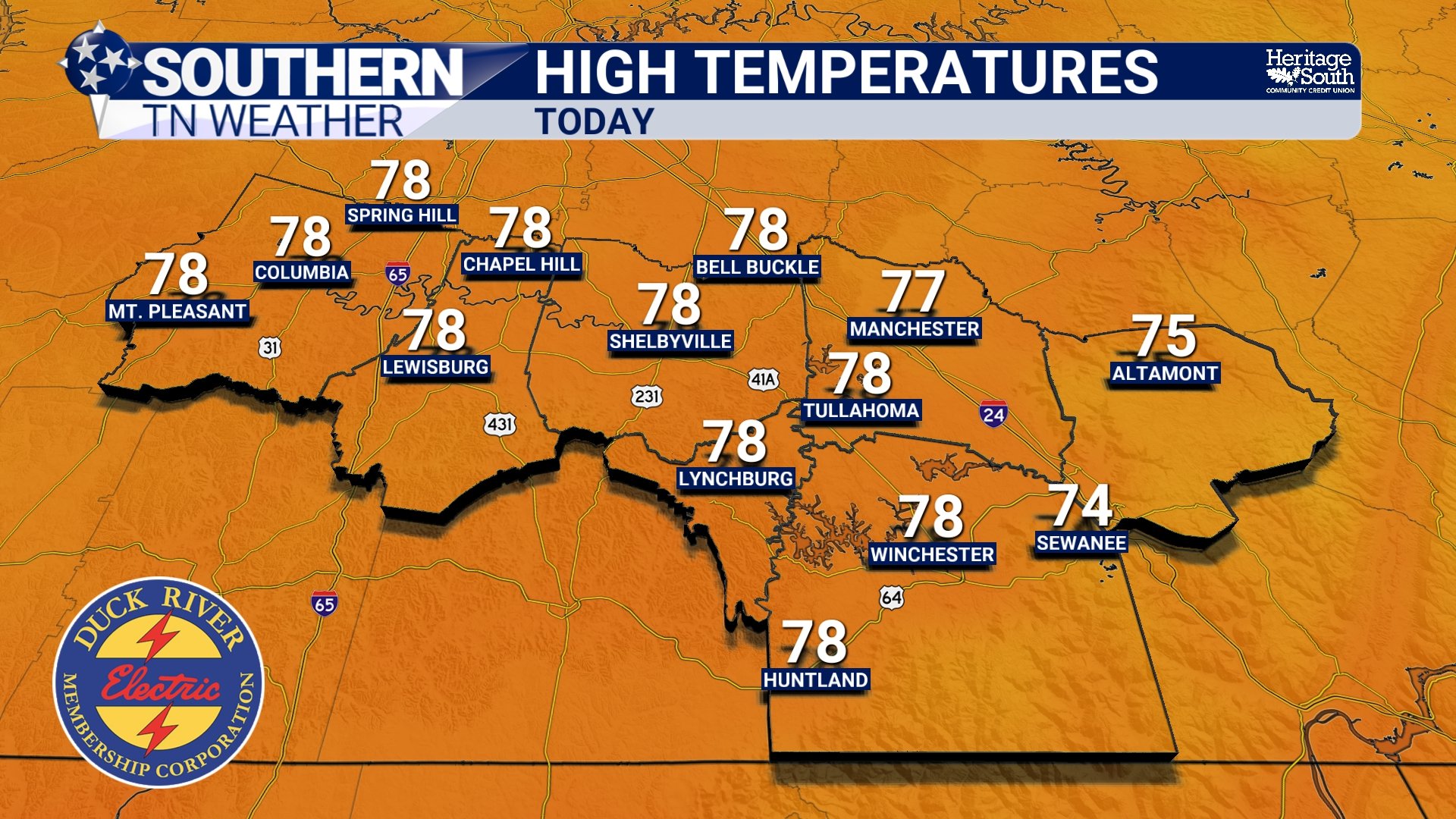
HIGH TEMPERATURES - TODAY
A Few Isolated Showers Possible
While the overall pattern remains warm and mostly dry, a weak disturbance moving through the Midwest is sending a little extra moisture into the region today.
This may allow a few isolated showers to develop later this afternoon, especially across western parts of Middle Tennessee. However, most locations across Southern Middle Tennessee should remain dry.
Tonight will remain very mild with lows only dropping into the upper 50s to near 60 degrees, which is closer to what we’d normally expect during the afternoon this time of year.
Another Shot at Records Tomorrow
Friday looks very similar to today. Temperatures will once again climb into the upper 70s to lower 80s, and another record high could be challenged. With increasing moisture in the atmosphere, there may also be a few pop-up showers or thunderstorms on Friday afternoon, but coverage will be scattered and many areas will stay dry.
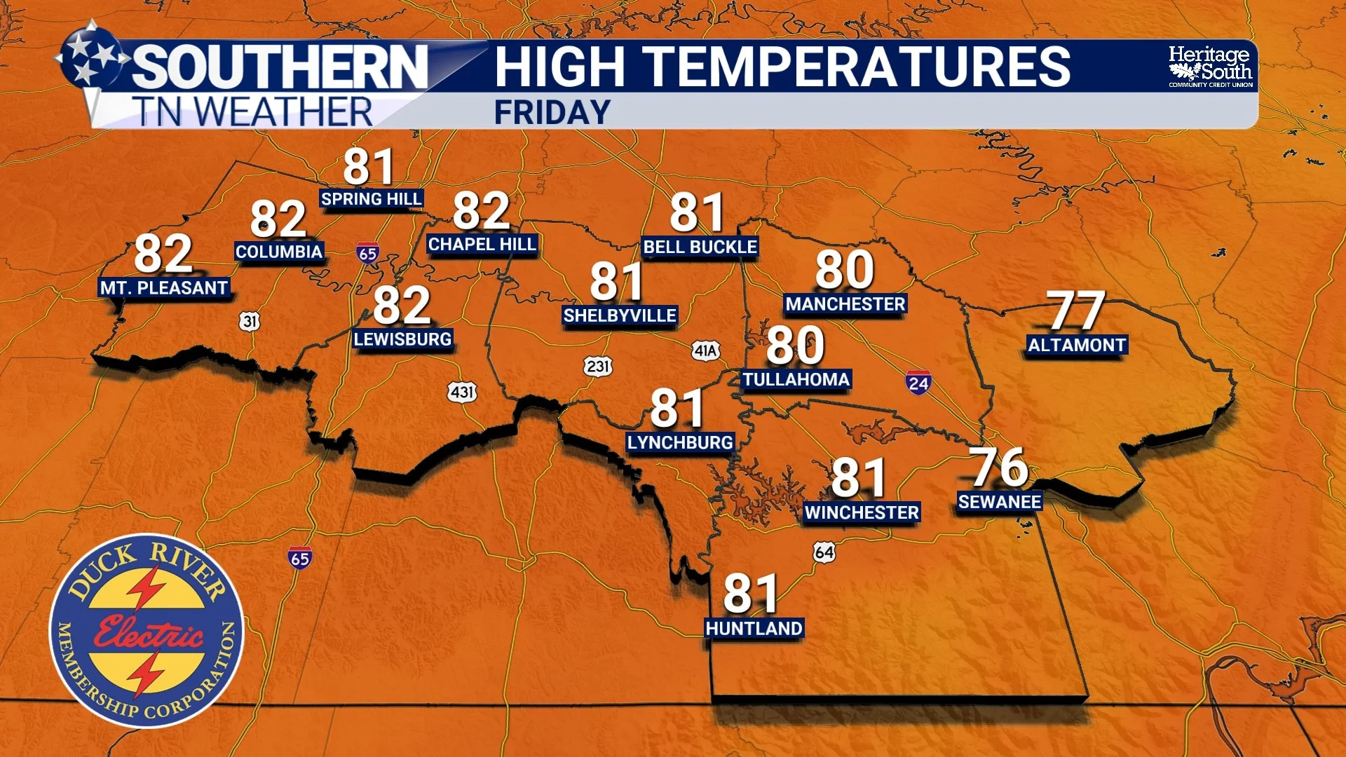
HIGH TEMPERATURES - TOMORROW
Storm Chances Increase This Weekend
The weather pattern begins to shift on Saturday as a stronger storm system pushes a cold front toward the Tennessee Valley.
Current expectations show:
Showers and thunderstorms likely Saturday
Some storms could be strong, mainly producing damaging wind gusts up to 60 MPH. A level 1/5 MARGINAL risk is in place from the Storm Prediction Center
Locally heavy rainfall possible
Severe weather risk remains limited but not zero
At this point, the setup does not appear particularly favorable for widespread severe weather, but a few stronger storms cannot be ruled out. Timing will be nailed down by tomorrow’s blog.
Rain and thunderstorm chances may continue into Sunday and early next week as the front slows and stalls nearby.
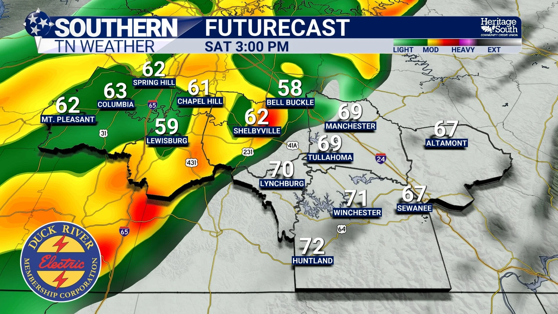
FUTURECAST - SATURDAY AFTERNOON
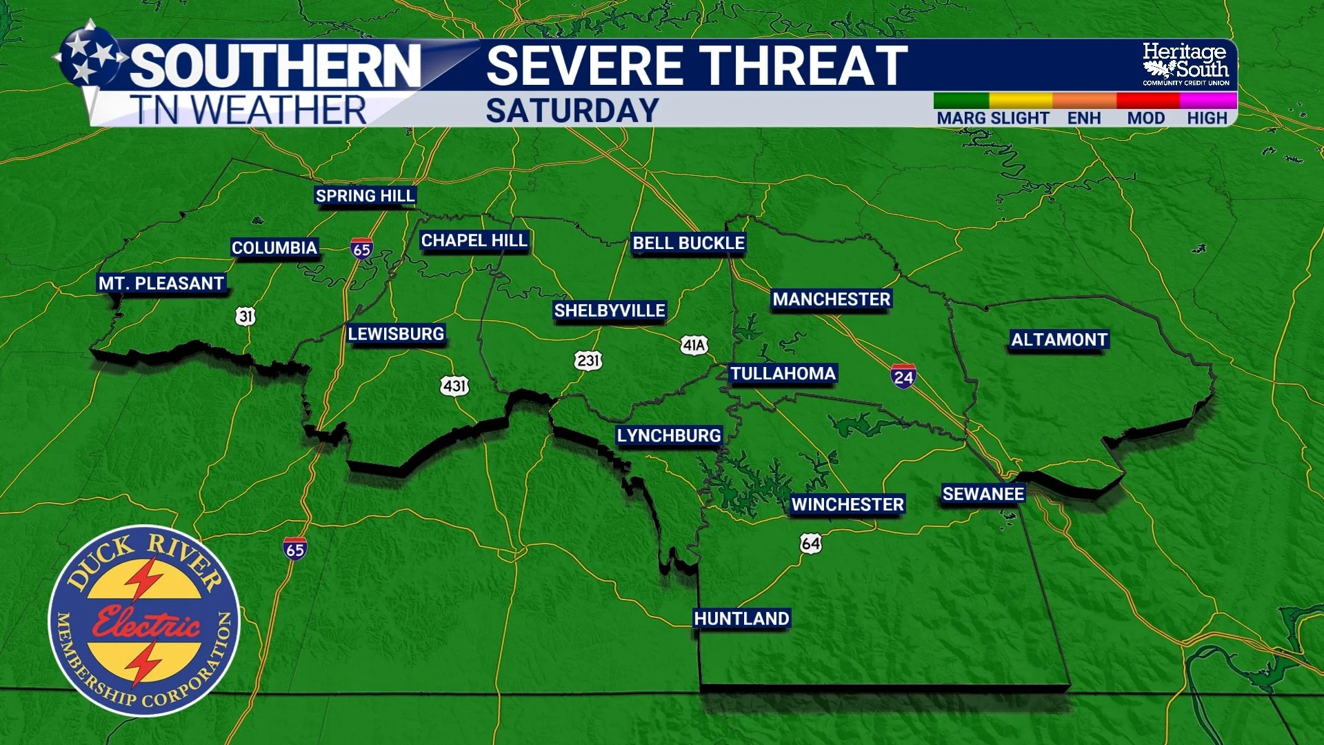
SEVERE THREAT - SATURDAY
Don’t Forget the Time Change
One more reminder: Daylight Saving Time begins this weekend!
Before going to bed Saturday night, set your clocks forward one hour. That means sunset will start occurring later in the evening, beginning Sunday.
The Bottom Line 🧾
Temperatures today and Friday remain 20+ degrees above normal.
Highs will reach the upper 70s to near 80 degrees.
A few isolated showers are possible late today and Friday.
Showers and thunderstorms are likely Saturday, with a few stronger storms possible.
Rain chances may linger into early next week.
📰 Reminder: The Southern Tennessee Weather Blog, presented by Heritage South Community Credit Union, is updated Monday through Friday with fresh, locally tailored forecasts you can trust.