
Spring Preview Continues Across Southern Middle Tennessee

The Southern Tennessee Weather Blog is proudly presented by Heritage South Community Credit Union.
We Help When Others Won’t!
Visit https://www.heritagesouth.org/ today to see how HSCCU can help YOU!
If it feels more like late April than early March, you’re not imagining it. Temperatures across Southern Middle Tennessee have surged into the mid and upper 70s this afternoon, running 15 to 20 degrees above normal for this time of year. This warm pattern is being driven by a strong upper-level ridge across the Southeast, which is essentially acting like a dome of warm air over the region. That ridge is keeping widespread storms away for now while allowing warm, humid Gulf air to stream north into the Tennessee Valley.
Dew points have climbed into the mid 50s to near 60°, which is why it feels noticeably more humid outside compared to the dry air we had just a week ago.
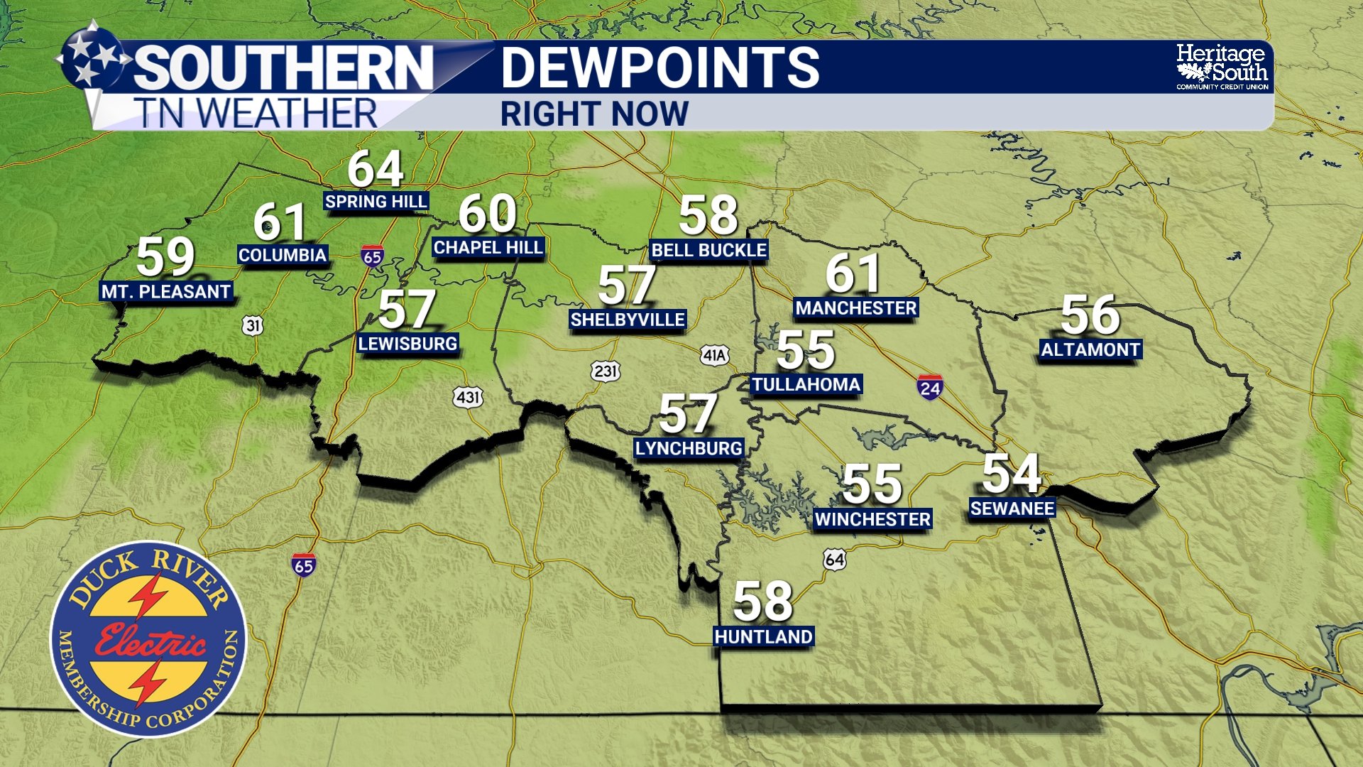
DEW POINTS - RIGHT NOW
A Rare Early March Warm Stretch
Early March typically brings afternoon highs in the mid 50s across our region. This week, however, we’re running closer to late April averages. Highs Thursday and Friday will likely push into the upper 70s to lower 80s, which means record highs may be challenged. Another interesting tidbit: If temperatures reach the lower 80s this week, that would put us nearly 25 degrees above normal for early March. It’s not unheard of, but stretches like this usually only occur a few times each spring.
Overnight temperatures will also stay unusually warm. Instead of the typical 30s or 40s, lows will remain in the upper 50s to near 60 degrees through the end of the week.
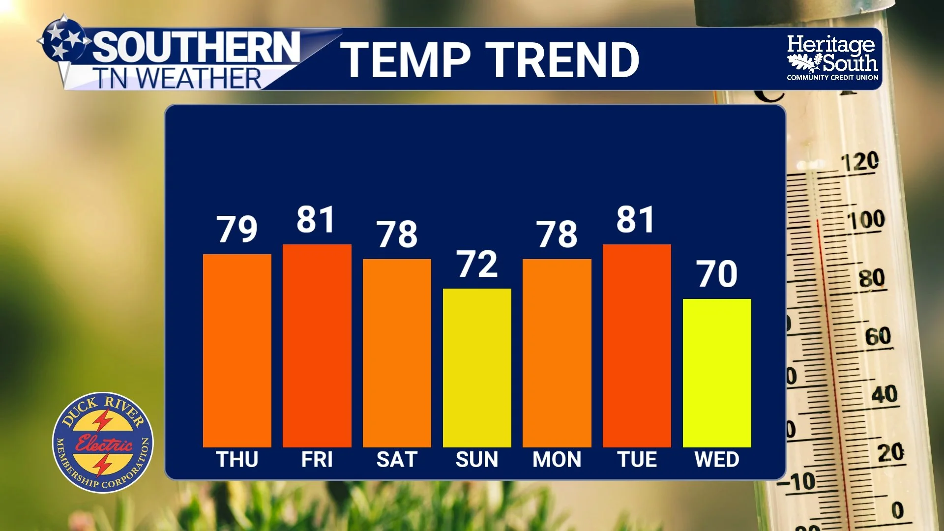
TEMP TREND - NEXT 7 DAYS
A Few Storm Chances Sneaking Back In
While the ridge continues to dominate our weather pattern, it won’t completely shut the door on storms. A weak disturbance could bring a very small chance of a shower or thunderstorm Thursday morning, mainly as a weakening front approaches from the west. Most areas will likely stay dry.
Another low chance for a few pop-up showers or storms may develop Friday afternoon as small disturbances rotate around the ridge. Even if storms develop, severe weather is not expected due to weak wind shear and limited forcing.
Weekend Pattern Turns More Active
The real change arrives this weekend. A stronger system moving across the Great Lakes will push a cold front toward the Tennessee Valley, bringing our best chance for widespread rain and thunderstorms.
Current expectations:
Rain likely Saturday
Periods of showers possible into Sunday
A few thunderstorms possible
Severe weather risk currently appears low
Some locally heavier downpours are possible Saturday as deep Gulf moisture moves north ahead of the front.
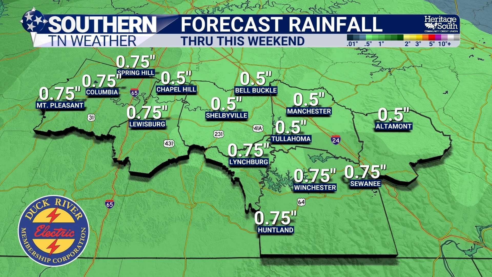
RAINFALL - THRU THIS WEEKEND
The Bottom Line 🧾
Temperatures today and tomorrow are 15–25 degrees above normal.
Highs in the upper 70s to lower 80s through Friday.
A few record highs could fall late this week.
Small rain chances Thursday and Friday.
Best chance for rain and storms arrives Saturday.
📰 Reminder: The Southern Tennessee Weather Blog, presented by Heritage South Community Credit Union, is updated Monday through Friday with fresh, locally tailored forecasts you can trust.