
First Weekend of Spring? More Like the First Weekend of Summer…

The Southern Tennessee Weather Blog is proudly presented by Heritage South Community Credit Union.
We Help When Others Won’t!
Visit https://www.heritagesouth.org/ today to see how HSCCU can help YOU!
Spring didn’t just arrive… it kicked the door in. We’re in the middle of a very warm and unusually stable weather pattern across Southern Middle Tennessee, with temperatures running 20 to 25 degrees above normal. While the headline continues to be the near-record warmth this weekend, there are a few more subtle changes happening in the atmosphere that are worth talking about today.
A Comfortable Warmth For Now
If you’ve been outside today, you’ve probably noticed it feels great — warm, but not sticky. That’s because dew points are still relatively low, sitting mainly in the 40s this afternoon. Dew point is one of the best ways to measure how the air actually feels. Lower values mean drier air, which is why today’s warmth feels comfortable instead of muggy. But that’s going to change over the next couple of days.
As winds begin to turn more out of the south and southwest, we’ll start pulling in moisture from the Gulf. This process, known as moisture advection, will gradually push dew points into the 50s and even low 60s by the weekend. In simple terms, it’s going to start feeling a lot more like spring — and maybe even a little like early summer.
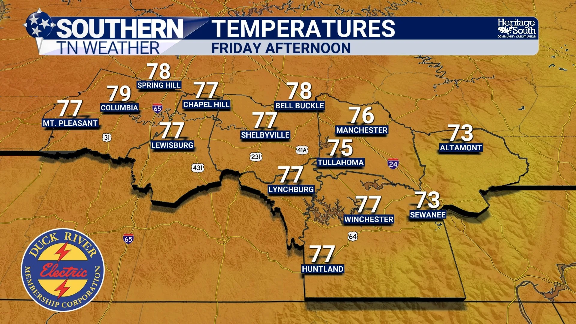
TEMPS - FRIDAY AFTERNOON
Why Temperatures Are So High
The reason for this warm stretch goes well beyond just sunshine. We’re currently sitting on the eastern edge of a large upper-level ridge, essentially a dome of warm air in the atmosphere. This setup promotes sinking air, which limits cloud development and allows for more efficient heating at the surface.
At the same time, temperatures a few thousand feet above the ground (what meteorologists look at around the 850mb level) are running well above normal. When that warmer air gets transported into the region and mixes down to the surface, it directly translates to higher temperatures where we live. That’s why highs will continue climbing into the low to mid 80s Saturday, and likely the mid to upper 80s by Sunday. That puts us within range of record highs and a good 15 to 25 degrees above average for mid-March.
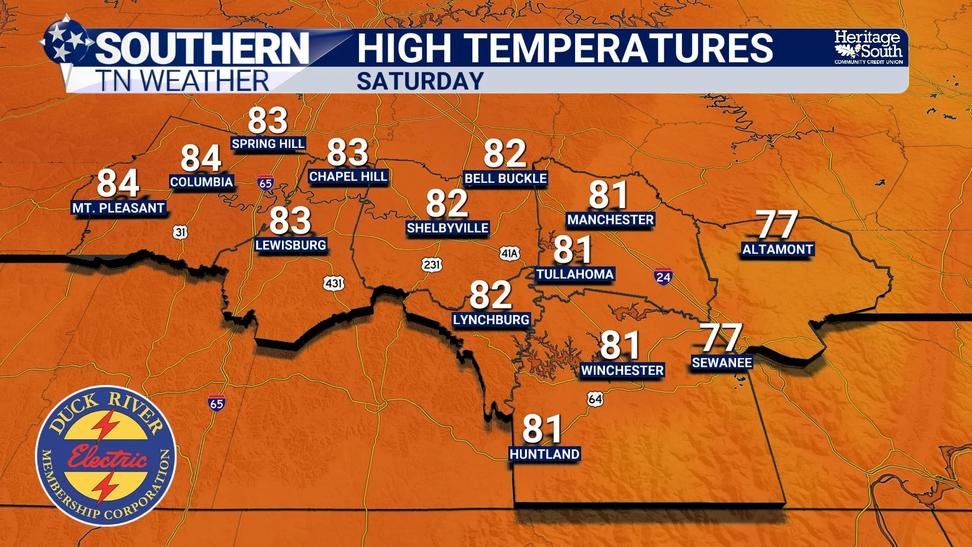
HIGH TEMPS - SATURDAY
A Small Chance for “Pop-Up” Storms
Even though the pattern is dominated by high pressure, it’s not 100% quiet. A weak disturbance will pass through the region Saturday afternoon, and with increasing warmth and moisture, there may be just enough energy in the atmosphere to spark a few isolated showers or thunderstorms. This would be a classic spring-to-summer transition setup, where storms develop during the warmest part of the day without much organization. Most areas will stay dry, but a few spots (especially east of I-65) could see a quick shower or brief storm. I currently have rain chances near 10% across the area. So yeah, don’t get your hopes up over a big storm. These would be short-lived and non-severe, but it’s something to keep in mind if you have outdoor plans.
Sunday: Peak of the Heat
Sunday looks to be the warmest day of this stretch. With continued southwest flow and strong ridging overhead, temperatures will likely push into the mid to upper 80s across Southern Middle Tennessee. It’s not out of the question that a few locations could flirt with record highs, especially if we stay mostly sunny through the afternoon.
Winds will also pick up a bit, which is another signal that the atmosphere is beginning to transition ahead of our next system.
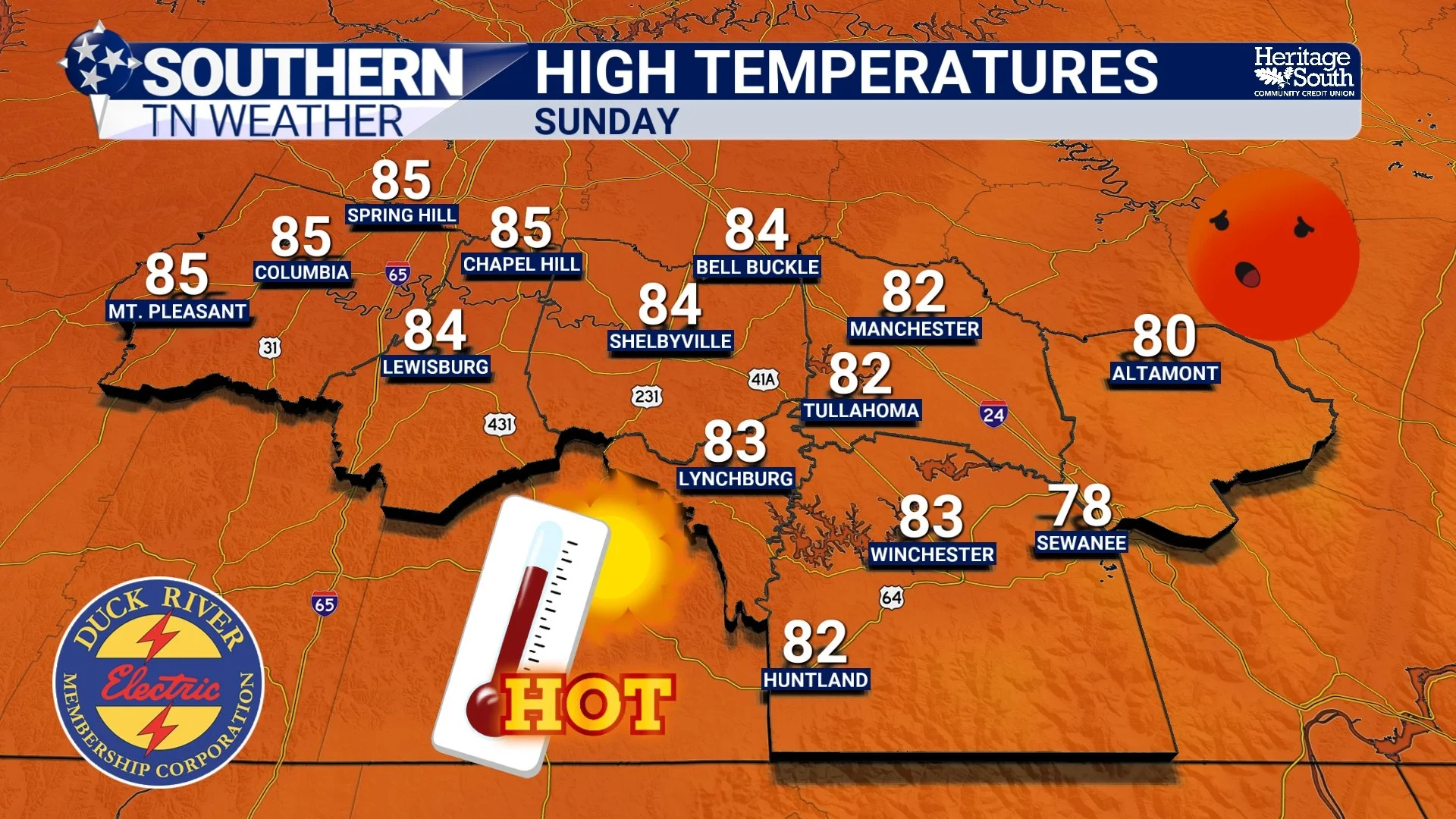
HIGH TEMPS - SUNDAY
A Weak Front… But Not Much Rain
That next system arrives in the form of a weak cold front Sunday night into Monday. However, this front will be losing strength as it approaches, and the better storm dynamics will stay to our north. Because of that, rain chances locally remain low, and many areas may not see anything at all.
If anything does develop, it would be brief and isolated, with maybe a few gusty winds, but overall severe weather is not expected across Southern Middle Tennessee with this system.
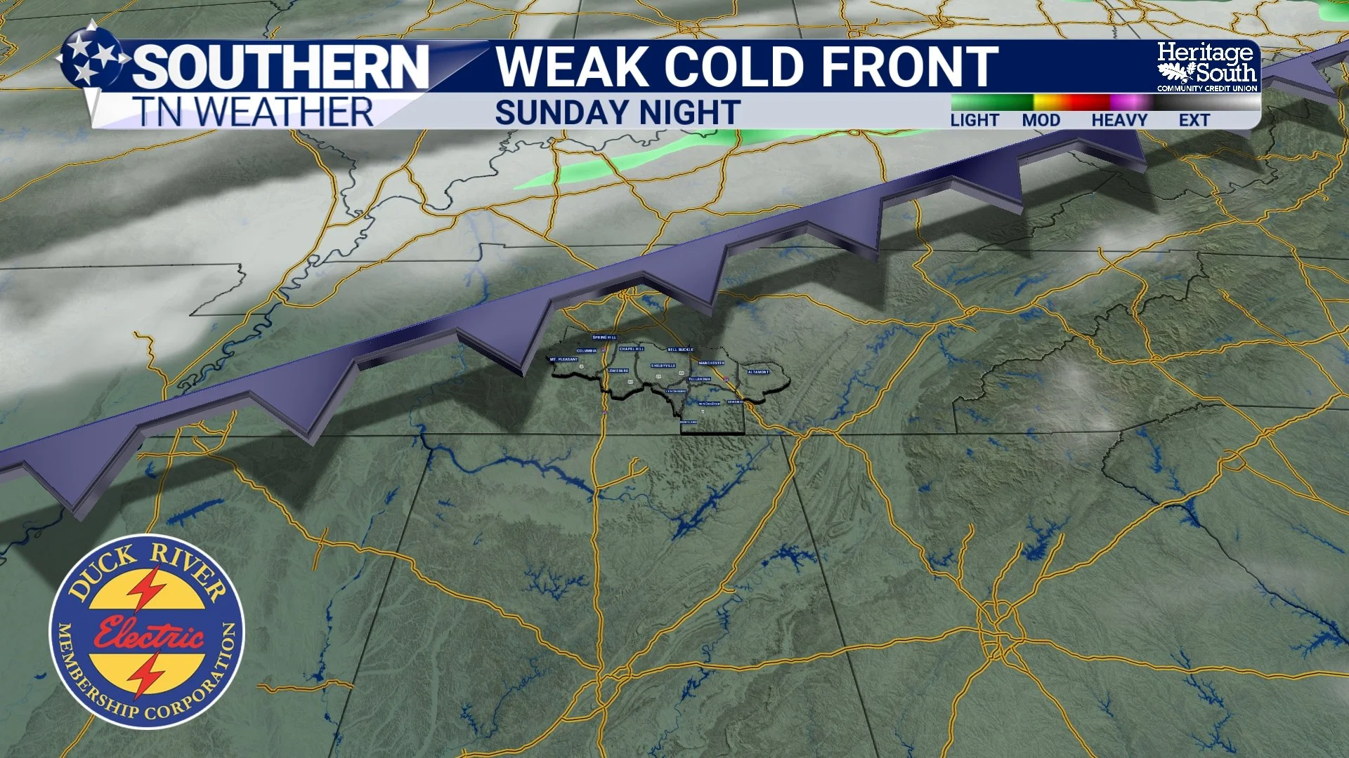
WEAK COLD FRONT - SUNDAY NIGHT
A Slight Pattern Shift Next Week
Behind the front, temperatures will cool a bit — but not dramatically. We’ll settle back into the upper 60s to low 70s, which is still slightly above normal. The pattern also becomes a little more active in the sense that small disturbances could bring low-end rain chances at times next week, but there are no strong signals right now for anything impactful.
The Bottom Line 🧾
• Very warm weekend ahead with highs in the 80s
• Near-record temperatures possible Sunday
• Humidity increases through the weekend
• Isolated pop-up showers or storms possible Saturday, mainly east of I-65
• Low rain chances Sunday night with a weak front
• Slight cooldown next week, but still above normal
📰 Reminder: The Southern Tennessee Weather Blog, presented by Heritage South Community Credit Union, is updated Monday through Friday with fresh, locally tailored forecasts you can trust.