
A Passing Front Today… Then a Dry and Breezy Weekend

The Southern Tennessee Weather Blog is proudly presented by Heritage South Community Credit Union.
We Help When Others Won’t!
Visit https://www.heritagesouth.org/ today to see how HSCCU can help YOU!
A cold front is sliding through Southern Middle Tennessee this afternoon, bringing a subtle but important shift in our overall weather pattern. While this system won’t deliver much in the way of rainfall, it will usher in a noticeably different air mass that sets the tone for the weekend.
Why Today’s Front Is So Quiet
Despite the cloud cover and scattered light showers around today, this is a fairly weak system from a meteorological standpoint. Most of the precipitation we’re seeing is occurring behind the front, which is a sign of a more stable atmospheric setup. In stronger systems, storms typically form ahead of the front where warm, unstable air is forced upward. Today, however, that instability simply isn’t there.
The atmosphere lacks meaningful lift, moisture is limited, and lapse rates are fairly poor. All of that works against the development of heavier rain or thunderstorms. Because of this, rainfall totals will stay light — generally under a couple tenths of an inch. For many across Southern Middle Tennessee, this will be more of a passing nuisance than anything impactful.
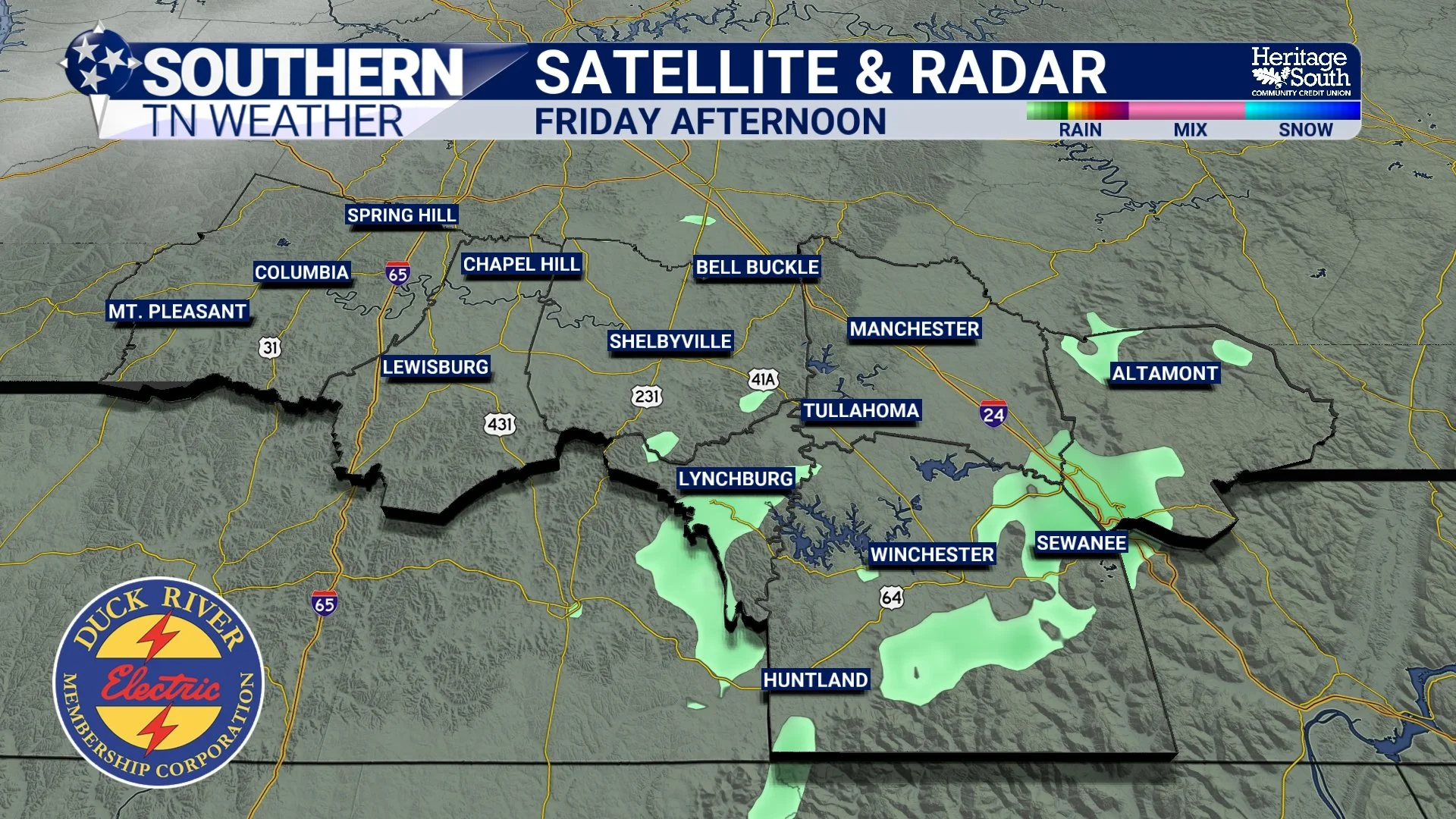
SAT & RAD - THIS AFTERNOON
A More Noticeable Change Behind the Front
While the rain is underwhelming, the air mass behind the front is not. As the boundary pushes through, winds will shift out of the north and begin pulling in a cooler, much drier air mass. This is a continental air source, meaning it originates from land rather than the Gulf, and it carries significantly less moisture.
Temperatures will fall into the 30s tonight, and with a steady breeze, it will feel even cooler at times. This is a classic example of cold air advection, where cooler air is transported into the region by the wind. It’s not a deep or long-lasting cold pattern, but it is a sharp enough change to notice, especially after the warmth we’ve had. Lows tonight will drop into the 30s, and a light freeze / frost cannot be ruled out for a few rural, outlying areas.
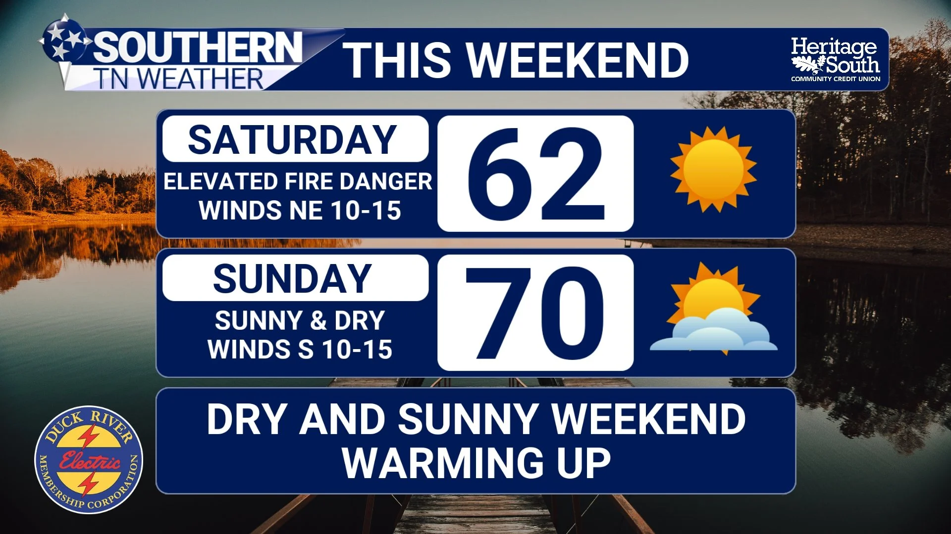
Saturday: Dry Air and fire danger Becomes the Story
By the time we get into Saturday, the bigger story won’t be the cooler temperatures — it will be just how dry the atmosphere becomes. Dew points will drop into the 20s, which is quite low for late March. As the sun heats the surface, the atmosphere mixes, pulling that dry air down from above and driving relative humidity values into the 20–25% range during the afternoon.
At the same time, winds will remain elevated, especially early in the day, with occasional gusts approaching 25 to 30 mph. That combination of dry air and wind creates an environment where WILDFIRES can ignite and spread quickly, even though temperatures are relatively mild in the upper 50s to low 60s. The Storm Prediction Center has most of our area outlooked in a level 1/3 for ELEVATED fire danger.
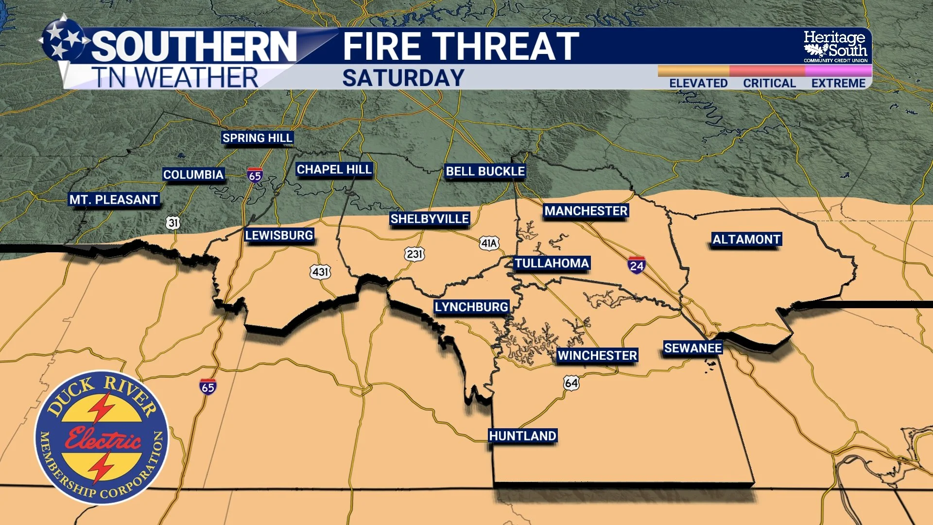
FIRE THREAT - SATURDAY
Sunday: A Return to More Typical Spring Weather
Conditions begin to moderate on Sunday as high pressure shifts east and winds turn more out of the south. That allows temperatures to rebound into the upper 60s to low 70s, with lighter winds and a more comfortable feel overall. While the air mass will still be on the drier side, it won’t be as extreme as what we see on Saturday.
All things considered, Sunday is shaping up to be the best day of the weekend, with plenty of sunshine and more seasonable conditions.
WEEKEND FORECAST
The Pattern Doesn’t Stay Quiet FOR MUCH LONGER
Looking ahead, this quieter stretch won’t last indefinitely. As we head into next week, southerly flow returns and begins transporting both warmth and moisture back into the region. Temperatures will climb quickly, with highs likely returning to the 80s by midweek.
At the same time, the upper-level pattern becomes more active again. Several disturbances are expected to move through between Wednesday and Friday, bringing increasing chances for showers and thunderstorms. Details remain uncertain this far out, but it does appear that we may finally get a better opportunity for more meaningful rainfall!
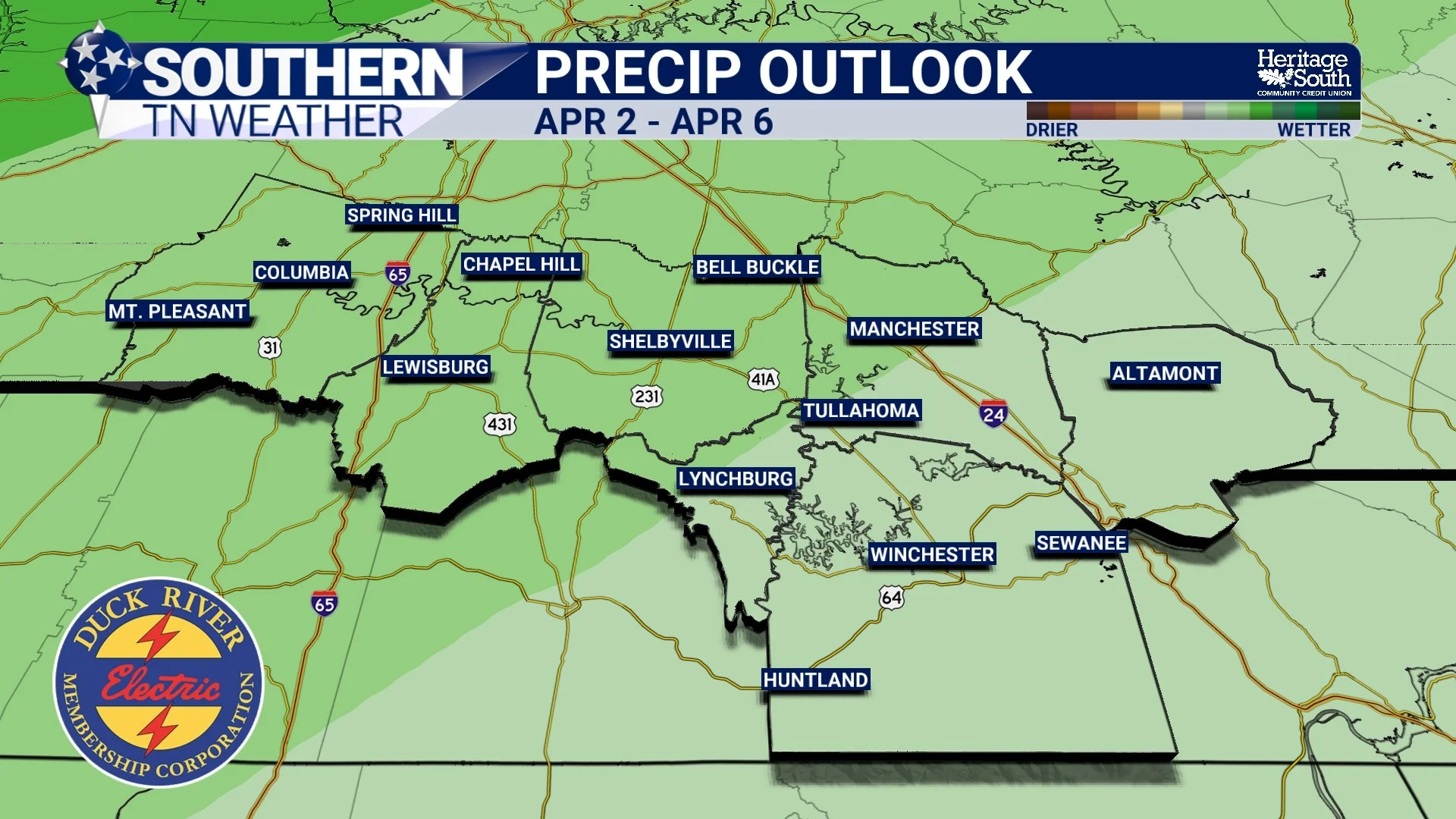
PRECIP OUTLOOK - LATE NEXT WEEK
The Bottom Line 🧾
• Light showers today with minimal rainfall
• Cooler air arrives tonight with lows in the 30s
• Saturday will be dry, breezy, and very low humidity
• Elevated fire danger expected due to dry air and wind
• Sunday turns milder with highs back into the upper 60s to low 70s
• Warmer and more active pattern returns next week
📰 Reminder: The Southern Tennessee Weather Blog, presented by Heritage South Community Credit Union, is updated Monday through Friday with fresh, locally tailored forecasts you can trust.