
Weather Whiplash Incoming!

The Southern Tennessee Weather Blog is proudly presented by Heritage South Community Credit Union.
We Help When Others Won’t!
Visit https://www.heritagesouth.org/ today to see how HSCCU can help YOU!
If you like dramatic weather changes, the next several days will deliver exactly that across Southern Middle Tennessee. We’re going from cool and breezy today… to spring warmth this weekend… to a stormy cold front Sunday night… and possibly even a few snowflakes early next week. In other words, WEATHER WIPLASH is on the way.
Cool Today, But a Warmup Begins
After Wednesday night’s cold front pushed through the region, much cooler and drier air has settled into Middle Tennessee today. Skies have cleared nicely across the area this afternoon, and while it’s sunny, temperatures are noticeably cooler than earlier this week. Winds have been a bit brisk today, but those will gradually diminish tonight as high pressure settles overhead.
The warming trend begins quickly though. Friday will already feel much milder, with highs climbing into the mid to upper 60s under mostly sunny skies as winds begin to shift back out of the south.
A Beautiful Start to the Weekend
The weekend begins on a very pleasant note across the region. Saturday looks fantastic, with plenty of sunshine and highs returning to the low to mid 70s across Southern Middle Tennessee. Southerly winds will also begin increasing slightly, which will start pulling moisture back into the region ahead of our next weather system.
But enjoy the nice weather while it lasts… because things change quickly Sunday.
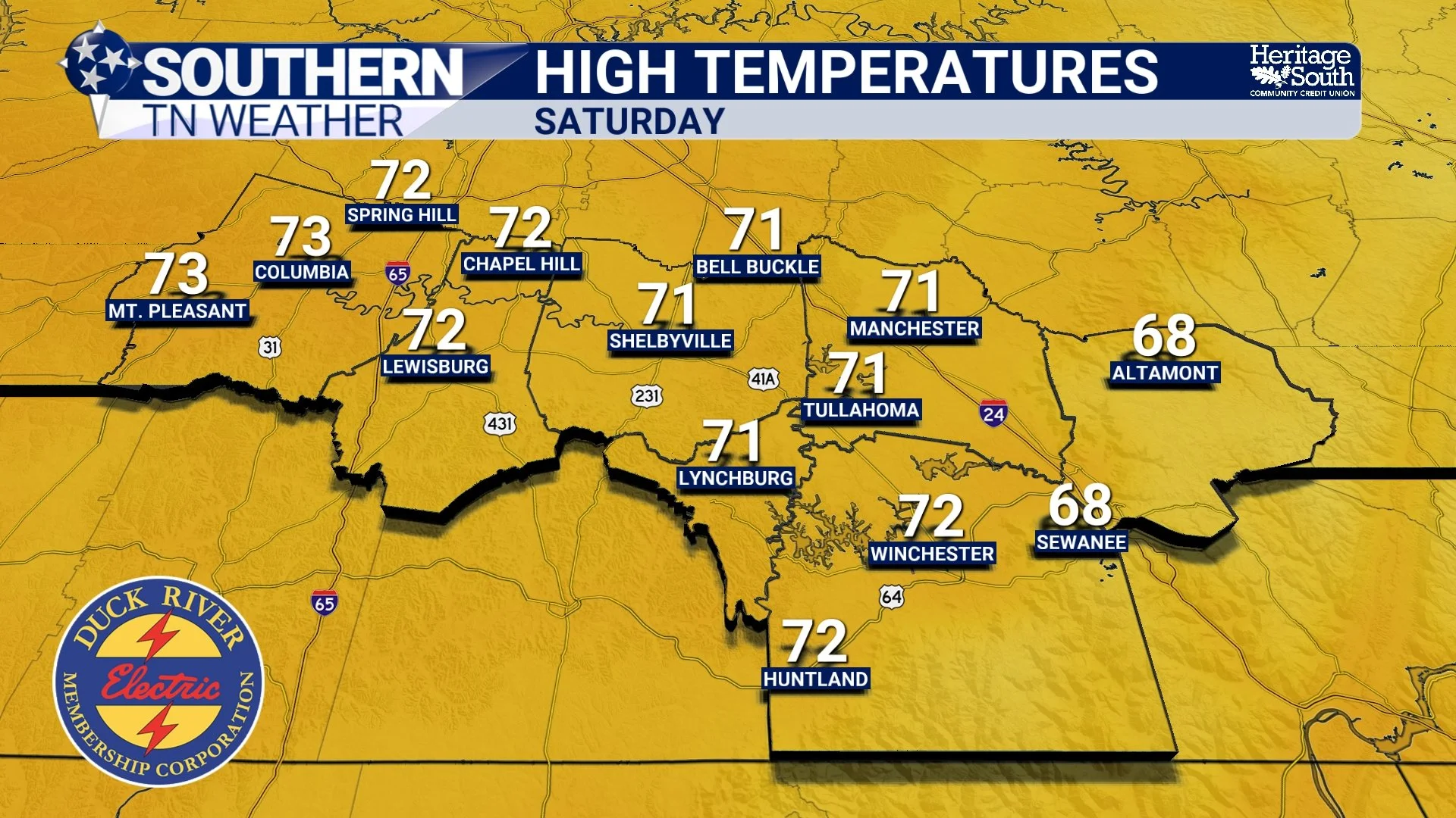
HIGH TEMPERATURES - SATURDAY
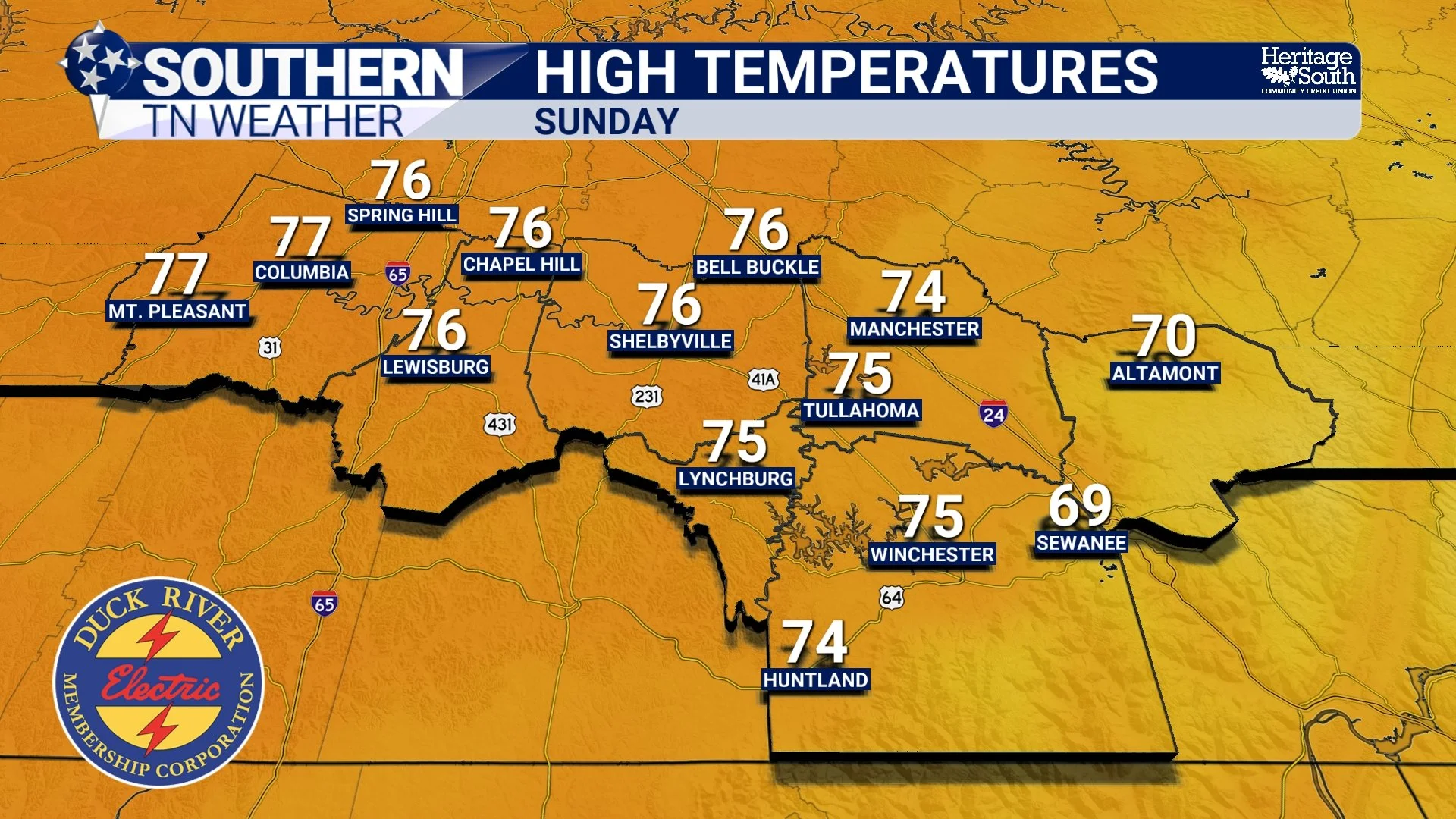
HIGH TEMPERATURES - SUNDAY
A Strong Cold Front Arrives Sunday Night
By Sunday, a powerful storm system will be developing across the central United States. As that system strengthens and tracks toward the Great Lakes, it will drag a strong cold front toward Tennessee Sunday evening and overnight. Winds will begin increasing through the day Sunday, and it’s possible a Wind Advisory may eventually be needed if forecast trends hold. Along the front itself, showers and thunderstorms are expected to develop Sunday evening and overnight. Right now, rainfall totals look fairly modest, generally between about 0.5 and 1 inch across the region.
At this time, the severe weather risk appears low, mainly because the storms will arrive during the overnight hours when atmospheric instability is limited. Some storms could still produce gusty winds and lightning, but the widespread severe weather risk is very low. This is something to monitor over the next few days, though. Stay tuned for updates, because some of the latest model data has been increasing our threat for Sunday night.
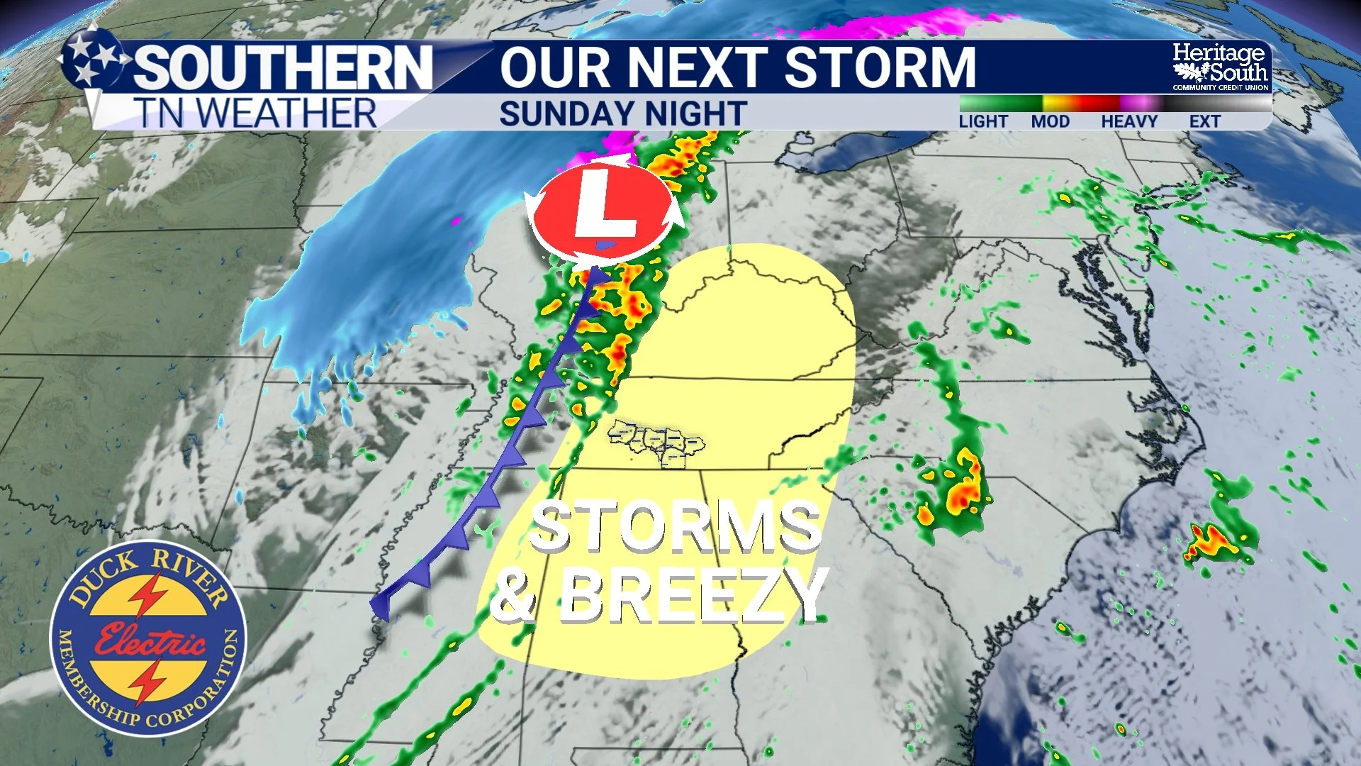
OUR NEXT STORM SYSTEM - SUNDAY NIGHT
A Dramatic Temperature Crash
Once the cold front moves through Sunday night, temperatures will fall rapidly across the region. This system will pull down much colder air from the north, and the drop in temperatures will be dramatic after the weekend warmth. Some light snow flurries or a few snowflakes may even mix in late Sunday night into Monday morning, though any accumulation would be very light and no travel impacts are expected.
By Monday afternoon, temperatures will struggle to reach the upper 40s to near 50 degrees, which will feel dramatically different after highs in the 70s on Sunday.
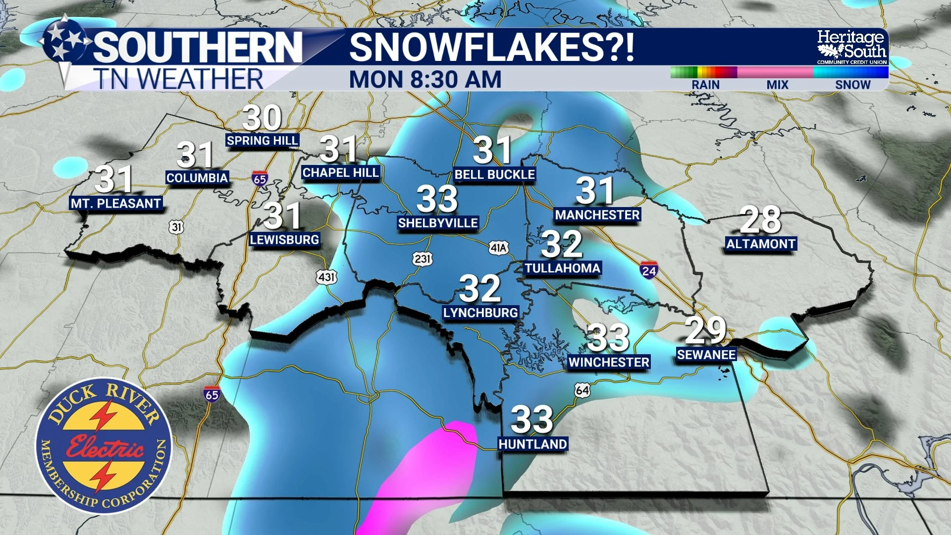
SNOWFLAKES - MONDAY MORNING
Hard Freeze Possible Early Next Week
The coldest temperatures will likely arrive Monday night into Tuesday morning. Clear skies, light winds, and very dry air could allow temperatures to drop into the upper teens to lower 20s across Southern Middle Tennessee.
That would represent a temperature drop of roughly 50 to 55 degrees compared to Sunday afternoon highs — a pretty remarkable swing for mid-March. Anyone with early spring plants or sensitive vegetation should be prepared to protect them, as a hard freeze looks increasingly likely!
Gradual Warmup Returns
Fortunately, the cold snap won’t last forever. After the early-week chill, temperatures should begin to slowly moderate through the middle of next week, with highs returning into the 50s and eventually back into the 60s by mid to late week.
The Bottom Line 🧾
• Cool and sunny today after yesterday’s cold front
• Warming trend begins Friday and continues into the weekend
• Beautiful weather Saturday with highs in the 70s
• Storms likely Sunday night along a strong cold front
• Severe weather risk currently appears low, but something to monitor
• Temperatures crash early next week with possible snowflakes Monday
• Hard freeze likely Monday night into Tuesday morning
📰 Reminder: The Southern Tennessee Weather Blog, presented by Heritage South Community Credit Union, is updated Monday through Friday with fresh, locally tailored forecasts you can trust.