
Sunshine Returns, Spring Preview This Weekend

The Southern Tennessee Weather Blog is proudly presented by Heritage South Community Credit Union.
We Help When Others Won’t!
Visit https://www.heritagesouth.org/ today to see how HSCCU can help YOU!
Southern Middle Tennessee is drying out today as the cold front that brought our midweek rain pushes south of the area. Clouds linger this morning, but gradual clearing is expected through the afternoon. You’ll notice a big difference compared to yesterday — no steady rain, no thunder, just improving conditions!
High temperatures today will range from the mid 50s across our northern counties to the mid 60s closer to the Alabama state line. It’s a transitional day: cooler air filtering in behind the front early, then sunshine helping stabilize temperatures this afternoon. Friday morning will be the chilliest of this forecast stretch, with lows dipping into the mid to upper 30s. After that, it’s full speed toward a very pleasant, spring-like weekend.
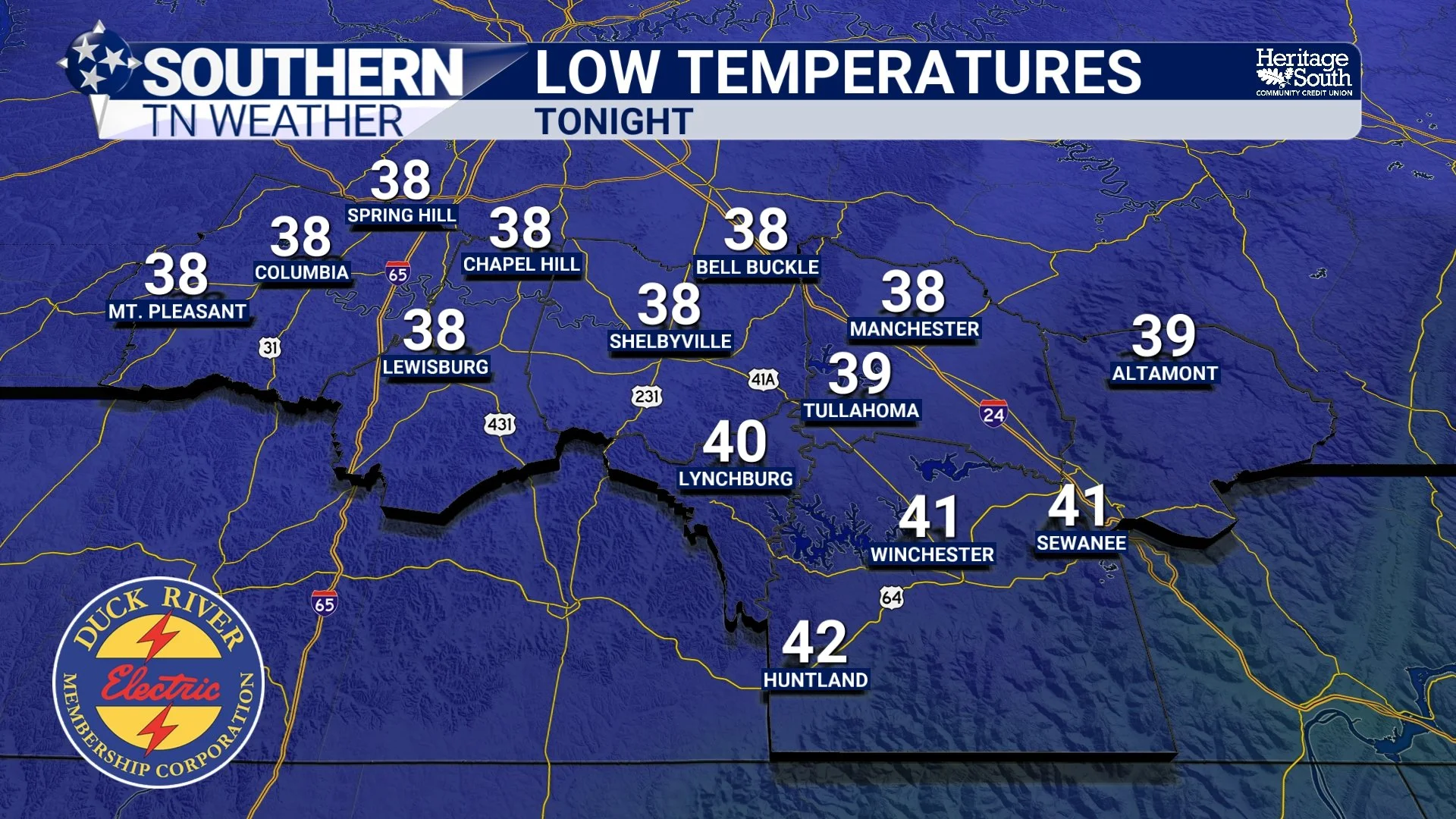
LOW TEMPS - TONIGHT
A Beautiful Friday and Saturday
High pressure settles in Friday and Saturday, bringing mostly sunny skies and above-normal temperatures. Afternoon highs will run 10 to 15 degrees above late-February averages. Many communities across our area will climb into the upper 60s Friday and potentially the low 70s Saturday.
With light winds and dry air in place, it will feel more like early April than late February. Outdoor plans this weekend? You picked a good one.
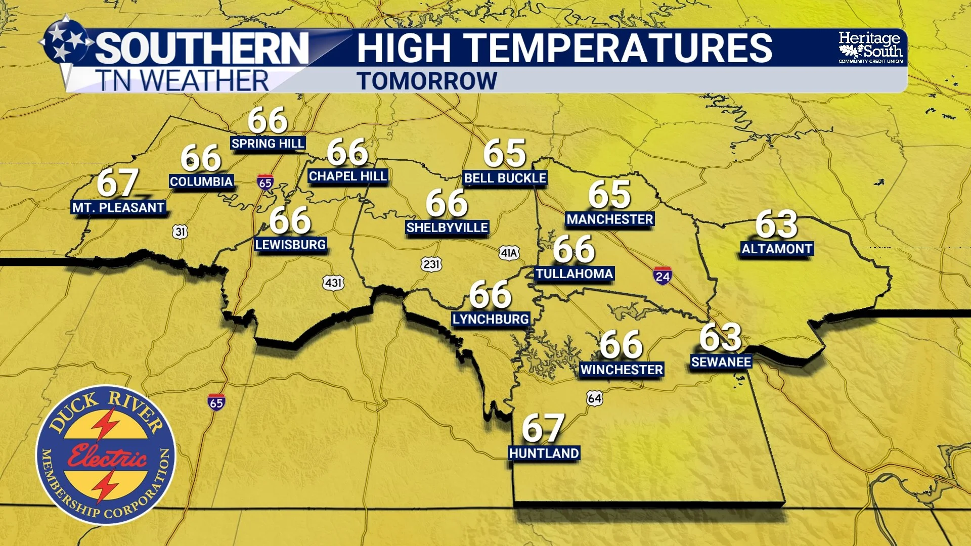
HIGH TEMPS - TOMORROW (FRIDAY)
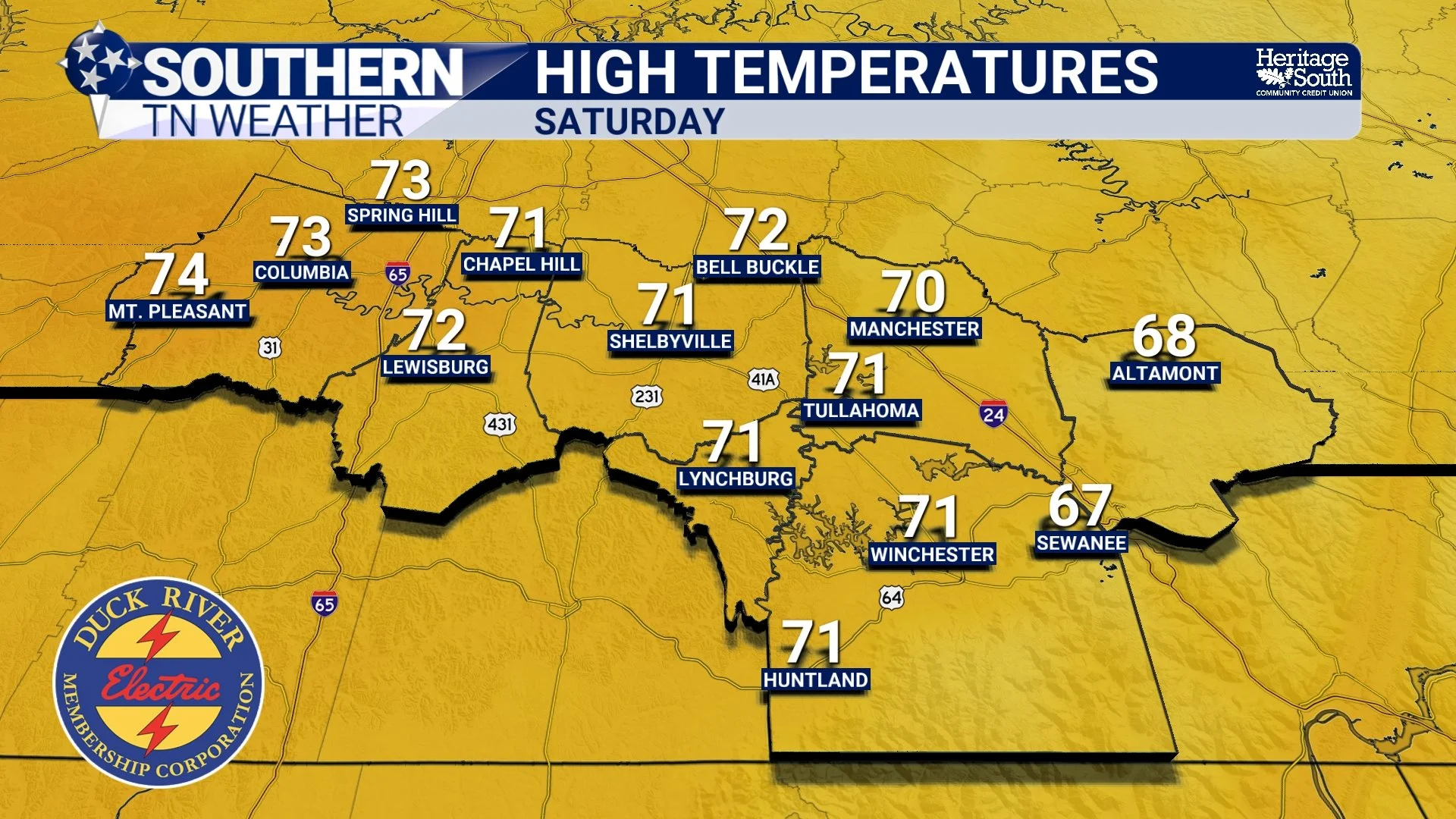
HIGH TEMPS - SATURDAY
Rain Returns Late Sunday into monday
Our next weather system approaches from the Plains on Sunday. Most of Sunday daylight hours look dry, but clouds will increase through the afternoon. Shower chances rise Sunday night into Monday as a mid-level wave moves through the region. There has been some discussion about whether any colder air could mix in Sunday night. While ensemble guidance technically shows a tiny probability of wintry precipitation, the odds are extremely low. For Southern Middle Tennessee, this looks like a rain event, not a winter weather setup. I’ll have more info as we get closer.
After Monday, the pattern turns more unsettled through midweek with periodic rain chances. Temperatures, however, remain generally mild.
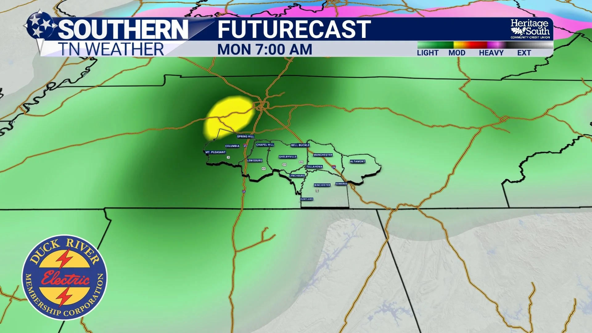
FUTURECAST - MONDAY MORNING
The Bottom Line 🧾
Sunshine gradually returns this afternoon.
Cool start Friday morning, then a warm and dry weekend.
Highs 10–15 degrees above normal Friday and Saturday.
Rain returns Sunday night into Monday.
📰 Reminder: The Southern Tennessee Weather Blog, presented by Heritage South Community Credit Union, is updated Monday through Friday with fresh, locally tailored forecasts you can trust.