
WEATHER BLOG

Presented By:
Bitter Cold and Passing Flurries: What’s Next for Southern Middle Tennessee
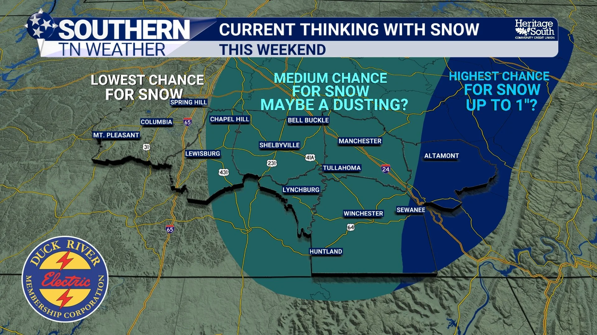
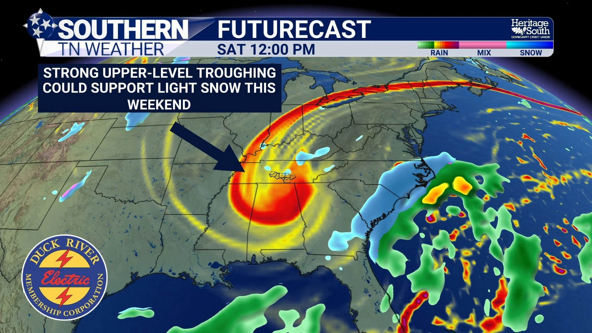
Southern Middle Tennessee remains firmly locked in a deep winter pattern, and the focus of this forecast is shifting away from storm recovery and fully into cold-weather hazards. While last weekend’s winter storm is now behind us, the atmosphere has not relaxed. In fact, the large-scale pattern aloft is becoming even more supportive of reinforcing Arctic air, and that will drive some of the coldest temperatures we have experienced so far this winter as we head into the upcoming weekend.
Prolonged Cold Pattern Continues Across Southern Middle Tennessee
Southern Middle Tennessee remains firmly locked in a winter pattern following last week’s storm, and while the active precipitation has ended, the impacts have not. The weather story now shifts into a prolonged post-storm phase defined by persistent cold, slow melting, and repeated nighttime refreezing. This is often the most deceptive part of winter events around here, because conditions may look improved during the afternoon, only to quietly deteriorate again after sunset.
Friday Night Winter Storm Update
I’m a little late on the weather blog today — but I promise I’m here and alive. This is going to be a QUICK RUNDOWN blog. Everything I expect over the next 36–48 hours, all in one place, written in a way that’s easy to follow and easy to reference as this storm unfolds.
Winter Storm Alerts Issued: A High-Impact Weekend Is Ahead
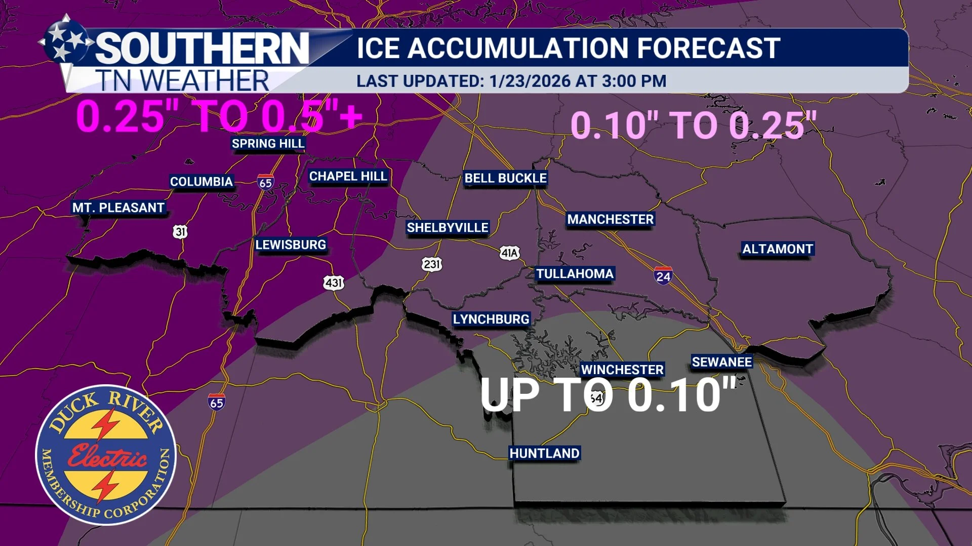
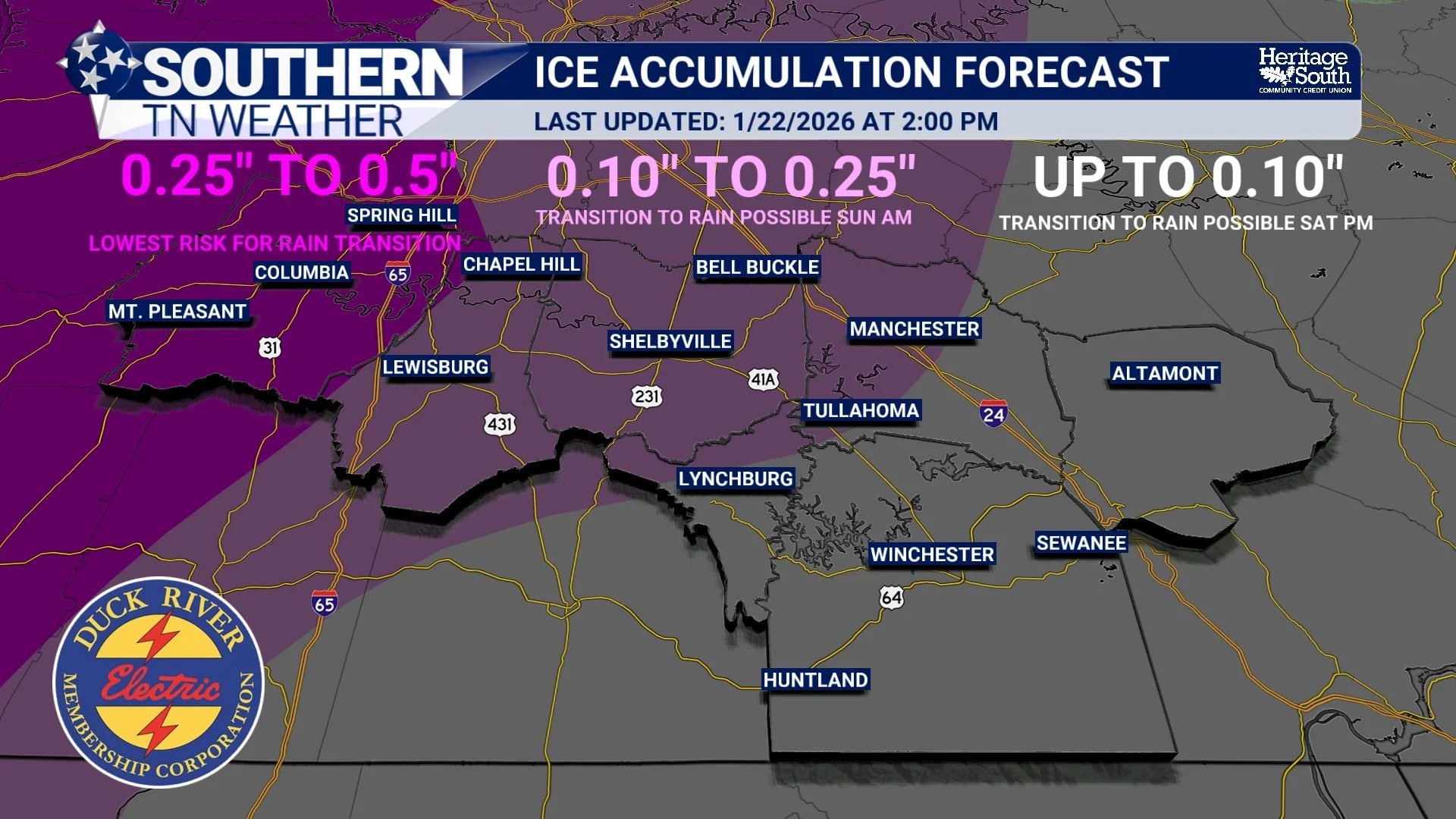
Southern Middle Tennessee is now within the high-confidence zone for a significant winter storm this weekend. After several days of watching trends and refining the pattern, we’ve reached the point where confidence is no longer in whether winter weather occurs but rather how it unfolds and where the greatest impacts ultimately set up.
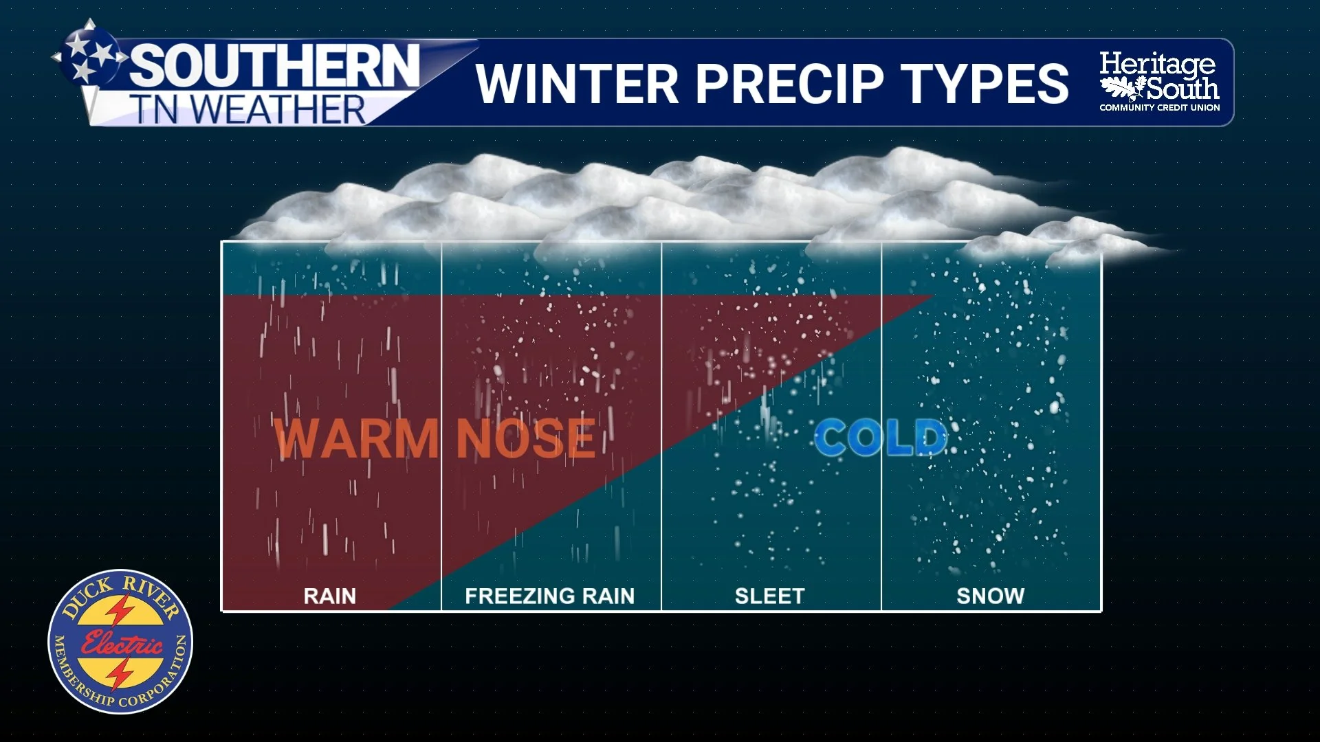
A Winter Storm Is Taking Shape… But Details Are Still Murky
If you’ve lived in Tennessee long enough, you know winter storms rarely arrive cleanly. They don’t usually give us textbook snow setups. They bend. They wobble. They introduce last-minute complications. That’s exactly what we’re watching unfold now. Confidence continues to increase that a major winter storm will impact parts of the South this weekend. That part of the forecast is becoming solid. What is becoming less solid is how that storm behaves once it reaches Tennessee.
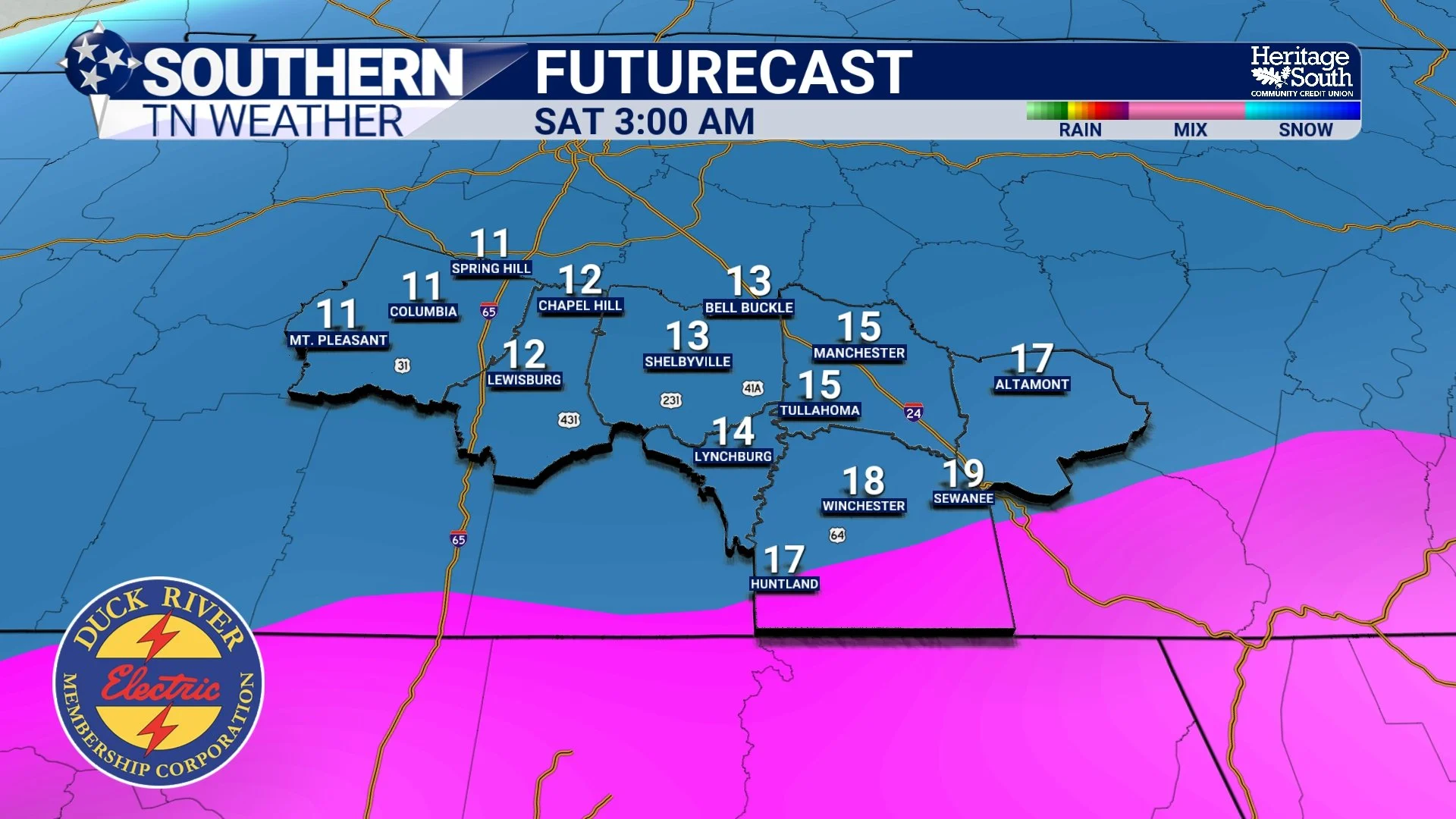
Confidence Growing in a High-Impact Winter Storm This Weekend
Southern Middle Tennessee remains firmly embedded in a cold-season pattern, but the focus is now shifting from reinforcing cold air to an increasingly organized winter storm threat late this week into the weekend.
While a weak system will bring scattered rain showers Wednesday into Wednesday night, confidence is growing that a much more impactful system will affect parts of the South Friday through Sunday. Forecast guidance from the National Weather Service, the Weather Prediction Center, and multiple ensemble systems is converging on a classic southern-stream winter storm setup — one capable of producing widespread snow and ice across the southern tier of the United States.
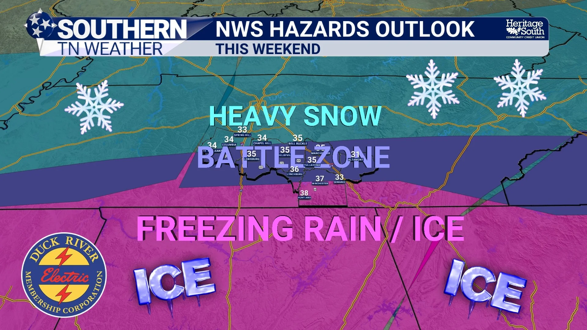
Very Cold Air Arrives Tonight as Winter Storm Signals Grow
Southern Middle Tennessee is settling into its coldest stretch of the winter so far, and the atmospheric pattern responsible is only becoming more firmly established. While the short-term forecast focuses on reinforcing cold air and generally quiet conditions over the next couple of days, attention is increasingly shifting toward a potential winter weather system late this week into the weekend. Confidence is growing that the large-scale setup will support winter weather somewhere across the southern United States from Friday through Sunday. What remains uncertain (and what we’ll be refining throughout the week) is how that system ultimately impacts Southern Middle Tennessee.
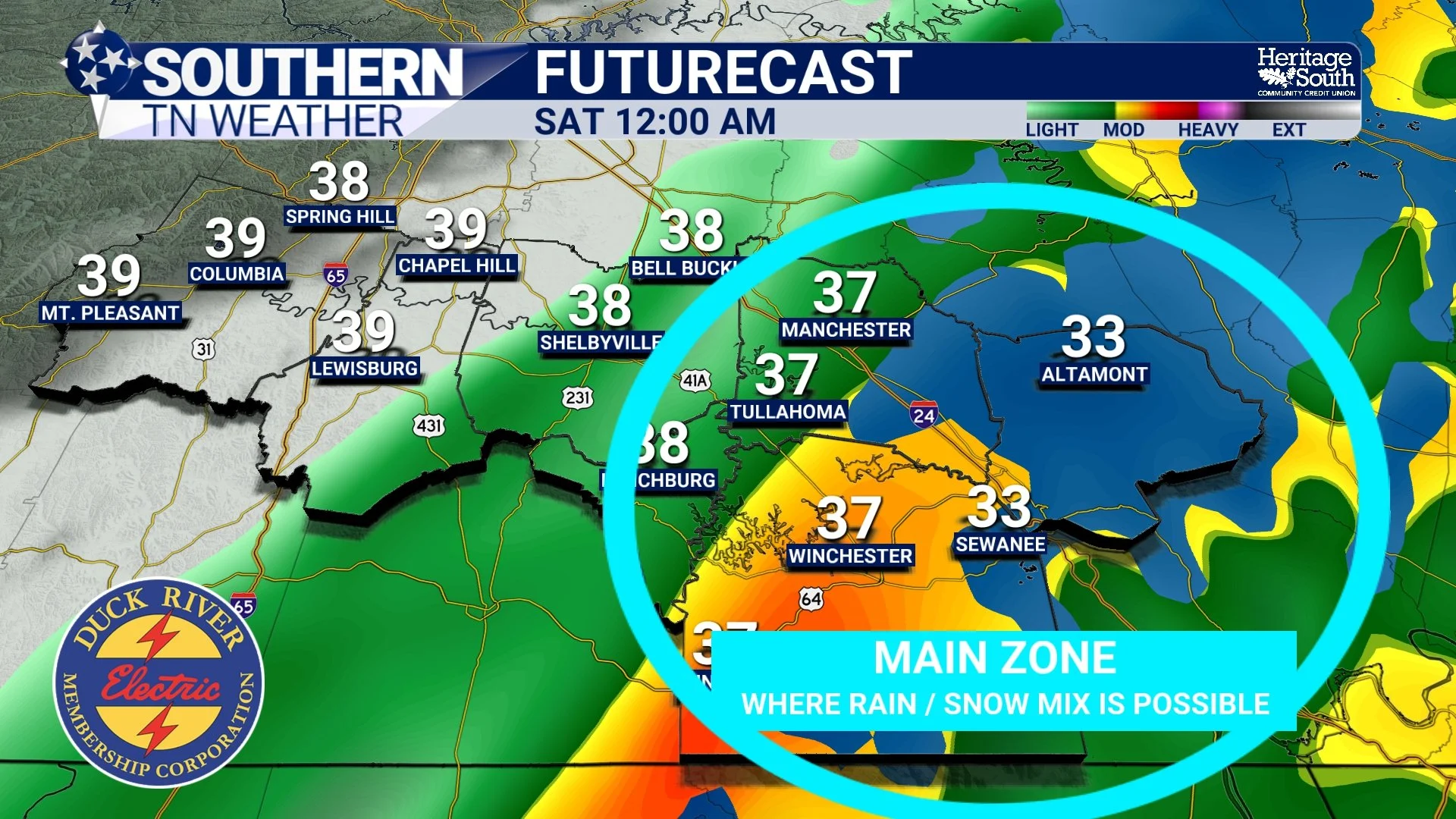
Light Showers This Evening, Watching for a Brief Rain-to-Snow Mix Tonight
Southern Middle Tennessee remains locked in a winter pattern, and while today has brought a modest break from the bitter cold, that break is short-lived. A weak disturbance is approaching the region this afternoon and evening, bringing another round of light precipitation. The main questions tonight revolve around timing, how much moisture is available, and whether a brief rain-to-snow mix develops before the system exits.
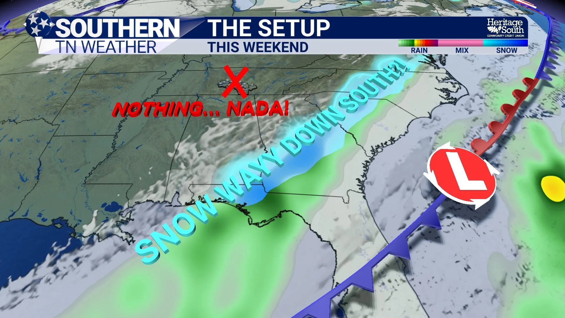
Cold, Weak Disturbances, and a Hard Pill to Swallow for Snow Fans
Light flurries and spotty snow showers that moved across parts of Southern Middle Tennessee this morning have largely come to an end. These developed as very cold air poured in behind yesterday’s cold front and passed over a shallow layer of lingering low-level moisture. Atmospheric moisture is extremely limited today, which is why no accumulation was seen locally and overall impacts have remained low. Outside of the Cumberland Plateau, no additional wintry precipitation is expected. Even on the Plateau, any minor dustings that occurred earlier should remain brief and localized.
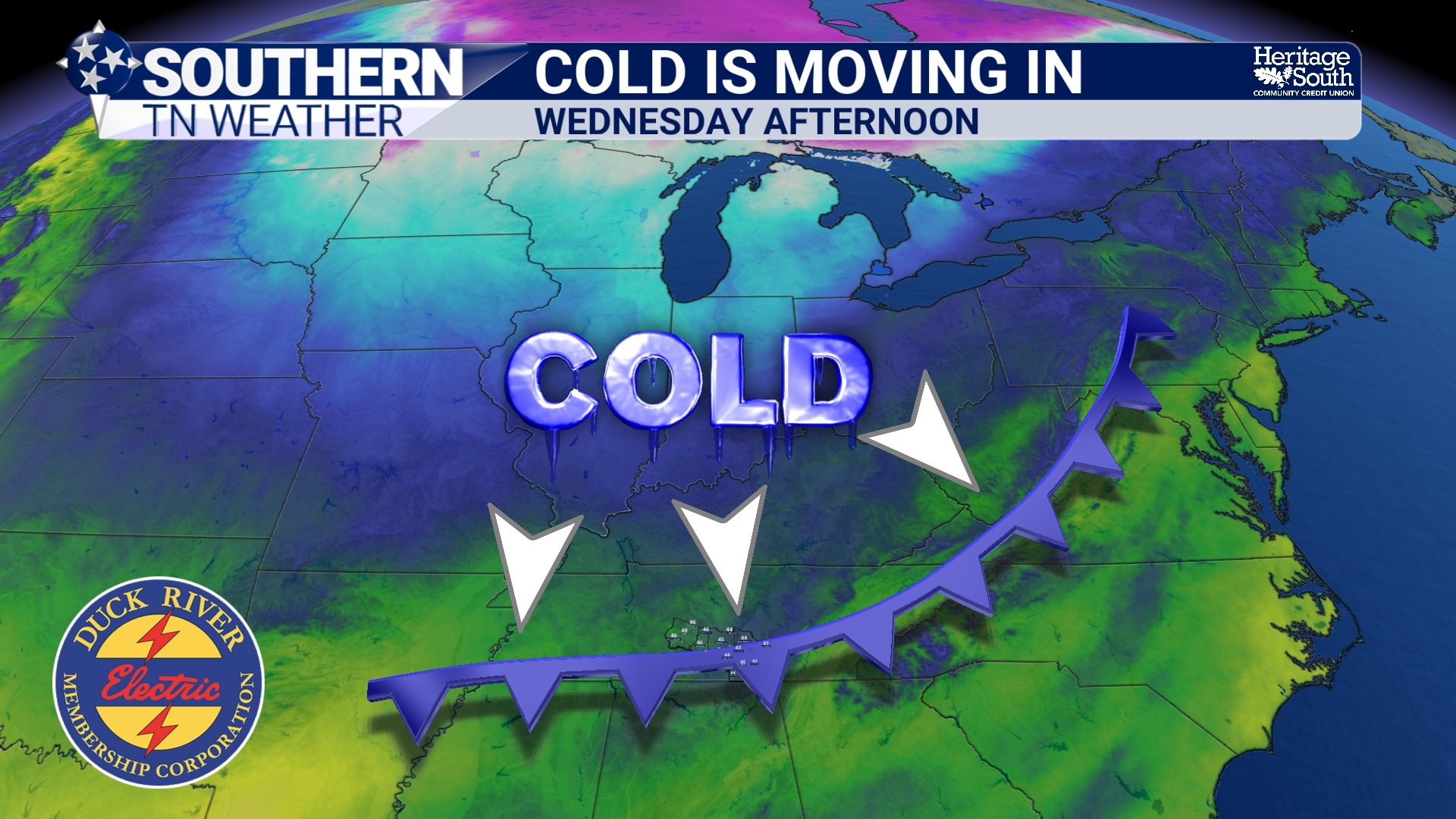
From Rain to Flurries… Then a True January Cold Blast Arrives
Southern Middle Tennessee’s midweek pattern change is now underway. After several days of tracking an approaching cold front and a possible rain-to-snow transition, today marks the execution phase of that forecast. Light rain is moving through the region this afternoon, colder air is closing in from the northwest, and by this evening we’ll begin the handoff from moisture to cold. Flurries will fly for many, but accumulating snow should remain confined to the Cumberland Plateau.
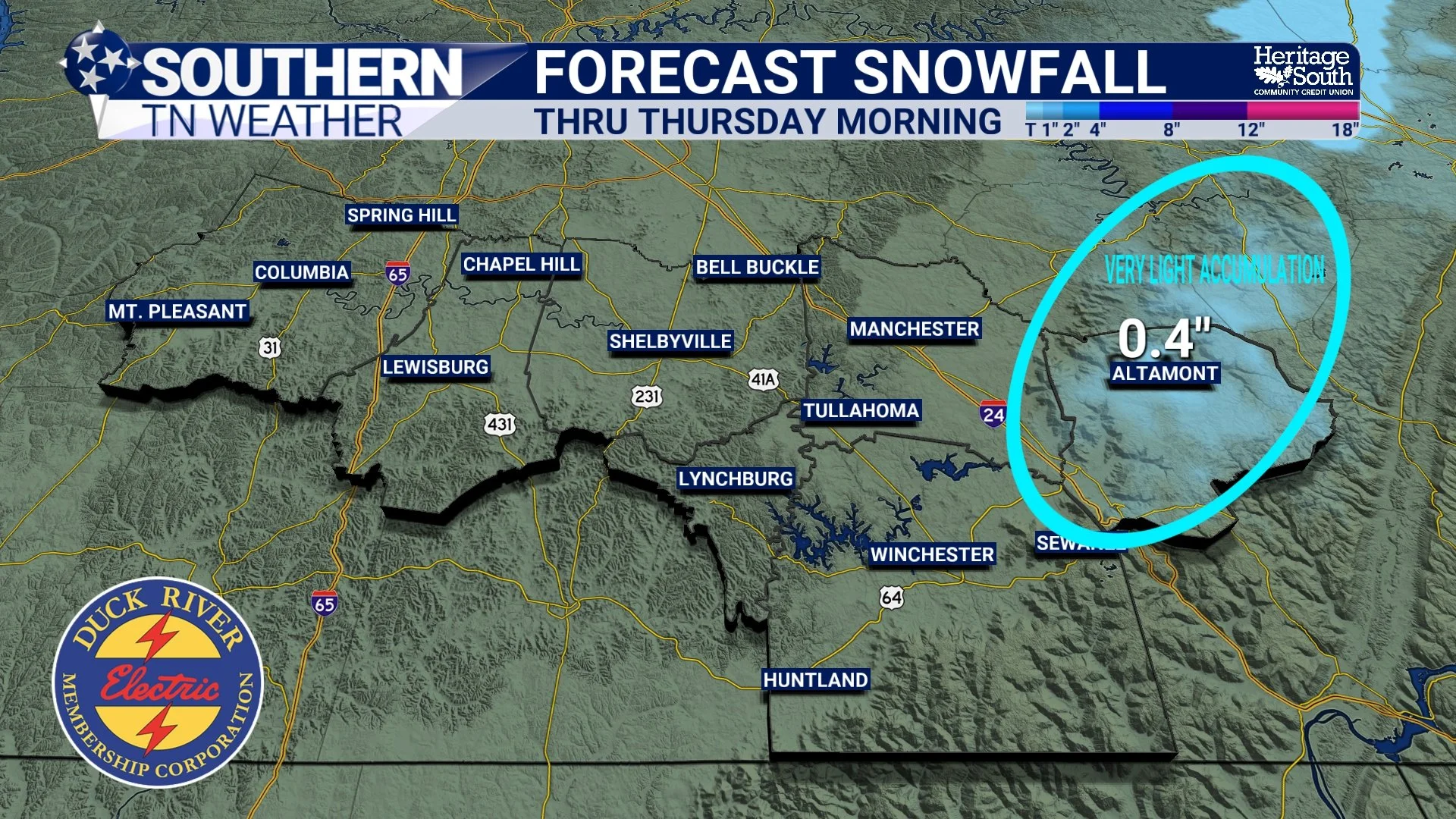
Midweek Rain, Brief Snow Chances, Then a Dip Toward Winter
Southern Middle Tennessee is entering a noticeably more active and colder weather pattern as we move through the middle of the week. After today’s mild conditions, rain returns Wednesday — followed by a sharp surge of cold air that may briefly flip rain to snow Wednesday evening, especially across the Cumberland Plateau.
This will not be a major winter storm for anyone in our area. However, light snow accumulations are becoming increasingly likely on the Plateau, and a prolonged stretch of colder-than-normal January weather will settle in behind this system.
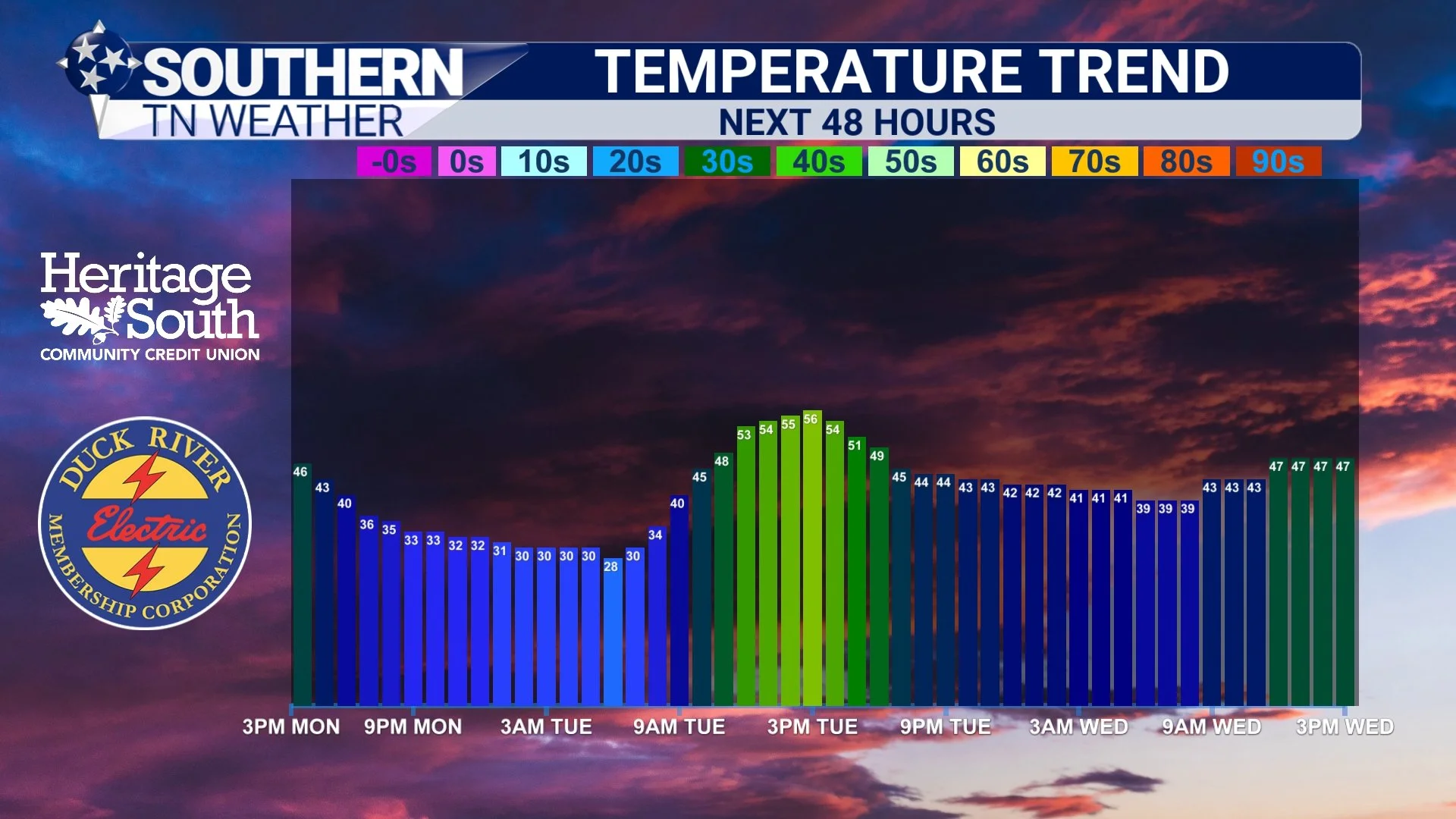
Gradual Warm-Up, With a Brief Shot at Rain Midweek
Southern Middle Tennessee is coming out of a cold start to the week, but the quiet weather won’t last much longer. After a couple of dry days and a modest warm-up, our next system arrives Wednesday bringing rain — followed by a sharp temperature drop that may briefly flip rain to flurries Wednesday night into early Thursday, especially toward the Cumberland Plateau. This will not be a major winter storm for our area. At this time, any snow looks light, limited, and elevation-dependent. However, it does mark the beginning of a colder, more January-like pattern heading into the second half of the week.
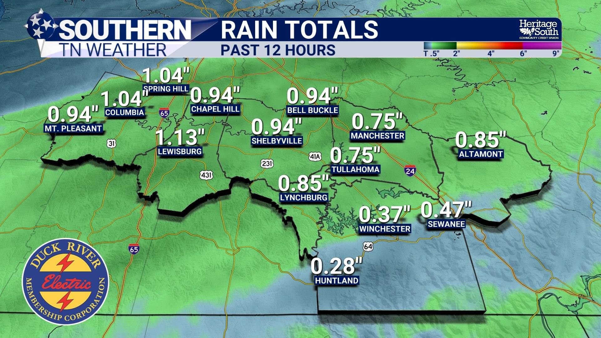
Flooding Remains the Main Concern as Rounds of Rain Continue
It was a rainy morning across Southern Middle Tennessee! While the severe weather threat has trended lower over the past 24 hours, the isolated flooding threat remains. Multiple rounds of rain are expected to continue through tonight and into Saturday, and while forecast totals have come down some, enough rain has already fallen (and more is still to come) to support localized flooding concerns.
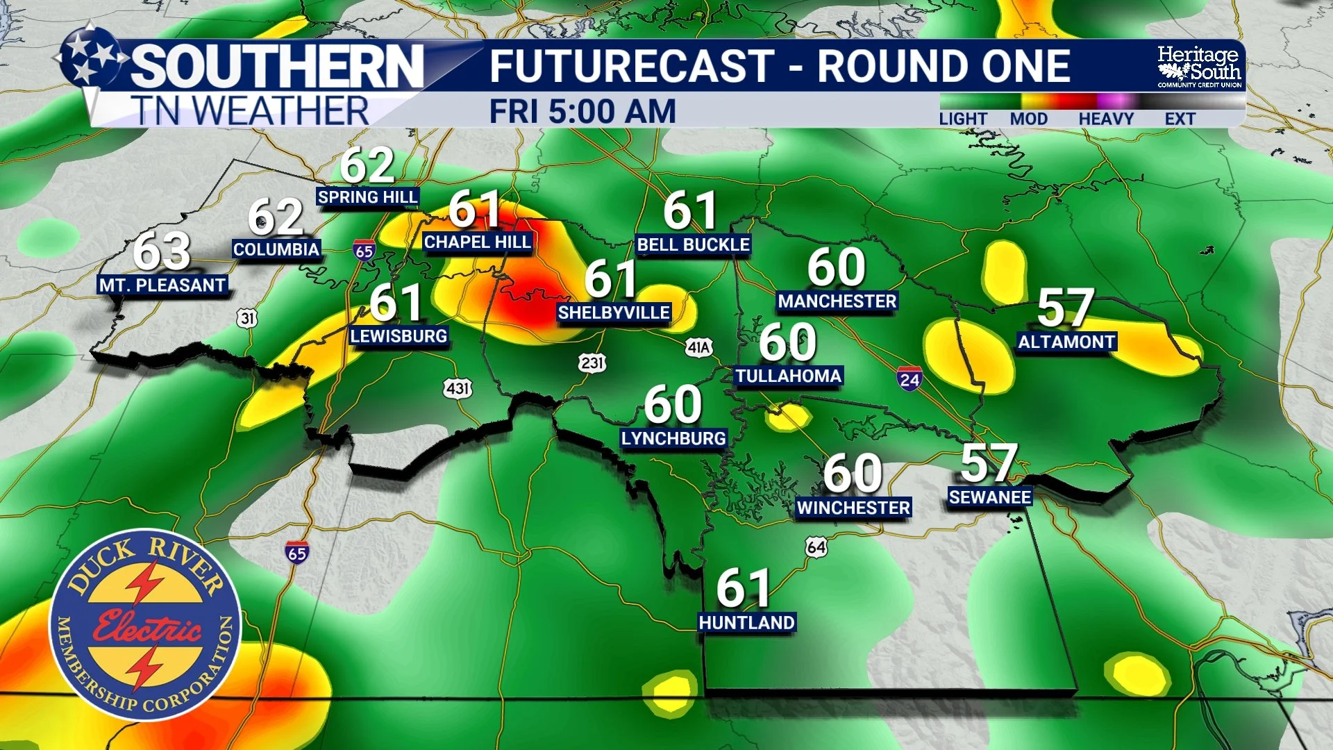
Active Weather Over the Next 48 Hours
Southern Middle Tennessee is entering its most active stretch of weather so far in 2026. After an unusually warm and mostly quiet start to January, multiple rounds of showers and thunderstorms are expected from late tonight through Friday night. This does not appear to be a major, high-end flooding or severe weather outbreak for our area. However, it will bring meaningful impacts — particularly the potential for localized flooding and a low-end severe storm risk.
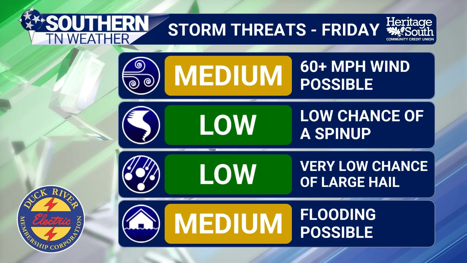
Friday’s Storm System Coming Into Focus: Newest Details Here
Southern Middle Tennessee remains in the middle of a very un-January-like stretch of weather, with spring-like warmth firmly in place and near-record temperatures likely again tomorrow. While conditions today are calm and comfortable, the larger weather pattern across the central United States is becoming increasingly active. Multiple national forecast centers are now highlighting our region for heavy rainfall and a low-end severe thunderstorm risk on Friday.
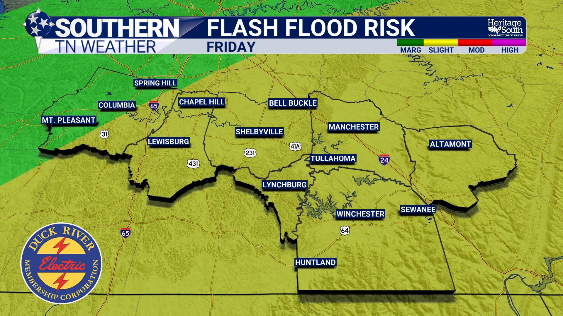
Heavy Rainfall Threat Increasing for Friday
Southern Middle Tennessee remains locked in an unusually warm and humid pattern for early January, but the quiet stretch of weather we’ve enjoyed is beginning to give way to a much more active setup. While today and Wednesday remain relatively calm, confidence is increasing that a widespread, heavy rainfall event will impact the region late Thursday night through Friday night, with a growing potential for heavy rainfall and localized flooding.
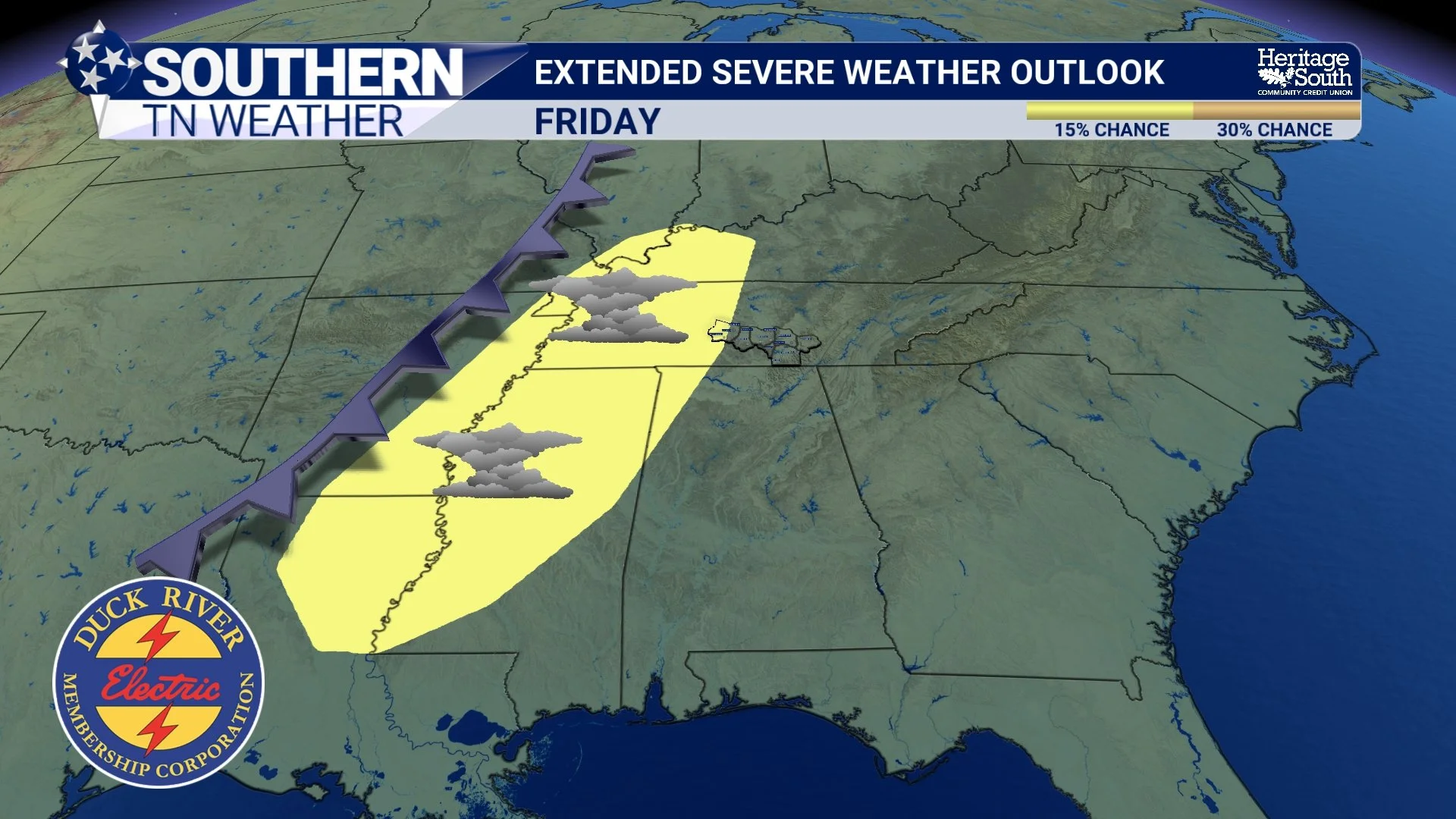
Unseasonable Warmth Settles In as Eyes Turn to Active Weather Late Week
Southern Middle Tennessee is entering a stretch of weather that feels far more like early spring than early January. This has been a familiar pattern over the past several weeks, with limited cold air and repeated surges of warmth dominating the region. As of this afternoon, a broad warm pattern is firmly in place, bringing above-normal temperatures, generally quiet conditions, and only limited rain chances through midweek.
While the short-term forecast remains calm and comfortable, attention is beginning to shift toward a more dynamic system expected late this week. That system could bring widespread rainfall and a low-end severe weather threat by Friday.
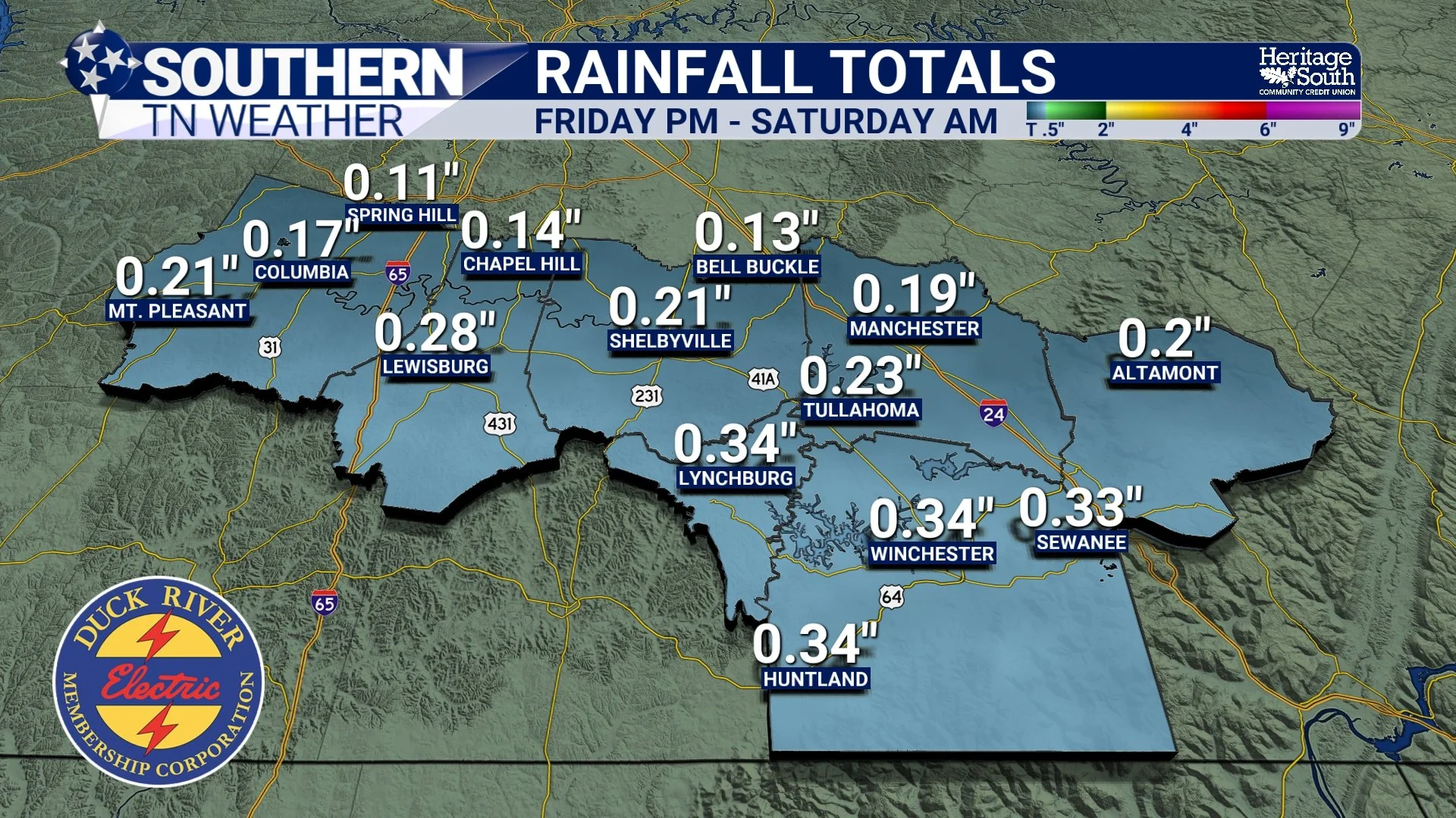
Rain Returns Tonight as 2026 Finds Its Rhythm
Southern Middle Tennessee is wrapping up the first couple days of 2026 on a calm and fairly mild note, but changes are already lining up just ahead. After a quiet and comfortable afternoon, rain will begin moving back into the region later today and tonight as our next weather system approaches from the west. This isn’t a high-impact setup, but it does mark a shift away from the dry stretch we’ve enjoyed and toward a more active pattern as we head into the weekend.
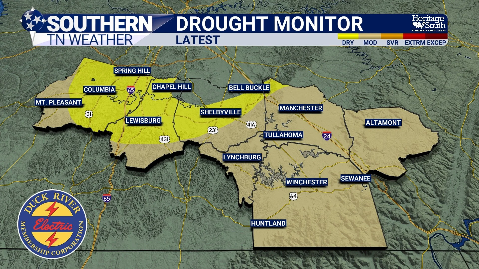
A Mild Start to 2026 with Rain on the Horizon
Southern Middle Tennessee is kicking off 2026 with calm, mild, and surprisingly pleasant weather for early January. After a chilly start to the week, temperatures have rebounded nicely today, and conditions remain quiet as we move through New Year’s Day. This is not an active weather pattern at the moment, but changes are on the way as we head into tomorrow. For now, enjoy the calm start to the new year with warmer air firmly in place.
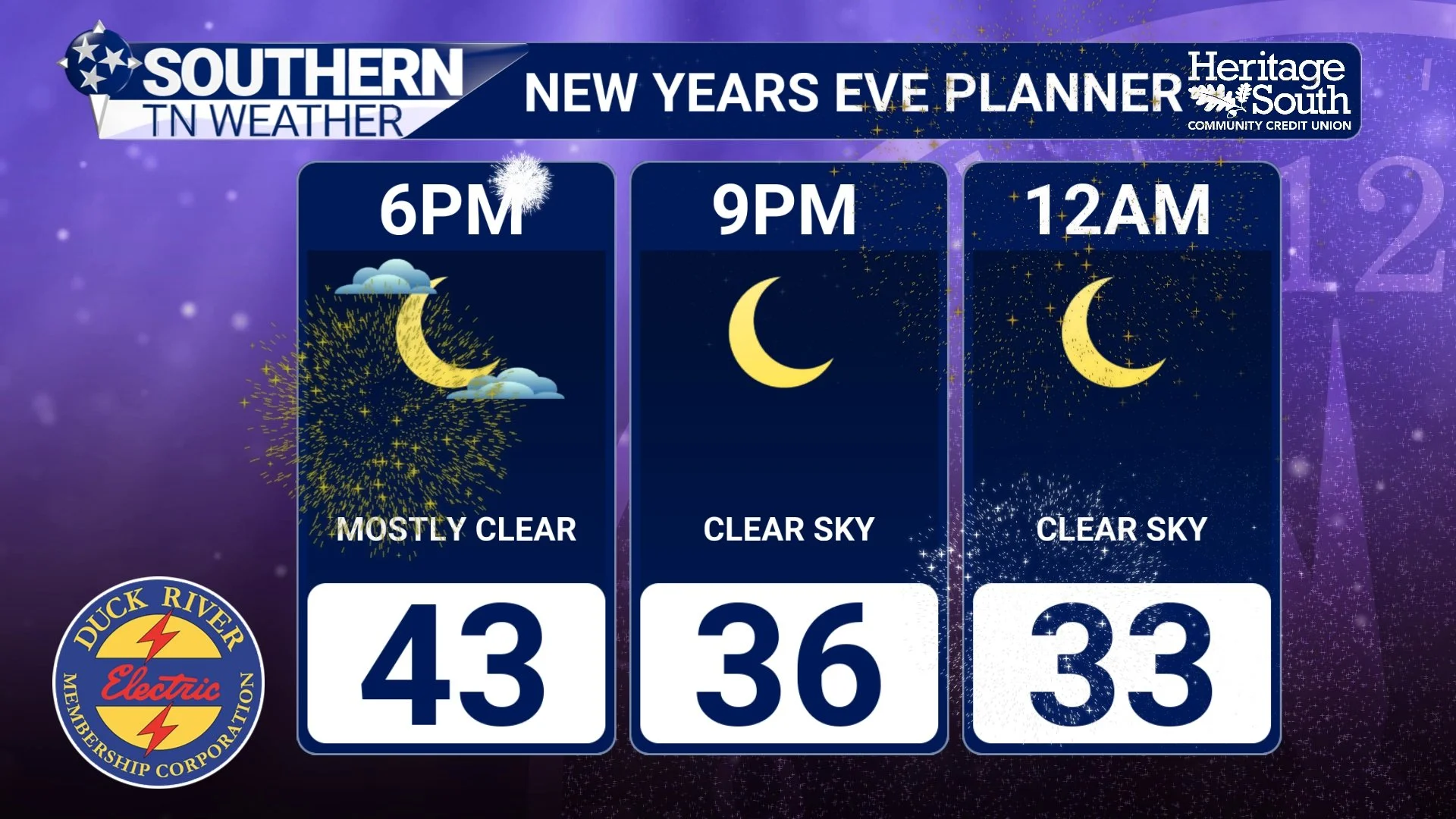
Calm Now, Warmer Ahead: A Quiet New Year’s Eve Across Southern Middle Tennessee
Southern Middle Tennessee is closing out 2025 on a calm and noticeably milder note. After the colder air earlier this week, temperatures are rebounding today as the overall weather pattern settles into something much quieter. For New Year’s Eve, conditions are cooperative, calm, and seasonably mild — a welcome break after the recent cold snap.