
Light Showers This Evening, Watching for a Brief Rain-to-Snow Mix Tonight

The Southern Tennessee Weather Blog is proudly presented by Heritage South Community Credit Union.
We Help When Others Won’t!
Visit https://www.heritagesouth.org/ today to see how HSCCU can help YOU!
Southern Middle Tennessee remains locked in a winter pattern, and while today has brought a modest break from the bitter cold, that break is short-lived. A weak disturbance is approaching the region this afternoon and evening, bringing another round of light precipitation. The main questions tonight revolve around timing, how much moisture is available, and whether a brief rain-to-snow mix develops before the system exits.
This is not a high-impact winter system. However, it is a good example of how subtle winter setups can still produce changing precipitation types and localized, elevation-driven differences.
This Afternoon: A Temporary Warm-Up Before the Front
High pressure has shifted east of the region today, allowing southerly winds to return. That return flow has helped temperatures climb into the 40s and low 50s this afternoon, making today the mildest day we will see for a while. Upstream, a weak cold front is positioned just northwest of Middle Tennessee. Moisture ahead of this boundary is limited, but increasing lift along the front is beginning to generate areas of light precipitation to our northwest. Clouds will continue to thicken this afternoon and evening, signaling the approach of this system.
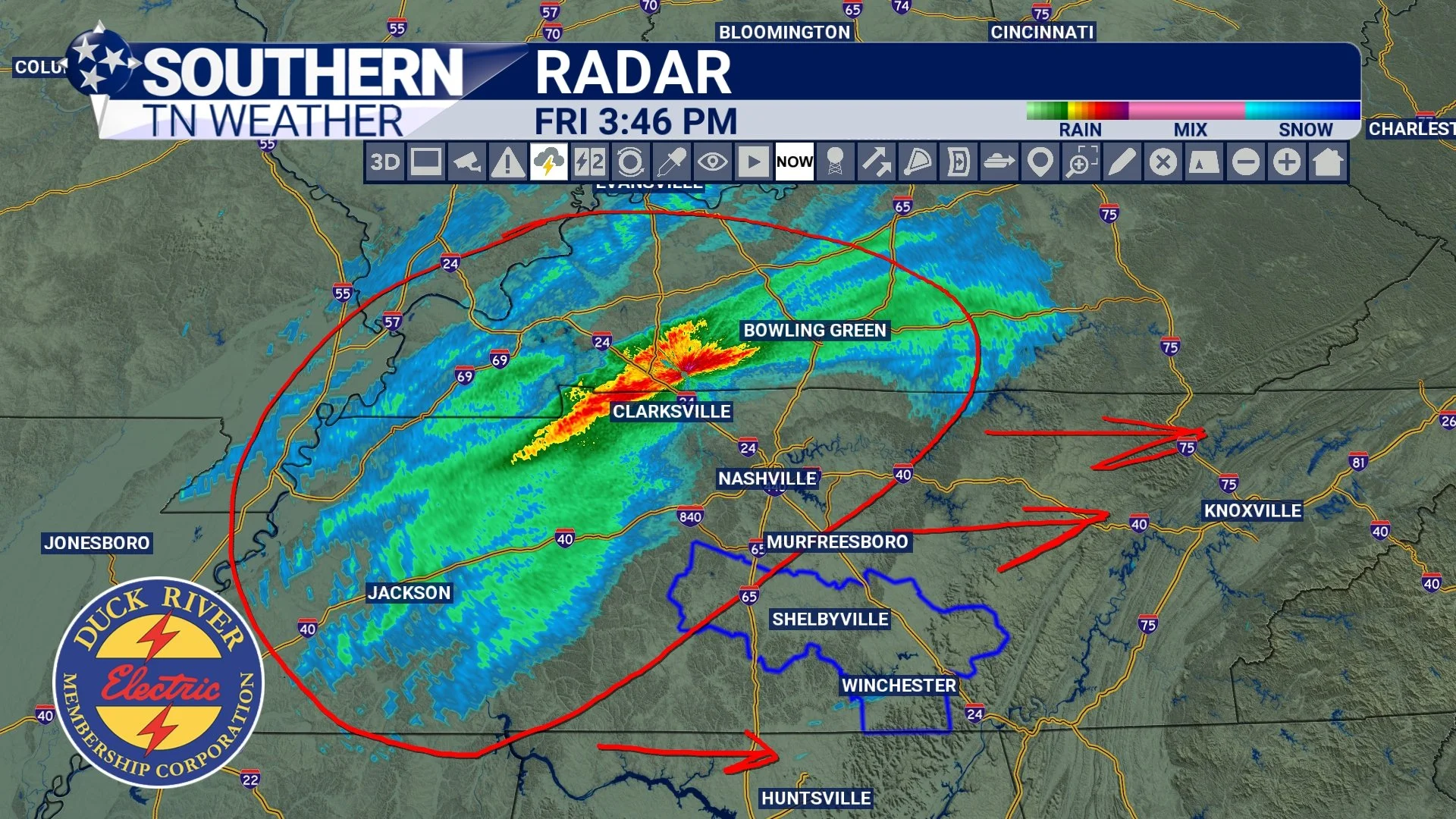
Current Radar
This Evening: Light Showers Develop
Light rain showers are expected to develop late this afternoon into the early evening hours, spreading from northwest to southeast across Southern Middle Tennessee.
• Maury and Marshall Counties: roughly 5–7 PM
• Bedford, Moore, and Coffee Counties: roughly 6–8 PM
• Franklin and Grundy Counties: roughly 7–9 PM
Once rain begins, it should last around 3 to 4 hours for most locations. This system is moisture-starved. Rainfall totals will be light (generally under a quarter inch), and there is no instability to support thunderstorms. The primary impact this evening will simply be damp roads and overcast skies. As the front approaches and surface winds turn northwest, colder air will begin filtering into the lower levels of the atmosphere.
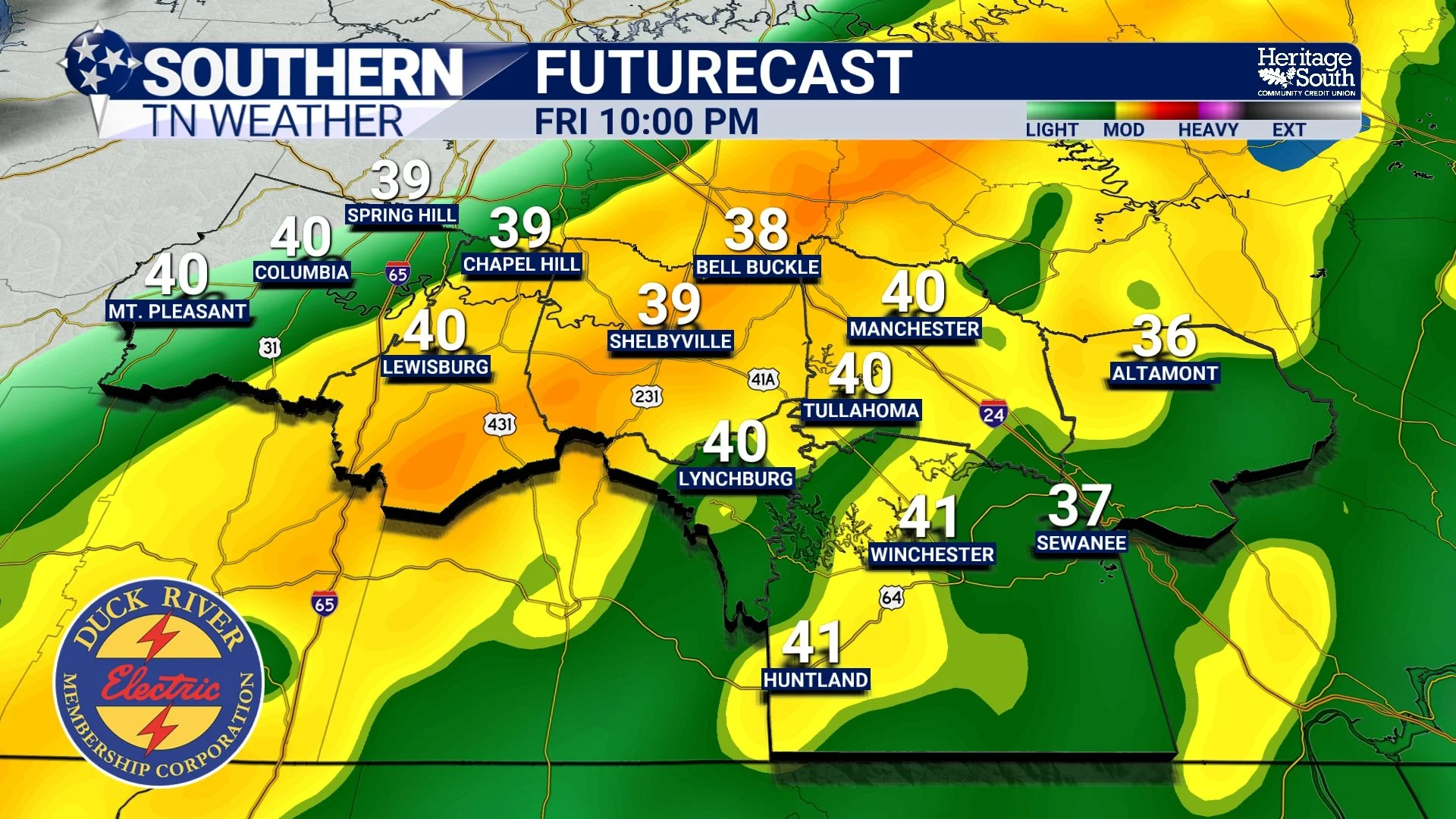
HRRR Futurecast - 10:00 PM tonight
Late Tonight: Watching for a Brief Changeover
The most interesting part of this system arrives late this evening into the overnight hours. As the cold front passes and colder air deepens, some of the remaining light precipitation may briefly mix with or change to snow, particularly across the Cumberland Plateau and higher terrain.
This is being driven by two processes working together: cold advection behind the front lowering temperatures, and evaporative cooling as dry air mixes into the system and cools the atmospheric column as precipitation falls.
For most of Southern Middle Tennessee east of Interstate 65, this will likely amount to nothing more than a few wet flakes mixing in before precipitation ends. The closer you are to the Plateau, the better your chances of seeing snowflakes. Franklin, Grundy, and Coffee Counties have the highest potential to see a brief mix. Farther west, toward I-65 in Marshall and Maury Counties, the chance of seeing snow is near zero. Along the Plateau, cold air and moisture overlap a little longer. Because of that, guidance continues to support the potential for a light dusting to under one-half inch in parts of Grundy County and Plateau areas of Franklin County. Even there, accumulations should be minor and localized. With temperatures above freezing while snow is falling, little to no travel impacts are anticipated.
Precipitation should end from northwest to southeast late tonight, with dry conditions returning before sunrise Saturday. Maybe some isolated flurries sticking around for a few hours into early Saturday morning… Please don’t go around saying I said a blizzard is coming tonight. As I mentioned this morning — this is NOT a bread-and-milk situation!
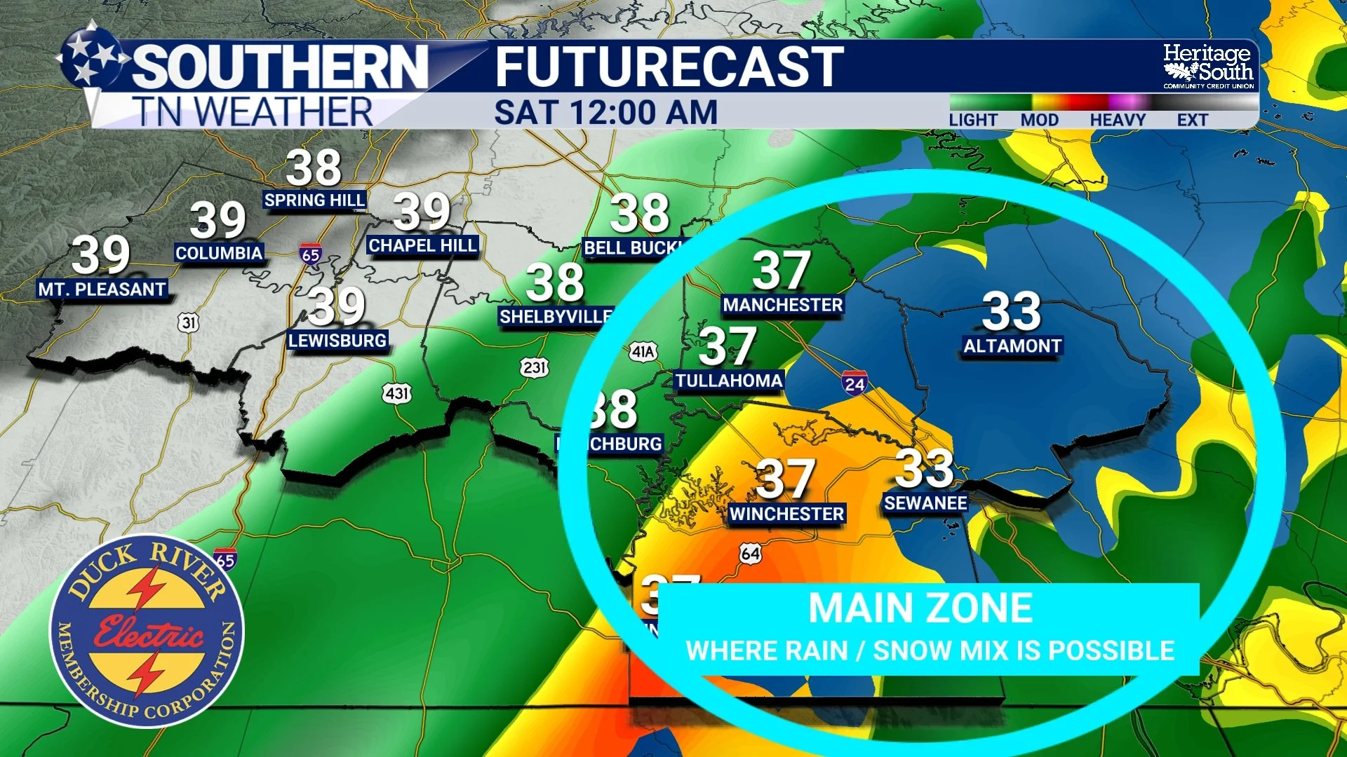
Main Zone Where Rain / Snow Mix is Possible
Saturday and Beyond: Cold Reasserts Control
Behind this system, clouds will linger into Saturday, but the bigger change will be temperature. Cold air will deepen overnight, and Saturday will turn colder again, reinforcing the pattern that has been building all week. Looking ahead, below-normal temperatures remain firmly in place through the middle of next week. Another reinforcing cold front arrives late Sunday into Monday, setting the stage for the coldest period of this stretch. Current guidance continues to support the potential for widespread teens and even some single-digit lows Monday night into Tuesday morning.
Precipitation chances then shut down until at least the middle of next week. There is a system late next week that has my attention… but that’s all I’m going to say for now.
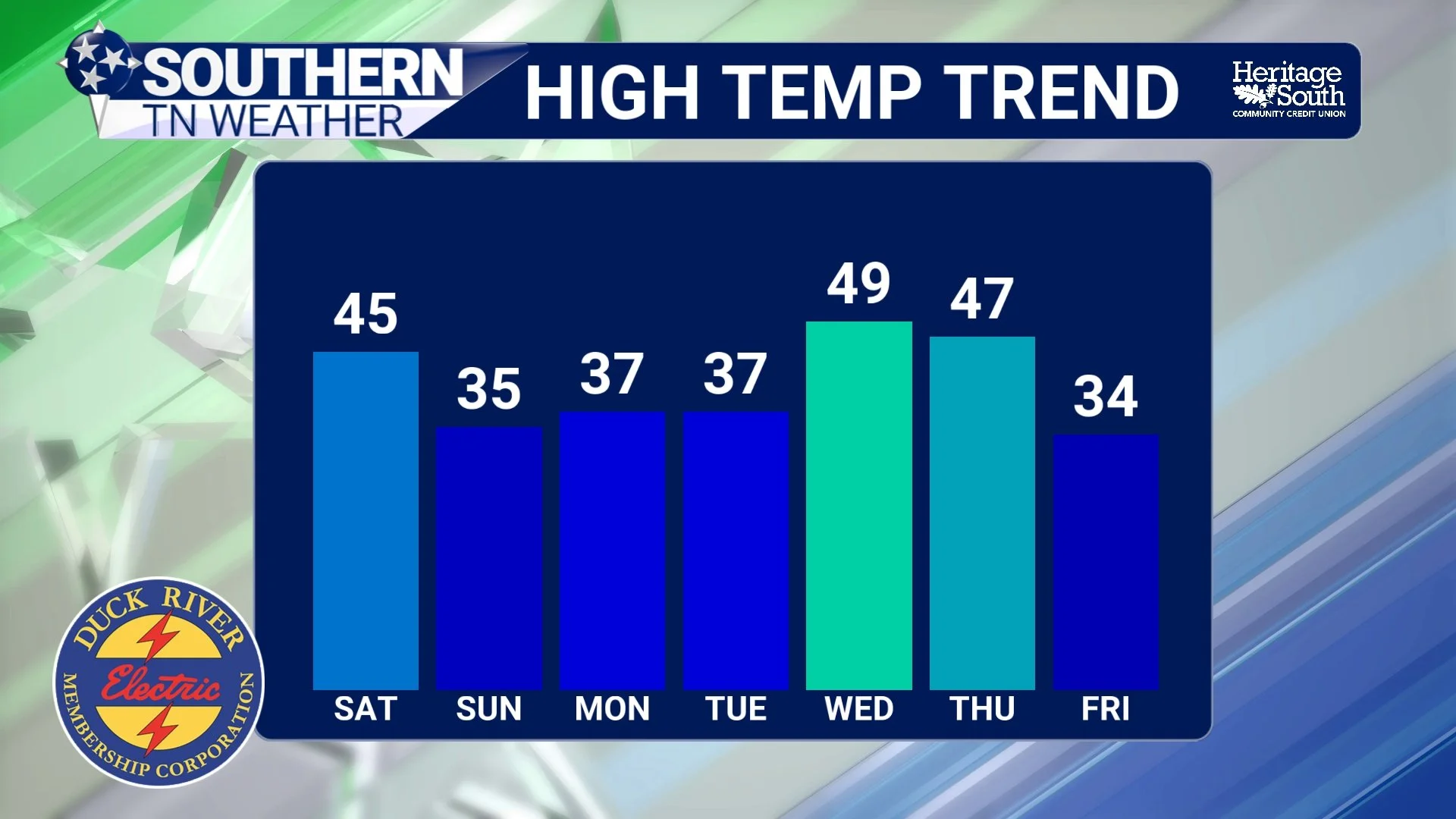
Temp Trend - Next 7 Days
The Bottom Line 🧾
• Light rain showers develop late this afternoon into this evening
• A brief rain-to-snow mix is possible late tonight, mainly across the Cumberland Plateau
• Any snow accumulation is expected to be light and confined to higher elevations
• Cold air strengthens behind the front, reinforcing a prolonged cold pattern
• Much colder nights are ahead, with teens and possible single digits early next week
📰 Reminder: The Southern Tennessee Weather Blog (Presented by Heritage South Community Credit Union) is updated Monday through Friday with fresh, locally tailored forecasts you can trust.