
Rain Returns Tonight as 2026 Finds Its Rhythm

The Southern Tennessee Weather Blog is proudly presented by Heritage South Community Credit Union.
We Help When Others Won’t!
Visit https://www.heritagesouth.org/ today to see how HSCCU can help YOU!
Southern Middle Tennessee is wrapping up the first couple days of 2026 on a calm and fairly mild note, but changes are already lining up just ahead. After a quiet and comfortable afternoon, rain will begin moving back into the region later today and tonight as our next weather system approaches from the west. This isn’t a high-impact setup, but it does mark a shift away from the dry stretch we’ve enjoyed and toward a more active pattern as we head into the weekend.
Calm Conditions This Afternoon
Temperatures this afternoon have climbed into the lower to mid 50s across much of Southern Middle Tennessee, thanks to light southerly winds and filtered sunshine. Cloud cover has gradually increased, but overall conditions remain pleasant for early January. You may already notice radar showing rain well to our west. However, much of that precipitation has been evaporating before reaching the ground. This is because the lower levels of the atmosphere remain fairly dry.
One way we track moisture is by comparing temperature and dew point. When those two values are far apart, the air is dry. As they move closer together, moisture increases and rain becomes more likely to reach the ground. That process is happening now and will continue through the afternoon
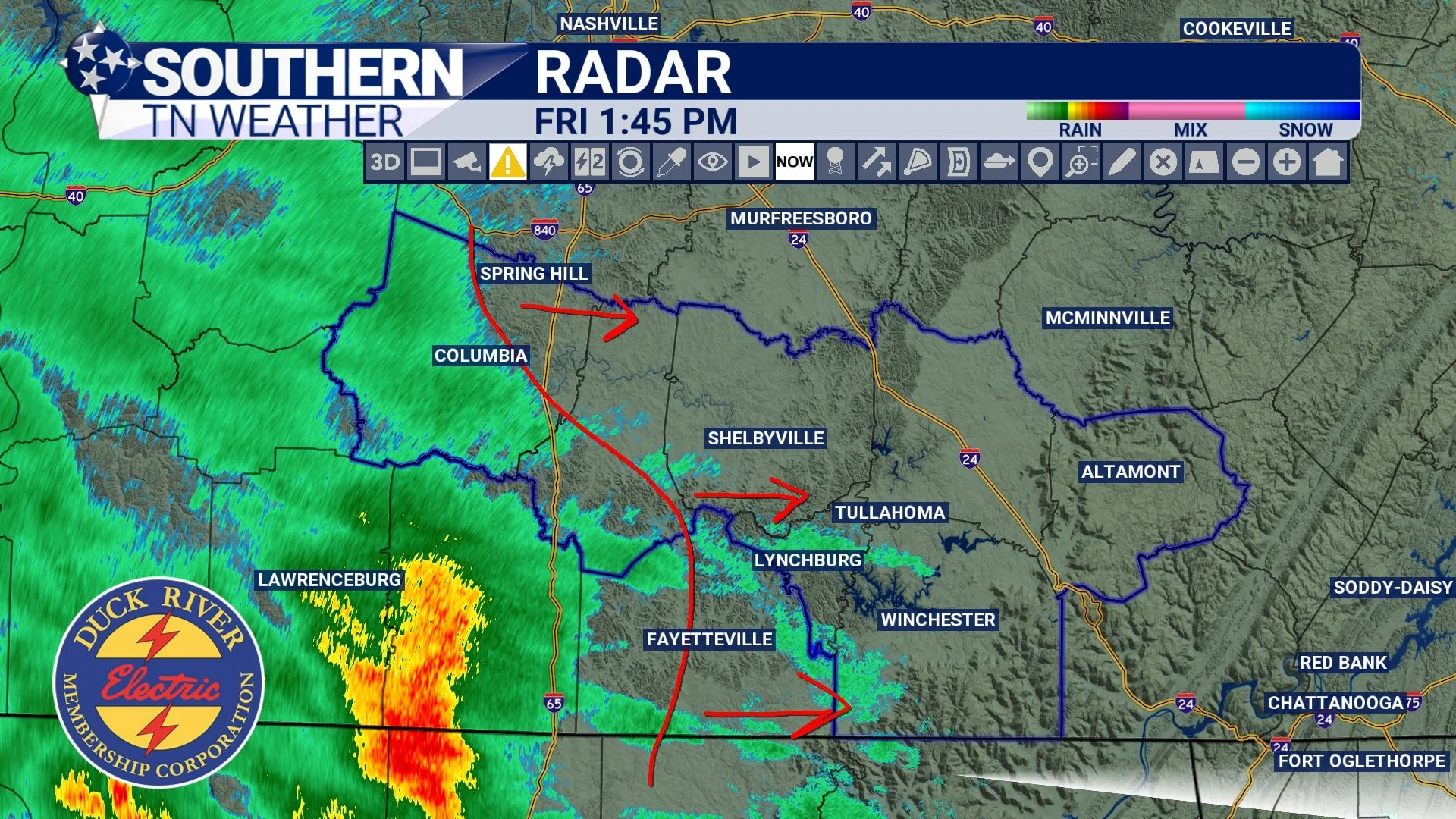
Radar as of 1:45 PM
Rain Moves In This Evening and Tonight
Rain chances increase later this afternoon and especially this evening as a surface low tracks east across the region. Most of the rainfall will occur between about 4 PM and midnight, with lighter showers lingering into early Saturday morning. Current guidance suggests rainfall totals generally between 0.25 and 0.75 inches, with a few localized spots possibly nearing 1 inch. Right now, those higher totals appear to be outliers rather than the rule. The National Blend of Models supports lighter, more widespread rainfall rather than a heavy event. While a few isolated rumbles of thunder can’t be ruled out late this evening, instability remains very limited. Severe weather is NOT expected!
This rainfall comes at a good time. Portions of Southern Middle Tennessee are currently classified in a D1 (Moderate) Drought, and this system should help ease some of those short-term moisture deficits. While it won’t erase drought conditions entirely, it’s a healthy step in the right direction.
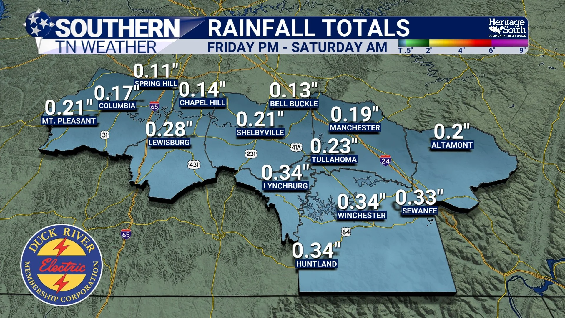
Rainfall Totals - National Blend of Models
What Happens Next
Rain tapers off early Saturday, with clouds lingering through much of the day. Temperatures remain mild, topping out in the upper 50s to near 60 degrees. Looking ahead, the overall pattern stays fairly quiet and mild. Highs will continue running above normal heading into next week, with no major cold outbreaks showing up in the forecast. Additional rain chances may return later next week, but confidence in timing and coverage remains low for now.
One thing is becoming clearer: colder air and winter weather are not lining up anytime soon. In fact, the latest Climate Prediction Center outlooks continue to favor above-average temperatures and above-average rainfall heading deeper into January (see below). Sorry, cold and snow lovers — this pattern still isn’t cooperating.
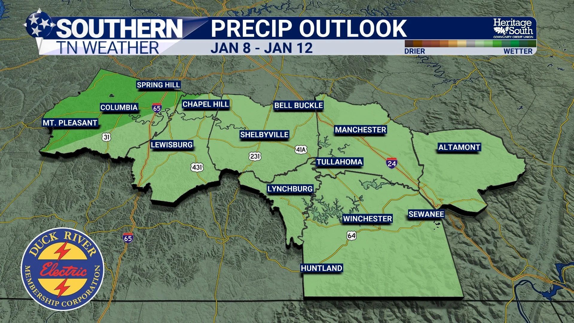
Precip Outlook
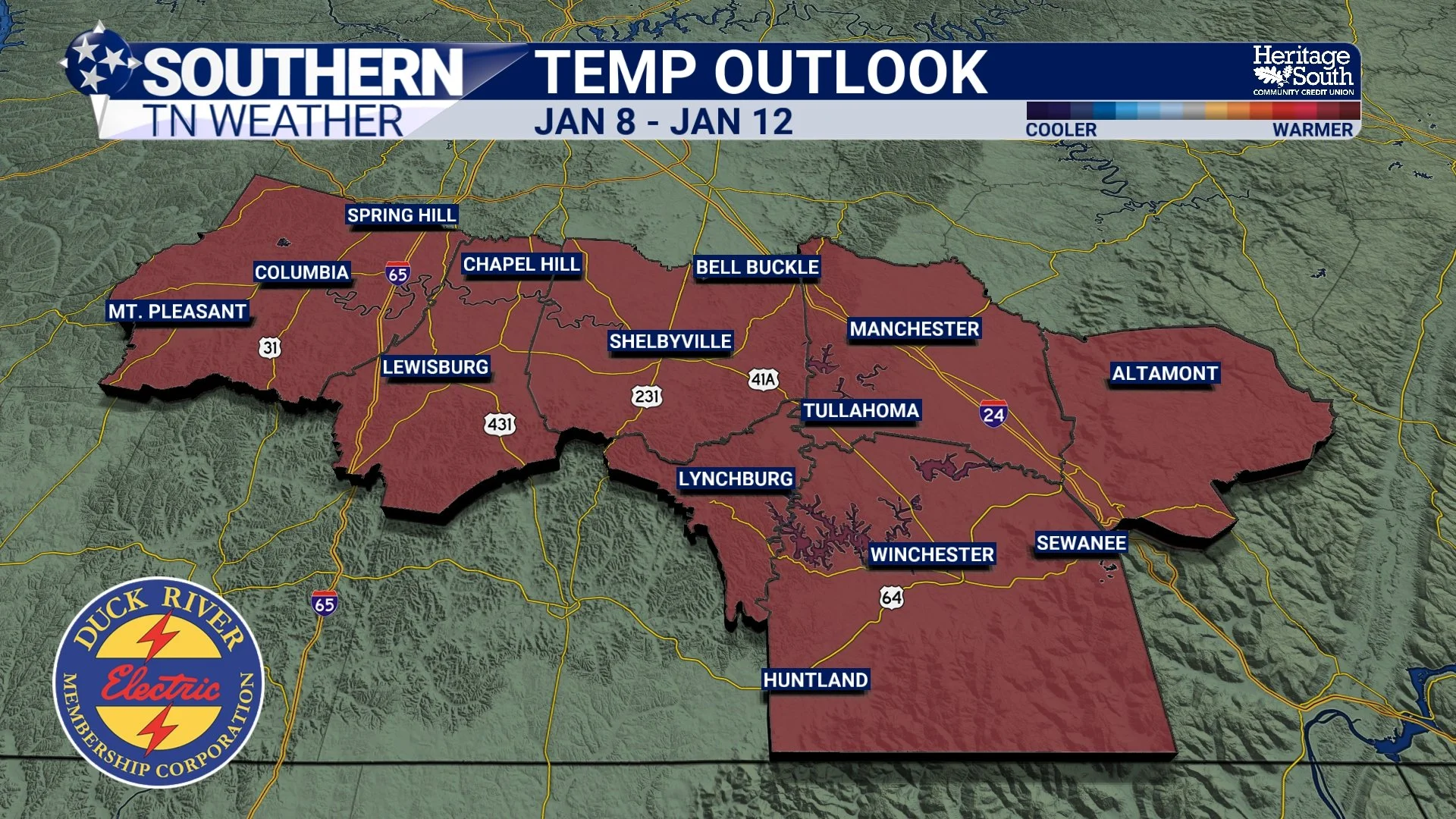
Temp Outlook
The Bottom Line 🧾
• Calm and mild this afternoon
• Rain moves in late today through tonight
• Rain totals of 0.25–0.75", locally near 1"
• No severe weather expected
• Dry and mild again Saturday
• Warmer-than-normal pattern continues into next week
📰 Reminder: The Southern Tennessee Weather Blog (Presented by Heritage South Community Credit Union) is updated Monday through Friday with fresh, locally tailored forecasts you can trust.