
WEATHER BLOG

Presented By:
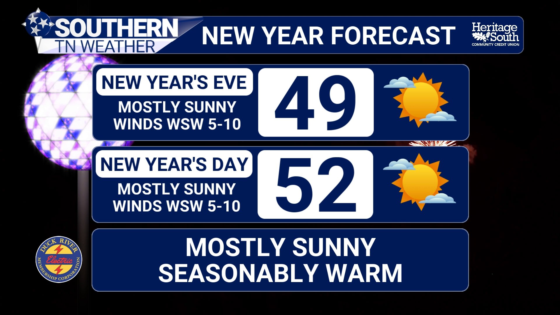
Gradual Warm-Up Ahead With Rain Returning Late Week
Southern Middle Tennessee is getting a true reminder of winter this afternoon as cold air remains firmly in place behind Sunday’s cold front. While sunshine has returned, temperatures are struggling to climb out of the 30s, and a steady northwest breeze is keeping the chill locked in.
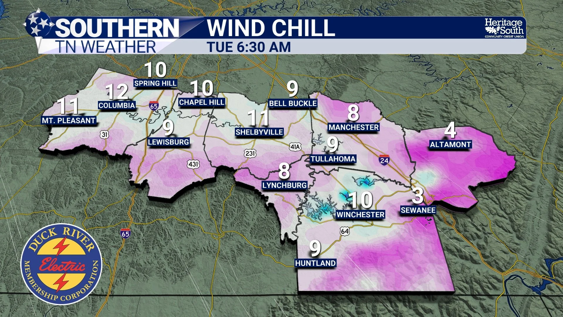
Cold and Breezy Now, Milder Days Ahead for the New Year
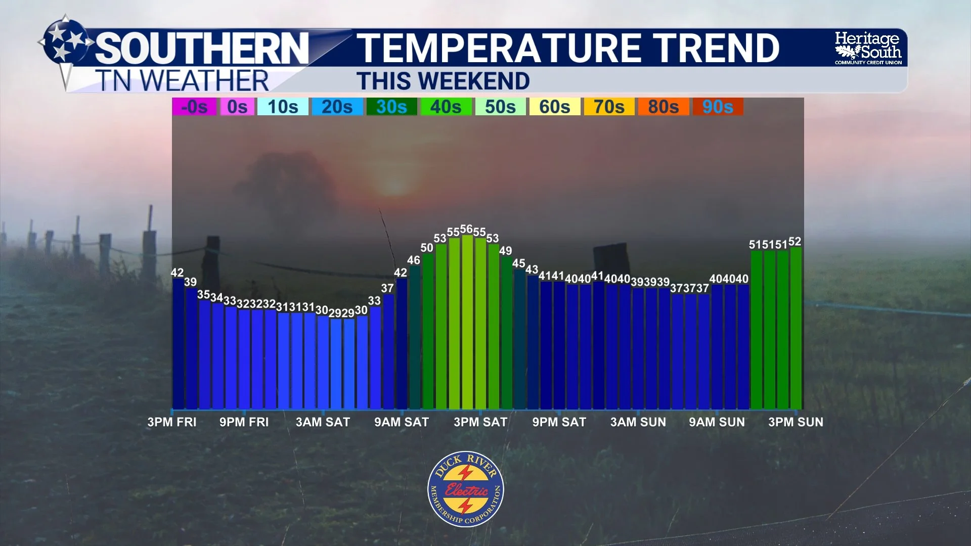
Southern Middle Tennessee is getting a sharp reminder that winter still has some bite left, at least for the next couple of days. A strong cold front pushed through overnight, bringing gusty winds and a noticeable drop in temperatures. While conditions are calmer this afternoon, the cold is here to stay through midweek before a gradual warmup takes over as we head toward the New Year.
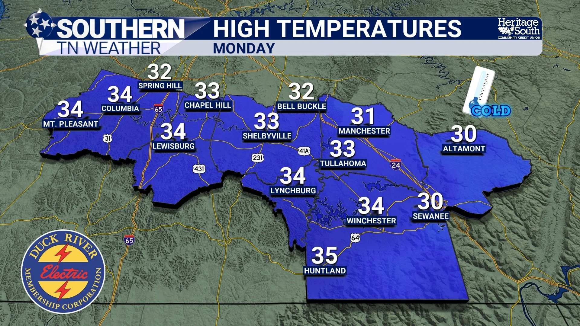
Warm and Cloudy Now — A Holiday Warmth Peak Before a Sharp Pattern Flip
It doesn’t feel very Christmas-like outside today, and that’s no accident. Southern Middle Tennessee remains locked in a warm, moist pattern as southerly winds continue to feed mild air into the region. Temperatures are running well above average, cloud cover has been stubborn, and occasional light showers are drifting through the area.
While it may feel stormy outside, this is not a hazardous setup. Instead, this forecast is about timing and perspective — enjoying an unusually warm holiday stretch while keeping an eye on a much colder pattern waiting just beyond it.
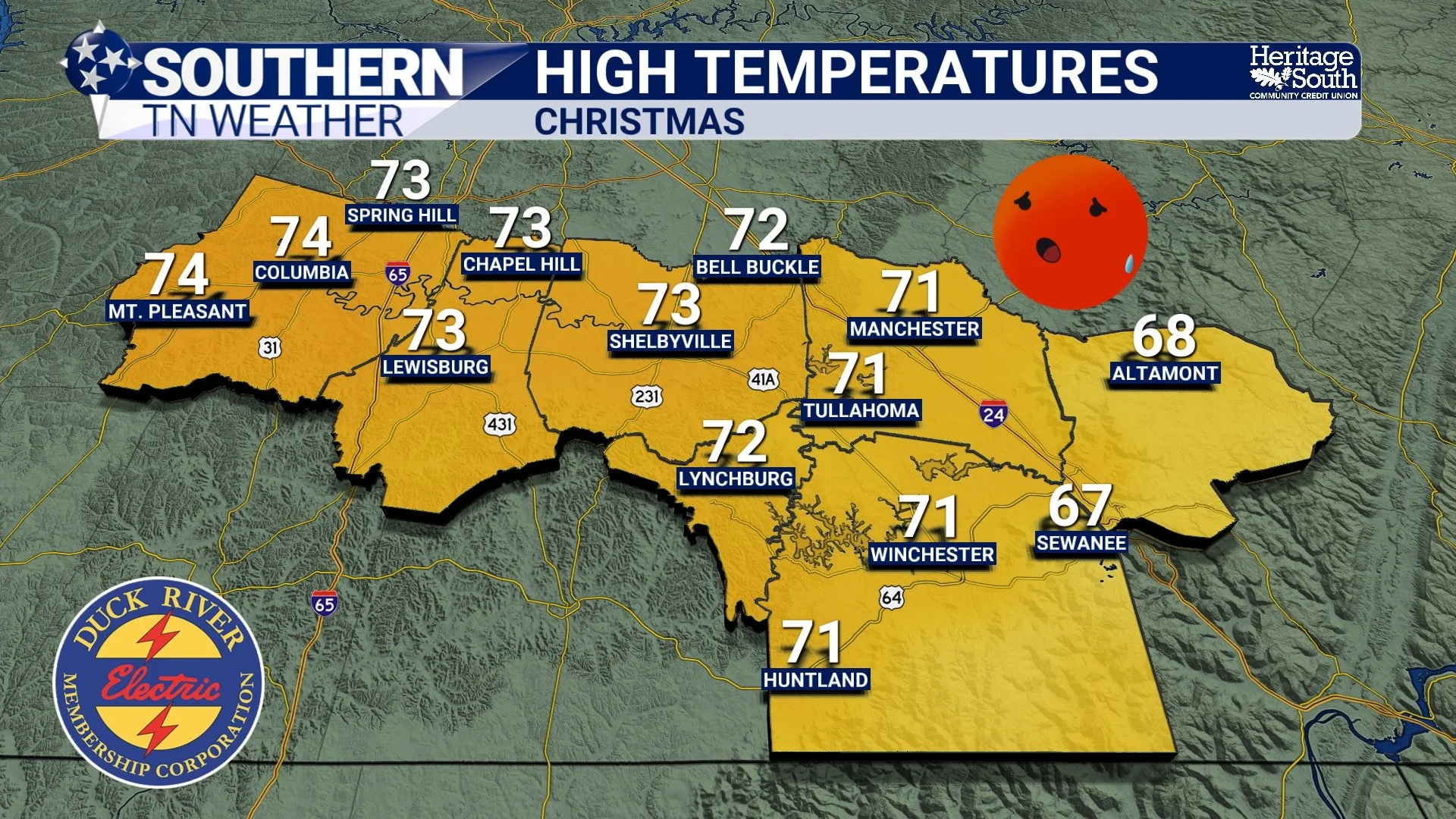
Slim Rain Chances Early This Week; Warm and Dry Christmas
It’s a noticeably milder start to the week across Southern Middle Tennessee. Southerly winds have done their job, pushing temperatures back into the mid to upper 50s this morning after yesterday’s sharp cool-down. Dew points are still playing catch-up after crashing into the single digits over the weekend, which is one reason the air feels dry despite the cloud cover hanging around.
Overall, we’re entering a quieter stretch of weather, with above-average temperatures becoming the main story, especially as we head toward Christmas.
Storm Reports from Thursday & A Look Ahead Toward Christmas
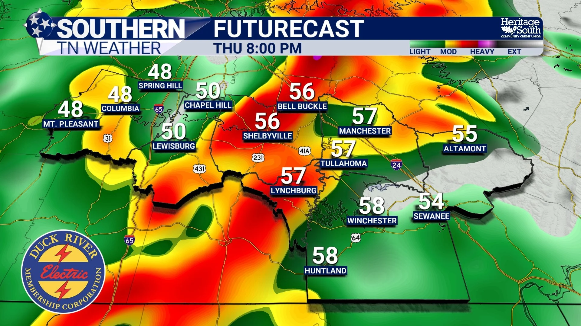
Thursday’s cold front definitely packed a punch across Southern Middle Tennessee. While the severe weather threat going into the event was fairly low, we still ended up with numerous damage reports, mainly due to strong winds interacting with saturated ground conditions.
Let’s recap what happened Thursday, then look ahead to a much calmer and warmer stretch of weather as we approach Christmas.
Thursday Afternoon Rain and Storm Update
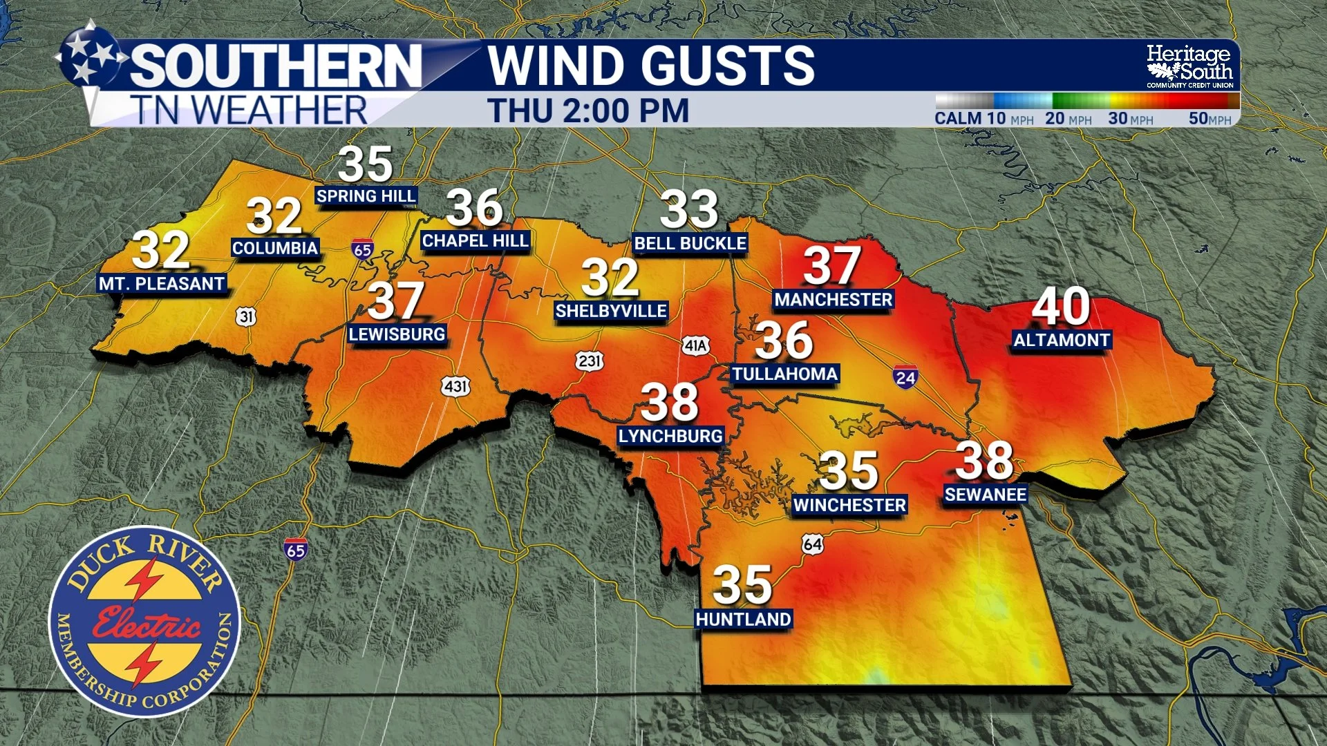
Rain and gusty winds continue to overspread Southern Middle Tennessee this afternoon as a cold front slowly works east across the region. This system has been on our radar for several days, and while the overall severe weather threat remains VERY low, the Storm Prediction Center has reintroduced a Marginal Risk (Level 1 of 5) for parts of the area through this evening… Before you bring out your pitchforks at me, let’s walk through what’s happening, what has changed, and what you should actually expect.
An Update on Thursday’s Storm Potential…
It’s been a mostly cloudy and mild day across Southern Middle Tennessee so far, with temperatures sitting in the 50s and only a few spotty sprinkles showing up here and there. That light activity is tied to a weak disturbance passing overhead today, but it’s really just a placeholder for the main weather system we’re tracking for Thursday.
Storms Possible Thursday, But Severe Threat Remains Low
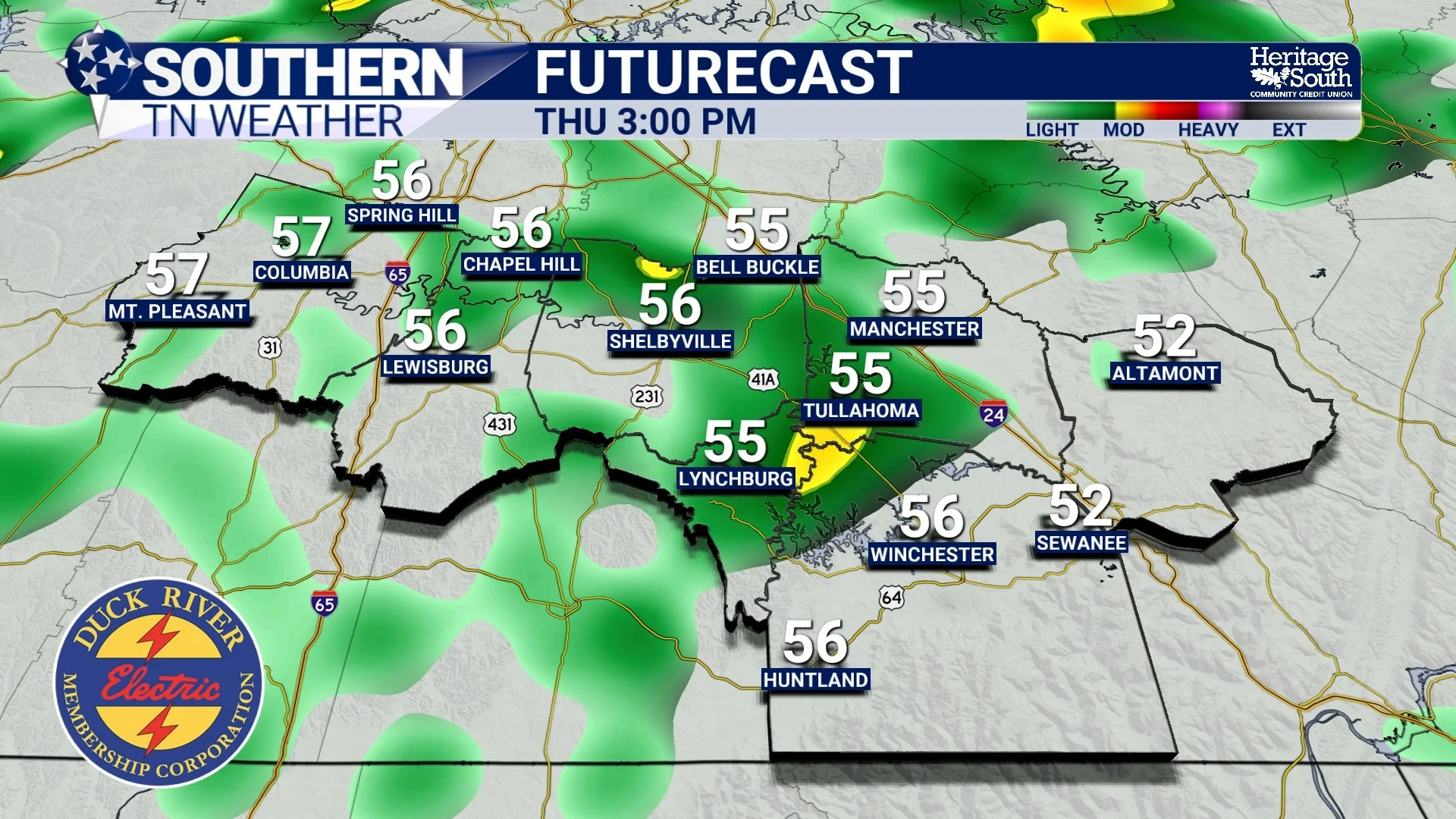
As we head toward the middle of the week, temperatures across Southern Middle Tennessee will continue to trend warmer. Highs will climb into the 50s and lower 60s Wednesday and Thursday, which is well above average for mid-December. That warmth, however, comes with our next widespread rain-maker and a low-end storm threat on Thursday.
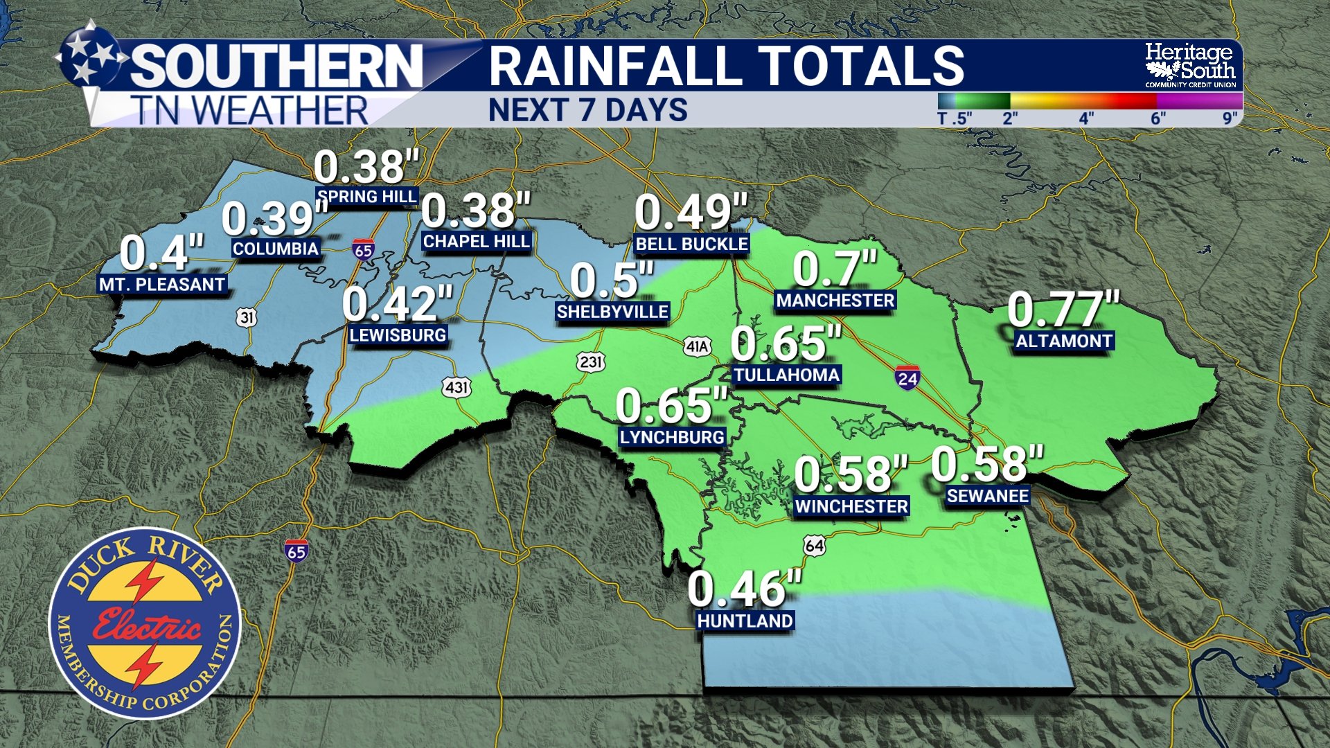
Midweek Rain Returns, But an Overall Mild Week Is in Store
It was a downright cold start across Southern Middle Tennessee this morning... Several locations dipped into the low 10s, and a few colder, rural spots were in the single digits. This marks one of the colder mornings we’ve seen recently and serves as a reminder that winter still has a firm grip on our overnight temperatures. Despite the cold start, sunshine is doing its job today. With mostly clear skies and lighter winds, temperatures are rebounding nicely through the afternoon. Highs will climb into the 40s, which may not sound warm on paper, but after a morning like today, it will feel noticeably better.
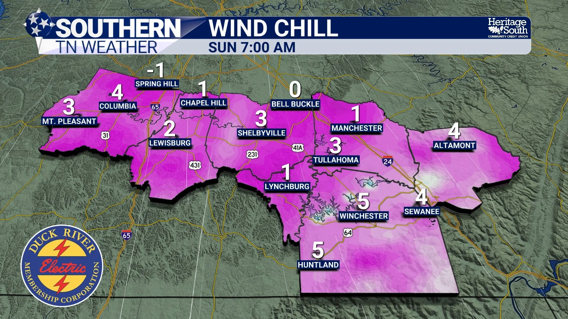
Enjoy Today… Dangerous Cold Arrives This Weekend
We’ve caught a brief break in the action this Friday across Southern Middle Tennessee. Aside from a few passing high clouds, sunshine is doing its job and temperatures are responding nicely. Many locations will finish the afternoon with temperatures near normal for this time of year, with highs feeling downright comfortable compared to what we’ve been dealing with lately.
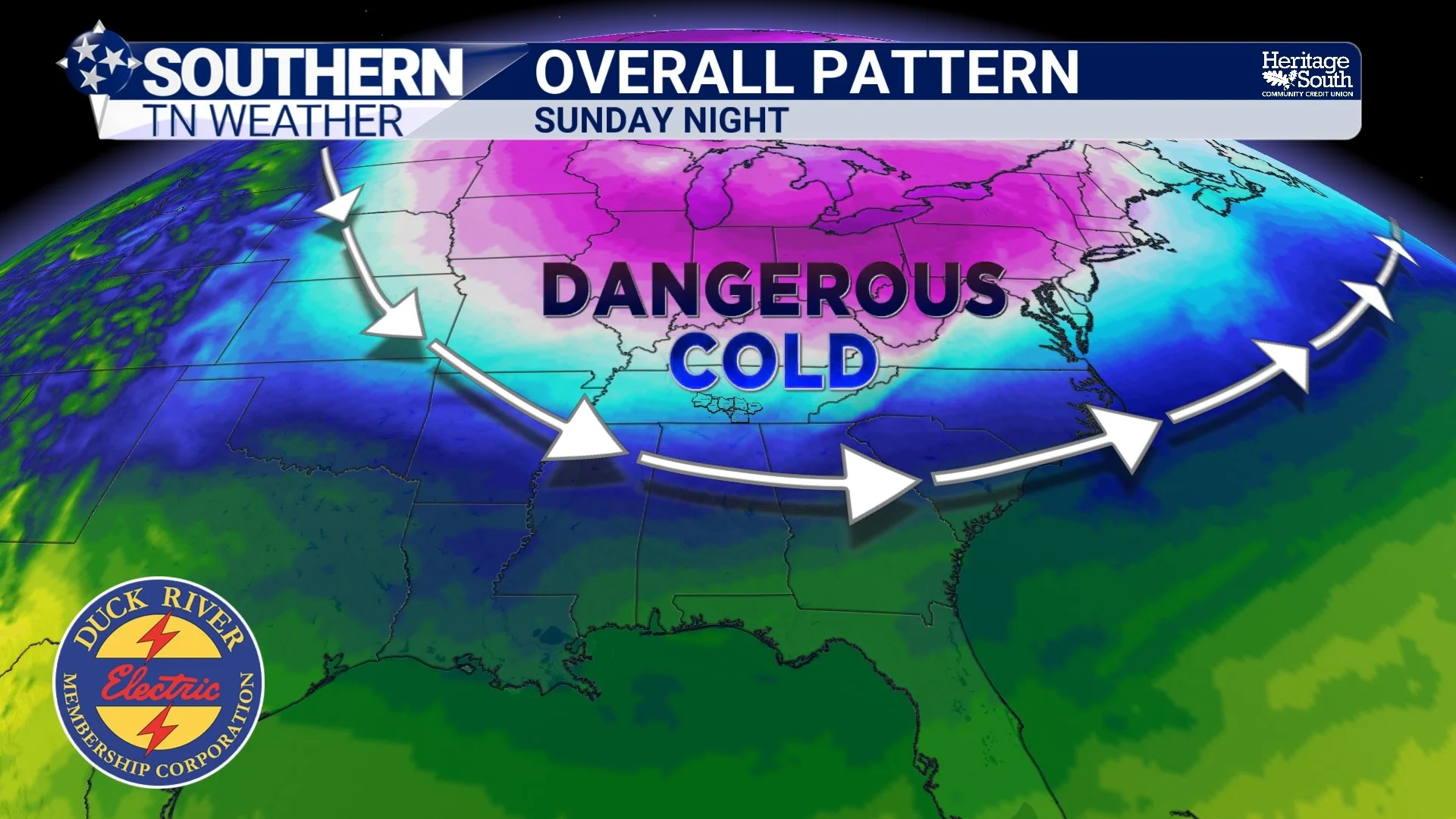
Dangerous Cold Sunday and Monday, But A Pattern Shift Is on the Horizon!
Thursday has turned out calm and comfortable across Southern Middle Tennessee. We’ve enjoyed some sunshine today, although clouds are gradually increasing ahead of a weak clipper system sliding by to our north in Kentucky. Winds are lighter than yesterday, and Friday will warm up nicely with highs approaching 60 degrees. It’s a welcome break in what has been a chilly stretch — but it won’t last long. A big-time cold snap is coming.
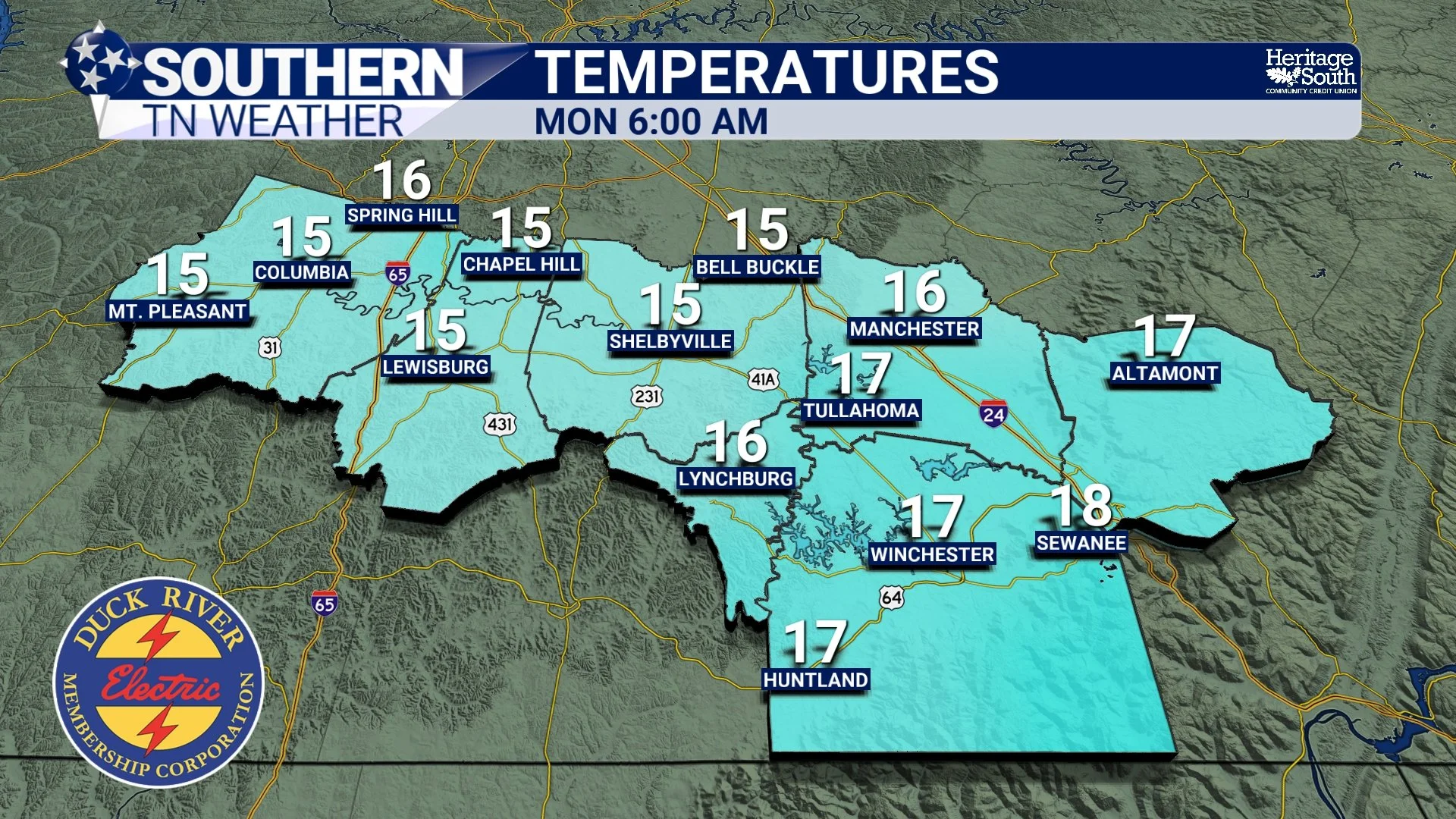
Pretty Quiet Over The Next 7 Days… but Cold Is Coming!
Today has been a typical early-December day — patches of sun, some stubborn clouds, and just enough wind to make the 40s / 50s feel noticeably colder than they look. Gusts have been topping out between 20 and 35 mph, which keeps the chill factor elevated even in the middle of the day.
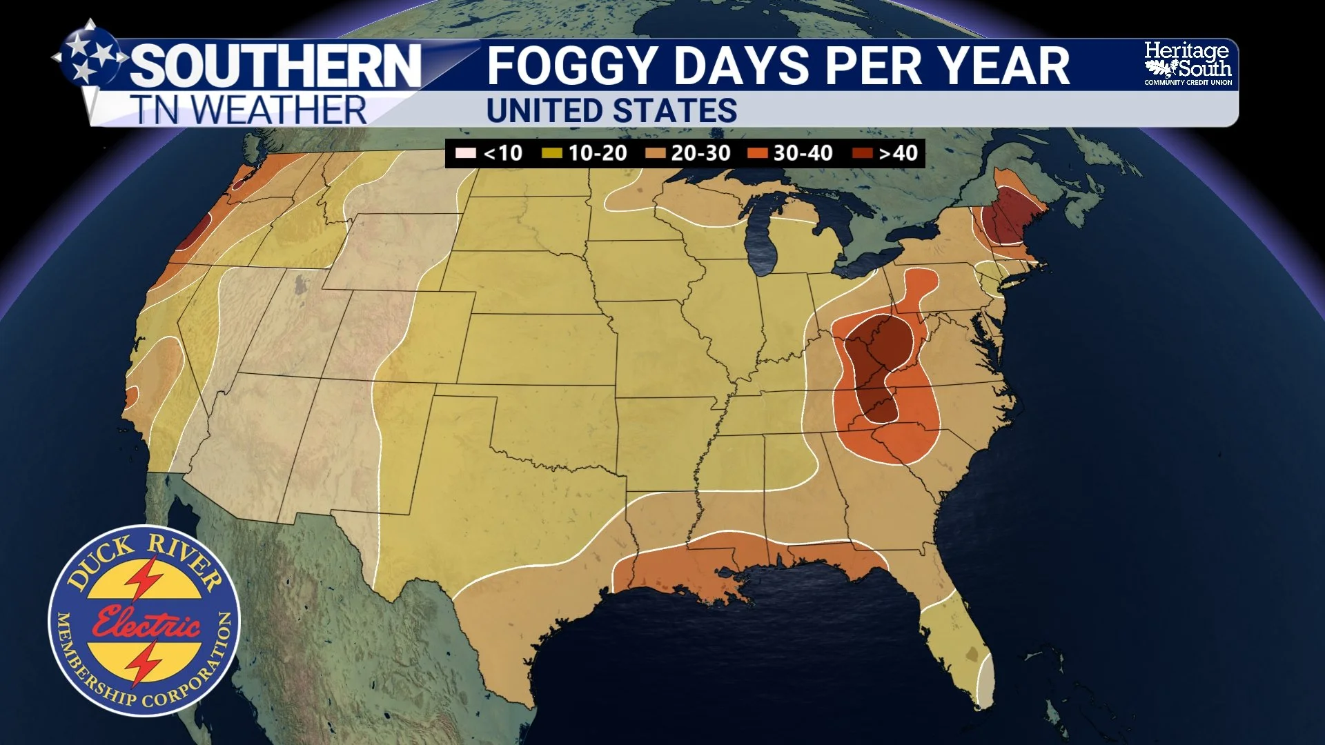
Weather Lesson Tuesday: What Actually Causes Fog?
When the weather pattern quiets down, it gives us a perfect chance to talk about something we’ve been seeing a lot of lately in Southern Middle Tennessee — fog. It’s been showing up in valleys, along the Plateau, and even during broad daylight on some mornings.
Today’s weather lesson uses four graphics to walk you through how fog forms, why it’s so common this time of year, and what makes freezing fog different.
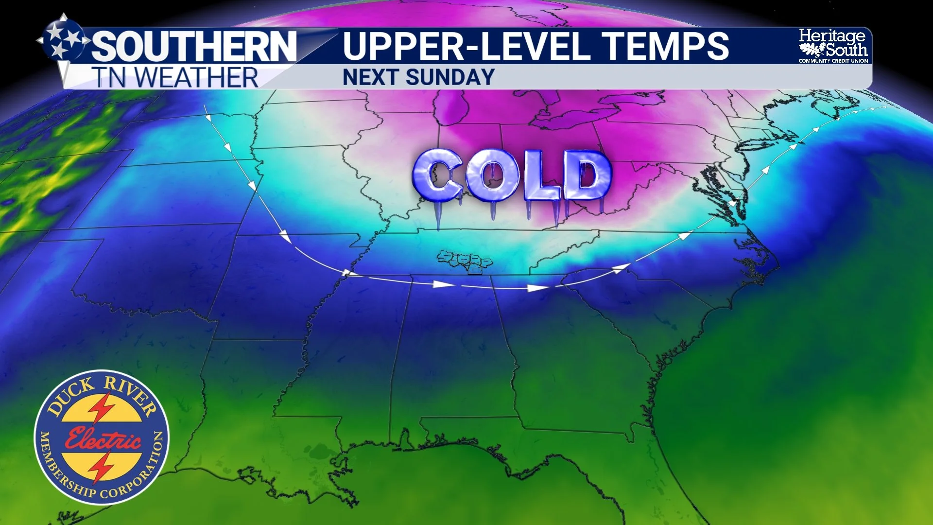
A Pretty Quiet Week Ahead… Cold Blast Soon?
Late November and early December have really settled into a pattern: cloudy, chilly, hazy, and damp. We had a weak little system roll through late Sunday night that brought scattered light showers, but rainfall totals were unimpressive – generally around a tenth of an inch or less. Today is more of the same. Clouds have been stubborn to break, and the latest NWS forecast discussion notes a strong inversion overhead (warmer, dry air sitting above colder, humid air near the surface). That traps the stratus deck in place and keeps temperatures chilly. Most of us will barely make it out of the 30s this afternoon.
Tonight, lows slip back into the 20s. If clouds clear even partially, freezing fog could develop thanks to saturated ground, high near-surface moisture, and calm winds. It’s not a guarantee, but something to keep in mind for the Tuesday morning commute.
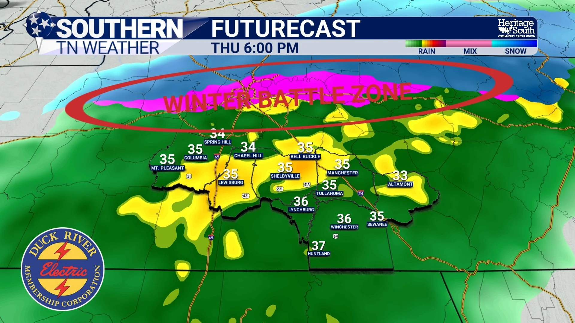
Living Life on the Edge Thursday Night
Normally I ease into these blogs, talk about the weather so far today, maybe throw in a fun stat — but not today. Let’s not cut corners: What is the deal with tonight? Rain is already pushing into Southern Middle Tennessee as we move through the afternoon, and this is all tied to a low-impact winter system sliding across Tennessee, southern Kentucky, Virginia, and eventually into the Carolinas. And while “winter system” sounds dramatic, the reality is that this is a borderline event, and even the places that do see wintry weather won’t see major impacts.
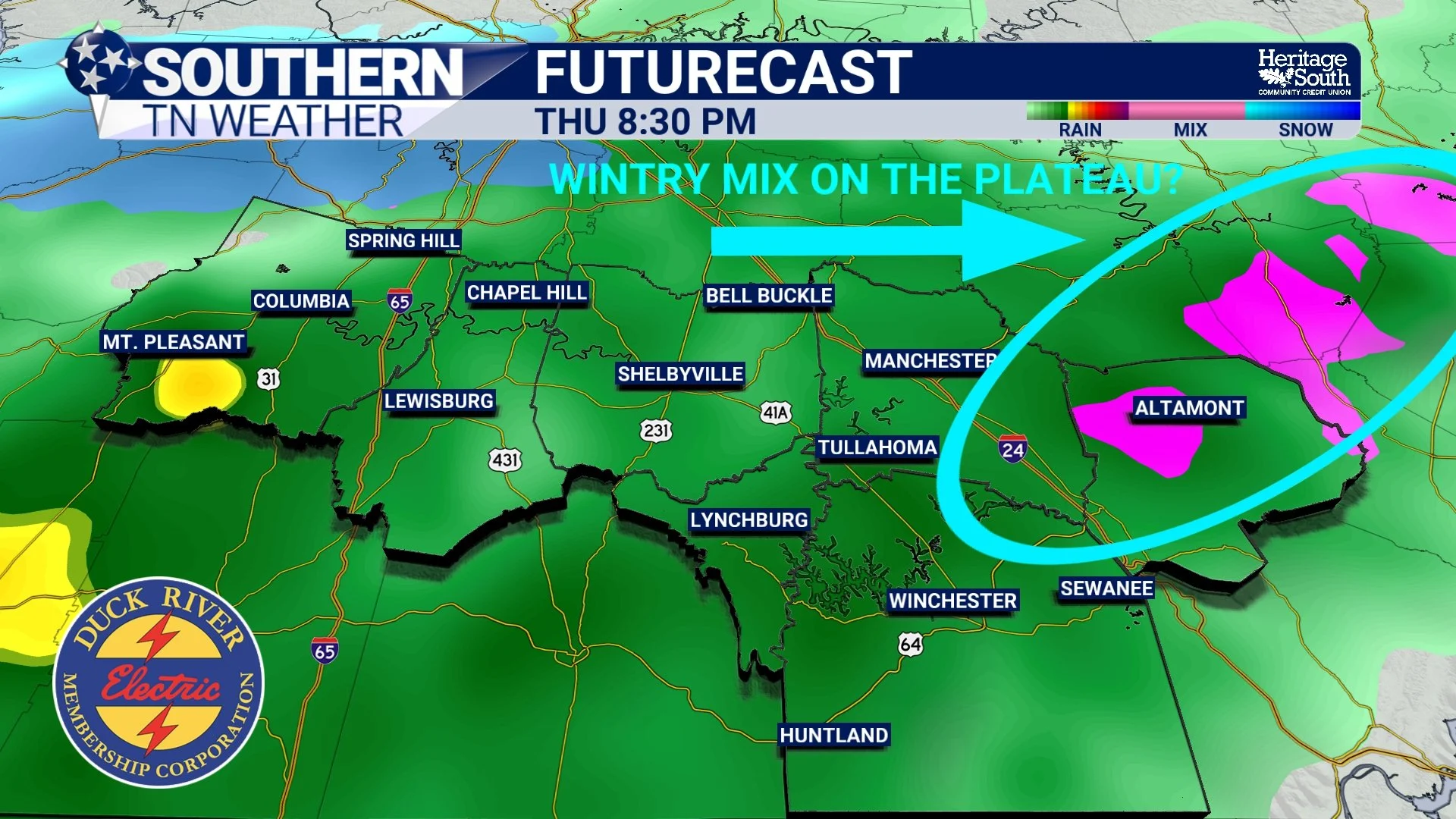
Flirting with Trouble Thursday Night and Into Friday
We’re stuck under a very stubborn cloud deck across Southern Middle Tennessee today. As of 10 AM, most of us are still in the 30s, and some locations may never make it out of the upper 30s at all. Unfortunately, these clouds are expected to hang tough through the day.
Watching Freezing Fog and Late-Week Precip Chances
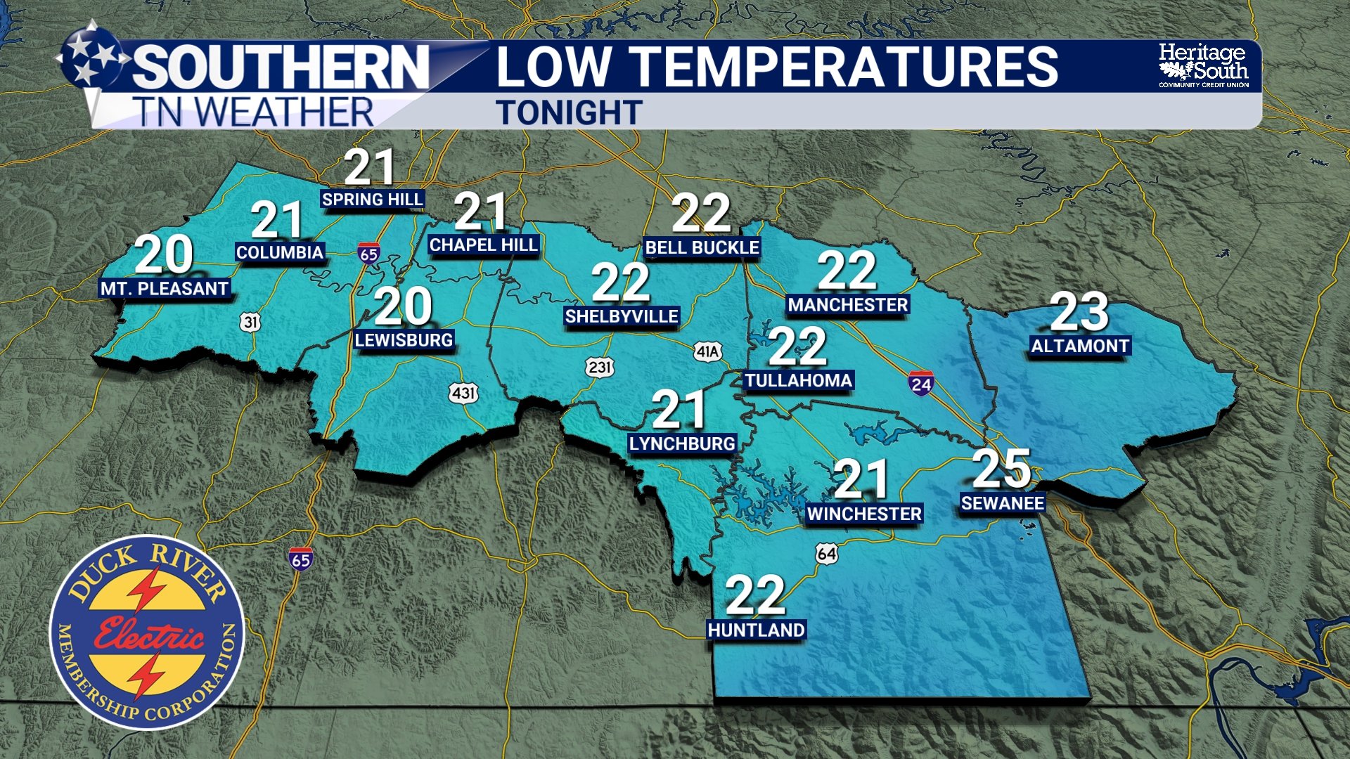
So far, it has been a quiet but very cold Tuesday across Southern Middle Tennessee. Our rain system cleared early this morning, leaving behind widespread totals of one half inch to one inch. Spring Hill was the big winner, picking up just under an inch along the Maury–Williamson County line. These totals aligned nicely with the forecast. Since the rain and its associated cold front moved out, temperatures have struggled all day. Most of us are stuck in the low to mid 30s under thick cloud cover, meaning we’re not getting any help from the sun. Wind chill values remain in the mid 20s, making it feel even colder.
Quick-Hitting, Cold Rain Tonight
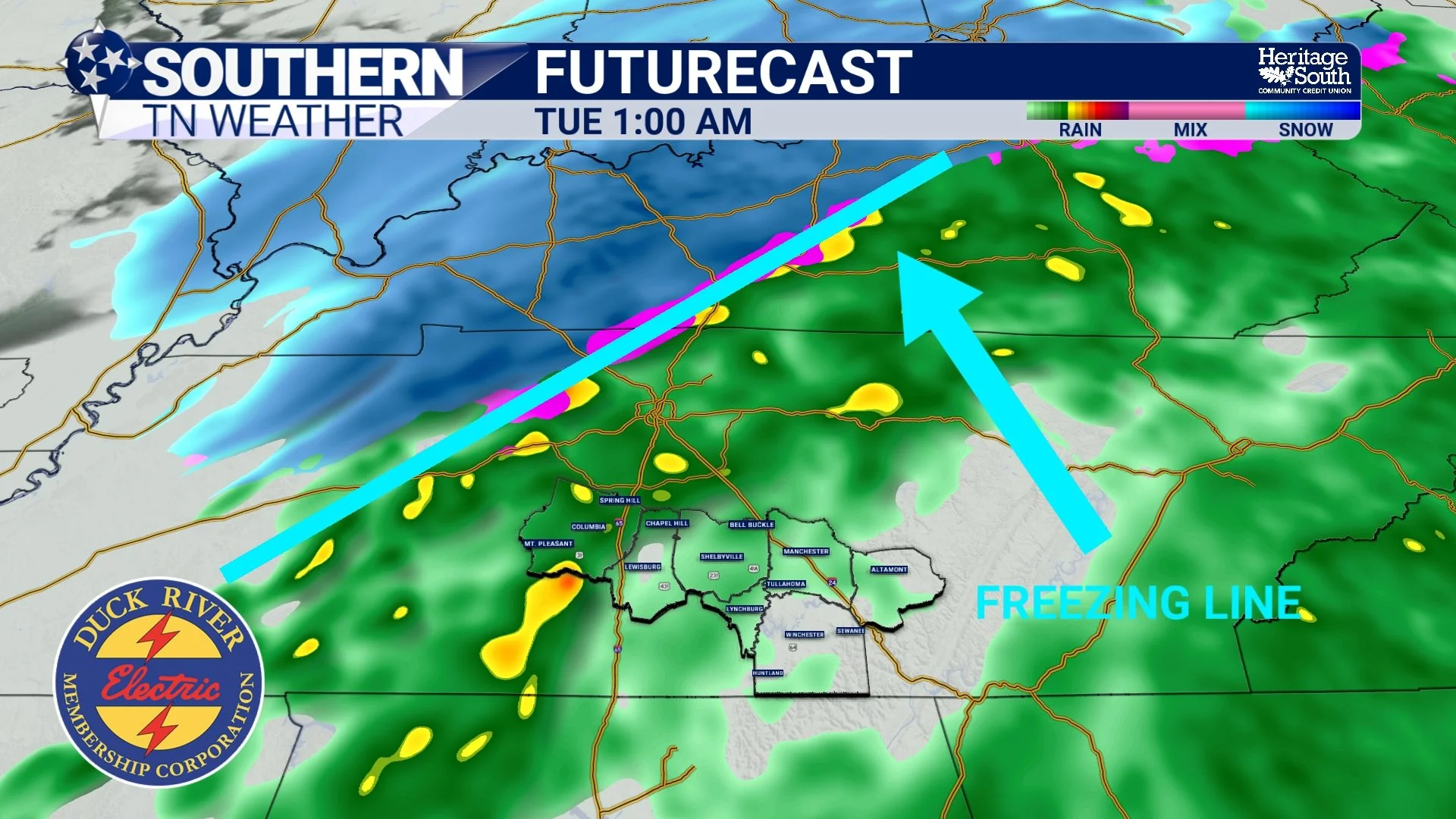
Today marks the first day of meteorological winter, and winter is certainly making her presence known. Lows were in the 20s this morning, and as of mid-afternoon, temperatures are still stuck in the low 40s—perfect “stay inside and cuddle up” weather. A light south breeze late today will help moderate temps just enough before our next round of rainfall moves in this evening
Active Weather to Start the New Week…
It’s been a very chilly end to the week across Southern Middle Tennessee. Highs on Thanksgiving only reached the mid to upper 40s, and today we’re struggling to climb out of the mid 40s — a solid 10–15 degrees below average for late November. Tonight brings yet another widespread hard freeze, with lows dipping well into the 20s. We’ll finally start a small warming trend on Saturday. Highs return to the 50s as southerly winds bring in Gulf moisture and increasing cloud cover through the day.
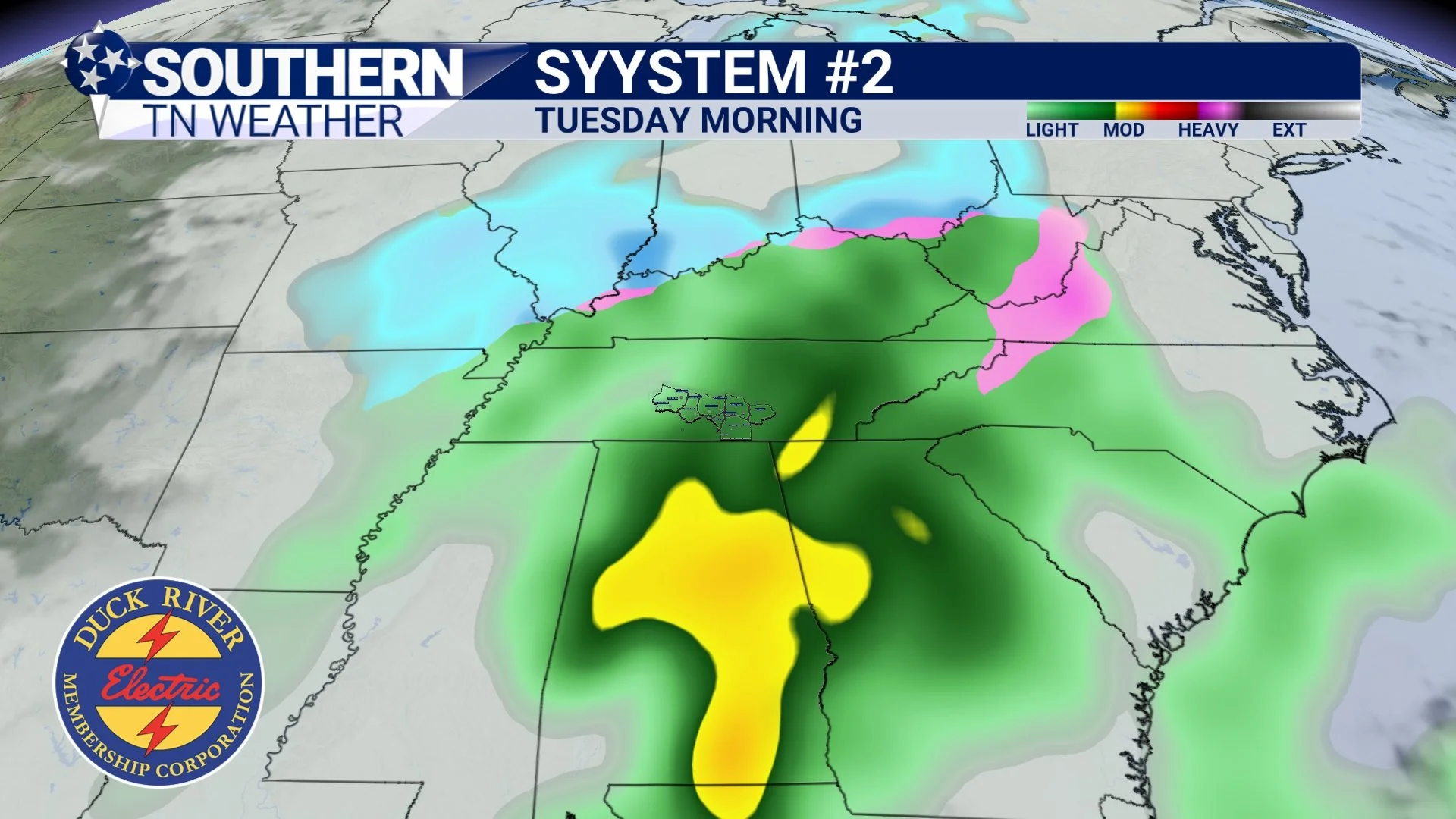
Two weather systems will impact us over the next few days:
System #1 Saturday night into Sunday morning, and
System #2 Monday night into Tuesday, which has some early-season winter-weather buzz around it. Let’s break them down.
A Cool Thanksgiving in Store…
Our much-anticipated storm system moved through early this morning and brought a healthy round of rainfall to Southern Middle Tennessee. Most locations picked up ½ to 1 inch, which matched the forecast nicely. As of the time of this blog post, light to moderate rain is still falling across parts of Franklin and Grundy Counties, so a few spots in our southeast may finish slightly above an inch before everything fully tapers off.
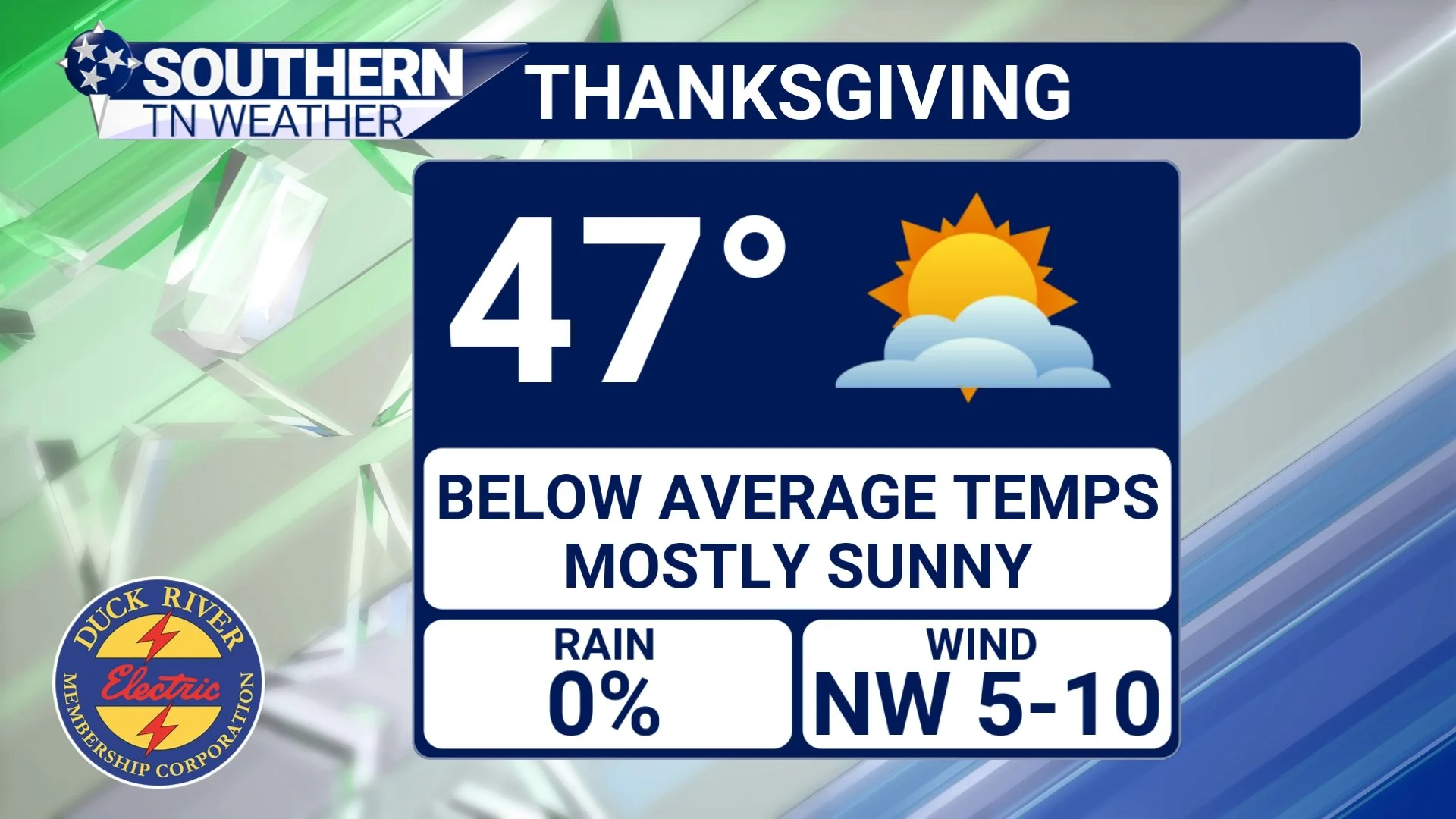
Today’s blog focuses on the quieting weather pattern ahead, what to expect for Thanksgiving, and the return of our next widespread rainmaker.