
A Mild Start to 2026 with Rain on the Horizon

The Southern Tennessee Weather Blog is proudly presented by Heritage South Community Credit Union.
We Help When Others Won’t!
Visit https://www.heritagesouth.org/ today to see how HSCCU can help YOU!
Southern Middle Tennessee is kicking off 2026 with calm, mild, and surprisingly pleasant weather for early January. After a chilly start to the week, temperatures have rebounded nicely today, and conditions remain quiet as we move through New Year’s Day. This is not an active weather pattern at the moment, but changes are on the way as we head into tomorrow. For now, enjoy the calm start to the new year with warmer air firmly in place.
New Year’s Day: Mild, Calm, and Comfortable
As of this afternoon, temperatures across Southern Middle Tennessee have climbed into the lower to middle 60s in many areas. Light southerly winds and filtered sunshine are making it feel much more like early spring than early January. Cloud cover will gradually increase through the evening, but conditions will remain dry and calm. Overnight lows will only fall into upper 30s and low 40s, which is above average for this time of year. If you have New Year’s evening plans, weather will not be an issue.
This mild pattern is being driven by high pressure positioned to our south and southwest, allowing warmer air to flow northward into the region. That same setup will remain in place through Friday Morning before our next system arrives.
Rain Returns Tommorrow
Our next round of active weather arrives late Friday into early Saturday as a low-pressure system moves east across the southern Plains and into the Tennessee Valley. Rain will push into the region between 4 and 8 PM tomorrow becoming more widespread during the evening and overnight hours. We should be drying out by sunrise on Saturday morning. Current guidance suggests rainfall totals generally between 0.25 and 0.75 inches, with locally higher amounts near 1 inch, especially closer to the Alabama state line.
There is some model disagreement with this system, particularly when it comes to rainfall totals. The HRRR model continues to show most of Southern Middle Tennessee picking up closer to 0.25-0.5 inches, while our in-house model, which can occasionally run a bit aggressive, is depicting a more widespread 1-inch rainfall footprint. In the grand scheme of things, this difference isn’t drastic, but it does highlight some remaining uncertainty in how efficiently rain develops Friday night. At this point, a general 0.25–0.75 inch range still looks like the most realistic forecast, with isolated higher totals possible if rain bands become more persistent.
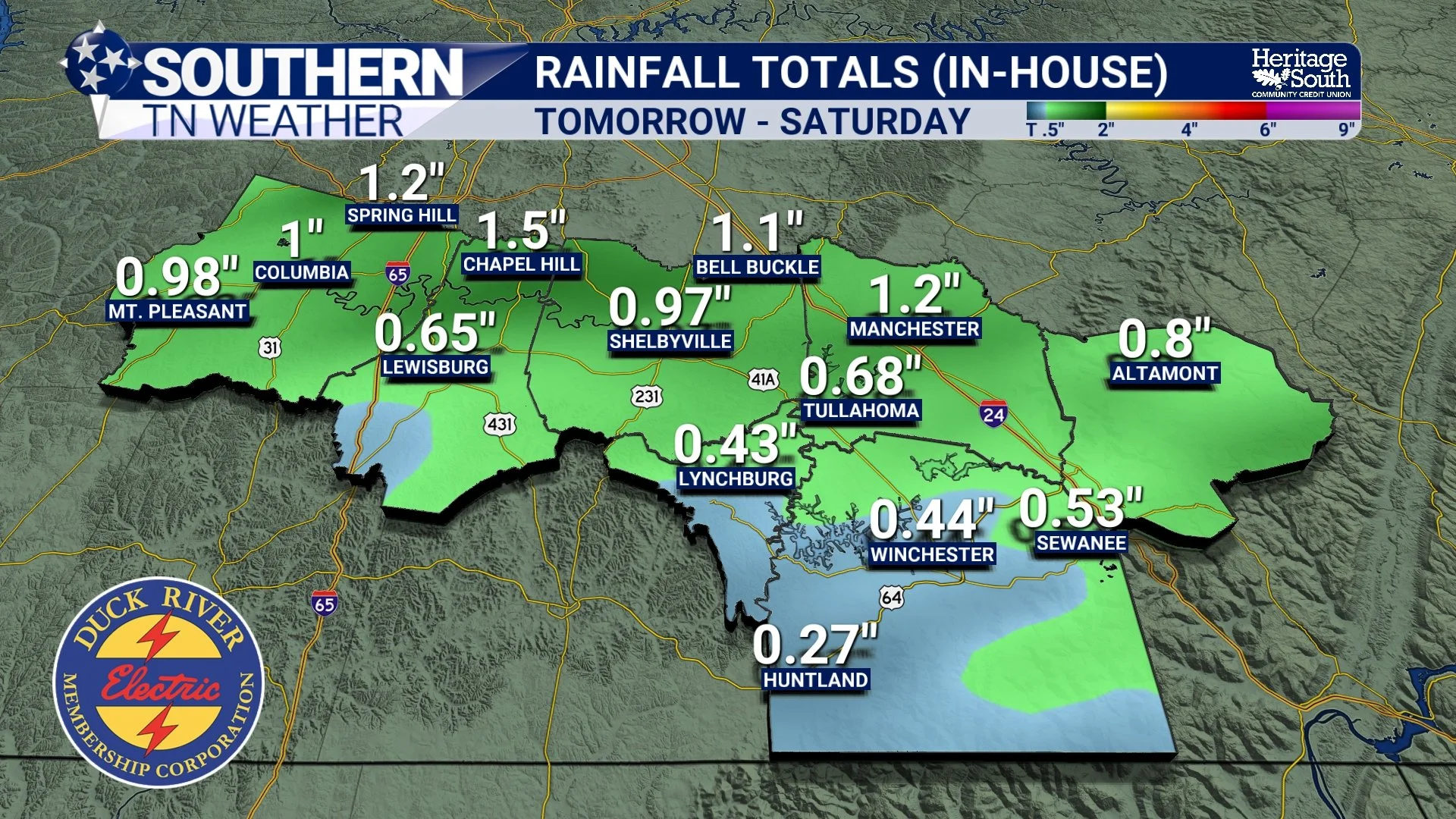
In-House rainfall totals
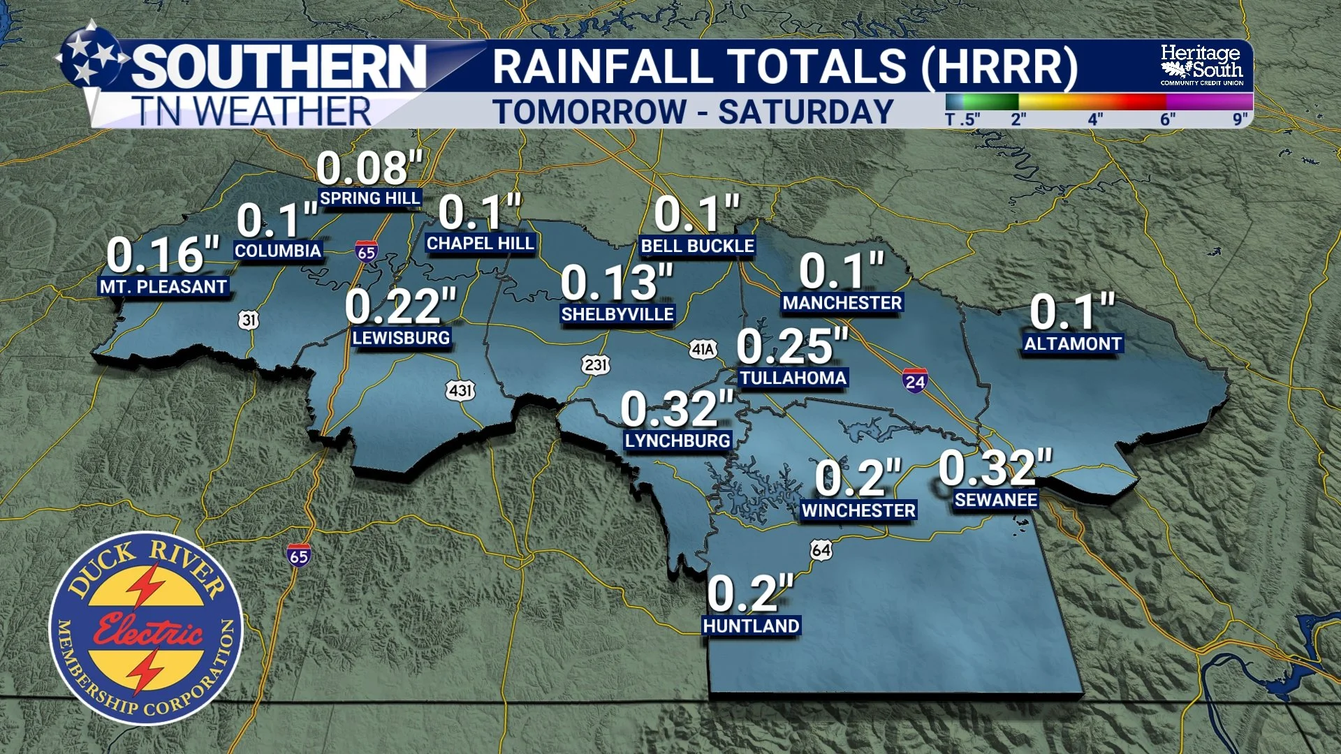
HRRR rainfall totals
The good news is that this rain will be beneficial. The latest U.S. Drought Monitor continues to show parts of Southern Middle Tennessee in a D1 (Moderate) Drought, and this system should help ease some of those short-term moisture deficits. The only areas not in a drought right now is far northeastern Marshall and northwestern Bedford County.
While a few isolated rumbles of thunder cannot be ruled out late Friday night, atmospheric instability remains limited. This means severe weather is not expected, and the primary impact will simply be periods of steady rainfall.
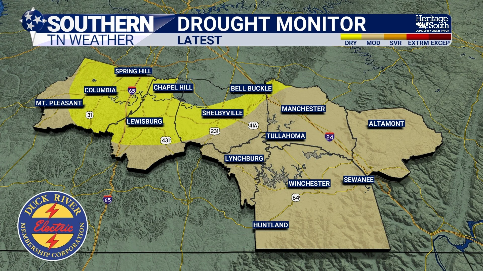
Latest Drought Monitor
What Happens After the Rain
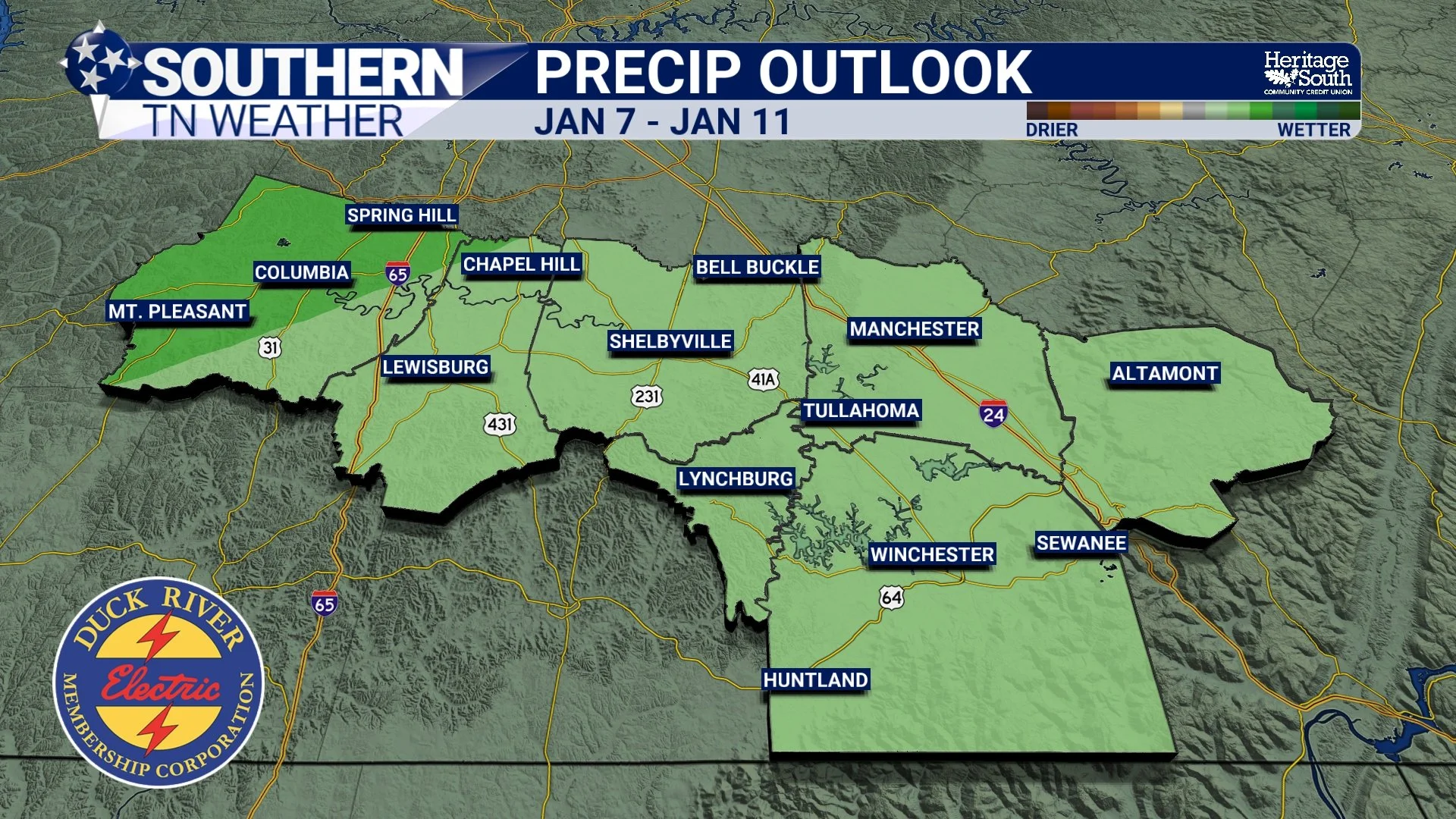
Behind this system, temperatures cool slightly but remain seasonable. Highs will settle back into the 50s with dry weather returning Sunday and continuing into early next week. There are no strong cold air intrusions in the immediate forecast, but signals are beginning to point toward a more active weather pattern later in January. The Climate Prediction Center continues to favor above-average precipitation heading into the middle of the month.
A Quick Thank You
As we step into a brand-new year, I just want to say thank you for your continued support. Whether you check in daily or only during active weather, your trust means everything. I’m proud to serve Southern Middle Tennessee and excited for what 2026 has in store!
The Bottom Line 🧾
• New Year’s Day stays mild, calm, and dry
• Temperatures remain well above average through Friday
• Rain arrives late Friday into early Saturday
• Widespread rainfall of 0.25–0.75" expected, locally higher
• Severe weather is not expected
• Drier and seasonable conditions return Sunday
• A more active pattern may develop later in January
📰 Reminder: The Southern Tennessee Weather Blog (Presented by Heritage South Community Credit Union) is updated Monday through Friday with fresh, locally tailored forecasts you can trust.