
From Rain to Flurries… Then a True January Cold Blast Arrives

The Southern Tennessee Weather Blog is proudly presented by Heritage South Community Credit Union.
We Help When Others Won’t!
Visit https://www.heritagesouth.org/ today to see how HSCCU can help YOU!
Southern Middle Tennessee’s midweek pattern change is now underway. After several days of tracking an approaching cold front and a possible rain-to-snow transition, today marks the execution phase of that forecast. Light rain is moving through the region this afternoon, colder air is closing in from the northwest, and by this evening we’ll begin the handoff from moisture to cold. Flurries will fly for many, but accumulating snow should remain confined to the Cumberland Plateau.
While today brings some light precipitation, the bigger story is what follows: a sustained, reinforcing cold pattern that locks in through the weekend and into early next week.
This Afternoon: Light Rain, Colder Air on the Way
A pre-frontal band of light rain continues to move across Southern Middle Tennessee early this afternoon. Rainfall amounts have been minimal, generally well under a quarter inch, and there has been no instability to support thunderstorms. Temperatures are holding in the 40s to near 50°, but that will not last much longer.
Upstream, a sharp cold front and a deep upper-level trough are surging southeast. Winds are already increasing from the west, and once the front passes later this afternoon and evening, temperatures will begin dropping rapidly. This sets the stage for flurries and light snow showers later today.
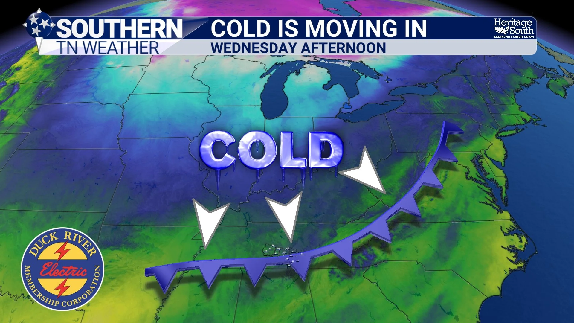
Cold Air is Moving In - Tonight
Late Afternoon & Evening: Cold Air Takes Over
As the front moves through, the atmosphere will undergo two important changes at the same time:
• Much colder air rushing in
• Remaining moisture rapidly pulling east
For most of Southern Middle Tennessee, this “cold chasing moisture” setup favors flurries or a brief light snow shower. The window will be short — mainly between 6 PM and midnight — and moisture will be fading, which greatly limits accumulation potential. The Cumberland Plateau (especially Grundy County) is the exception. Because cold air and moisture overlap a little longer there, light snow accumulation is possible this evening, particularly along and near the highest elevations.
Current guidance supports a dusting to around ½ inch for much of the Plateau, including Monteagle, Tracy City, Altamont, and Coalmont. Outside of the Plateau, many communities may see flakes fly (especially along and east of I-65), but no accumulation or impacts are anticipated.
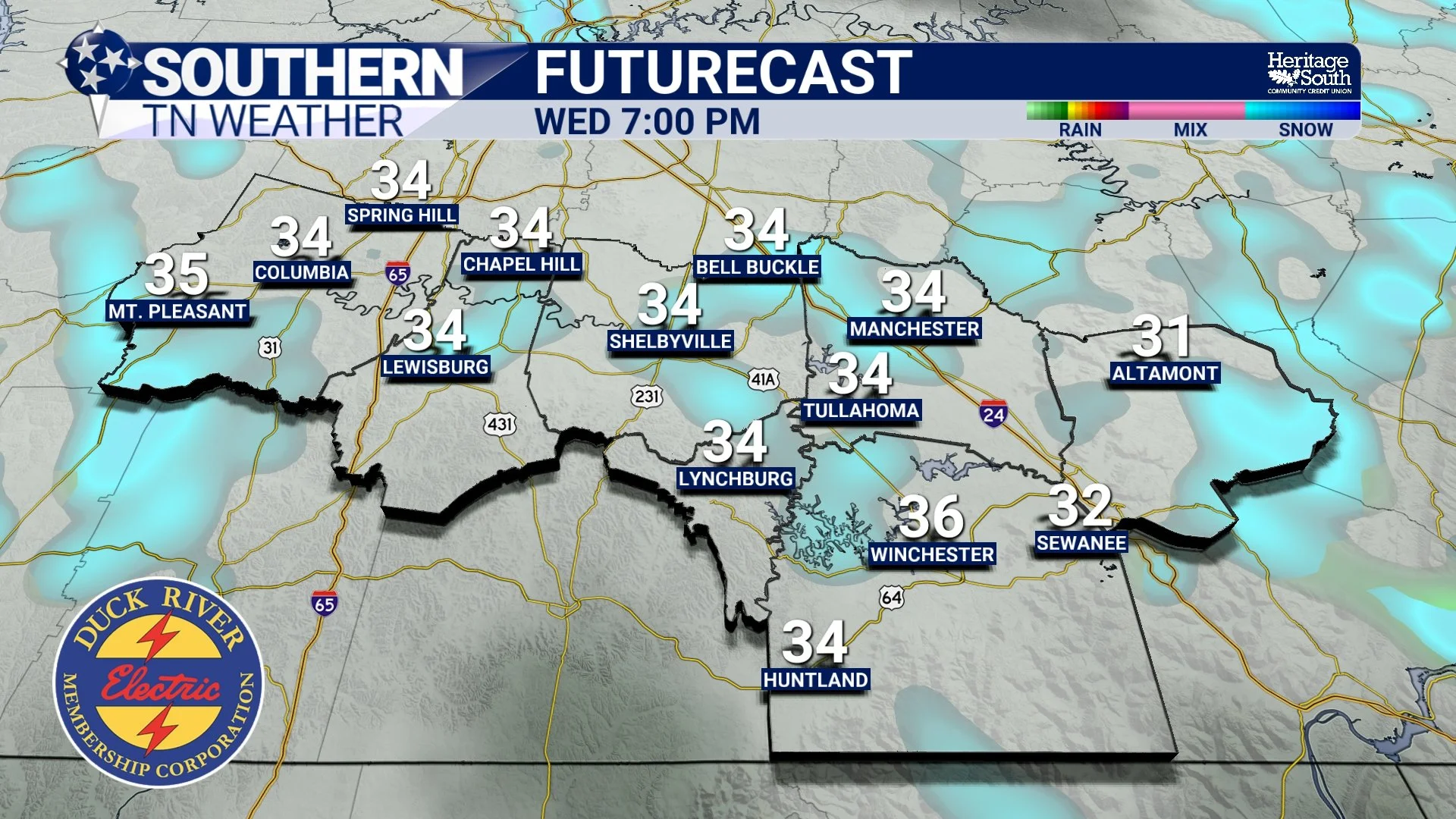
Futurecast Snow Showers - Tonight
Tonight: Flash-Freeze Setup on the Plateau, Wind Chills for Everyone
Once precipitation ends this evening, cold air will continue pouring in. Skies will gradually clear, winds will increase, and temperatures will plunge into the teens and lower 20s by daybreak Thursday. Across the Plateau, any light snow or leftover moisture could briefly create slick spots, especially on elevated or untreated surfaces.
Winds gusting over 30 mph will drive wind chills into the single digits overnight and Thursday morning, with values between 0° and 10° likely.
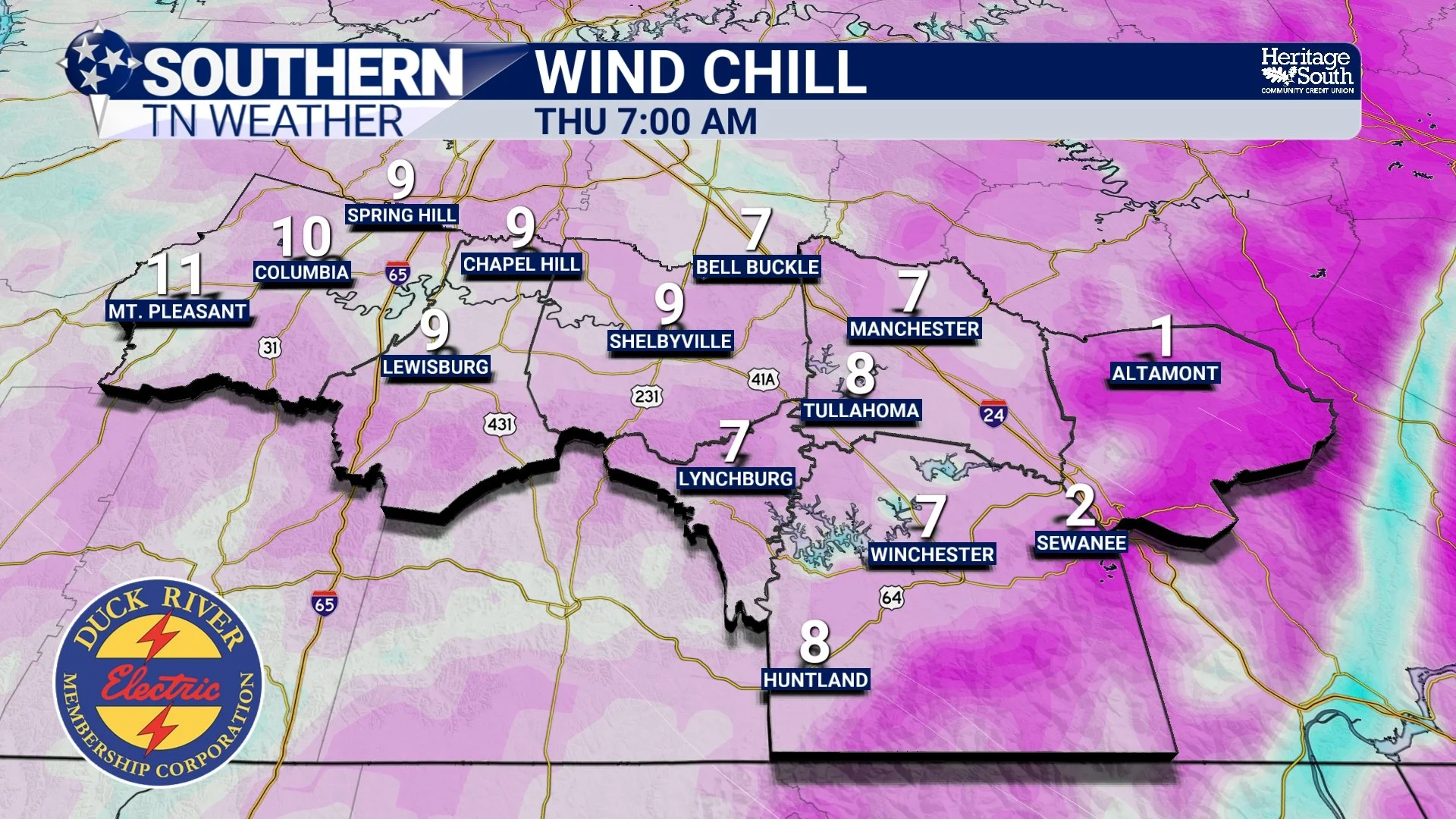
Wind Chills - Thursday Morning
Thursday: The Coldest Day of the Week
Thursday will feel dramatically different from earlier this week. Despite some sunshine, strong cold air advection and persistent northwest winds will keep highs limited to the upper 20s and lower 30s. Wind chills will remain in the teens and lower 20s through much of the day.
Any lingering flurries on the Plateau should fade early, with dry but very cold conditions taking over.
Beyond Thursday: Cold Becomes the Main Story
The broader pattern will become firmly established. Longwave troughing across the eastern U.S. means cold air will be reinforced, not replaced.
What that means locally:
• Many nights in the teens and 20s
• Daytime highs mainly in the 30s and 40s
• Occasional weak disturbances that could bring clouds, flurries, or light rain/snow showers
• No strong storm systems immediately evident — but winter is now “online”
There is a low-confidence signal for light precipitation Friday night into Saturday morning, again favoring the Plateau, but for now cold is the headline, not snow.
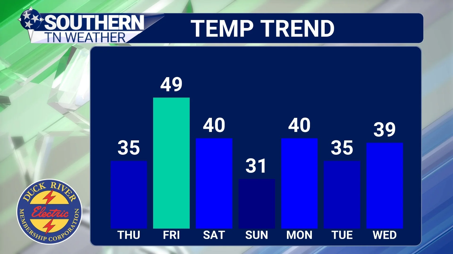
Temperature Trend - Next 7 Days
The Bottom Line 🧾
• Light rain ends today as a strong cold front arrives
• Flurries possible for many this evening
• Light snow accumulation likely on the Cumberland Plateau
• Temperatures crash tonight with single-digit wind chills
• Thursday is blustery and very cold
• A sustained January cold pattern locks in through the weekend and early next week
📰 Reminder: The Southern Tennessee Weather Blog (Presented by Heritage South Community Credit Union) is updated Monday through Friday with fresh, locally tailored forecasts you can trust.