
WEATHER BLOG

Presented By:
Storm Chances Ticking Up For Saturday: Latest Details Here
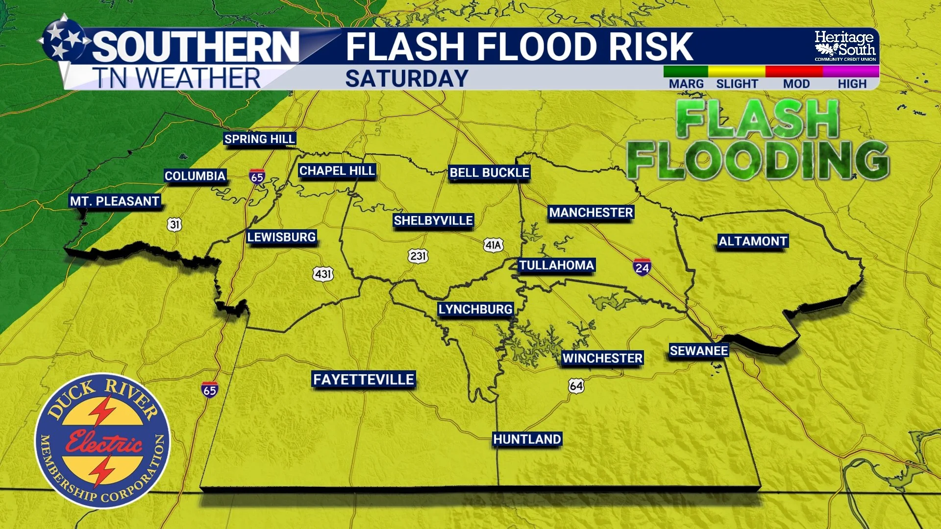
If you've been enjoying the break from the heat and humidity over the past couple of days, don't worry—you've still got another beautiful day ahead on Friday. But after that, our attention quickly turns to Saturday, which is shaping up to be our next active weather day. The good news is that this doesn't look like a widespread severe weather outbreak. The bad news? Heavy rain, frequent lightning, and a few stronger thunderstorms could make for a soggy Saturday across Southern Middle Tennessee.
Finally... A Small Break From The Heat And Humidity
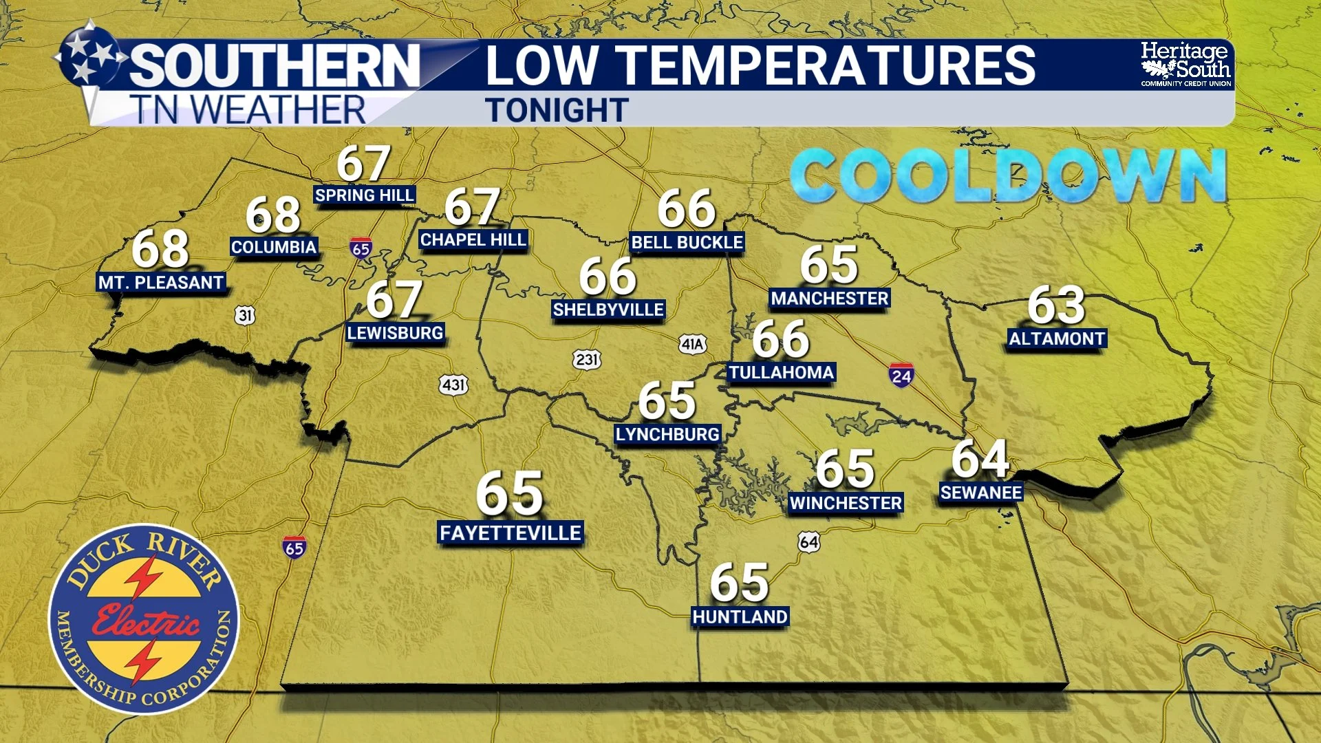
If you've stepped outside today, you've probably noticed something almost immediately. It doesn't feel nearly as miserable.
The Heat Peaks Today... Short-Lived Relief Arrives Tomorrow
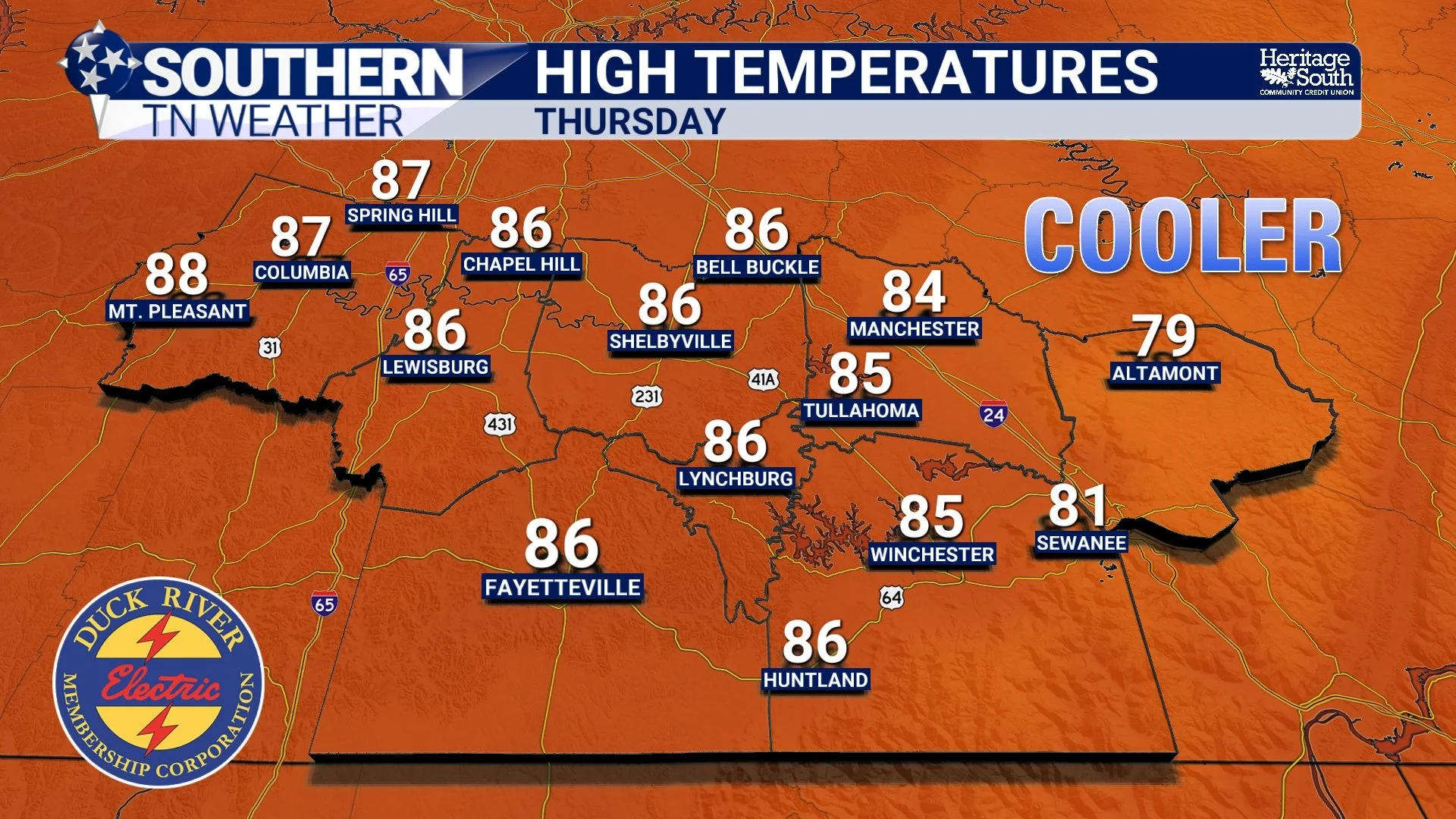
If you've been counting down the days until this latest stretch of dangerous heat finally comes to an end, I've got some good news. Today is likely the hottest day we'll experience for quite some time.
Behind The Forecast: Why Has The Weather Been So Hard To Predict Lately?
If you've been following Southern Tennessee Weather over the past couple of weeks, you've probably noticed something. The forecast has... evolved. Quite a bit. One day we're talking about storms arriving around midnight. A few hours later, the arrival time shifts to 3:00 AM. Then the storms weaken before they ever make it here. The next night, another complex develops that wasn't expected to amount to much, only to strengthen as it approaches Middle Tennessee.
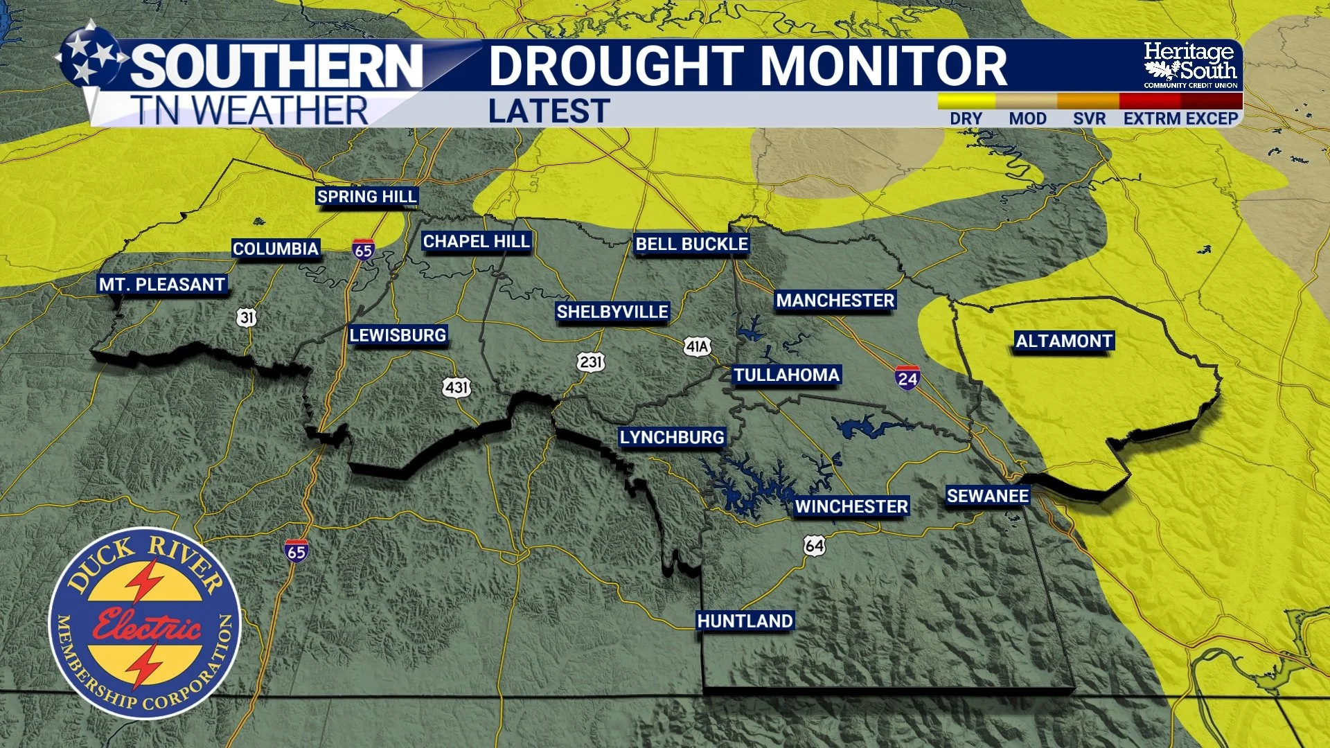
Good News! Southern Middle Tennessee Is Officially Drought-Free
For the first time in quite a while, Southern Middle Tennessee has something to celebrate. According to this week's latest U.S. Drought Monitor, every county in our coverage area is now completely free of drought conditions.
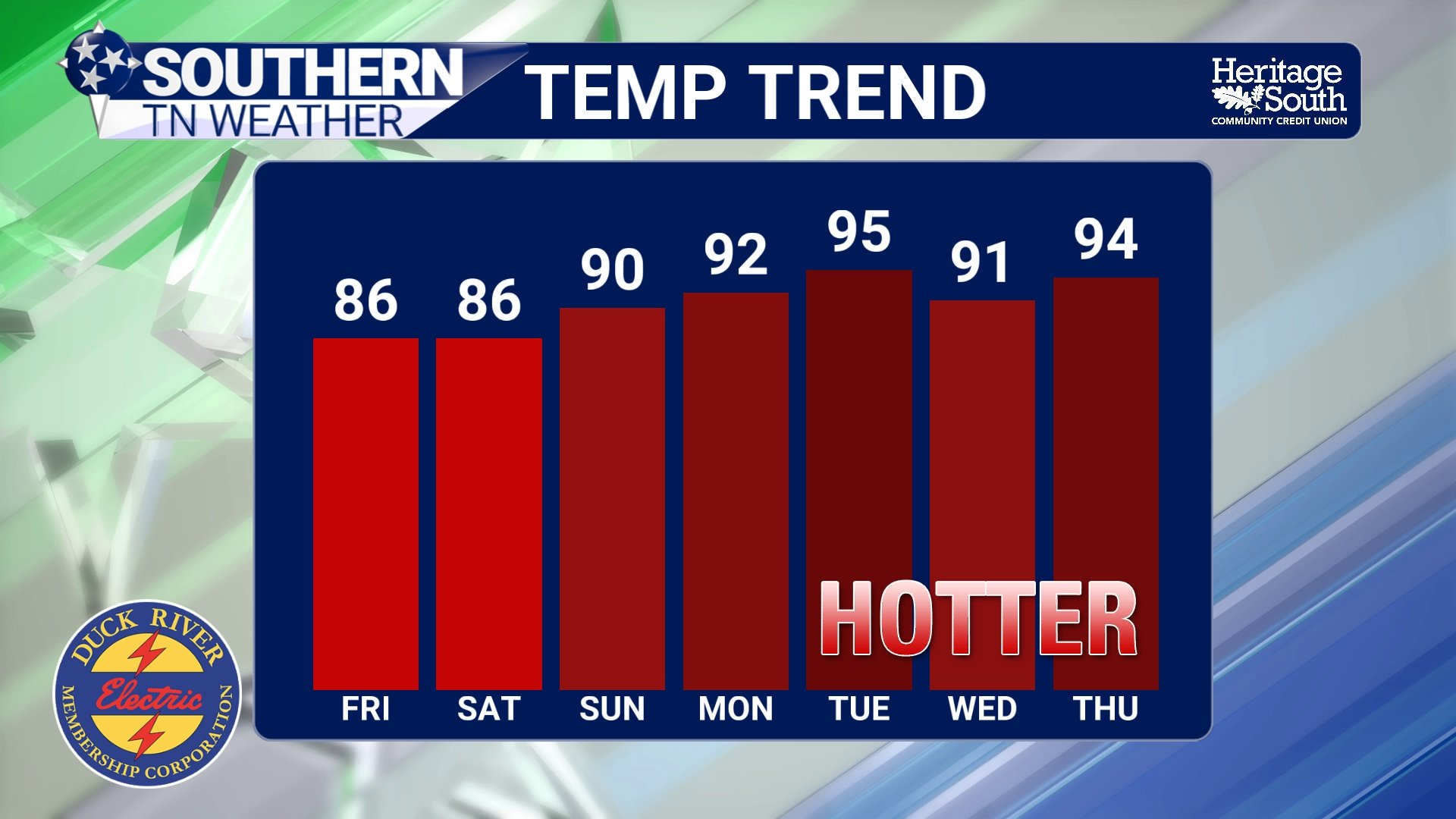
Don't Get Used To This Weather… Weekend Rain And Next Week's Heat Are Ahead
If you've stepped outside today, you've probably noticed it already. The oppressive humidity is gone. The air feels noticeably lighter. Temperatures are running well below where they've been for most of July, and after weeks of feeling like we were living in a sauna, Southern Middle Tennessee is finally getting a well-deserved break.
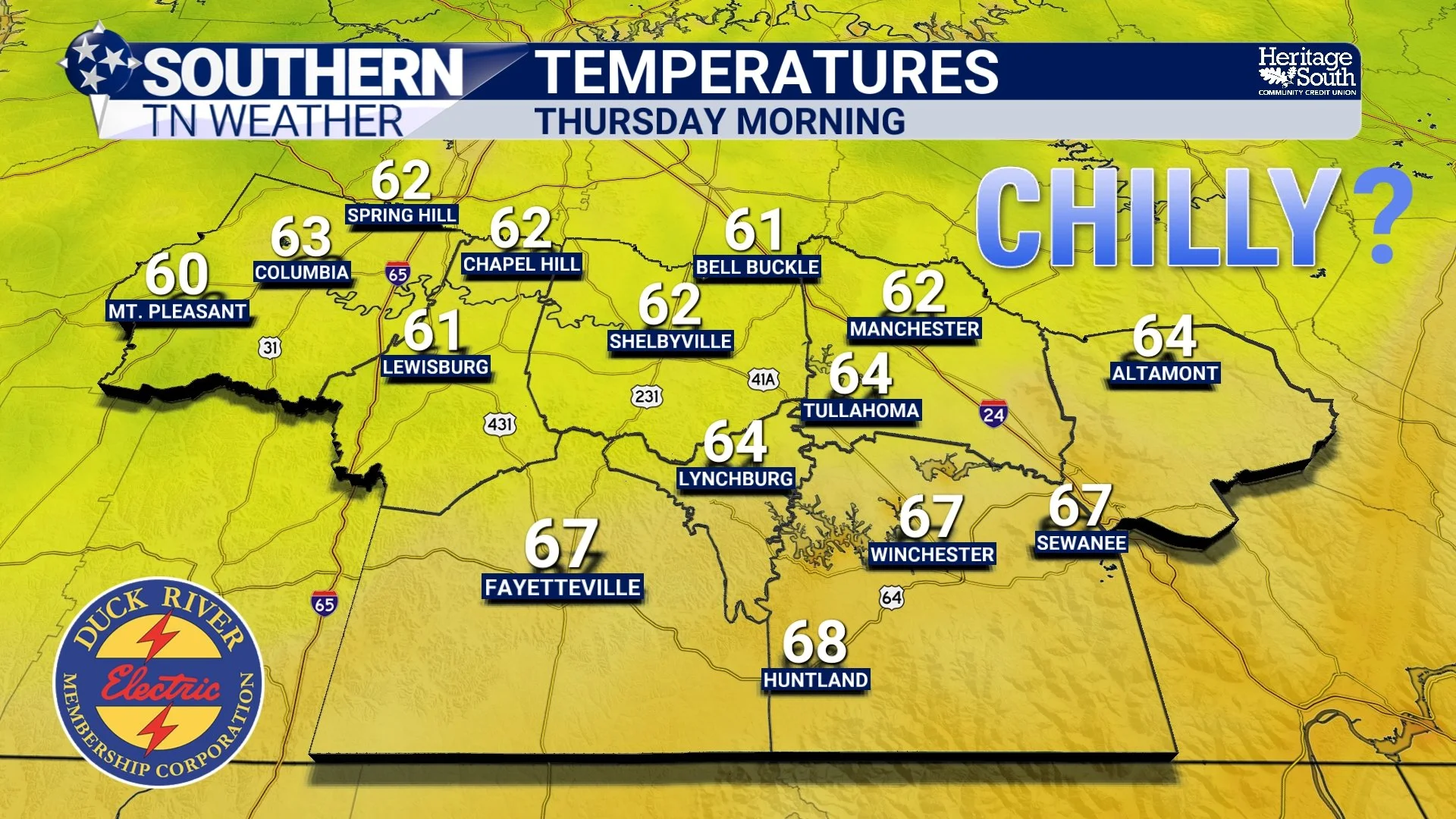
One More Round Of Heat And Storms… Then Summer's Best Air Arrives (For A Short Visit)
We've made it to what will likely be the most active weather day of the week. Tuesday brings a one-two punch of dangerous heat during the afternoon followed by the potential for strong to severe thunderstorms later this evening and tonight. After that, one of the nicest air masses we've experienced all summer will settle into Southern Middle Tennessee. Let's break it down…
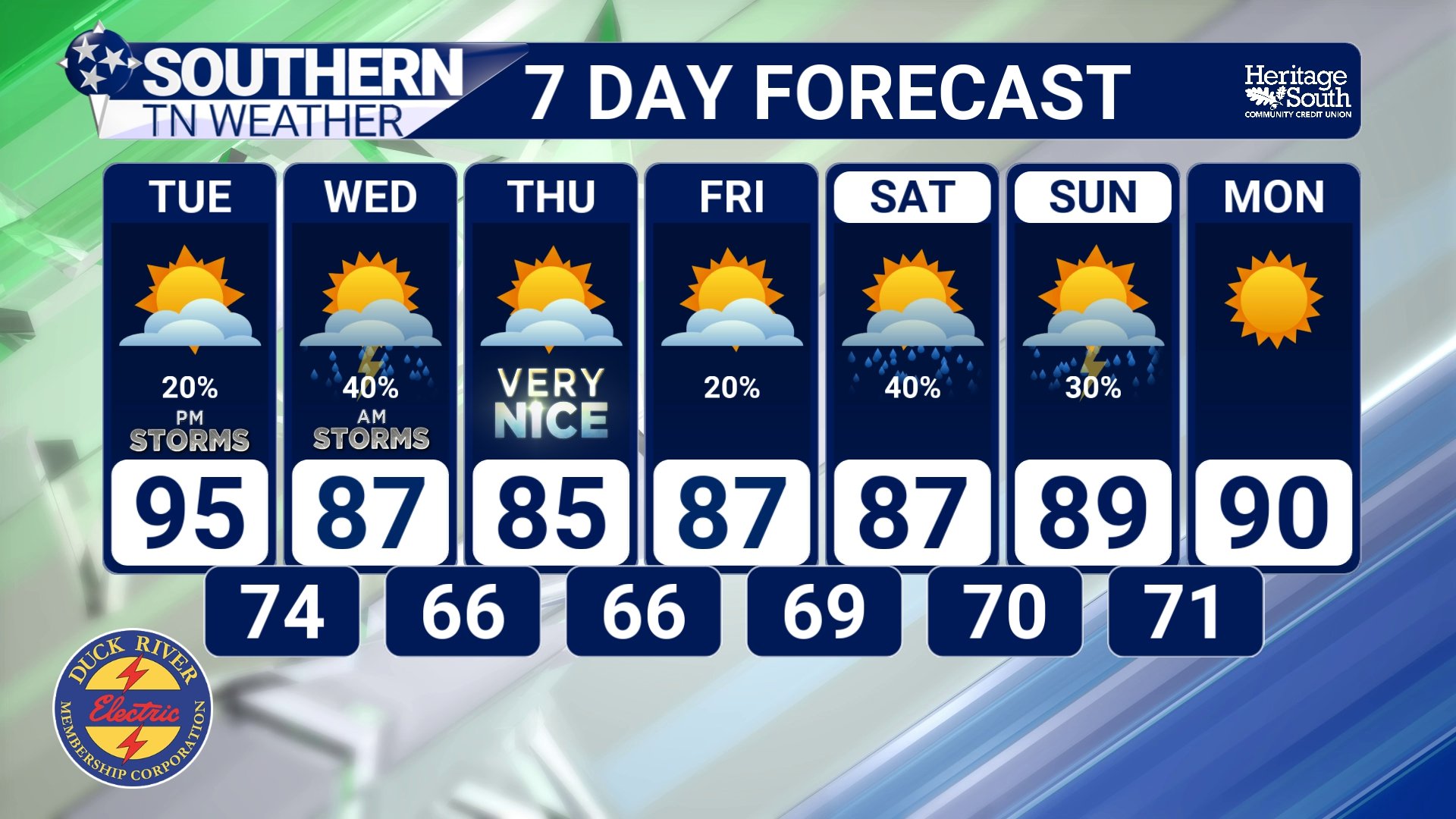
Dangerous Heat, A Severe Storm Threat, Then A Taste Of Relief: Your Week Ahead
After several weeks of nearly nonstop afternoon thunderstorms and summer humidity, this week will feature just about everything Tennessee weather has to offer. Dangerous heat will dominate the first half of the week before a cold front brings our next chance for strong to severe storms. Behind that front, we'll finally get a break from both the oppressive heat and humidity.
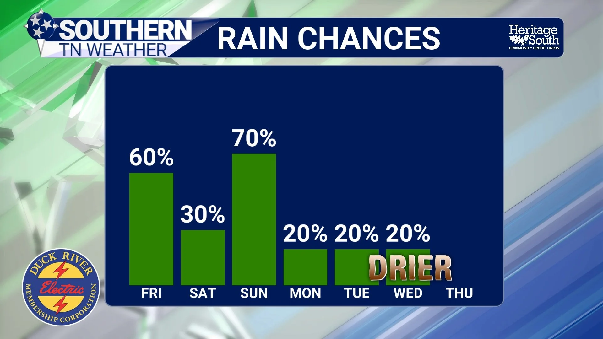
When Is Our Next Dry Spell? The Answer Is Finally Coming Into Focus
If it feels like we've been talking about afternoon thunderstorms for weeks... you're not wrong. Since early July, Southern Middle Tennessee has settled into a persistent summertime pattern featuring daily showers and thunderstorms, occasional heavy rainfall, and plenty of humidity. While not everyone has seen rain every day, there have been very few days where at least part of our area stayed completely dry.
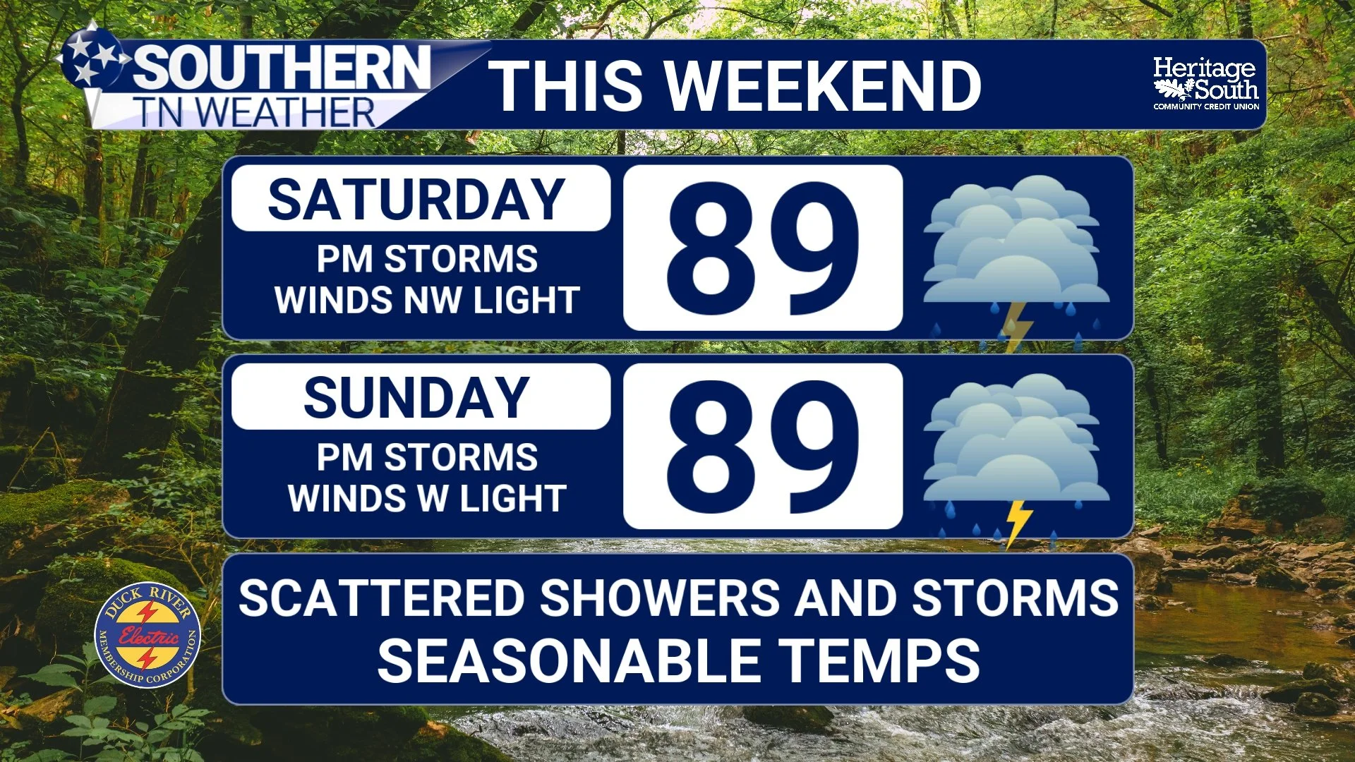
Weekend Outlook: Storm Chances Increase Before Next Week's Heat Builds
After several days of the typical summertime "hit-or-miss" showers and thunderstorms, we're beginning to transition into a slightly more active pattern as we head into the weekend. The good news? WIDESPREAD severe weather is not expected (a few still could be strong). The not-so-good news? Rain chances will increase, especially Saturday night, and the hottest weather we've seen in a couple of weeks is waiting just around the corner.
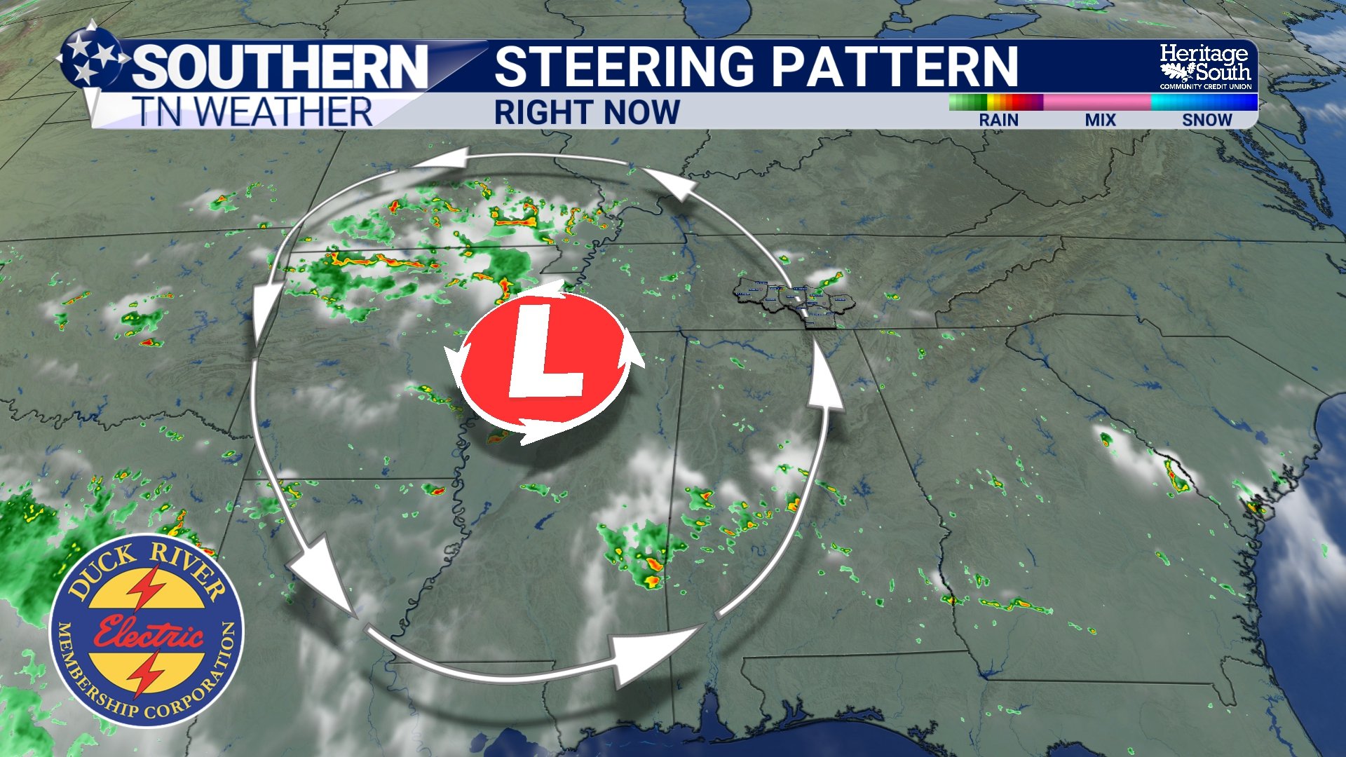
Why Have Storms Been Moving The "Wrong" Way? Here's What's Going On
If you've watched the radar over the past several days, you may have noticed something that seems... well... backwards. Instead of the usual west-to-east movement we're accustomed to across Tennessee, many of our showers and thunderstorms have been drifting from east to west, or even southwest. It certainly isn't something we see very often, and it's generated quite a few questions from viewers.
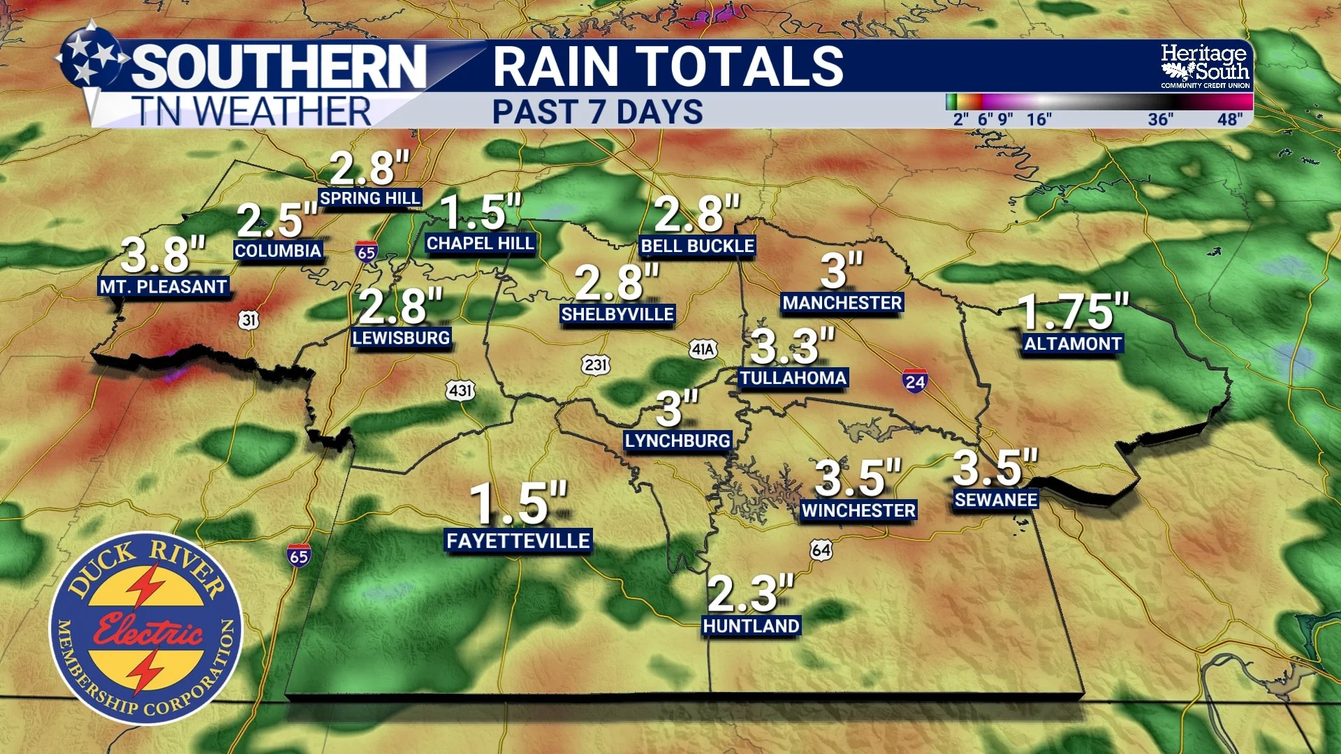
Rainfall Totals Tell The Story: A Soaking Week Across Southern Middle Tennessee
If it feels like we've been talking about rain for the past week... it's because we have.
Over the past seven days, nearly everyone across Southern Middle Tennessee has picked up between 2 and 4 inches of rainfall, with a few communities receiving even more. While the almost daily showers and thunderstorms have certainly put a damper on some outdoor plans, they've also delivered some much-needed rainfall to an area that has spent much of the past year running well below average.
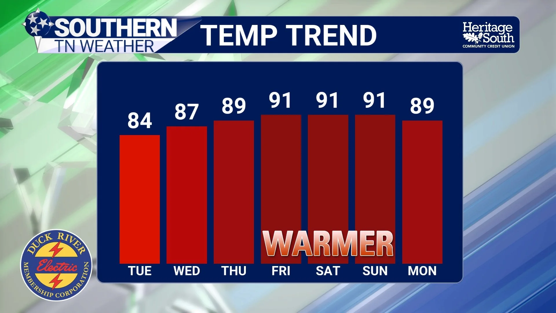
Storm Chances Continue, But A Pattern Change Is On The Horizon
After an active stretch of weather over the past week, we're finally beginning to see signs that our weather pattern is slowly changing. The next couple of days will still feature scattered to numerous showers and thunderstorms, especially during the afternoon and evening hours. However, by the middle and latter part of the week, rain chances should begin decreasing as the stubborn upper-level disturbance responsible for our recent wet weather finally pulls away.
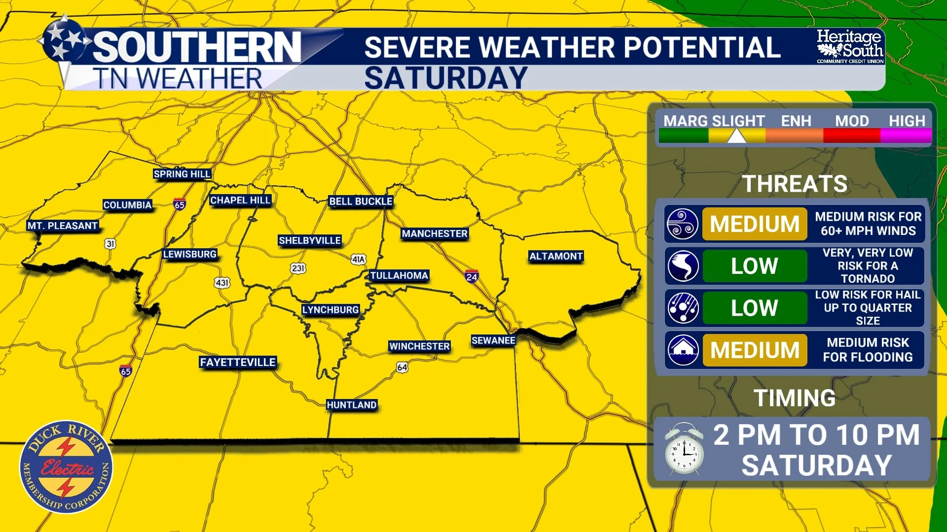
Level 2 Out of 5 Risk for Severe Weather Introduced for Saturday
Saturday has become the day we're watching most closely this weekend. The Storm Prediction Center has upgraded much of Middle Tennessee to a Slight Risk (Level 2 out of 5) for severe thunderstorms. While this is still considered a relatively low-end severe weather event, it's a step above the Marginal Risk we've been dealing with recently and indicates scattered severe storms are possible.
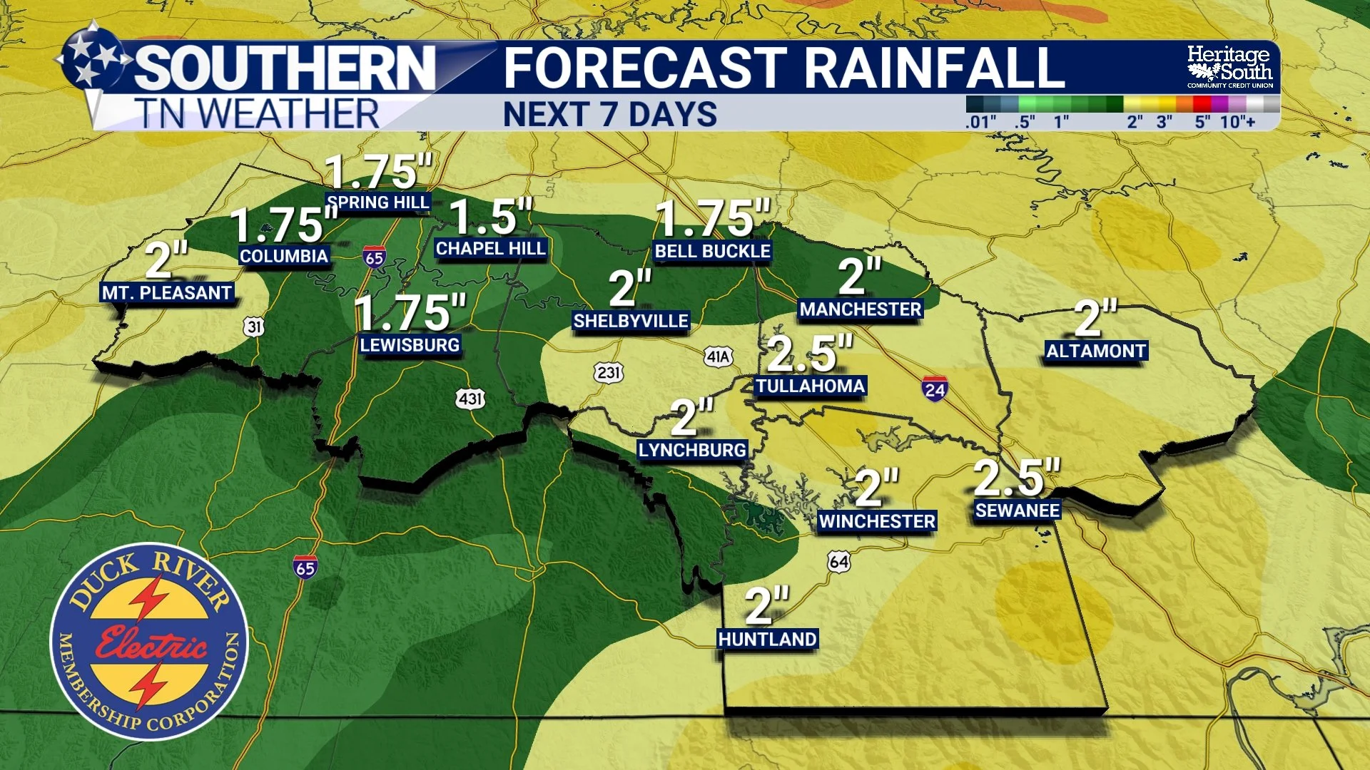
Active Weather Takes Us Through The Weekend: Latest Details Here
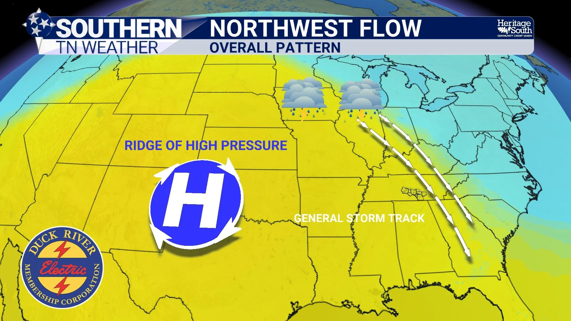
After several days of ordinary summertime pop-up thunderstorms, we're transitioning into a weather pattern that's a little more concerning: northwest flow.
During the summer, a large dome of high pressure often parks itself across the southern United States. Air circulates clockwise around that high, placing Tennessee beneath northwesterly winds several miles above the ground. Those upper-level winds act like a conveyor belt, carrying clusters of thunderstorms that develop across the Midwest southeastward into the Tennessee Valley.
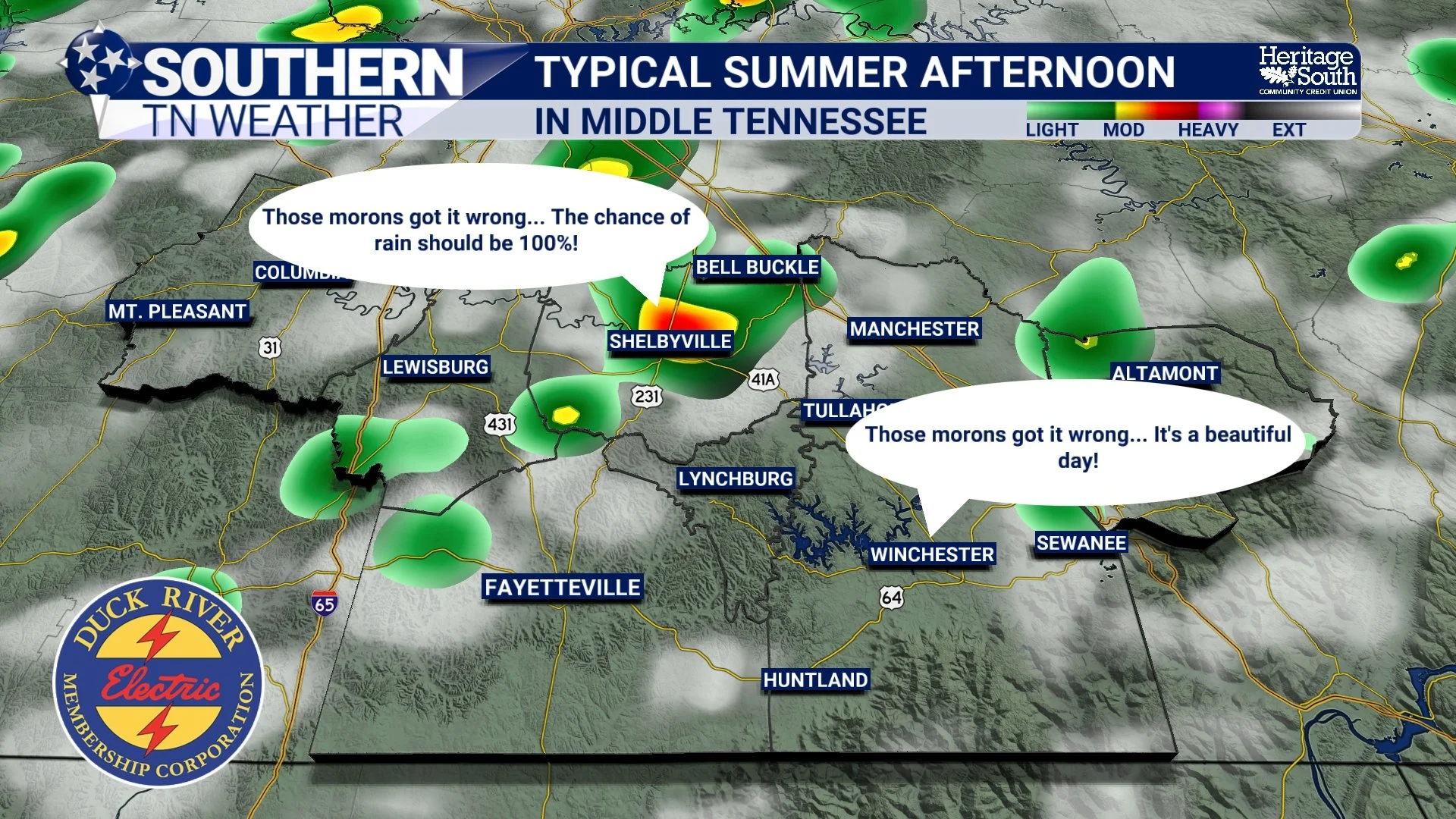
Why Some Towns Keep Getting Rain... While Others Stay Dry
If you've looked at the radar the past several afternoons, you've probably noticed something frustrating. One town picks up a soaking rain while another community just five or ten miles away doesn't see a single drop.
That's simply the nature of summertime weather, and it's exactly the pattern we'll remain in over the next several days.
A More Typical Summer Pattern Settles In
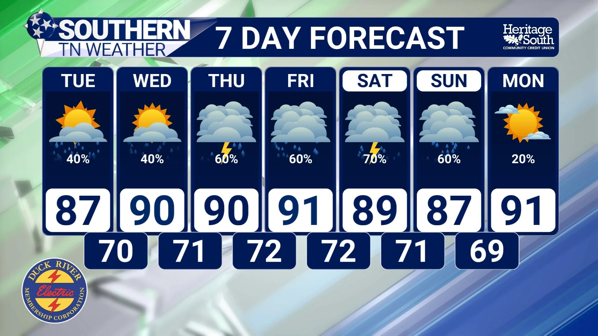
After the prolonged stretch of dangerous heat last week, Southern Middle Tennessee is finally settling into a much more typical July weather pattern. While it's still going to be warm and humid, temperatures have backed off closer to seasonal averages, and daily afternoon shower and thunderstorm chances will become the norm over the next seven days.
Independence Day: In-Depth Forecast Here
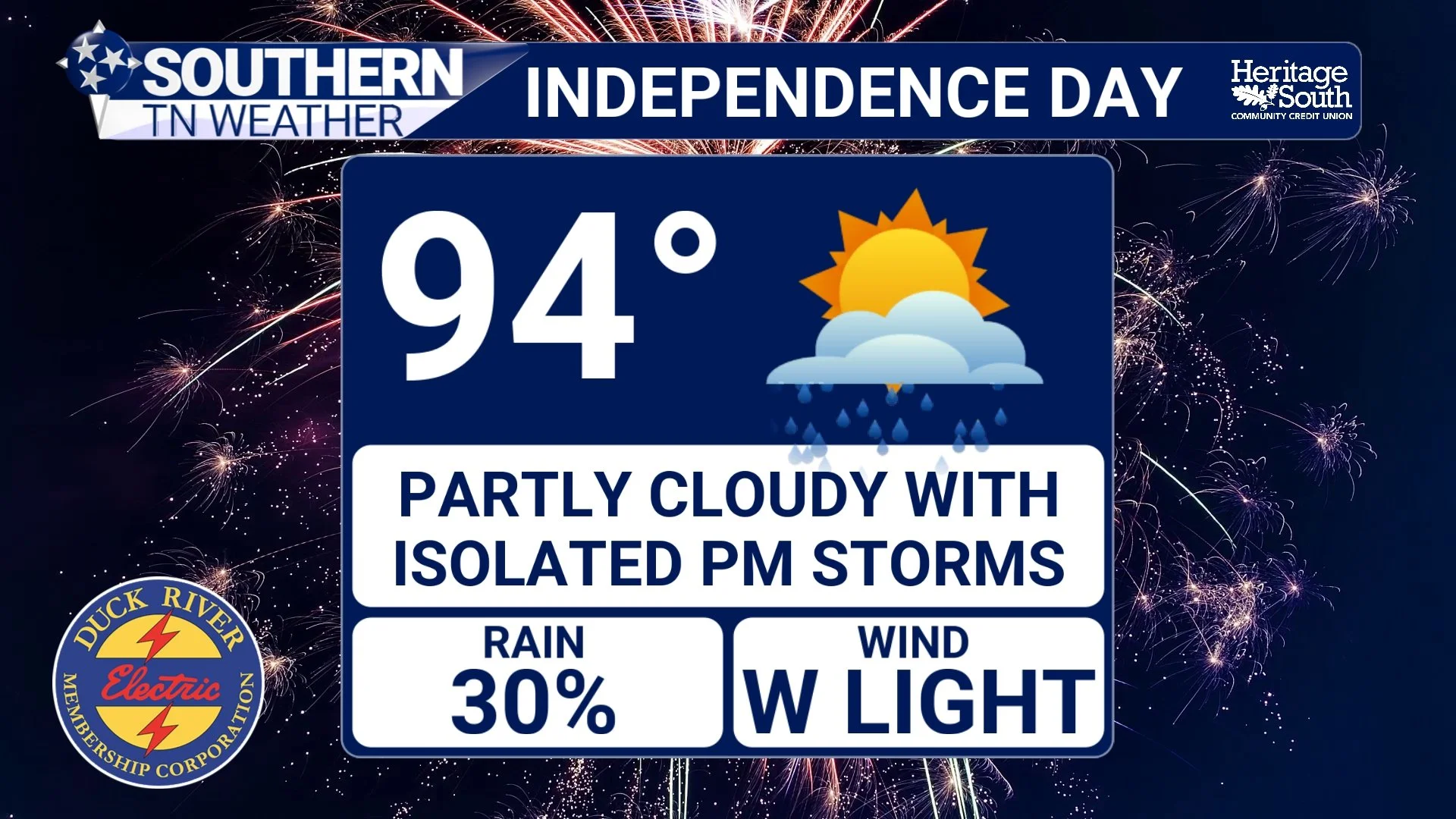
Happy Birthday, America! The Fourth of July is finally here, and after one of the hottest stretches we've experienced in several years, I have some encouraging news. While the heat certainly isn't going away, we're finally beginning to see the weather pattern change ever so slightly. Temperatures will ease down a couple of degrees, and while scattered thunderstorms remain in the forecast, this does not look like an all-day washout.
That said, there are still a few weather concerns you'll want to keep in mind before heading out to parades, cookouts, the lake, or your favorite fireworks show.
Drought Improving, But Heat & Storms Continue Into The Holiday Weekend
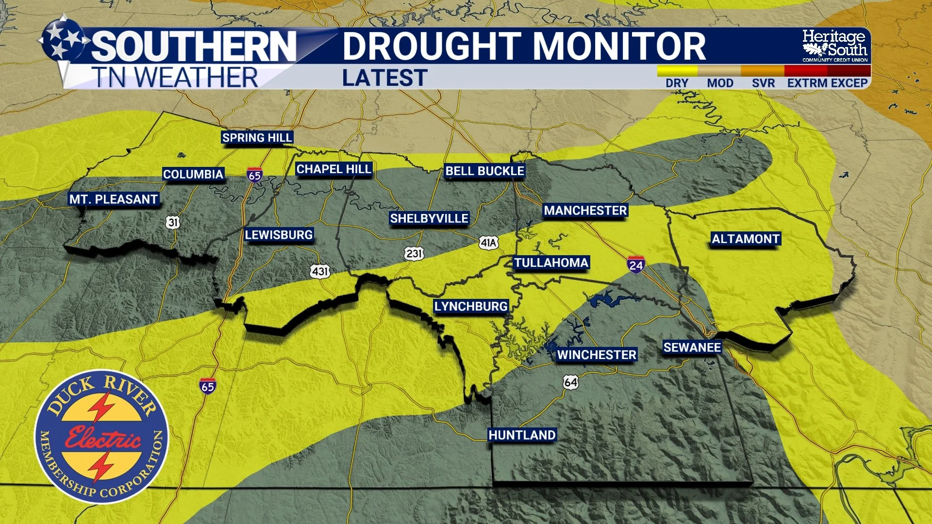
We've spent the past week talking almost exclusively about dangerous heat, heat indices over 110 degrees, and the daily chance for a few strong afternoon thunderstorms. Those remain the primary weather stories through the Independence Day weekend. But today, I wanted to highlight something we don't get to talk about very often. For many of us, the drought is officially over!
Low-End Severe Storm Risk This Afternoon & Evening
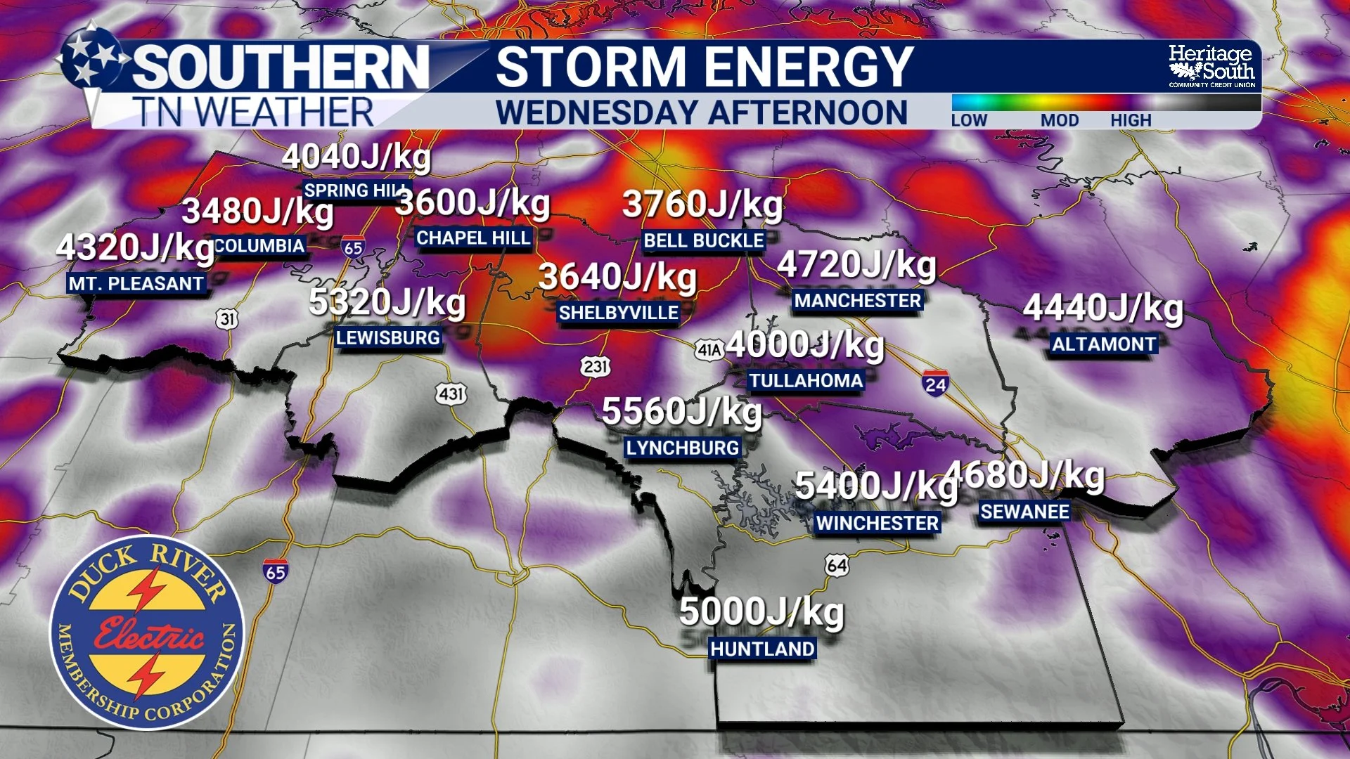
After several days of talking almost exclusively about the dangerous heat, today finally gives us something else to watch. The Storm Prediction Center has upgraded southern portions of our coverage area to a SLIGHT RISK (Level 2 of 5) for severe thunderstorms this afternoon and evening, while the remainder of Southern Middle Tennessee remains under a MARGINAL RISK (Level 1 of 5). This is not a widespread, high-end severe weather setup like we often see during the spring. Instead, this is a classic summertime pattern where only a few storms become severe—but the ones that do can become intense in a hurry.