
Dangerous Heat, A Severe Storm Threat, Then A Taste Of Relief: Your Week Ahead

The Southern Tennessee Weather Blog is proudly presented by Heritage South Community Credit Union.
We Help When Others Won’t!
Visit https://www.heritagesouth.org/ today to see how HSCCU can help YOU!
After several weeks of nearly nonstop afternoon thunderstorms and summer humidity, this week will feature just about everything Tennessee weather has to offer. Dangerous heat will dominate the first half of the week before a cold front brings our next chance for strong to severe storms. Behind that front, we'll finally get a break from both the oppressive heat and humidity.
Let's take a look at what the next seven days have in store.
Heat Advisory Continues Through Tuesday
The biggest concern through Tuesday won't actually be the thunderstorms—it'll be the heat. A Heat Advisory remains in effect through Tuesday evening as afternoon heat index values climb to 105° or higher across much of southern Middle Tennessee. Actual air temperatures will reach the lower to middle 90s, but when combined with dew points in the middle and upper 70s, it'll feel much hotter.
Tuesday looks to be the hottest day of the week. Some locations could briefly see heat index values approach 108 to 110 degrees, especially before thunderstorms develop later in the day. If you have to be outdoors, make sure you're drinking plenty of water, taking frequent breaks in the shade or air conditioning, and checking on those who are more vulnerable to the heat.
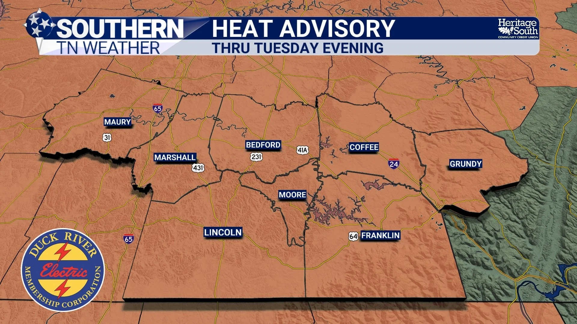
HEAT ADVSIORY - THRU TUESDAY EVENING
Strong Storms Return Tuesday PM
While a few isolated "pop-up" thunderstorms are possible Monday afternoon, the more organized severe weather threat arrives on Tuesday. A cold front dropping south out of Kentucky will interact with the hot, humid air already in place across Tennessee. That setup has prompted the Storm Prediction Center to place much of our area in a Level 1 out of 5 Marginal Risk for severe weather Tuesday into early Wednesday.
Unlike the scattered summertime storms we've seen lately, these storms are expected to organize into a line as they move south. The primary threat will once again be damaging straight-line winds, which has been the most common severe weather hazard we've experienced this summer. Torrential rainfall and frequent lightning will also accompany the stronger storms, and while the tornado threat appears low, it is not zero.
One question that still remains is exactly when the storms arrive… Some forecast models bring a single line of storms through Tuesday evening, while others develop two separate rounds extending into the overnight hours. Regardless of the exact timing, Tuesday afternoon through early Wednesday morning will be the timeframe to watch.
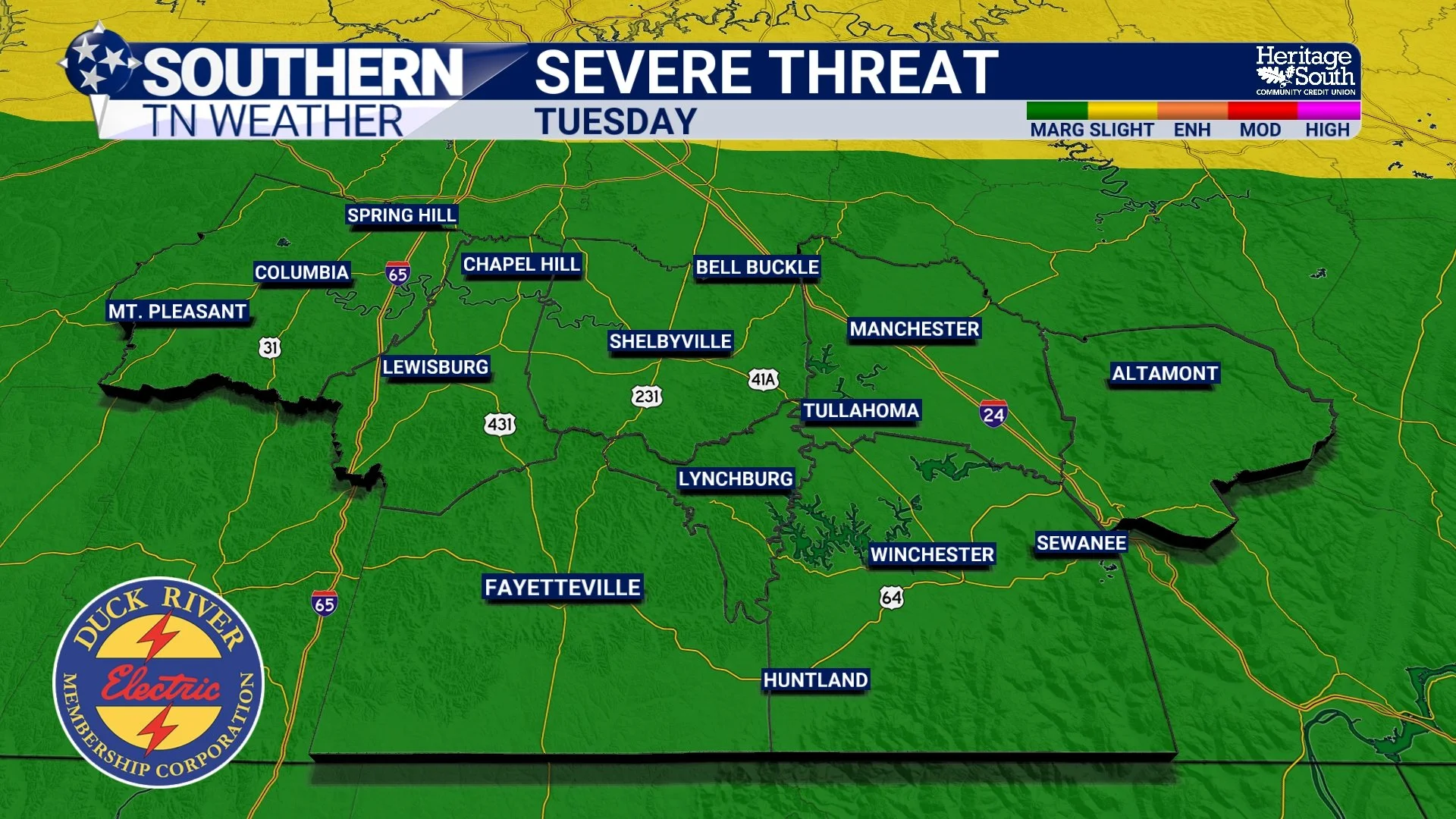
SEVERE THREAT - TUESDAY
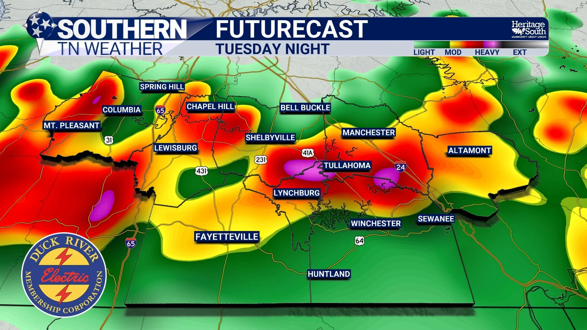
FUTURECAST - TUESDAY NIGHT
Cooler Air Arrives Midweek
Once the cold front pushes through Wednesday, the weather begins heading in a much more comfortable direction. High temperatures will drop back into the middle 80s to around 90 degrees by Thursday and Friday, and perhaps even more noticeable, humidity levels will fall considerably.
After spending much of July with tropical-like air in place, it'll actually feel refreshing by comparison. Rain chances also decrease substantially during the second half of the week. While an isolated shower or thunderstorm can't be ruled out (it is still summertime in Tennessee, after all) we won't be dealing with the widespread daily afternoon storm coverage we've experienced recently.
Don't Put Away The Umbrella Just Yet
The quieter weather probably won't last forever… Forecast guidance is already hinting at another disturbance approaching sometime Friday into Saturday, although confidence in the exact timing and impacts remains fairly low this far out. In addition, the overall upper-air pattern shifts into a classic northwest flow setup late this week and into next weekend. That's a pattern capable of sending clusters of thunderstorms, known as mesoscale convective systems (MCSs), southeast into Tennessee. It's too early to know if that happens this weekend, but it's something we'll be watching closely over the next several days.
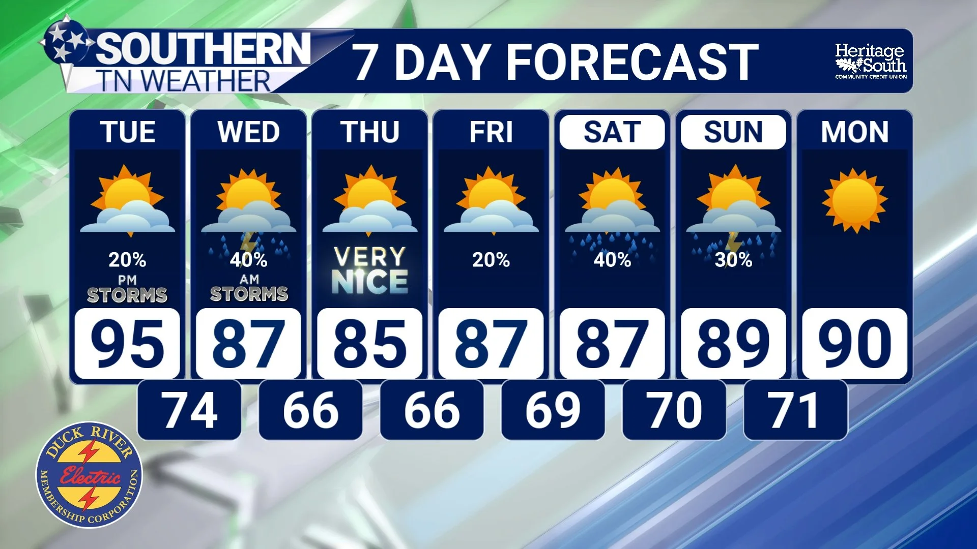
STNWX 7-DAY FORECAST
The Bottom Line 🧾
🥵 A Heat Advisory remains in effect through Tuesday evening.
🌡️ Tuesday will likely be the hottest day of the week with heat index values between 105° and 110°.
⛈️ A Level 1 of 5 Marginal Risk for severe weather is in place Tuesday into early Wednesday.
💨 Damaging winds, heavy rainfall, and frequent lightning are the primary concerns.
🌤️ A cold front moves through Wednesday, bringing cooler temperatures and lower humidity.
😌 Thursday and Friday look much more comfortable, with highs in the 80s and lower humidity.
🌦️ While isolated pop-up storms are always possible during the summer, the second half of the week looks considerably drier than what we've experienced recently.
👀 We'll keep an eye on another possible weather system toward next weekend as confidence increases.
📰 Reminder: The Southern Tennessee Weather Blog, presented by Heritage South Community Credit Union, is updated Monday through Friday with fresh, locally tailored forecasts you can trust.
