
Good News! Southern Middle Tennessee Is Officially Drought-Free

The Southern Tennessee Weather Blog is proudly presented by Heritage South Community Credit Union.
We Help When Others Won’t!
Visit https://www.heritagesouth.org/ today to see how HSCCU can help YOU!
For the first time in quite a while, Southern Middle Tennessee has something to celebrate. According to this week's latest U.S. Drought Monitor, every county in our coverage area is now completely free of drought conditions.
After months of watching drought conditions slowly expand across the region earlier this year, the persistent rounds of rainfall we've experienced throughout July have completely erased what remained of the drought. It's a milestone that seemed hard to imagine just a couple of months ago.
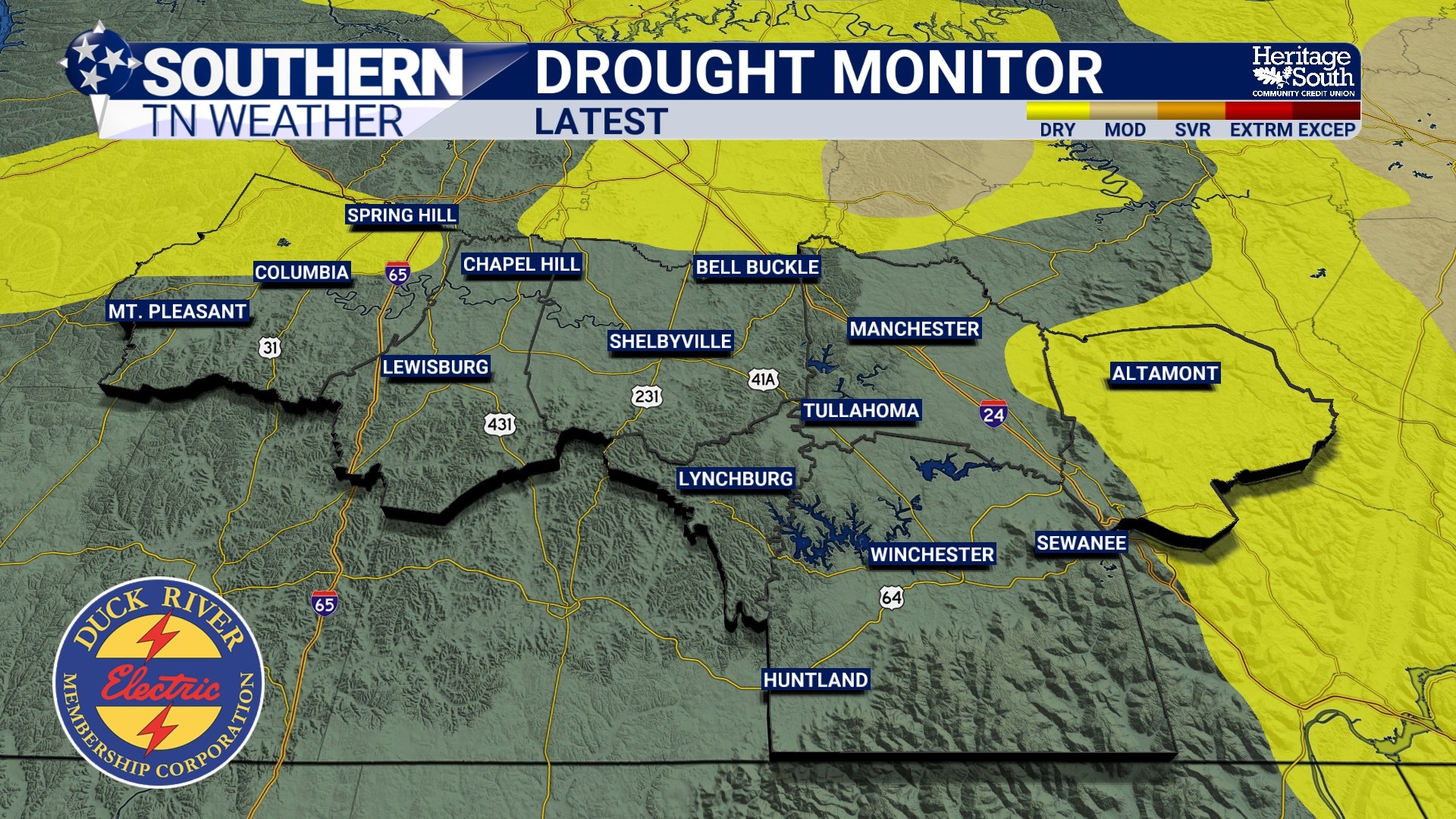
US DROUGHT MONITOR
July Has Been A Different Story
If it feels like it's rained a lot lately... that's because it has. Nearly every week this month has featured multiple rounds of showers and thunderstorms. While many of us have grown tired of dodging afternoon storms and weekend rain chances, all of that precipitation has had a tremendous impact beneath the surface.
According to the U.S. Drought Monitor, above-normal rainfall over the past month led to significant improvements across western and Middle Tennessee, allowing the remaining drought conditions to disappear completely. In fact, several locations across Tennessee have experienced one of their wettest 30-day stretches on record.
While the repeated rainfall has certainly created its share of headaches (including localized flooding and soggy weekends) it has also replenished soil moisture, improved streamflows, and given area vegetation a much-needed boost.
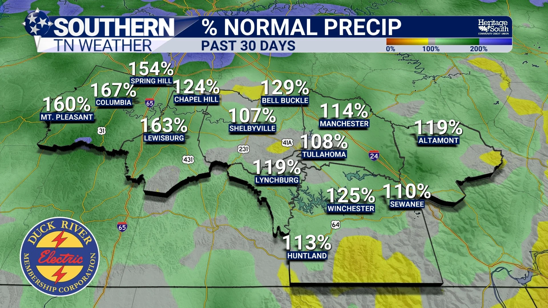
PERCENT NOMAL PRECIP - PAST 30 DAYS
A Complete Turnaround
Earlier this summer, parts of Southern Middle Tennessee were dealing with drying soils, stressed lawns, and growing concerns about rainfall deficits. Fast forward to today, and the conversation has completely changed. Instead of wondering when it might rain again, we've spent much of July talking about flash flooding, heavy downpours, and whether outdoor plans would need a backup option.
It's a reminder of just how quickly weather patterns can change in Tennessee.
What's Next?
The good news is that we aren't immediately heading back into another dry pattern. Rain chances increase again Friday night into Saturday as another disturbance moves through the Tennessee Valley. While widespread severe weather isn't expected, periods of moderate to heavy rainfall remain possible, and a few localized flooding issues can't be ruled out. Looking beyond the weekend, the weather pattern shifts once again.
High pressure strengthens across the central United States, allowing temperatures to climb back into the middle and upper 90s early next week. Heat index values will once again soar well into the triple digits, especially by Tuesday. The good news is that we're not expecting the widespread daily thunderstorm pattern we've dealt with recently. Instead, rain chances next week look much more isolated and typical for late July.
That doesn't necessarily mean drought conditions will redevelop anytime soon. Soil moisture across the region is in much better shape than it was just a few weeks ago, so it'll take an extended period of hot, dry weather before drought concerns begin returning. For now, Southern Middle Tennessee is entering the hottest part of the summer in much better shape than we were at the beginning of July.
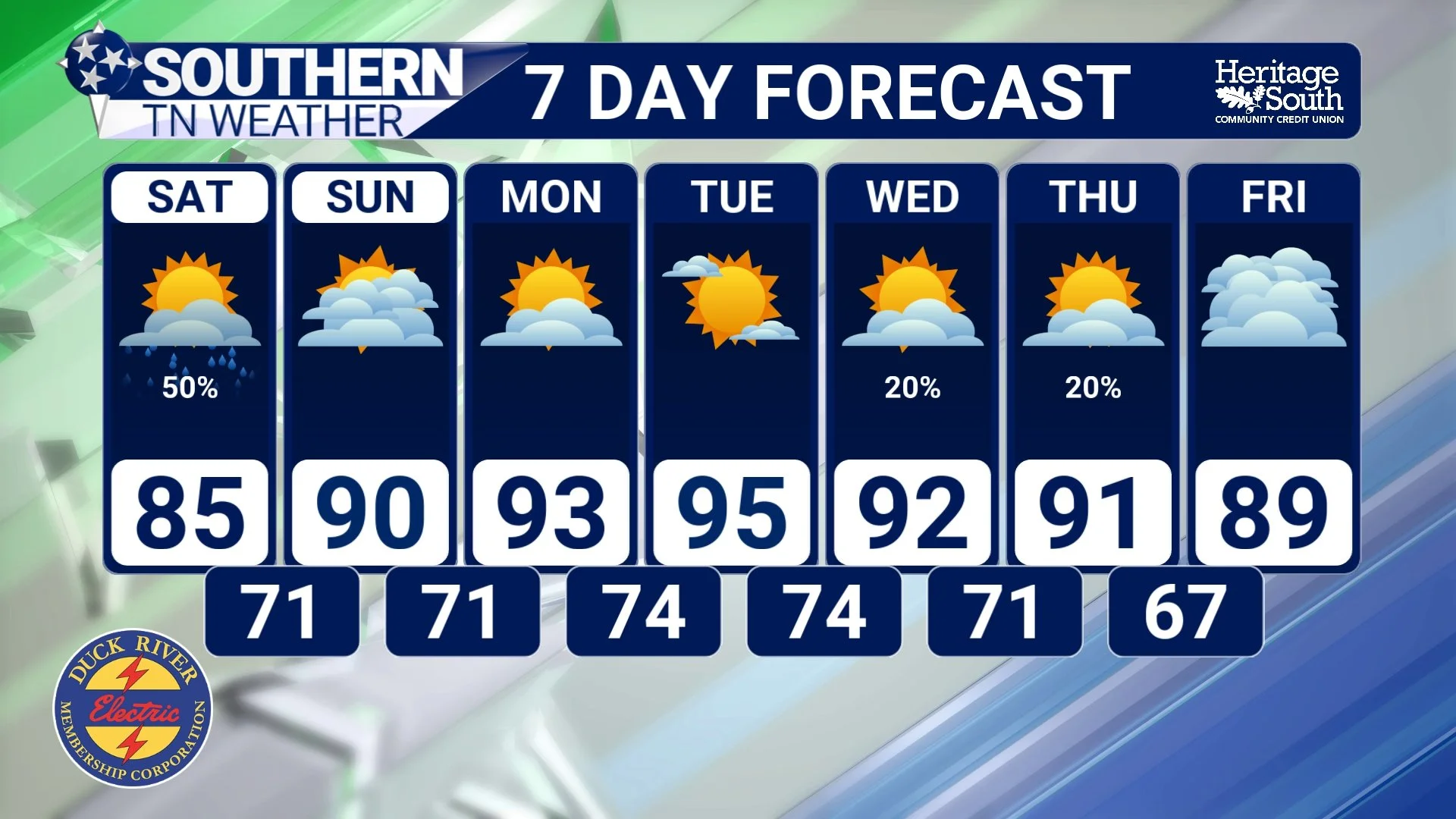
STNWX 7-DAY FORECAST
The Bottom Line 🧾
🌧️ Southern Middle Tennessee is now completely free of drought conditions according to this week's U.S. Drought Monitor.
✅ Persistent rainfall throughout July has erased the drought across our entire coverage area.
🌿 Soil moisture, streams, and vegetation have all benefited from the recent wet pattern.
🌦️ Rain chances increase again Friday night into Saturday, with locally heavy rainfall possible.
🥵 Heat returns early next week, with temperatures climbing into the middle and upper 90s and heat index values well into the triple digits.
🌤️ While isolated afternoon storms remain possible next week, widespread daily rainfall is not expected, and the region enters the hottest stretch of summer in much better shape than it did just a few weeks ago.
📰 Reminder: The Southern Tennessee Weather Blog, presented by Heritage South Community Credit Union, is updated Monday through Friday with fresh, locally tailored forecasts you can trust.
