
Storm Chances Continue, But A Pattern Change Is On The Horizon

The Southern Tennessee Weather Blog is proudly presented by Heritage South Community Credit Union.
We Help When Others Won’t!
Visit https://www.heritagesouth.org/ today to see how HSCCU can help YOU!
After an active stretch of weather over the past week, we're finally beginning to see signs that our weather pattern is slowly changing. The next couple of days will still feature scattered to numerous showers and thunderstorms, especially during the afternoon and evening hours. However, by the middle and latter part of the week, rain chances should begin decreasing as the stubborn upper-level disturbance responsible for our recent wet weather finally pulls away.
That doesn't mean we're turning completely dry—but we are transitioning back toward a more typical July weather pattern.
More Showers And Storms Through Tuesday
The atmosphere remains very moisture-rich across Southern Middle Tennessee, and that's why showers and thunderstorms continue to develop so easily each afternoon. A weak upper-level disturbance has been slowly spinning over the region for the past several days. Instead of moving quickly east like most weather systems, it's been meandering around almost aimlessly, providing just enough lift to keep showers and thunderstorms firing each day.
The good news is that severe weather remains very unlikely. The biggest concerns with any storm will continue to be brief heavy rainfall, frequent lightning, and isolated gusty winds. Storms will once again be most numerous Tuesday afternoon before gradually diminishing after sunset. An additional half inch to one inch of rain will be possible through Tuesday night.
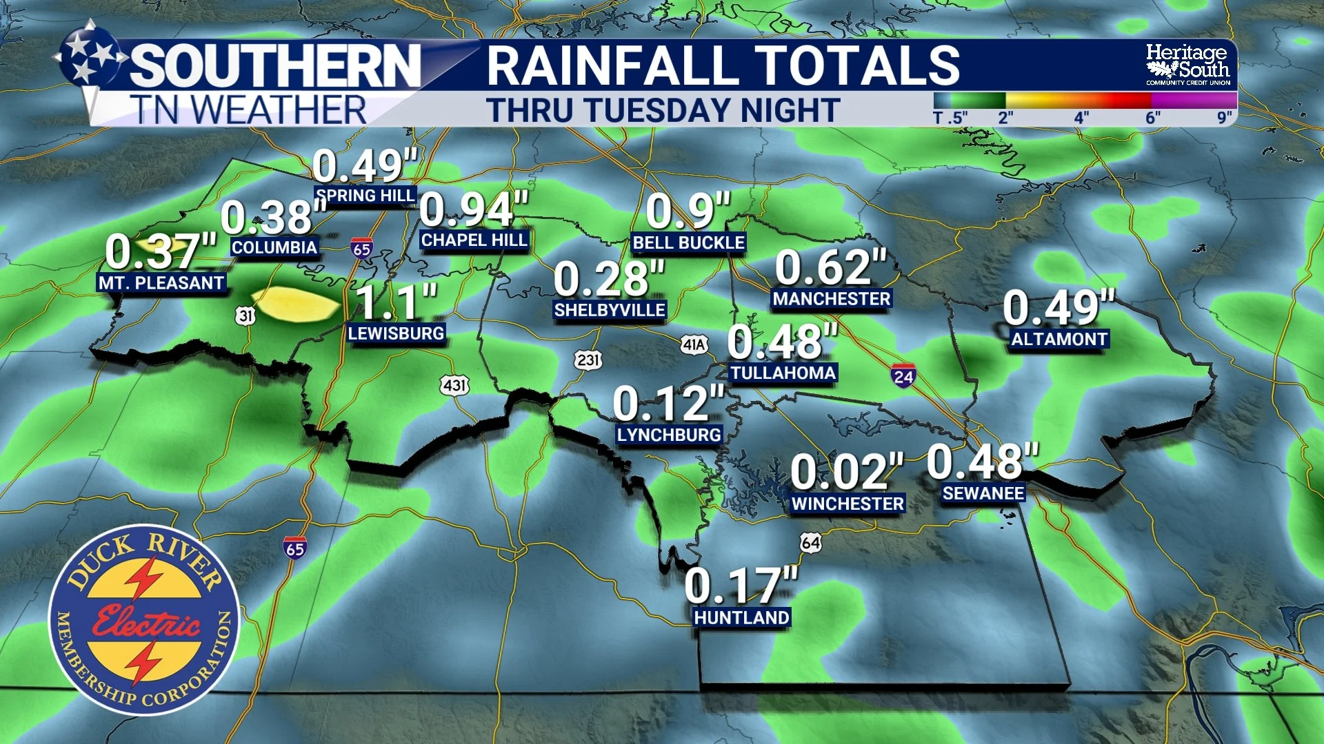
RAIN TOTALS - THRU TUESDAY NIGHT
Why Does Everything Move West?
If you've watched the radar over the past 24 hours, you may have noticed something that seems backwards—many of the showers have actually been moving from east to west. Normally, our weather moves from west to east.
The reason is that storms are rotating around the weak upper-level low currently parked over the region. Air circulates counterclockwise around low pressure, so depending on where you are relative to that low, storms can temporarily move in unusual directions. It's not something we see very often, but it's another sign that this has been an unusual summertime weather pattern.
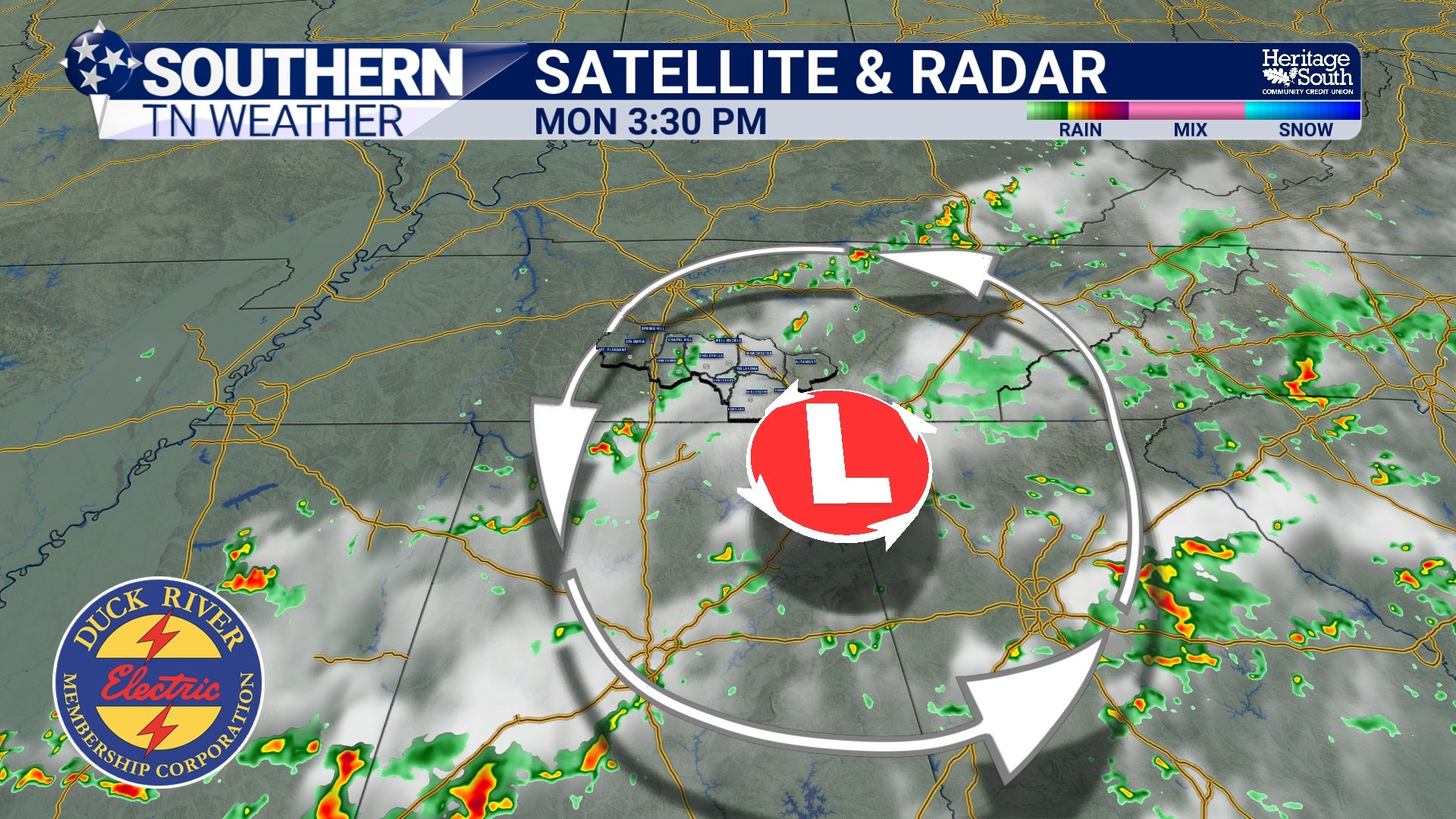
SATRAD - MONDAY AFTERNOON
Things Slowly Begin To Improve
By Wednesday into Thursday, that upper-level disturbance finally begins weakening and drifting away. We'll still have enough heat and humidity to develop isolated to scattered afternoon thunderstorms, but coverage should gradually decrease compared to what we've experienced recently.
By late week, we'll be transitioning back into the more familiar summertime routine: warm mornings, hot afternoons, and isolated pop-up storms rather than widespread rainfall.
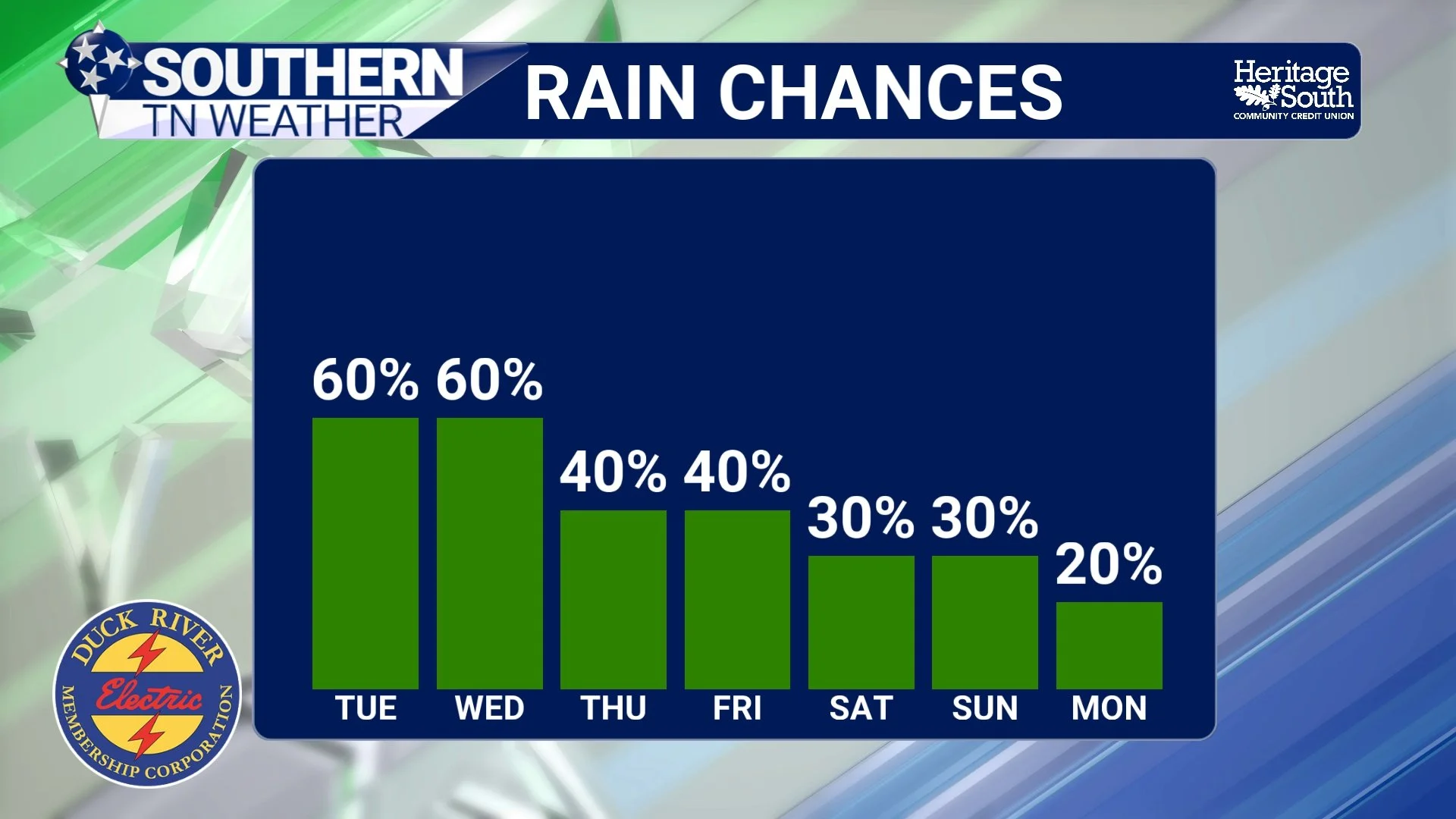
RAIN CHANCES - NEXT 7 DAYS
Heat Starts Creeping Back
As rain coverage begins decreasing later this week, temperatures will begin climbing once again. Afternoon highs will gradually return to the upper 80s and lower 90s, while humidity remains elevated. By the upcoming weekend, heat index values may once again reach 100 to 105 degrees, especially west of the Cumberland Plateau.
This won't be another extreme heat wave like we experienced around the Fourth of July, but it'll certainly remind us that we're still in the middle of July.
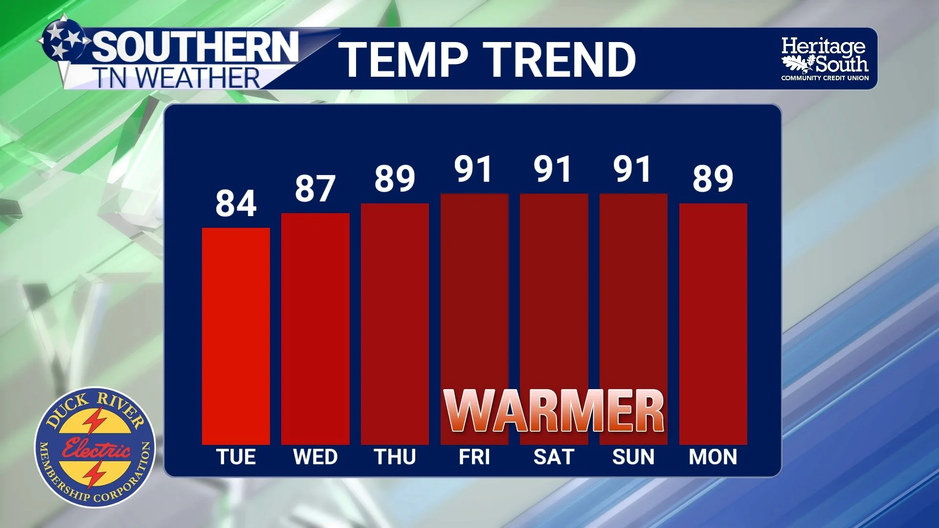
TEMPERATURE TREND - NEXT 7 DAYS
The Bottom Line 🧾
Scattered to numerous showers and thunderstorms continue through Tuesday.
Severe weather is not expected, but heavy rain, lightning, and isolated gusty winds remain possible.
Some storms may continue moving from east to west as they rotate around a weak upper-level low.
Rain chances gradually decrease beginning Wednesday.
Temperatures and humidity will slowly increase later this week.
Heat index values may climb back into the 100–105° range by the weekend.
📰 Reminder: The Southern Tennessee Weather Blog, presented by Heritage South Community Credit Union, is updated Monday through Friday with fresh, locally tailored forecasts you can trust.
