
When Is Our Next Dry Spell? The Answer Is Finally Coming Into Focus

The Southern Tennessee Weather Blog is proudly presented by Heritage South Community Credit Union.
We Help When Others Won’t!
Visit https://www.heritagesouth.org/ today to see how HSCCU can help YOU!
If it feels like we've been talking about afternoon thunderstorms for weeks... you're not wrong. Since early July, Southern Middle Tennessee has settled into a persistent summertime pattern featuring daily showers and thunderstorms, occasional heavy rainfall, and plenty of humidity. While not everyone has seen rain every day, there have been very few days where at least part of our area stayed completely dry.
So naturally, one of the questions I've been getting the most is: "When are we finally going to get a break?" The answer is... next week. But before we get there, we still have a few weather hurdles to clear.
Another Active Weekend Ahead
Daily afternoon and evening thunderstorms will continue through the weekend, although coverage will vary from day to day. Friday and Saturday both feature scattered showers and thunderstorms developing during the heat of the afternoon. Unlike organized storm systems, these will remain largely driven by daytime heating and pockets of lift moving through the atmosphere.
Earlier this week, it looked like Saturday would be the wettest day of the forecast period. While a few showers and storms will certainly be possible, it looks like the best day for widespread stormage is Sunday.
The atmosphere remains loaded with moisture, with precipitable water values above 2 inches—well above what's typical for mid-July. That means any thunderstorm will be capable of producing torrential rainfall in a short amount of time. Add in very slow storm motions, and localized flooding or ponding of water remains possible through the weekend. A few storms could also produce strong, gusty wind gusts, especially across communities closer to the Cumberland Plateau where a Marginal Risk (Level 1 of 5) for severe weather remains in place through the weekend.
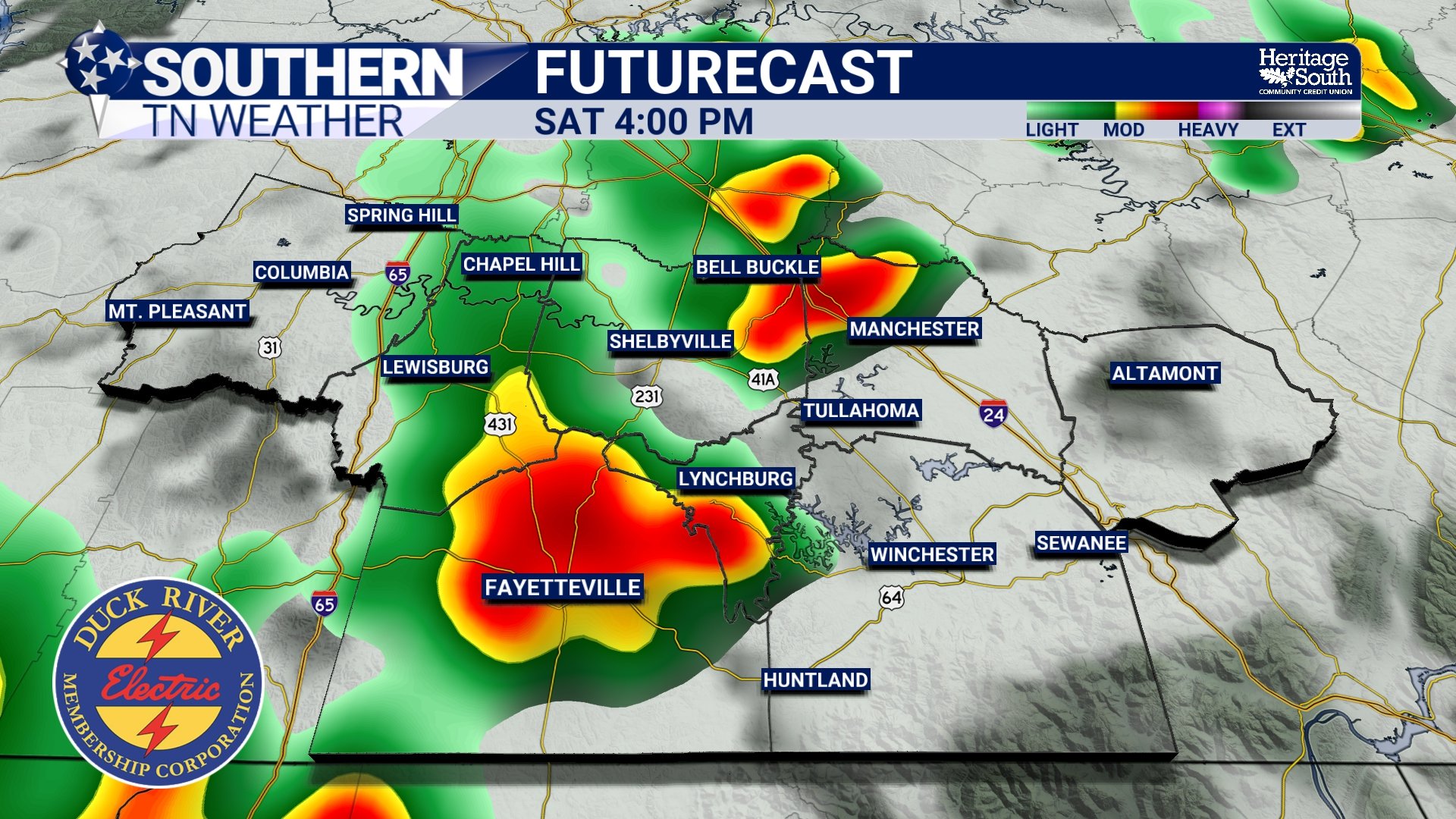
FUTURECAST - SATURDAY AFTERNOON
Then The Heat Takes Center Stage
As we move into early next week, the weather story shifts from rain to heat. A strengthening ridge of high pressure will begin expanding across the Southeast, allowing temperatures to climb back into the lower and middle 90s while humidity remains firmly in place. For many communities west of the Cumberland Plateau, afternoon heat index values will reach the low 100s beginning this weekend.
Tuesday currently looks like the hottest day of the forecast. Forecast guidance continues to suggest heat index values could approach or even exceed 105 degrees, which may eventually require Heat Advisories if current trends continue. Whether an advisory is issued or not, it will be important to limit strenuous outdoor activity during the hottest part of the afternoon, drink plenty of water, and take frequent breaks if you're working outside. The NWS has already highlighted our area under a level 4 out of 5 MAJOR heat risk for Tuesday.
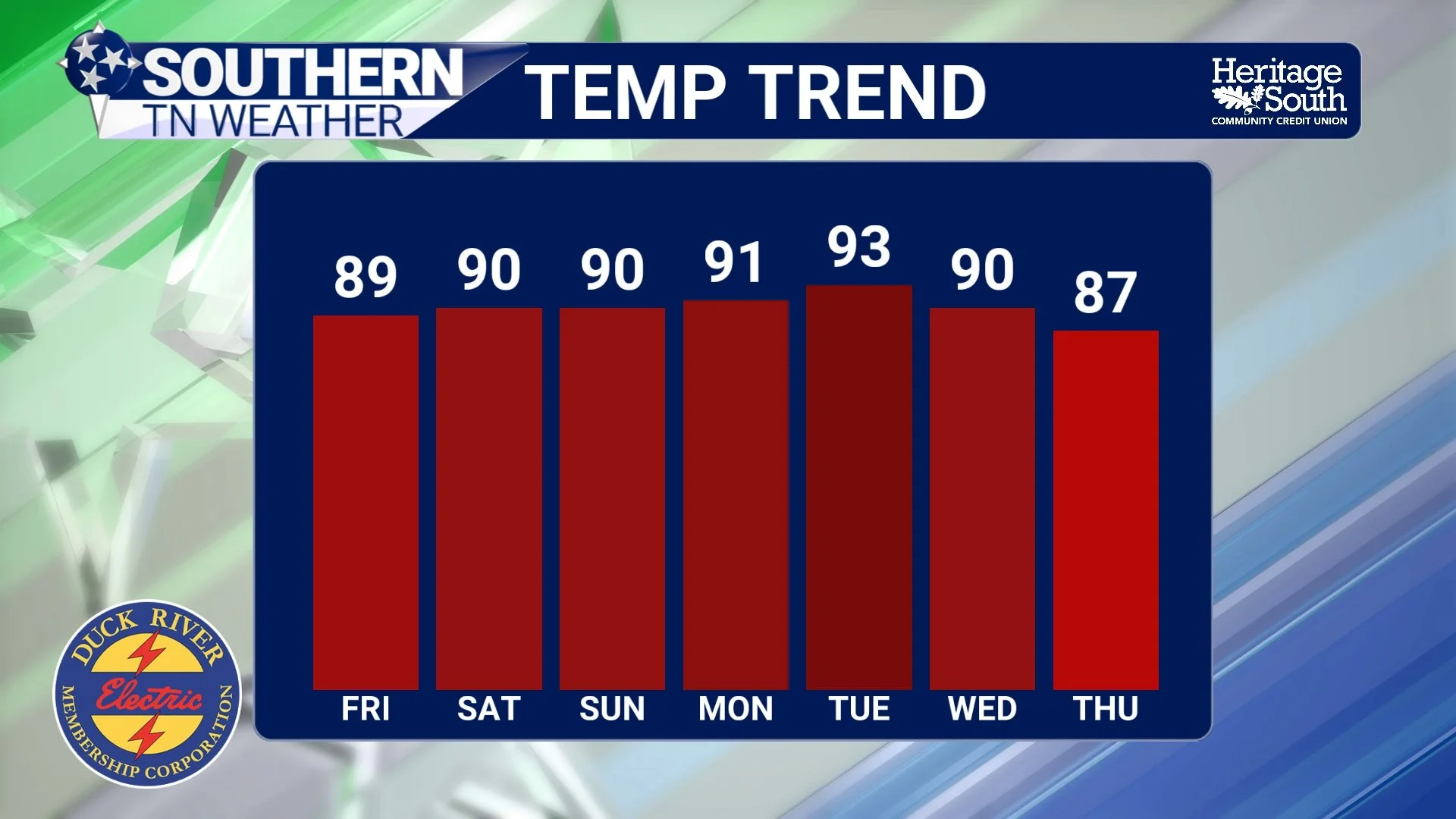
TEMP TREND - NEXT 7 DAYS
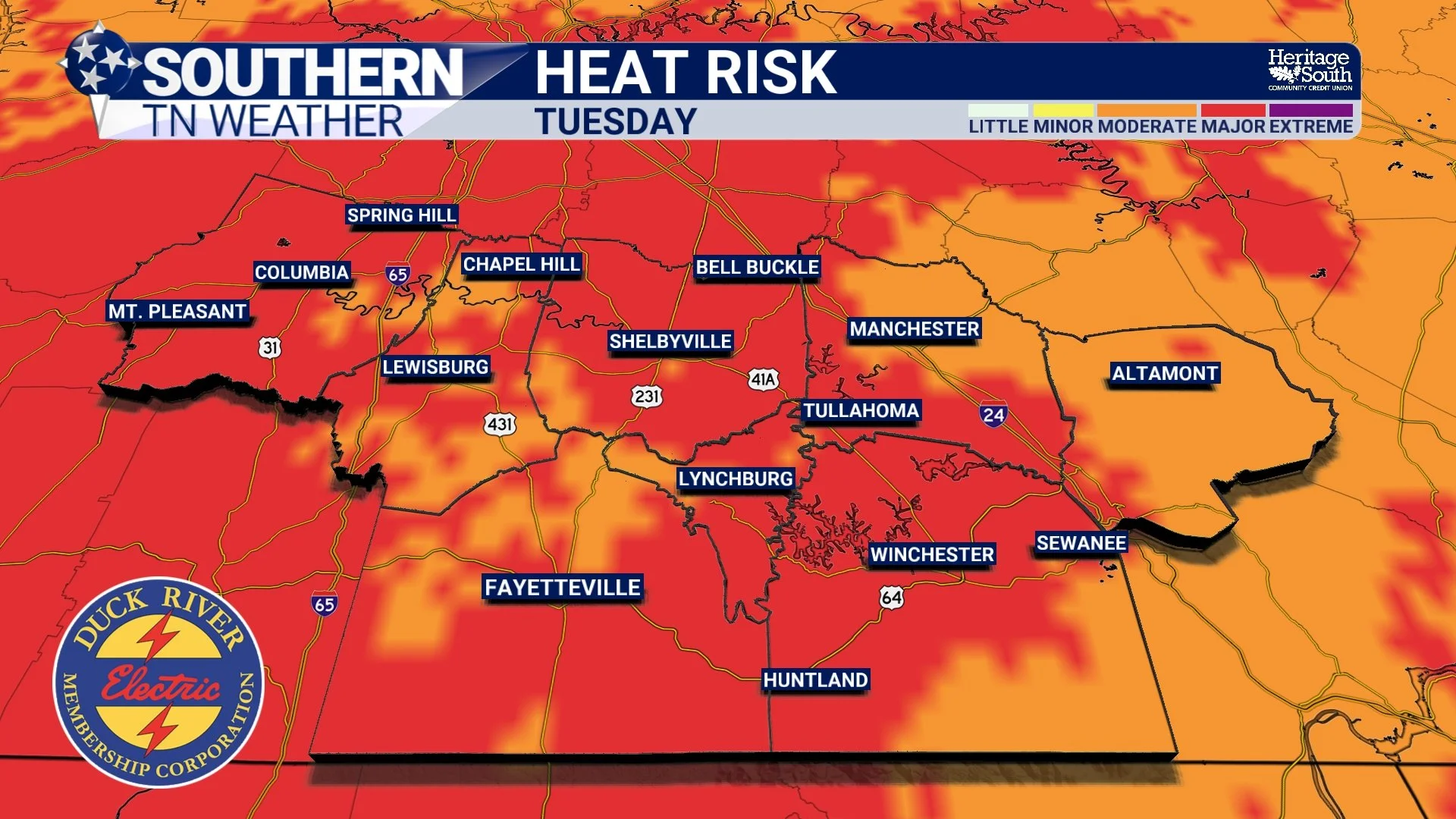
NWS HEAT RISK - TUESDAY
So... When Does The Pattern Finally Change?
The good news is that we're finally seeing signs of a more noticeable pattern change by the middle of next week. A cold front is expected to sweep through Tennessee sometime Wednesday, knocking temperatures back into the mid-80s by Thursday and Friday while also lowering humidity levels.
Just as importantly, rain chances should decrease significantly behind the front. Instead of widespread daily afternoon thunderstorms, we'll return to the more isolated "pop-up" variety that is much more typical for late July. Will we become completely dry? Probably not. This is still summertime in Tennessee, after all.
But compared to the nearly daily storm chances we've dealt with over the past couple of weeks, the second half of next week is shaping up to be our best opportunity for an extended break from the wet pattern. Looking even farther ahead, longer-range outlooks from the Climate Prediction Center continue to favor above-normal temperatures across much of the Southeast through late July, while precipitation signals become much less pronounced. That doesn't mean rain disappears entirely, but it does support the idea that our recent stretch of frequent thunderstorms will gradually become less active.
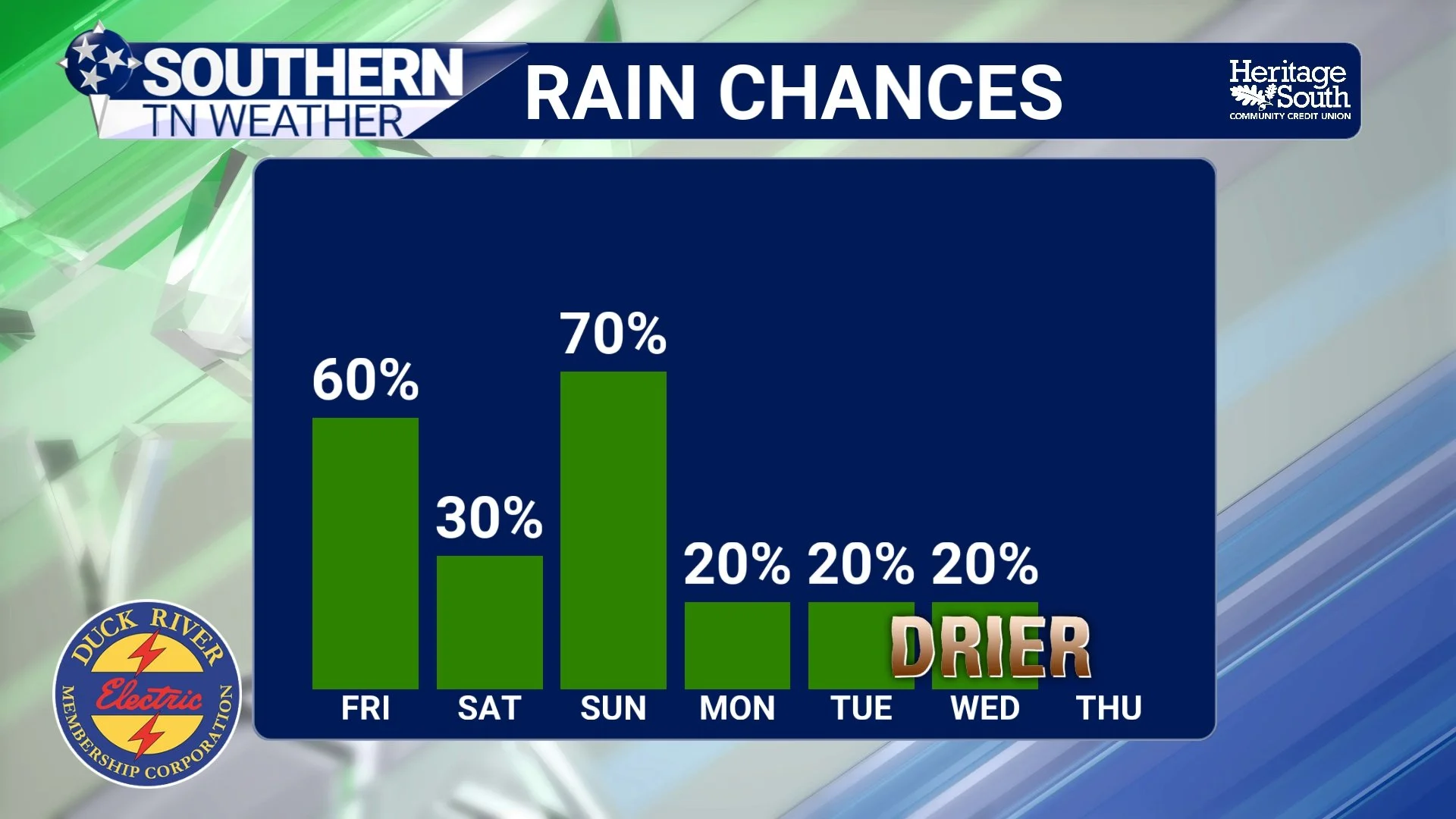
RAIN CHANCES - NEXT 7 DAYS
The Bottom Line 🧾
Daily scattered showers and thunderstorms continue through the weekend.
Saturday night still appears to offer the best chance for more widespread rainfall.
A few stronger storms could produce gusty winds and localized flooding, especially near the Cumberland Plateau.
Heat and humidity steadily increase through early next week.
Tuesday currently looks to be the hottest day, with heat index values nearing or exceeding 105°.
A cold front is expected Wednesday, bringing cooler, less humid air.
The second half of next week currently looks like our best chance at a prolonged dry spell in quite some time.
📰 Reminder: The Southern Tennessee Weather Blog, presented by Heritage South Community Credit Union, is updated Monday through Friday with fresh, locally tailored forecasts you can trust.
