
Rainfall Totals Tell The Story: A Soaking Week Across Southern Middle Tennessee

The Southern Tennessee Weather Blog is proudly presented by Heritage South Community Credit Union.
We Help When Others Won’t!
Visit https://www.heritagesouth.org/ today to see how HSCCU can help YOU!
If it feels like we've been talking about rain for the past week... it's because we have.
Over the past seven days, nearly everyone across Southern Middle Tennessee has picked up between 2 and 4 inches of rainfall, with a few communities receiving even more. While the almost daily showers and thunderstorms have certainly put a damper on some outdoor plans, they've also delivered some much-needed rainfall to an area that has spent much of the past year running well below average.
Now, while we're not completely finished with the wet pattern, we're beginning to see some changes in the forecast.
A Week Of Much-Needed Rain
The past week has been one of the wettest stretches we've seen so far this summer across Southern Middle Tennessee. According to a blended precipitation analysis (which combines radar estimates, satellite data, weather observations, and other meteorological datasets) much of the region received 2 to 4 inches of rainfall over the past seven days. Unlike a single rain gauge, this type of analysis provides a much more complete picture of how rainfall was distributed across the entire area.
The analysis estimates around 3.8 inches near Mt. Pleasant, 3.5 inches around Winchester and Sewanee, 3.3 inches in Tullahoma, and around 3 inches near Manchester and Lynchburg. Much of Bedford, Marshall, Maury, Moore, Franklin, and Coffee counties picked up between 2.5 and 3 inches, while lighter amounts of around 1.5 to 2 inches fell near Chapel Hill, Fayetteville, and Altamont.
What's especially impressive is that nearly all of this rainfall came from slow-moving, scattered thunderstorms rather than one large storm system. That explains why rainfall totals varied so much over relatively short distances—one community may have picked up over three inches of rain, while another just a few miles away received less than half that amount.
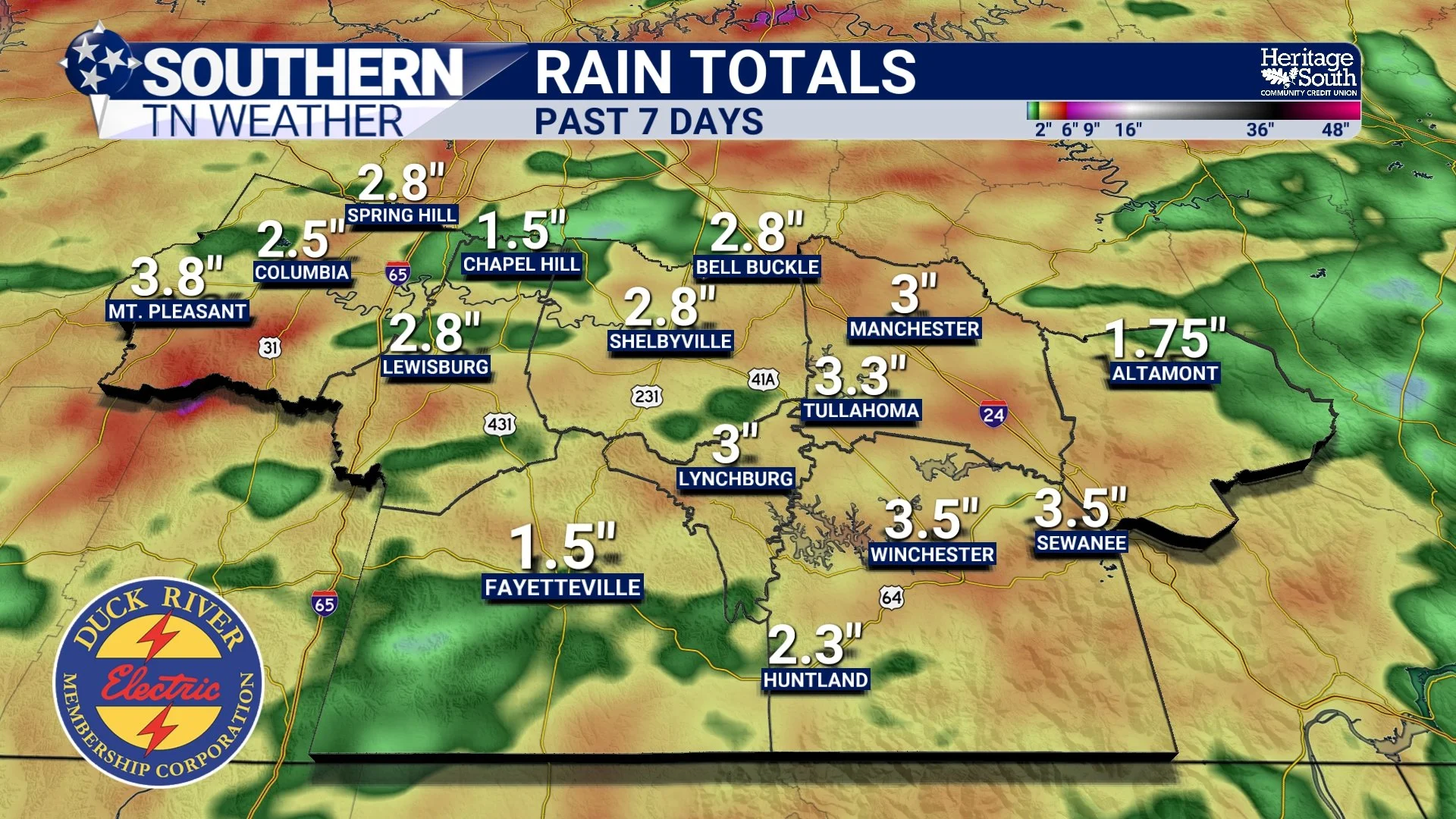
RAIN TOTALS - PAST 7 DAYS
The Drought Isn't TOTALLY Gone... But It's Helping
While the recent rainfall has been beneficial, it's important to remember just how dry we've been. Over the past 365 days, many communities across Southern Middle Tennessee are still running 10 to nearly 20 inches below average on rainfall. Tullahoma and Manchester remain around 18 inches below normal, Altamont is approaching 20 inches below, and several other communities continue to carry deficits well into the double digits.
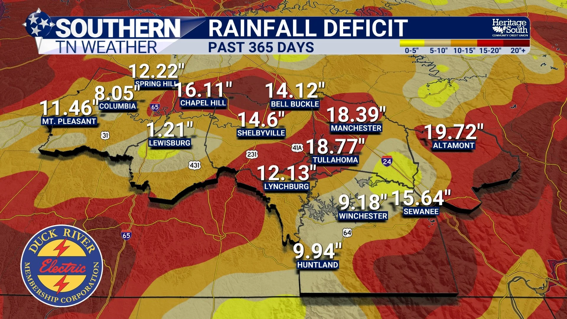
RAINFALL DEFICIT - PAST YEAR
The good news? Looking at just the past 30 days, many of those deficits have essentially disappeared. Across much of our coverage area, rainfall has been very close to average over the past month. In other words, we've made tremendous progress recently, even though we still have a long way to go before fully erasing the longer-term rainfall deficit.
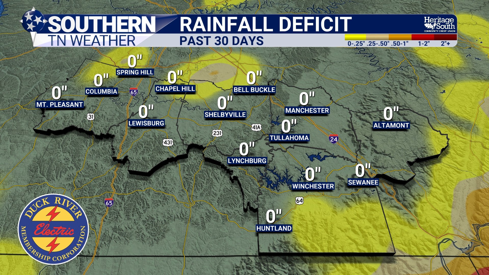
RAINFALL DEFICIT - PAST 30 DAYS
Rain Chances Aren't Going Away After All
Earlier forecasts suggested we would begin drying out significantly during the second half of this week. That no longer appears to be the case.
Over the past couple of days, forecast models have trended noticeably wetter as several weak disturbances are now expected to move through the region Thursday through the weekend. That doesn't mean it'll rain all day, every day, but it does mean daily afternoon and evening thunderstorms will remain fairly common.
With the atmosphere continuing to hold an incredible amount of moisture, any thunderstorm that develops will be capable of producing brief torrential rainfall, frequent lightning, and localized ponding or minor flooding. The overall severe weather threat remains very low.
Temperatures Begin Climbing Again
As we head toward the weekend, temperatures will slowly begin warming back into the upper 80s and lower 90s. Humidity will also increase, pushing afternoon heat index values back toward 100 degrees, especially beginning Thursday and lasting into early next week. So while this won't be another major heat wave, it will certainly start feeling more like a typical Tennessee July again.
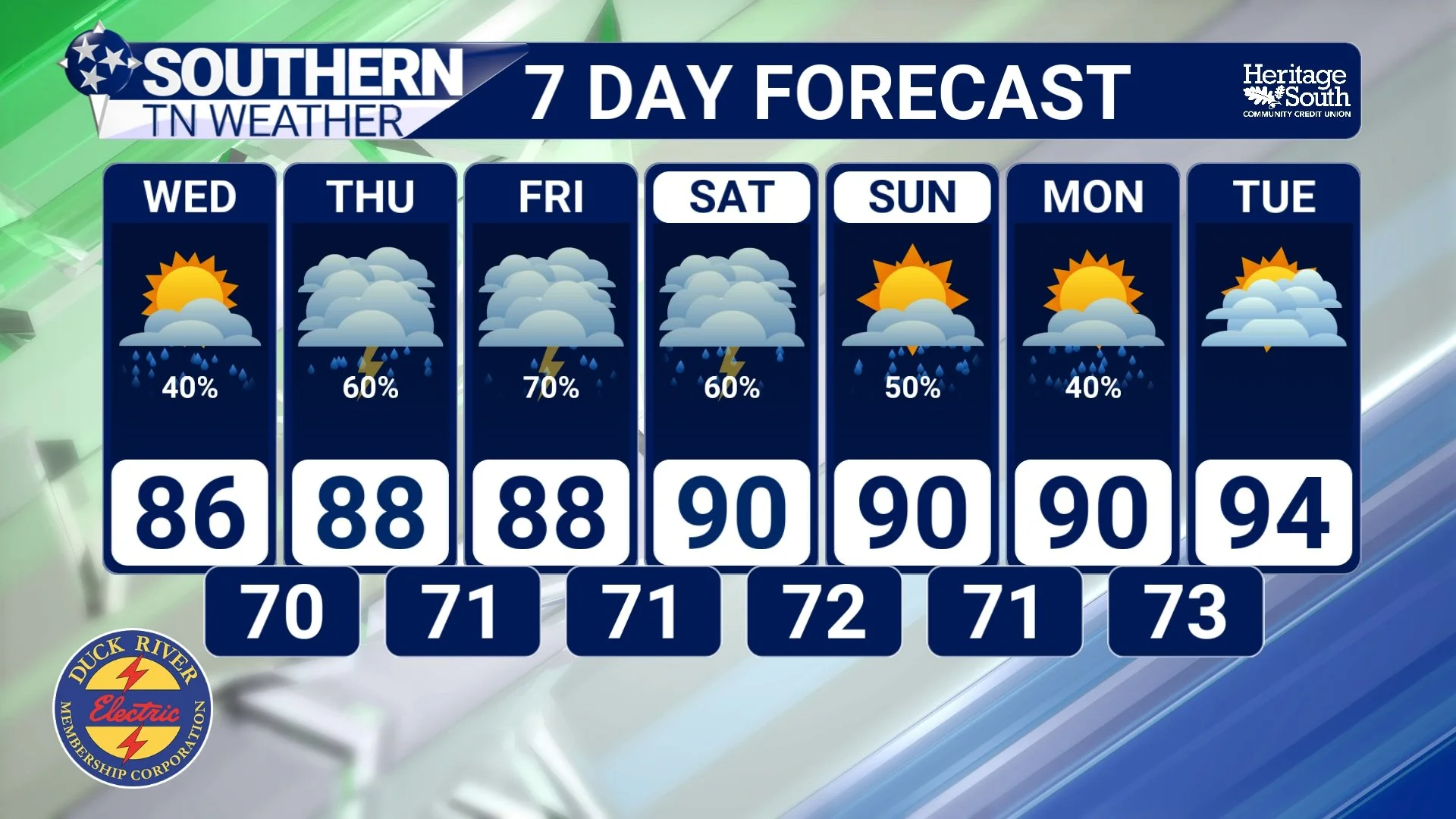
STNWX - 7 DAY FORECAST
The Bottom Line 🧾
Most of Southern Middle Tennessee received 2 to 4 inches of rain over the past seven days.
The recent rainfall has helped tremendously, but many locations are still 10 to 20 inches below normal over the past year.
Thirty-day rainfall deficits have largely disappeared across much of the area.
Rain chances were expected to decrease later this week, but forecast trends have shifted wetter once again.
Scattered afternoon and evening showers and thunderstorms remain in the forecast through the weekend.
Heavy rainfall and frequent lightning remain the primary threats, while the severe weather risk stays very low.
Temperatures gradually warm back into the upper 80s and lower 90s with heat index values approaching 100° by late week.
📰 Reminder: The Southern Tennessee Weather Blog, presented by Heritage South Community Credit Union, is updated Monday through Friday with fresh, locally tailored forecasts you can trust.
