
Level 2 Out of 5 Risk for Severe Weather Introduced for Saturday

The Southern Tennessee Weather Blog is proudly presented by Heritage South Community Credit Union.
We Help When Others Won’t!
Visit https://www.heritagesouth.org/ today to see how HSCCU can help YOU!
Saturday has become the day we're watching most closely this weekend. The Storm Prediction Center has upgraded much of Middle Tennessee to a Slight Risk (Level 2 out of 5) for severe thunderstorms. While this is still considered a relatively low-end severe weather event, it's a step above the Marginal Risk we've been dealing with recently and indicates scattered severe storms are possible.
The biggest threats will be damaging straight-line wind gusts and localized flash flooding, although exactly how Saturday unfolds will depend on what happens earlier in the day.
The Forecast Isn't Straightforward
Unfortunately, this isn't one of those forecasts where I can confidently say storms will arrive at 3:00 PM and be gone by dinner. Instead, we're dealing with a classic northwest flow pattern where thunderstorms developing hundreds of miles away can directly impact what happens here later in the day. Forecast models generally agree that two rounds of storms are possible Saturday. The first could move through during the morning hours, followed by a break late morning into early afternoon. If enough sunshine returns after that first round, the atmosphere should recover quickly, allowing another, potentially stronger, round of thunderstorms to develop during the afternoon and evening.
However, if morning storms linger longer than expected or produce extensive cloud cover, that second round may not become as intense. In other words, Saturday morning's radar trends will make or break the forecast.
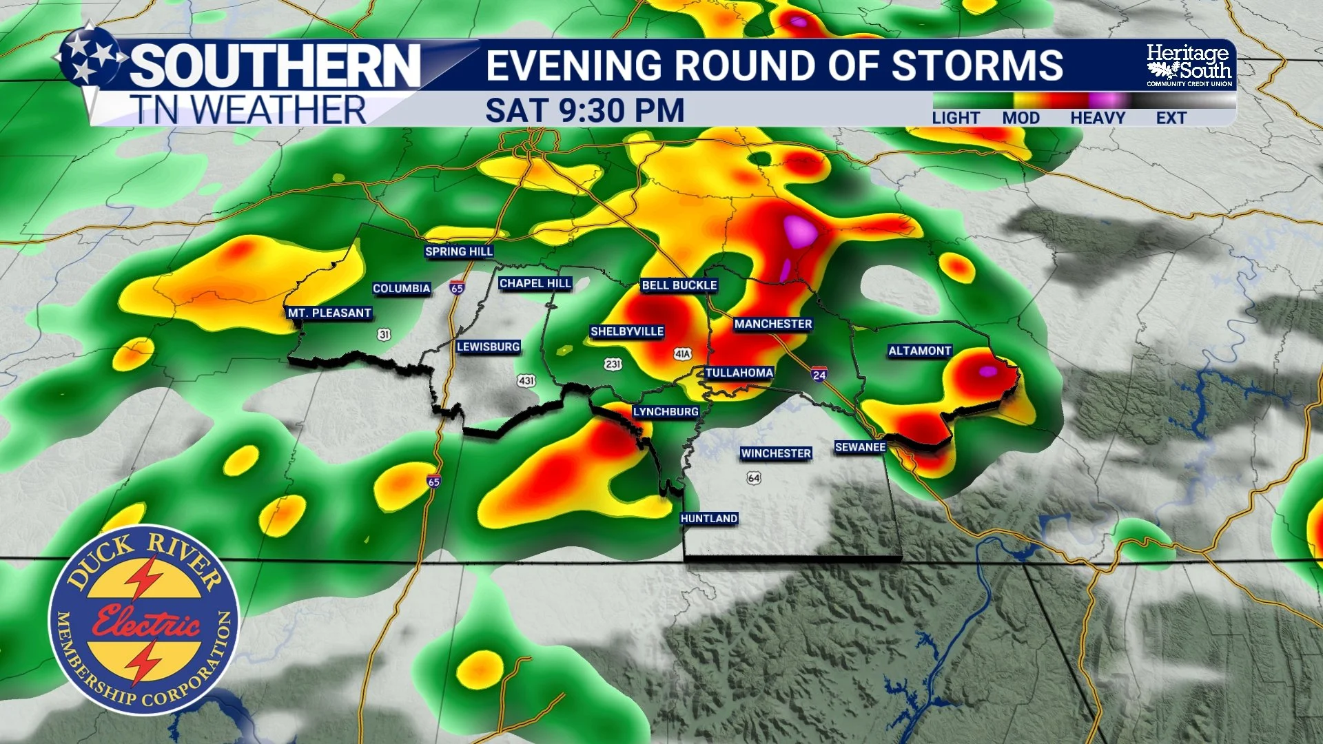
FUTURECAST - SATURDAY PM STORMS
Timing
While timing will likely continue to be adjusted, here's the general expectation:
Early Morning: A cluster of showers and thunderstorms may move through the area.
Late Morning into Early Afternoon: Possible lull in activity.
2 PM through 10 PM: Highest confidence window for strong to severe thunderstorms if the atmosphere is able to recover.
If you have outdoor plans Saturday, especially later in the day, you'll want to keep a close eye on the forecast.
The Primary Threat: Damaging Winds
The atmosphere will become increasingly unstable Saturday afternoon, with plenty of energy available for thunderstorms. As storms organize into clusters, they could produce damaging straight-line wind gusts capable of reaching 60 to 70 MPH. These winds can down trees, damage roofs, and cause scattered power outages. Unlike springtime severe weather events, this setup does not appear particularly favorable for tornadoes. While I can never completely rule one out in any thunderstorm, damaging winds are overwhelmingly the primary concern.
Frequent lightning and torrential rainfall will accompany any stronger storms as well.
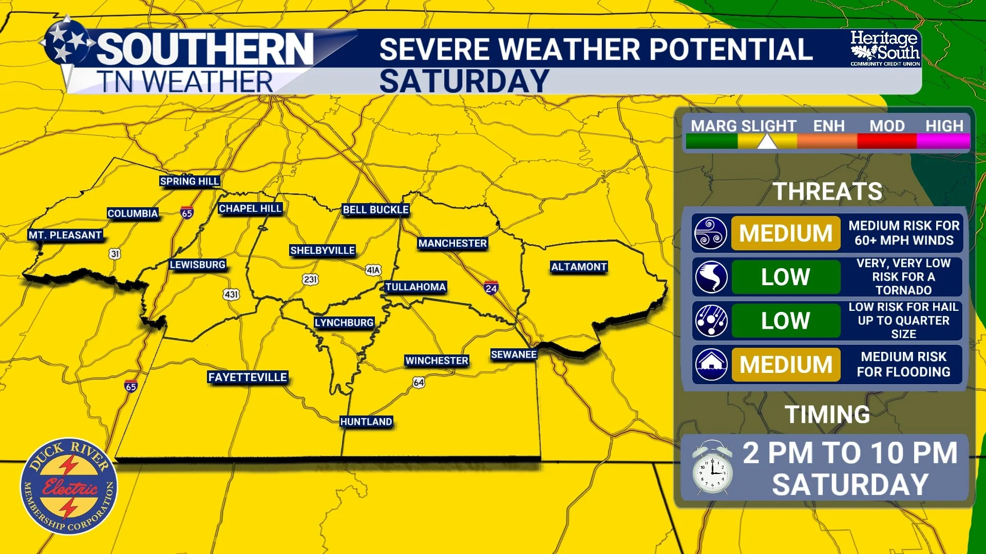
SEVERE WEATHER POTENTIAL - SATURDAY
Flooding May Become An Even Bigger Problem
While the severe weather outlook has received much of the attention today, I'm honestly just as concerned about flooding. A Flood Watch remains in effect through Sunday as multiple rounds of thunderstorms continue moving across the region. Many locations have already picked up 2 to 3 inches of rain this week, leaving soils increasingly saturated. The Weather Prediction Center continues to highlight much of Tennessee in a Slight Risk (Level 2 out of 4) for Excessive Rainfall, meaning scattered flash flooding is becoming more likely if heavier storms repeatedly move over the same locations.
Some forecast guidance even suggests localized rainfall totals of several additional inches where storms train over the same areas. Remember, flash flooding often becomes more dangerous than the thunderstorms themselves.
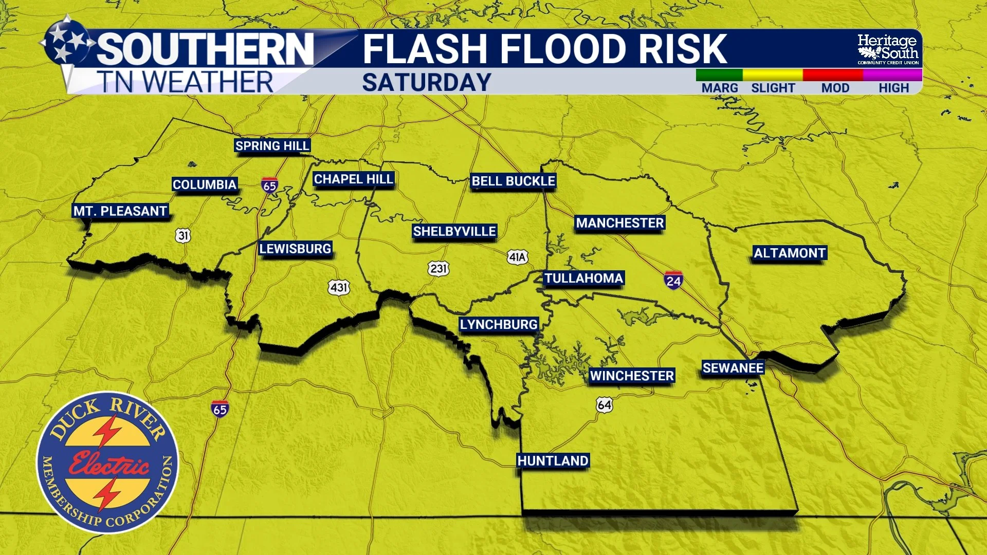
FLASH FLOOD RISK - SATURDAY
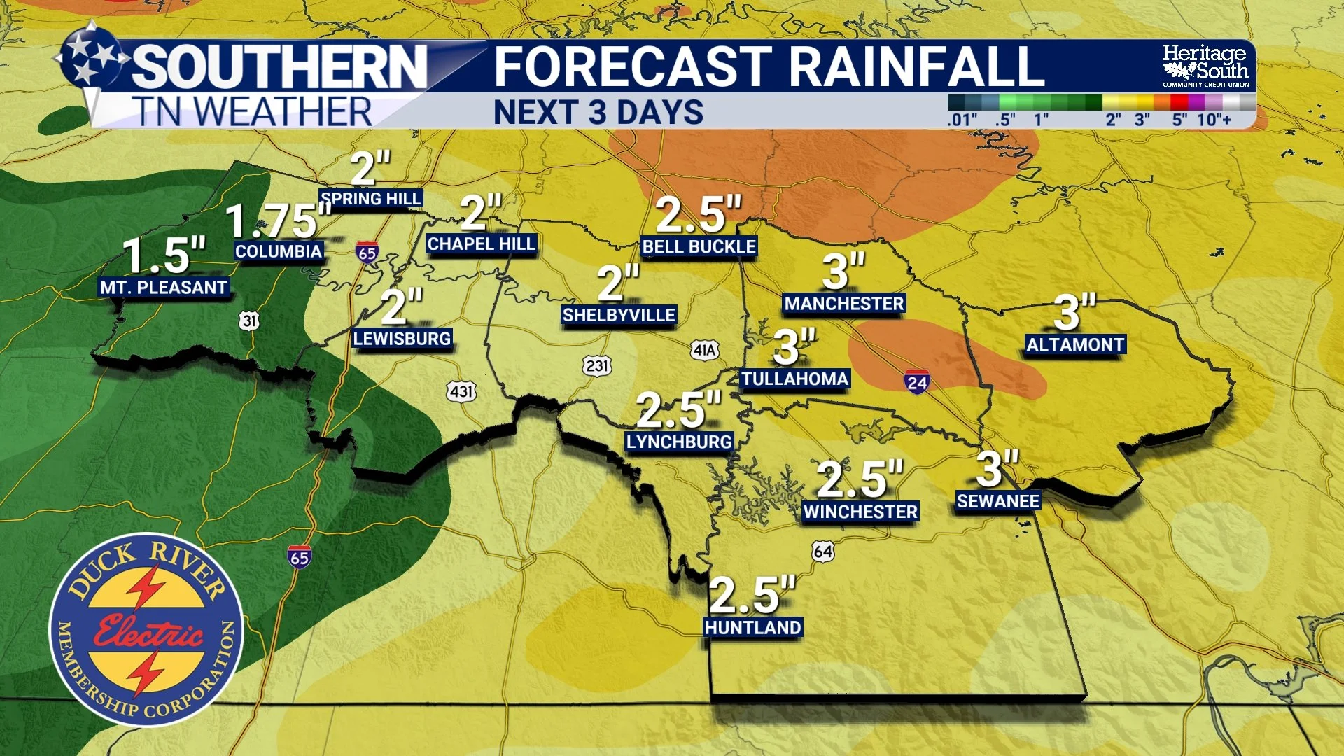
FORECAST RAINFALL - NEXT 3 DAYS
Confidence Will Continue To Improve
One of the biggest reasons this forecast remains challenging is because it depends on small-scale weather features that haven't even formed yet. One of those features is called a mesoscale convective vortex, or MCV. Think of it as a small area of spin left behind after a large cluster of thunderstorms weakens. Even after the original storms fall apart, that leftover circulation can act like a seed for new thunderstorms later in the day, sometimes hundreds of miles away from where it first developed. Exactly where an MCV tracks can determine where the strongest storms redevelop, making it one of the more difficult features for meteorologists to forecast.
As those features become better defined overnight, confidence in the forecast will continue to increase. Expect forecast updates throughout this evening and Saturday morning as we fine-tune the timing and impacts.
The Bottom Line 🧾
A Slight Risk (Level 2 out of 5) for severe thunderstorms is now in place for Saturday.
Damaging straight-line winds are the primary severe weather threat.
Two rounds of storms are possible, with the greatest severe weather threat between 2 PM and 10 PM.
How the morning storms evolve will determine how intense the afternoon storms become.
A Flood Watch remains in effect through Sunday, and flash flooding is a significant concern.
Continue checking back for forecast updates, as Saturday's details will become clearer overnight and into Saturday morning.
📰 Reminder: The Southern Tennessee Weather Blog, presented by Heritage South Community Credit Union, is updated Monday through Friday with fresh, locally tailored forecasts you can trust.
