
Finally... A Small Break From The Heat And Humidity

The Southern Tennessee Weather Blog is proudly presented by Heritage South Community Credit Union.
We Help When Others Won’t!
Visit https://www.heritagesouth.org/ today to see how HSCCU can help YOU!
If you've stepped outside today, you've probably noticed something almost immediately. It doesn't feel nearly as miserable.
After several days of dangerous heat, tropical humidity, and heat index values well above 105 degrees, Southern Middle Tennessee is finally getting a small—but very welcome—break. No, we're not talking about sweater weather, and summer certainly isn't over. But thanks to a cold front that pushed through Tuesday night, the atmosphere has finally become much more comfortable. It's the kind of weather that reminds you late July can actually be enjoyable every once in a while.
It's Not Much Cooler... But It Feels Much Better
One thing that surprises people is that today's actual temperatures aren't dramatically different from yesterday's. Highs this afternoon will still climb into the middle 80s and lower 90s, which is right around normal for this time of year. The difference is the humidity.
Behind yesterday's cold front, winds have shifted out of the north, allowing noticeably drier air to spill into Middle Tennessee. Dew points have dropped by nearly 10 degrees compared to the beginning of the week. That may not sound like much, but it makes a tremendous difference in how the weather feels. Instead of stepping outside and immediately feeling like you're wrapped in a warm, wet blanket, the air actually feels refreshing by late July standards. Your body can cool itself more efficiently, and "feels like" temperatures are much closer to the actual air temperature. Sometimes it's not the thermometer that matters most—it's the moisture in the air.
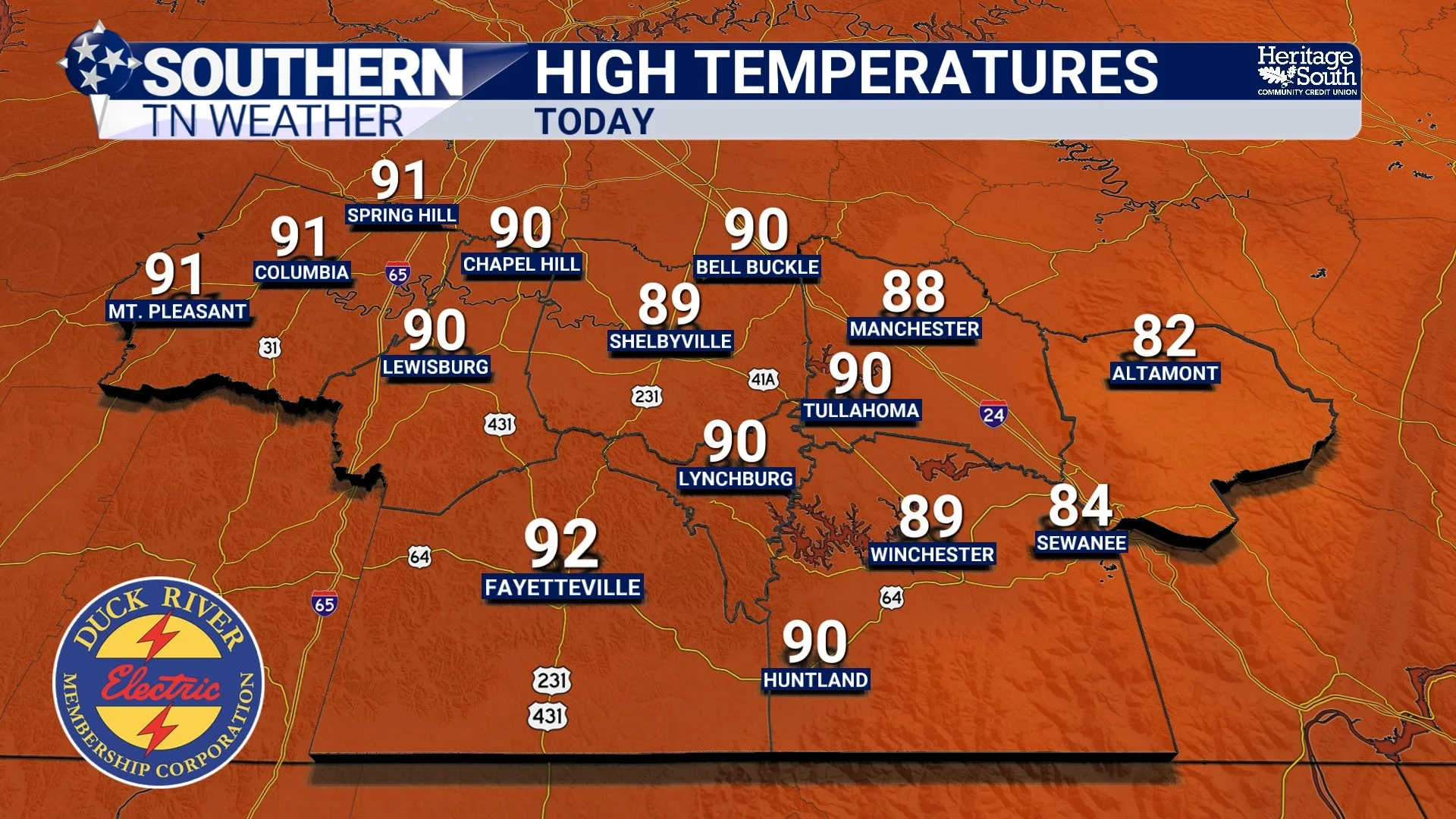
HIGH TEMPERATURES - TODAY
Thursday Looks Even Better
As nice as today feels, Thursday could end up being the best day of the week. Morning temperatures will start out in the 60s, and a few of our higher elevations along the Cumberland Plateau could briefly dip into the upper 50s. That's something we certainly haven't been talking about much lately. By afternoon, highs will climb into the middle and upper 80s under mostly sunny skies with comfortably low humidity still in place.
If you've been putting off mowing the yard, taking a walk, or tackling outdoor projects because of the heat, Thursday may be your best opportunity. Friday looks very similar, although temperatures will begin creeping upward just a bit.
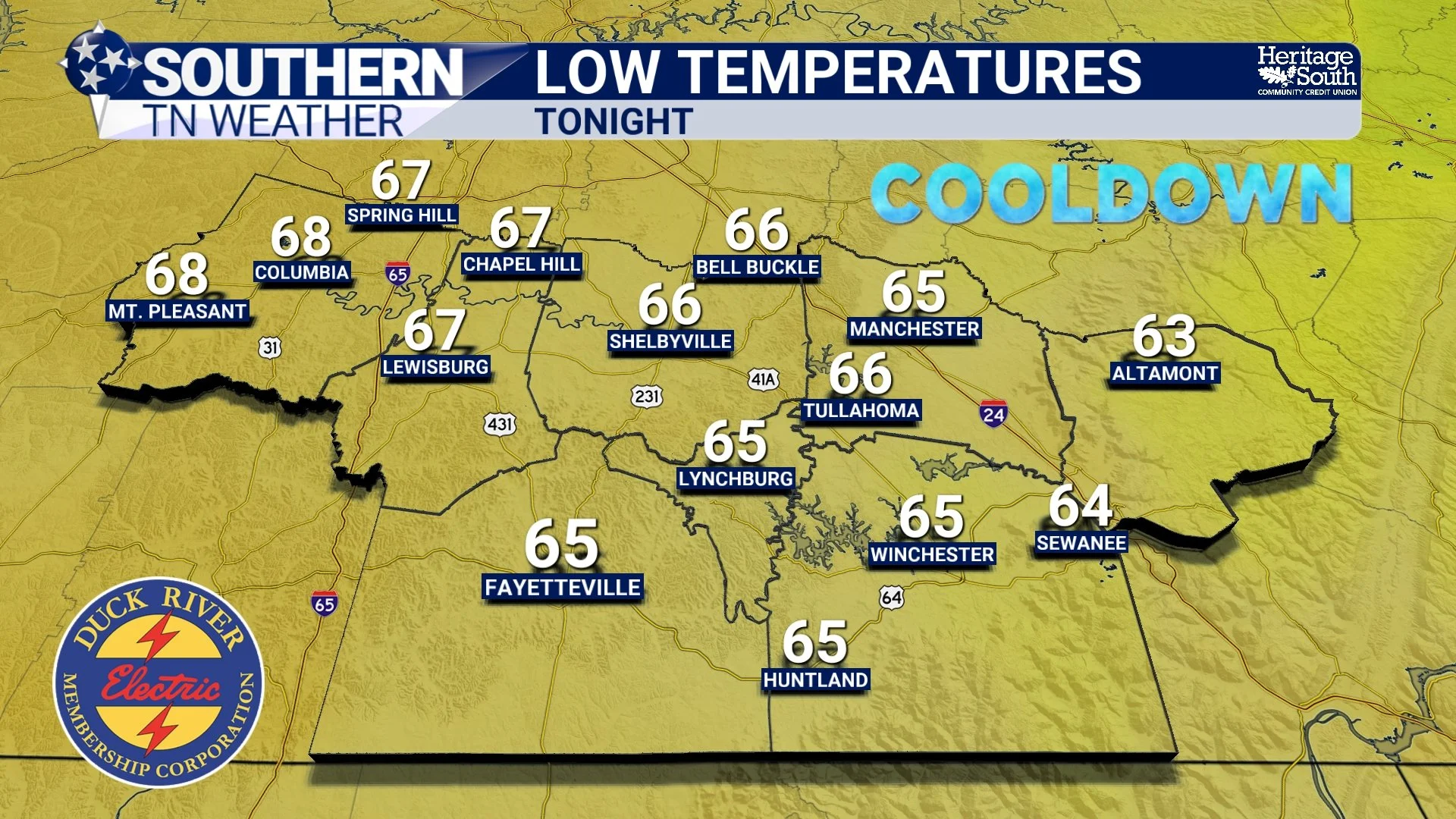
LOW TEMPERATURES - TONIGHT
The Weekend Brings A Pattern Change
Unfortunately, our break won't last forever. Clouds will begin increasing Friday afternoon ahead of a fairly organized weather system moving out of the Midwest. Showers and thunderstorms should become more widespread Friday night before continuing at times through much of the weekend. Current forecast guidance suggests many communities could receive between one-half inch and one and a half inches of rainfall through the weekend, although locally higher amounts will certainly be possible where thunderstorms repeatedly move over the same areas.
Right now, the primary concern appears to be heavy rainfall, not severe weather. While we'll continue monitoring trends over the next couple of days, forecast guidance continues to show only a limited signal for organized severe storms.
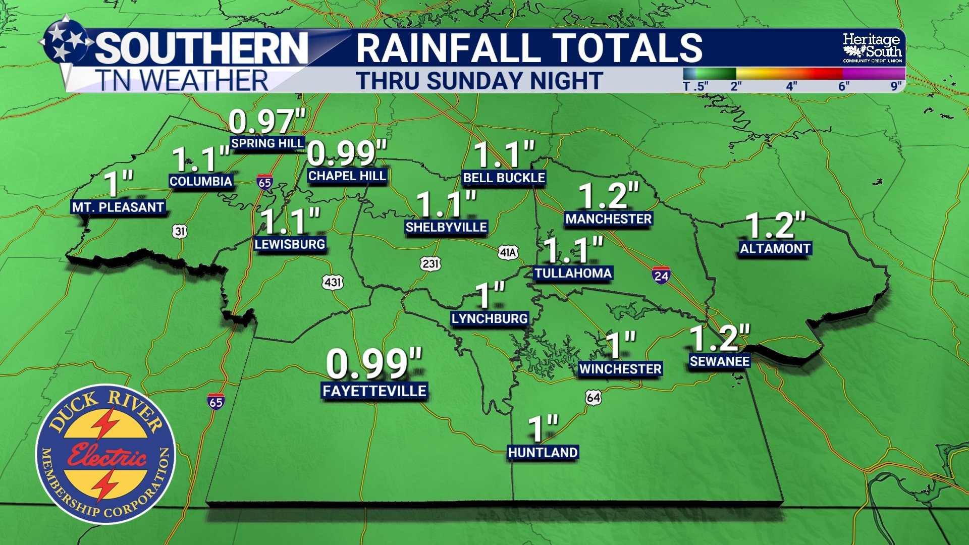
RAINFALL TOTALS THRU SUNDAY NIGHT
Enjoy It While You Can
As we head into next week, temperatures and humidity will gradually begin increasing once again, bringing us back toward a more typical early August weather pattern. That doesn't mean another dangerous heat wave is immediately around the corner, but it does mean this stretch of comfortable weather is only temporary. So if you've been waiting for an excuse to eat dinner on the porch, roll the windows down during your drive home, or simply spend a little extra time outside... This is your time to shine!
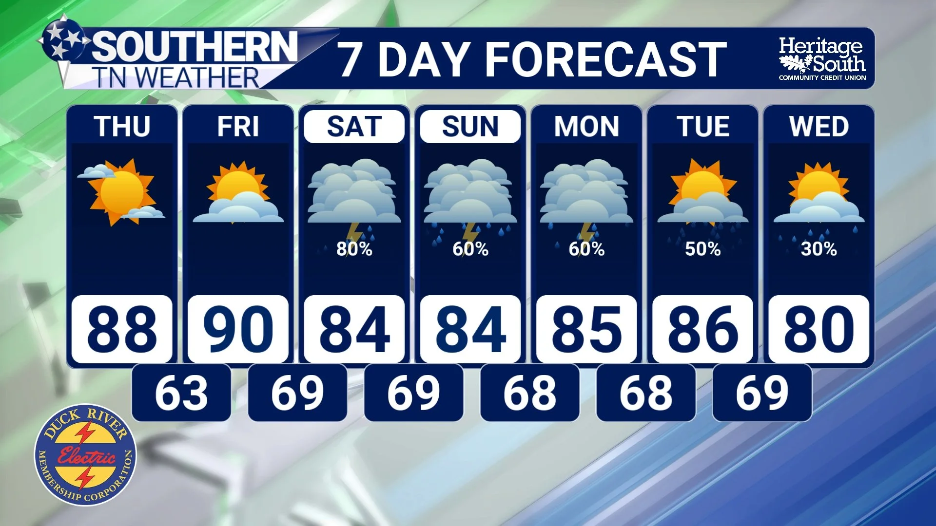
STNWX 7-DAY FORECAST
The Bottom Line 🧾
😌 Southern Middle Tennessee is finally getting a small break from the heat and humidity.
🌡️ Temperatures remain seasonable, but much lower humidity is making it feel dramatically more comfortable.
☀️ Thursday looks to be the nicest day of the week, with highs in the 80s and refreshingly dry air.
🌧️ Rain and thunderstorm chances increase Friday night and continue through much of the weekend.
🌊 Heavy rainfall currently appears to be the primary concern, while the severe weather threat remains low.
🍃 Enjoy the comfortable weather while it lasts—it's about as pleasant as late July gets in Tennessee.
📰 Reminder: The Southern Tennessee Weather Blog, presented by Heritage South Community Credit Union, is updated Monday through Friday with fresh, locally tailored forecasts you can trust.
