
Active Weather Takes Us Through The Weekend: Latest Details Here

The Southern Tennessee Weather Blog is proudly presented by Heritage South Community Credit Union.
We Help When Others Won’t!
Visit https://www.heritagesouth.org/ today to see how HSCCU can help YOU!
After several days of ordinary summertime pop-up thunderstorms, we're transitioning into a weather pattern that's a little more concerning: northwest flow.
During the summer, a large dome of high pressure often parks itself across the southern United States. Air circulates clockwise around that high, placing Tennessee beneath northwesterly winds several miles above the ground. Those upper-level winds act like a conveyor belt, carrying clusters of thunderstorms that develop across the Midwest southeastward into the Tennessee Valley.
Unlike your typical afternoon pop-up storm that forms from daytime heating, northwest flow setups can produce multiple rounds of thunderstorms at almost any time of day or night. They're also much more likely to organize into clusters capable of producing damaging wind gusts, torrential rainfall, and frequent lightning. That's exactly the pattern we'll be dealing with through the weekend. The biggest concern isn't widespread severe weather. Instead, it's the potential for repeated rounds of heavy rain, which is why a Flood Watch is now in effect through Sunday evening for our northern counties (Bedford, Coffee, Grundy, Marshall, and Maury).
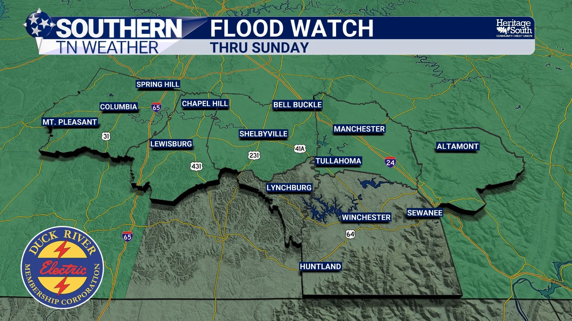
FLOOD WATCH - THIS WEEKEND
Flooding Becomes The Main Concern
The atmosphere is loaded with tropical moisture, meaning any thunderstorm that develops will be capable of producing torrential rainfall in a short amount of time. Unlike a fast-moving cold front that brings one line of storms before moving out, this setup favors multiple waves of showers and thunderstorms moving across the same general areas. Some of these storms will be locally developed during the afternoon, while others may arrive as organized clusters riding southeast along the northwest flow pattern.
If storms repeatedly track over one location, rainfall can quickly add up, leading to localized flash flooding. Remember, flooding doesn't have to occur along a river. Urban streets, low-lying areas, small creeks, and poor drainage locations can flood quickly during heavy downpours. If you encounter a flooded roadway, Turn Around, Don't Drown. It only takes a small amount of moving water to sweep away a vehicle. 2-4 inches of rain is the current forecast.
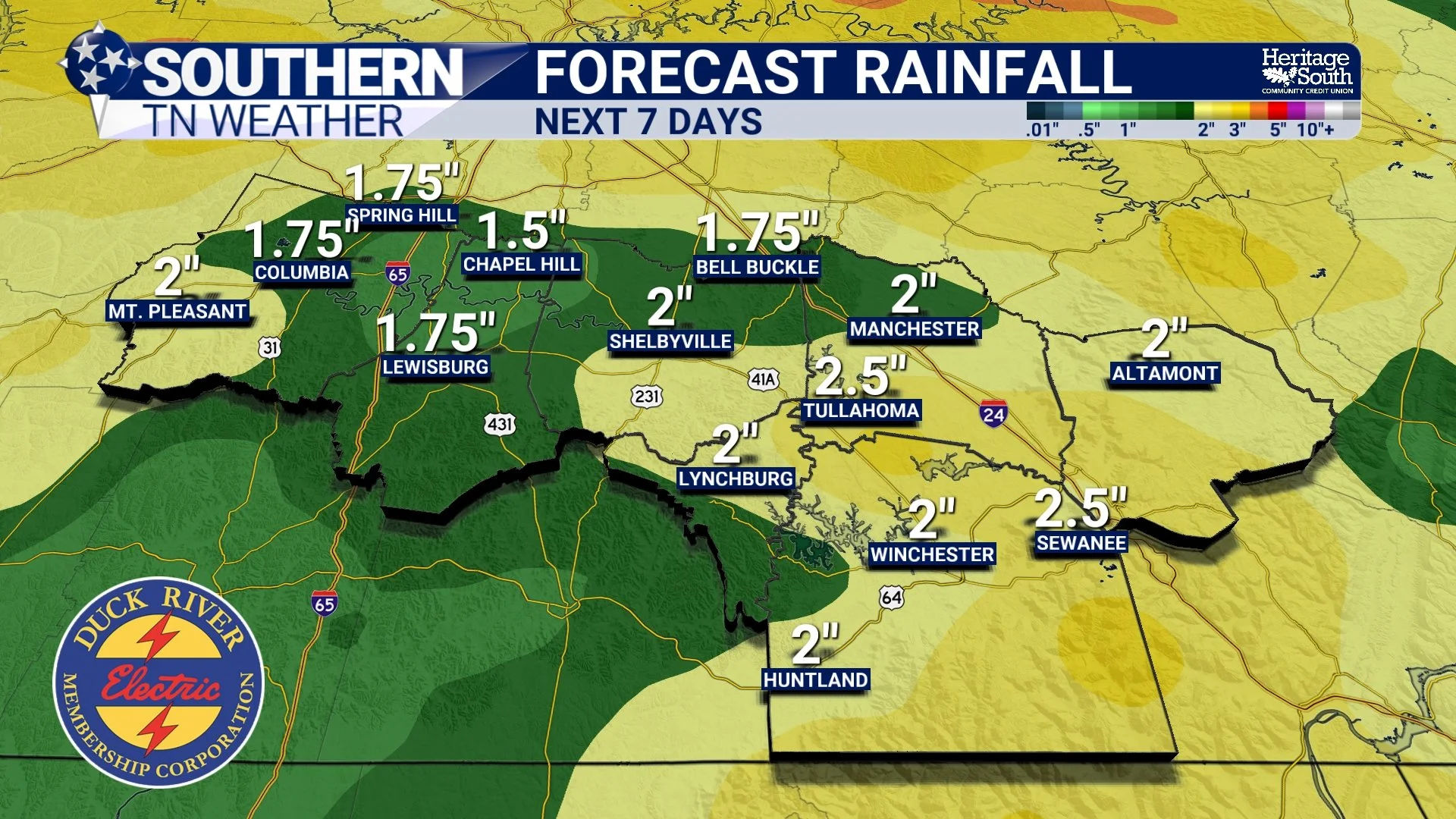
FORECAST RAINFALL - NEXT 7 DAYS
There Is Still A Low-End Severe Weather Risk
Although flooding is the primary concern, we can't completely ignore the severe weather threat. The Storm Prediction Center has placed Southern Middle Tennessee under a Marginal Risk (Level 1 of 5) for severe thunderstorms through Sunday. A Marginal Risk doesn't mean everyone will experience severe weather. Instead, it means a few isolated severe storms are possible, especially within any organized complexes that move through the region.
The primary severe weather hazard will be damaging straight-line wind gusts, capable of knocking down trees and producing isolated power outages. Frequent lightning and torrential rainfall will accompany the stronger storms as well. Wind shear remains fairly weak overall, which should limit the number of organized severe storms. However, northwest flow events have a history of producing pockets of damaging winds, so it's something we'll continue monitoring closely through the weekend.
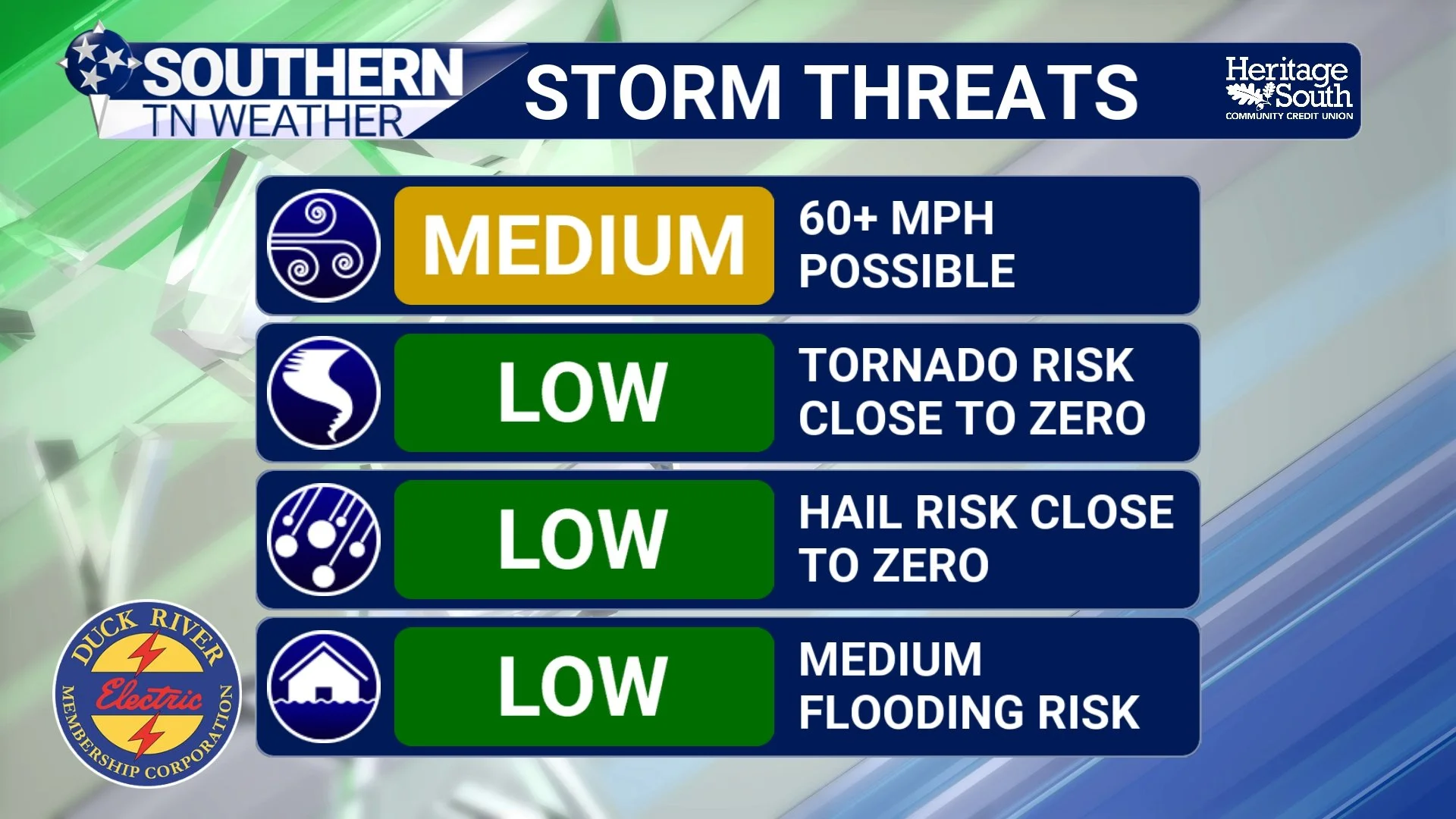
STORM THREATS - THIS WEEKEND
Why This Forecast Will Continue To Change
If you've noticed the forecast changing a little from day to day, there's a good reason for it. Northwest flow patterns are notoriously difficult to forecast several days in advance. Small-scale disturbances, leftover outflow boundaries from previous thunderstorms, and where storms develop upstream across the Midwest all play a role in determining what happens here.
A cluster of storms that forms a little farther north or south than expected can completely change where the heaviest rain falls across Tennessee. That's why you'll likely continue seeing adjustments to timing and rainfall coverage over the next couple of days. The overall message won't change, though: multiple rounds of storms are expected, with flooding becoming the primary concern.
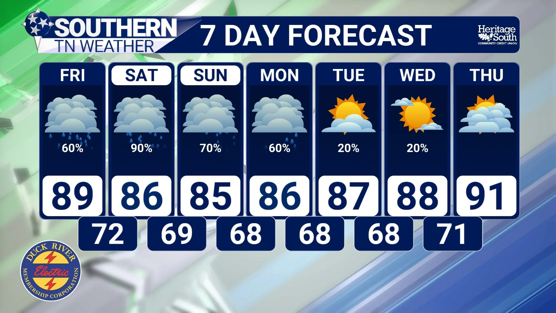
STNWX 7-DAY FORECAST
Better News Next Week
There is finally some encouraging news in the forecast. The northwest flow pattern should begin relaxing early next week, allowing humidity levels to slowly come down. Afternoon showers and thunderstorms won't disappear completely, but they should become more typical for July instead of arriving in organized waves.
It won't be cool by any means, but stepping outside should no longer feel like walking into a swimming pool.
The Bottom Line 🧾
We're transitioning into a classic northwest flow weather pattern through the weekend.
A Flood Watch remains in effect through Sunday evening for all of Southern Middle Tennessee.
Multiple rounds of showers and thunderstorms are expected, including some arriving in organized clusters.
Flooding is the primary concern, especially where storms repeatedly move over the same locations.
A Marginal Risk (Level 1 of 5) for severe weather remains in place through Sunday.
Damaging wind gusts are the primary severe weather hazard with the strongest storms.
Conditions become a little less humid next week, although typical afternoon shower and thunderstorm chances will continue.
📰 Reminder: The Southern Tennessee Weather Blog, presented by Heritage South Community Credit Union, is updated Monday through Friday with fresh, locally tailored forecasts you can trust.
