
Weekend Outlook: Storm Chances Increase Before Next Week's Heat Builds

The Southern Tennessee Weather Blog is proudly presented by Heritage South Community Credit Union.
We Help When Others Won’t!
Visit https://www.heritagesouth.org/ today to see how HSCCU can help YOU!
After several days of the typical summertime "hit-or-miss" showers and thunderstorms, we're beginning to transition into a slightly more active pattern as we head into the weekend. The good news? WIDESPREAD severe weather is not expected (a few still could be strong). The not-so-good news? Rain chances will increase, especially Saturday night, and the hottest weather we've seen in a couple of weeks is waiting just around the corner.
One More Typical Summer Day
Thursday's forecast is about as typical as it gets for mid-July. A very moisture-rich atmosphere remains in place across Southern Middle Tennessee, so a few scattered showers and thunderstorms will develop during the afternoon and evening. Like we've seen much of this week, storms will be slow-moving thanks to weak steering winds.
That means any thunderstorm that develops will be capable of producing torrential rainfall in a short amount of time, frequent lightning, and some localized ponding of water. Fortunately, the atmosphere still lacks the wind shear needed to organize severe thunderstorms. Most locations, however, won't see rain at all.
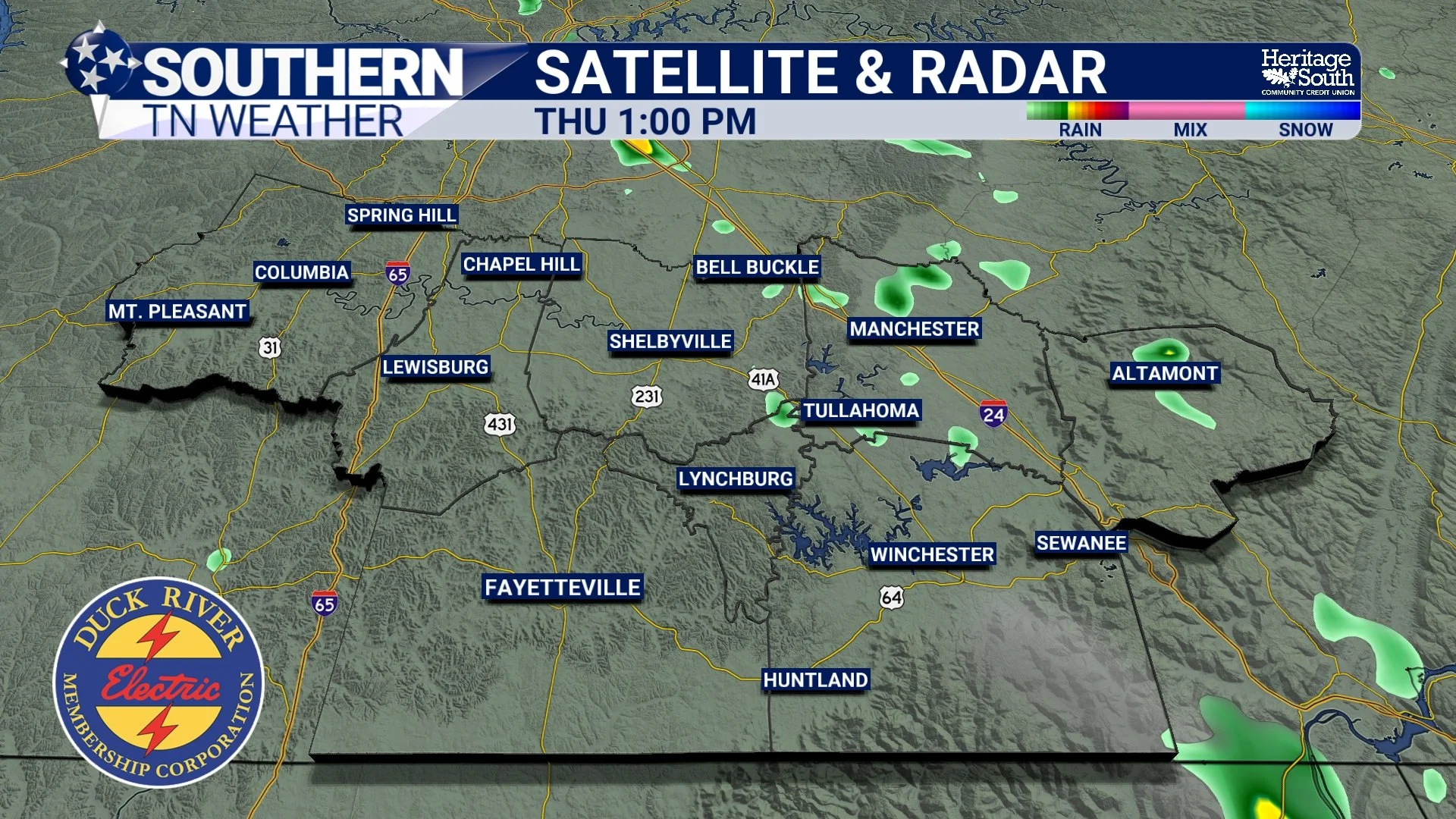
SAT RAD - THURSDAY AFTERNOON
Rain Chances Begin Increasing Friday
By Friday, the weather pattern begins changing. A few weak disturbances riding along the northern edge of a strengthening ridge of high pressure will begin moving toward Tennessee. Those disturbances provide additional lift in the atmosphere, allowing showers and thunderstorms to become a little more numerous than they've been over the past couple of days.
Not everyone will receive rain, but coverage should increase compared to Thursday.
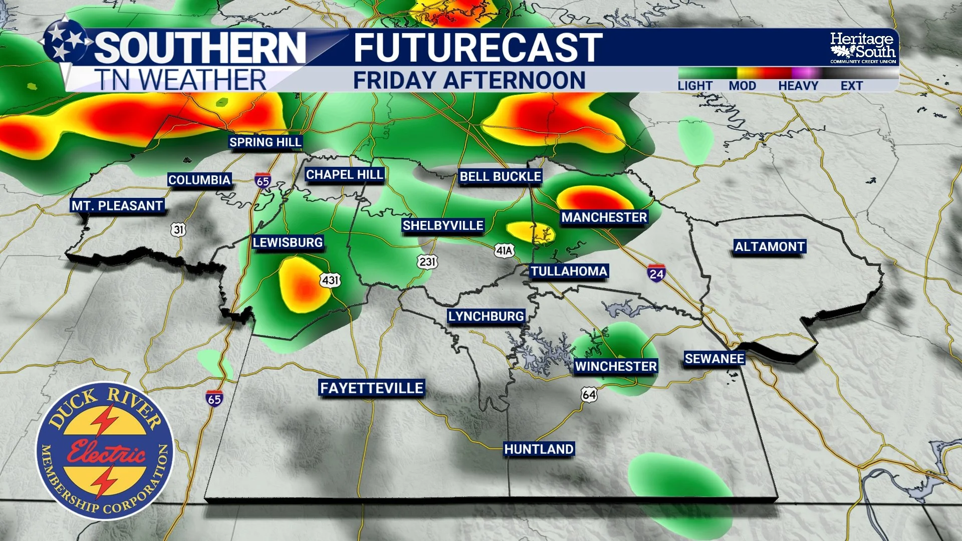
FUTURECAST - FRIDAY AFTERNOON
Saturday Looks Like The Most Active Day
At this point, Saturday appears to have the greatest potential for widespread showers and thunderstorms. A stronger disturbance is expected to move through the Tennessee Valley Saturday evening into Saturday night. While we're not expecting a widespread severe weather outbreak, this system should provide enough organization to produce a more concentrated area of showers and thunderstorms than we've seen recently.
The primary concern continues to be damaging wind gusts, especially with stronger storm outflow. The atmosphere simply doesn't have enough wind shear or steep lapse rates to support a significant hail or tornado threat, but gusty winds capable of downing a few tree limbs certainly can't be ruled out. Heavy rainfall will remain another concern, especially where storms repeatedly move over the same locations. Localized flooding and ponding of water will once again be possible.
One thing we'll continue watching over the next couple of days is timing. Small changes in when this disturbance arrives could have a big impact on when storms are most widespread Saturday.
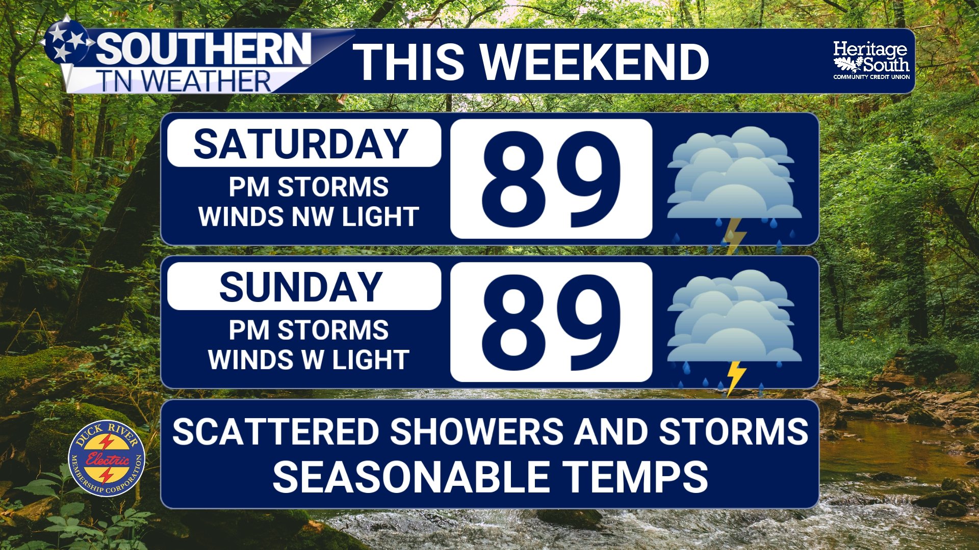
FORECAST - THIS WEEKEND
Then... The Heat Turns Up
Once we move into early next week, our attention quickly shifts from thunderstorms back to the heat. Temperatures will steadily climb into the lower and middle 90s while humidity continues increasing. Heat index values should reach the upper 90s to lower 100s over the weekend before climbing even higher early next week. Right now, Tuesday appears to be the hottest day of the forecast.
Forecast guidance suggests heat index values could reach or even exceed 105 degrees across much of Southern Middle Tennessee. That's approaching Heat Advisory criteria, and we'll be watching closely to see if heat headlines become necessary over the next several days. The good news is that a cold front is currently expected to move through Tuesday night, bringing temperatures back closer to normal for the second half of next week.
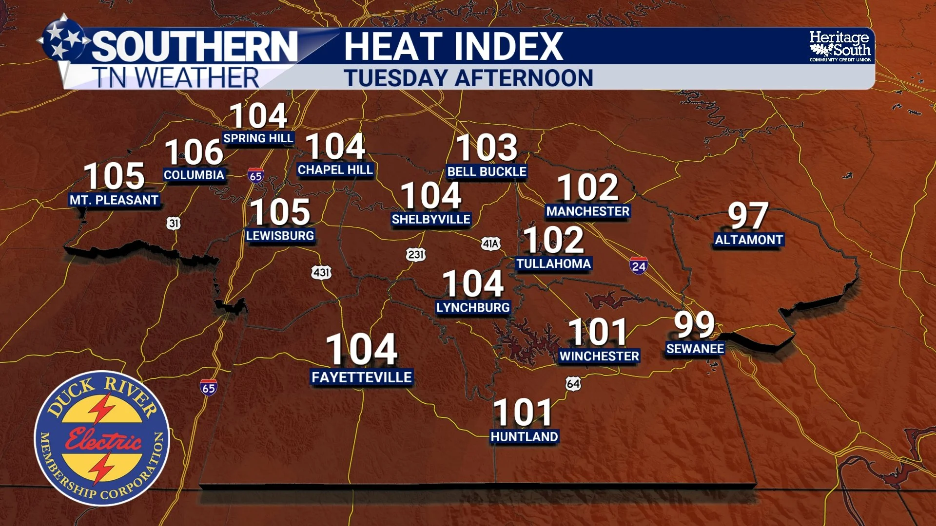
HEAT INDEX - TUESDAY AFTERNOON
The Bottom Line 🧾
Isolated to scattered afternoon storms continue Thursday.
Rain chances increase Friday as weak disturbances move into the region.
Saturday currently looks like the wettest and most active day of the weekend.
A few stronger storms Saturday evening could produce damaging wind gusts and heavy rainfall.
Localized flooding remains possible with slow-moving storms.
Heat and humidity continue building through the weekend.
Tuesday currently looks to be the hottest day, with heat index values potentially reaching 105° or higher before a cold front brings some relief.
📰 Reminder: The Southern Tennessee Weather Blog, presented by Heritage South Community Credit Union, is updated Monday through Friday with fresh, locally tailored forecasts you can trust.
