
WEATHER BLOG
Presented By:

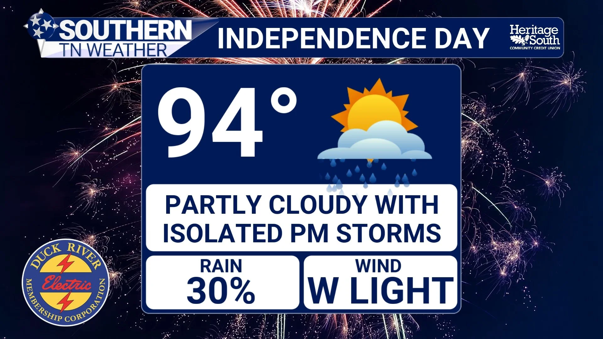
Independence Day: In-Depth Forecast Here
Happy Birthday, America! The Fourth of July is finally here, and after one of the hottest stretches we've experienced in several years, I have some encouraging news. While the heat certainly isn't going away, we're finally beginning to see the weather pattern change ever so slightly. Temperatures will ease down a couple of degrees, and while scattered thunderstorms remain in the forecast, this does not look like an all-day washout.
That said, there are still a few weather concerns you'll want to keep in mind before heading out to parades, cookouts, the lake, or your favorite fireworks show.
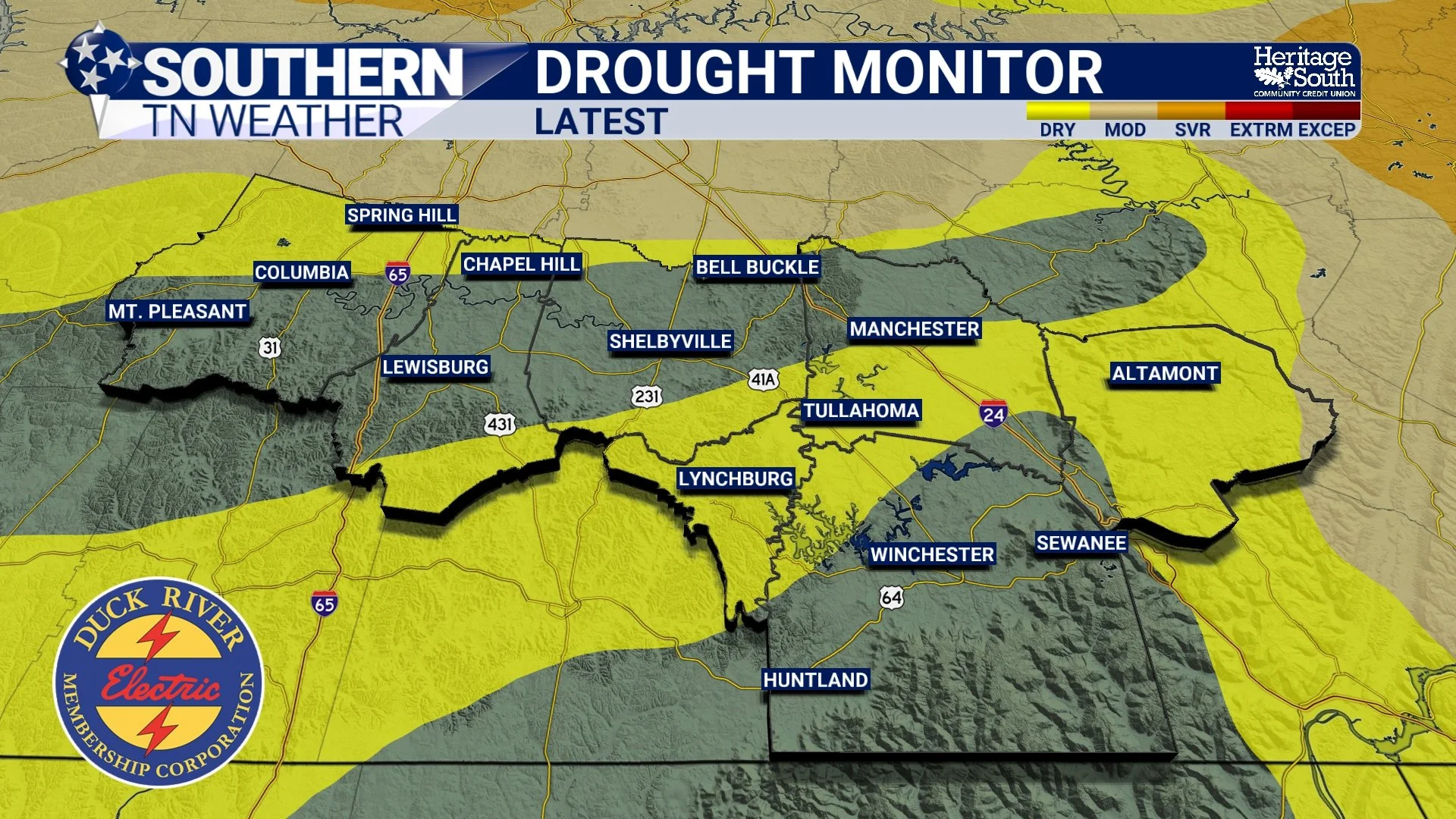
Drought Improving, But Heat & Storms Continue Into The Holiday Weekend
We've spent the past week talking almost exclusively about dangerous heat, heat indices over 110 degrees, and the daily chance for a few strong afternoon thunderstorms. Those remain the primary weather stories through the Independence Day weekend. But today, I wanted to highlight something we don't get to talk about very often. For many of us, the drought is officially over!
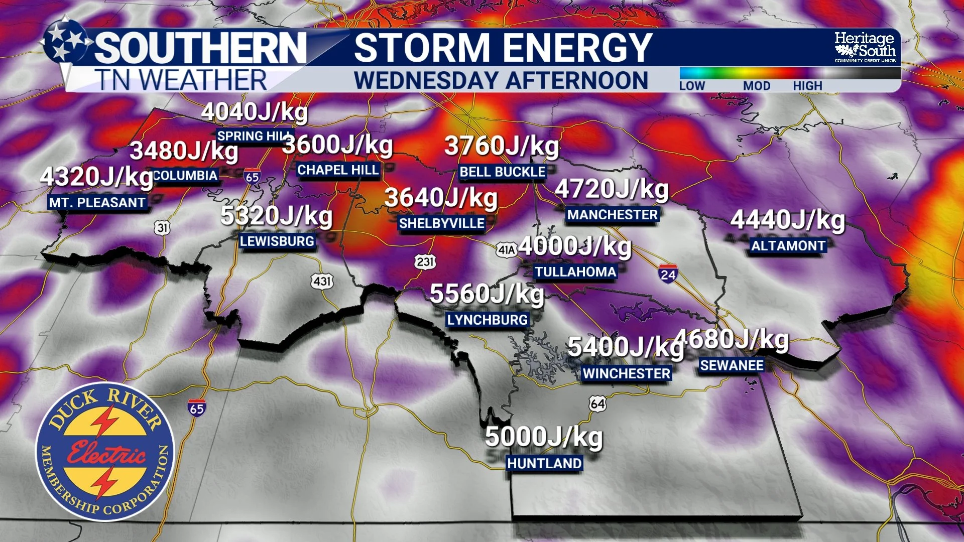
Low-End Severe Storm Risk This Afternoon & Evening
After several days of talking almost exclusively about the dangerous heat, today finally gives us something else to watch. The Storm Prediction Center has upgraded southern portions of our coverage area to a SLIGHT RISK (Level 2 of 5) for severe thunderstorms this afternoon and evening, while the remainder of Southern Middle Tennessee remains under a MARGINAL RISK (Level 1 of 5). This is not a widespread, high-end severe weather setup like we often see during the spring. Instead, this is a classic summertime pattern where only a few storms become severe—but the ones that do can become intense in a hurry.
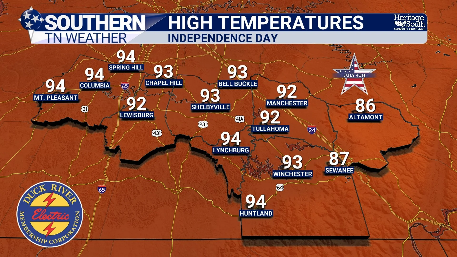
First Look Forecast for Independence Day
With Independence Day just a few days away, I've been getting one question more than any other: "What's the weather going to be like on the Fourth?"
The good news is that we're finally getting close enough for forecast confidence to improve. While there are still a few details to fine-tune, the overall weather pattern is becoming much clearer. Before we get there, though, we have to get through one of the hottest stretches of weather we've seen in over a year.
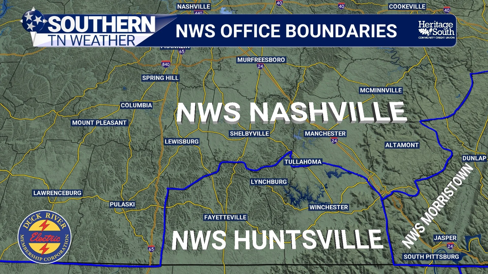
Why Do Weather Alerts Sometimes Seem To "Stop" At The County Line?
If you've lived in Southern Middle Tennessee for very long, you've probably noticed something that can seem a little odd during active weather. A Severe Thunderstorm Warning may include Bedford County, but stop right at the Lincoln County line. A Heat Advisory may cover Coffee County but not Franklin County. Sometimes a Flood Watch appears to end almost perfectly along a county boundary, even though the rain clearly doesn't know where one county ends and another begins.
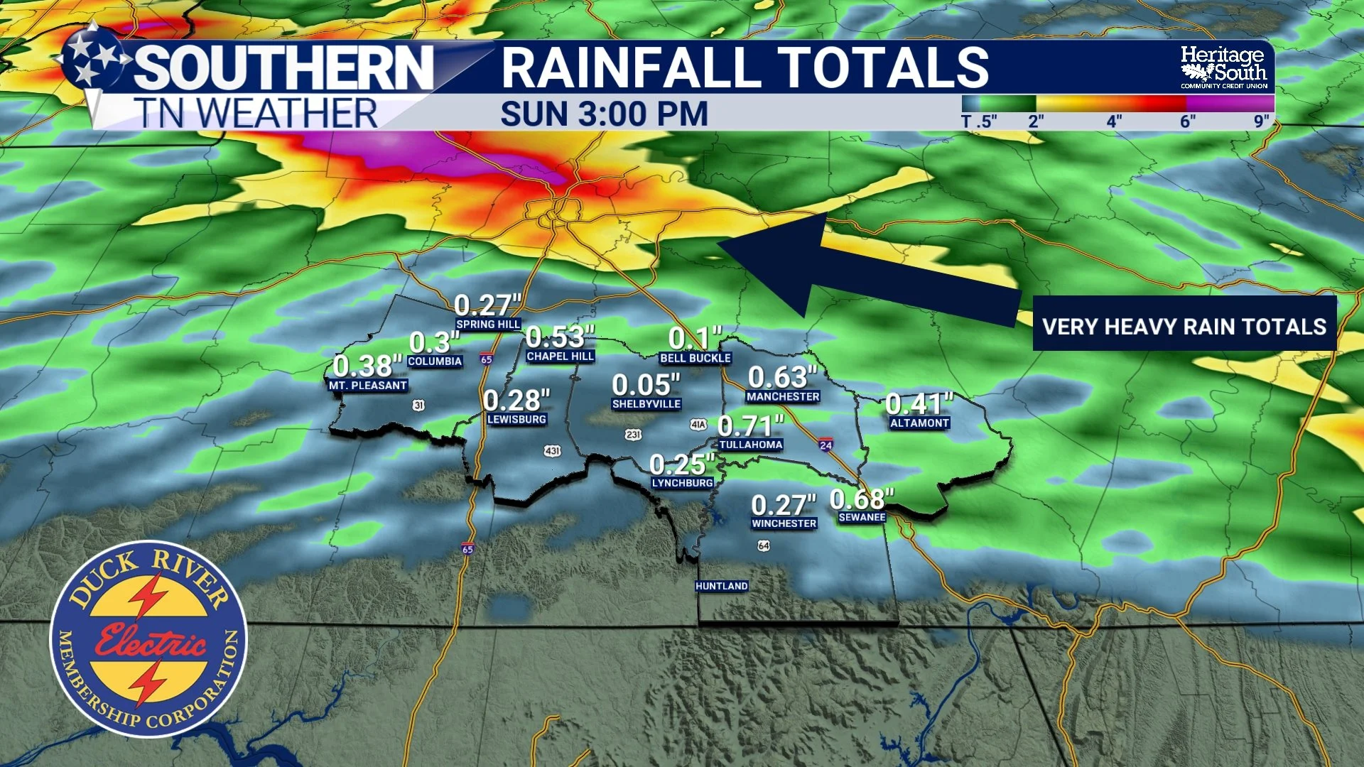
Complicated Forecast for Saturday: Latest Details Here
If you've been following my forecasts over the past couple of days, you've probably noticed that I've been using the word "complicated" quite a bit when talking about Saturday's weather.
There's a good reason for that.
Confidence is high that showers and thunderstorms will develop somewhere across Middle Tennessee this weekend. The challenge isn't determining if storms will form—it's figuring out where they'll form. And in a summertime weather pattern like this, a shift of only 25 to 50 miles can completely change who sees heavy rain, who experiences stronger storms, and who stays mostly dry.
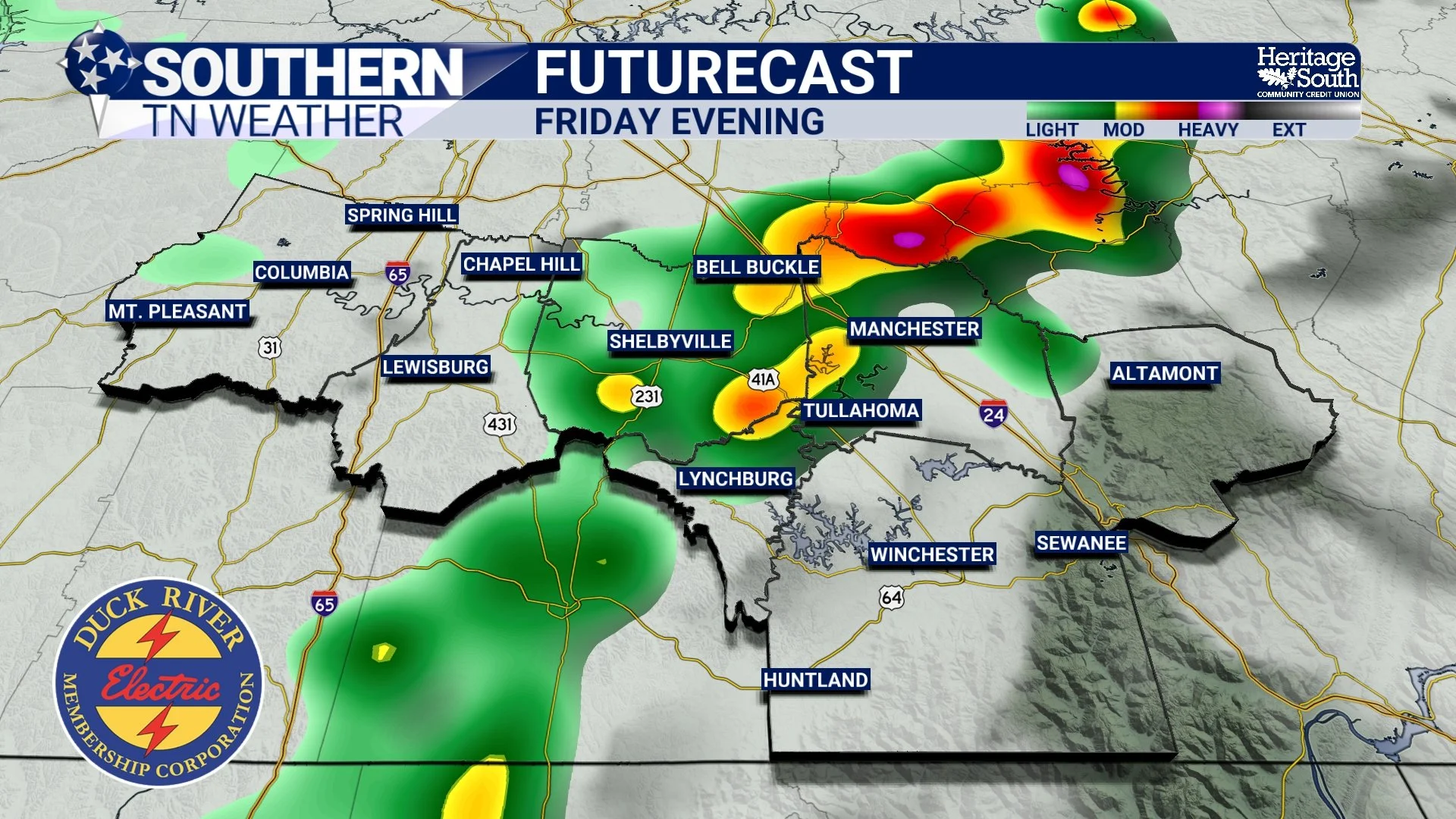
Small Rain Chances Through Sunday
After several days of quiet weather, Southern Middle Tennessee is beginning the transition back into a more active summertime pattern. Fortunately, we're not looking at a washout, but you'll want to keep an eye on the forecast over the next few days as scattered showers and thunderstorms make a return. The bigger weather story, however, may not be the rain at all. Dangerous heat is beginning to take shape for early next week.
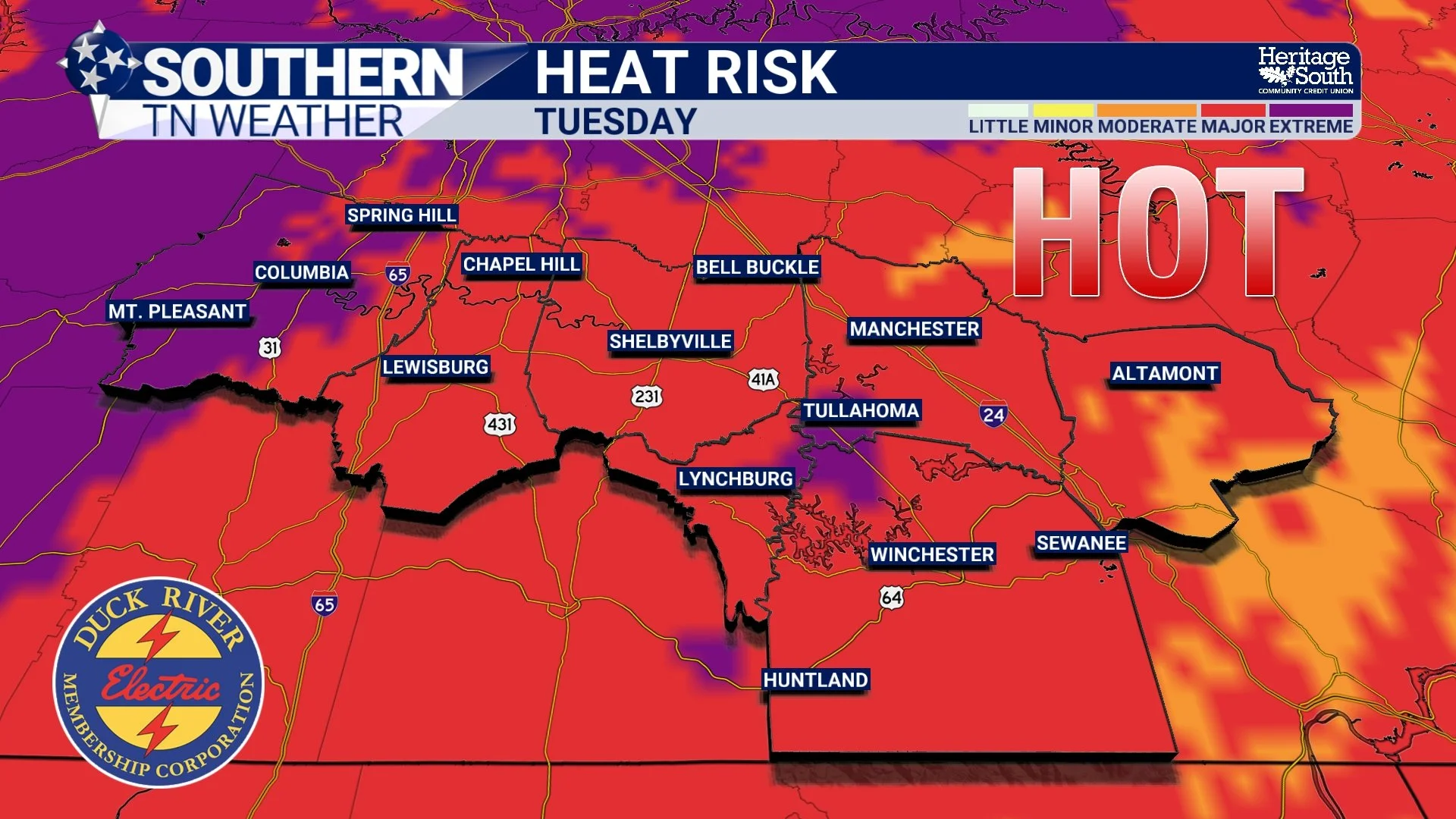
Heat Risk Increasing As We Head Into Next Week
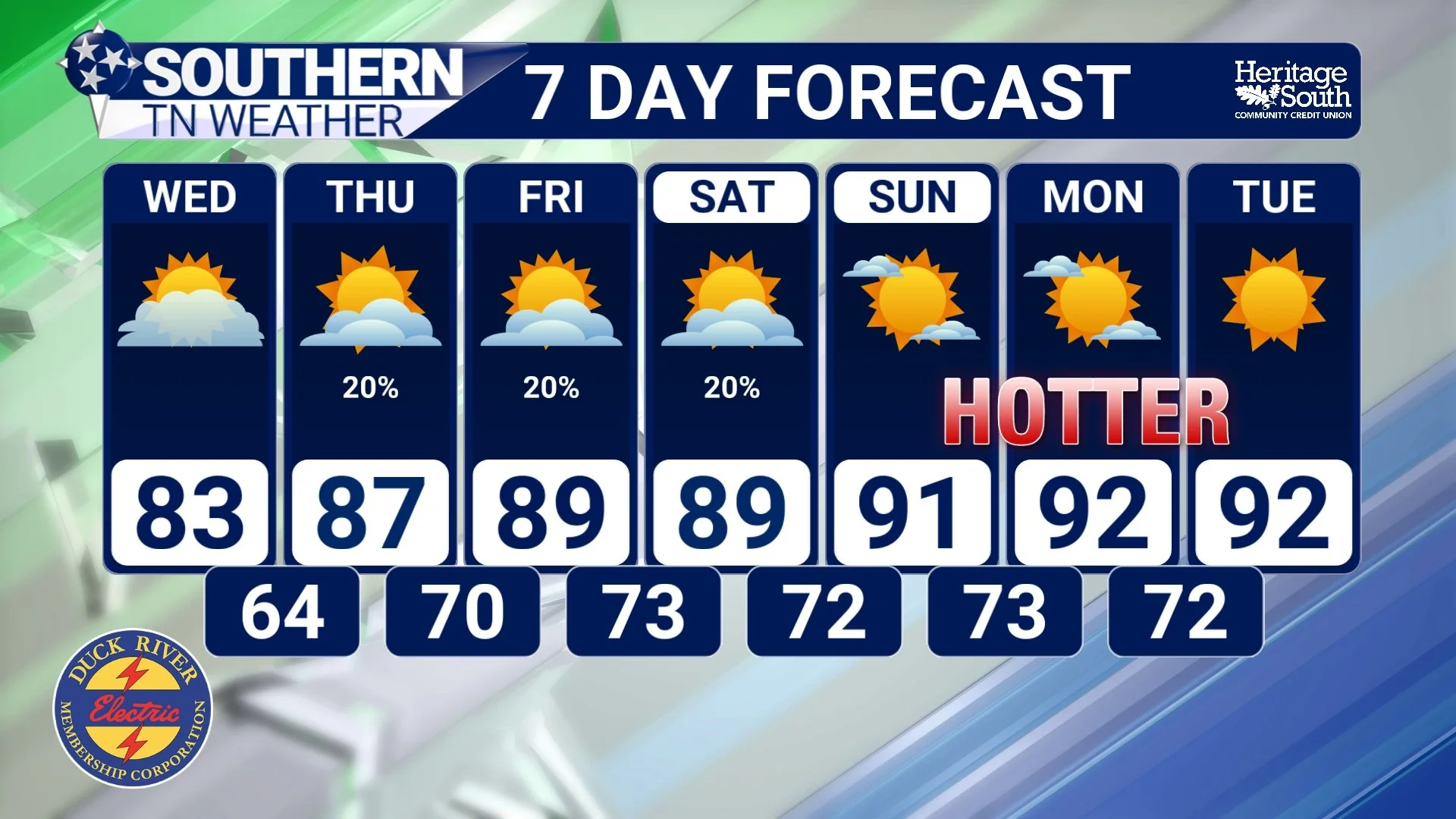
After another beautiful day across Southern Middle Tennessee, our weather pattern is about to begin a gradual transition back toward a more typical late-June setup. That means two things: increasing rain chances and increasing heat.
Tracking The Next Round Of Rain & Heat
After what feels like weeks of talking about severe weather risks, heavy rainfall, flooding concerns, tropical moisture, cold fronts, and popup thunderstorms, Southern Middle Tennessee is finally getting a chance to catch its breath. In fact, today and Wednesday may end up being two of the nicest weather days we've seen all month.
Enjoy The Weekend, But Keep An Eye On Sunday
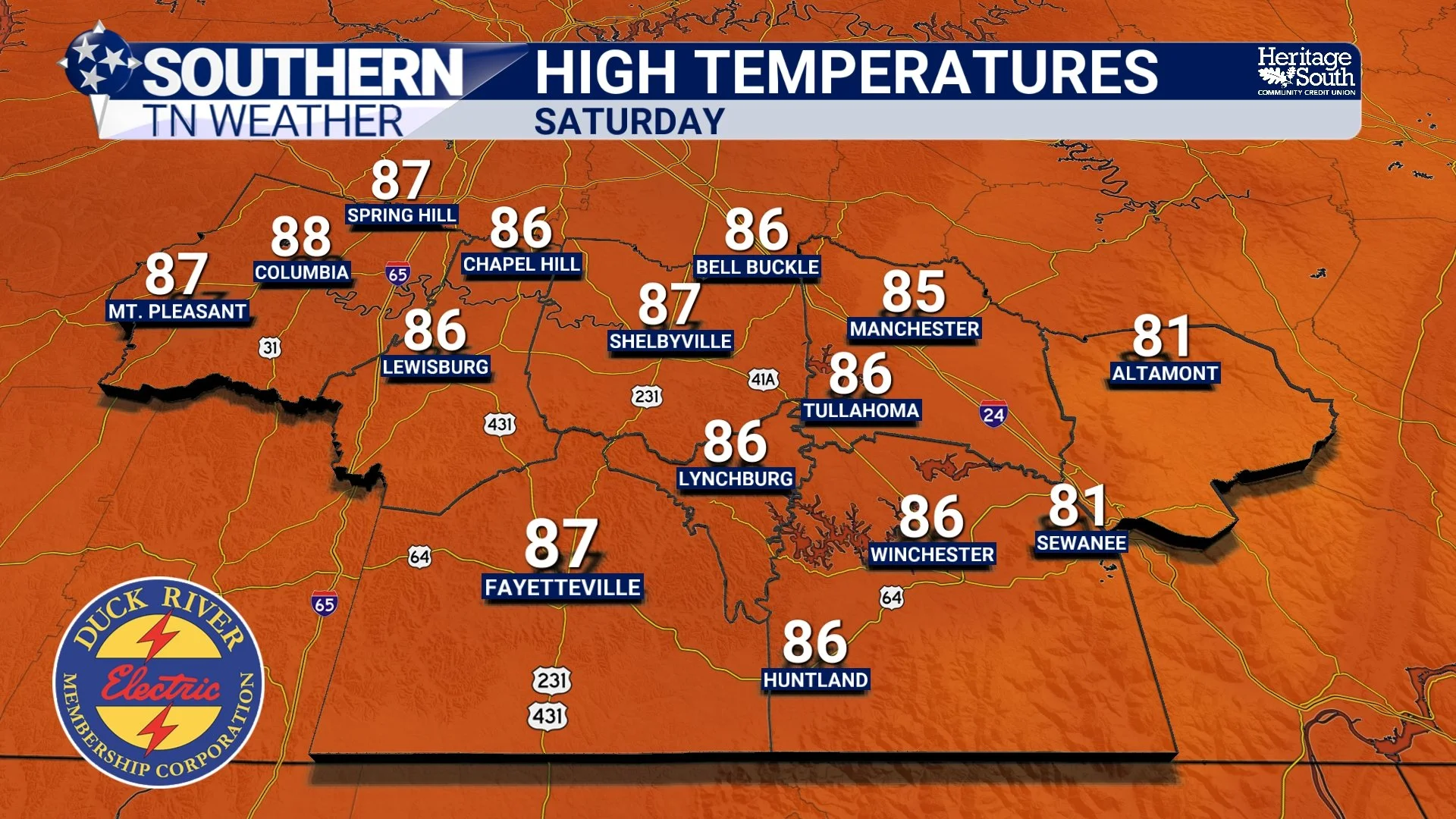
If you've stepped outside today, you've probably noticed something feels... different. After several days of tropical moisture, muggy afternoons, and rounds of thunderstorms, Southern Middle Tennessee is finally getting a well-deserved break. Unfortunately, the atmosphere isn't quite ready to settle down for good.
Drying Out On Friday, But Rain Returns On Sunday
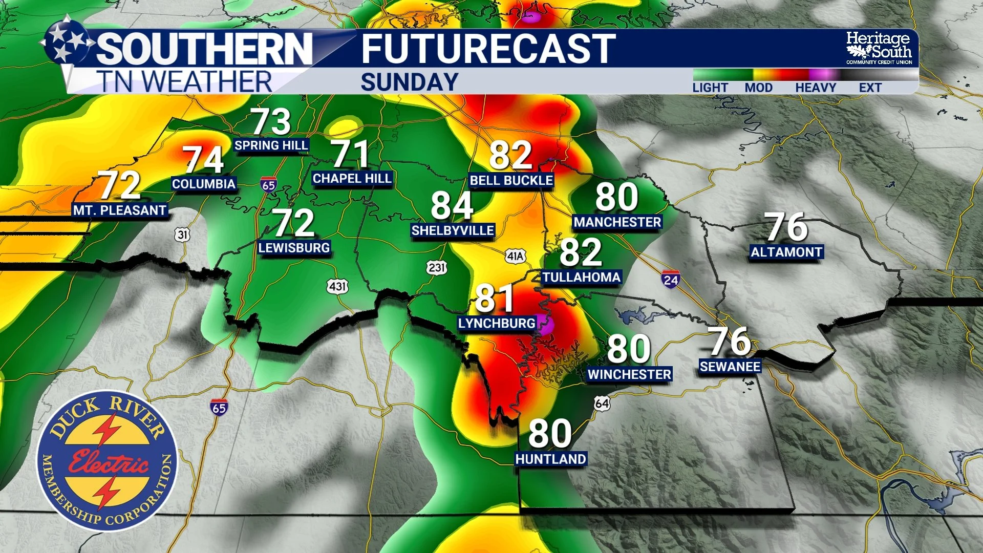
It's been a busy weather day across Southern Middle Tennessee, but thankfully, some of the concern from earlier forecasts has begun to ease. Showers and thunderstorms have blossomed across the region this afternoon as tropical moisture associated with the remnants of Arthur interacts with an approaching cold front. The atmosphere remains loaded with moisture, and scattered heavy downpours will continue to be possible through the evening hours.
A Full Breakdown On What To Expect Thursday
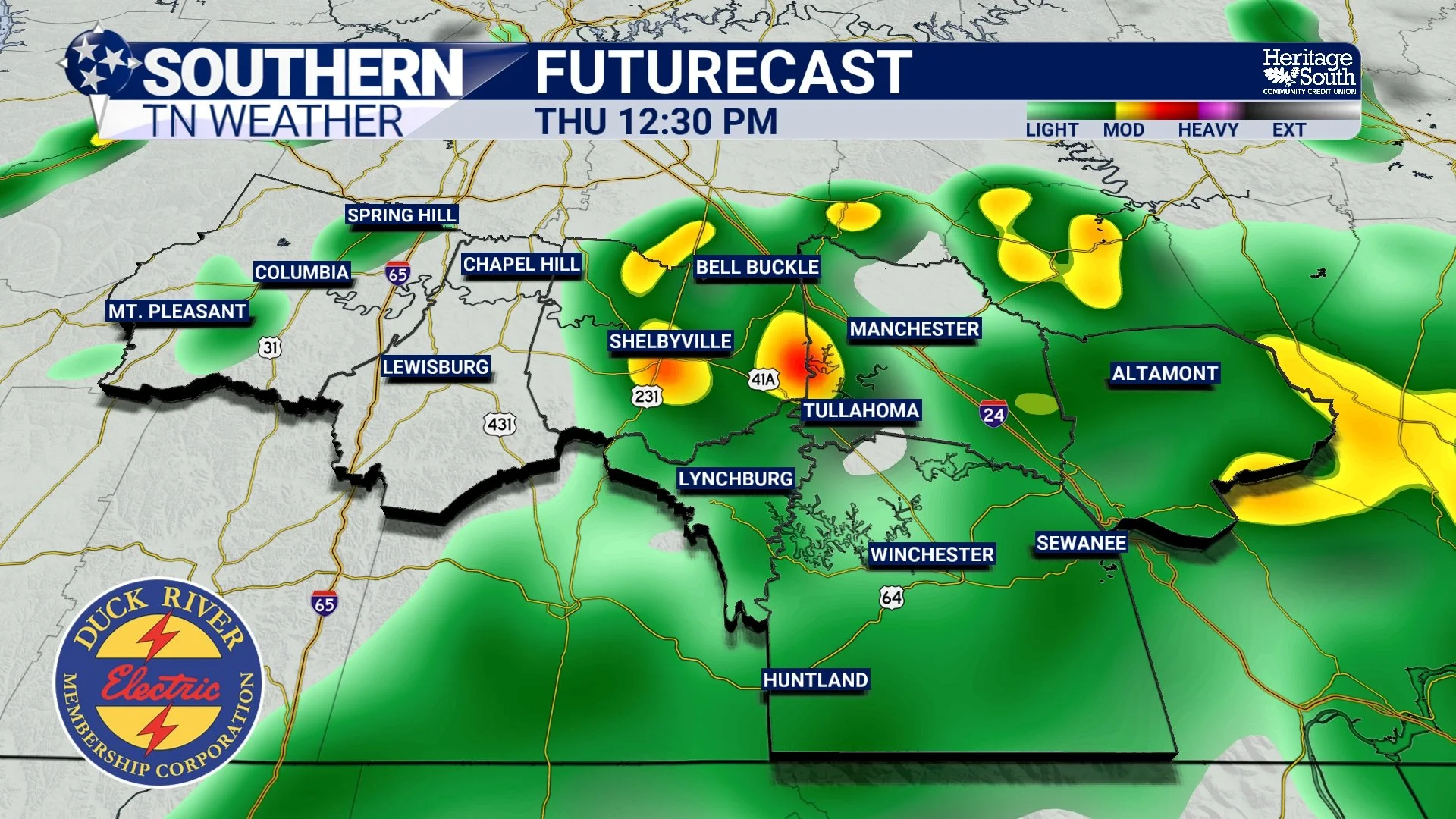
Well, the comfortable weather was nice while it lasted. Over the past few days, Southern Middle Tennessee has enjoyed lower humidity, cool nights, and pleasant afternoons. Unfortunately, that's quickly becoming a distant memory as Gulf moisture surges back into the region.
Today's weather is really the transition day. Tomorrow is when things get interesting. If you've got outdoor plans this week, today is by far your best opportunity to enjoy them before a much more active weather pattern settles in for Thursday and early Friday.
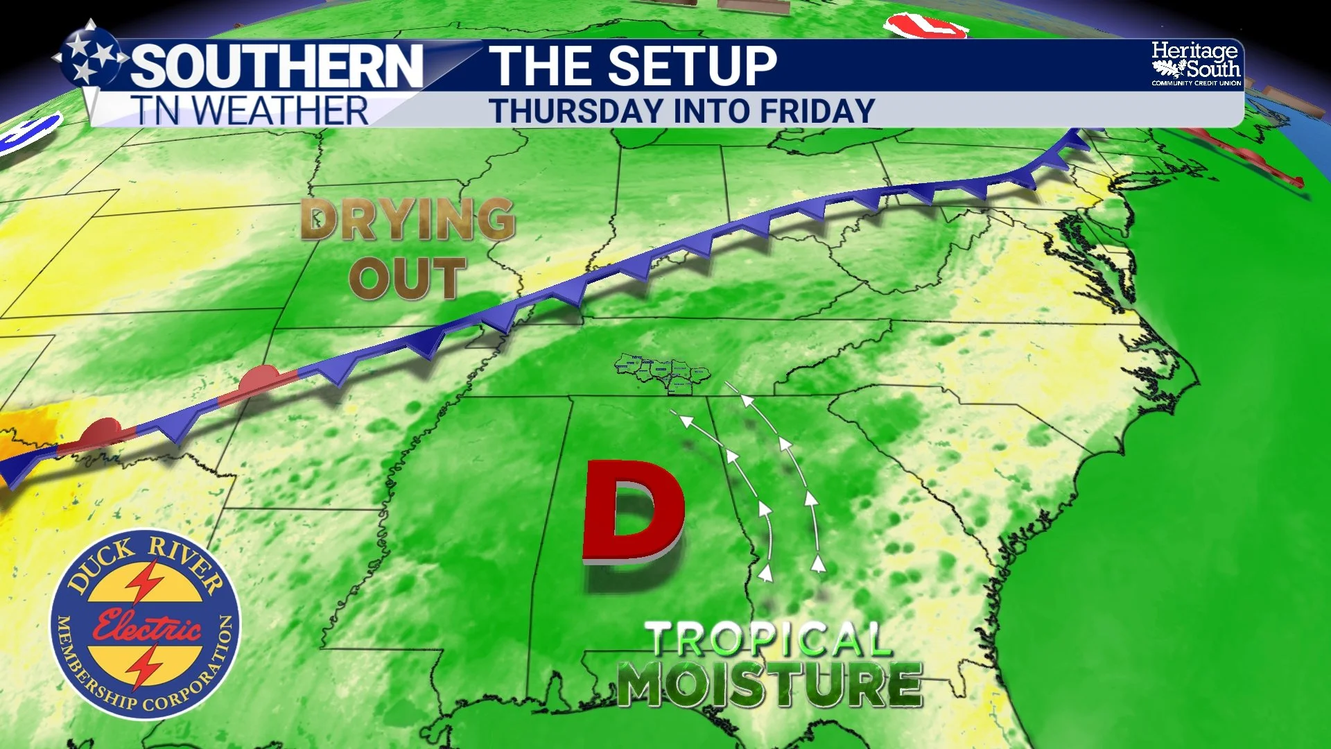
How Will Arthur Impact Us? Here's What To Expect Locally
Whenever a tropical system develops in the Gulf, one of the first questions I get is simple: "Is it coming here?"
The short answer with Arthur is no. The center of the storm is expected to stay well to our south as it moves inland along the Gulf Coast and eventually weakens. Southern Middle Tennessee won't experience tropical storm conditions, storm surge, or anything close to what some on the Gulf Coast will see. But that doesn't mean Arthur won't impact our weather.
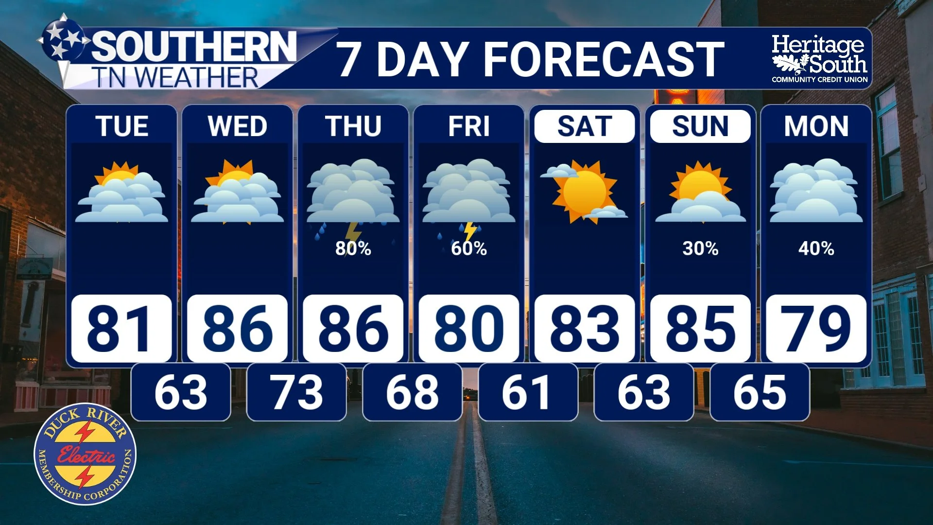
Work Week Outlook: Dry Periods and Some Rain
After the active weather we've dealt with over the past couple of weeks, Southern Middle Tennessee is finally getting a bit of a breather. Notice I said "breather" and not "dry spell."
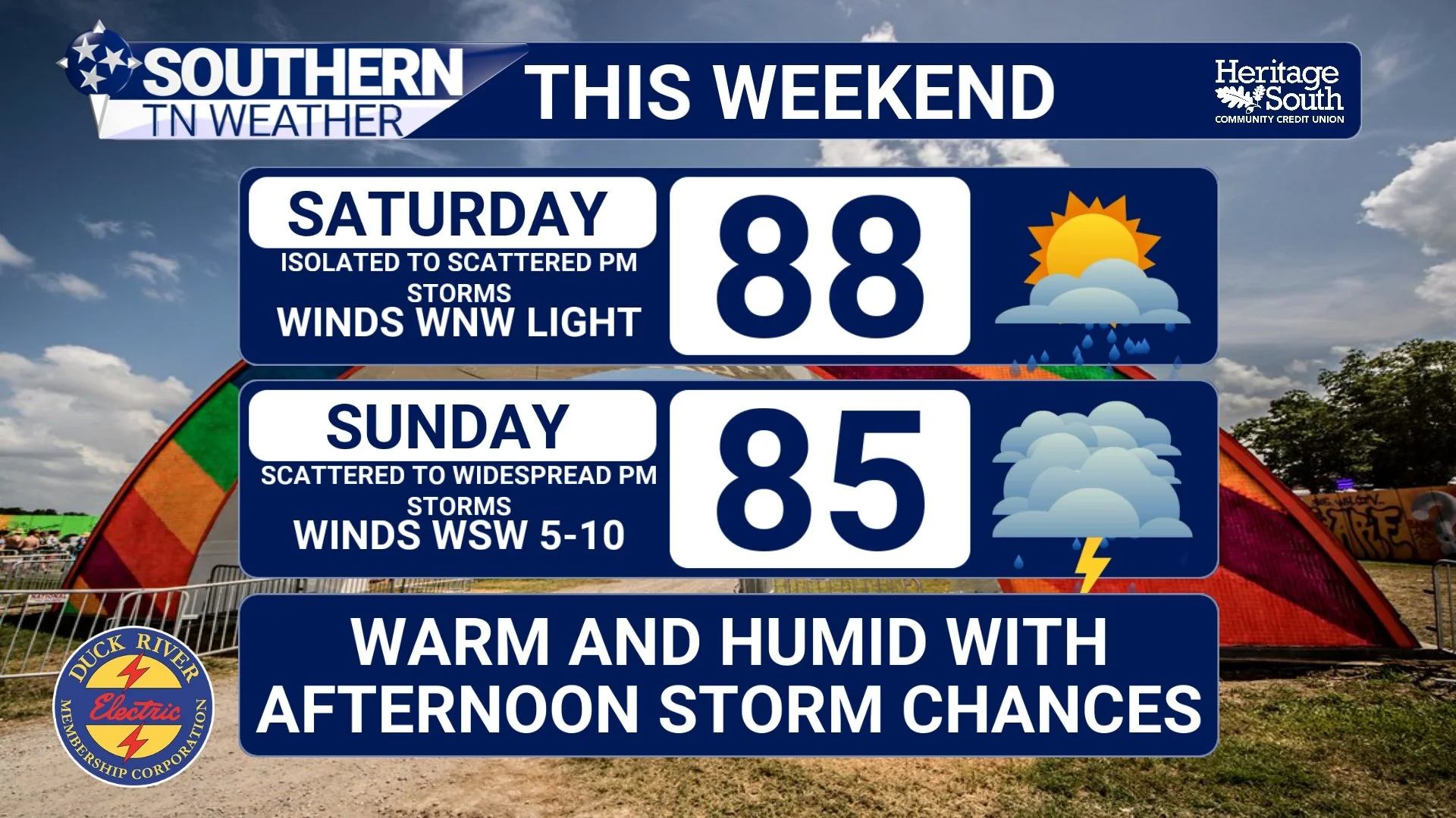
Weekend Forecast: A Little Bit Of Everything
If you've looked outside today, you've probably noticed that Mother Nature couldn't quite make up her mind. This morning's line of showers and thunderstorms weakened as it moved into Southern Middle Tennessee, and for many of us, it was more bark than bite. A few heavier downpours and gusty winds occurred, but widespread severe weather never materialized.
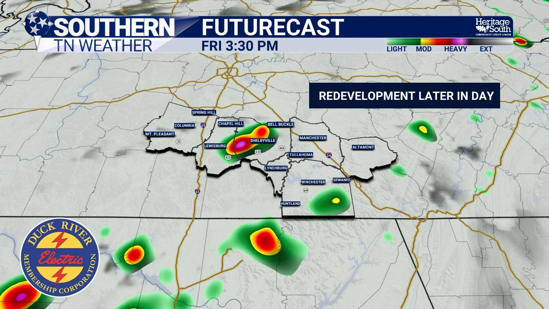
Complicated Forecast for Friday: Latest Details Here
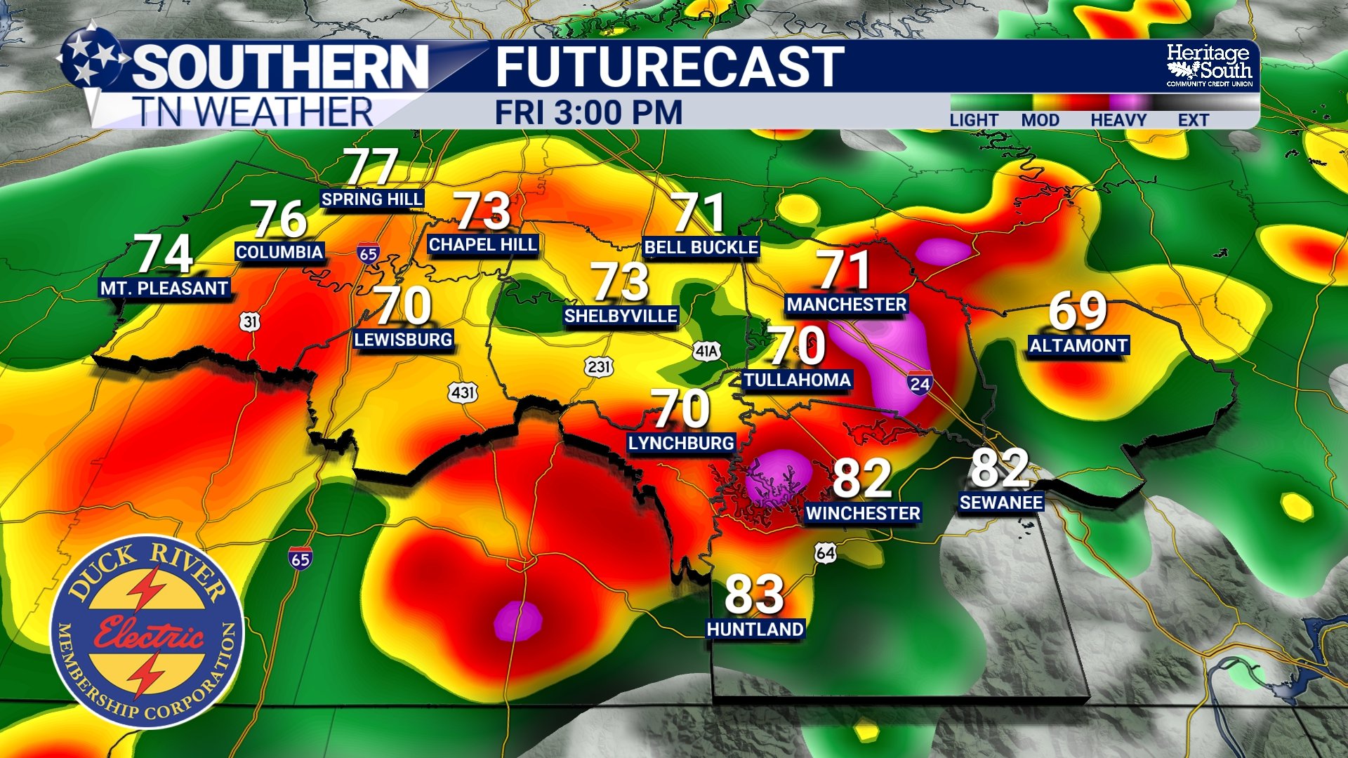
If you've been following my forecasts over the past couple of days, you've probably noticed that Friday's forecast has been anything but straightforward. In fact, I think "complicated" is probably the best way to describe it.
Hot, Humid, Then Stormy
If you've stepped outside today, you've probably noticed two things. First, it's hot. Second, it's humid.
The Devil's Armpit Returns
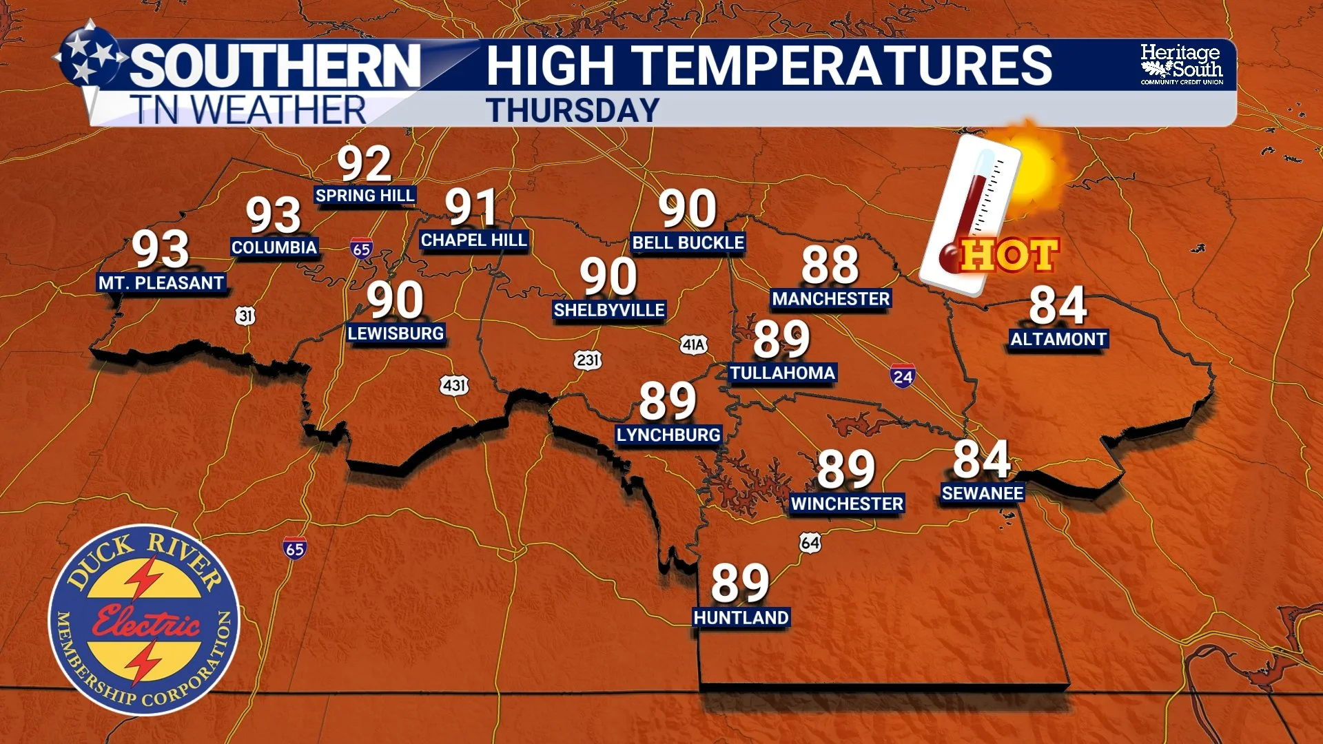
The weather across Southern Middle Tennessee is about to change in a big way. Today, we're still keeping an eye on a few showers and thunderstorms capable of producing heavy rainfall and gusty winds. By tomorrow, however, the conversation shifts dramatically as hotter temperatures and sticky humidity take over the forecast.
From Heavy Rain To Heat: Tennessee's Weather Is Changing Gears
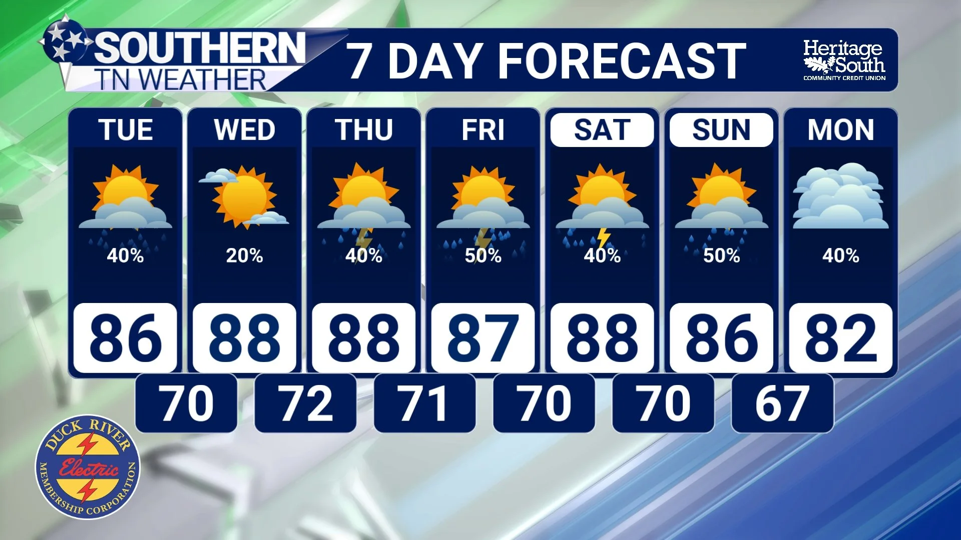
It's going to be a busy week across Southern Middle Tennessee, but perhaps not for the reasons you might expect. Over the next several days, we'll be dealing with a little bit of everything. Showers and thunderstorms will continue through at least Tuesday with localized flooding concerns, while by the middle of the week our attention will gradually shift toward building heat and humidity as summer begins tightening its grip on the region.
The Atmospheric Tug-Of-War Happening Over Tennessee Right Now
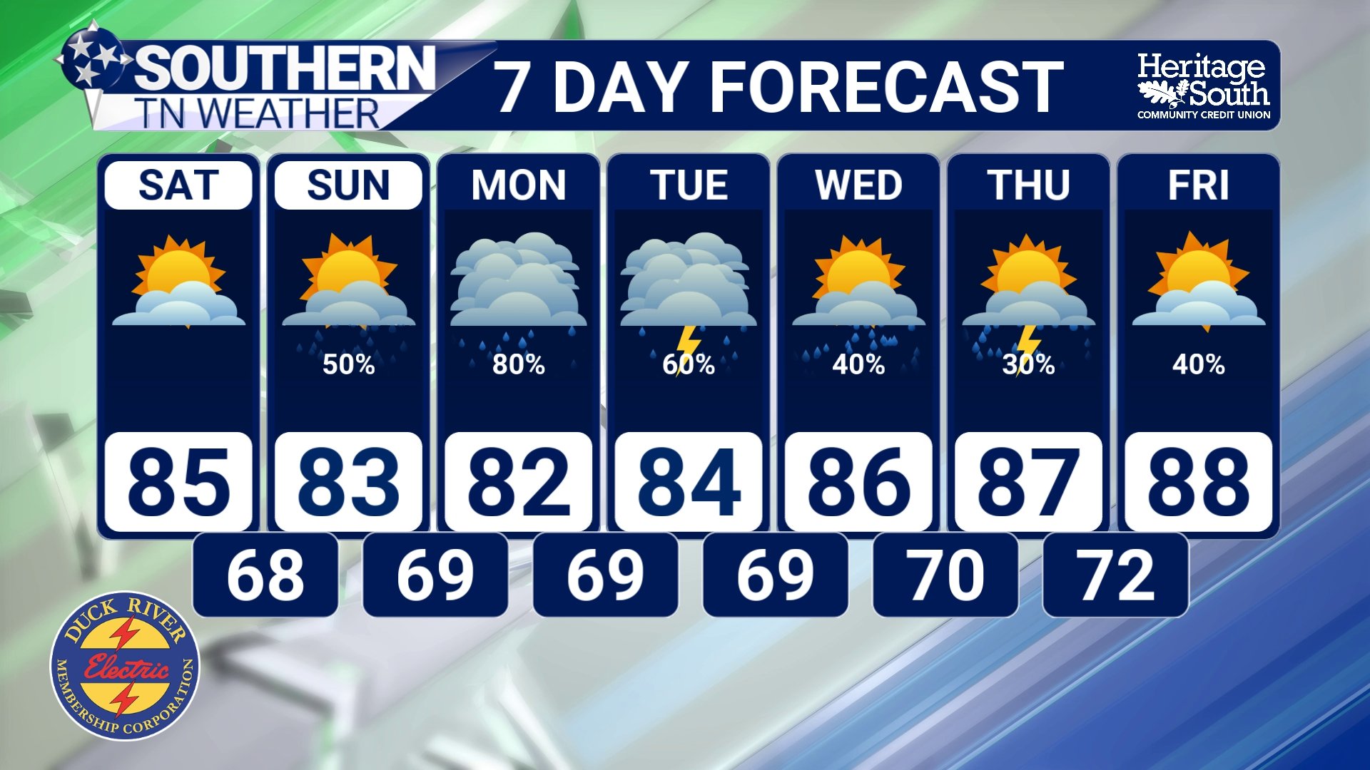
If you've stepped outside this week, you've probably noticed that something feels different. The air has been noticeably more comfortable. Mornings have felt refreshing. The sky has been a deeper shade of blue. Even afternoon temperatures in the lower and middle 80s have felt pleasant compared to what we often experience in June.