
Enjoy The Weekend, But Keep An Eye On Sunday

The Southern Tennessee Weather Blog is proudly presented by Heritage South Community Credit Union.
We Help When Others Won’t!
Visit https://www.heritagesouth.org/ today to see how HSCCU can help YOU!
If you've stepped outside today, you've probably noticed something feels... different. After several days of tropical moisture, muggy afternoons, and rounds of thunderstorms, Southern Middle Tennessee is finally getting a well-deserved break. Unfortunately, the atmosphere isn't quite ready to settle down for good.
The next several days will feature a little bit of everything: pleasant weather for outdoor activities, increasing humidity, and eventually another round of showers and thunderstorms to wrap up the weekend and start the new work week.
A Beautiful End To The Work Week
The cold front responsible for Thursday's active weather has finally pushed south of the area, allowing a much drier air mass to work into Southern Middle Tennessee. One of the biggest differences you'll notice is the humidity. Yesterday, dew points were firmly in the middle 70s, making it feel downright tropical outside. Today, they're falling back into the upper 50s and lower 60s, which is much more comfortable for mid-June. High temperatures this afternoon will stay in the lower to middle 80s under a mix of sunshine and some passing high clouds. Tonight should be even better, with overnight lows dropping into the lower and middle 60s.
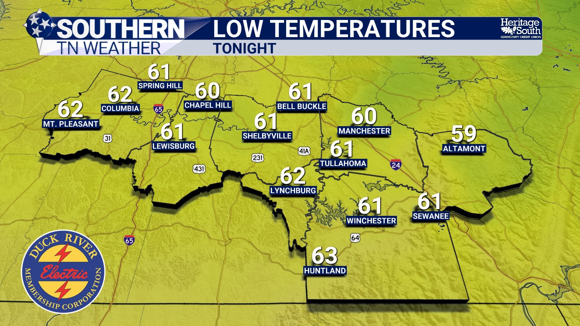
LOW TEMPERATURES - TONIGHT
Saturday Continues The Good News
The pleasant weather doesn't end today. High pressure will continue to influence our weather on Saturday, keeping rain chances very low for much of Southern Middle Tennessee.
Temperatures will warm back into the middle and upper 80s, but much of the day should remain dry with a mix of sun and clouds. Humidity will gradually begin increasing during the afternoon as southerly winds return, signaling that our next weather system isn't too far away. If you've got outdoor plans this weekend, Saturday is shaping up to be the better of the two days.
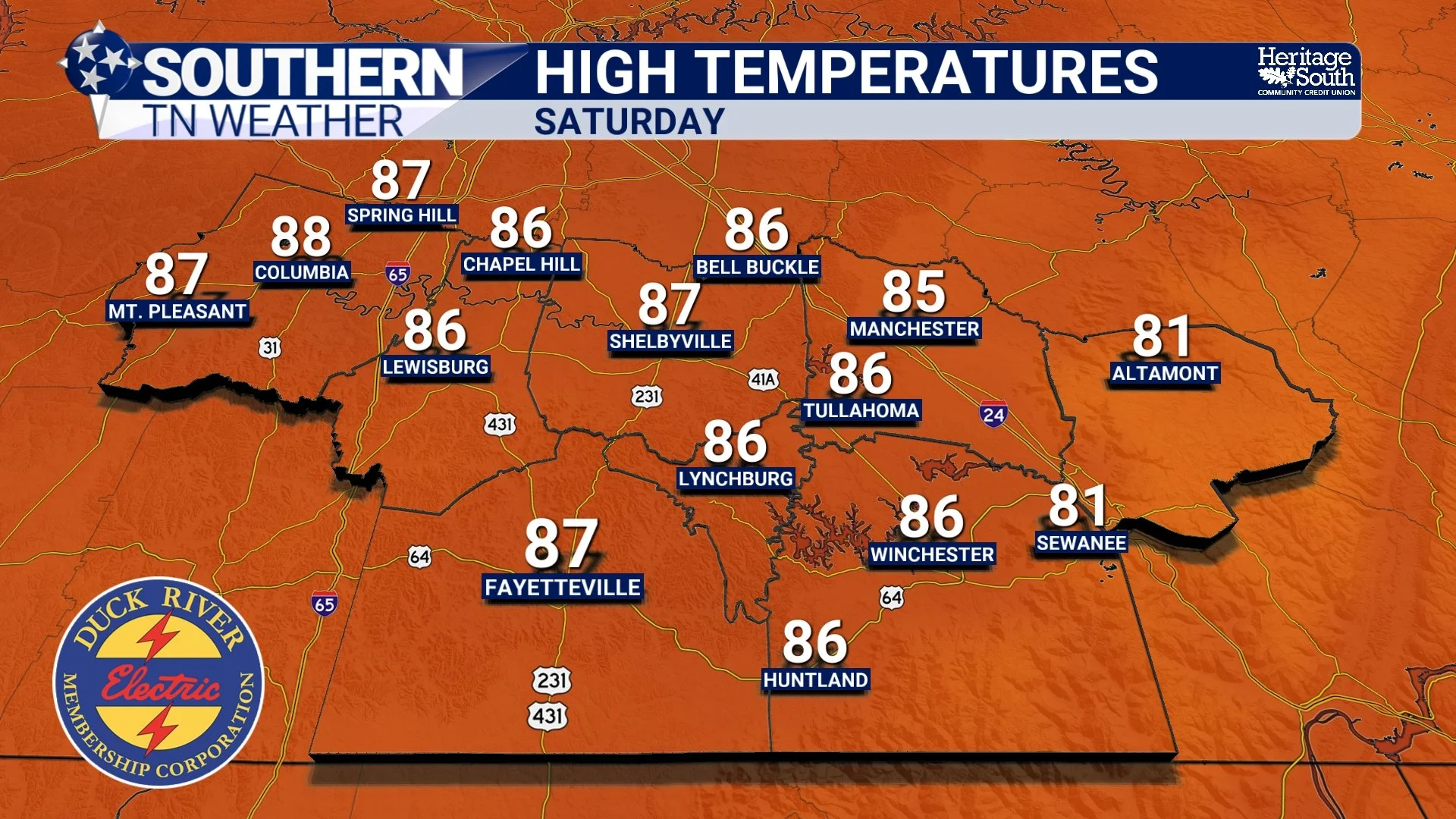
HIGH TEMPERATURES - SATURDAY
Sunday Brings The Pattern Change
By Saturday night, a warm front will begin lifting northward across the region while another disturbance develops over the Plains. As this system approaches, moisture levels will once again increase across Tennessee. Meteorologists measure this using precipitable water, or PWAT, and values will climb back toward two inches by Sunday. In simple terms, the atmosphere will once again be capable of producing heavy rainfall.
Showers and thunderstorms should become more numerous Sunday morning and continue into the afternoon and evening hours.
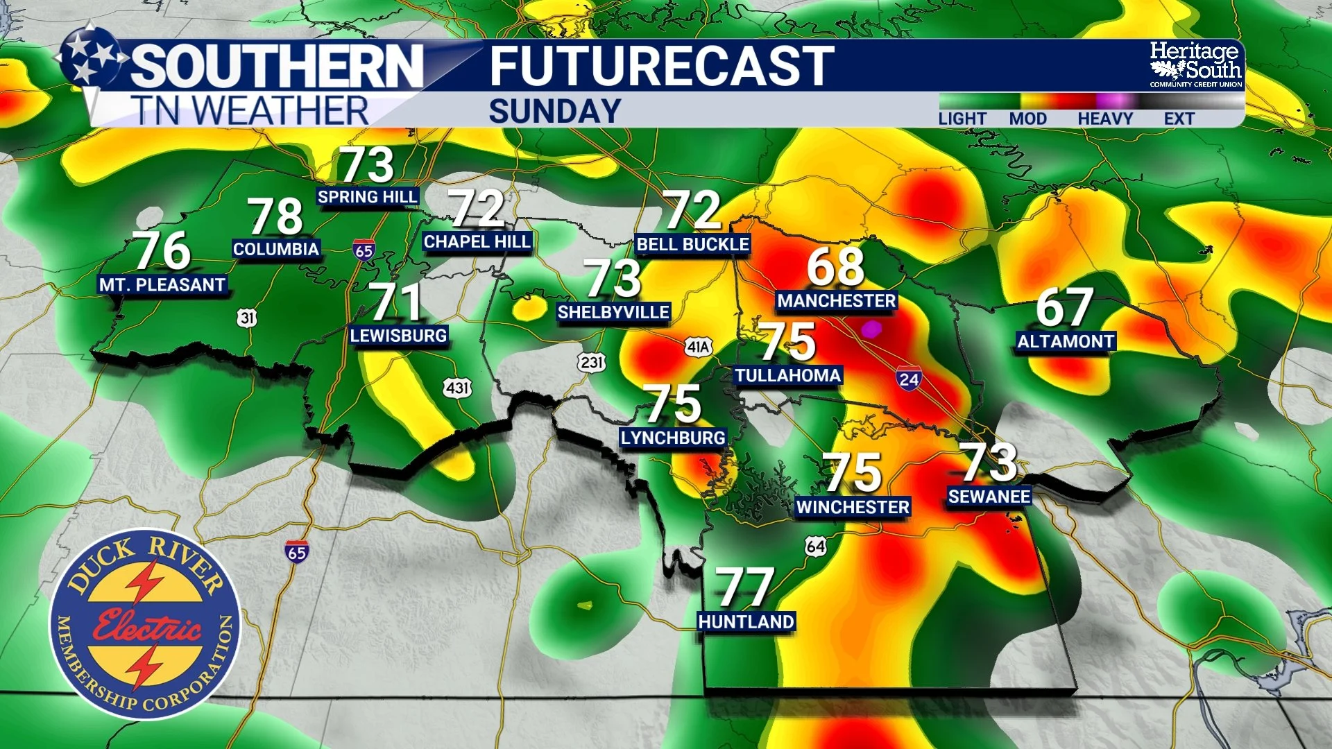
FUTURECAST - SUNDAY
Should We Worry About Severe Weather?
At this point, the answer is probably not—but it's something I'll continue watching. The atmosphere will certainly have enough instability to support thunderstorms, but one ingredient appears to be lacking: strong wind shear.
Without significant shear, thunderstorms often struggle to organize into widespread severe weather events. That said, a few stronger storms capable of producing gusty winds can't be ruled out, especially as we move into Sunday night and early Monday when a cold front approaches from the northwest. The primary severe weather concern at this point would be isolated damaging wind gusts. The Storm Prediction Center has areas just off to our north under a MARGINAL risk (level 1/5) for severe weather for Sunday.
Monday Stays Active
The approaching cold front will likely continue moving across Southern Middle Tennessee during the day Monday. There's still some uncertainty regarding exactly how much instability develops ahead of the front, but scattered showers and thunderstorms remain likely.
A few stronger storms remain possible, especially across southern and eastern portions of our area where warmer, more unstable air may linger longer. As always, exact timing and storm intensity will become clearer over the weekend.
Next Week Settles Down A Bit
The good news is that the front should gradually work south of the area by Tuesday. Rain chances won't disappear completely, but they should become much more isolated through the middle of next week.
A slightly drier northwest flow pattern should help limit widespread rainfall while keeping temperatures fairly comfortable for late June. Highs should generally remain in the lower to middle 80s with overnight lows in the 60s.
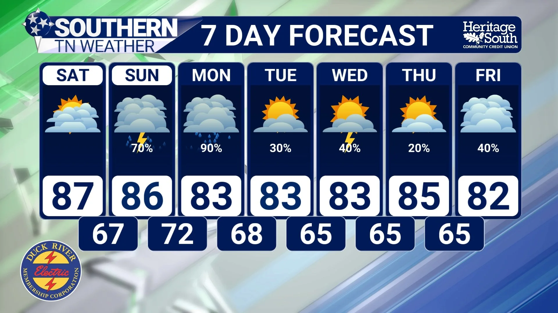
STNWX - 7-DAY FORECAST
Looking Ahead
This is a fairly typical summertime pattern for Tennessee. We get a couple of nice days courtesy of a passing cold front, humidity gradually builds back in, another disturbance arrives with showers and storms, and then the cycle starts over again.
The important takeaway is simple… Enjoy the quiet weather while it's here because Sunday and Monday look considerably more active.
The Bottom Line 🧾
Dry and comfortable weather continues through today.
Saturday looks warm and mainly dry with increasing humidity.
Shower and thunderstorm chances increase Sunday into Monday.
A few stronger storms with gusty winds are possible.
Widespread severe weather is not currently expected.
Rain chances gradually decrease by the middle of next week.
Saturday remains the pick of the weekend for outdoor plans.
📰 Reminder: The Southern Tennessee Weather Blog, presented by Heritage South Community Credit Union, is updated Monday through Friday with fresh, locally tailored forecasts you can trust.