
Complicated Forecast for Friday: Latest Details Here

The Southern Tennessee Weather Blog is proudly presented by Heritage South Community Credit Union.
We Help When Others Won’t!
Visit https://www.heritagesouth.org/ today to see how HSCCU can help YOU!
If you've been following my forecasts over the past couple of days, you've probably noticed that Friday's forecast has been anything but straightforward. In fact, I think "complicated" is probably the best way to describe it.
The good news is that we're not looking at a widespread, high-end severe weather event. The challenge, however, is that several smaller-scale features will ultimately determine who sees storms, how intense they become, and where the greatest impacts occur. As is often the case during the summer months, some of those details won't become clear until we're much closer to the event itself.
Today Is About The Heat
Before we get to Friday, we have yet another hot, dry, and humid day to work through. High pressure remains in control across Southern Middle Tennessee, keeping rain chances very low while temperatures climb into the upper 80s and lower 90s. Combined with dewpoints in the 70s, it'll feel more like the upper 90s and lower 100s during the hottest part of the afternoon. If you've got outdoor plans today, don't forget that heat can be just as impactful as severe weather.
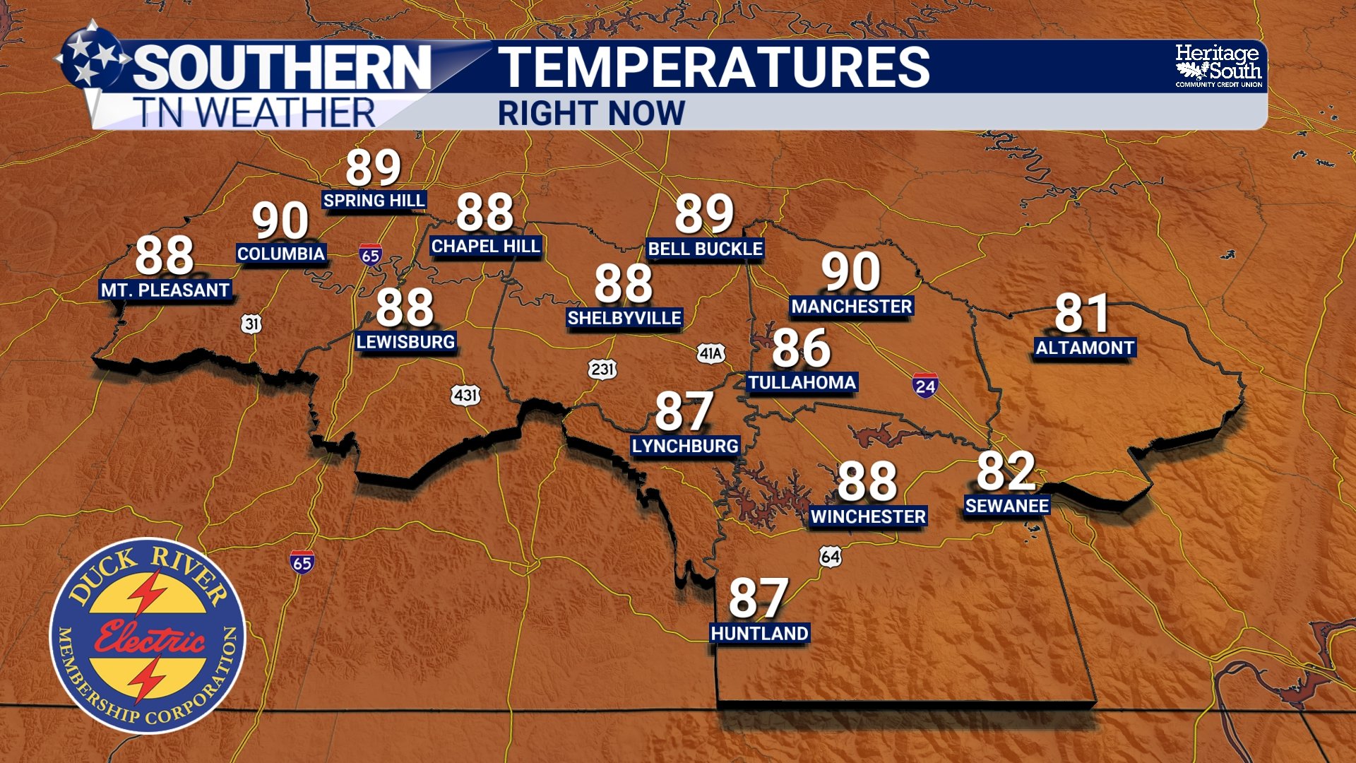
TEMPS - THURSDAY PM
Friday Morning Isn't The Main Event
One thing I want to clear up is that Friday's weather probably won't begin with strong storms rolling into Southern Middle Tennessee. A weakening complex of showers and thunderstorms is expected to move into the region during the morning hours as a cold front gradually approaches from the northwest.
The key word there is weakening. By the time this activity reaches our area, some locations may only see a few showers or even just a little drizzle along the leading edge. While a rumble of thunder can't be ruled out, I'm not particularly concerned about significant weather during the morning hours. Ironically, what happens with that weakening line may determine what happens for the rest of the day.
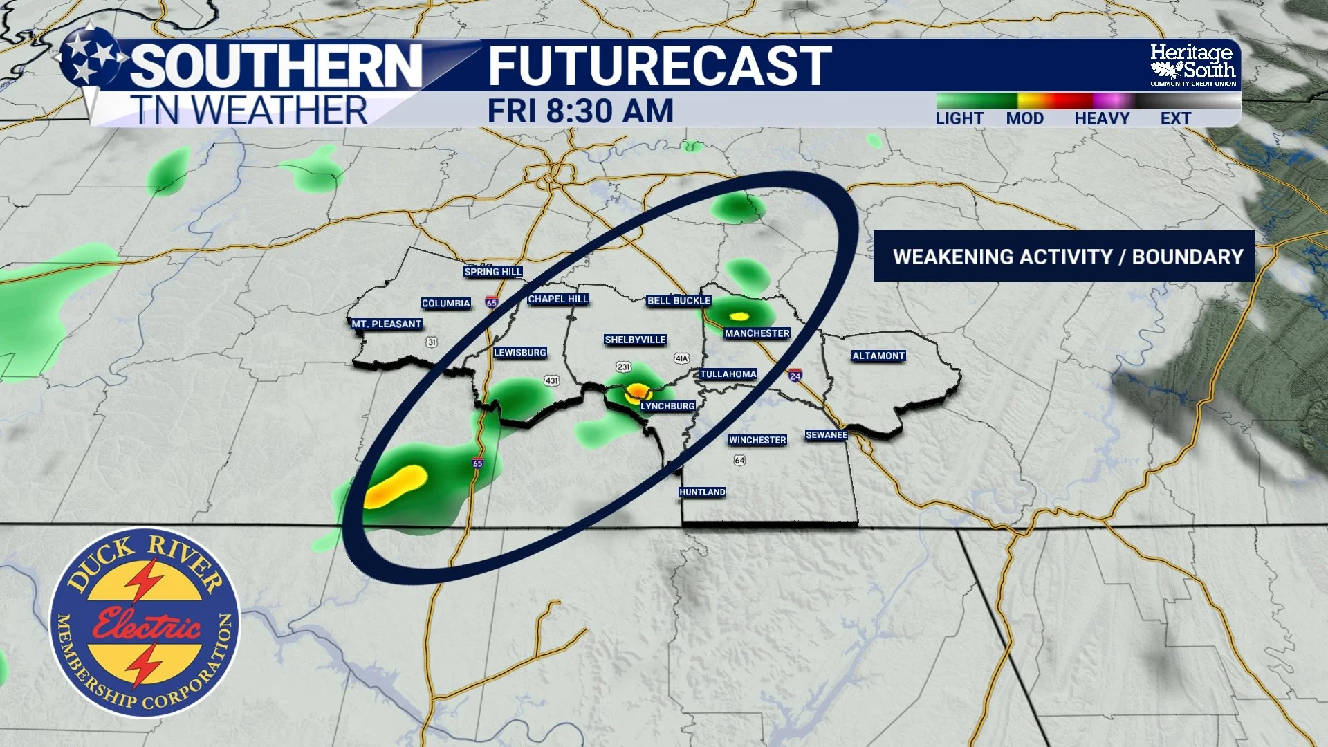
FUTURECAST - FRIDAY AM
The Leftovers Could Become The Bigger Story
As the morning activity weakens, it will likely leave behind an outflow boundary across the region. Think of this boundary as a miniature cold front. It's essentially a dividing line between different air masses and can become a focal point for new thunderstorm development later in the day.
The problem is that we don't know exactly where that boundary will set up. Over the past 12 hours alone, forecast guidance has bounced around considerably. Some model solutions place it as far south as northern Alabama, which would leave much of Southern Middle Tennessee relatively quiet. Other solutions bring it directly across our area, while some place it closer to Nashville.
That uncertainty is one of the main reasons Friday's forecast remains challenging. The atmosphere itself will have plenty of fuel available. Afternoon heating combined with abundant Gulf moisture should create a very unstable environment capable of supporting thunderstorms. The biggest question isn't whether the atmosphere can support storms. It's where the atmosphere decides to pull the trigger. With the photo below, remember that this is ONE FRAME. Activity will blossom and be a bit more widespread than shown.
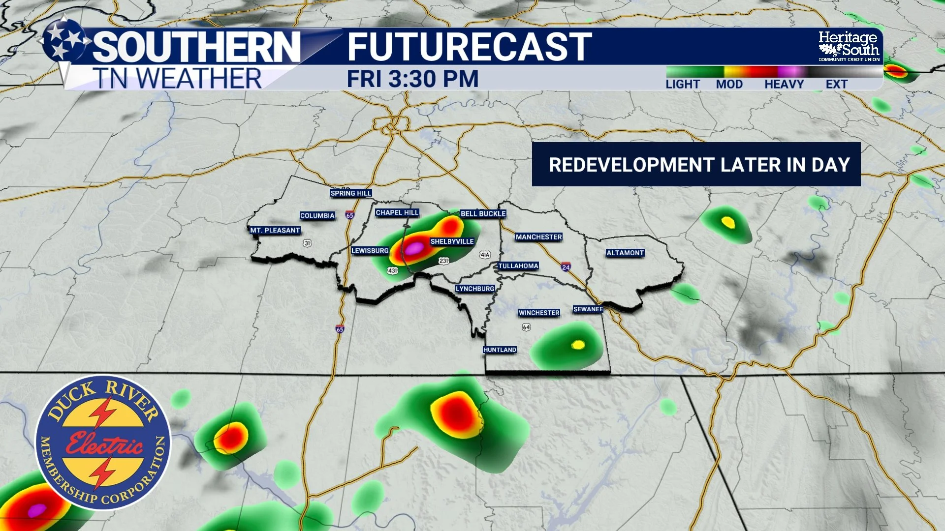
FUTURECAST - FRIDAY PM
What I'm Watching
At this point, the greatest opportunity for showers and thunderstorms appears to be between roughly 2 PM and 8 PM Friday. The Storm Prediction Center continues to highlight portions of our area for severe weather, although the outlook has shifted a bit since this morning. They have removed most of the area from the marginal risk, BUT introduced a slight risk at the cutoff as far west as Grundy County. Now, this does not mean the storm risk is decreasing for tomorrow. I am still messaging that a few storms could be strong. The highest concern remains for isolated damaging wind gusts, with some storms capable of producing winds up to 60 MPH. Small hail is also possible.
The tornado threat currently appears fairly low thanks to limited wind shear across the region. Heavy rainfall will accompany many of these storms as well. While widespread flooding isn't expected, any stronger thunderstorm could produce torrential rainfall and localized flooding in a short amount of time. This is one of those setups where not everyone will see severe weather. In fact, some communities may receive very little rainfall while others nearby deal with a strong thunderstorm. That's part of what makes summertime forecasting so difficult! I know I’m preaching to the choir at this point.
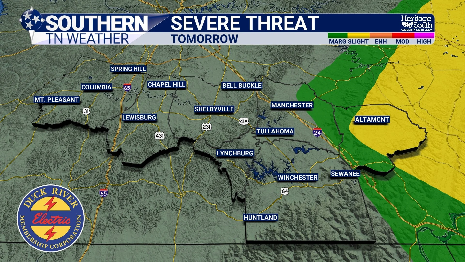
SEVERE THREAT - TOMORROW (FRIDAY)
The Weekend Forecast
Once Friday's cold front moves through, Saturday should provide a brief break with somewhat quieter weather and lower rain chances. By Sunday, however, another disturbance approaches the region and rain and thunderstorm chances begin increasing once again. I am watching the chance for some stronger storms as well.
The good news is that forecast guidance has actually trended somewhat drier for next week compared to previous forecasts. Rain chances won't disappear entirely, but they may not be as widespread as earlier model runs suggested.
in summary
Friday's forecast is a great example of why summer weather can be so challenging to predict. The morning round of weakening storms may not look particularly impressive on radar, but the leftover boundaries they leave behind could ultimately determine where afternoon thunderstorms develop. The atmosphere will certainly have enough heat, humidity, and instability to support strong storms.
The challenge is figuring out exactly where those ingredients come together. I'll continue watching forecast trends closely and will provide updates as confidence increases.
The Bottom Line 🧾
Hot and humid weather continues today with heat index values near 100°.
A weakening line of showers and storms moves through Friday morning.
The leftovers from that activity may determine where afternoon storms develop.
The best chance for storms appears to be between 2 PM and 8 PM Friday.
A few storms could produce damaging wind gusts up to 60 MPH.
Heavy rainfall and localized flooding are also possible.
The tornado threat currently appears low.
Saturday looks quieter before rain chances increase again Sunday.
📰 Reminder: The Southern Tennessee Weather Blog, presented by Heritage South Community Credit Union, is updated Monday through Friday with fresh, locally tailored forecasts you can trust.