
Weekend Forecast: A Little Bit Of Everything

The Southern Tennessee Weather Blog is proudly presented by Heritage South Community Credit Union.
We Help When Others Won’t!
Visit https://www.heritagesouth.org/ today to see how HSCCU can help YOU!
If you've looked outside today, you've probably noticed that Mother Nature couldn't quite make up her mind. This morning's line of showers and thunderstorms weakened as it moved into Southern Middle Tennessee, and for many of us, it was more bark than bite. A few heavier downpours and gusty winds occurred, but widespread severe weather never materialized.
The question now shifts from "What's happening today?" to "What can we expect this weekend?" As it turns out, the answer isn't entirely straightforward.
Today's Storms are pretty much done
This morning's showers and thunderstorms have largely run their course, and I'm not expecting any additional widespread rainfall across Southern Middle Tennessee this afternoon or evening. The cold front responsible for today's activity is gradually pushing through the region, with the atmosphere becoming increasingly worked over behind it.
While I can't completely rule out a stray light shower or perhaps a brief rumble of thunder, especially toward the Cumberland Plateau, most of us should stay dry for the remainder of the day. Overall, the severe weather threat has come to an end, and we're transitioning into a much quieter weather pattern heading into tonight. Lows tonight will be in the upper 60s and low 70s.
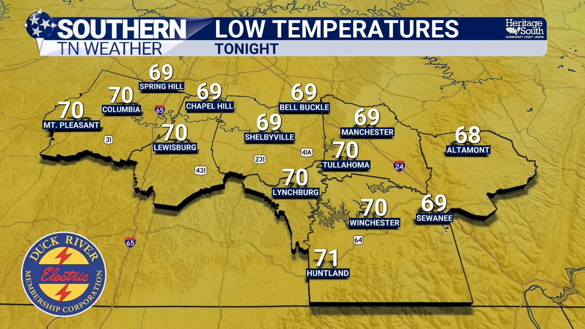
LOW TEMPS - TONIGHT
Saturday Isn't A Washout
One thing I want to clear up is that Saturday doesn't look like an all-day rain event. In fact, much of the day should feature a mix of clouds and sunshine with warm and humid conditions continuing across the area. Temperatures will climb back toward 90 degrees, while dewpoints remain in the lower 70s, making it feel rather muggy outside.
There is, however, another wrinkle in the forecast. Forecast models continue hinting that another mesoscale convective system, or MCS, could surge southward into Tennessee during the day Saturday. If you've read some of my previous blogs, you know these storm complexes can sometimes be difficult to forecast several hours in advance. At this point, I'm carrying a chance for scattered showers and thunderstorms, but confidence in the exact timing and intensity remains fairly low.
For now, I don't see a significant severe weather threat on Saturday, but it's something I'll continue monitoring.
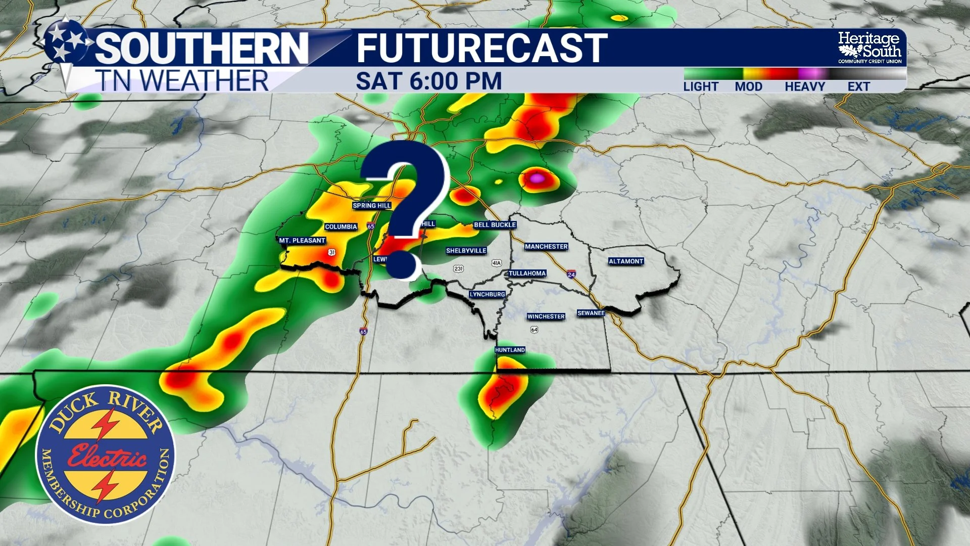
FUTURECAST - SATURDAY PM
Sunday Looks More Active
The better opportunity for more widespread rainfall appears to arrive on Sunday. Another disturbance moving out of the Plains will help increase moisture and instability across the area while another cold front approaches from the north. As a result, scattered showers and thunderstorms should become more numerous during the afternoon and evening hours.
The overall severe weather threat remains fairly low at this time. However, a few stronger storms capable of gusty winds can't be ruled out, especially across southern and eastern portions of our area. Heavy rainfall will also be possible with any stronger thunderstorms. If you have outdoor plans Sunday, I'd certainly keep an eye on the forecast and have a backup plan ready.
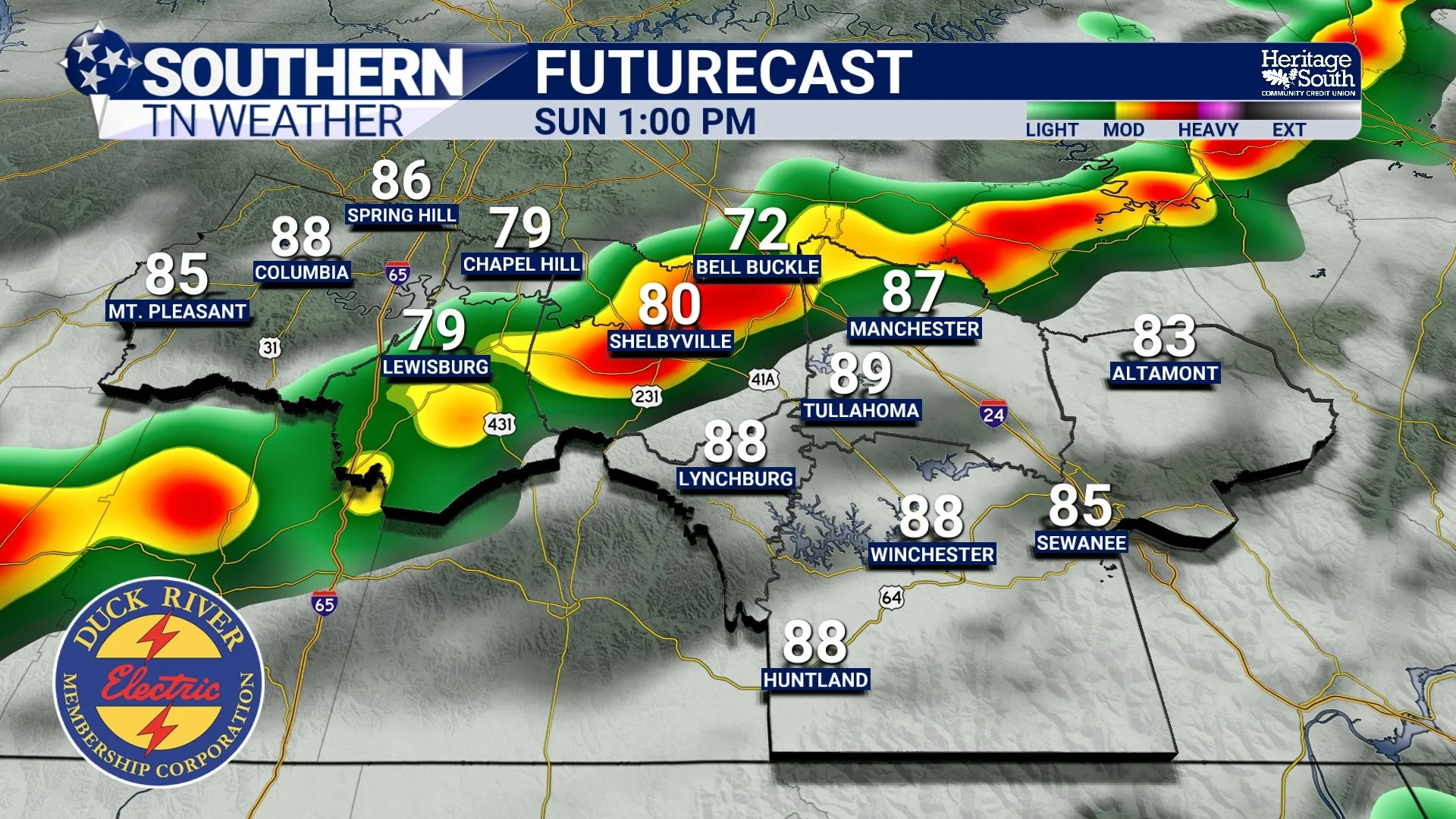
FUTURECAST - SUNDAY PM
Next Week Brings Some Good News
After a fairly active weekend, next week's forecast is looking a bit more manageable. A cooler and less humid air mass will filter into Southern Middle Tennessee behind Sunday's system, with highs settling back into the upper 70s and lower 80s for the first half of the week. Dewpoints should also back off a bit, making it feel much more comfortable compared to the sticky weather we've dealt with recently.
That doesn't mean rain chances disappear entirely. Isolated showers and thunderstorms will remain possible each afternoon, but drier air should help keep coverage fairly limited through at least Wednesday. Many communities could stay completely dry during this stretch. By the latter part of next week, temperatures will gradually climb back into the upper 80s and lower 90s as humidity slowly returns. A few typical summertime pop-up storms may also work back into the forecast, but for now, no major weather systems are on the horizon.
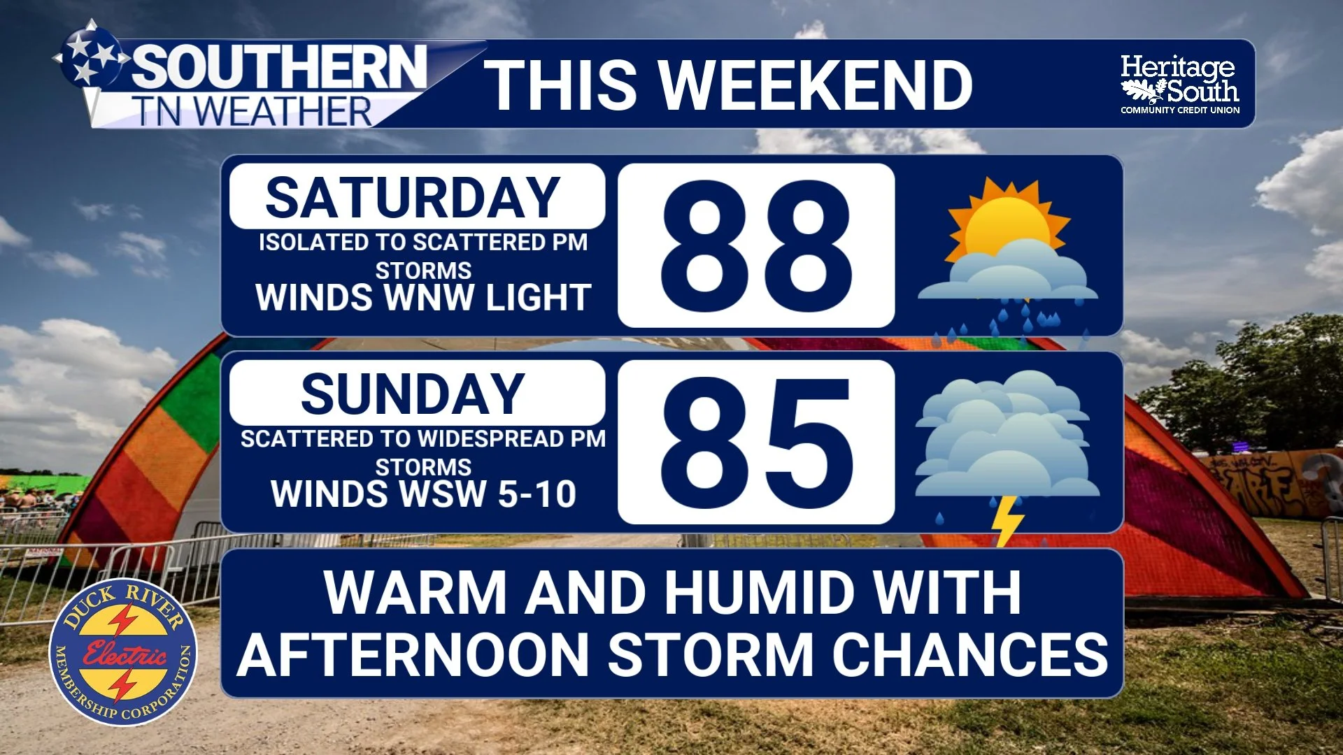
THIS WEEKEND
The Bottom Line 🧾
This morning's storms have weakened, but isolated redevelopment is possible this evening.
Widespread severe weather is not expected today.
Saturday will be warm and humid with scattered storm chances.
Sunday looks to be the more active day of the weekend.
A few stronger storms and heavy rainfall are possible Sunday.
Cooler and less humid air arrives early next week.
Rain chances decrease Monday through Wednesday.
📰 Reminder: The Southern Tennessee Weather Blog, presented by Heritage South Community Credit Union, is updated Monday through Friday with fresh, locally tailored forecasts you can trust.