
WEATHER BLOG

Presented By:
The Atmosphere Is Flipping the Summer Switch
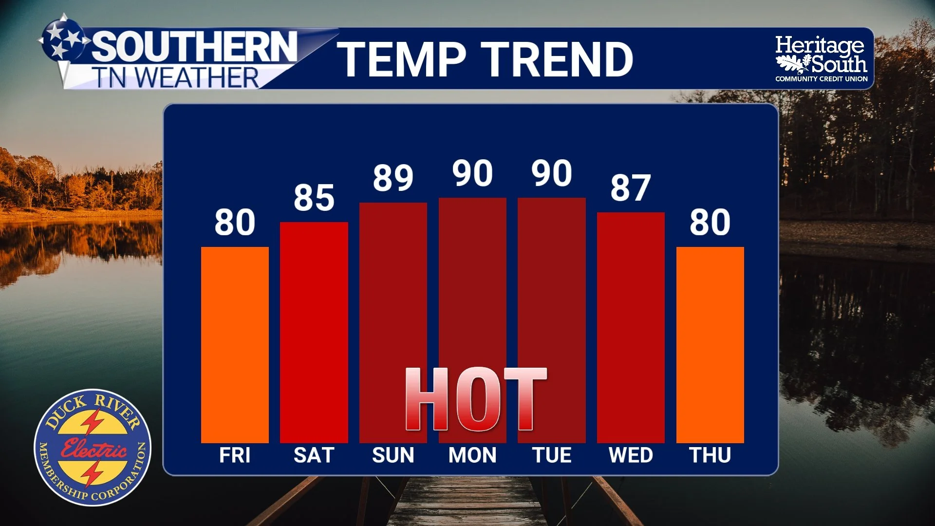
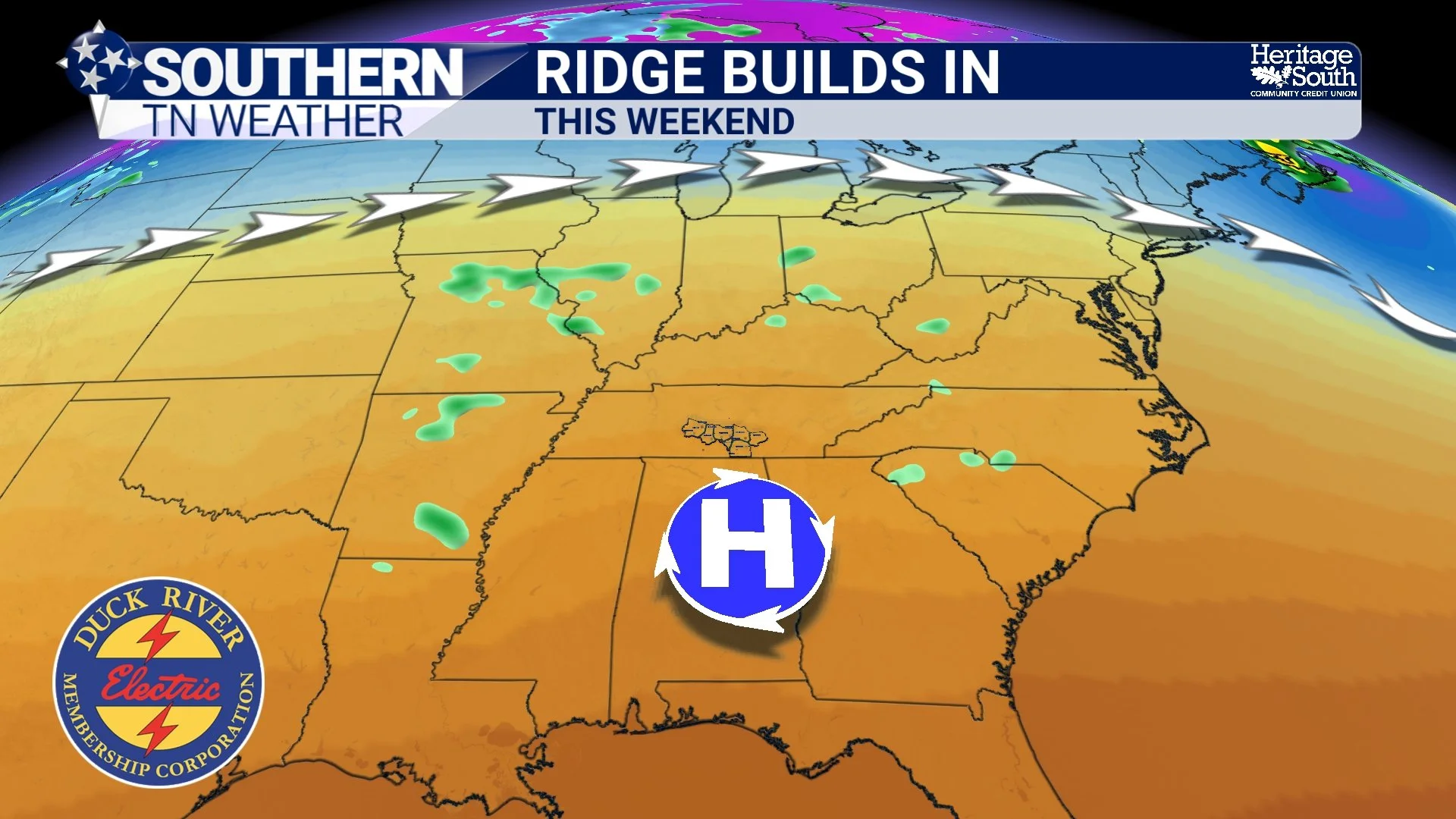
If you enjoy cooler mornings and comfortable spring weather, enjoy the next 24 hours… because a major pattern change is underway across Southern Middle Tennessee. Over the next several days, temperatures are going to steadily climb as a large ridge of high pressure strengthens across the Southeast United States. By Sunday and early next week, many communities west of the Plateau will likely see highs surge into the lower 90s for the first time this year.
The Heat Is Building… But The Rainfall Isn’t
The forecast over the next several days is going to feature two very different stories unfolding across Southern Middle Tennessee. First, we’ll continue enjoying several more days of absolutely beautiful spring weather with cool mornings, comfortable humidity, and highs mostly in the 70s and lower 80s. But second… the atmosphere is preparing to flip the switch toward an early taste of summer by this upcoming weekend.
El Niño Is Coming Back… What Does That Mean for Us?
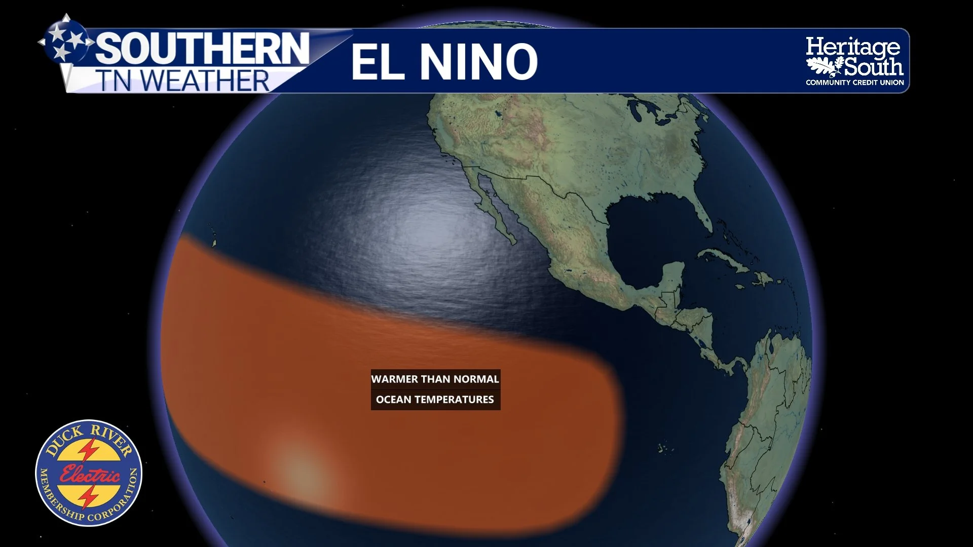
After several years dominated by La Niña and neutral conditions, the Pacific Ocean is beginning to show stronger signs that El Niño may develop again later this year. While the phrase “El Niño” gets thrown around constantly in weather coverage, many people don’t fully understand what it actually is… or why water temperatures thousands of miles away in the Pacific Ocean can dramatically influence weather patterns here in Tennessee.
A Warm Weekend Ahead… But Rain Returns Sunday
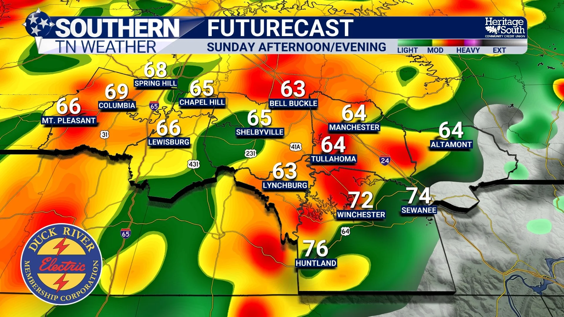
Southern Middle Tennessee is about to squeeze just about every season of spring into one weekend. Cool mornings are giving way to warm afternoons, humidity is still behaving itself for now, and most outdoor plans should be in pretty good shape through Saturday night. The next interruption arrives Sunday, when another quick-moving cold front brings scattered showers and a few thunderstorms back into the picture.
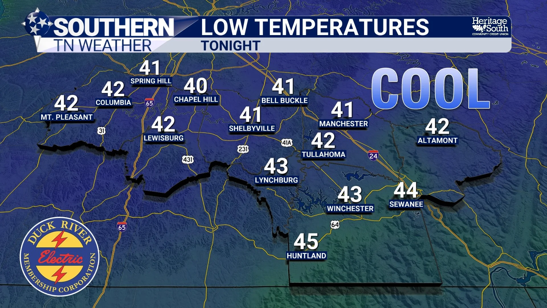
Cooler Nights, A Weekend Warm-Up, and the Next Rain Chance Ahead
After several days of rain, thunderstorms, and humidity, Southern Middle Tennessee is finally settling into a much quieter weather pattern. Cooler and drier air has filtered into the region behind yesterday’s cold front, and honestly, it feels pretty incredible outside today.
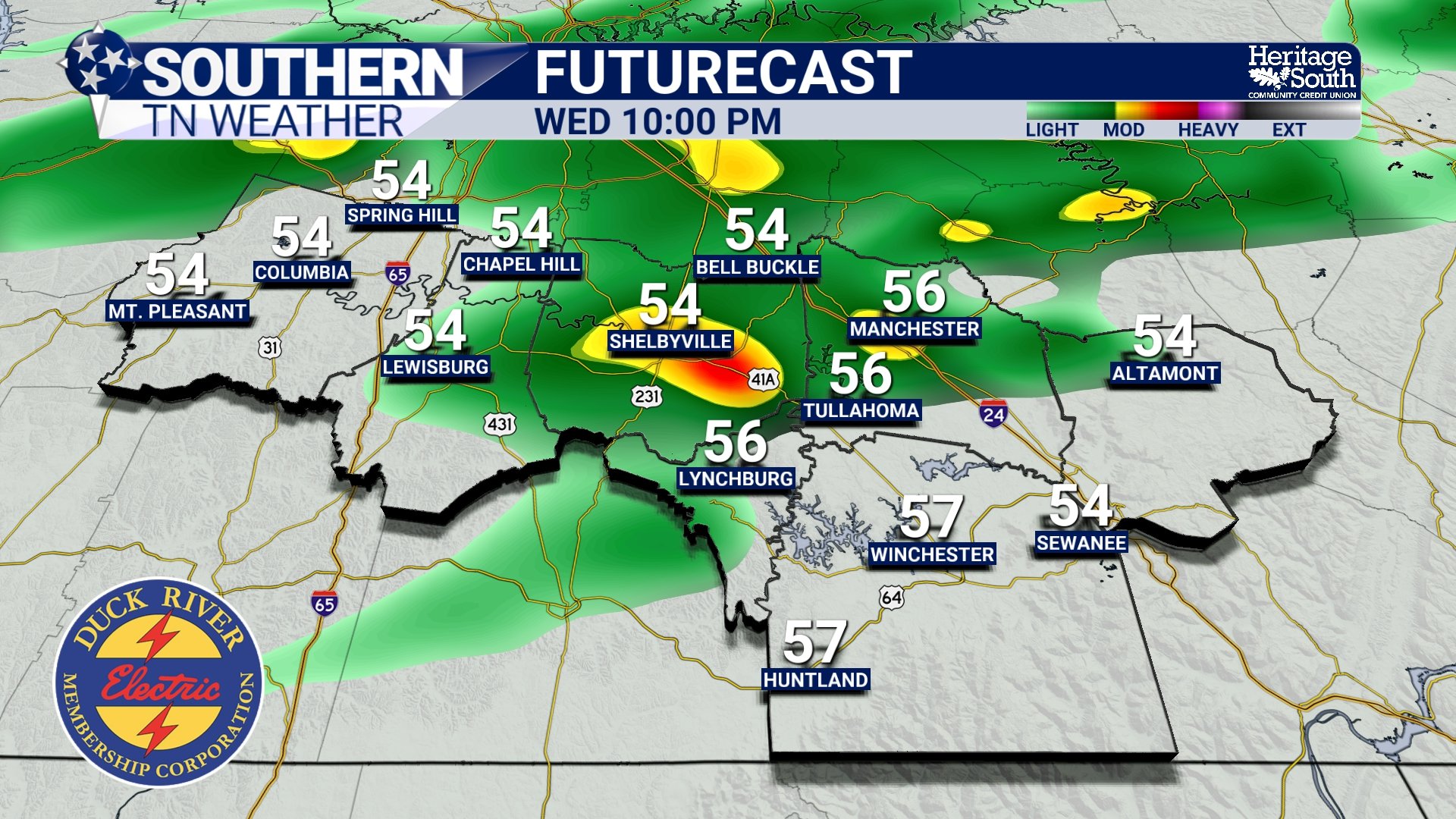
Rain and Storms Continue… Here’s What to Expect Through Tonight
After a quiet start to the week, the pattern across Southern Middle Tennessee is now transitioning into a much more active phase. The atmosphere is gradually loading with moisture, and over the next 24 to 36 hours, we’ll see an increase in both shower and thunderstorm coverage.
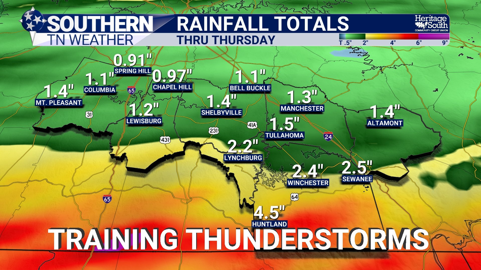
Showers and Storms Increase… A Closer Look at Tonight into Wednesday
After a quiet start to the week, the pattern across Southern Middle Tennessee is now transitioning into a much more active phase. The atmosphere is gradually loading with moisture, and over the next 24 to 36 hours, we’ll see an increase in both shower and thunderstorm coverage.
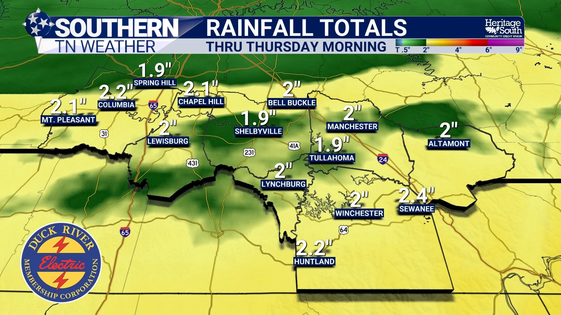
Rain Returns… A Closer Look at the Next 3 Days
It’s been a quiet, comfortable stretch across Southern Middle Tennessee, but the pattern is about to flip again in a pretty classic late-spring way. A warm, breezy Monday is serving as the transition point between dry air and what will become a multi-day period of rain and embedded storms.
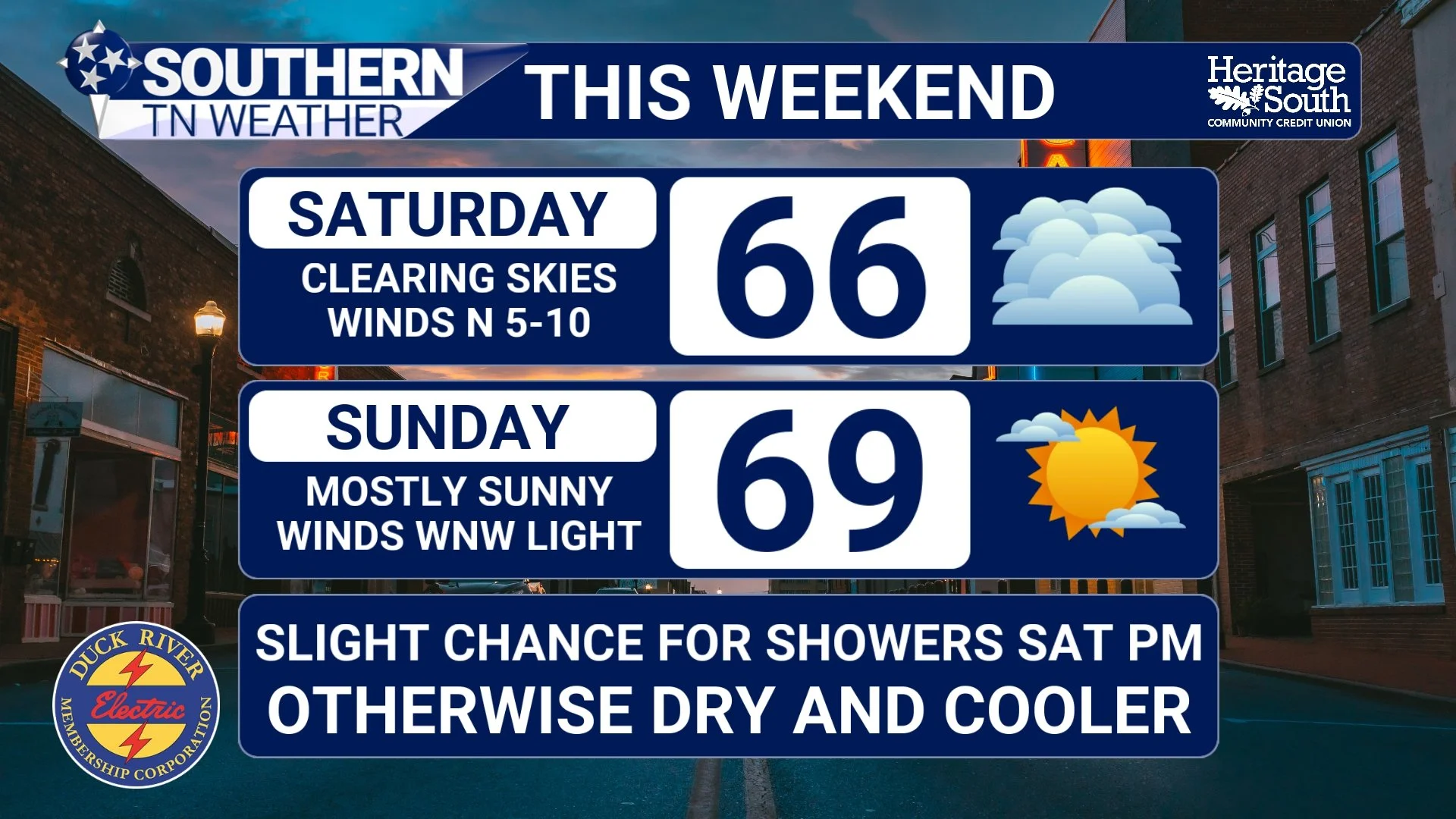
A Cool, Quiet Weekend… Before Storms Return Next Week
Southern Middle Tennessee is heading into one of those classic “reset” weekends after an active stretch of weather. The atmosphere has settled down, cooler air has moved in, and for the most part, we’re looking at a quiet and comfortable few days ahead.
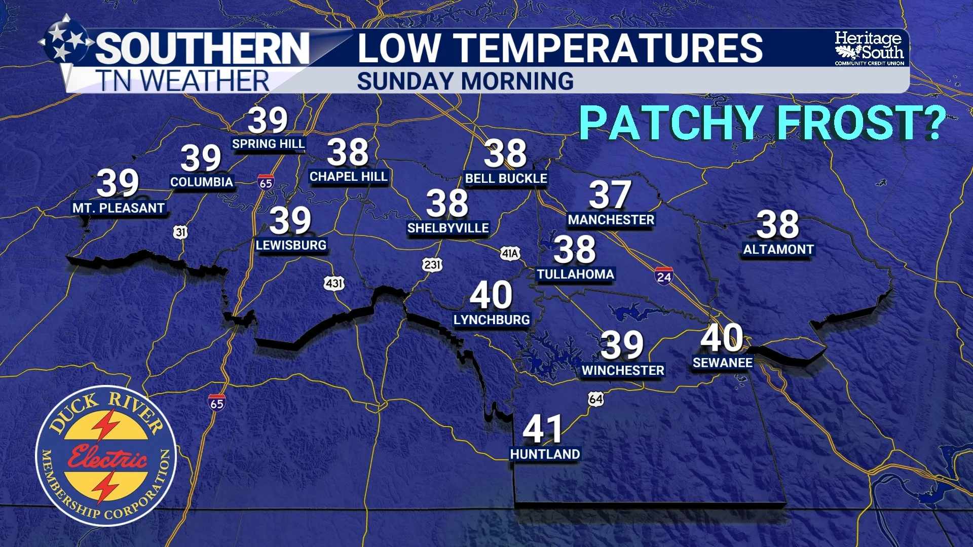
A Spring Reset… Cooler Days, Chilly Nights, But Storms Return Next Week
After a stretch of active weather earlier this week, Southern Middle Tennessee has officially settled into a much quieter and noticeably cooler pattern. This is one of those classic post-storm transitions where the atmosphere essentially “resets,” trading stormy conditions for a more stable, calm setup.
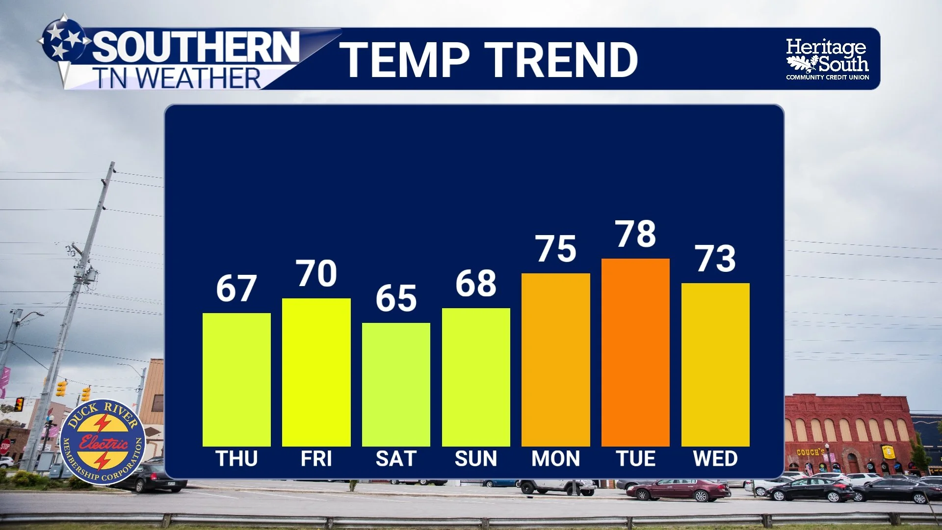
Cooler Air Moves In… What’s Left of the Rain and What Comes Next
After a very active stretch of weather across Southern Middle Tennessee, things are finally beginning to settle down. The same system that brought us rounds of storms and much-needed rainfall over the past couple of days is now pushing off to our southeast, and with it comes a noticeable shift in our overall weather pattern.
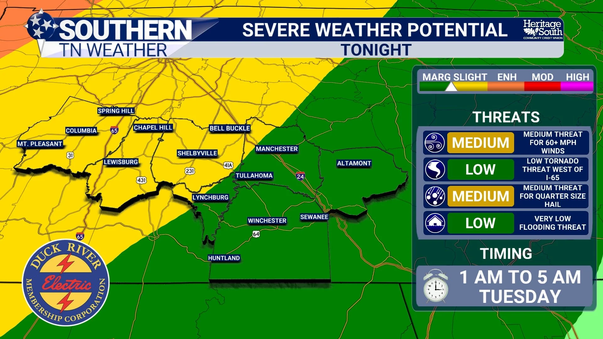
Storms Return: A 48-Hour Look at What to Expect
We are entering one of the more active stretches of weather we’ve seen in a while across Southern Middle Tennessee, and the next 48 hours will feature two distinct rounds of storms, both with their own characteristics and uncertainties. This is not a clean, textbook setup. It’s a layered, evolving situation where what happens tonight will directly influence what happens tomorrow. That’s important to understand up front, because this is not a one-and-done forecast. This is a process that will continue to evolve in real time.
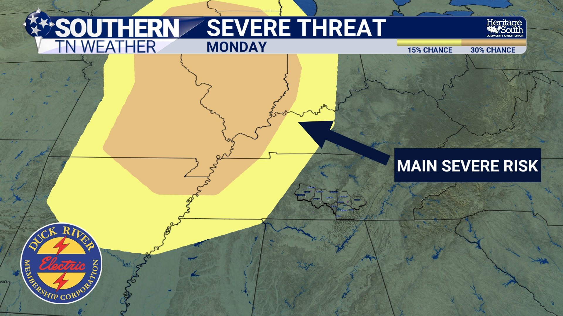
Monday: A Deeper Look into the Evolving Forecast
We’re heading into a more active stretch of weather across Southern Middle Tennessee, and while there are some rain chances to get through this weekend, the bigger story is how the forecast has evolved for Monday. This is one of those situations where it’s worth slowing down and explaining not just what is happening, but WHY it’s happening.
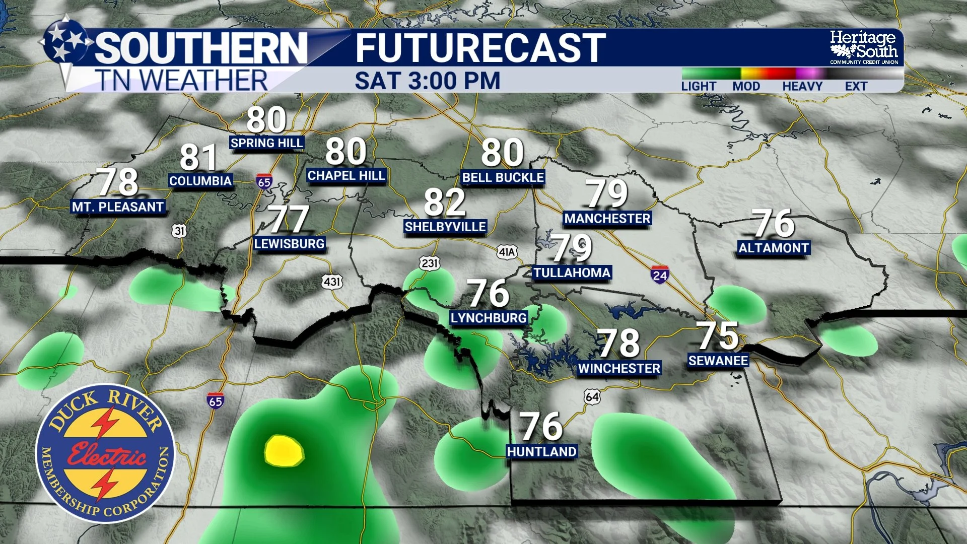
Friday & Saturday Coming Into Focus
We’ve squeezed just about everything we can out of this quiet stretch of weather. Warm afternoons, comfortable humidity, and plenty of sunshine have been the theme across Southern Middle Tennessee. That continues today, but the atmosphere is already beginning to transition behind the scenes.
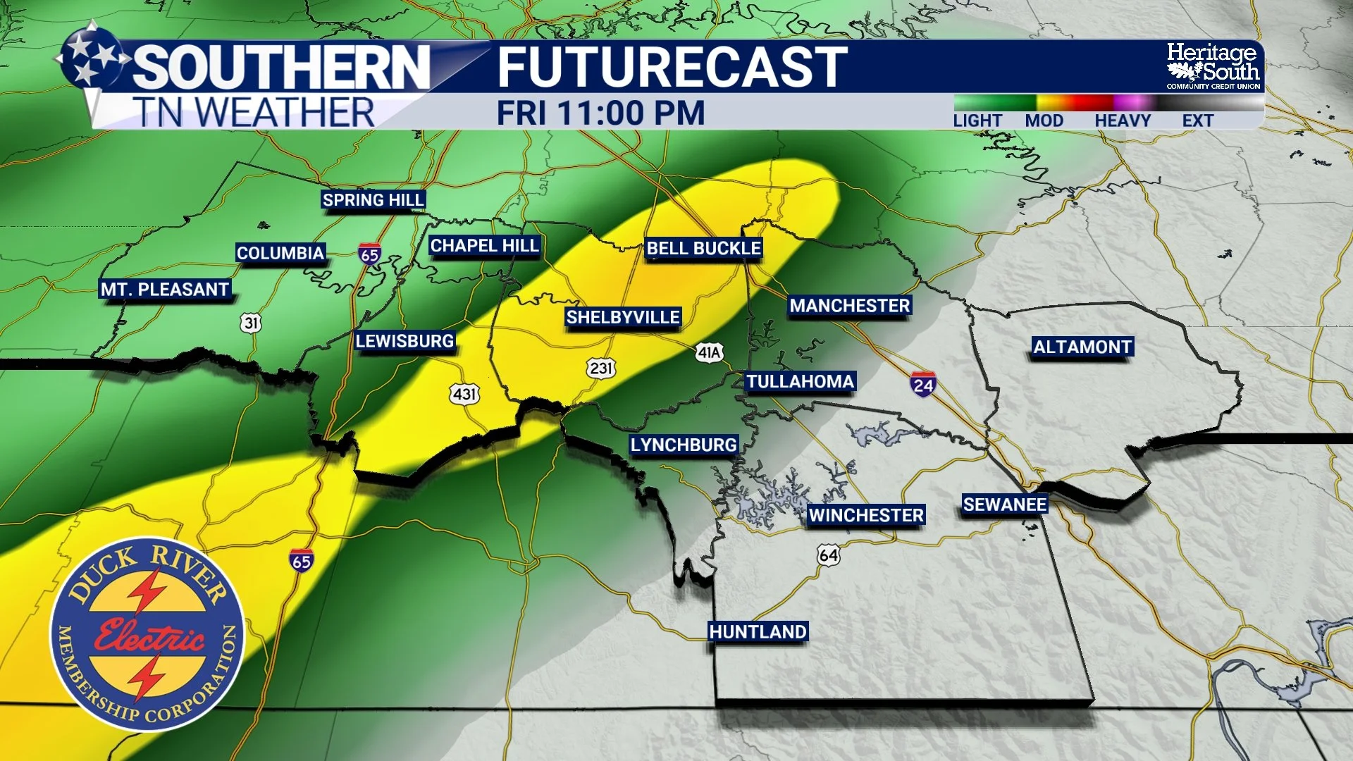
Two Storm Threats to Watch Over the Next 5 Days
The recent stretch of warm, dry, and comfortable weather across Southern Middle Tennessee has been driven by a ridge of high pressure. In simple terms, that means air is sinking from above. Sinking air warms and dries out as it moves downward, which prevents clouds and rain from forming. That’s why we’ve had so many sunny days in a row. The downside is that this same pattern has allowed drought conditions to worsen. Now, that setup is beginning to change…
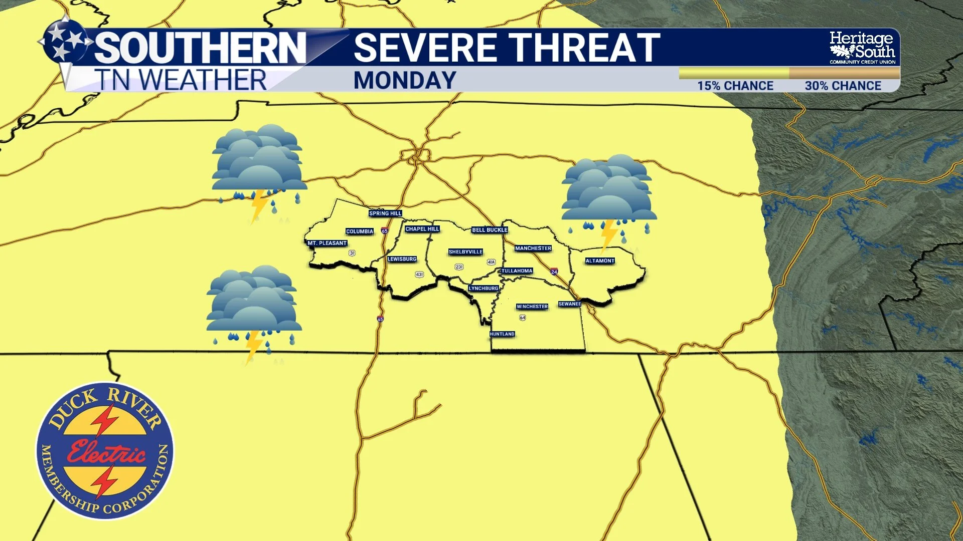
Storms Return This Weekend… and We’re Watching Next Monday Closely
It’s hard to complain about the weather we’ve had lately. Sunshine, warm afternoons, cool mornings… it’s about as comfortable as it gets for mid-April across Southern Middle Tennessee. But from a forecasting standpoint, this kind of stretch always raises an eyebrow.
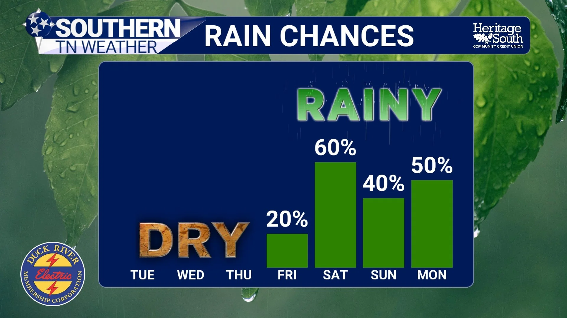
A Wet Pattern is Emerging… Latest Details Here
If you stepped outside this morning, you probably noticed it felt a little more like early spring again. Crisp air, clear skies, and temperatures running below normal to start the day. That’s all thanks to high pressure firmly in control across the Southeast. Lows this morning were very chilly in the mid to upper 30s!
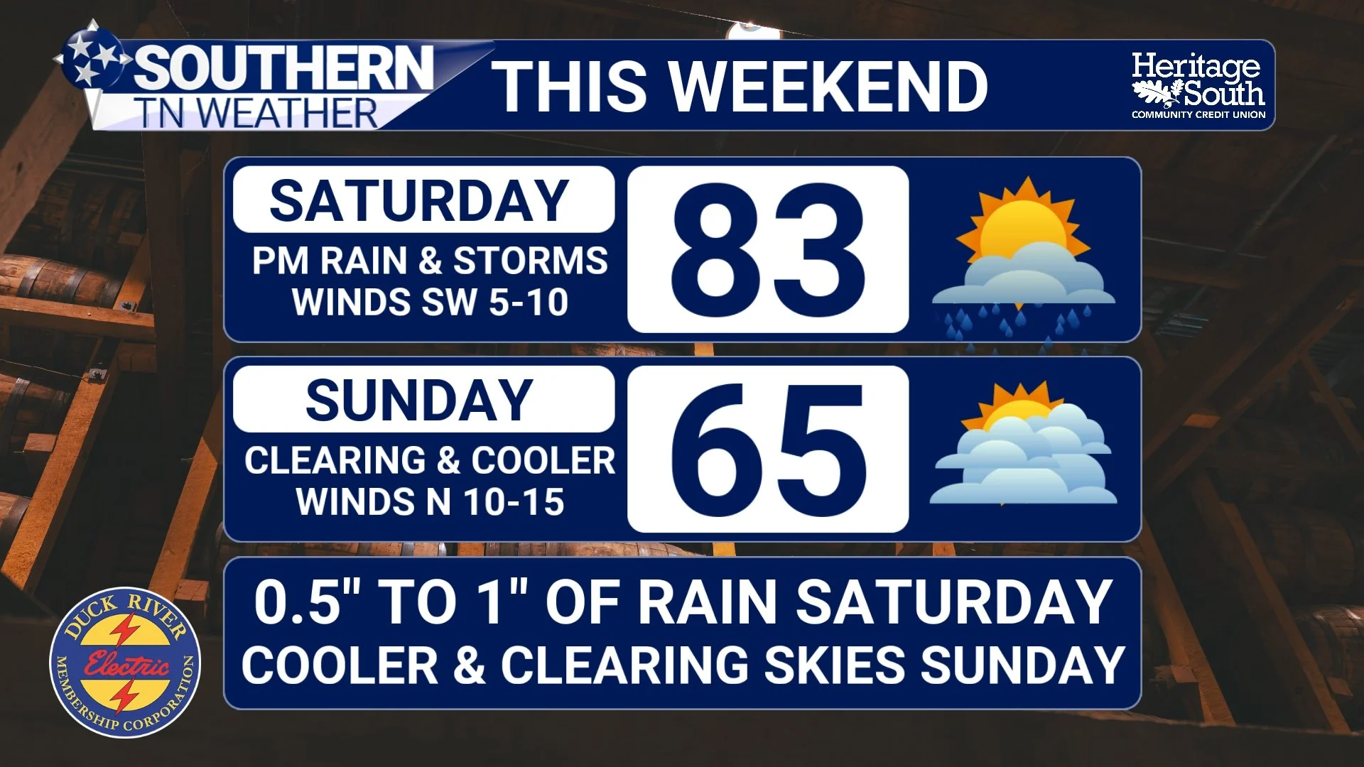
Weekend Outlook: Rain Returns… Then a Big Cooldown
It’s been another warm one across Southern Middle Tennessee today, and honestly it still feels more like early June than mid-April. High pressure has given us a quiet break after last night’s storms, but that break is short-lived. Changes are on the way as we head into the weekend.
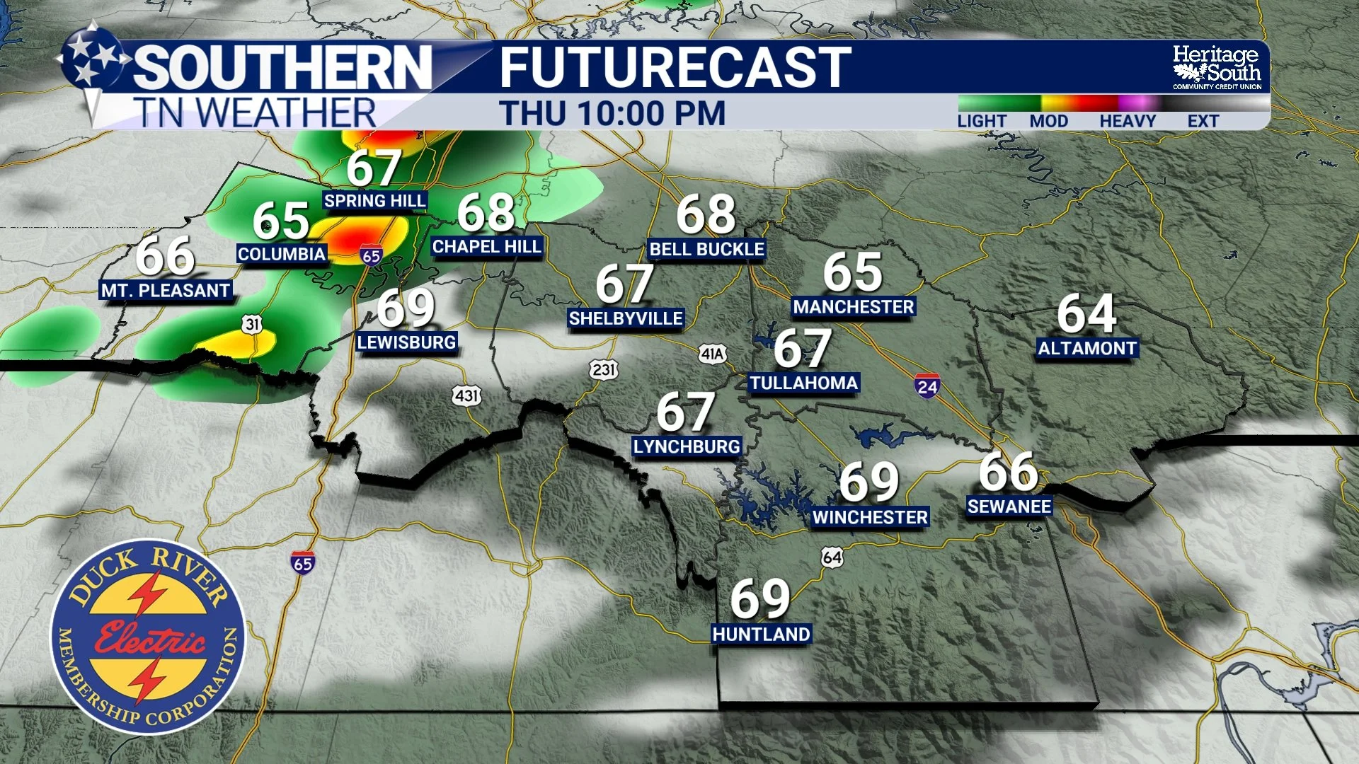
Showers and Storms Return Tonight… But Don’t Expect Much
It’s been another warm, quiet day across Southern Middle Tennessee, and honestly that’s been the theme for a while now. High pressure has kept us dry, stable, and running well above normal temperature-wise. But that pattern is starting to bend just a little bit.
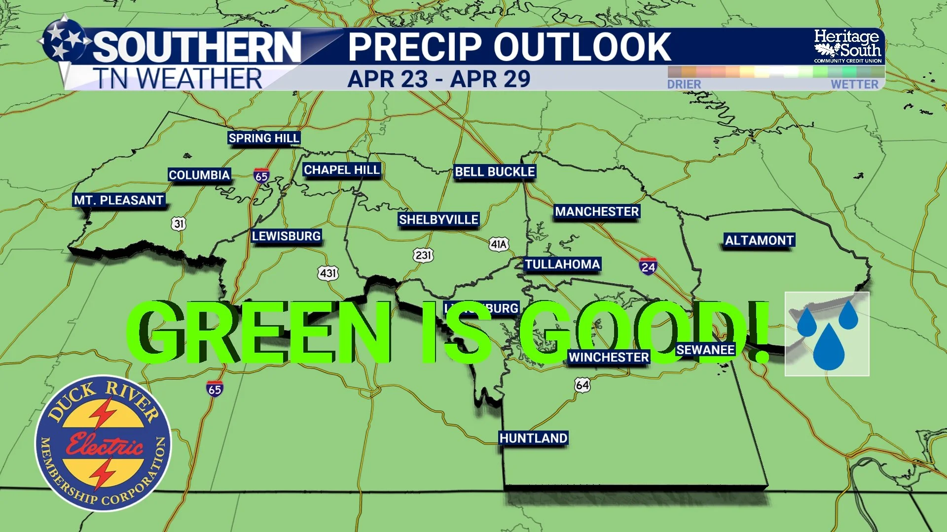
Is an Active Pattern Finally Coming Back? Not So Fast…
If it feels like we’ve been stuck in the same weather pattern for a while… that’s because we have. High pressure is still firmly in control across the Southeast, both at the surface and aloft. That means sinking air, lots of sunshine, and temperatures climbing into the 80s again this afternoon. Pretty nice if you like warm weather… not so great if you’re waiting on rain.