
A Cool, Quiet Weekend… Before Storms Return Next Week

The Southern Tennessee Weather Blog is proudly presented by Heritage South Community Credit Union.
We Help When Others Won’t!
Visit https://www.heritagesouth.org/ today to see how HSCCU can help YOU!
Southern Middle Tennessee is heading into one of those classic “reset” weekends after an active stretch of weather. The atmosphere has settled down, cooler air has moved in, and for the most part, we’re looking at a quiet and comfortable few days ahead.
But, as always this time of year, the calm won’t last forever.
TONIGHT: A SMALL SOUTHERN RAIN CHANCE
Let’s start with tonight. Most of Southern Middle Tennessee will stay dry, but there is a very low chance for a few light showers, mainly along the Tennessee/Alabama border and into our southern counties. This is tied to a weak disturbance tracking along the Gulf Coast, trying to push a little moisture northward.
The key word here is light. Rainfall amounts, if you see anything at all, will be very minimal. Many locations won’t see a drop, and those that do may only pick up a few hundredths of an inch. Temperatures tonight will fall into the mid 40s to near 50, with a good bit of cloud cover hanging around.
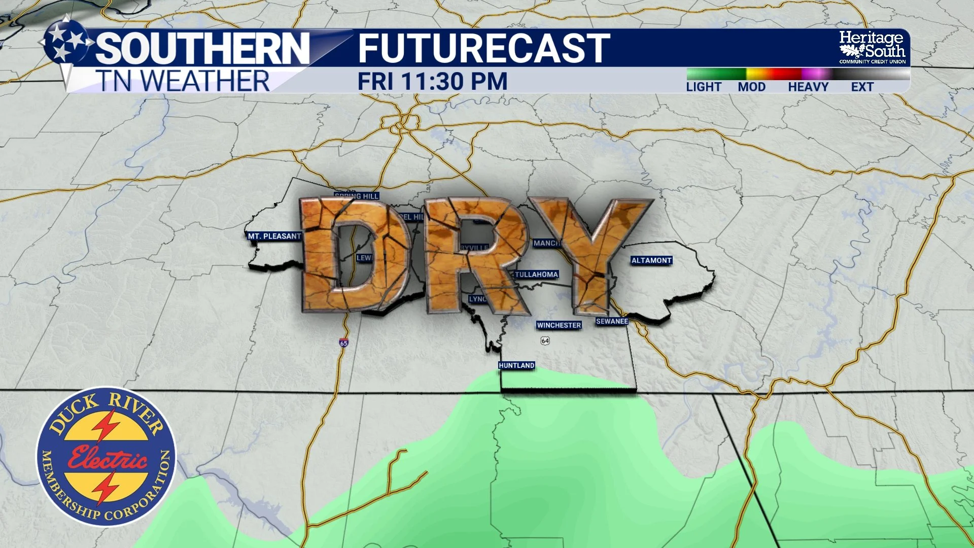
FUTURECAST TONIGHT - DRY
SATURDAY: COOLER THAN NORMAL, BUT NICE
As we head into Saturday, cooler air really settles in behind the recent front. Even with some sunshine returning, highs will struggle to climb much, topping out in the mid 60s for most of Southern Middle Tennessee. That’s several degrees below normal for early May.
There is a small chance for a stray shower, especially during the afternoon, but coverage will be very limited. Most areas will stay dry, and any rain that does develop will be brief and light. Overall, it’s just a cool, quiet spring day.
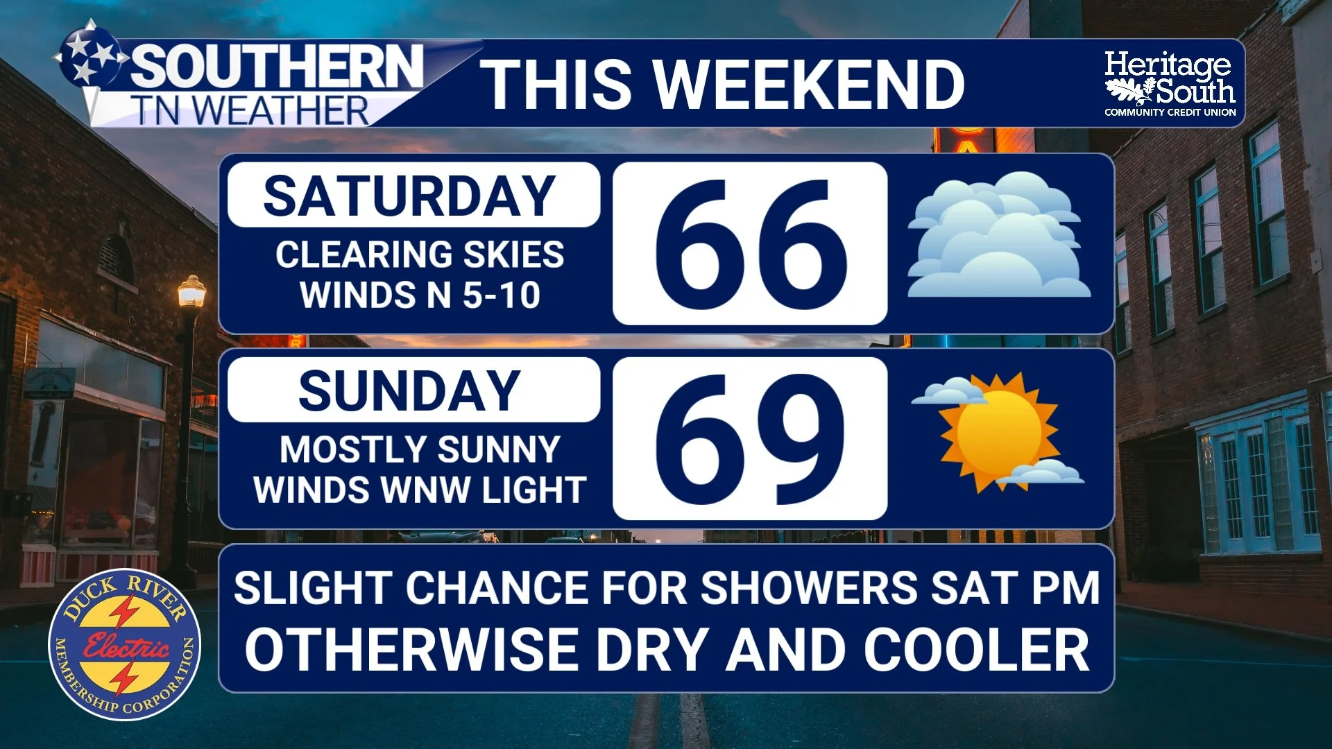
FORECAST - THIS WEEKEND
SATURDAY NIGHT INTO SUNDAY: CHILLY NIGHTS, COMFORTABLE DAYS
Saturday night is when things get interesting from a temperature standpoint. With clearing skies and lighter winds, we’ll have a setup that allows heat to escape efficiently overnight. That’s why lows will drop into the upper 30s to low 40s, especially in outlying and rural areas. Some light, patchy frost cannot be ruled out either.
A few of those colder spots could briefly dip into the upper 30s, so it’s going to feel more like early April than early May when you step outside Sunday morning. By Sunday afternoon, sunshine takes over and temperatures recover into the upper 60s to near 70. Still on the cool side, but very comfortable with low humidity.
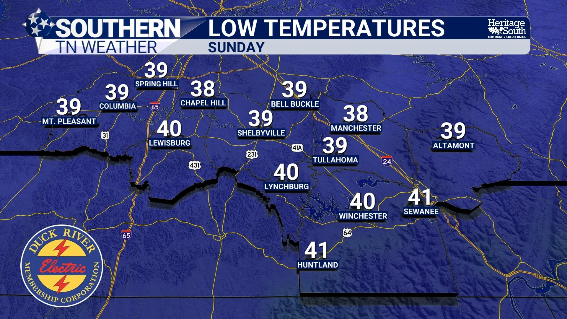
LOW TEMPERATURES - SUNDAY
EARLY NEXT WEEK: WARMING TREND RETURNS
By Monday, the pattern begins to shift again. High pressure slides east, allowing winds to turn more southerly. That brings warmer air back into the region, and we’ll see highs jump back into the mid to upper 70s, with some spots pushing near 80. Humidity will also begin to creep back up, signaling that the next change in the pattern is on the way.
TUESDAY INTO WEDNESDAY: STORMS RETURN
The next real weather-maker arrives by Tuesday into Wednesday, and this one looks much more impactful than anything we’re dealing with this weekend. A developing low pressure system over the Plains will move east, pushing a front toward the Tennessee Valley. As it does, moisture and energy will increase across the region.
Right now, we’re looking at medium chances for showers and thunderstorms, with a fairly good signal for widespread rainfall. Some guidance even suggests a decent shot at picking up over an inch of rain during that time frame. There are still questions regarding instability and storm strength, but there are early indications that some stronger storms could develop, especially Wednesday into Wednesday evening as better dynamics move in. It’s still several days out, so details will continue to change, but this is something we’ll be watching closely.
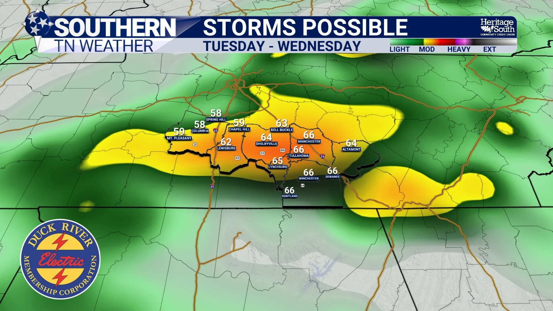
STORMS POSSIBLE - TUESDAY INTO WEDNESDAY
The Bottom Line 🧾
Very low rain chance tonight, mainly south
Cooler weekend with highs in the 60s
Chilly nights with lows in the upper 30s to 40s
Dry and comfortable conditions dominate Saturday and Sunday
Warmer weather returns Monday
Next round of storms arrives Tuesday into Wednesday
📰 Reminder: The Southern Tennessee Weather Blog, presented by Heritage South Community Credit Union, is updated Monday through Friday with fresh, locally tailored forecasts you can trust.