
Showers and Storms Increase… A Closer Look at Tonight into Wednesday

The Southern Tennessee Weather Blog is proudly presented by Heritage South Community Credit Union.
We Help When Others Won’t!
Visit https://www.heritagesouth.org/ today to see how HSCCU can help YOU!
After a quiet start to the week, the pattern across Southern Middle Tennessee is now transitioning into a much more active phase. The atmosphere is gradually loading with moisture, and over the next 24 to 36 hours, we’ll see an increase in both shower and thunderstorm coverage.
This is not a classic severe weather setup. Instead, this is a moisture-driven system where the primary concern shifts toward coverage of rain and localized heavy downpours, rather than widespread organized severe storms. That distinction matters, because it changes both how this event behaves and what impacts we expect locally.
Tuesday Afternoon: Spotty to Scattered Development
As of this afternoon, the atmosphere is still in the early stages of moistening. You may have noticed clouds increasing, and a few areas (especially closer to the Alabama state line) may see spotty showers trying to develop.
However, there is still some dry air in place, particularly in the lower levels of the atmosphere. When rain falls into dry air, some of it evaporates before reaching the ground. Meteorologists call this virga, and it’s one of the reasons coverage has been limited so far today. As we continue into the late afternoon and evening, moisture will deepen, allowing more of that precipitation to actually reach the surface. Even so, activity will remain somewhat scattered and disorganized through the early evening hours.
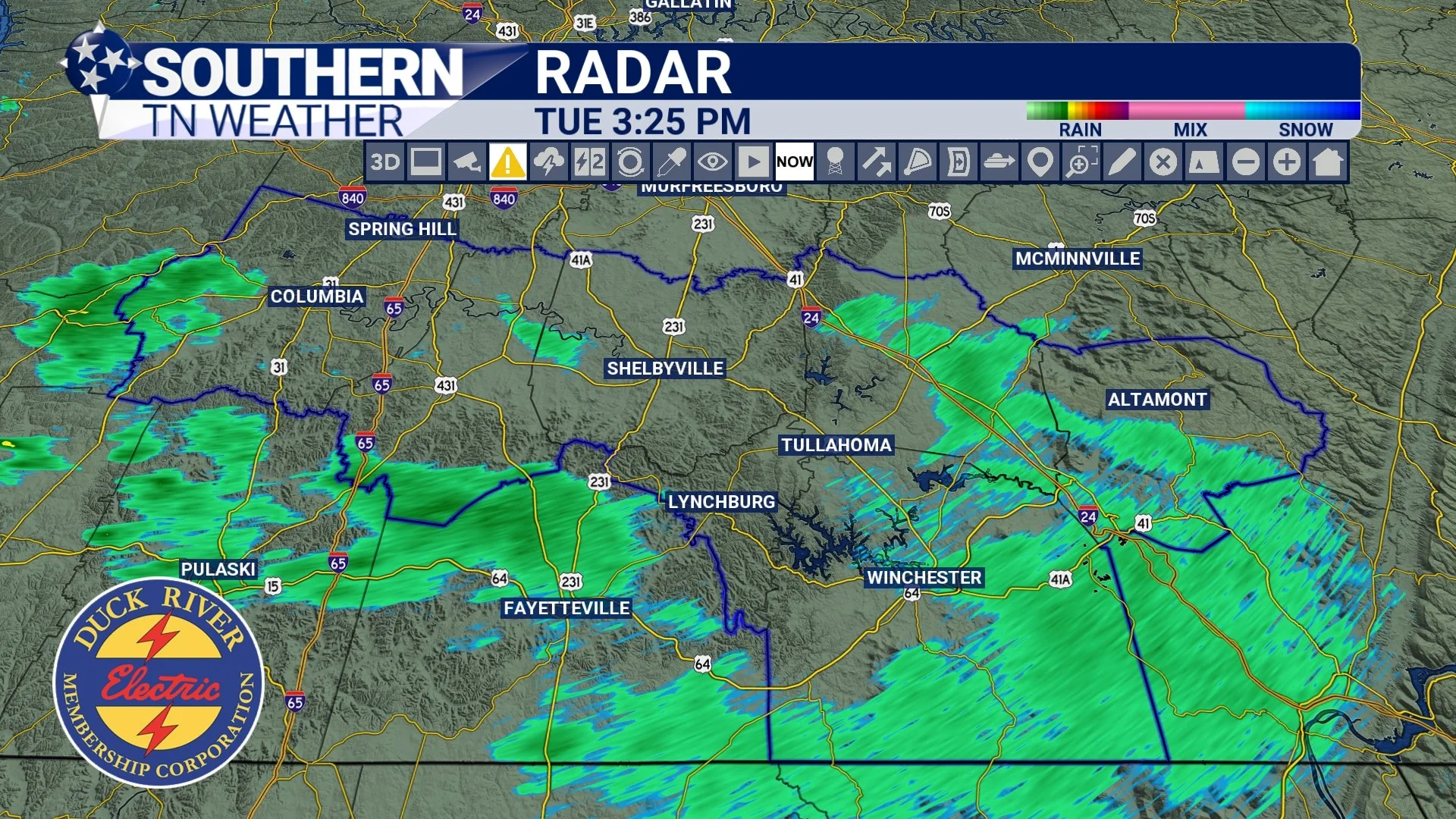
RADAR - TUESDAY AFTERNOON
Tuesday Night: Coverage Increases, Rain Becomes More Widespread
The better setup arrives tonight. A frontal boundary approaching from the northwest will begin to slow down as it nears the region, while upper-level disturbances move overhead. This combination enhances lift in the atmosphere, which is the process that allows air to rise and form clouds and precipitation. As lift increases, shower coverage will expand from west to east across Southern Middle Tennessee.
Instability will remain limited overnight, which means most of what we see will be rain with embedded thunder, rather than strong or severe storms. Still, a few heavier pockets of rain are expected, especially across our area. Rainfall totals through Wednesday morning will generally range from around a half inch to locally over an inch, with higher amounts possible where heavier bands set up.
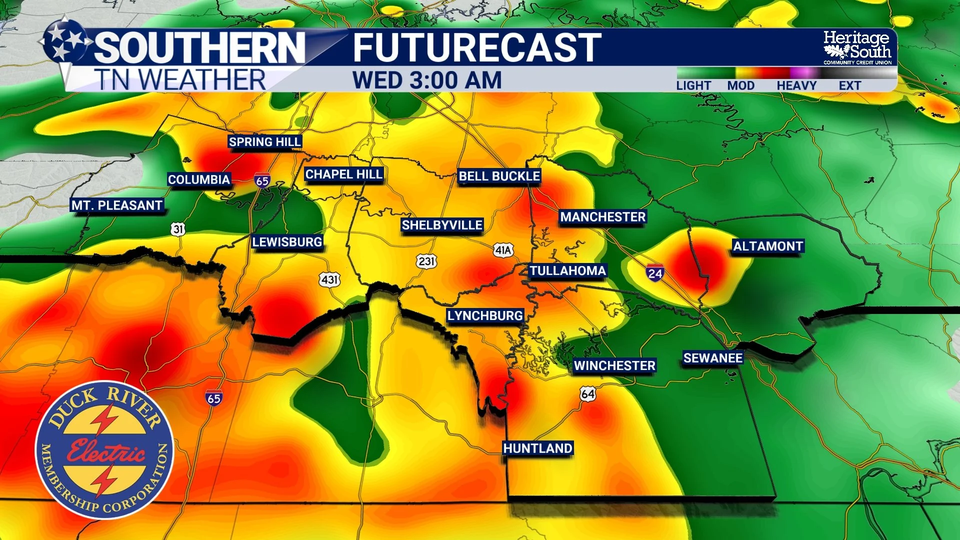
FUTURECAST - WEDNESDAY MORNING
Wednesday: A More Complex Setup
Wednesday is where things become more nuanced. By this point, the atmosphere will be very moist. Forecast PWAT values near 2 inches suggest a near “tropical-like” moisture profile for early May. This means any storm that develops will be capable of producing very efficient, heavy rainfall.
At the same time, we’ll be watching for something called instability recovery. After overnight rain and cloud cover, the atmosphere often needs time to “recharge” before it can support stronger storms. This recharge process depends on how much sunshine breaks through and how warm and humid the air becomes during the day. If enough instability develops Wednesday afternoon, a few stronger storms could form along and south of the stalled boundary. Wind shear, which helps storms organize, will be present. Timing would be 12:00 noon to 6:00 PM.
However, the overall environment still appears somewhat limited in terms of instability, which is why the severe weather threat remains low overall. That said, it is not zero. The main threats Wednesday, if storms can strengthen, would be:
Damaging wind gusts
Localized heavy rainfall
The best chance for any stronger storm would (again) be closer to the Alabama state line where slightly better instability may develop. A MARGINAL risk (level 1/5) for severe weather is in place from the Storm Prediction Center.
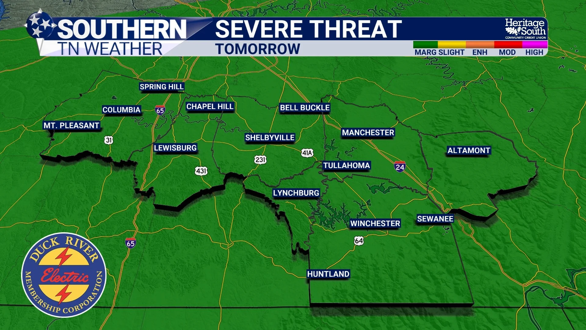
SEVERE THREAT - TOMORROW
Heavy Rain and Flooding Potential
Regardless of storm strength, the moisture in place will support periods of heavy rain, especially if storms move repeatedly over the same area. This process, known as training, occurs when storms follow the same path over and over again. While widespread flooding is not expected due to ongoing drought conditions, localized issues can still develop.
Watch for:
Water ponding on roads
Minor flooding in low-lying areas
Brief issues in poor drainage locations
In total, 1-2 inches of rainfall can be expected through Thursday morning. Locally higher amounts of 3+ inches will be possible where training occurs. We don’t know EXACTLY where this band of heavier rain will set up… So keep this in mind!
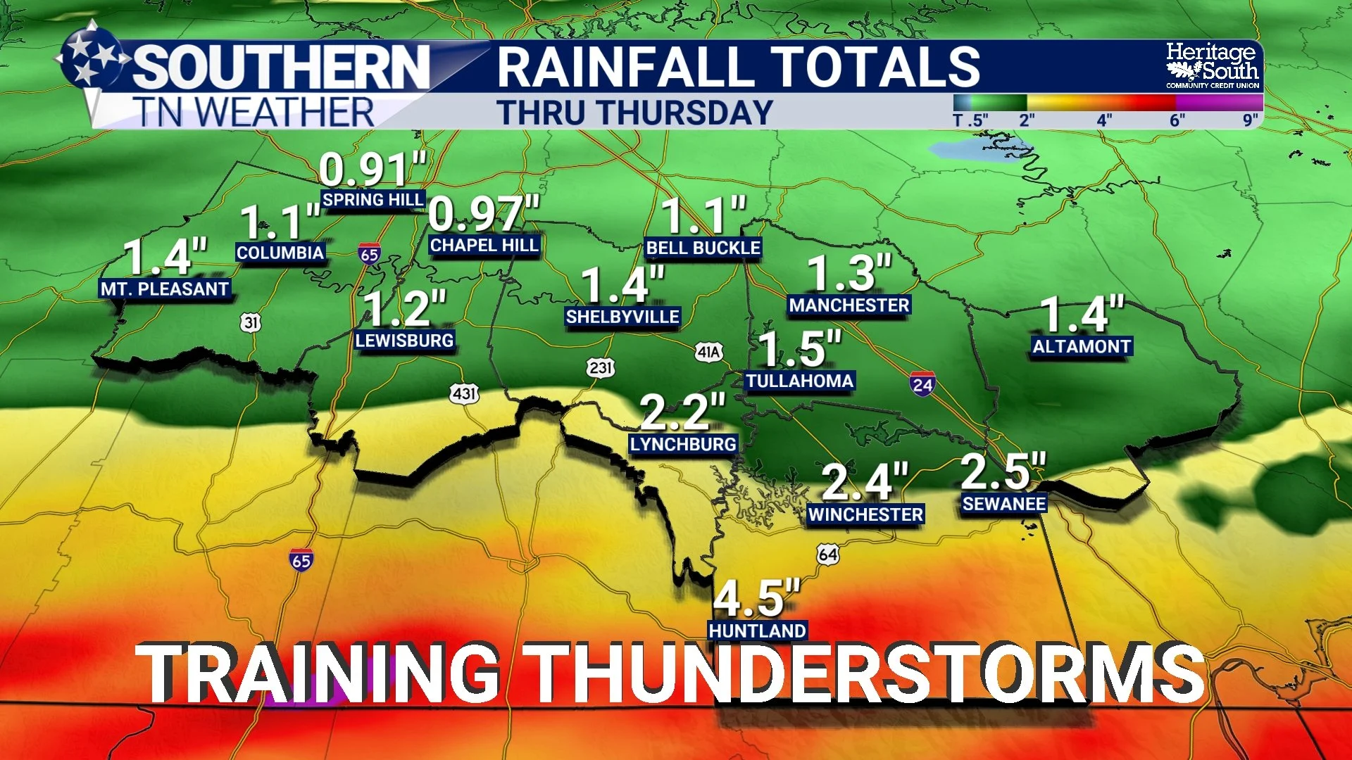
RAIN TOTALS - THRU THURSDAY
Looking Ahead
By late Wednesday night into Thursday, the front will begin to push through the area, gradually bringing an end to the more widespread rain. Behind it, cooler and more stable air will settle in, giving us a quieter end to the week.
The Bottom Line 🧾
Scattered showers this afternoon, becoming more numerous tonight
Widespread rain with embedded thunder Tuesday night into Wednesday
Rainfall totals of 0.5 to 1.5+ inches, locally higher possible
Heavy downpours possible due to very high moisture levels
Severe weather threat is low, but not zero Wednesday afternoon/evening
Best chance for any stronger storms Wednesday afternoon
Localized flooding possible, especially in poor drainage areas
📰 Reminder: The Southern Tennessee Weather Blog, presented by Heritage South Community Credit Union, is updated Monday through Friday with fresh, locally tailored forecasts you can trust.