
Friday & Saturday Coming Into Focus

The Southern Tennessee Weather Blog is proudly presented by Heritage South Community Credit Union.
We Help When Others Won’t!
Visit https://www.heritagesouth.org/ today to see how HSCCU can help YOU!
We’ve squeezed just about everything we can out of this quiet stretch of weather. Warm afternoons, comfortable humidity, and plenty of sunshine have been the theme across Southern Middle Tennessee. That continues today, but the atmosphere is already beginning to transition behind the scenes.
Moisture is slowly increasing, the upper-level pattern is flattening out, and disturbances are starting to move in from the west. All of that sets the stage for our next round of showers and storms as we head into Friday and Saturday.
FRIDAY: A WEAKENING SYSTEM MOVES IN
By Friday morning, a weakening cold front and associated line of showers and storms will be approaching from the west. This system originates from a stronger setup across the Plains, but as it moves into Tennessee, it begins to lose organization.
That weakening trend is important. As storms move into Southern Middle Tennessee, they will be dealing with a less favorable environment. Instability, which is the energy storms use to grow, looks fairly limited. Forecast values suggest CAPE (a measure of that energy) generally staying in the 400 to 800 range during the day, then decreasing into the evening. Wind shear, which helps storms organize and sustain themselves, also remains fairly modest, generally around 20 to 25 knots. That’s enough for storms to hold together briefly, but not enough to support widespread severe weather.
So what does that mean locally? Friday looks like a scattered, somewhat disorganized storm day, especially during the afternoon and evening hours. Coverage will not be uniform, and many areas may see little to no rain at all. That said, a few stronger storms cannot be ruled out. If a storm is able to briefly organize, it could produce gusty winds and maybe some small hail, but the overall severe threat remains low. The Storm Prediction Center has actually REMOVED their risk for strong to severe thunderstorms from the area for tomorrow.
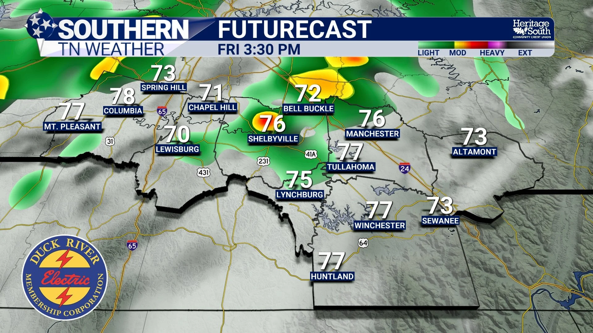
FUTURECAST - FRIDAY AFTERNOON
FRIDAY NIGHT INTO SATURDAY MORNING: BEST CHANCE FOR RAIN
The better opportunity for more widespread rain actually comes Friday night into early Saturday morning. This is when a shortwave, essentially a pocket of energy in the upper atmosphere, moves overhead and helps enhance lift across the region. Lift is what allows air to rise and form clouds and precipitation, and this added support increases rain coverage. Even with that, the environment still lacks strong instability and steep lapse rates, so storms will remain relatively weak overall.
For Southern Middle Tennessee, this looks like a period of showers with embedded thunderstorms, with the main impacts being brief heavy rain. Rainfall totals generally look to fall in the quarter to half inch range, with some locally higher amounts possible. It’s beneficial rain, but not a drought-buster.
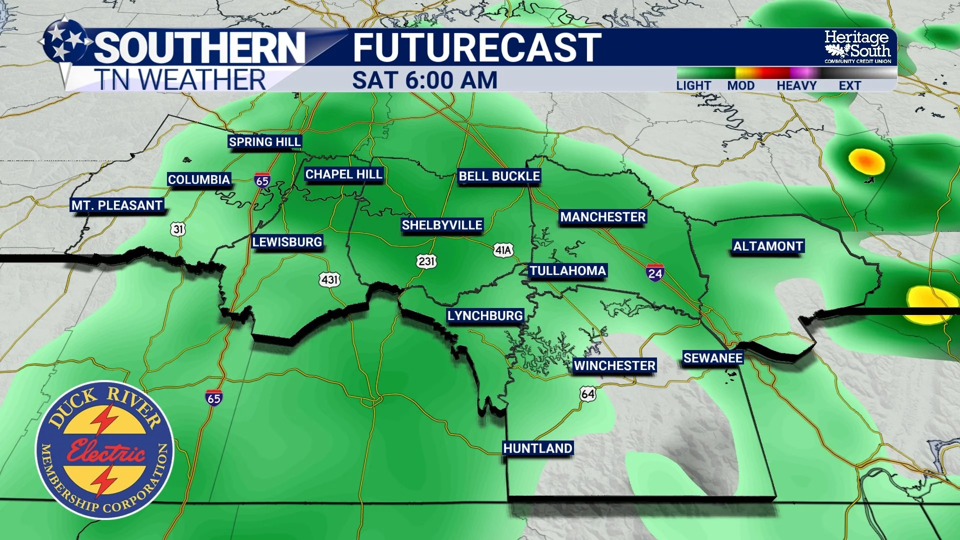
FUTURECAST - SATURDAY MORNING
SATURDAY: LINGERING SHOWERS, LOWER INTENSITY
As we move into Saturday, the atmosphere begins to lose some of its support for organized precipitation. The main energy associated with the system shifts east of the area, and while some instability may try to build during the afternoon, the lack of strong forcing means storm coverage will be more limited.
In practical terms, that means lingering showers in the morning, followed by a lower chance of isolated showers or storms during the afternoon. Overall intensity remains low, and severe weather is not expected. I’ve had many folks ask about exact timing for activity on Saturday. As it stands right now, anything more than “afternoon and evening” would just be me trying to throw a dart at the board and hoping it lands on the bullseye. And I would be doing a disservice by forecasting in that way.
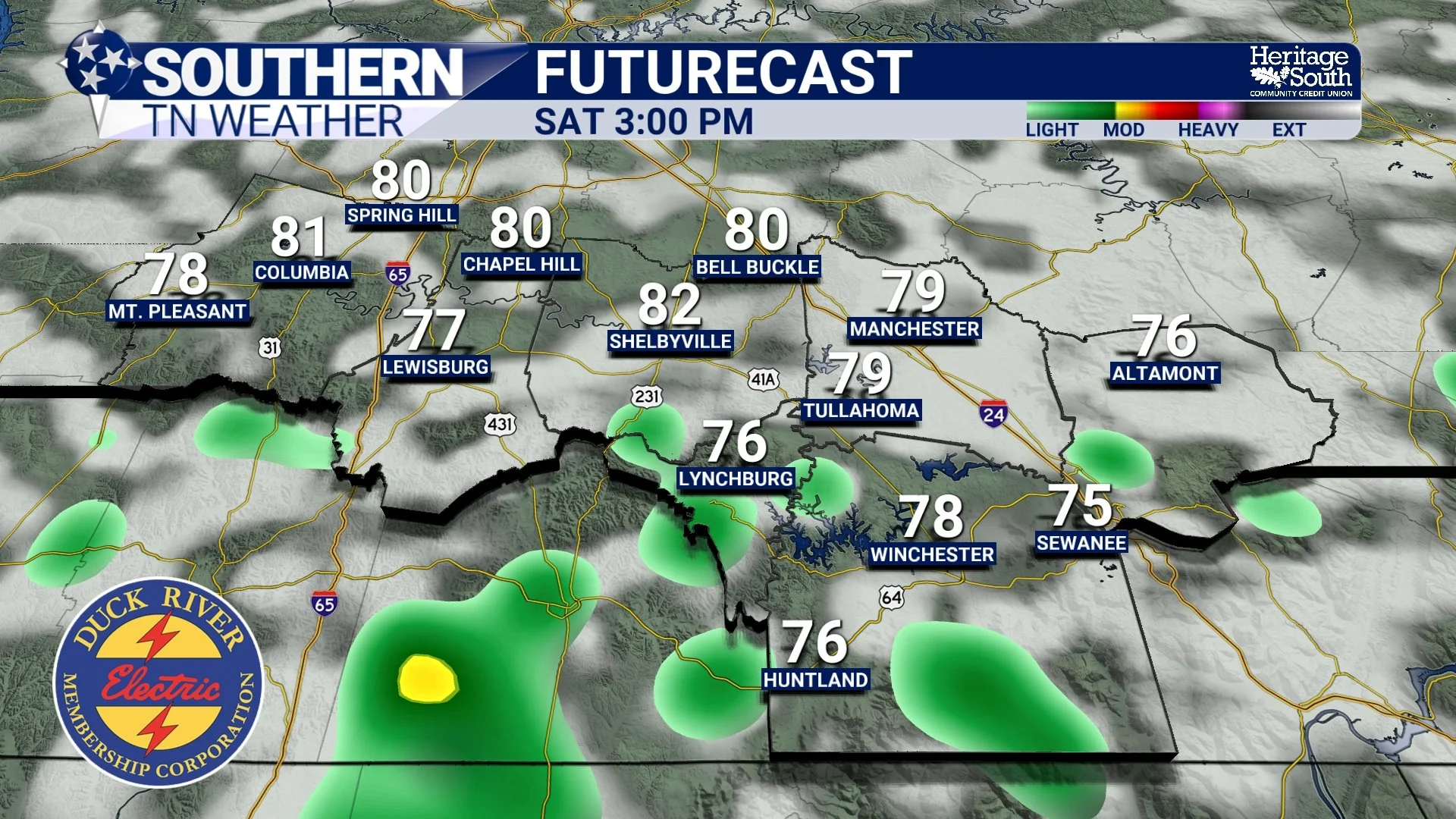
FUTURECAST - SATURDAY AFTERNOON
A QUICK NOTE ABOUT MONDAY
While Friday and Saturday are more about scattered rain and low-end storm potential, Monday continues to stand out as a much more organized system. A stronger trough and cold front will move into the region, bringing better instability, stronger wind shear, and a more supportive environment for severe storms. The latest data has moved some of the better ingredients off to our north and west, but still we need to watch closely. All hazards appear possible at this point, but it is still several days out and details will continue to change. The Storm Prediction Center continues the SLIGHT risk (level 2/5) in their extended outlook for areas along and west of US 231.
For now, the focus remains on getting through this weekend’s setup first.
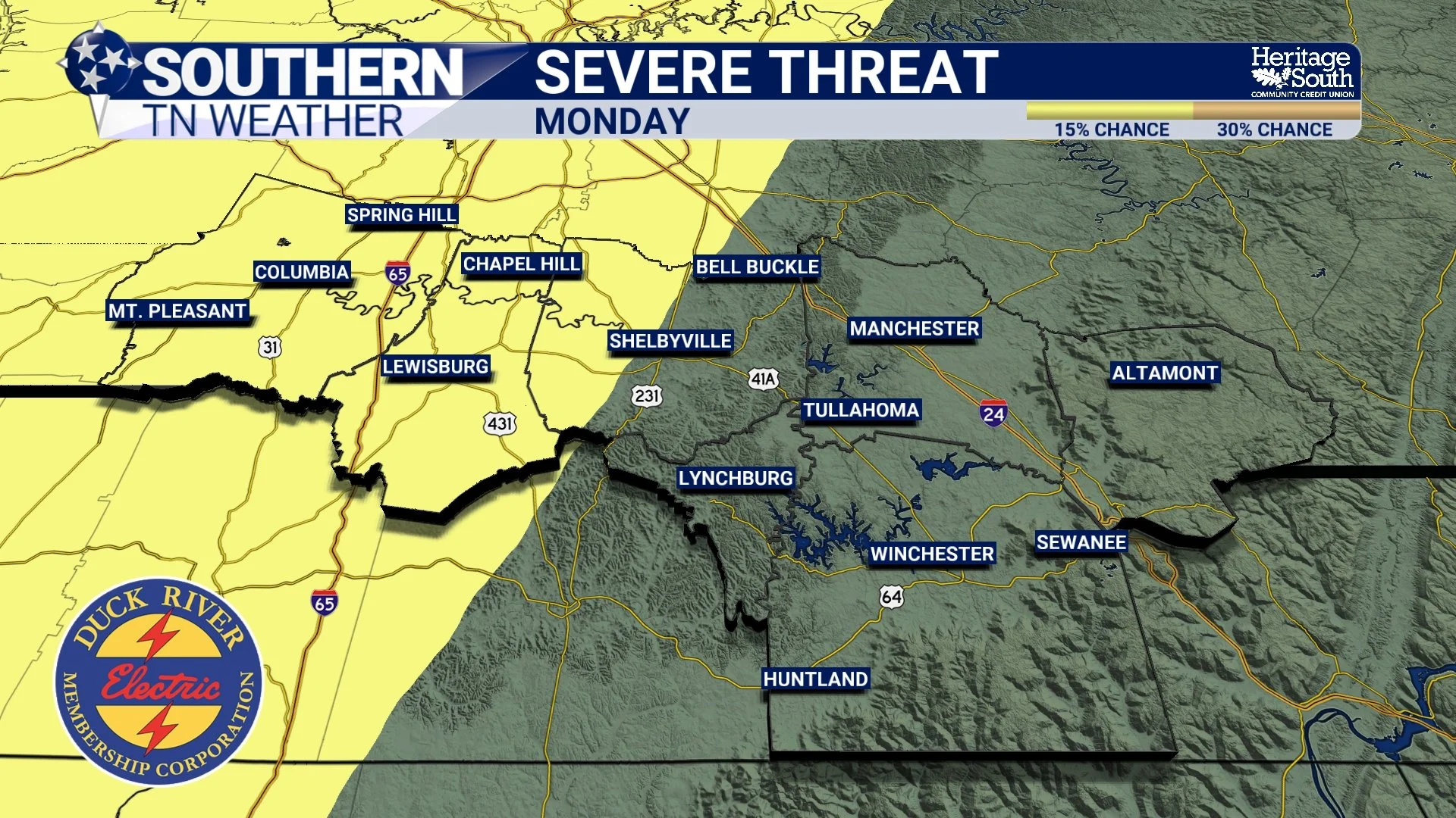
SEVERE THREAT - MONDAY
The Bottom Line 🧾
Dry and warm conditions continue through today
Scattered storms develop Friday with low severe risk
Best rain chances come Friday night into Saturday morning
Rainfall generally light to moderate and uneven
Monday remains a system to watch for stronger storms
📰 Reminder: The Southern Tennessee Weather Blog, presented by Heritage South Community Credit Union, is updated Monday through Friday with fresh, locally tailored forecasts you can trust.