
Cooler Air Moves In… What’s Left of the Rain and What Comes Next

The Southern Tennessee Weather Blog is proudly presented by Heritage South Community Credit Union.
We Help When Others Won’t!
Visit https://www.heritagesouth.org/ today to see how HSCCU can help YOU!
After a very active stretch of weather across Southern Middle Tennessee, things are finally beginning to settle down. The same system that brought us rounds of storms and much-needed rainfall over the past couple of days is now pushing off to our southeast, and with it comes a noticeable shift in our overall weather pattern.
But before we fully turn the page, there are still a few lingering pieces to talk through for today, along with a look at a quieter, cooler stretch ahead.
THIS AFTERNOON: THE FINAL PUSH OF THE FRONT
A cold front is currently sliding through Southern Middle Tennessee, acting as the dividing line between our recent warm, humid air and a much cooler, drier airmass moving in behind it. Ahead of that front, we’ve seen a few scattered showers develop, and in some cases, a brief rumble of thunder cannot be ruled out. The best chance for that thunder will be across our eastern communities, especially up on the Cumberland Plateau, where slightly better instability still exists.
That term “instability” refers to the atmosphere’s ability to support rising air. Warmer, more humid air near the surface combined with cooler air aloft creates an environment where air can rise more freely, which is what fuels showers and thunderstorms. Today, that instability is limited, which is why we are not expecting anything severe.
Most locations across Southern Middle Tennessee will simply deal with passing light showers or even just increased cloud cover as the front moves through. As it continues pushing southeast through the afternoon, rain chances will steadily decrease from northwest to southeast.
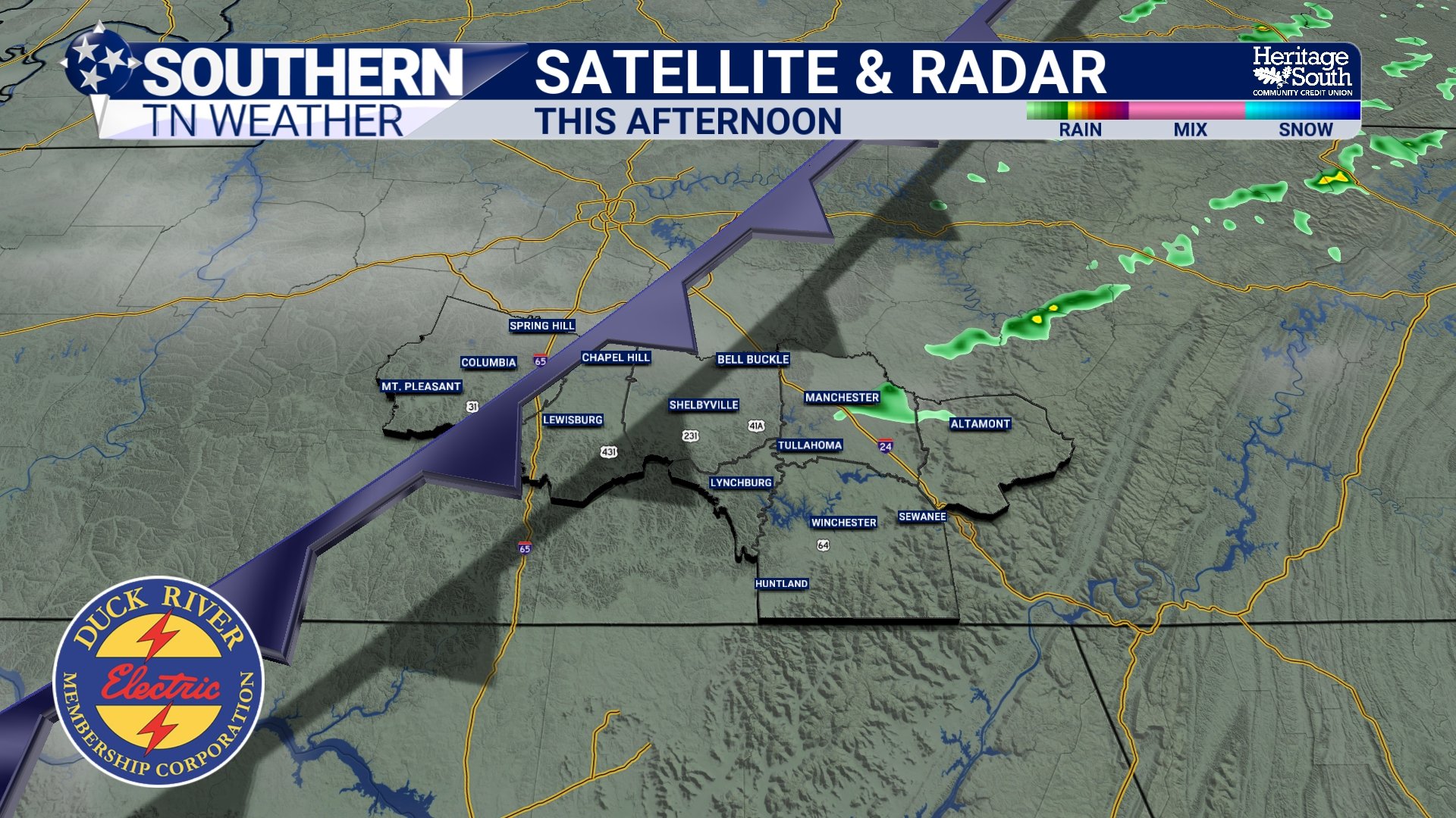
SATRAD - THIS AFTERNOON
TONIGHT: A TRUE AIR MASS CHANGE
Behind the front, a much cooler and drier airmass begins to settle in. You’ll feel it almost immediately this evening. Winds will shift, humidity will drop, and temperatures will fall off more efficiently overnight. By early Thursday morning, many communities across Southern Middle Tennessee will wake up to temperatures in the upper 40s to near 50 degrees.
This is a classic post-frontal setup where cooler air from the north replaces the warm, moisture-rich air we’ve had in place. It’s also why skies will gradually clear out tonight, allowing for better radiational cooling, which is just a scientific way of saying heat escapes more easily into space under clear skies.
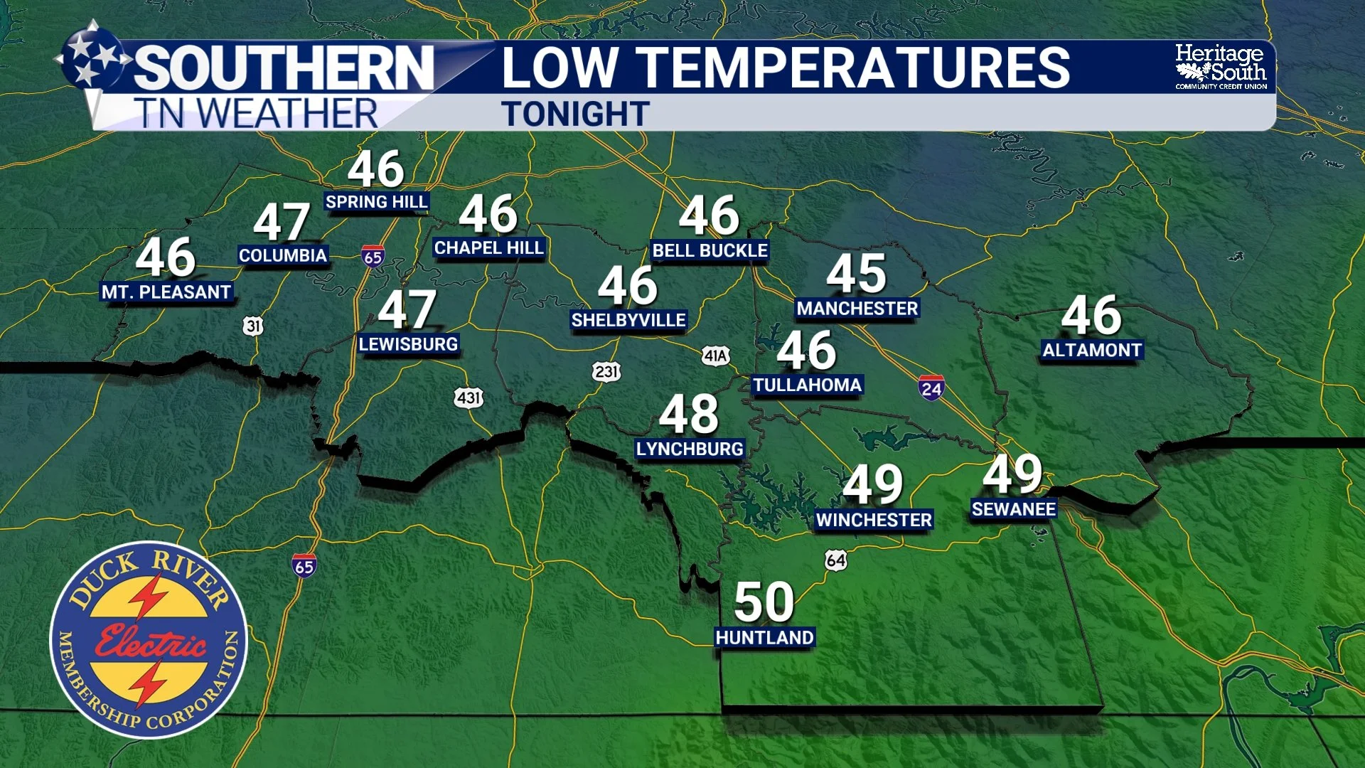
LOW TEMPERATURES - TONIGHT
THURSDAY THROUGH THE WEEKEND: A QUIET, COMFORTABLE PATTERN
Once we get past today, the overall pattern becomes much more stable. High pressure will take control of the region. In simple terms, high pressure is associated with sinking air, and sinking air suppresses cloud formation and storm development. That’s why we’re looking at a stretch of generally quiet weather.
Temperatures will run a few degrees below normal for late April, with highs mainly in the 60s and low 70s and comfortably cool nights. Humidity levels will stay low, which is going to make it feel especially pleasant compared to the muggy conditions we’ve had recently. This is one of those stretches where you can open the windows, enjoy the fresh air, and give the AC a break.
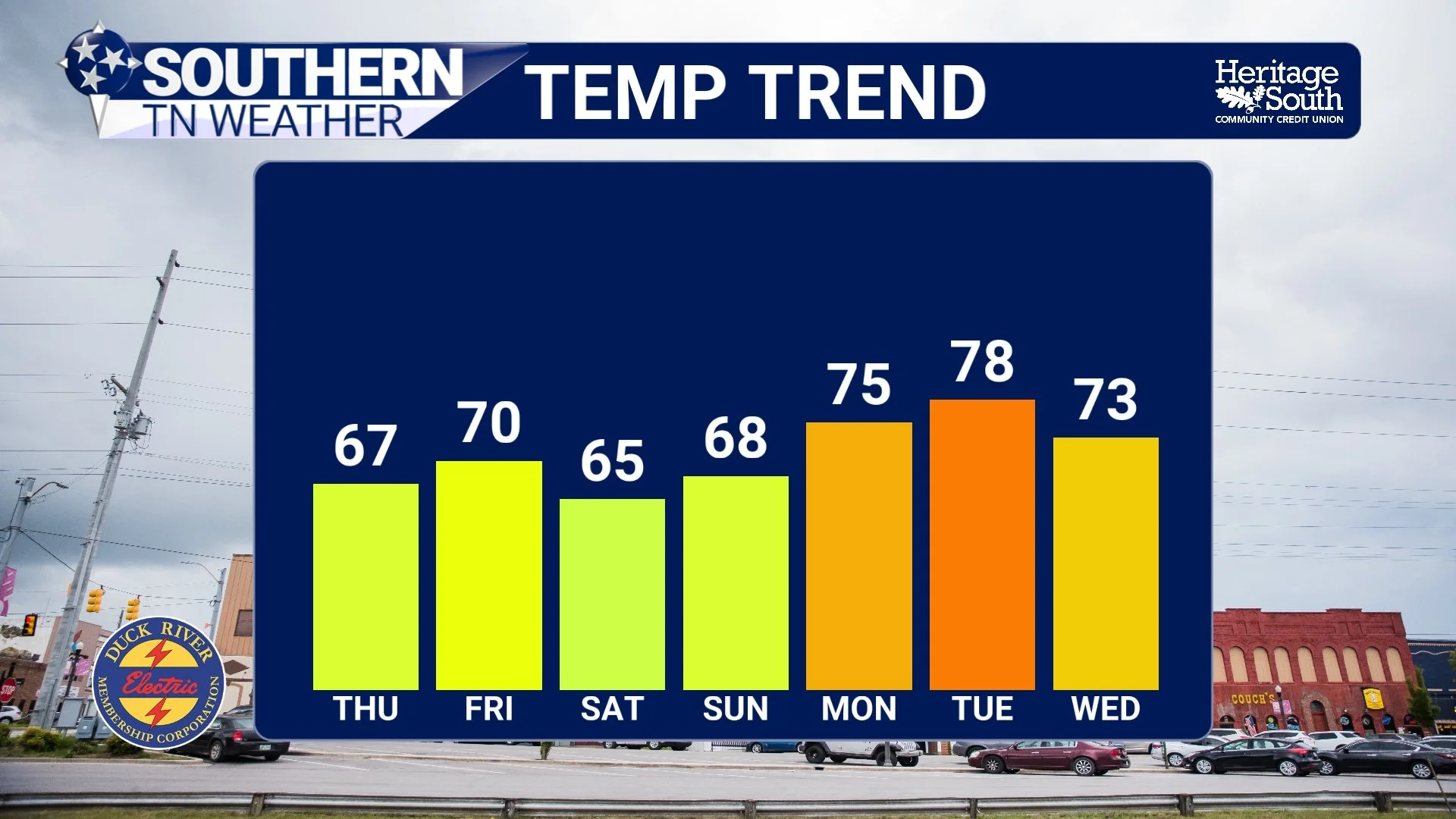
TEMPERATURE TREND - NEXT 7 DAYS
FRIDAY INTO SATURDAY: A SMALL RAIN CHANCE
There is one feature to watch as we head into Friday night and Saturday. A weak disturbance, or “shortwave,” is expected to pass to our south. A shortwave is essentially a small ripple in the atmosphere that can enhance lift and lead to cloud and rain development.
The key detail here is track. Right now, the best moisture and forcing with this system are expected to stay south of Southern Middle Tennessee, meaning our rain chances remain on the lower end. However, if that system trends a bit farther north over the next couple of days, we could see an increase in rain coverage.
Even in a scenario where rain does move in, this does not look like a heavy or impactful event. Most of what falls would be light to moderate, and many locations could stay completely dry. Any rain should be out of the area by mid-morning on Saturday at the latest. This, again, will depend on the exact track of the system.
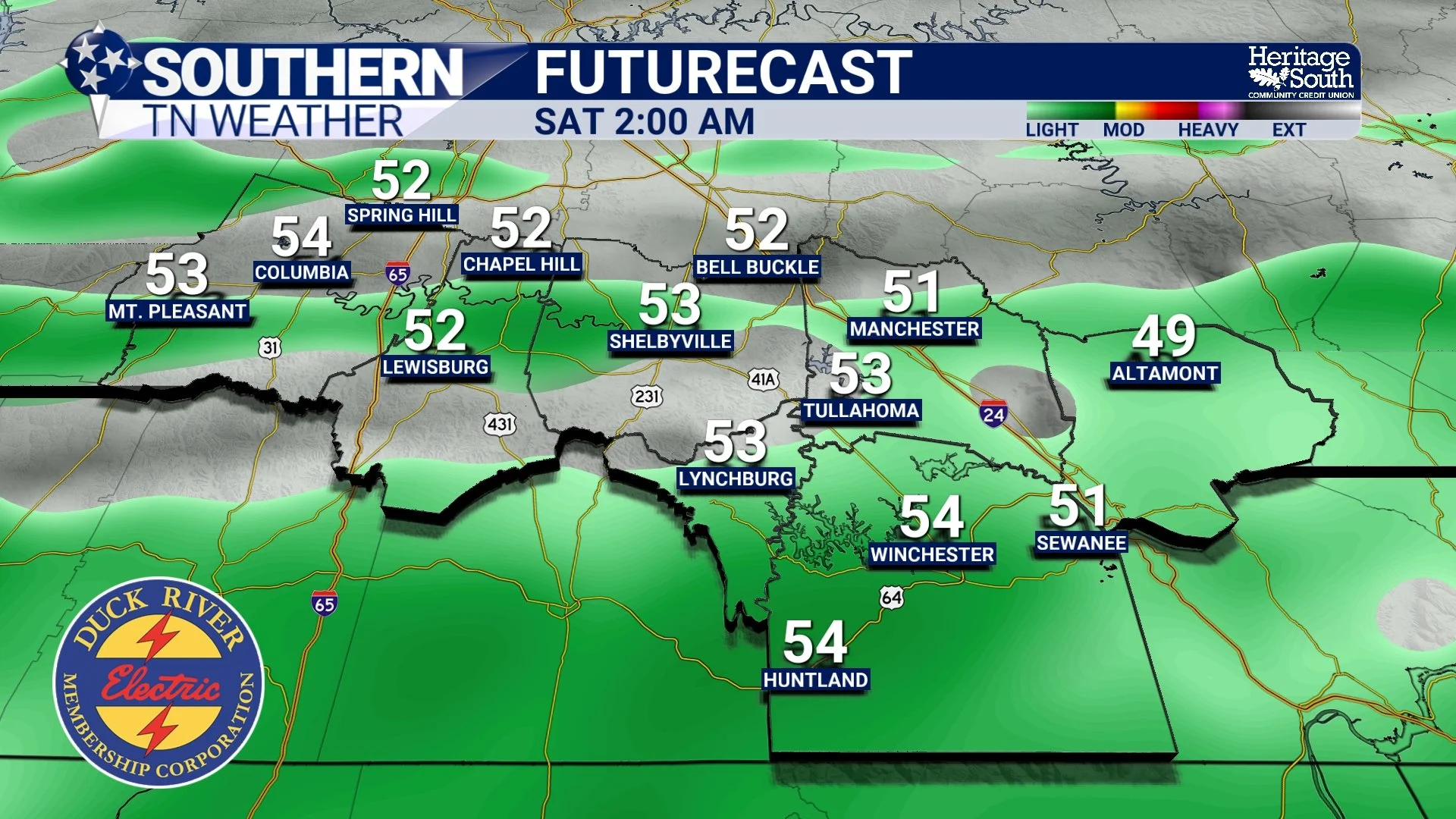
FUTURECAST - SATURDAY MORNING
LOOKING AHEAD
Beyond the weekend, the pattern remains relatively quiet at first, with temperatures gradually warming back toward seasonal levels early next week. There are some early signals of a more dynamic system developing by the middle of next week, but that is still several days out and details remain uncertain. For now, the focus is on the much calmer stretch we’re heading into.
The Bottom Line 🧾
A cold front moves through this afternoon with a few light showers
Best chance for a rumble of thunder is on the Plateau
Cooler, drier air arrives tonight with lows in the upper 40s
Quiet, comfortable weather Thursday through the weekend
Low rain chances Friday night into Saturday, but many stay dry
📰 Reminder: The Southern Tennessee Weather Blog, presented by Heritage South Community Credit Union, is updated Monday through Friday with fresh, locally tailored forecasts you can trust.