
A Wet Pattern is Emerging… Latest Details Here

The Southern Tennessee Weather Blog is proudly presented by Heritage South Community Credit Union.
We Help When Others Won’t!
Visit https://www.heritagesouth.org/ today to see how HSCCU can help YOU!
QUIET NOW… BUT ENJOY IT WHILE IT LASTS
If you stepped outside this morning, you probably noticed it felt a little more like early spring again. Crisp air, clear skies, and temperatures running below normal to start the day. That’s all thanks to high pressure firmly in control across the Southeast. Lows this morning were very chilly in the mid to upper 30s!
And for the next few days, that same setup sticks around. Sunshine will be plentiful, temperatures will gradually warm, and honestly… it’s about as quiet as it gets for late April. But if you’ve been waiting on a pattern change… it’s coming.
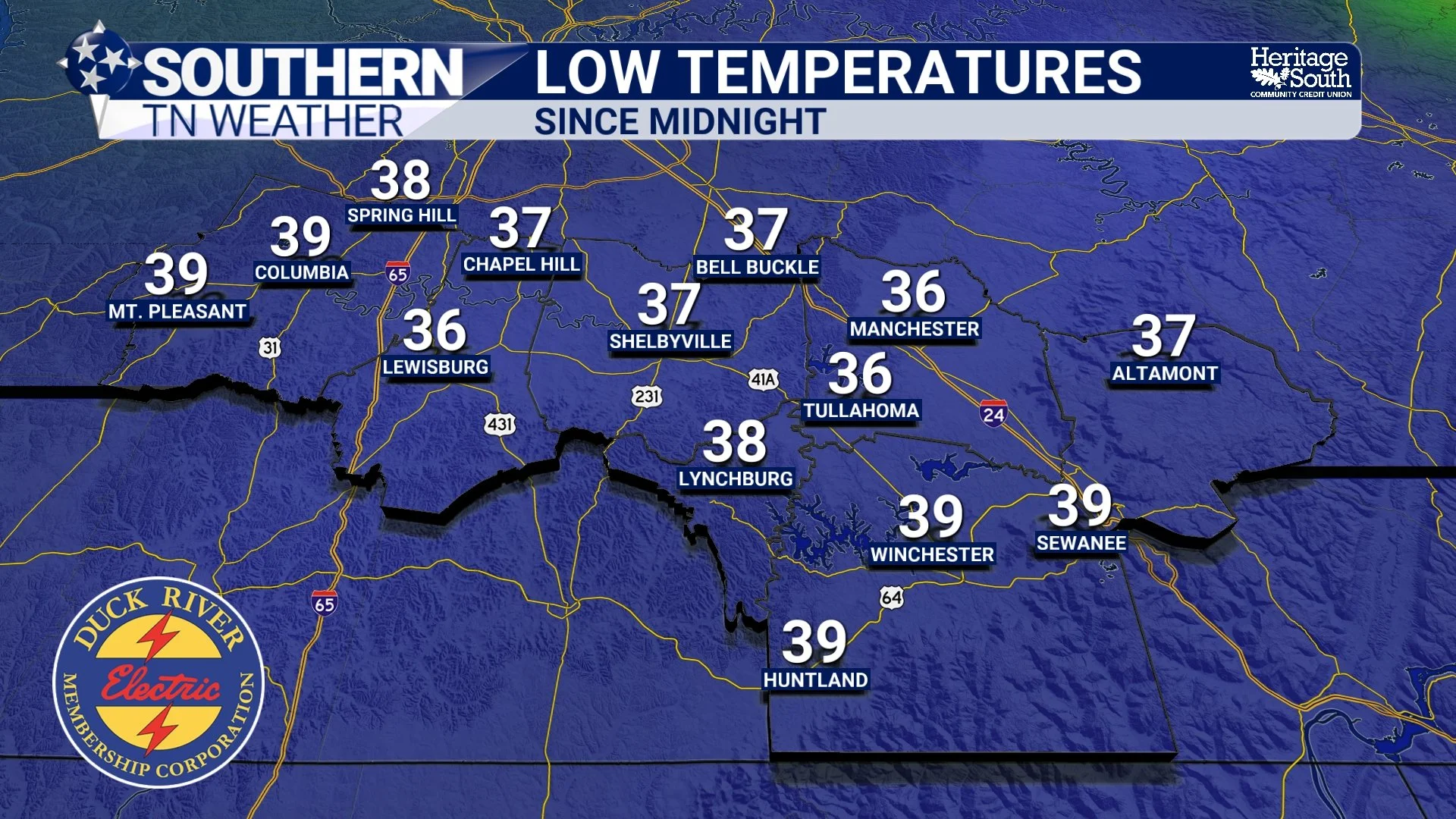
LOW TEMPERATURES - THIS MORNING
THE TRANSITION: FROM DRY TO UNSETTLED
By the time we get into late week, the pattern begins to shift in a pretty noticeable way. That big ridge that’s been protecting us from rain starts to weaken and slide east. At the same time, troughing develops out west and begins sending disturbances our way.
What does that mean in plain English? The door opens. Moisture starts increasing, winds turn more southerly, and suddenly the atmosphere becomes much more supportive of showers and storms.
FRIDAY: THE FIRST CRACK IN THE PATTERN
Our first real shot at rain comes Friday, most likely later in the day and into the evening. Right now, this doesn’t look like a particularly impressive setup. Instability is limited, and the atmosphere just doesn’t have a lot of energy to work with. So while we should see some showers and maybe a few storms, this looks like more of a “get things going” type system.
Think scattered activity, not a widespread soaking rain.
SATURDAY: THINGS START TO LOOK MORE LIKE SPRING
Saturday is where things begin to get more interesting. Instability increases, moisture deepens, and we start to see a more typical spring setup take shape. We’re talking higher energy in the atmosphere, better lapse rates, and enough wind shear to support organized storms. Now… before anyone runs with that, its still way too early to talk specifics, and we are not looking at anything clearly significant right now. But the ingredients are trending in a direction that at least gets your attention this far out. At the very least, Saturday looks like a better chance for more widespread showers and storms compared to Friday.
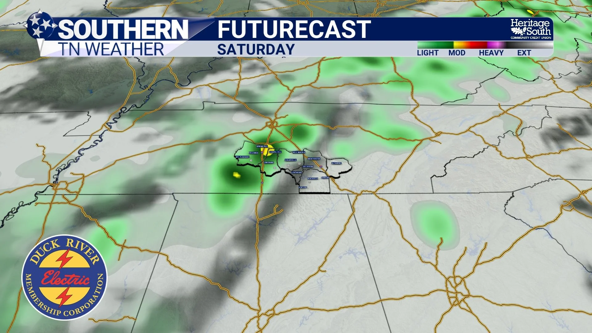
FUTURECAST - SATURDAY
LOOKING AHEAD: THIS MAY NOT BE A ONE-AND-DONE
Here’s the bigger takeaway. This doesn’t look like just one quick system moving through and we go right back to dry weather. Both the GFS and European models are hinting at another system early next week, possibly as soon as Monday. And beyond that, the overall pattern favors continued chances for rain and storms.
Even long-range guidance is pointing toward a more active, wetter setup across much of the central and eastern U.S. So after weeks of asking “where is the rain?”… we may finally be entering a stretch where we’re asking “when is the next round?”
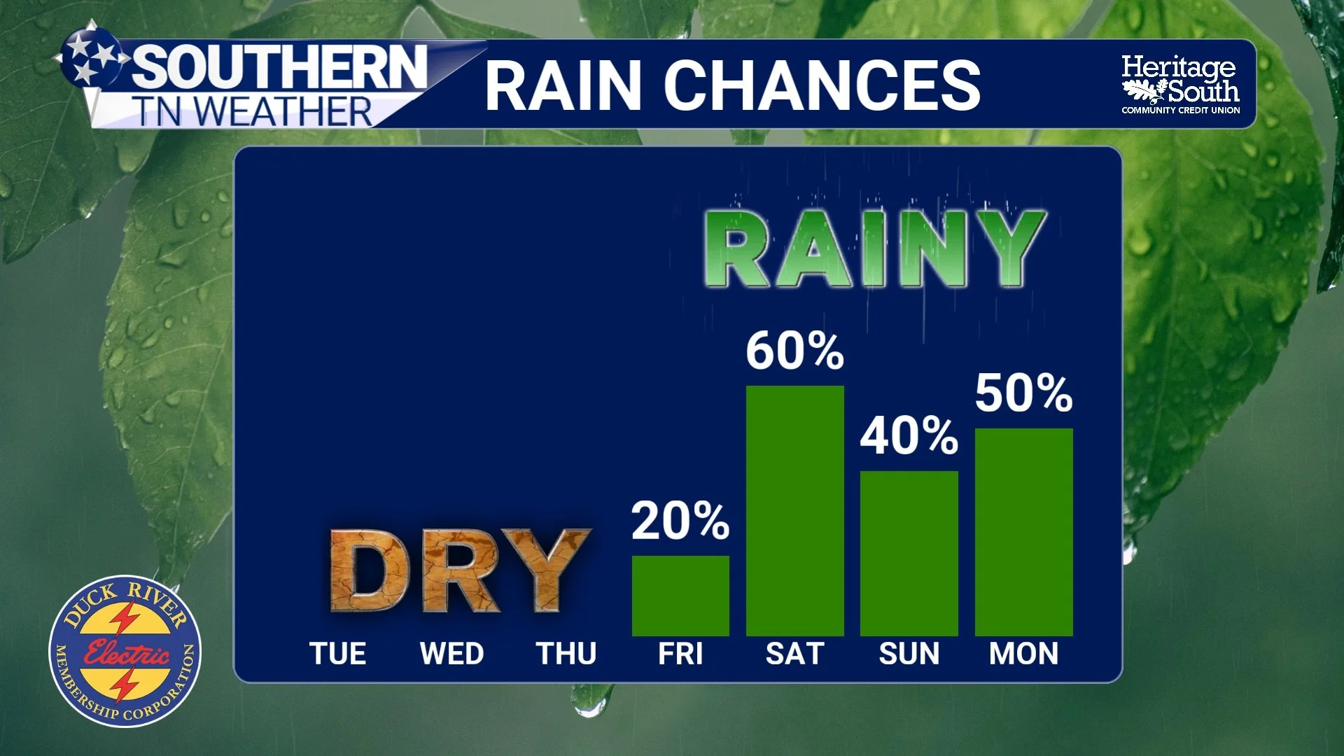
RAIN CHANCES - NEXT 7 DAYS
TEMPERATURES: A ROLLERCOASTER CONTINUES
In the meantime, temperatures will steadily climb through the week. We go from below normal today… back into the 70s and 80s by mid to late week… and then potentially dealing with more cloud cover and rain-cooled air as we head into the weekend. Pretty classic April behavior.
THE BIG PICTURE
We’re not flipping a switch into a soaking wet pattern overnight. But the signs are there. The ridge is weakening. Moisture is returning. Systems are lining up. And that’s how these transitions happen… gradually, then all at once.
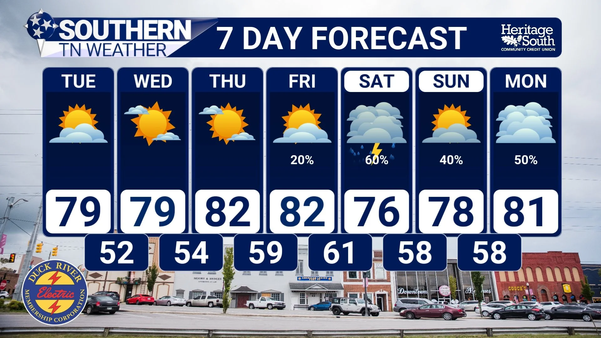
STNWX 7-DAY FORECAST
The Bottom Line 🧾
Dry and pleasant weather continues through Thursday
Rain chances return Friday, but limited at first
Better chance for showers and storms Saturday
Pattern turning more active into next week
Additional systems possible early next week
📰 Reminder: The Southern Tennessee Weather Blog, presented by Heritage South Community Credit Union, is updated Monday through Friday with fresh, locally tailored forecasts you can trust.