
Showers and Storms Return Tonight… But Don’t Expect Much

The Southern Tennessee Weather Blog is proudly presented by Heritage South Community Credit Union.
We Help When Others Won’t!
Visit https://www.heritagesouth.org/ today to see how HSCCU can help YOU!
A QUIET START… BUT CHANGES ARE COMING THIS EVENING
It’s been another warm, quiet day across Southern Middle Tennessee, and honestly that’s been the theme for a while now. High pressure has kept us dry, stable, and running well above normal temperature-wise. But that pattern is starting to bend just a little bit.
A weak disturbance brought a few sprinkles earlier today, but the real focus is this evening as a cluster of showers and storms tries to move in from the west.
TONIGHT’S SETUP: TIMING HELPS US OUT
Storms will develop to our west this afternoon and move into the area this evening, generally between 6 PM and 12 AM for most of Southern Middle Tennessee. And here’s the key… They’re arriving after peak heating.
That means instability is already starting to drop off, and the atmosphere is becoming less supportive of strong storms. That’s a big reason why the overall severe threat remains low.
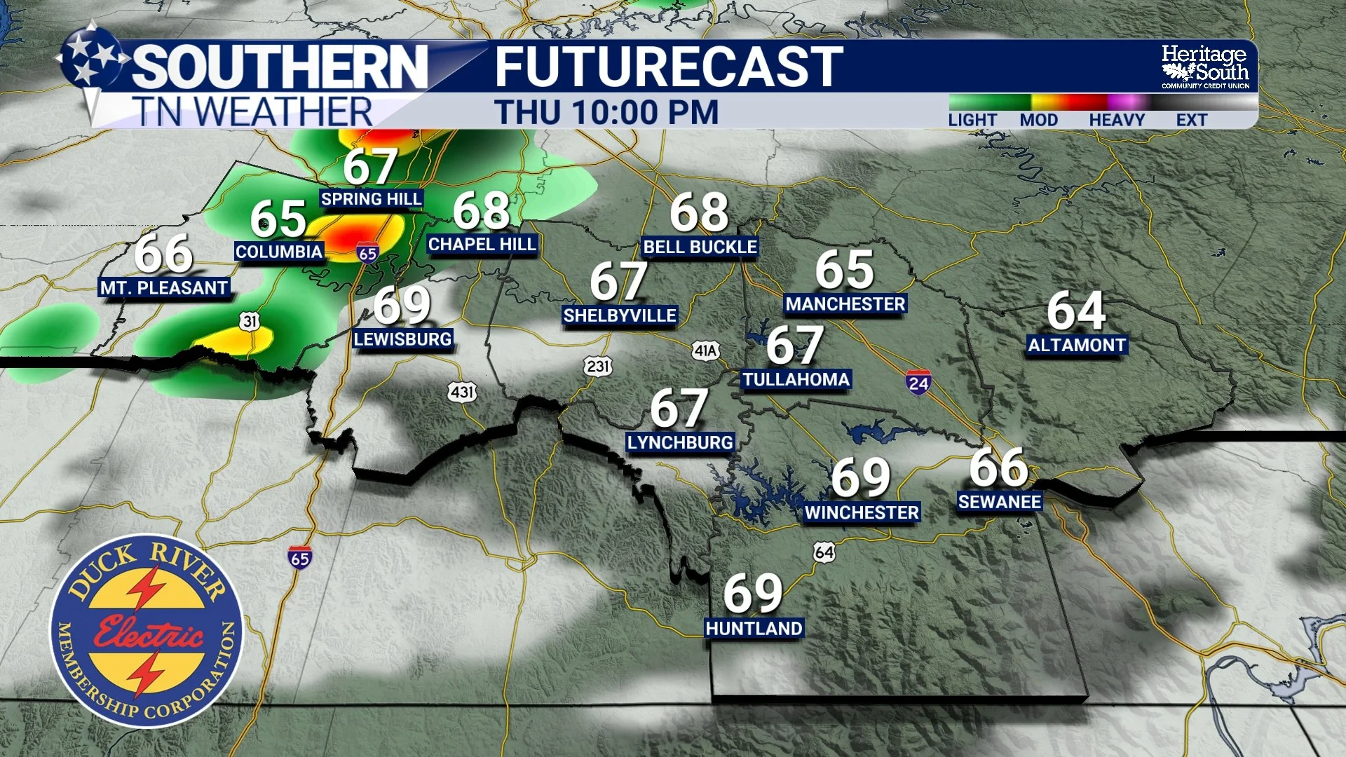
FUTURECAST - THURSDAY NIGHT
LET’S TALK ABOUT “CRYING WOLF”
I know how this goes. We mention a severe weather risk… and then nothing really happens… and people start thinking we’re just hyping things up. That’s not what’s happening here.
We will always communicate a severe weather risk, even if it’s on the low end. That’s part of the job. It is always better to be prepared than to be caught off guard. At the same time, we’re not going to hype up a setup like this when the overall threat is clearly low.
Two things can be true: There is a low-end risk worth mentioning AND this is not a high-impact event. So yes, we’re talking about it. No, we’re not overblowing it.
WHAT TO EXPECT FROM STORMS TONIGHT
This looks like a cluster of storms moving in from the west, not something that just pops up overhead. A few storms could briefly be on the stronger side, especially early on, with gusty winds up to 60 MPH and maybe some small hail. But as they move east, they’re expected to weaken as the atmosphere becomes more stable. So western areas have the better shot at seeing anything stronger, while areas east of I-65 will likely see storms on a downward trend.
Still, the Storm Prediction Center has our area under a MARGINAL risk (level 1/5) for severe thunderstorms this evening.
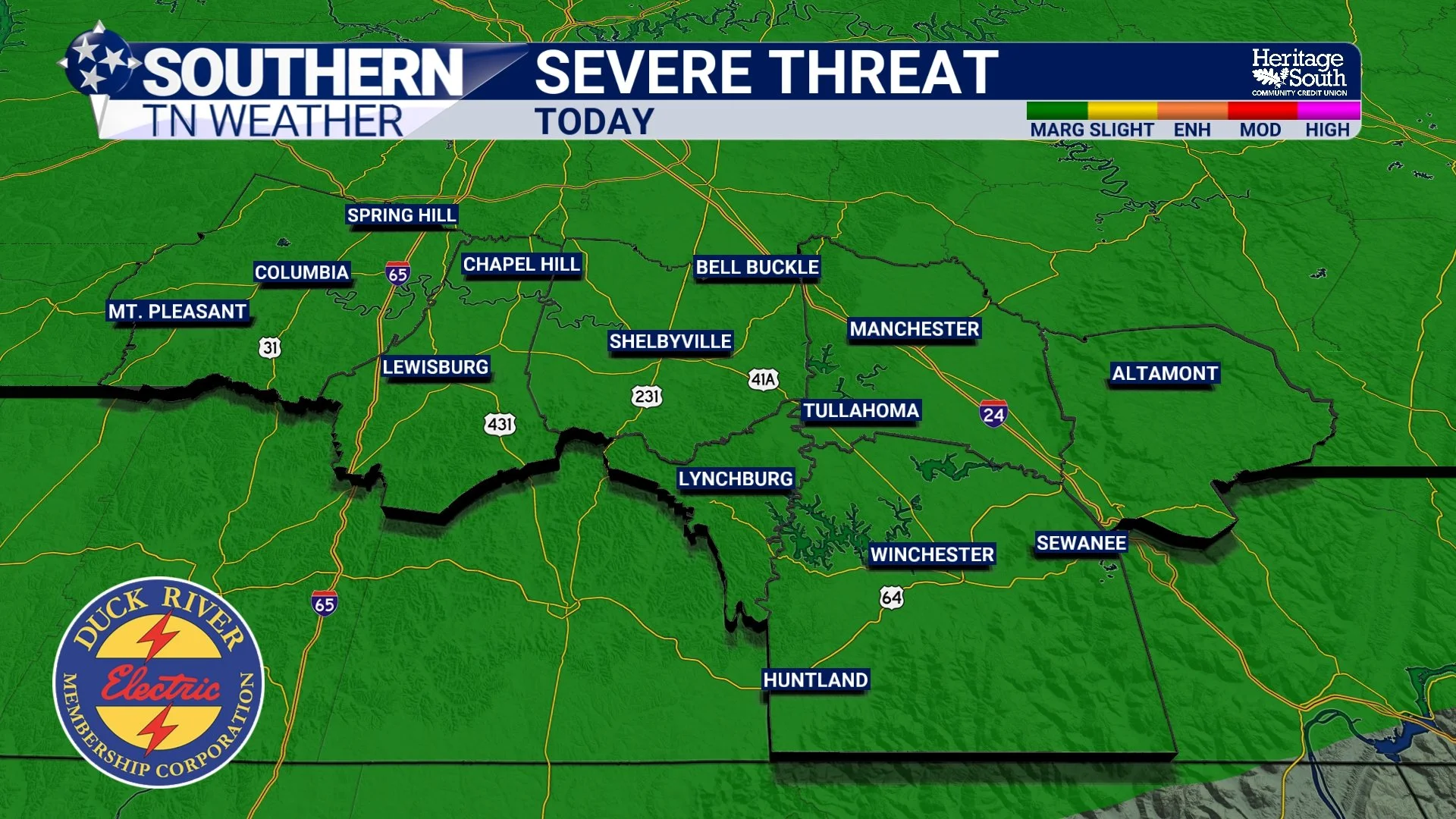
SEVERE WEATHER THREAT - TODAY
RAINFALL: VERY HIT OR MISS
Now for the part a lot of you care about… rain totals. This is going to be scattered stormage. Not everyone is going to see rain. Some of you will get a quick downpour. Others may get absolutely nothing.
Where it does rain, totals will generally be light. Most spots that see rain will pick up a few hundredths to maybe a quarter inch. A few lucky locations could push closer to a half inch. But again… very hit or miss.
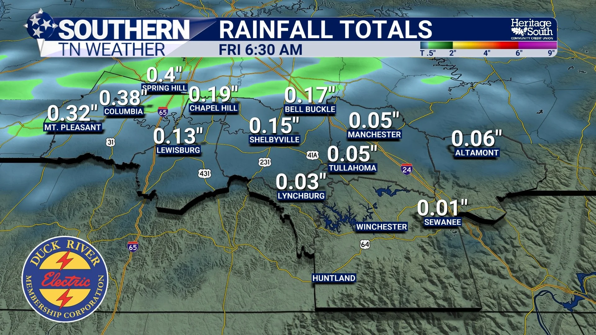
RAINFALL TOTALS - THRU FRIDAY AM
WHAT HAPPENS NEXT
Once these storms move out tonight, we quiet right back down again. Friday looks warm and mostly dry, and then we do it all over again Saturday with another system. That one brings better coverage, but still not a major rainmaker. Behind that front, we finally cool down heading into Sunday and early next week.
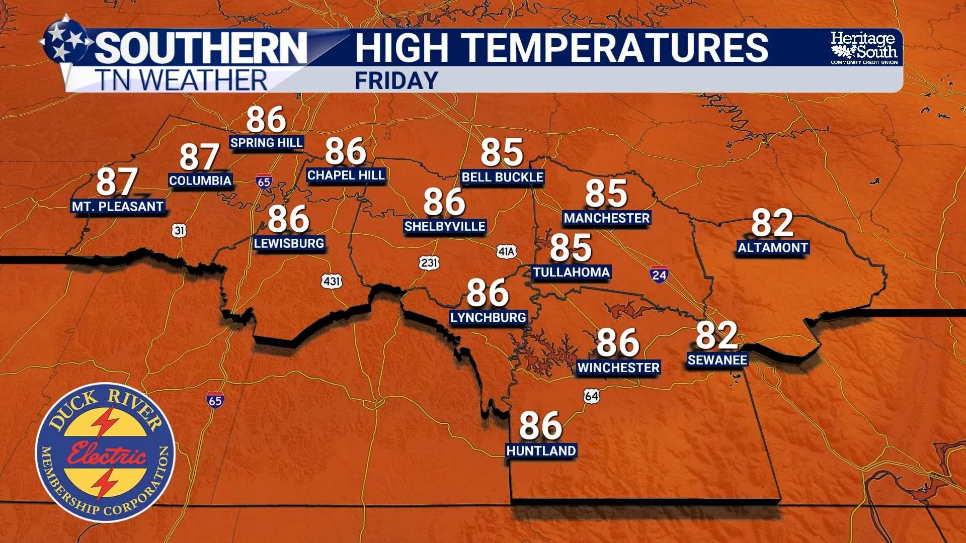
HIGH TEMPERATURES - FRIDAY
The Bottom Line 🧾
Storms arrive this evening, mainly 6–12 AM
Low-end severe risk, mainly wind and small hail
No hype… but still something to watch
Not everyone will see rain
Rainfall will be light and very hit or miss
📰 Reminder: The Southern Tennessee Weather Blog, presented by Heritage South Community Credit Union, is updated Monday through Friday with fresh, locally tailored forecasts you can trust.