
Is an Active Pattern Finally Coming Back? Not So Fast…

The Southern Tennessee Weather Blog is proudly presented by Heritage South Community Credit Union.
We Help When Others Won’t!
Visit https://www.heritagesouth.org/ today to see how HSCCU can help YOU!
RIGHT NOW: WARM, DRY, AND A LITTLE TOO QUIET
If it feels like we’ve been stuck in the same weather pattern for a while… that’s because we have. High pressure is still firmly in control across the Southeast, both at the surface and aloft. That means sinking air, lots of sunshine, and temperatures climbing into the 80s again this afternoon. Pretty nice if you like warm weather… not so great if you’re waiting on rain.
We’ve also got that classic combo today of dry air, gusty winds, and dry fuels. In other words, it does not take much to get a fire going. We’re under yet another ELEVATED risk (level 1/3) for Fire Weather today from the Storm Prediction Center. This is one of those days where “just being careful” actually matters.
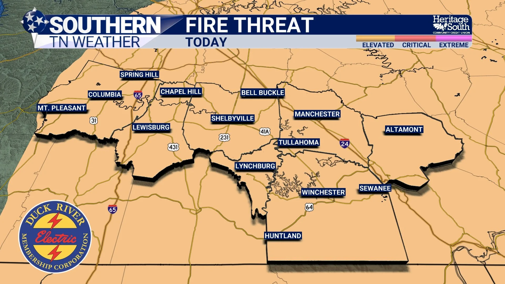
Fire Threat Today
THURSDAY: A LITTLE ACTION… BUT NOT MUCH PAYOFF
A weak boundary will slip into the region tonight into Thursday, bringing our next chance for showers and maybe a few thunderstorms. There’s even a chance a small cluster of storms clips the northwest portions of Middle Tennessee Thursday evening.
But let’s temper expectations here. Rainfall totals are underwhelming. Most spots will see around a quarter inch or less, maybe a half inch if you’re lucky. That’s helpful… but it’s not fixing anything. Why? The atmosphere still isn’t fully on board. Moisture is limited, and the system itself is not particularly strong. So we get activity… just not efficiency.
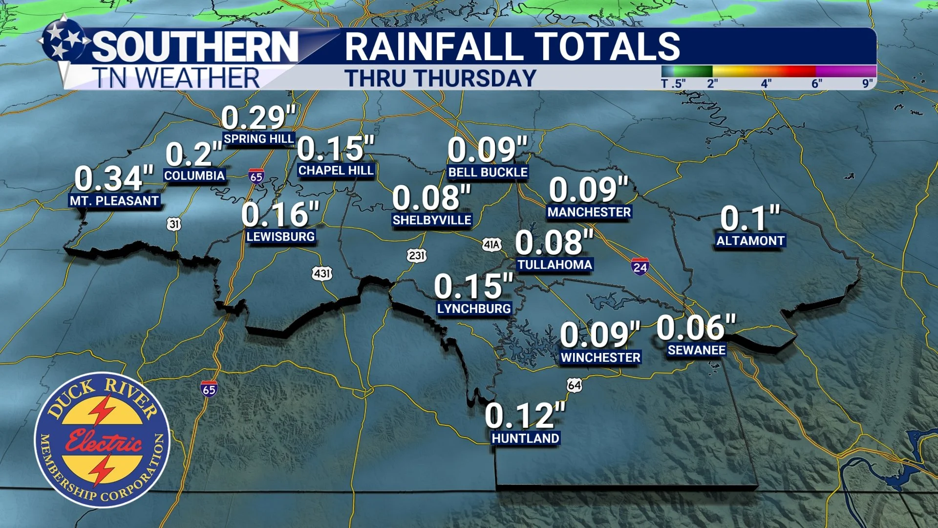
Rainfall Totals - Thru Thursday
SATURDAY: A STRONGER SYSTEM… SAME LIMITATIONS
Then we look ahead to the weekend, and this is where things get interesting. A stronger cold front will move through Saturday into Saturday night. Normally, that would be your signal for a more widespread rain event, maybe even a better chance at storms.
But once again, the setup works against us… The atmosphere ahead of the front is still relatively dry, and a lot of the storm activity looks to develop along and even behind the front. That’s what we call a more post-frontal setup, and it tends to limit both severe weather and rainfall totals.
So yes, rain chances go up Saturday. Yes, most of us should see rain. But even then, totals around a half inch are common. Helpful, but not drought-busting.
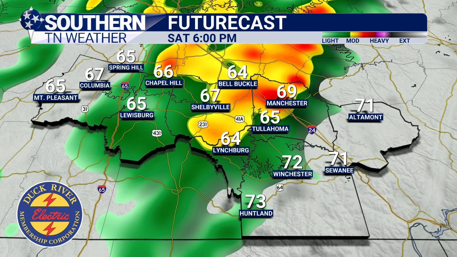
Futurecast - Saturday evening
THE BIGGER PICTURE: IS THE PATTERN ACTUALLY CHANGING?
But here’s the million dollar question. Are we actually transitioning into a more active pattern?
Short answer… kind of.
Longer answer… the pattern is trying to shift, but it’s doing so slowly. The ridge that’s been dominating the Southeast is beginning to weaken just enough to allow these systems to sneak in. That’s why we’re seeing more frequent rain chances. But it’s not completely breaking down yet. That’s the key.
Looking ahead into late April, long-range guidance suggests the overall pattern becomes more zonal, meaning less dominance from high pressure and more opportunities for systems to move through the country. There are even signals pointing toward a wetter pattern developing across much of the central and eastern U.S. But for us? It’s not a flip-the-switch moment. It’s more of a gradual transition. More chances… but not necessarily bigger totals right away. The Climate Prediction Center outlook (shown below) has our area under a good chance to see above-average precip towards the end of the month. So there is HOPE!
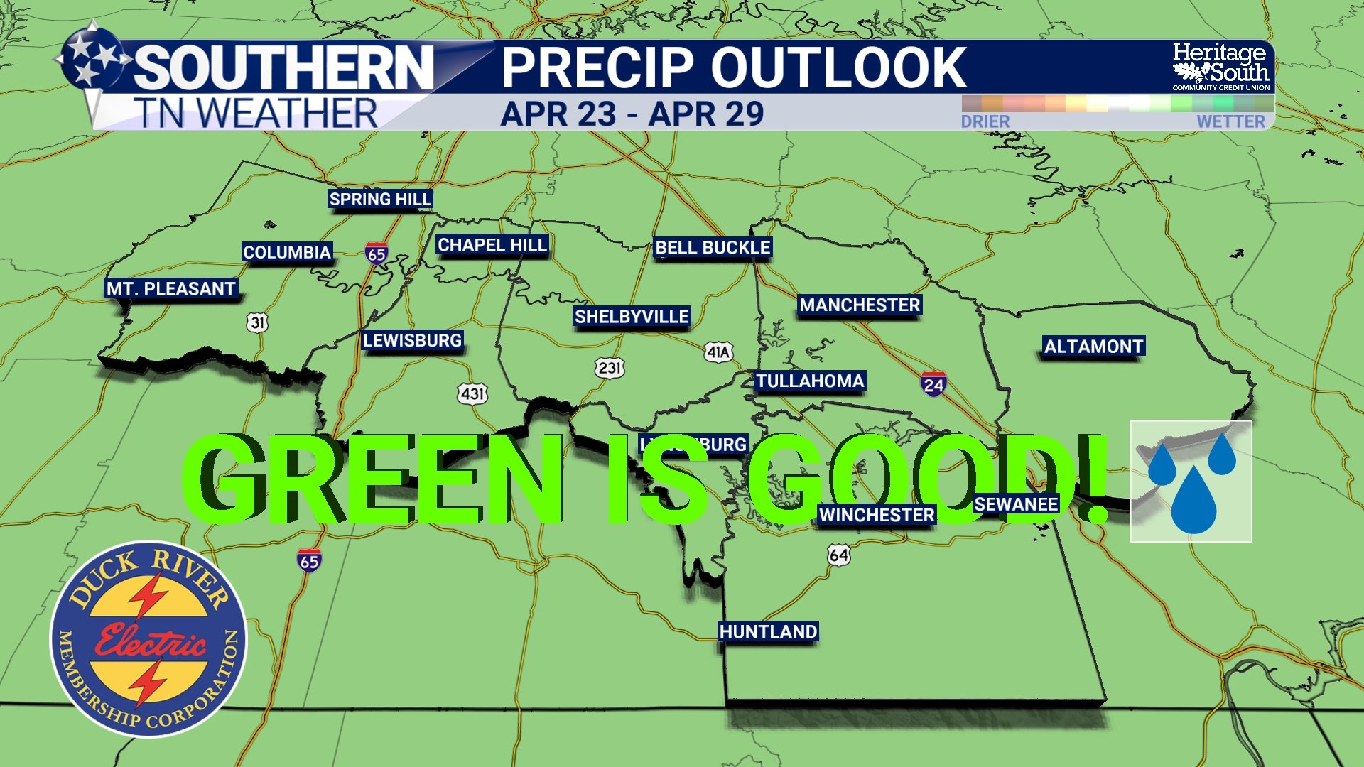
Precip Outlook - End of the Month
WHAT YOU’LL NOTICE AFTER THE FRONT
One thing that will change is temperature. Behind Saturday’s front, we finally get knocked out of this early summer preview. Highs drop back into the 60s on Sunday, and mornings early next week will feel noticeably cooler with lows dipping into the upper 30s and 40s. So while the rain may not be overly impressive, the air mass change definitely will be.
The Bottom Line 🧾
Warm and dry today with elevated fire danger
Light rain chances Thursday with limited totals
Better chances Saturday, but still not a big rainmaker
Pattern is slowly becoming more active, but not fully there yet
Cooler air returns behind the weekend front
📰 Reminder: The Southern Tennessee Weather Blog, presented by Heritage South Community Credit Union, is updated Monday through Friday with fresh, locally tailored forecasts you can trust.