
Storms Return This Weekend… and We’re Watching Next Monday Closely

The Southern Tennessee Weather Blog is proudly presented by Heritage South Community Credit Union.
We Help When Others Won’t!
Visit https://www.heritagesouth.org/ today to see how HSCCU can help YOU!
It’s hard to complain about the weather we’ve had lately. Sunshine, warm afternoons, cool mornings… it’s about as comfortable as it gets for mid-April across Southern Middle Tennessee. But from a forecasting standpoint, this kind of stretch always raises an eyebrow.
Not because it’s unusual, but because it rarely lasts. And now, we’re starting to see exactly why…
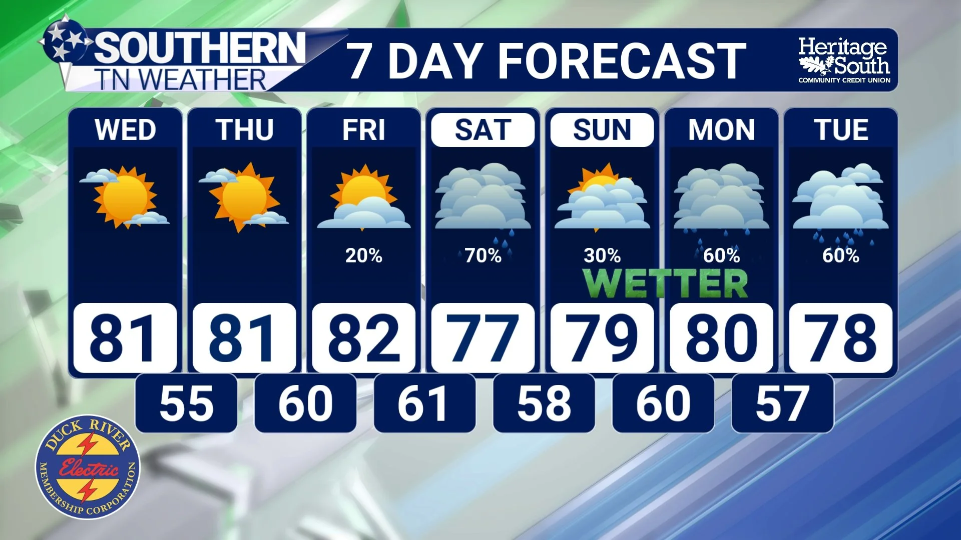
STNWX - 7 DAY FORECAST
A SUBTLE BUT IMPORTANT SHIFT IS UNDERWAY
Through Thursday, the forecast is straightforward. High pressure remains in control, skies stay mostly clear, and temperatures continue to climb into the 80s. The real story isn’t what you feel outside yet. It’s what’s changing above us.
The upper-level pattern is beginning to flatten out, transitioning away from a stable ridge into a more progressive flow. At the same time, low-level winds turn southerly, which starts pulling moisture back into the region. That combination is what begins to destabilize the atmosphere. Not all at once, but gradually. By the time we get to the end of the week, we’re no longer dealing with the same air mass that’s been in place.
FRIDAY AND SATURDAY: A DIFFERENT KIND OF SETUP
When storms return Friday, they won’t be tied to a clean, classic cold front moving straight through the area. Instead, we’re dealing with a more nuanced setup where energy is moving in from the west, but the details depend heavily on how things evolve upstream. That matters.
Storms that form well to our west will either organize and push into Middle Tennessee or fall apart before they get here. That’s the difference between a quiet evening and one where scattered storms roll through. The environment locally will be capable of supporting storms. There will be enough instability and improving wind shear to at least allow for some organization. But it’s not an environment that screams widespread severe weather.
It’s more of a “watch what develops and adjust accordingly” type of situation. Saturday doesn’t necessarily clean things up. In fact, it may complicate the picture even more.
Depending on how Friday night plays out, the atmosphere could either become more unstable or temporarily stabilize. Some guidance suggests a shift in surface winds that would actually limit storm intensity for a time. Other solutions keep enough moisture and instability around for additional scattered activity. That’s why the weekend forecast feels a bit messy right now. Not because we don’t understand the pattern, but because small details will make a big difference in how it plays out locally.
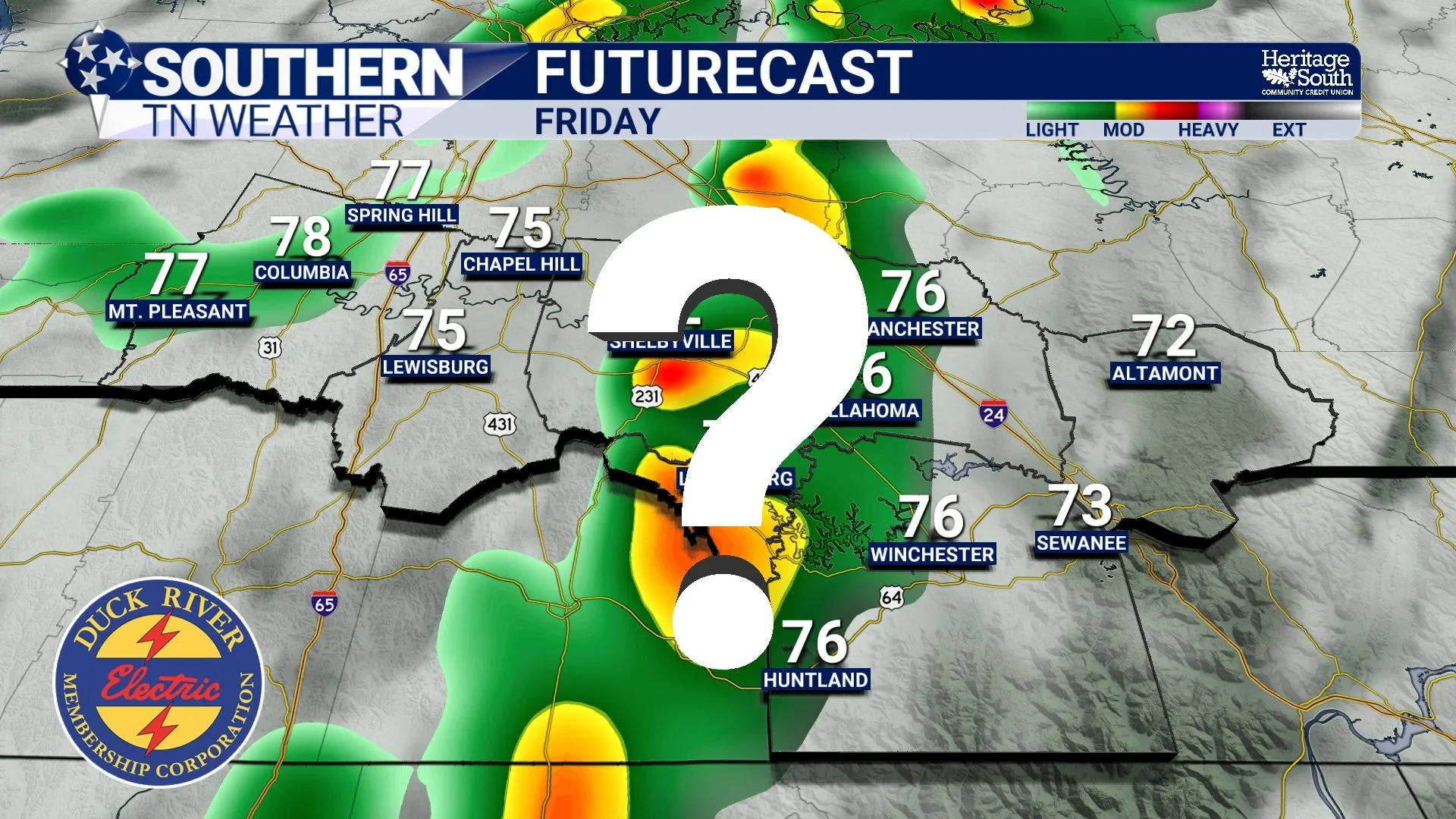
FRIDAY ?
WHY MONDAY IS GETTING ATTENTION
Looking beyond the weekend, the pattern becomes more defined. A stronger system is expected to develop across the Plains and track toward the Midwest early next week. This is the kind of setup that tends to pull deeper Gulf moisture northward and increase wind fields across the Southeast. That’s where Monday comes into play…
We’re already seeing signals in the data that point toward a more organized severe weather environment. Increasing instability, improving lapse rates, and stronger deep-layer shear all suggest that storms, if they develop, would have the ability to organize and persist. That does not guarantee severe weather here. But it does raise the ceiling compared to what we’re looking at Friday and Saturday.
The important thing right now is not to lock in on specific impacts. It’s simply to recognize that the pattern is evolving in a way that supports stronger systems moving through the region. And with it being April, that always gets our attention. The Storm Prediction Center already has our area defined in a 15% SLIGHT risk (level 2/5) in their extended severe weather outlook. Think of this like a “tap on the shoulder” saying we’re watching it closely, but there is no reason to get worked up over it yet.
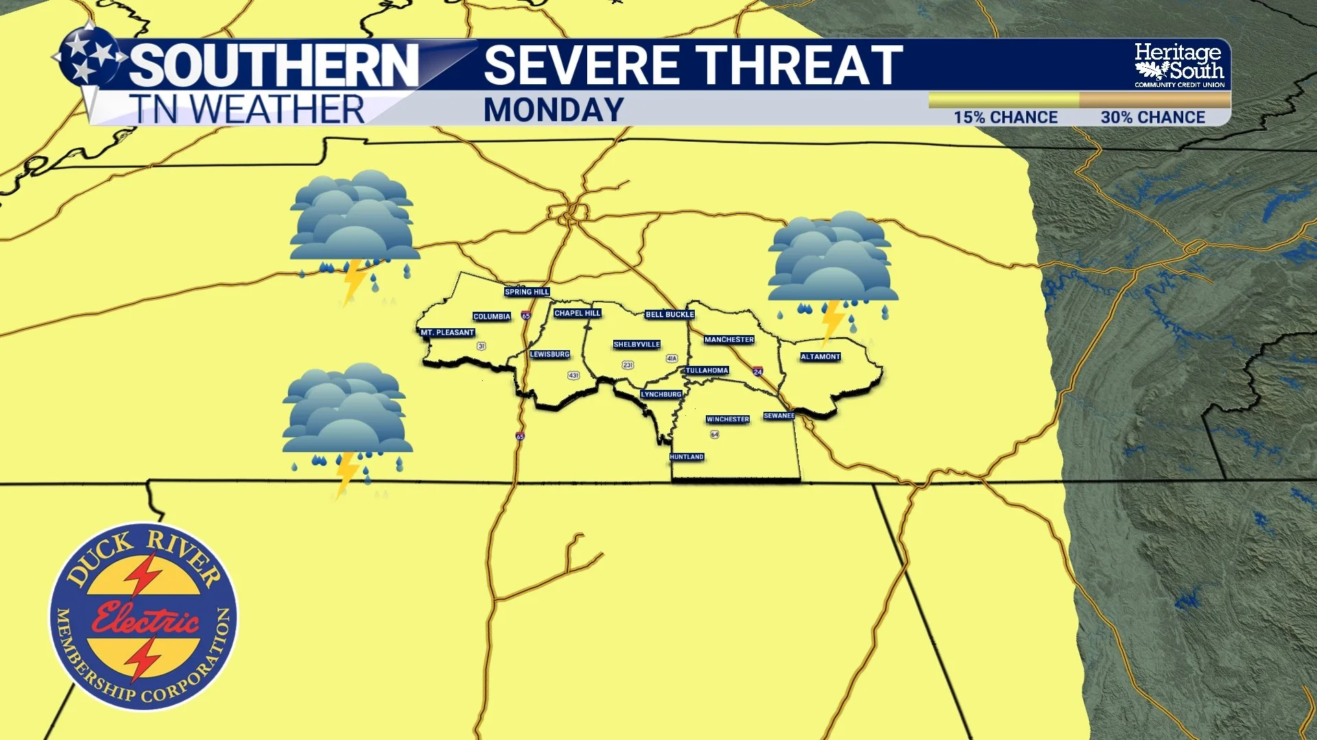
SEVERE THREAT - MONDAY
THE BIGGER PICTURE MOVING FORWARD
What we’re really watching is the transition from a quiet, stable regime into a more active spring pattern. That means the return of humidity, more frequent storm chances, and a wider range of possible outcomes from day to day.
It also means we finally start getting opportunities for meaningful rainfall, even if it comes in pieces rather than one big event. After weeks of dry weather, that alone is a welcome change!
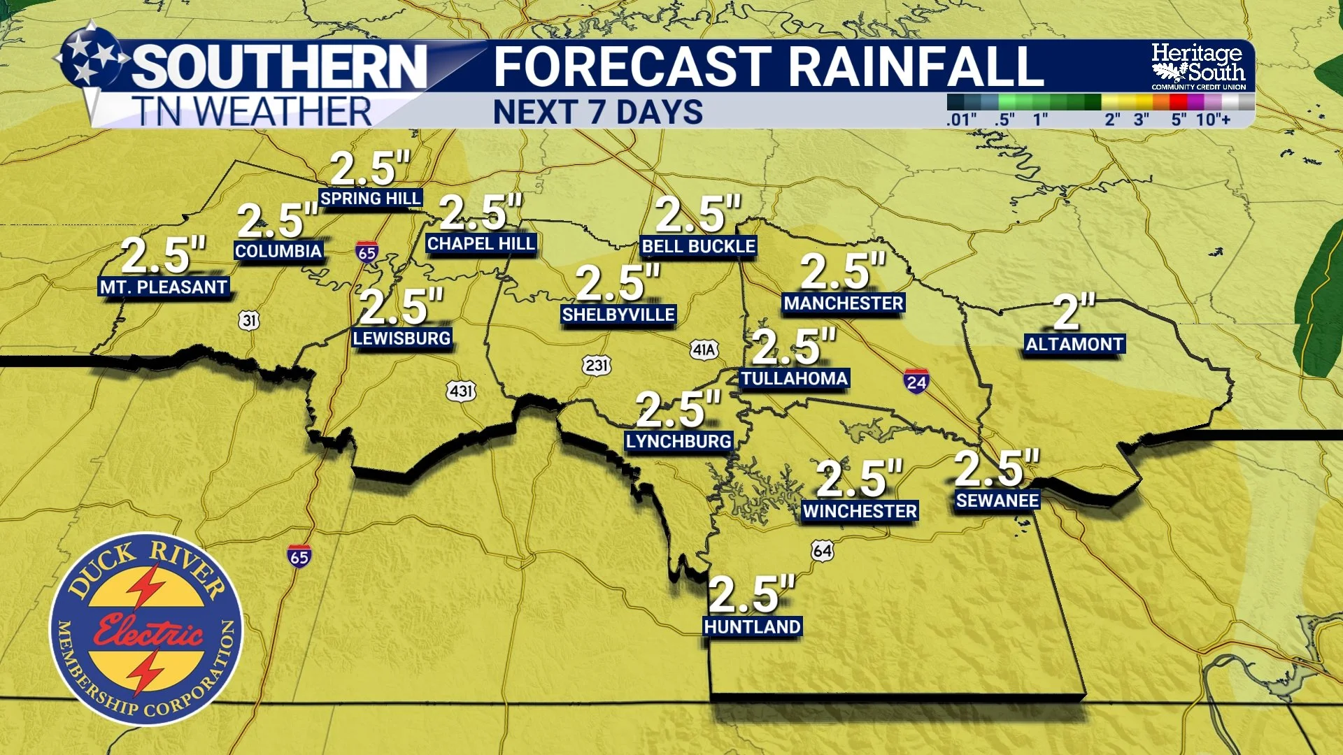
FORECAST RAINFALL - NEXT 7 DAYS
The Bottom Line 🧾
Dry, warm weather continues through Thursday
Storm chances return Friday with a conditional setup
Saturday remains uncertain with scattered activity possible
Monday shows signs of a stronger system, but details will change
Overall pattern turning more active heading into next week
📰 Reminder: The Southern Tennessee Weather Blog, presented by Heritage South Community Credit Union, is updated Monday through Friday with fresh, locally tailored forecasts you can trust.