
Rain and Storms Continue… Here’s What to Expect Through Tonight

The Southern Tennessee Weather Blog is proudly presented by Heritage South Community Credit Union.
We Help When Others Won’t!
Visit https://www.heritagesouth.org/ today to see how HSCCU can help YOU!
Rain, thunderstorms, and periods of heavy downpours continue across Southern Middle Tennessee this afternoon as a slow-moving cold front works its way through the region. While the overall severe weather threat has diminished compared to earlier concerns this week, we are still dealing with a very moisture-rich atmosphere capable of producing locally heavy rainfall and a few stronger storms, especially closer to the Alabama state line.
The overall setup today is fairly classic for a late-spring frontal boundary across the Tennessee Valley. Cooler, more stable air has already filtered into areas north of the front, while warmer and more humid air remains pooled across our southern counties. That temperature contrast is helping focus ongoing showers and thunderstorms along the boundary.
Where the Front Is Located Matters
As of this afternoon, the cold front is roughly positioned from around Lawrenceburg eastward toward Crossville. North of that boundary, temperatures are cooler with cloudy skies, areas of mist, and a generally stable atmosphere. In those locations, severe weather is not expected.
South of the boundary, however, the atmosphere has had at least some opportunity to destabilize. That simply means the air is becoming more supportive of rising motion and thunderstorm development. The amount of instability today is still fairly limited overall, but enough exists for scattered thunderstorms to continue developing through the afternoon and evening hours, particularly closer to the Tennessee-Alabama border.
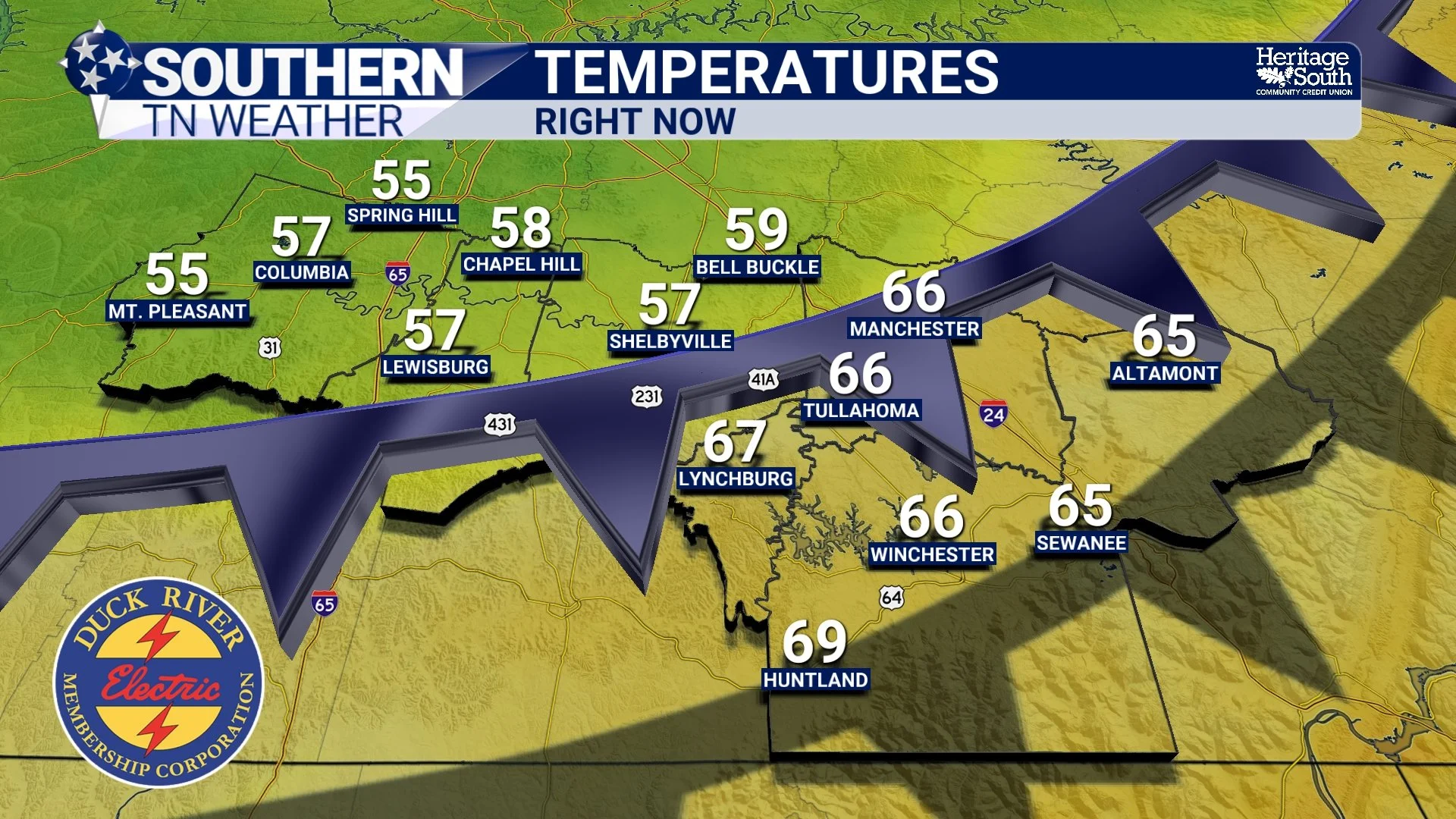
TEMPERATURES - RIGHT NOW
Heavy Rain Remains the Primary Concern
The biggest headline with this setup continues to be the rainfall. Atmospheric moisture remains unusually high for early May, with PWAT values between 1.4 and 1.8 inches across the region. PWAT, or precipitable water, is essentially a measurement of how much moisture is available in the atmosphere. Higher PWAT values mean storms can produce heavier rainfall rates in a shorter amount of time.
Some locations across Southern Middle Tennessee have already picked up 1-2 inches of rain over the last 24 hours, and additional rounds of showers and thunderstorms continue to move through the area this afternoon.
Because the ground has already become saturated in spots, it will not take much additional rainfall to create temporary water issues. Widespread flooding is still not expected, but localized problems remain possible, especially in:
Poor drainage areas
Low-lying roadways
Ditches and creeks
Urban areas with standing water issues
Ponding of water on roads is likely during heavier downpours, so use caution if you have to travel this afternoon or evening.
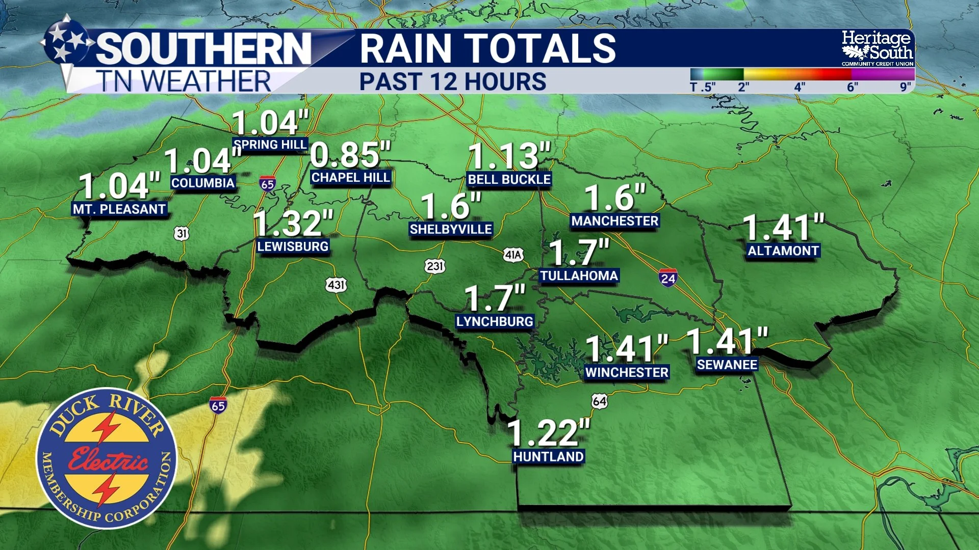
RAINFALL TOTALS - PAST 12 HOURS
Can a Few Stronger Storms Still Occur?
Yes, but the threat remains fairly low overall.
The severe weather setup today is not particularly ideal. One of the main limiting factors has been extensive cloud cover and ongoing rain earlier in the day, which prevented the atmosphere from fully destabilizing across much of Middle Tennessee. However, farther south into northern Alabama and counties near the Tennessee state line, there has been at least some destabilization this afternoon. Combined with fairly strong wind shear, that could allow a few storms to briefly strengthen.
Wind shear refers to changes in wind speed and direction with height, and it helps storms organize and sometimes rotate. The primary concern with any stronger storm today would be:
Gusty winds
Very heavy rainfall
Small hail
Storms today are expected to organize mainly into multicell clusters, meaning groups of storms moving together, rather than isolated supercells. That tends to favor heavy rain and gusty winds over more significant severe weather. The best severe weather risk remains to our south in Alabama.
What Happens Tonight?
Showers and storms will continue on and off through tonight, although overall coverage and intensity should gradually decrease overnight as cooler, more stable air pushes farther south into the region. By Thursday morning, most of the widespread rain should be ending, with cooler and drier air finally settling into Southern Middle Tennessee.
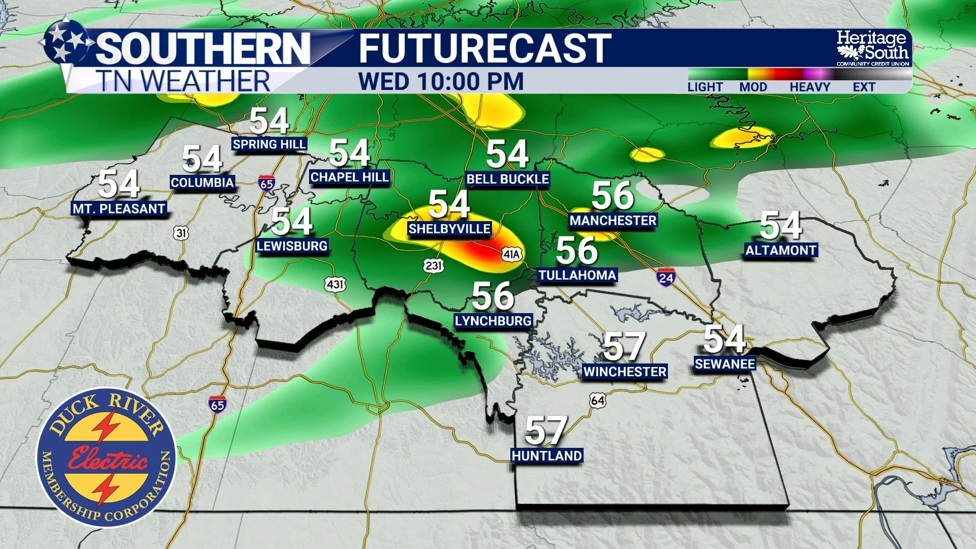
FUTURECAST - THIS EVENING
Much Quieter weather returns
After the last several days of storminess, the pattern finally calms down heading into Thursday and Friday. Temperatures will be noticeably cooler with highs generally in the upper 60s and 70s before warming gradually into the weekend.
Rain chances return again by Sunday, but at least for now, there are no major signals for significant severe weather in the longer-range forecast.
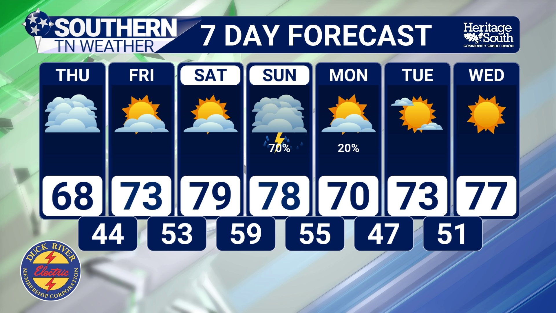
STNWX 7-DAY FORECAST
The Bottom Line 🧾
Showers and storms continue through tonight
Heavy rainfall remains the main concern across Southern Middle Tennessee
Localized flooding and ponding on roads possible during heavier downpours
The severe weather threat is very low
Cooler, drier weather returns Thursday into Friday
📰 Reminder: The Southern Tennessee Weather Blog, presented by Heritage South Community Credit Union, is updated Monday through Friday with fresh, locally tailored forecasts you can trust.