
Weekend Outlook: Rain Returns… Then a Big Cooldown

The Southern Tennessee Weather Blog is proudly presented by Heritage South Community Credit Union.
We Help When Others Won’t!
Visit https://www.heritagesouth.org/ today to see how HSCCU can help YOU!
ONE MORE TASTE OF SUMMER… THEN CHANGE ARRIVES
It’s been another warm one across Southern Middle Tennessee today, and honestly it still feels more like early June than mid-April. High pressure has given us a quiet break after last night’s storms, but that break is short-lived. Changes are on the way as we head into the weekend.
A cold front will move through the region on Saturday, bringing our next round of showers and storms. And unlike the past few systems, this one at least looks a little more organized and widespread.
THIS WEEKEND
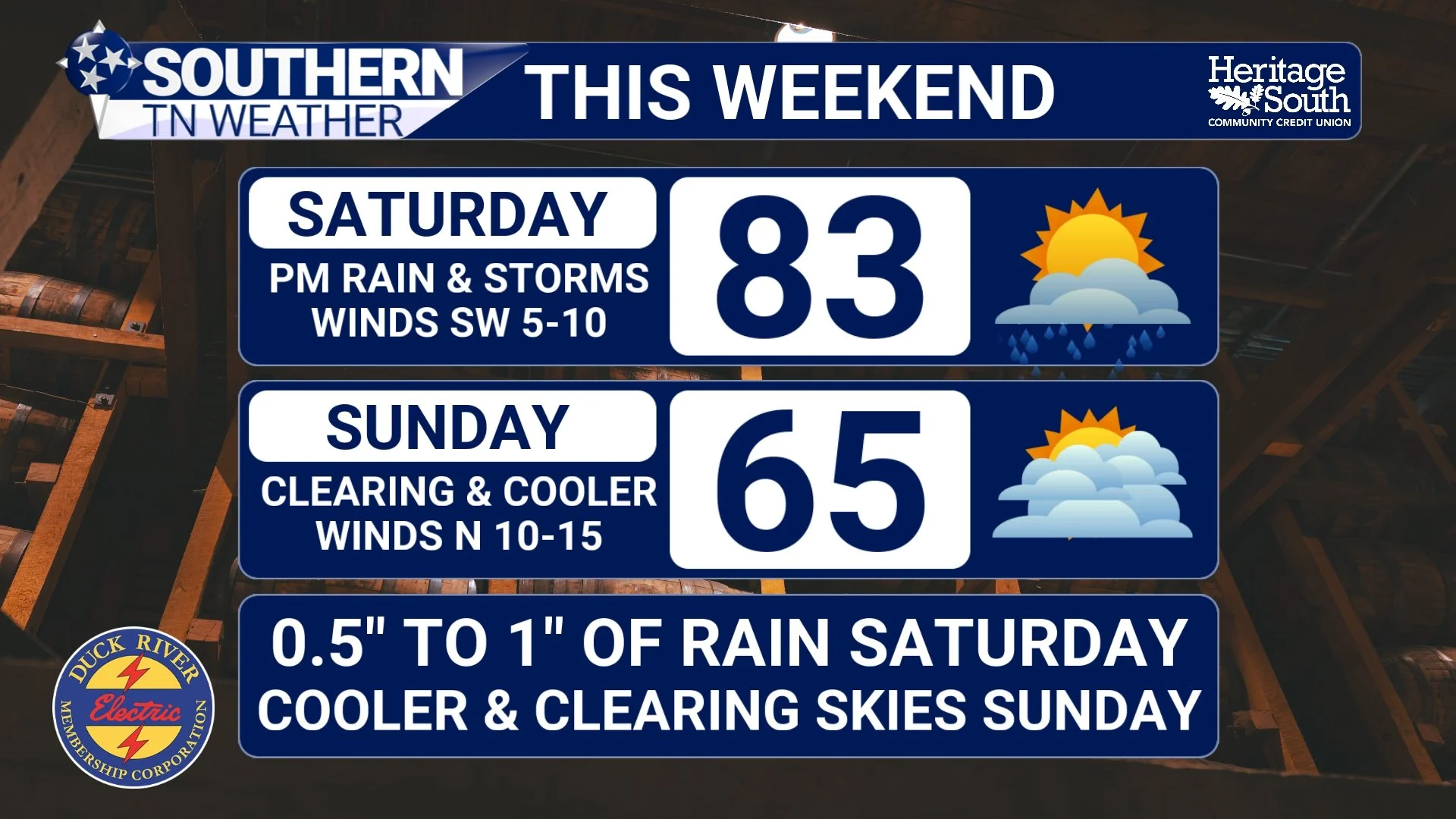
SATURDAY: RAIN AND STORMS RETURN
Saturday will start off warm and a bit more humid with increasing clouds through the day. There may even be a few showers around early, but the better chance for rain holds off until the afternoon and evening especially between 3 PM and 9 PM. If you have any late afternoon plans, be sure to keep this in mind!
Here’s the interesting part about this setup… Most of the activity actually looks to develop along and behind the cold front. That means we’re not dealing with a classic warm-sector severe weather setup. Instead, storms will be working with limited instability, which keeps the overall severe weather threat very low.
That said, a few storms could still produce gusty winds or small hail, especially if the atmosphere manages to destabilize just a bit more than expected. But overall, this is not shaping up to be a severe weather event. Rain coverage will be much better than what we’ve seen lately. This is not the scattered, hit-or-miss setup we’ve dealt with. Most of the area should see rain at some point Saturday afternoon through Saturday night.
Rainfall totals are trending a little higher too, which is some good news. Many areas will pick up around a half inch, with some locations pushing closer to an inch, especially toward the Plateau where terrain can enhance rainfall a bit. It’s not a drought-buster, but it’s at least a step in the right direction.
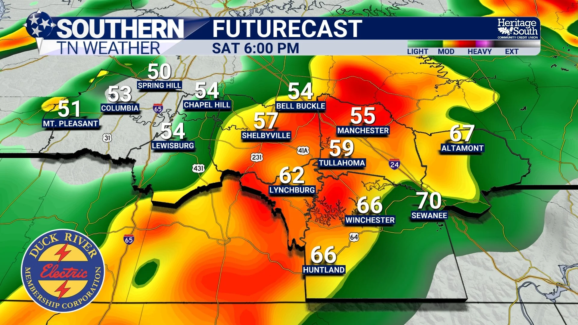
FUTURECAST - SATURDAY EVENING
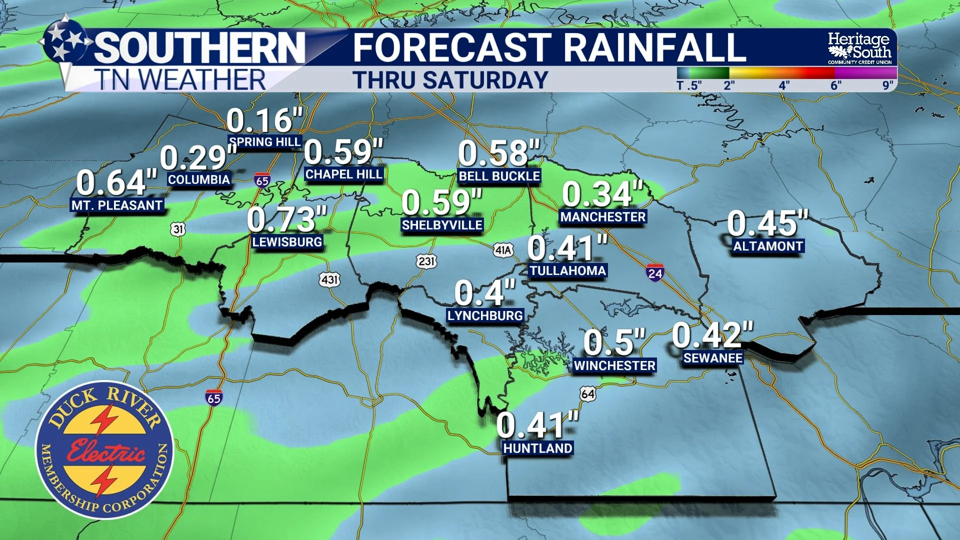
FORECAST RAINFALL - THRU SATURDAY
SATURDAY NIGHT INTO SUNDAY: THE BIG SWITCH
Once the front moves through Saturday night, everything changes. Winds turn out of the north, and a much cooler, drier air mass moves in quickly. Rain will taper off from west to east overnight, and by Sunday morning, most of us are dry. Sunday is going to feel completely different.
Highs will only reach the 60s, which is a solid 15 to 20 degrees cooler than what we’ve been dealing with. If you’ve gotten used to the 80s this week… Sunday is going to feel like a bit of a shock to the system. And it doesn’t stop there. Sunday night into Monday morning will be downright chilly for mid-April, with lows dropping into the 40s, and even a few upper 30s in the cooler spots. At this time, widespread frost appears unlikely.
EARLY NEXT WEEK: QUIET AGAIN
After the weekend system moves out, we settle right back into a quieter pattern. High pressure takes over, bringing dry weather through much of next week. Temperatures will gradually warm back up, climbing from the 60s Sunday into the 70s Monday and eventually back into the 80s by mid to late week. Rain chances look very limited during this stretch, with the next more organized system not arriving until late next week or next weekend.
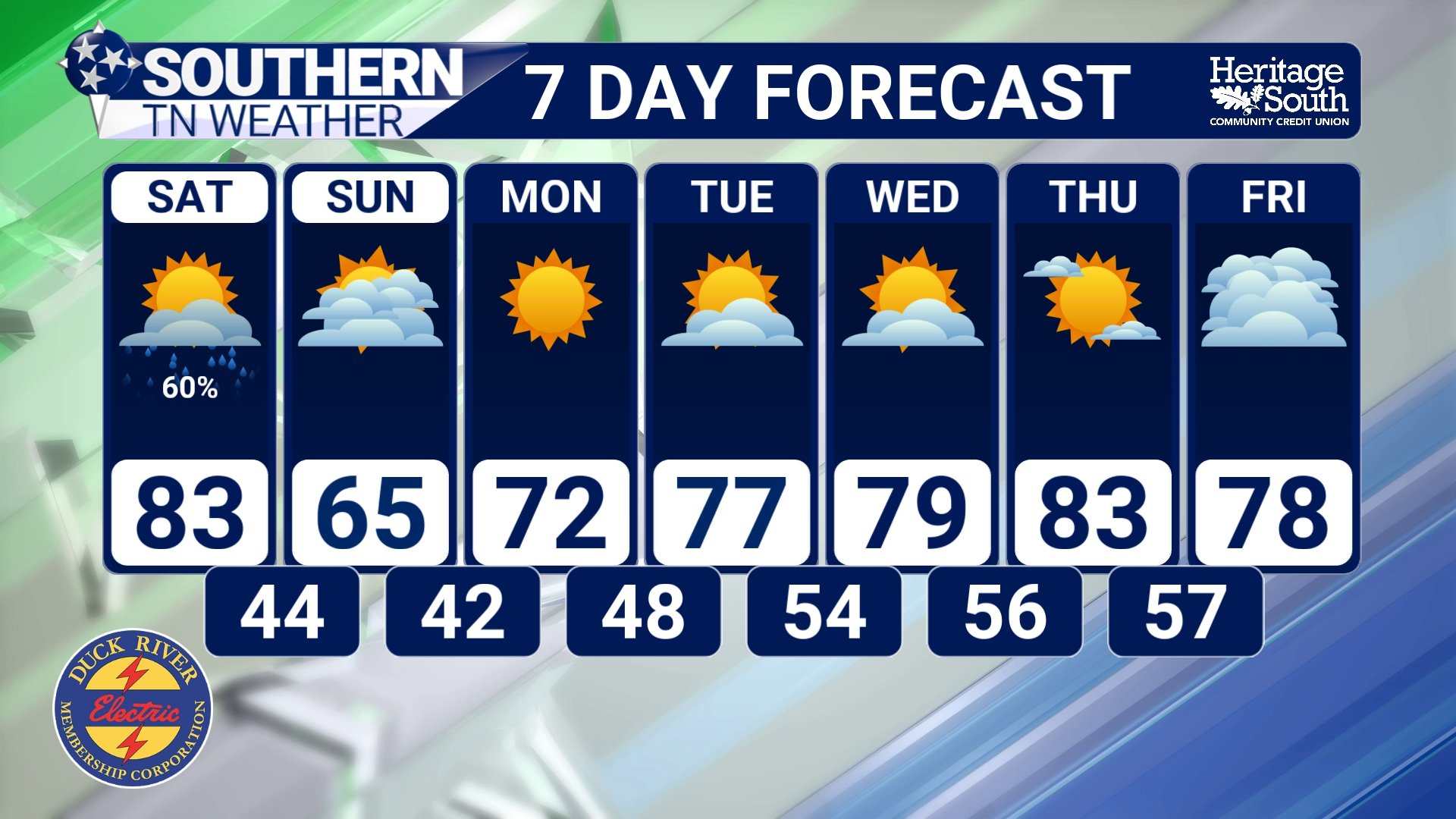
7-DAY FORECAST
The Bottom Line 🧾
Warm again today and Saturday ahead of a cold front
Showers and storms likely Saturday afternoon and evening
Severe weather threat remains very low
Rainfall around 0.5" to 1" for many areas
Much cooler Sunday with highs in the 60s and chilly nights
📰 Reminder: The Southern Tennessee Weather Blog, presented by Heritage South Community Credit Union, is updated Monday through Friday with fresh, locally tailored forecasts you can trust.