
WEATHER BLOG

Presented By:
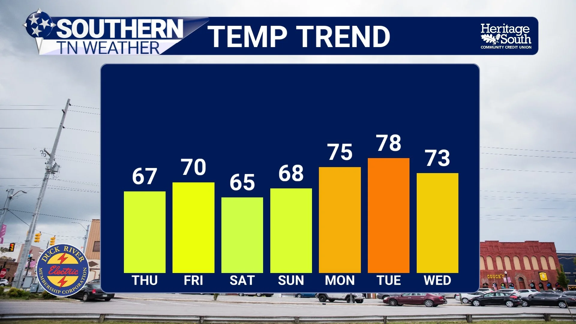
Cooler Air Moves In… What’s Left of the Rain and What Comes Next
After a very active stretch of weather across Southern Middle Tennessee, things are finally beginning to settle down. The same system that brought us rounds of storms and much-needed rainfall over the past couple of days is now pushing off to our southeast, and with it comes a noticeable shift in our overall weather pattern.
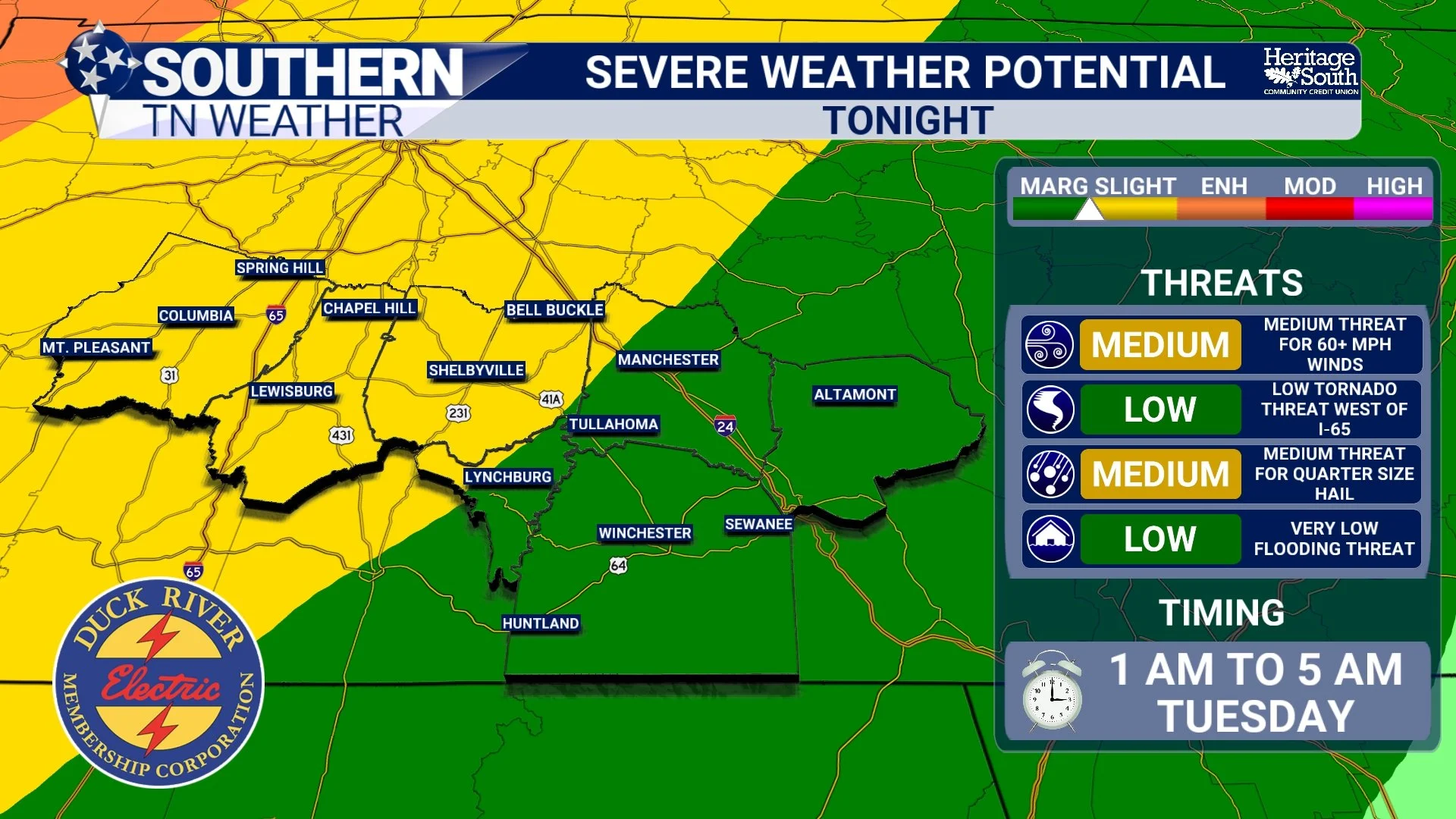
Storms Return: A 48-Hour Look at What to Expect
We are entering one of the more active stretches of weather we’ve seen in a while across Southern Middle Tennessee, and the next 48 hours will feature two distinct rounds of storms, both with their own characteristics and uncertainties. This is not a clean, textbook setup. It’s a layered, evolving situation where what happens tonight will directly influence what happens tomorrow. That’s important to understand up front, because this is not a one-and-done forecast. This is a process that will continue to evolve in real time.
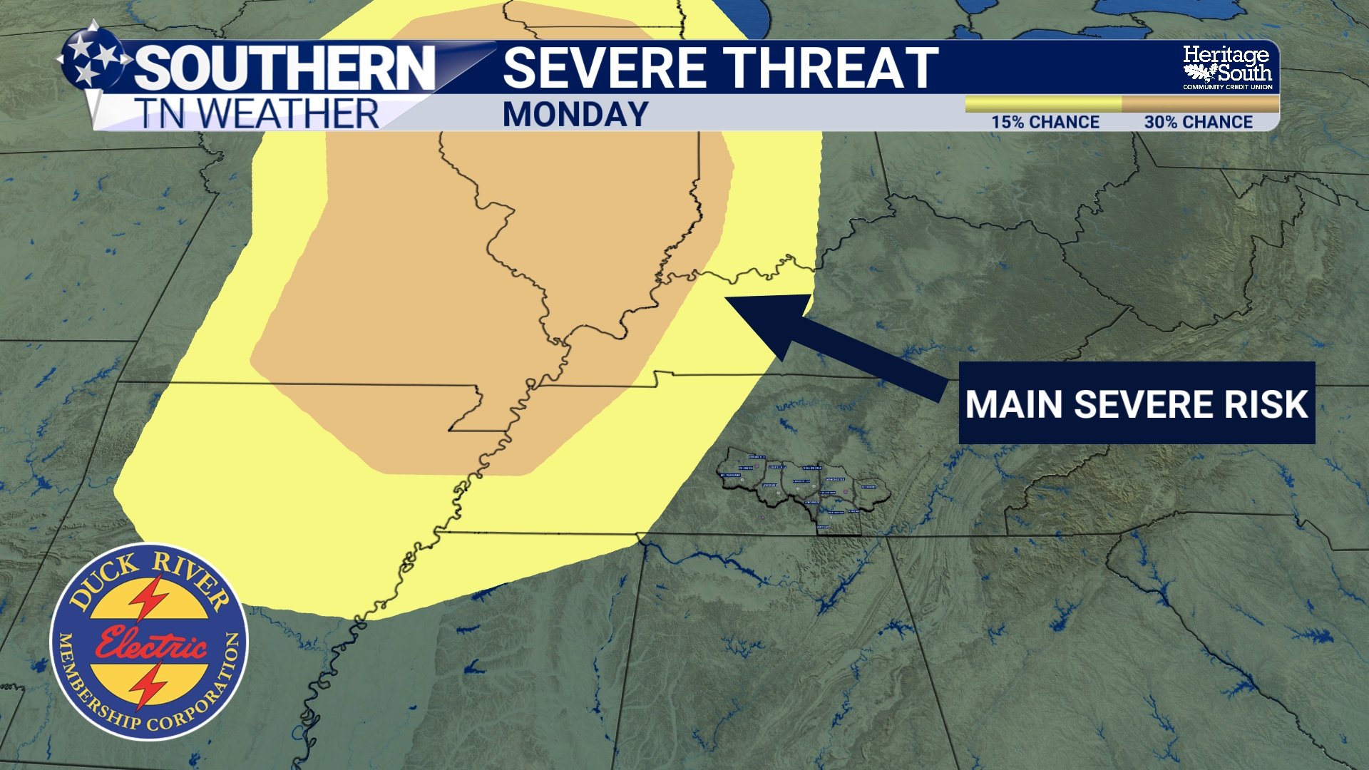
Monday: A Deeper Look into the Evolving Forecast
We’re heading into a more active stretch of weather across Southern Middle Tennessee, and while there are some rain chances to get through this weekend, the bigger story is how the forecast has evolved for Monday. This is one of those situations where it’s worth slowing down and explaining not just what is happening, but WHY it’s happening.
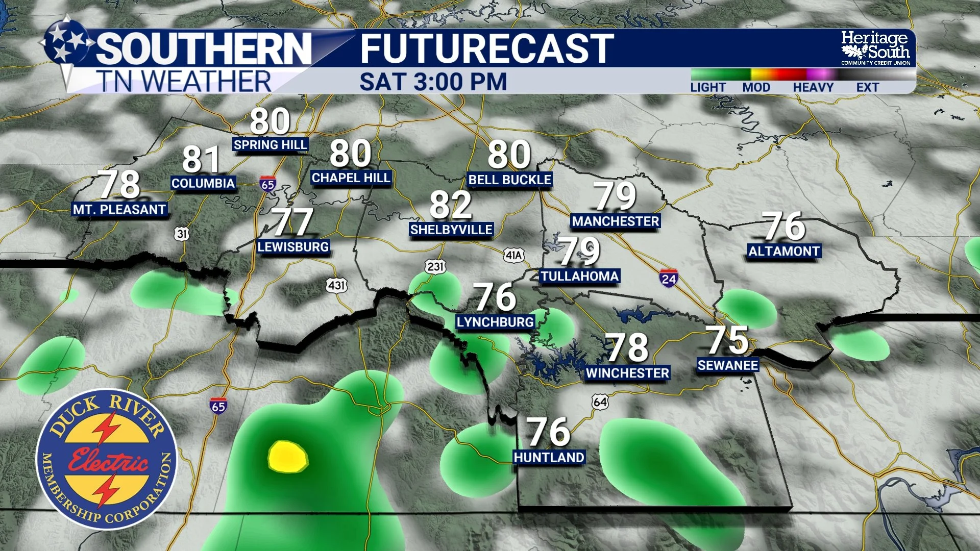
Friday & Saturday Coming Into Focus
We’ve squeezed just about everything we can out of this quiet stretch of weather. Warm afternoons, comfortable humidity, and plenty of sunshine have been the theme across Southern Middle Tennessee. That continues today, but the atmosphere is already beginning to transition behind the scenes.
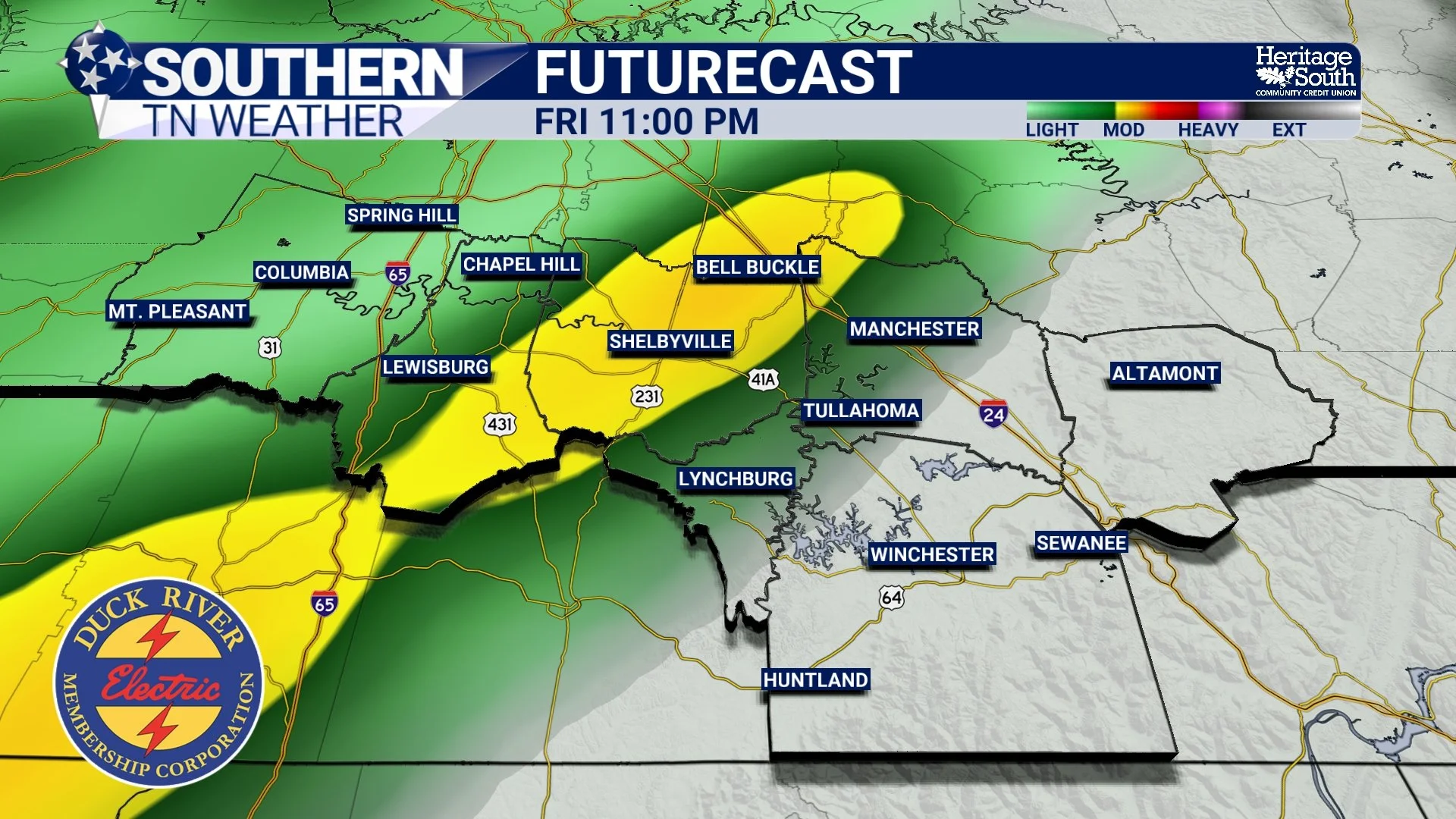
Two Storm Threats to Watch Over the Next 5 Days
The recent stretch of warm, dry, and comfortable weather across Southern Middle Tennessee has been driven by a ridge of high pressure. In simple terms, that means air is sinking from above. Sinking air warms and dries out as it moves downward, which prevents clouds and rain from forming. That’s why we’ve had so many sunny days in a row. The downside is that this same pattern has allowed drought conditions to worsen. Now, that setup is beginning to change…
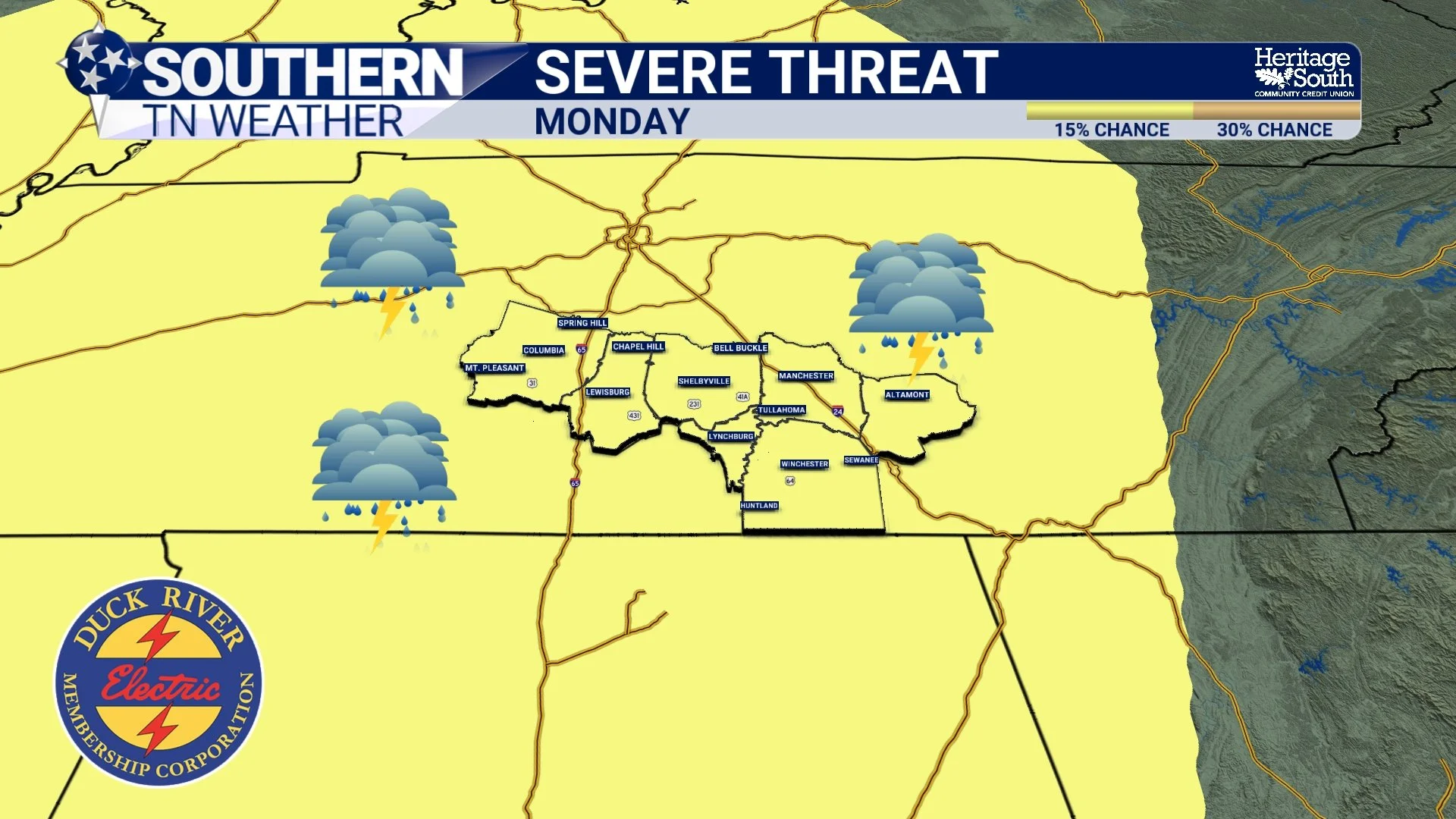
Storms Return This Weekend… and We’re Watching Next Monday Closely
It’s hard to complain about the weather we’ve had lately. Sunshine, warm afternoons, cool mornings… it’s about as comfortable as it gets for mid-April across Southern Middle Tennessee. But from a forecasting standpoint, this kind of stretch always raises an eyebrow.
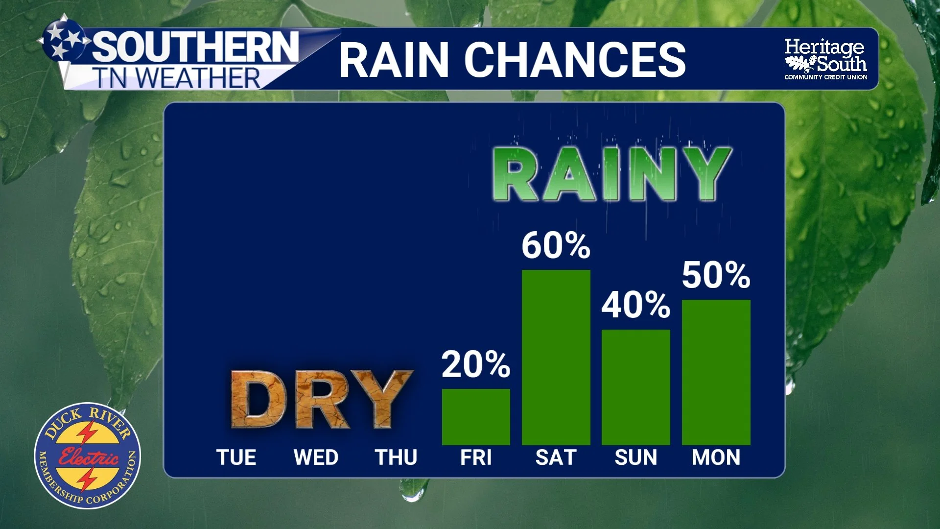
A Wet Pattern is Emerging… Latest Details Here
If you stepped outside this morning, you probably noticed it felt a little more like early spring again. Crisp air, clear skies, and temperatures running below normal to start the day. That’s all thanks to high pressure firmly in control across the Southeast. Lows this morning were very chilly in the mid to upper 30s!
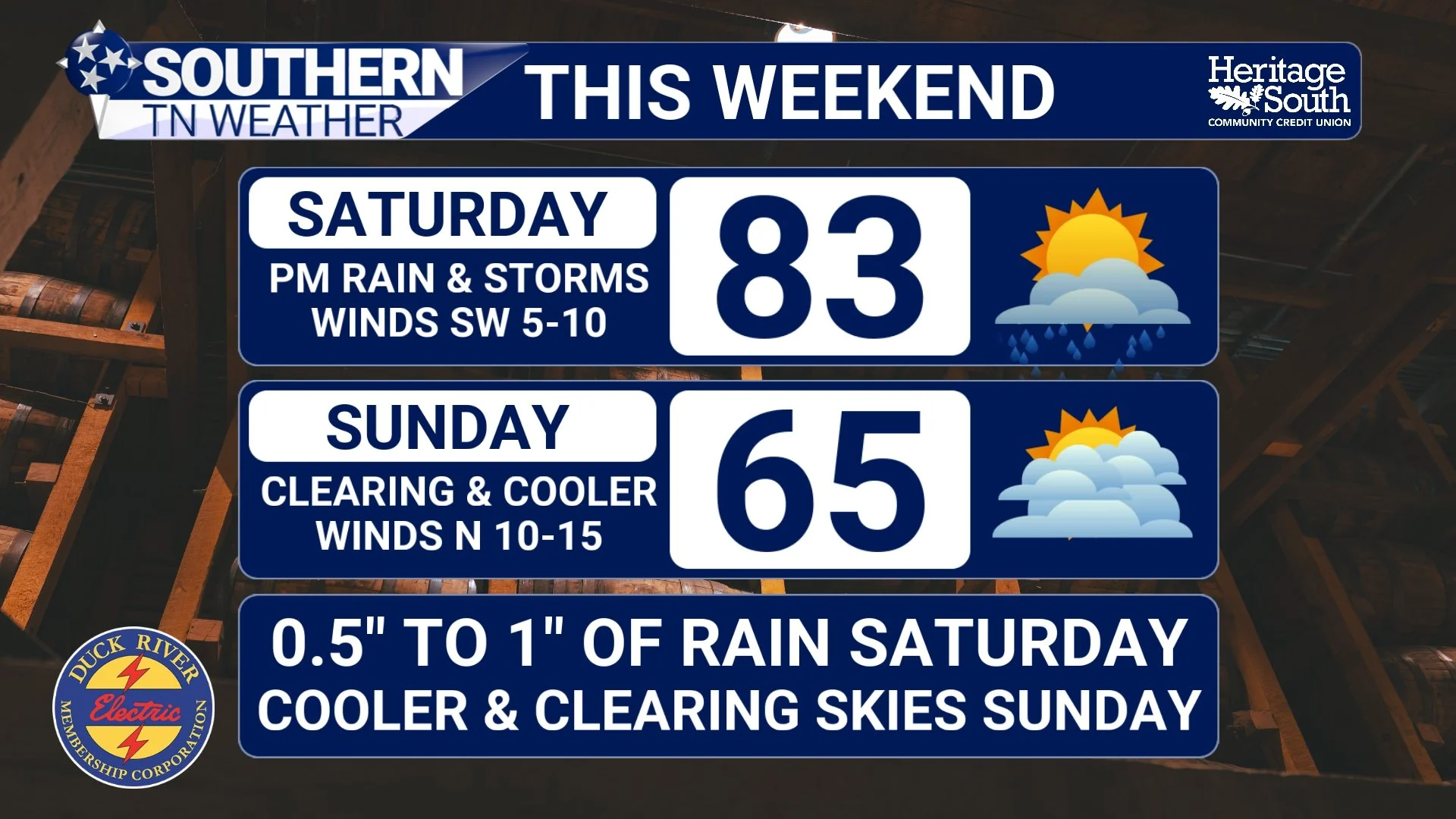
Weekend Outlook: Rain Returns… Then a Big Cooldown
It’s been another warm one across Southern Middle Tennessee today, and honestly it still feels more like early June than mid-April. High pressure has given us a quiet break after last night’s storms, but that break is short-lived. Changes are on the way as we head into the weekend.
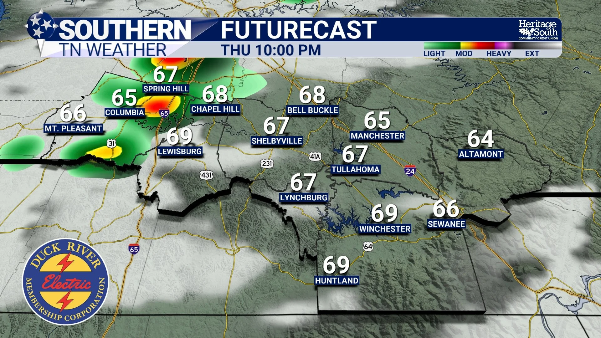
Showers and Storms Return Tonight… But Don’t Expect Much
It’s been another warm, quiet day across Southern Middle Tennessee, and honestly that’s been the theme for a while now. High pressure has kept us dry, stable, and running well above normal temperature-wise. But that pattern is starting to bend just a little bit.
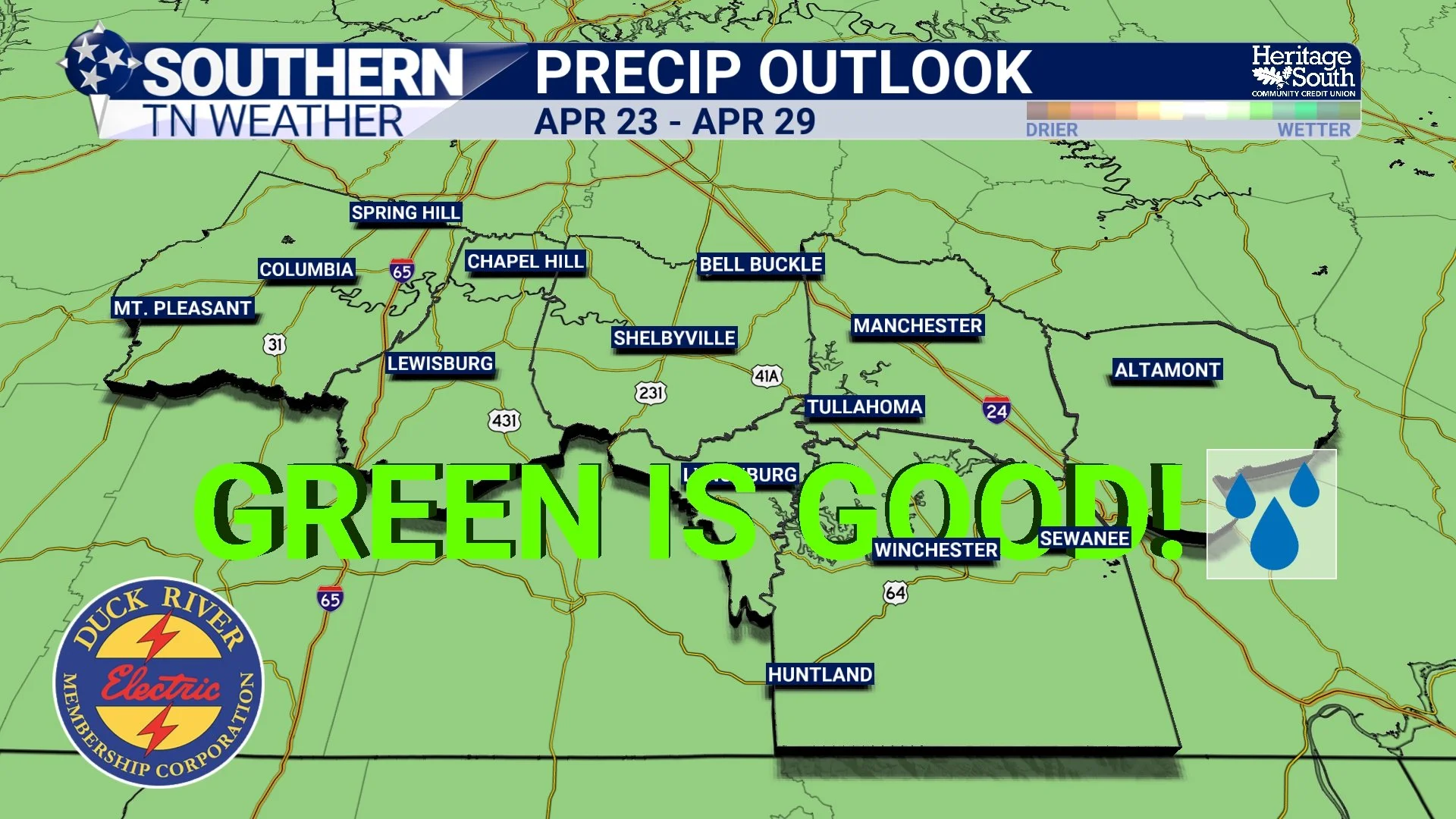
Is an Active Pattern Finally Coming Back? Not So Fast…
If it feels like we’ve been stuck in the same weather pattern for a while… that’s because we have. High pressure is still firmly in control across the Southeast, both at the surface and aloft. That means sinking air, lots of sunshine, and temperatures climbing into the 80s again this afternoon. Pretty nice if you like warm weather… not so great if you’re waiting on rain.
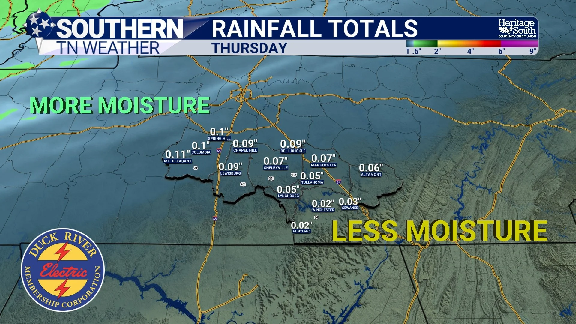
A Few Rain Chances… But Limited Rainfall
At first glance, the forecast almost looks encouraging. You see multiple mentions of rain this week, another round this weekend, and even some storm chances mixed in. But when you dig a little deeper into the setup, a different story starts to emerge.
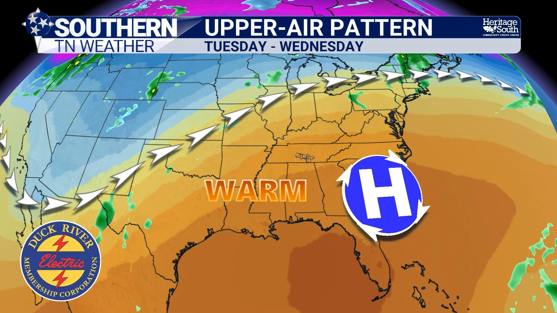
Summer-Like Heat Builds… But Where’s the Rain?
If you’ve looked up today and thought, “this doesn’t feel like the past few days,” you’re right. A weak disturbance is sliding through Southern Middle Tennessee today. It’s not a strong system by any means, but it’s just enough to increase cloud cover and squeeze out a few light showers. The key word here is light. Much of what’s showing up on radar is struggling to even reach the ground in spots due to dry air below the cloud base.
Warm, Quiet, and Dry… A Spring Weekend that Feels a Lot Like Summer
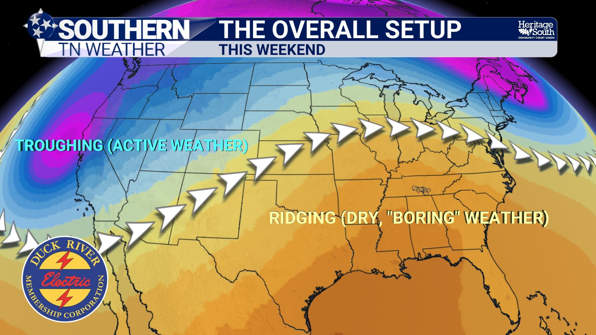
If you’ve stepped outside today, you already know… this is about as good as it gets for mid-April. Sunshine, comfortable warmth, and absolutely nothing going on weather-wise. That’s not by accident. We are sitting under a strengthening upper-level ridge that is sliding east into the Southeast. When you have ridging overhead, air is sinking instead of rising. Rising air is what creates clouds and storms. Sinking air does the opposite. It shuts that process down.
Why Are We Staying so Dry? A Look Inside the Forecast
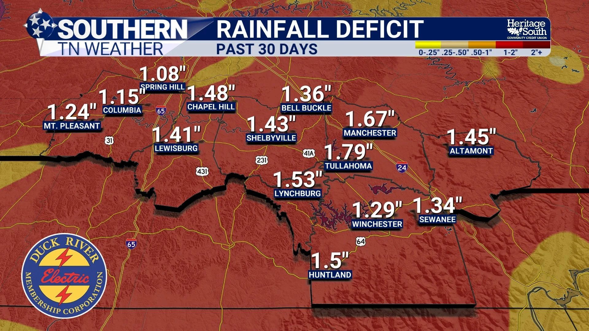
Our stretch of quiet weather continues across Southern Middle Tennessee today, and at first glance the forecast looks pretty simple. Sunshine, comfortable temperatures, and no rain in sight. But if you dig into today’s forecast discussion, there is actually a really interesting story playing out behind the scenes. We have disturbances nearby, clouds at times, and even subtle lift in the atmosphere. Yet we continue to stay dry. So what is going on?
Quiet Pattern Holds… But Heat Builds and Drought Worsens
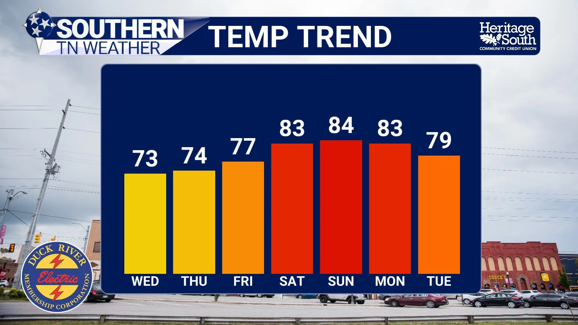
If you’ve enjoyed the last couple of days, you’re not alone. This is about as “textbook spring” as it gets across Southern Middle Tennessee. Comfortable afternoons, cool mornings, low humidity, and not a cloud in sight most of the time. But as nice as it feels, there is a bigger story unfolding behind the scenes. The same pattern giving us this beautiful weather is also setting the stage for increasing heat and worsening drought conditions…
Dry Stretch Continues… But Summer-Like Heat Builds Back In
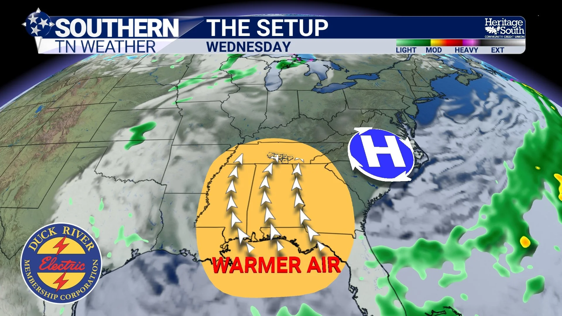
If you’ve stepped outside today, you’ve probably noticed something a little different compared to this time last week. The air feels cleaner, cooler, and much less humid. That’s not by accident. It’s the result of a strong area of high pressure settling in across the region, and it’s going to control our weather for several more days..
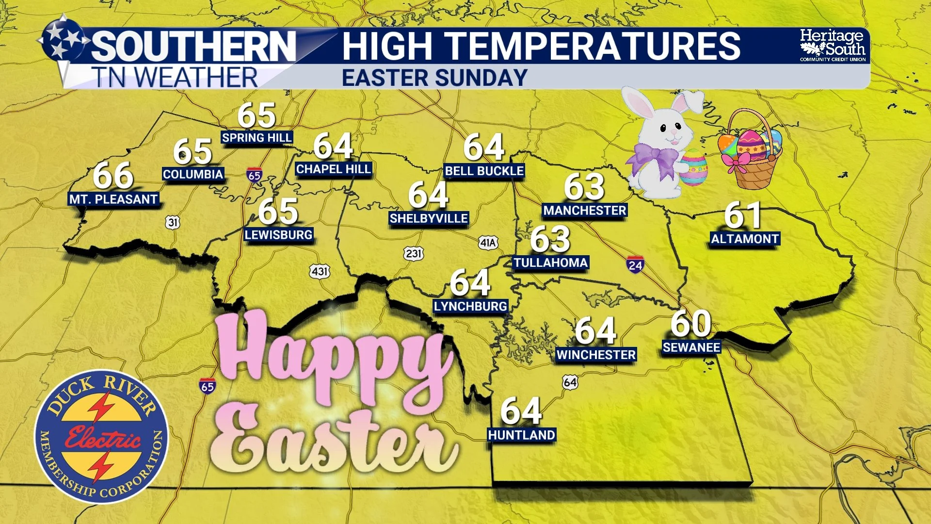
Easter Weekend Forecast: Rain Moves In… Then A Spring Cooldown
If you’ve enjoyed the early taste of summer this week, soak it in today… because the pattern is about to flip just in time for Easter weekend. Southern Middle Tennessee will go from warm, breezy, and dry… to a period of widespread rain Saturday… and then back to cooler, more typical April weather by Easter Sunday.
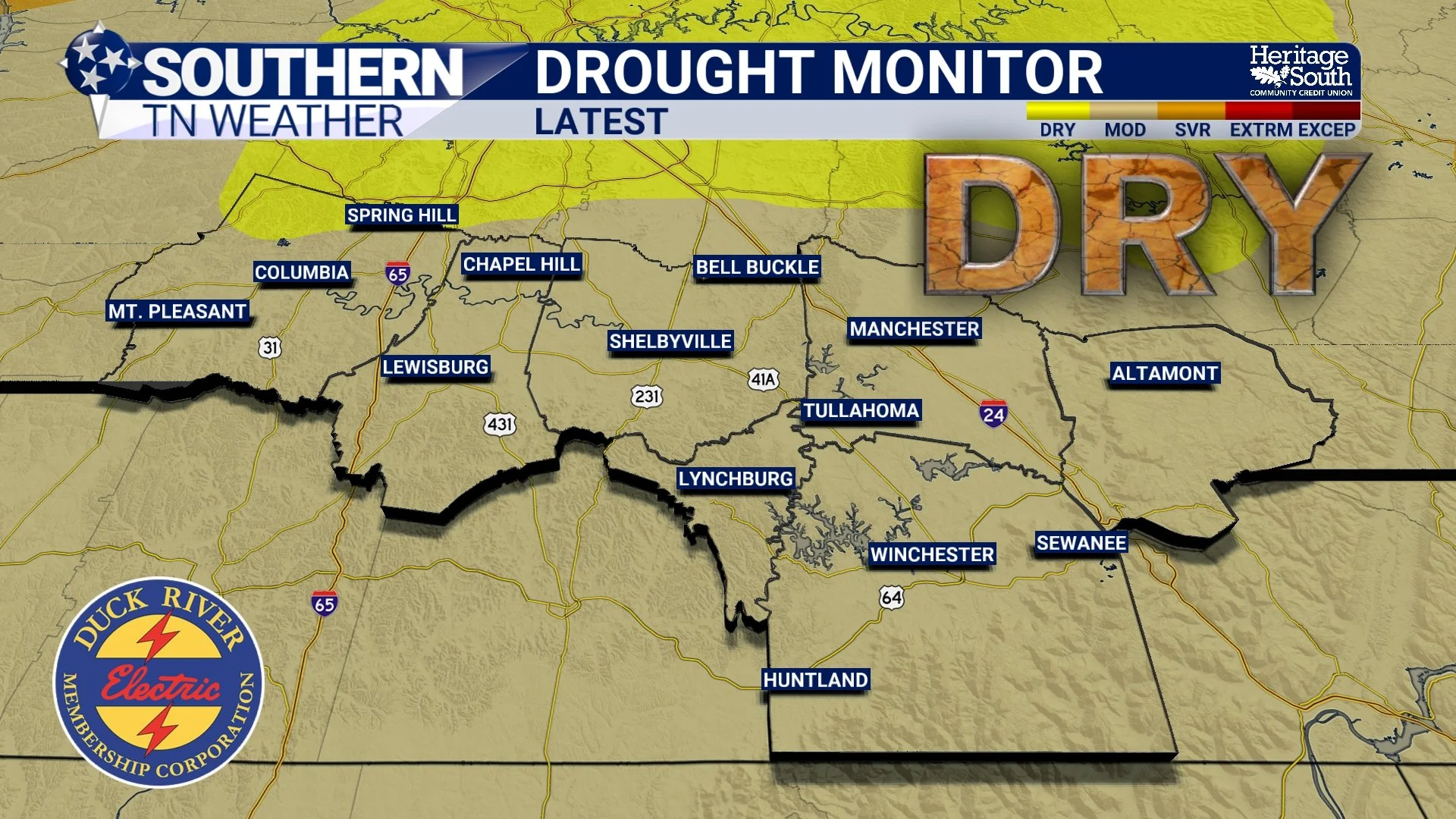
Drought Concerns Growing… But Rain Returns This Weekend
It has been a familiar story across Southern Middle Tennessee lately. Warm afternoons, breezy winds, and very little in the way of meaningful rainfall. This pattern continues this afternoon and into Friday, but we are starting to see signs of change heading into the weekend. While this is not shaping up to be a high-impact storm system, it will bring our best chance for beneficial rain in quite some time…
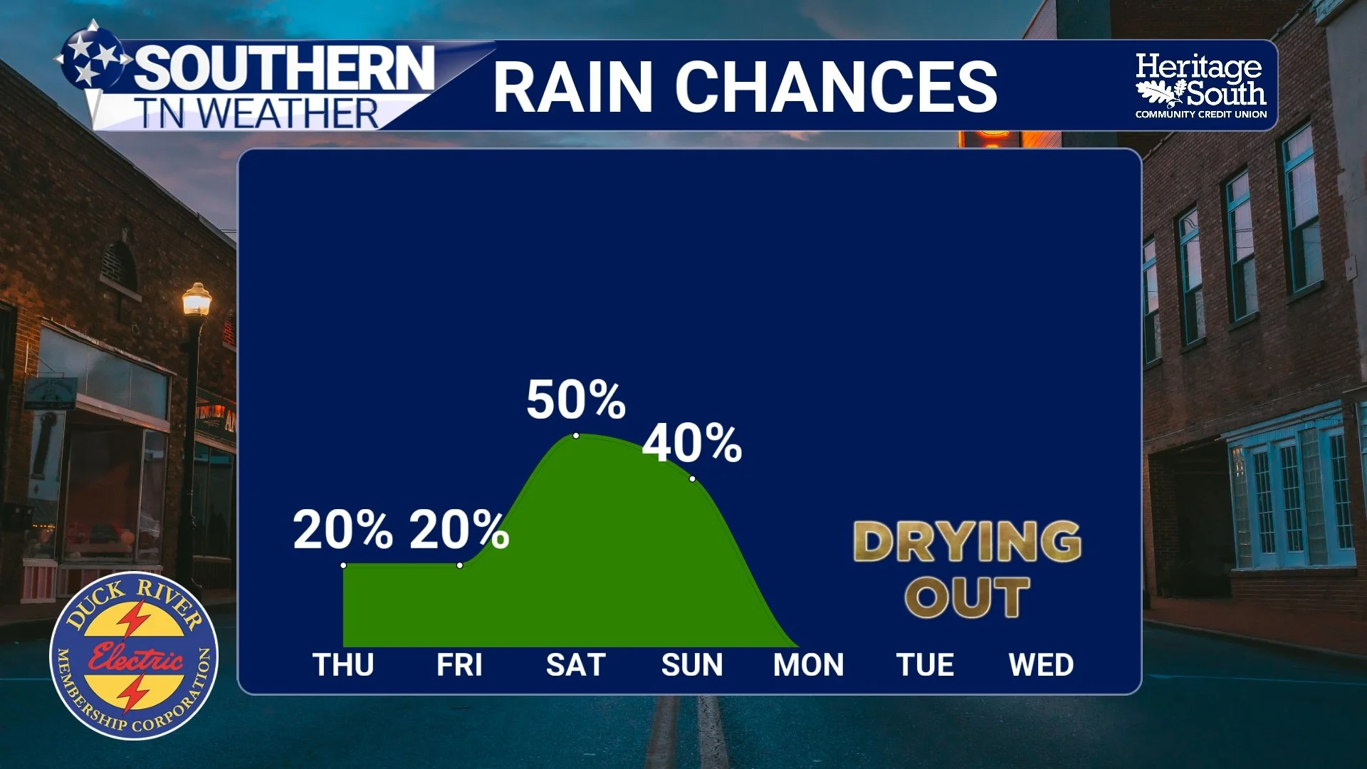
A Warm, Unsettled Pattern… Tracking Storm Chances Through the Weekend
If it feels more like late May than early April, you’re not wrong. We are sitting in a classic warm sector across Southern Middle Tennessee right now. Temperatures are running well above normal, humidity is increasing, and the atmosphere is just unstable enough to support scattered showers and thunderstorms at times. The key word there is scattered.
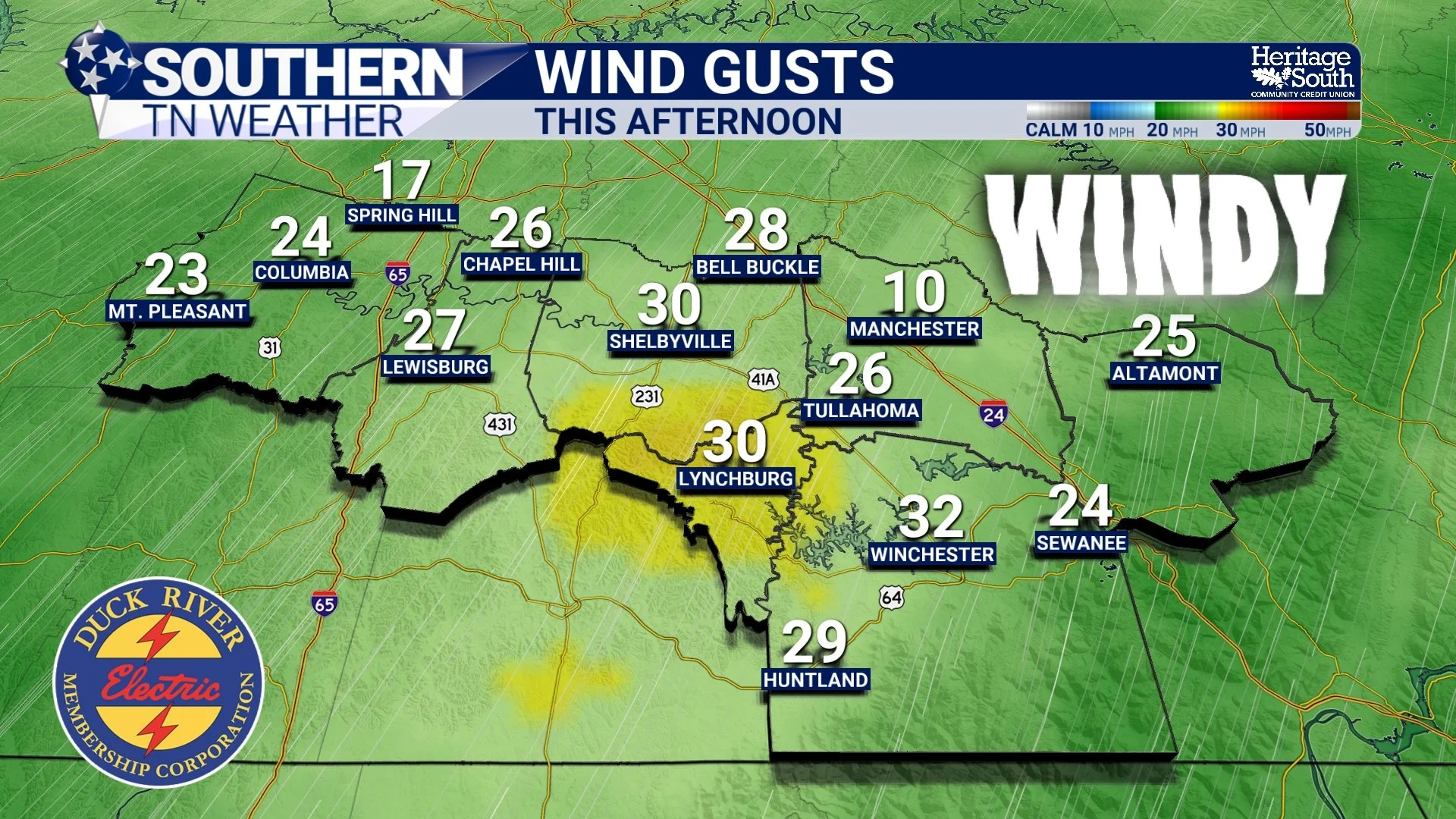
Windy today - Rain Chances Return Tomorrow… Here’s What to Expect
After several days of warm, dry, and breezy conditions across Southern Middle Tennessee, the pattern is beginning to shift. It’s not a dramatic flip, but it is a meaningful one — and it starts with our first real chance for showers and thunderstorms on Wednesday. This isn’t shaping up to be a washout or a severe weather day. Instead, it’s the beginning of a more active, spring-like pattern where the atmosphere becomes just unstable enough to support scattered storms.