
Summer-Like Heat Builds… But Where’s the Rain?

The Southern Tennessee Weather Blog is proudly presented by Heritage South Community Credit Union.
We Help When Others Won’t!
Visit https://www.heritagesouth.org/ today to see how HSCCU can help YOU!
TODAY’S SETUP: WHY YOU’RE SEEING CLOUDS (AND MAYBE A FEW SPRINKLES)
If you’ve looked up today and thought, “this doesn’t feel like the past few days,” you’re right. A weak disturbance is sliding through Southern Middle Tennessee today. It’s not a strong system by any means, but it’s just enough to increase cloud cover and squeeze out a few light showers. The key word here is light. Much of what’s showing up on radar is struggling to even reach the ground in spots due to dry air below the cloud base.
This is what we call virga, where precipitation evaporates before it hits the surface. So while the radar may look a little more active, rainfall amounts will be minimal at best. By later this afternoon, drier air moves back in aloft and shuts this down pretty quickly.
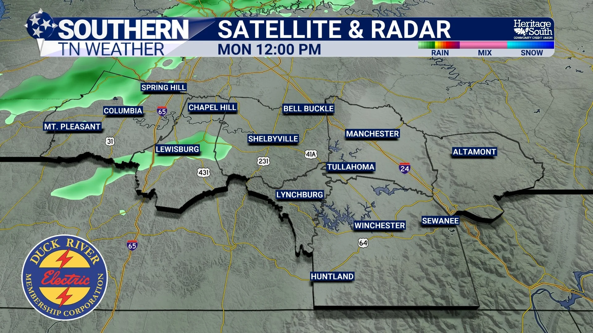
SATRAD - THIS AFTERNOON
MIDWEEK HEAT: RIDGE TAKES OVER AGAIN
Once this weak disturbance exits, the bigger player returns… and that’s the ridge. High pressure both at the surface and aloft rebuilds across the Southeast Tuesday and Wednesday. That leads to sinking air, fewer clouds, and a rapid warm-up. Highs will climb well into the 80s both days across Southern Middle Tennessee. In fact, we’ll be pushing record territory, especially by Wednesday. That’s impressive for mid-April.
From a scientific standpoint, this is being driven by rising heights and thickness values in the atmosphere. In simple terms, the air column is warming and expanding, which directly correlates to higher surface temperatures. At the same time, humidity values will stay relatively low for this time of year. Afternoon relative humidity dropping into the 30% range, combined with gusty winds, will lead to increased fire danger. Even though we’re not in extreme territory, it doesn’t take much for fires to spread in a pattern like this.
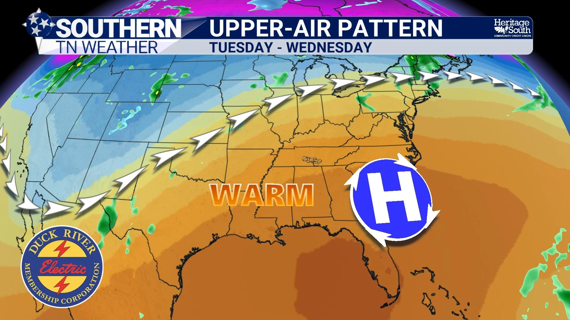
UPPER-AIR PATTERN. TUESDAY AND WEDNESDAY
THURSDAY: A BETTER SHOT AT RAIN (BUT NOT A DROUGHT BUSTER)
By Thursday, we finally get another system trying to work into the region. This one is a bit stronger than today’s disturbance. It has better lift and slightly deeper moisture to work with, which means rain chances will be higher and more widespread. But let’s be real about it. Even with that increase, rainfall totals still look fairly modest. This is not a system that’s going to fix our dry conditions. It’s more of a “we’ll take what we can get” situation.
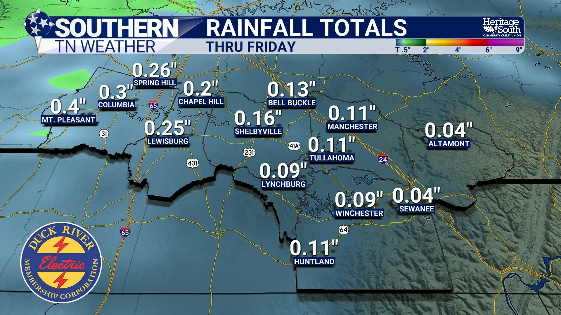
RAIN TOTALS THRU FRIDAY
THE WEEKEND: PATTERN FINALLY TRIES TO CHANGE
After a brief return to warm and dry weather Friday into early Saturday, attention turns to a more organized system. A stronger upper-level trough and surface low will track through the Great Lakes, dragging a cold front toward Tennessee. That front looks to move through sometime late Saturday into Saturday night.
This will bring another round of showers and storms. It’s still too early for exact timing and details, but confidence is growing that rain chances will be higher with this system compared to anything we see during the week. Right now, severe weather does not appear to be a major concern. The dynamics are stronger, but the overall setup still does not scream high-end severe. Behind that front, we finally see a more noticeable change. Cooler air filters in Sunday into early next week, giving us a break from the early-season heat.
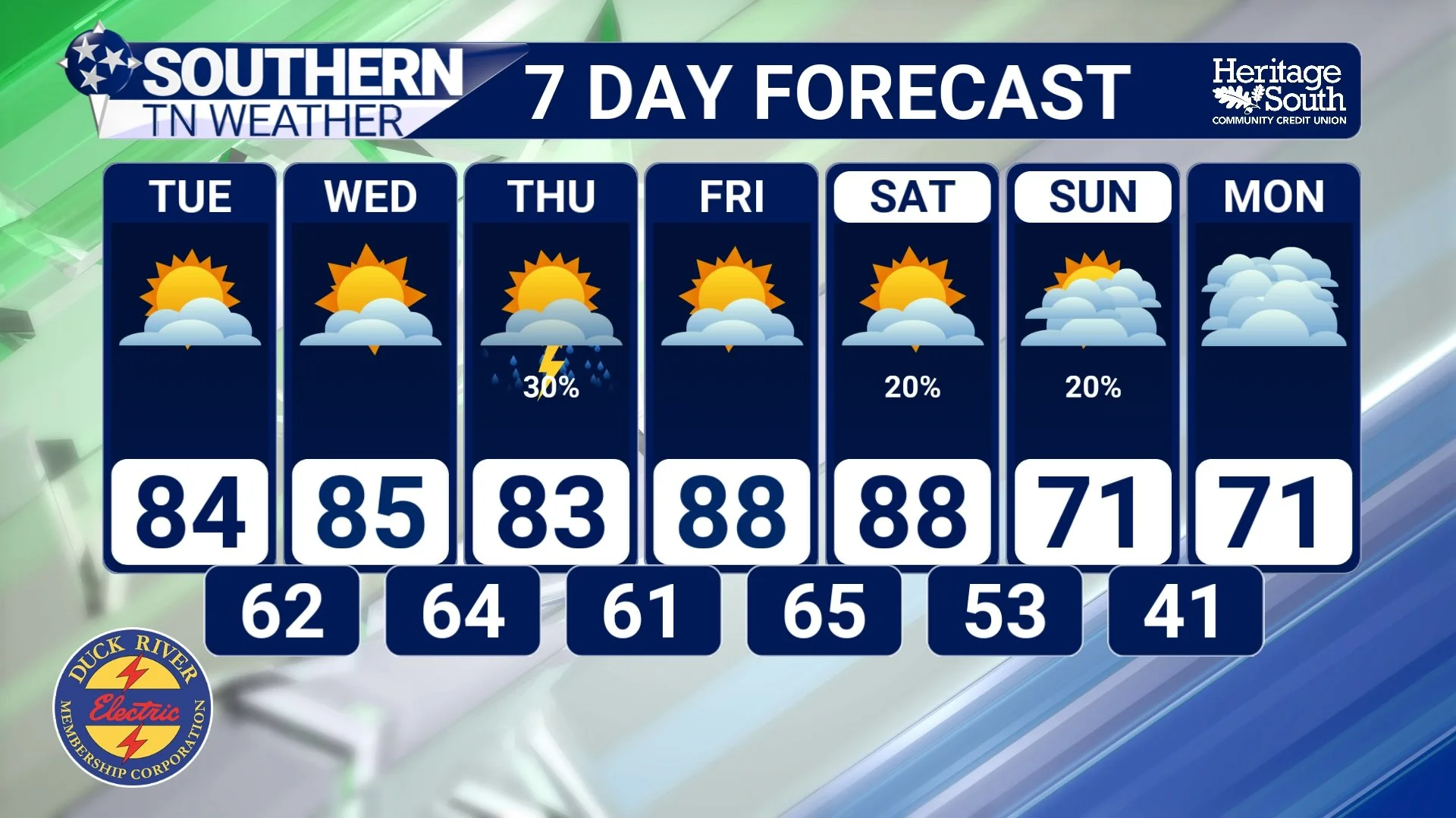
7-DAY FORECAST
The Bottom Line 🧾
A few light showers possible today, but very little rainfall
Hot Tuesday and Wednesday with highs in the 80s and near records
Better rain chances Thursday, but totals remain light
More widespread rain and storms possible this weekend with a cold front
Cooler air returns behind the front late weekend into next week
📰 Reminder: The Southern Tennessee Weather Blog, presented by Heritage South Community Credit Union, is updated Monday through Friday with fresh, locally tailored forecasts you can trust.