
Quiet Pattern Holds… But Heat Builds and Drought Worsens

The Southern Tennessee Weather Blog is proudly presented by Heritage South Community Credit Union.
We Help When Others Won’t!
Visit https://www.heritagesouth.org/ today to see how HSCCU can help YOU!
If you’ve enjoyed the last couple of days, you’re not alone. This is about as “textbook spring” as it gets across Southern Middle Tennessee. Comfortable afternoons, cool mornings, low humidity, and not a cloud in sight most of the time. But as nice as it feels, there is a bigger story unfolding behind the scenes. The same pattern giving us this beautiful weather is also setting the stage for increasing heat and worsening drought conditions…
Let’s break it down.
Why It Feels So Good Right Now
At the surface, high pressure is still firmly in control of our weather. This system is centered to our north and east, feeding in slightly cooler and drier air from the northeast. That’s why dew points have been low, humidity has been comfortable, and mornings have had that crisp feel with temperatures in the 40s.
From a meteorological standpoint, we are still seeing the effects of weak cold air advection from earlier in the week. Even though it is April, the air mass currently in place is not particularly warm or moist. That keeps instability low and prevents cloud development. The result is efficient daytime heating under full sunshine, paired with efficient nighttime cooling under clear skies. It is a very stable, very quiet setup.
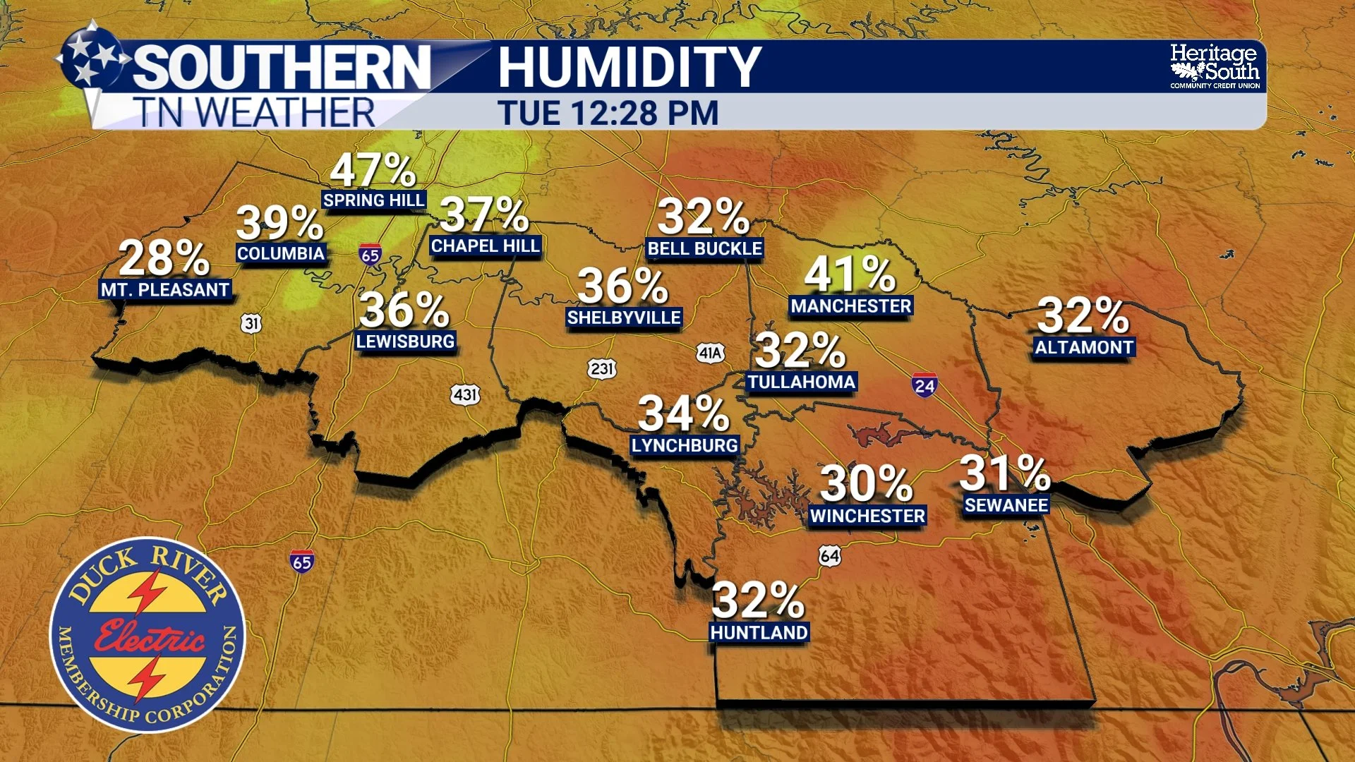
HUMIDITY - THIS AFTERNOON
The Pattern Shift Begins Wednesday
Starting Wednesday, the atmosphere begins to transition. High pressure slides off to the east, and winds begin to turn out of the southeast and eventually the south. This is what we call return flow, and it is the key to everything that happens next. Once winds shift southerly, we begin tapping into a warmer air mass. Temperatures will respond quickly, climbing a few degrees each afternoon through the rest of the week.
At the same time, an upper-level ridge begins building over the southeastern United States. This ridge is essentially a large area of warm air aloft that promotes sinking motion in the atmosphere. Sinking air leads to warming and drying, which reinforces the surface warmth and suppresses any meaningful cloud or storm development. So not only do we warm up, we stay dry while doing it…
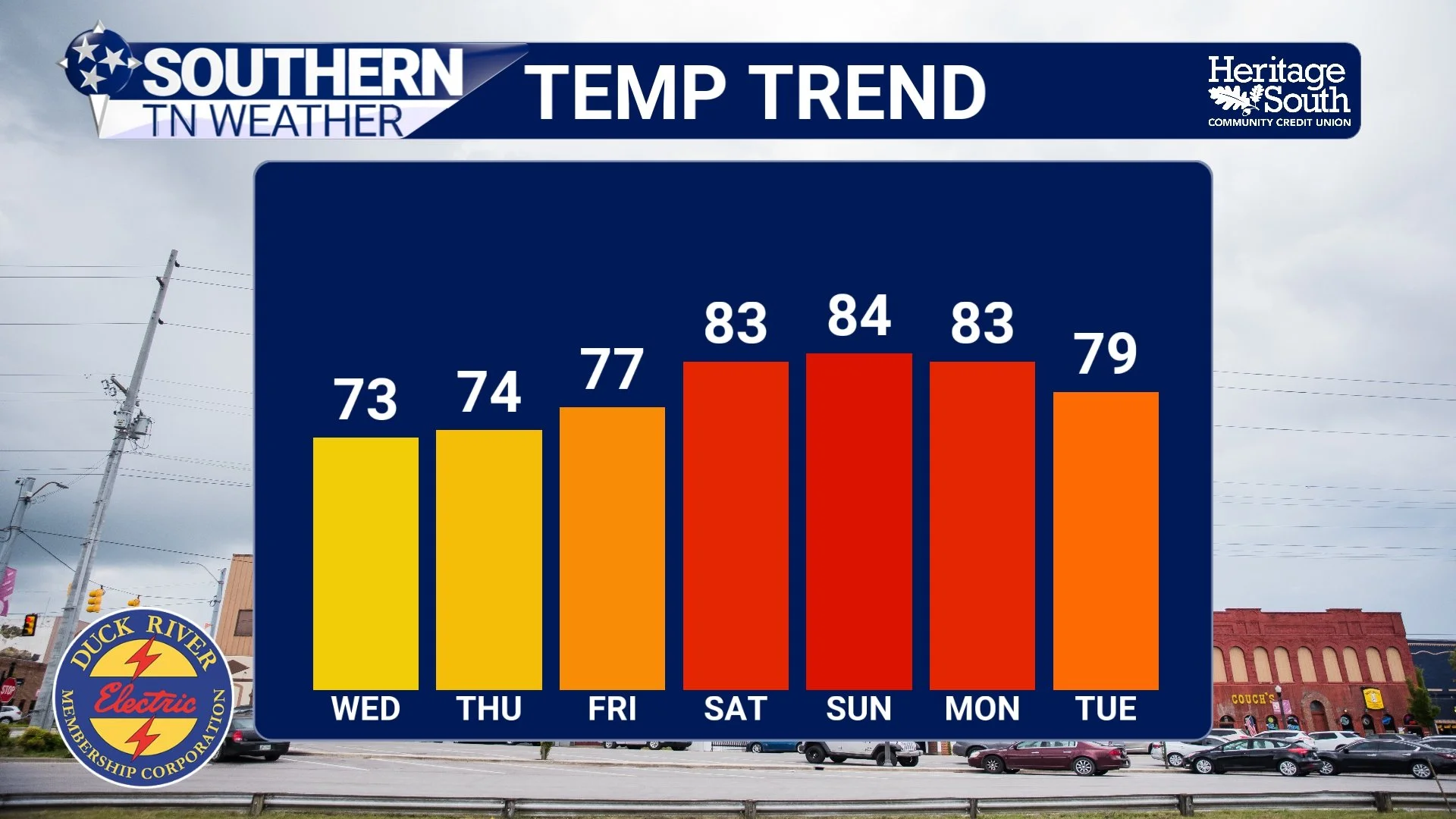
TEMPERATURE TREND - NEXT 7 DAYS
Near-Record Heat by the Weekend
By the time we reach the weekend, this pattern really flexes. Highs will push into the mid 80s across much of Southern Middle Tennessee, and a few spots could get even warmer. Based on current guidance, Sunday looks like the warmest day of the stretch.
There is a legitimate chance we challenge record highs, especially Sunday. Some guidance suggests a 60 to 70 percent chance of tying or breaking long-standing records in parts of the region. For early April, that is significant warmth. And it will not just be warm during the day. Overnight lows will also trend milder, climbing into the 50s and even 60s as the air mass modifies.
The Bigger Issue: No Rain in Sight
Now for the part that matters long term. Despite how nice this stretch of weather has been, it is not doing us any favors in terms of rainfall. In fact, the pattern is actively working against it. Upper ridging blocks storm systems from moving into our area. Instead, those systems are forced to track well to our north. Without lift, moisture convergence, or instability, rain simply cannot develop.
Forecast models remain in strong agreement that we stay dry through at least early next week. The earliest opportunity for rain may not arrive until the middle of next week, and even that is uncertain. From a scientific perspective, this is a classic example of a “blocked pattern” dominated by high pressure.
And from a practical standpoint, it means drought conditions will continue to worsen. Even though we picked up some rain recently, it was not enough to fully offset the longer-term dryness. Soil moisture will continue to decrease, especially with warmer temperatures increasing evaporation rates.
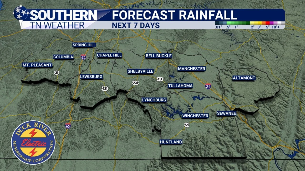
FORECAST RAINFALL - NEXT 7 DAYS
What This Means Going Forward
We are entering a stretch where the weather is very predictable, but that predictability comes with tradeoffs. Warm, sunny, and quiet conditions are great for outdoor plans. But the lack of rain combined with increasing heat is something we will have to watch closely in the coming days.
Eventually, this pattern will break. It always does. The question is when, and whether that next system brings meaningful rainfall. For now, we wait…

The Bottom Line 🧾
• Beautiful, dry weather continues through midweek
• Warming trend begins Wednesday as winds turn southerly
• Highs climb into the 80s by the weekend
• Near-record heat possible, especially Sunday
• No meaningful rainfall expected through at least early next week
• Drought conditions will continue to gradually worsen
📰 Reminder: The Southern Tennessee Weather Blog, presented by Heritage South Community Credit Union, is updated Monday through Friday with fresh, locally tailored forecasts you can trust.